Surveying
At some point in our childhood days, we see from other people or even ourselves usually mistaken the tool (refer to the picture below) as a camera, or something else.

source
Surveying is the science of finding the area, position, and shape of points or places on the surface of the earth. It includes the measurement of distance and angles and the figuring of elevations. The information gained is often placed on a map or chart. Surveys are made for a variety of purposes such as determining boundary lines of all kinds; finding elevation above sea level; planning for highways, bridges, and buildings, and making topographical maps.
Surveyors at work.

source
A railroad surveying party at Russel's Tank, Arizona in the 1860s
source
There are claims that surveying has occurred since humans built the first large structures. In ancient Egypt, a rope stretcher would use simple geometry to re-establish boundaries after the annual floods of the Nile River. The almost perfect squareness and north-south orientation of the Great Pyramid of Giza, built c. 2700 BC, affirm the Egyptians' command of surveying.
A picture of an Egyptian artifact shows the probable ancient Egyptians' survey.

source
In the United States, surveys are either public or private. Public surveys are made by national, state, or local governments. Private surveys are made for many reasons, such as the establishment of property lines and locating the position of building foundations.
A German engineer surveying during the First World War, 1918

source
Here's an example of a small-area survey work.

source
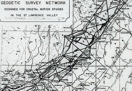
In surveying small areas, the curvature of the earth is not taken into consideration. In small areas this does not cause any significant error in the measurement. However, the curvature of the earth must be taken into consideration in surveying large areas. The survey of large areas is called a geodetic survey and involves the use of very precise instruments to obtain accurate measurements.
Here's a sample of a geodetic survey work.
source
Three types of measurements are usually involved in surveying, the measurement of distance, the measurement of direction, and the measurement of differences in elevation. Each requires different types of instruments.
The principles of geometry and trigonometry are applied to the readings taken from the instruments used by the surveyor. The instruments include transits, measuring tapes or chains, levels, special types of aneroid barometers, and accurate compasses.
Topographic surveying is for determining the shape of the earth's surface and locating both natural and man-made features to be shown on a map of the area. On a topographical map, surface elevations and depressions are shown by a system of contour lines. A contour line on a map is drawn along points that have the same elevation. Topographic maps are important in the planning of large engineering projects such as the building of highways and railroads. For such large-scale projects, aerial photography is often used.
This is a sample of a very large-scaled topographic survey work.

source
References:
https://en.wikipedia.org/wiki/Surveying
http://www.nrcan.gc.ca/earth-sciences/geomatics/geodetic-reference-systems/18766
http://digicoll.library.wisc.edu/cgi-bin/HistSciTech/HistSciTech-idx?type=turn&id=HistSciTech.Cyclopaedia02&entity=HistSciTech.Cyclopaedia02.p0813&isize=XL
You received a 10.0% upvote since you are not yet a member of geopolis and wrote in the category of "geology".
To read more about us and what we do, click here.
https://steemit.com/geopolis/@geopolis/geopolis-the-community-for-global-sciences-update-4
Its a pleasure @geopolis! I'll be following you. Thank you!
Congratulations! This post has been upvoted from the communal account, @minnowsupport, by olivercuico from the Minnow Support Project. It's a witness project run by aggroed, ausbitbank, teamsteem, theprophet0, someguy123, neoxian, followbtcnews, and netuoso. The goal is to help Steemit grow by supporting Minnows. Please find us at the Peace, Abundance, and Liberty Network (PALnet) Discord Channel. It's a completely public and open space to all members of the Steemit community who voluntarily choose to be there.
If you would like to delegate to the Minnow Support Project you can do so by clicking on the following links: 50SP, 100SP, 250SP, 500SP, 1000SP, 5000SP.
Be sure to leave at least 50SP undelegated on your account.