Isle Royale National Park - Longread with 37 Photos
This one is going to take you a few minutes to get through. I have been writing this article since the first few weeks when I joined Steemit in September. It is the collected and revised edition of my posts about Isle Royale. It is topping out over 2,800 total words and 37 pictures - amongst my biggest contribution here on Steemit.
I hope you enjoy the trip Andrew and I took this summer!
First Day : Departure & Arrival
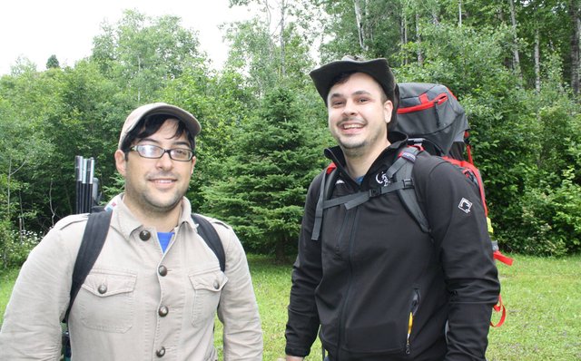
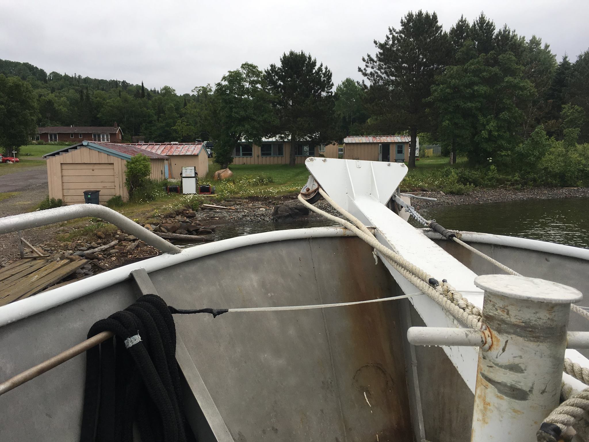
They threw our bags below deck of the ferry boat into the storage area with the other backpackers’ gear. Andrew and I were lucky to be aboard that morning. We arrived on the dock without reservations but enough cash to convince the boat captain to find two more seats and let us travel to the island. Somehow I knew they’d manage to find enough room for us if we had enough greenbacks on us.
The crew unhooked from the dock in Grand Portage, Minnesota and kicked the vessel into the bay. Deep within the hull of the boat, the engine roared to life as it began to propel us away from the mainland. For us, that meant being isolated together on the island for the next 5 days.
The two of us had been talking about going to Isle Royale for a year. “Through-hiking” is a far more demanding excursion, even comparing it to “car-camping” or “clamping” is unfair treatment. As it turns out, we’re probably lucky we didn’t go when we first thought about heading up the first time.
We wouldn’t have been ready…
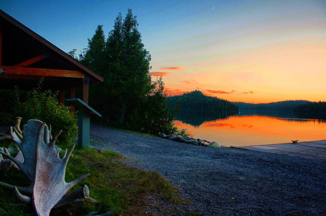
Heading Out from Windigo
The hour and a half long ferry trip would have been unbearable if I had stayed on the exposed bow of the boat. Lake Superior is cold all year, the winds are like relentless winter even at the slow speed we were accelerating across the water in late July. There was a very real fear that perhaps I had under-prepared for cold weather. My cousin had been to the island a few years prior and suffered a constant onslaught of rain.
The ride to the island were the coldest temperatures we experienced on the trip.
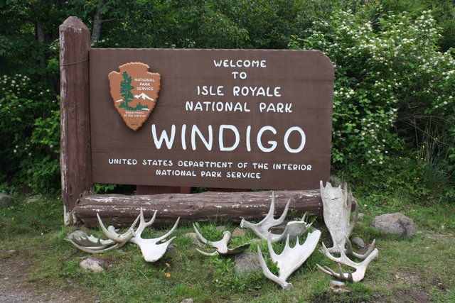
Windigo is the second largest “community” on the island and that's stretching the concept. Realistically there are a couple folks that work the tiny shop as well as maybe a dozen park rangers that offer learning programs and generally maintain the area. There are campsites located about a third of a mile from there but when the night sets in, there is no nightlife save for the call of loons.
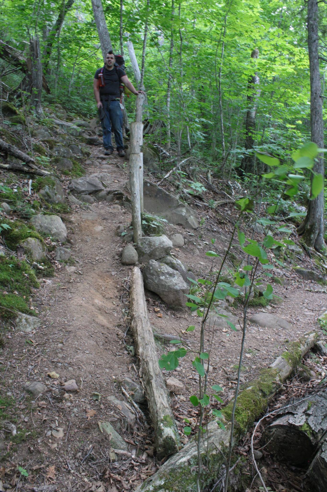
Andrew and I needed to clear up some paperwork at the visitor center regarding park passes before making our way deeper into the island. We had nearly 9 miles to hike that first day. It was about 1:00 pm when we set out on the Feldtman Loop going counter clockwise. Backpacking hikers that were better prepared were able to set off straight away from the boat.
We didn’t see another person on that first day of hiking.
That was just fine with us.
Getting Around the Loop
The first day was a good long hike along the southeastern side of the island through the woods. It had some peaks and valleys but nothing was overwhelming or particularly grueling. One thing we did learn once we were in the woods: there were mosquitos and they knew our names.
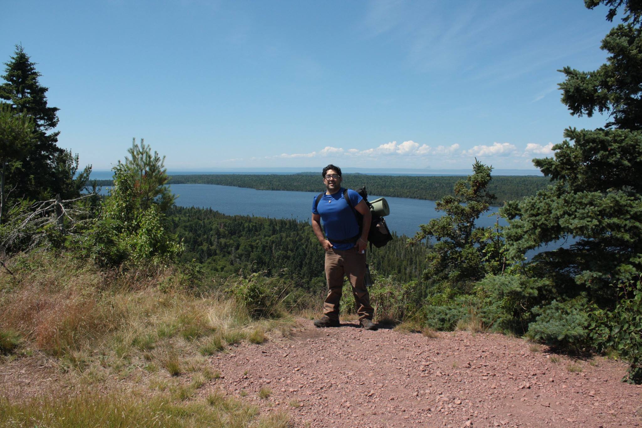
We hit our first summit of the loop and the inner island revealed herself to us. We looked across the valley to the other ridge. I found the ranger watchtower that would be our approximate halfway mark in the 30 mile total hike to get back to Windigo.
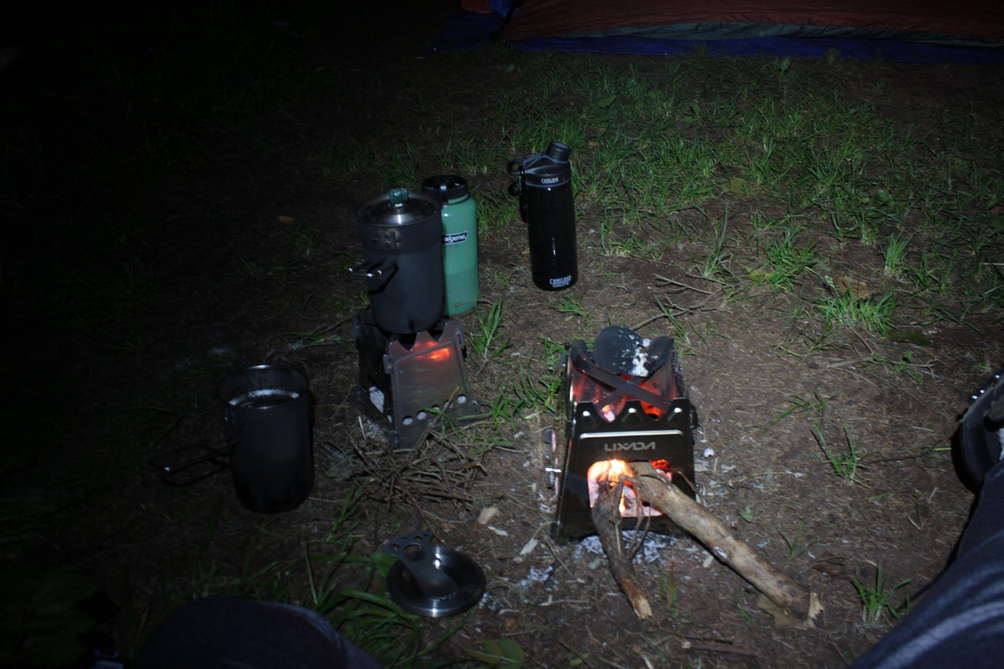
Later down the trail we crossed a stream and felt like this was a good opportunity to replenish our water supplies. It was also our first test of the Sawyer water filtration systems. Everything worked for us. I’ll probably upgrade this unit in the near future though because by the end of our trip the threads were experiencing some leakage. I wouldn’t recommend these small filters for anything beyond a backup to a much larger and better constructed device now.
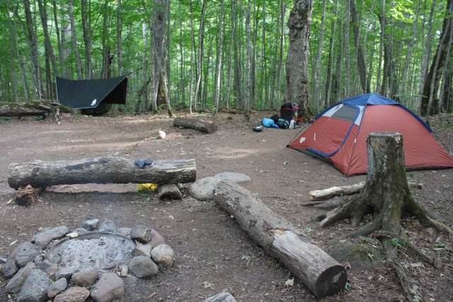
Neither of us were truly prepared for the 8.8 miles of the first day. We arrived into camp as the sun set. Feldtmann Lake campground was settling in for the night when we clamored in to set up camp and cook dinner.
We met Tim, a guy that had taken the ferry over with us, who was doing the loop on his own. He pointed out the next campsite over was empty and on the water, also it was currently occupied by a moose. Our first of the trip! I tried to creep in close for a picture of the cow. It didn’t become apparent until I started to process the pics back at home that I had been just 12 feet from a bull.
It had been a tough day for Andrew, his pack was overloaded by 10-15 pounds. We progressed slowly. I suggested he go fish for a while to chill for a bit while I prepared our cooking equipment to make our first freeze-dried dinner on the island. We ate so much and went to bed with full stomachs and tired legs.
Onto the Ridge
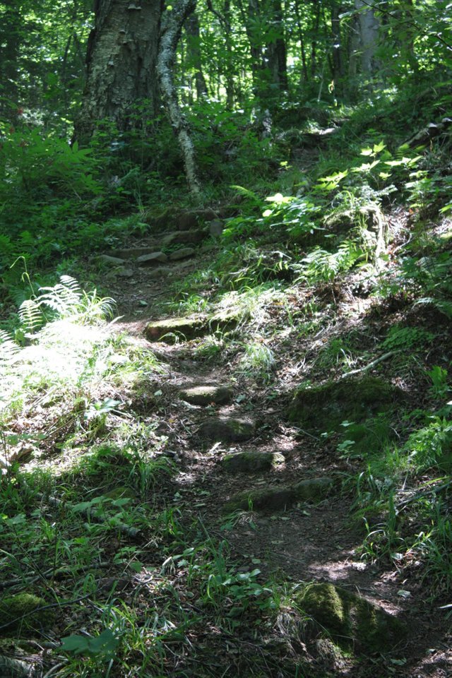
We listened to the last group of folks besides ourselves still in camp when we finally got up. The beginning of our second day looked similar to the day before in terms of terrain. However, it didn’t take long for our ascent to begin introducing us to higher grounds than we had seen on the first day.
We stopped to have a snack on ledge of the ridge overlooking Feldtmann Pond where we had camped the previous night.
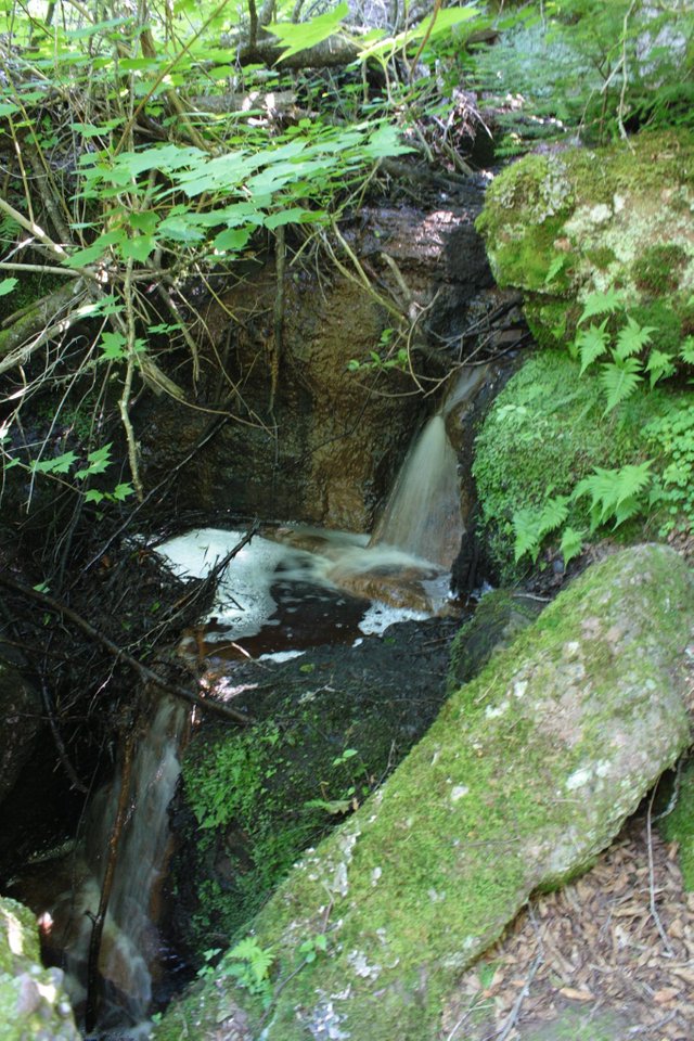
After hanging out for a bit and enjoying the excellent weather and sunlight the day was providing, we began to descend back into the forest. It wasn’t too long until we happened on the waterfall you see above and took this opportunity to replenish our water supplies.
For the Watch
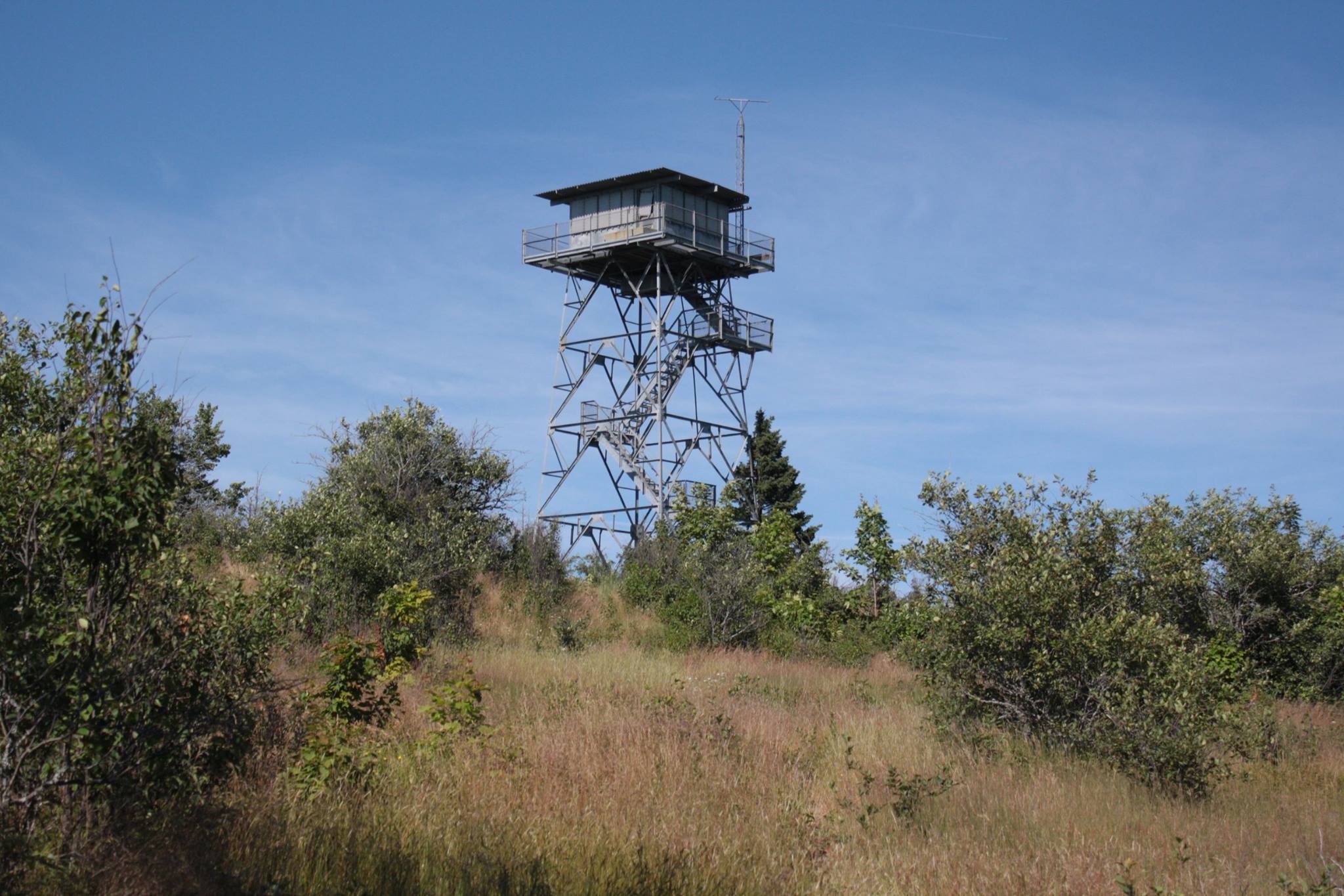
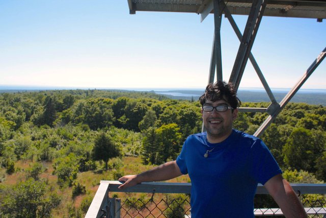
The afternoon was fading when the watchtower emerged over the horizon. We had to climb it, I let Andrew go first. I get incredible vertigo when I look down so it helps to go slow at first while my equilibrium stabilizes.
It’s not an unsecured height though. We went up as far as the stairs would allow us to go, at the top was a padlocked door to the actual lookout room. Some rangers mentioned that the watchtower was no longer regularly staffed but that occasionally some of them did use it as a waypoint for supplies.
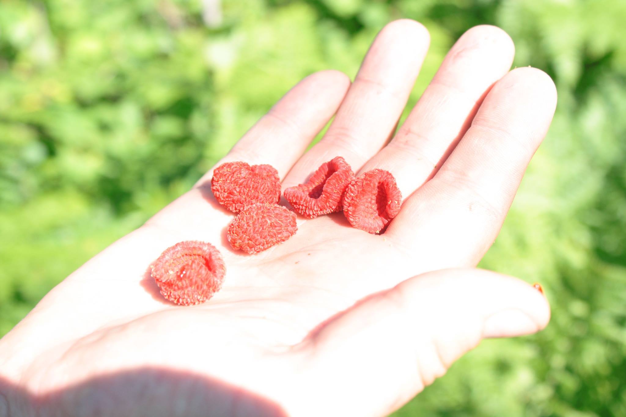
As we left the clearing where the watchtower was located, the trail yielded thimble berries. It was a pleasant surprise. A few handfuls were perfectly ripe. We had been eating a few along the way that weren’t ready. I estimated that if anywhere else on the island had ripe berries, it would be on the ridge near the watchtower since it had the best sunlight exposure throughout the day.
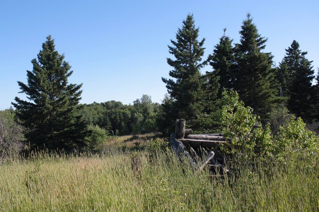
Another clearing opened up after the section of trail with ripe berries, revealing the remains of the old wooden-log watchtower. The day's hike was 10 miles and we were only a little over halfway to our destination. Andrew’s bag was slowing him down considerably. The sun was making instructions for the moon as we descended from the higher ground of the ridge into the prairies that lead to Siskiwit Bay.
Down to the Coastline
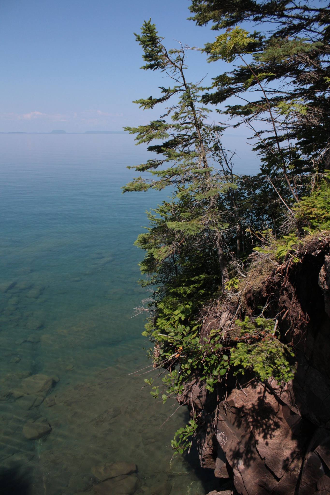
Isle Royale is quite far to the north. It’s technically closest to the Canadian mainland, while Minnesota is just to the west. This National Park is actually part of Michigan thanks in part to a dispute with Ohio over Toledo that also lead to the creation of the Upper Peninsula from territory that logically seems like it should be Wisconsin. Confused? Look it up.
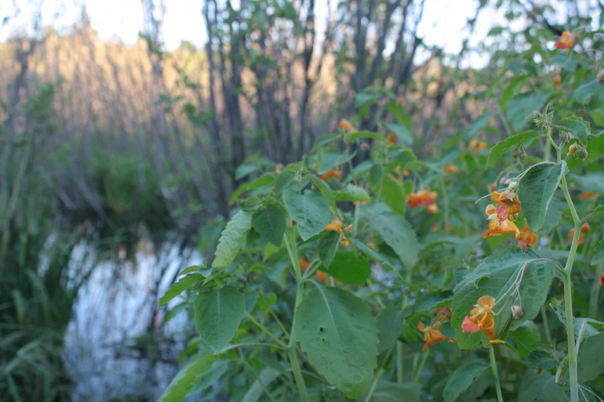
Flowers of all types were in bloom across the island while we made our way around Feldtman.
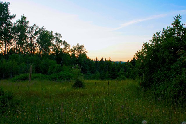
The land was generally flat by the time we hit this field but light was beginning to insist its impending scarcity. Meaning, we had to pick up the pace. Then the path opened into an intersection with some signage about destinations. Our's was only now less than a half mile farther.

Siskiwit Bay
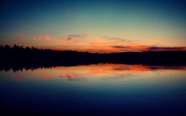
We began setting up camp and preparing dinner as night was unraveling itself. The horizon was a sliver of sunrays over the inner hills of the island. I ran down to the dock to get a few pictures before there wasn’t enough light to capture anything.
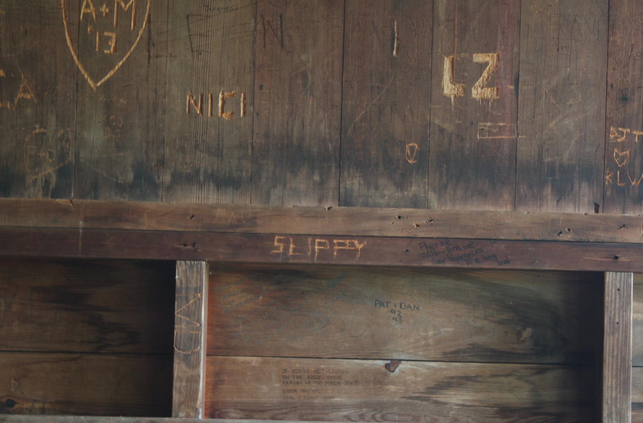
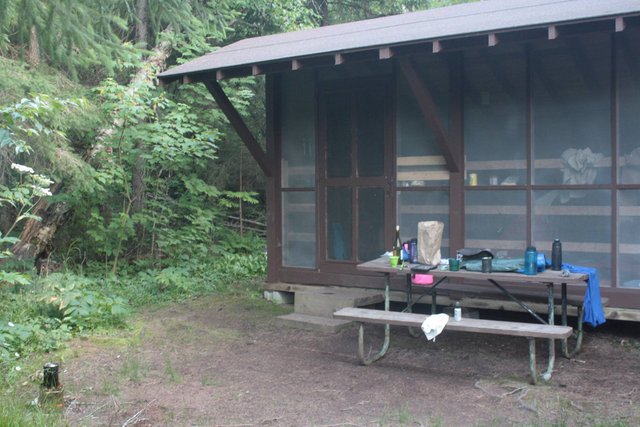
The next morning we made breakfast and began wandering around the bay near the campgrounds. I managed to find Tim in Siskiwit again. He had pounded through the first two days and told me that he was going to stay here in Siskiwit for a extra day to recover. As it would turn out, Tim was staying in the same shelter that my cousin had used a few years earlier. That's his nickname carved into the shelter frame. It was a pleasant surprise to see a familiar message in such a remote place. Only Canadian cellular coverage is partially available to parts of the island, if you want to pay the fees.
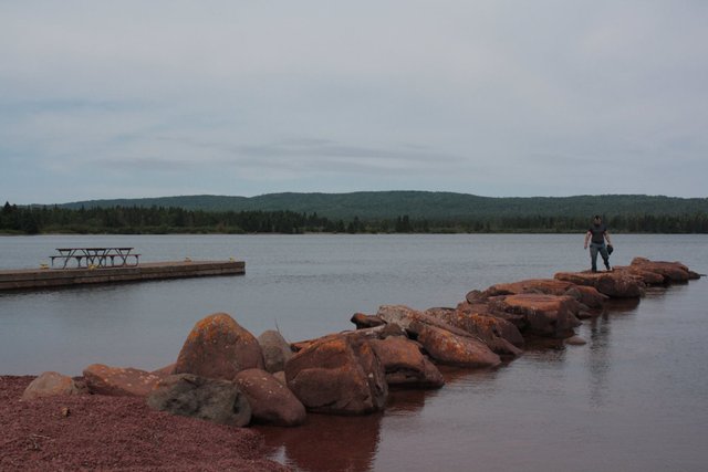
We collected everything together from our campsite and made the way down to the water to get a few pictures before heading out on the trail for the day.
Brutalized to the Mines
What started off as a sweltering hot slog through the swamp by Siskiwit Bay quickly escalated into a grueling uphill hike that seemed to average about 10-20% inclines.
There are few pictures of this stretch because of how demanding it was and truthfully, unremarkable. Mosquitos were a constant annoyance. The heat on the uphill pushed our still developing stamina.
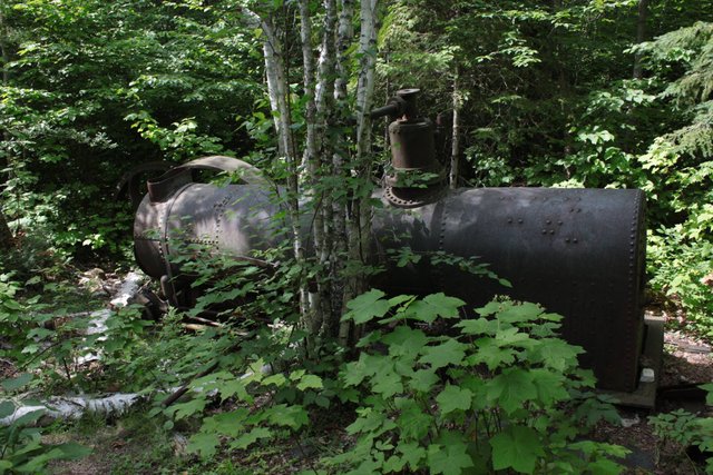
A few hundred yards off the main path were the few remains of a mining camp that had been in operation through the mid 1800’s.
I knew we were close but this was the only real feature on our path that day so we went pack-down and headed off the path to see what the old mine was about. In Duluth, Minnesota many of the buildings were made of this deep brick red stone that was striking. While we had been driving north and passed through the city, both of us made note of the rich color while we wandered around the town looking for something to eat.
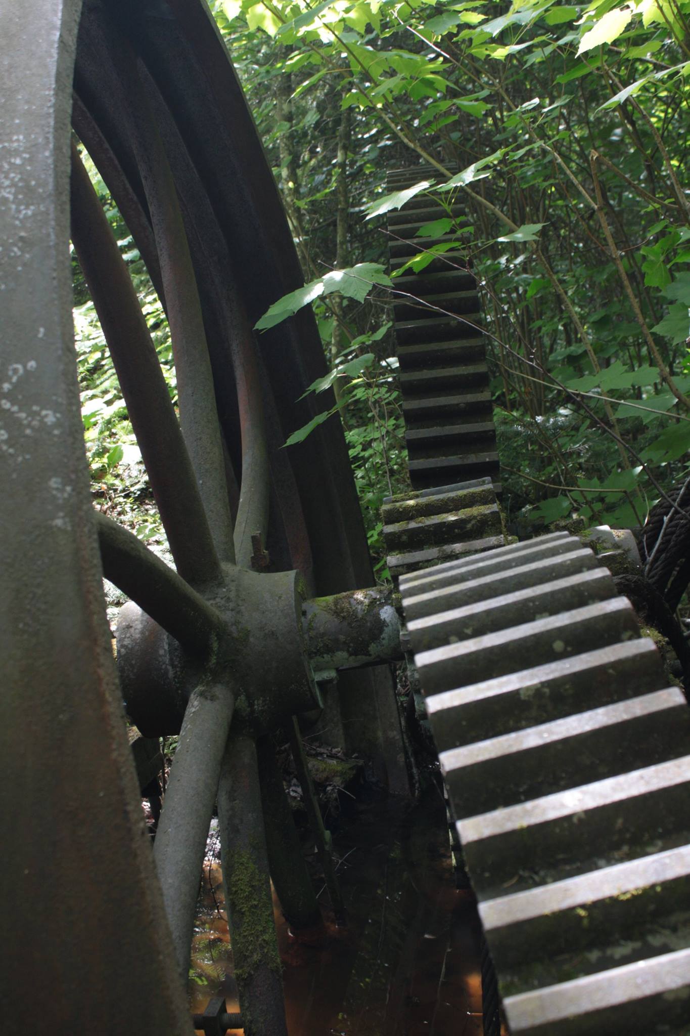
The mine had large mounds of rocks and chips that were the same color as the architecture we had seen a few days before in Duluth. It's hard to imagine extracting rock from this area except for a few months of the year. Even in the height of summer the temperatures weren't very conducive to our activities, being so far north. Weather is incredibly unpredictable in this area.
A little Farther to Camp
As I have mentioned, this day was our shortest hiking distance but the miles were the most demanding. Anything exciting (I use the term loosely here) was a good enough excuse to kill a few minutes to break from the relentless uphill hike we had before us.
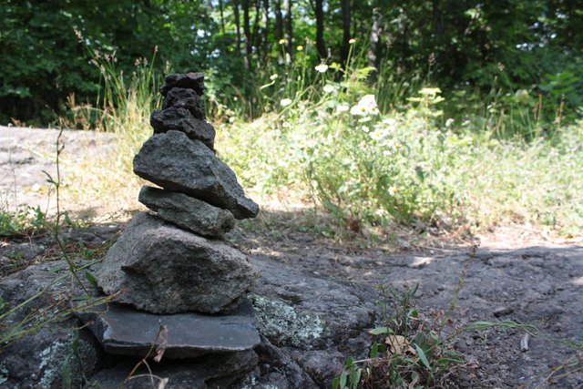
We came upon a small outcropping of stone and the our path was hard to determine, luckily a small cairn was set up to designate our direction. I added a few more stones to the pile as I always do and worked to get a decent angle, Andrew maintained his momentum and trudged onward.
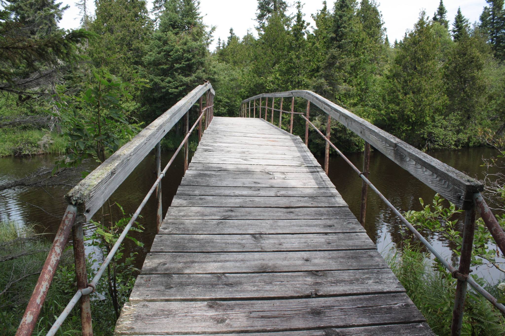
The trail became a forest again and the desire to reach camp was high. We crossed over a small creek that was on our itinerary and I knew we were close. Just a little way up the hill, we reached camp with plenty of day light to relax.
Finishing the Loop
The final leg of our journey around the Feldtmann Loop was about 6 miles, mostly downhill to Washington Creek. I'm of the opinion that downhill hiking is actually more demanding because you have to be careful about stepping properly and managing against the pull of gravity. My calfs were feeling it by that third day.
We hadn’t crossed another soul on the trails going clockwise around the loop. However, as we descended to Washington Creek from the junction, a number of people were making their way deeper into the island on a number of routes.
I was concerned about the time and was moving at a more rapid pace than Andrew. We agreed that I would charge ahead and secure the best campsite available to us when I arrived. The night before we had discussed what time the ferry would be bringing new thru-hikers to the island. I was about 20 minutes from camp when I heard the horn signaling its arrival.
When I first hit the group sites, it was a bit of a relief. I've never hiked 30 miles with 35 pounds on my back so knowing that I had arrived back at the beginning of the trail was a legitimate triumph for me personally.
I'm no too proud to say it was a comfort to know we could spend the remaining two days in a shelter. Only about a third of the sites were claimed when I arrived. I was already getting comfortable for about 30 minutes when I headed up to the camp junction to wait for Andrew. It didn't take him long to find me there.
We had made it around the Feldtmann Loop.
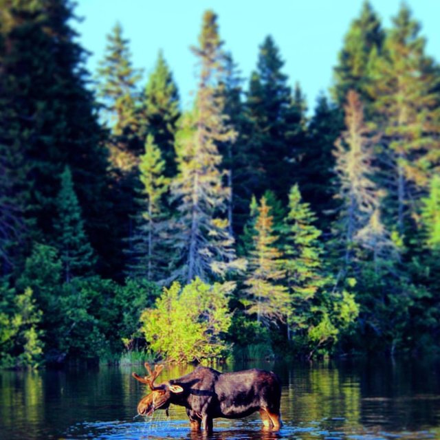
The photo above was taken from the water’s edge of our campsite. What's that saying about how to figure out if its Cow or Bull?
Go milk it...
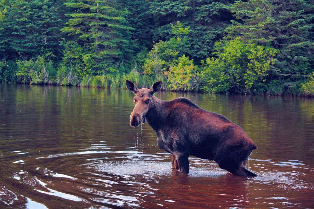
I got really close here and want to stress how dangerous large animals can be. Don't think that I went running in like she owed me money.
Creeping slowly to the edge of our campsite, then through the brush, I approached the ridge to the bank of the inlet water.
She stayed patiently eating as I moved in closer for a picture. We were very close to each other, looking into each other eyes. The mechanical sounds of the camera intrigued her for a few moments before realizing it was no threat.
I took so many pictures. The both of us were no more than 10 feet from one another.
A Day without Packs
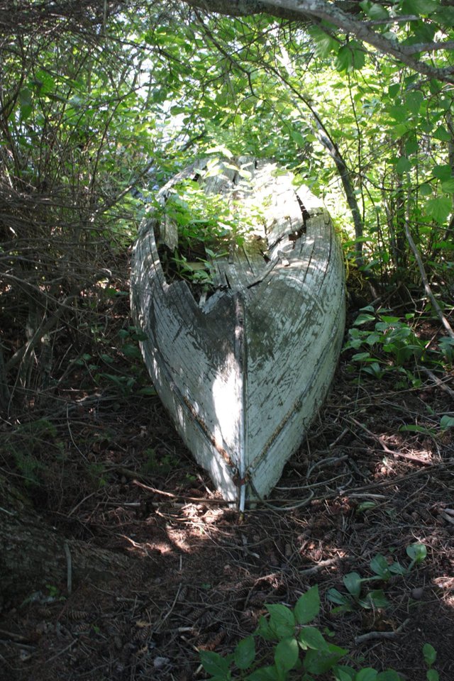
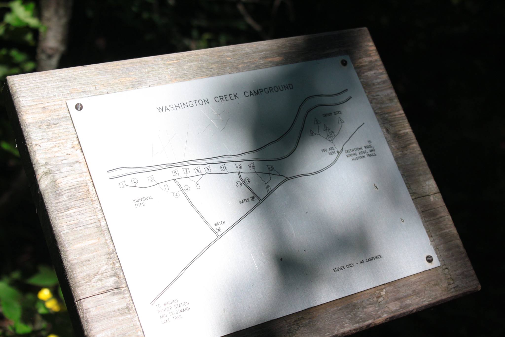
The Washington Creek campground is the closest to the docks in Windigo. There are typically a few boats in the harbor as well, at least while we were on the island. Even a few relics from the past are still hanging around, like the old canoe you can see above.
With an entire day without a new destination, we made our way out of camp for a 10 mile roundtrip day-hike to the northwest. The trail ran along the very edge of the island which was primarily a rock trail as you can see from the bluffs that are a sheer drop to the water below.
It was great to wander around these new trails without having to carry 40 pounds of equipment on my back. We took our time to look at all the features that interested us as we made our way. Soaking in Isle Royale on the last full day was our only task.
On the final morning we packed up, solemnly dragging our feet on the short walk to the docks. We waited by our gear as the new arrivals unloaded their packs from below deck. The ferry was the same boat we had arrived on but the captain was swapped for the day. Everyone boarding was curious if we would get to see the Rock of Ages lighthouse on the way back to the mainland.
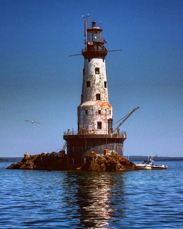
The lighthouse was being restored to its prior working condition after years of disuse. We didn’t get a chance to see it when we were headed to the island but the ferry took us near it on the way back to Minnesota. As you can see there is a crane and other scaffolding around it at the time I took this picture. The preservation efforts seek to restore the structure to the state it was in while operating for ship navigating near the island in Lake Superior.
I would go back to Isle Royale. The island and the backpacking experience gave me a lot of confidence regarding my skills to handle the challenge. If I return I would like to thru-hike from Rock Harbor in the northern area and come south, probably stay a few extra days near the official lodge.
Thanks for reading. I’m hoping to turn this into a video as well…at some point.
Isle Royale is gorgeous!
I haven't been there in decades.
Your post took me back to some great adventures there.
Glad you liked it - My aunt is going later this year but just handing, no through-hiking.
what a great adventure! I felt the energy through the pictures!! thanks for sharing!
Definitely worth visiting if you ever get the chance.
@therealwolf 's created platform smartsteem scammed my post this morning (mothersday) that was supposed to be for an Abused Childrens Charity. Dude literally stole from abused children that don't have mothers ... on mothersday.
https://steemit.com/steemit/@prometheusrisen/beware-of-smartsteem-scam
Truly great post, interesting reading, wonderful photo images. Resteemed!
Congratulations! Your post has been selected as a daily Steemit truffle! It is listed on rank 7 of all contributions awarded today. You can find the TOP DAILY TRUFFLE PICKS HERE.
I upvoted your contribution because to my mind your post is at least 30 SBD worth and should receive 119 votes. It's now up to the lovely Steemit community to make this come true.
I am
TrufflePig, an Artificial Intelligence Bot that helps minnows and content curators using Machine Learning. If you are curious how I select content, you can find an explanation here!Have a nice day and sincerely yours,

TrufflePigHi @mdf-365, I just stopped back to let you know your post was one of my favourite reads and I included it in my Paddling Nature Ramble. You can read what I wrote about your post here.
hi!
Awesome post! It is very well written and your pictures are really nice too :)
Looks like a truly beautiful place :)
This was a great post and an interesting read. I have some friends in Minnesota, so if I ever go back to America, I am sure this is something we would all be interested in. You took some great shots and the information provided was very helpful!
An upvote from me! I am also following you.
Thanks,
@emmalg87
@originalworks