Photo Essay: In Praise of Minnehaha Falls
I have a tendency to take urban waterfalls for granted. As a resident of the Minneapolis-St. Paul metro area, where we have five notable urban waterfalls, they seem a natural part of city life. I'm always a little disoriented when I visit other cities and they don't have any. The more places I go, the more I realize how special our waterfalls are, and I'd like to introduce you to one of our best.

Currently the most culturally relevant waterfall in the Twin Cities is Minnehaha Falls. While St. Anthony Falls, on the Mississippi River, was essential to the milling industry which drove Minneapolis' early growth, flour milling isn't done with water power anymore, and the industrial waterfall has given way to the picturesque parkland of Minnehaha.
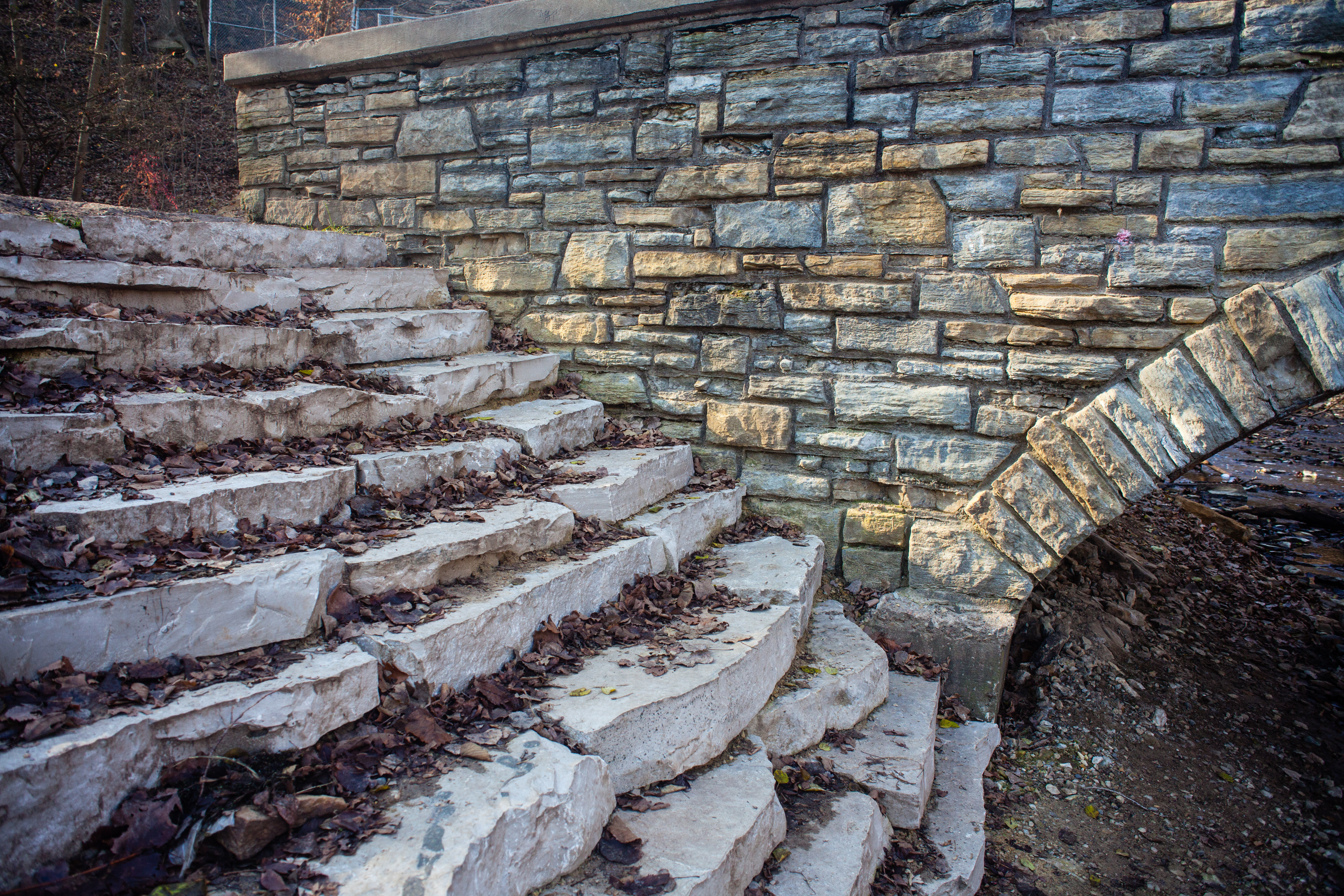
The park saw several short-lived attempts at development during the early part of the Twentieth Century, but the advent of the Works Progress Administration changed everything. The WPA built five stone bridges in the park, one immediately upstream of the Falls, and four downstream on the way to the Mississippi River.
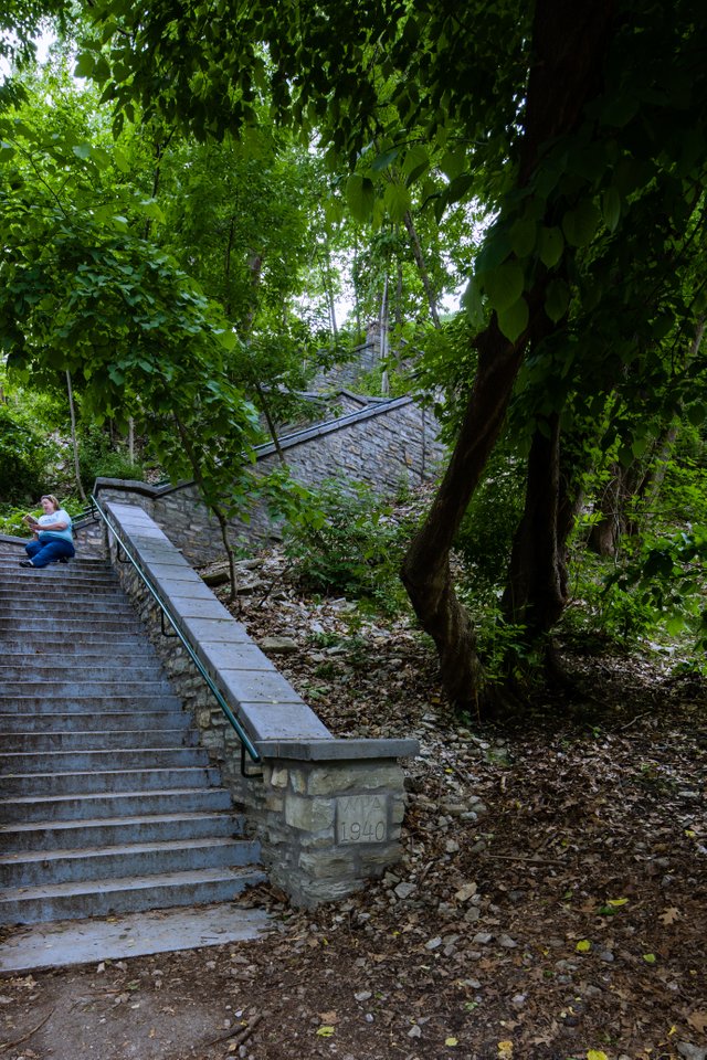
The ravine, fifty-three feet below the main section of the park, is accessible via four stone stairways: one on each side of the waterfall, and one downstream on each side of the creek. A handicapped-accessible path halfway between the Falls and the river was added in 2011.
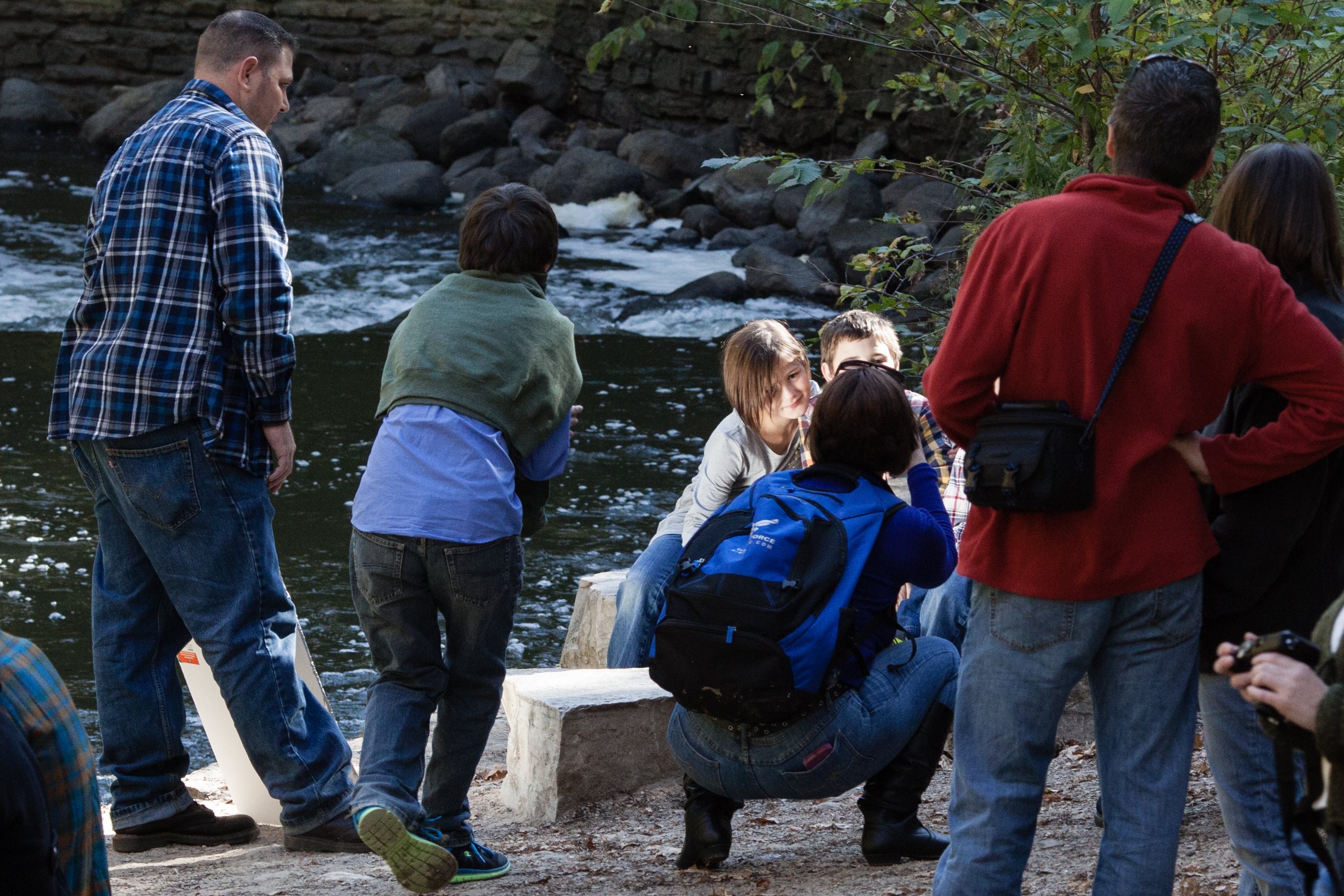
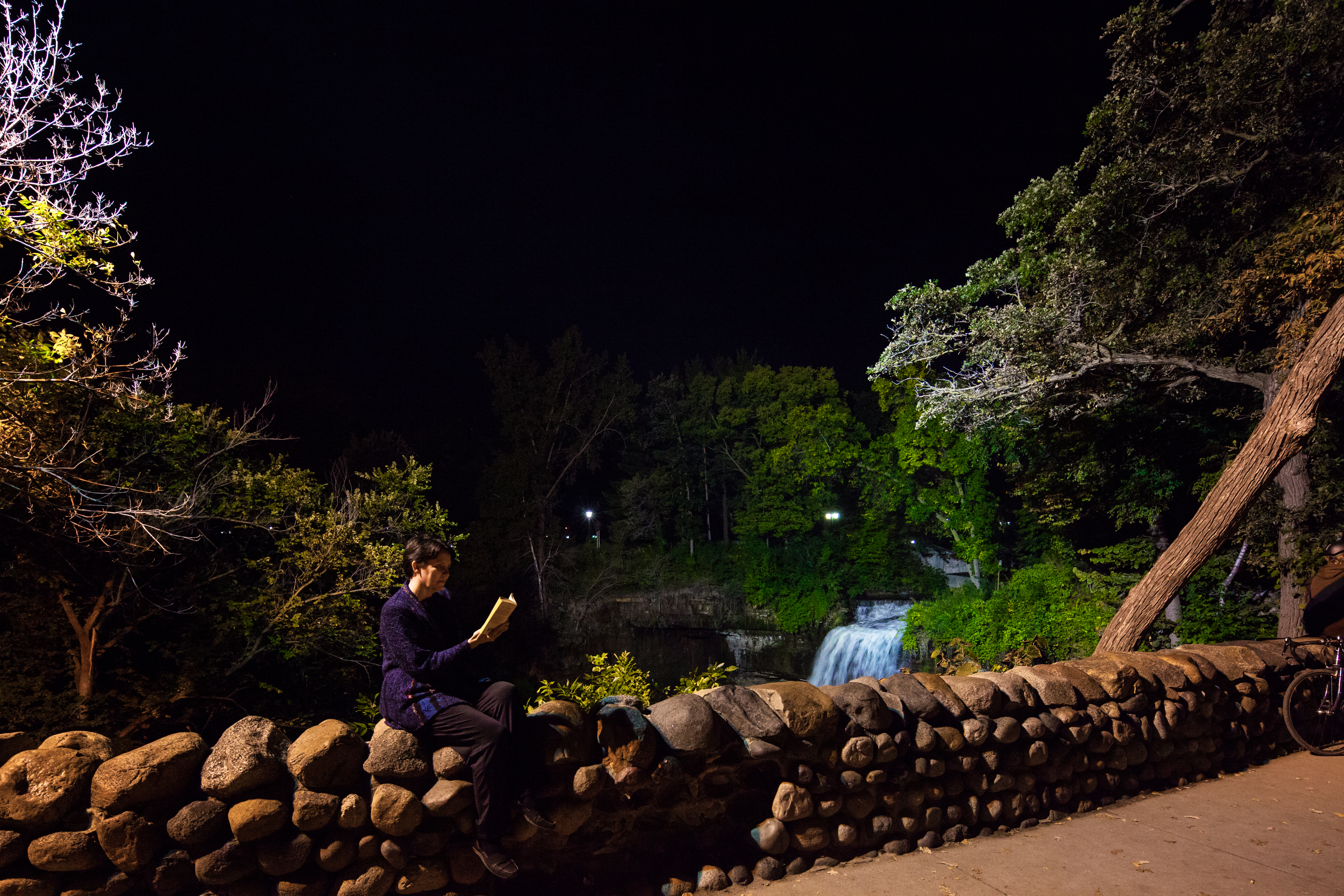
Just below the bridge is a small flat area for viewing the creek, popular for picnicking, writing, or especially portrait photography, any time people can convince themselves it's warm enough to go. This photo was taken on a weekend afternoon in October, not the warmest moment in Minnesota, and the place was packed with photographers.

After the second bridge, the creek slows down and broadens into a section suitable for swimming and wading, which was the focus of engineering improvements in 2011. This is again in October, so you don't see any waders, though there were a few out of the shot. And if you look closely you can see a young man has climbed the tree on an island in the middle of the creek.
As we continue downstream and approach the Mississippi, we come to one of the most beautiful sections of the creek. While the whole creek-falls system is subject to seasonal variations in water flow, this is one of the most dramatic, as the spring flood of the Mississippi backs up into the creek channel and creates a deep and still pool. If you look closely in the distance in the photo on the right, you can see the fourth and final bridge of the park, partially underwater. The photo below is this same area in November (though looking the opposite direction) when the water is much lower.

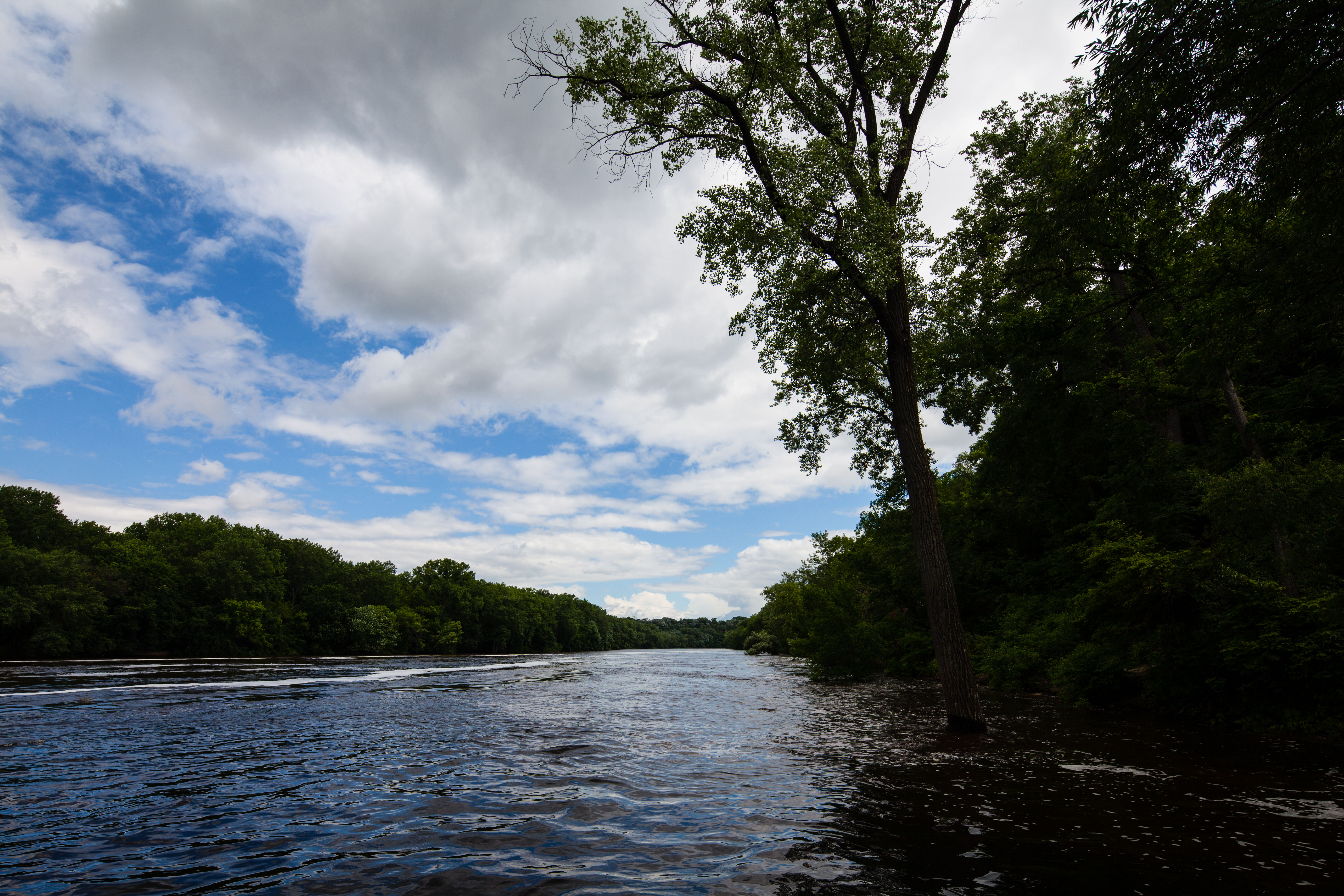
Although the riverbank is part of a national park, the Mississippi National River and Recreation Area, there are no paths here. To get home we must turn around and walk back up the creek, to the Falls. On the way I will tell you something about the cultural significance of the Falls and the park that surrounds them.

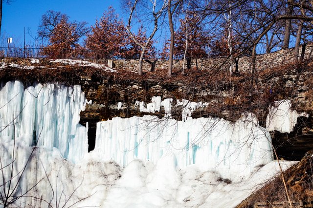
In the winter, the Falls freeze over, and not just the waterfall itself. Water seeps through the limestone of the basin, forming a curtain of ice all around the cliffside. It's hollow behind, and though it's technically not allowed, people frequently climb up to visit the ice cavern behind the Falls.
At the top of the Falls, the park is a more standard major city park, with playgrounds, a band shell, three gardens, a shelter with a seasonal restaurant, and several historic buildings. It's one of the most popular recreational facilities in the Twin Cities.
Minnehaha Creek winds its way from west to east across South Minneapolis in a strip of parkland. It drains Lake Minnetonka, Minnesota's ninth-largest lake, which is located to the west of the Twin Cities. The creek is named after the waterfall. "Minnehaha" is the word for "waterfall" in the language of the local Lakota natives, although local legend, and Longfellow, have mistranslated it as "laughing water."
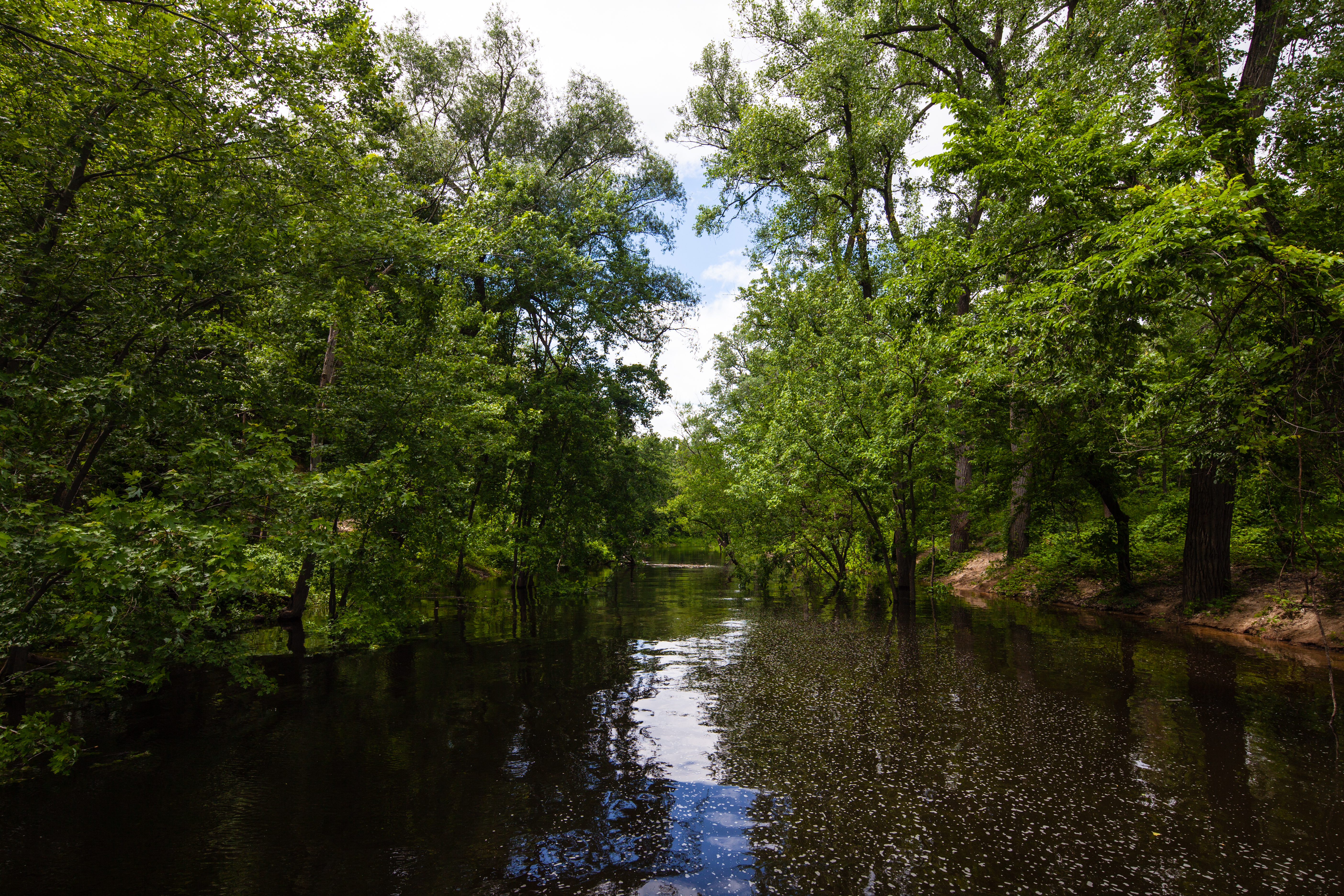
The WPA and the Park Board have also channeled the creek in the three-quarter-mile ravine that lies between the Falls and the Mississippi River, creating a popular short hike where the formerly fast-moving creek slows down and becomes suitable for swimming, wading, and fishing in the summer.

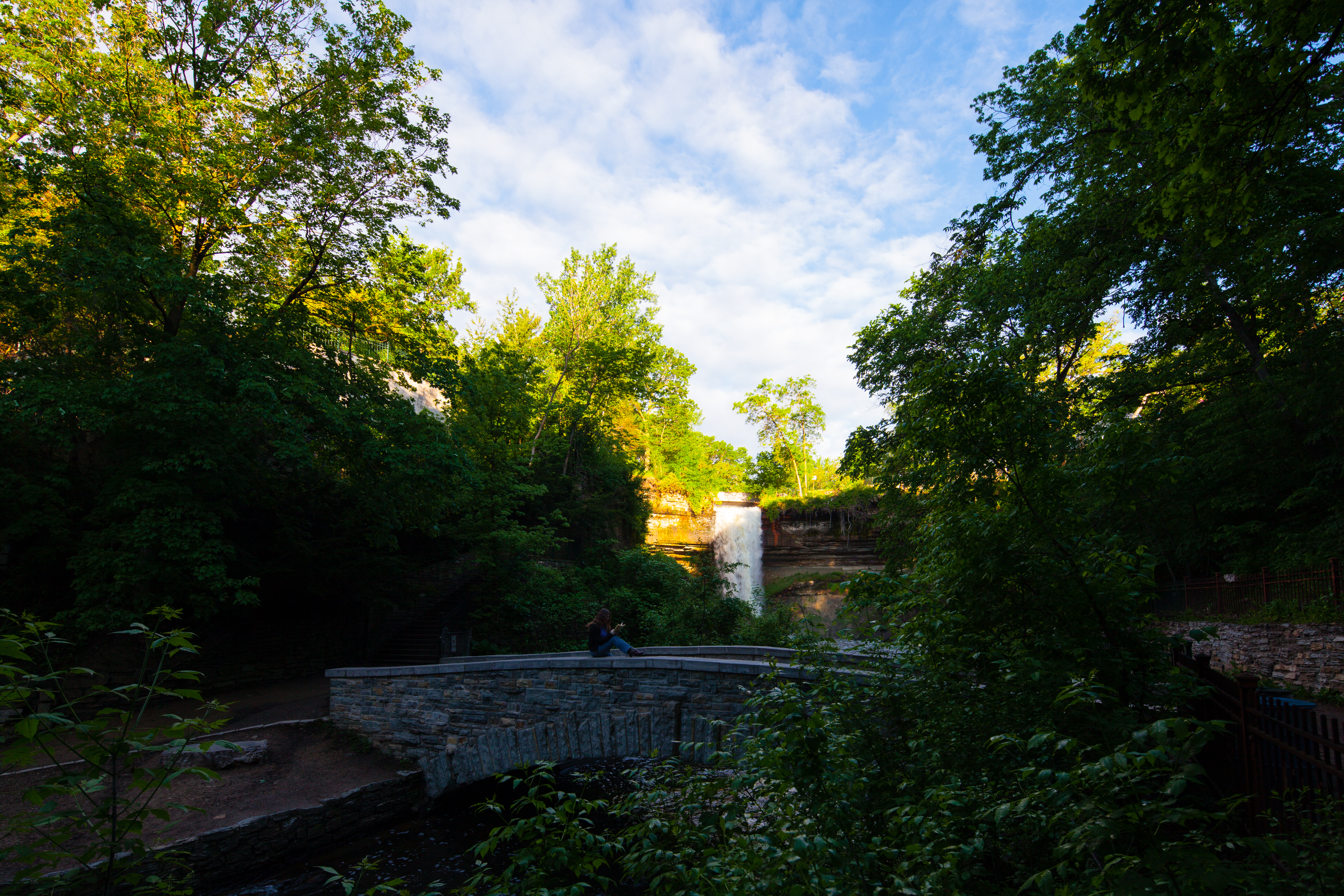
Where the two main stairways meet below the Falls is the first, and most popular, of the four bridges on the lower section of the creek. To get a photo of it that wasn't full of people, we had to get there at sunrise on this June morning, and even then there were hundreds of people in the upper section of the park preparing for a bike race.
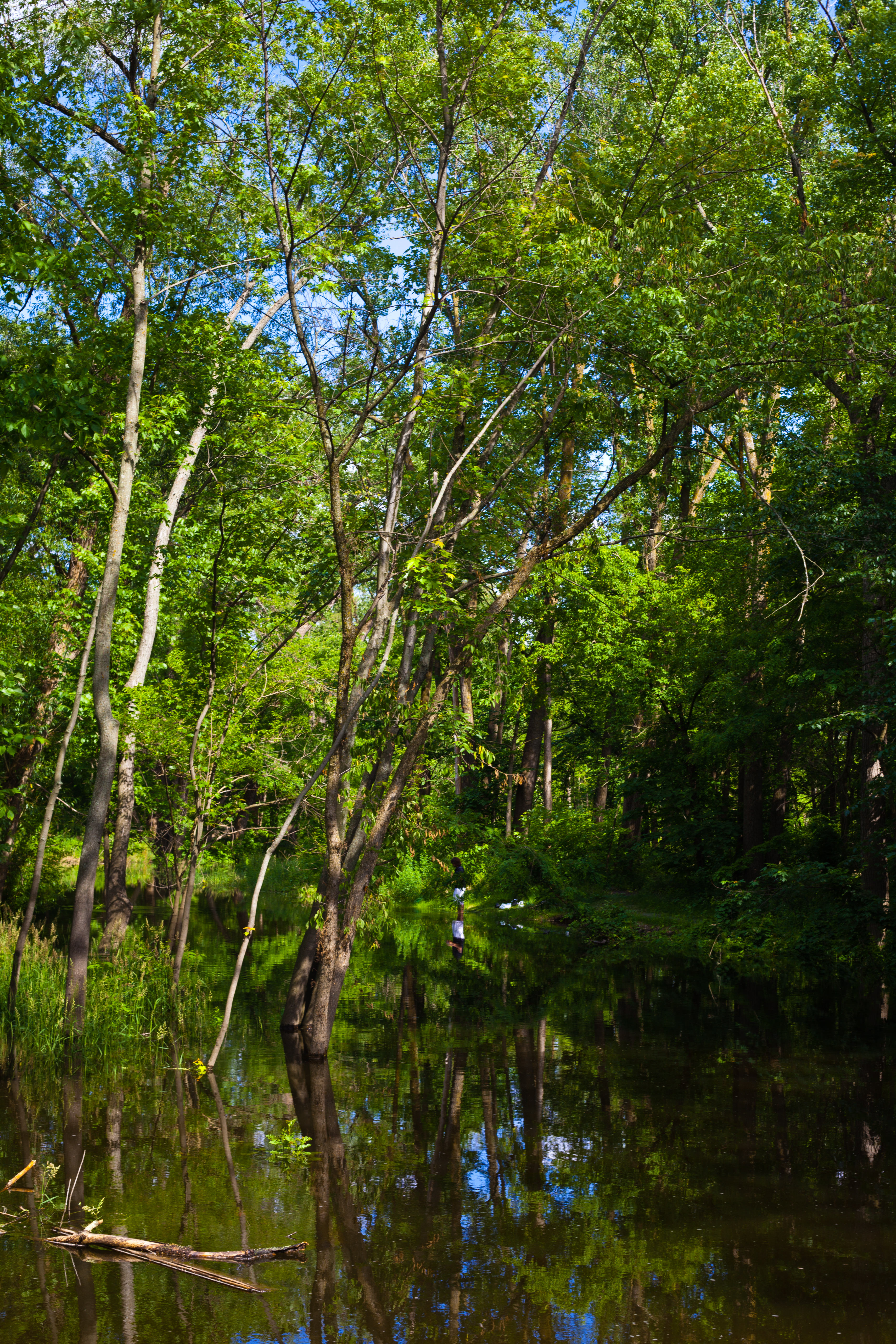
Below the bridge there's a path on the south shore of the creek leading downstream. While the WPA engineering remains very obvious, this is where the creek is at its fastest and wildest. This section of the path is hilly and treacherous in the winter, often limiting the number of people who come downstream and making the lower section of the park more peaceful in the off-season.

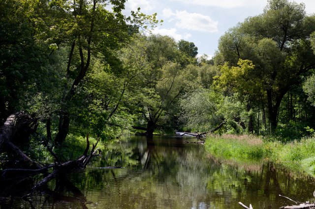
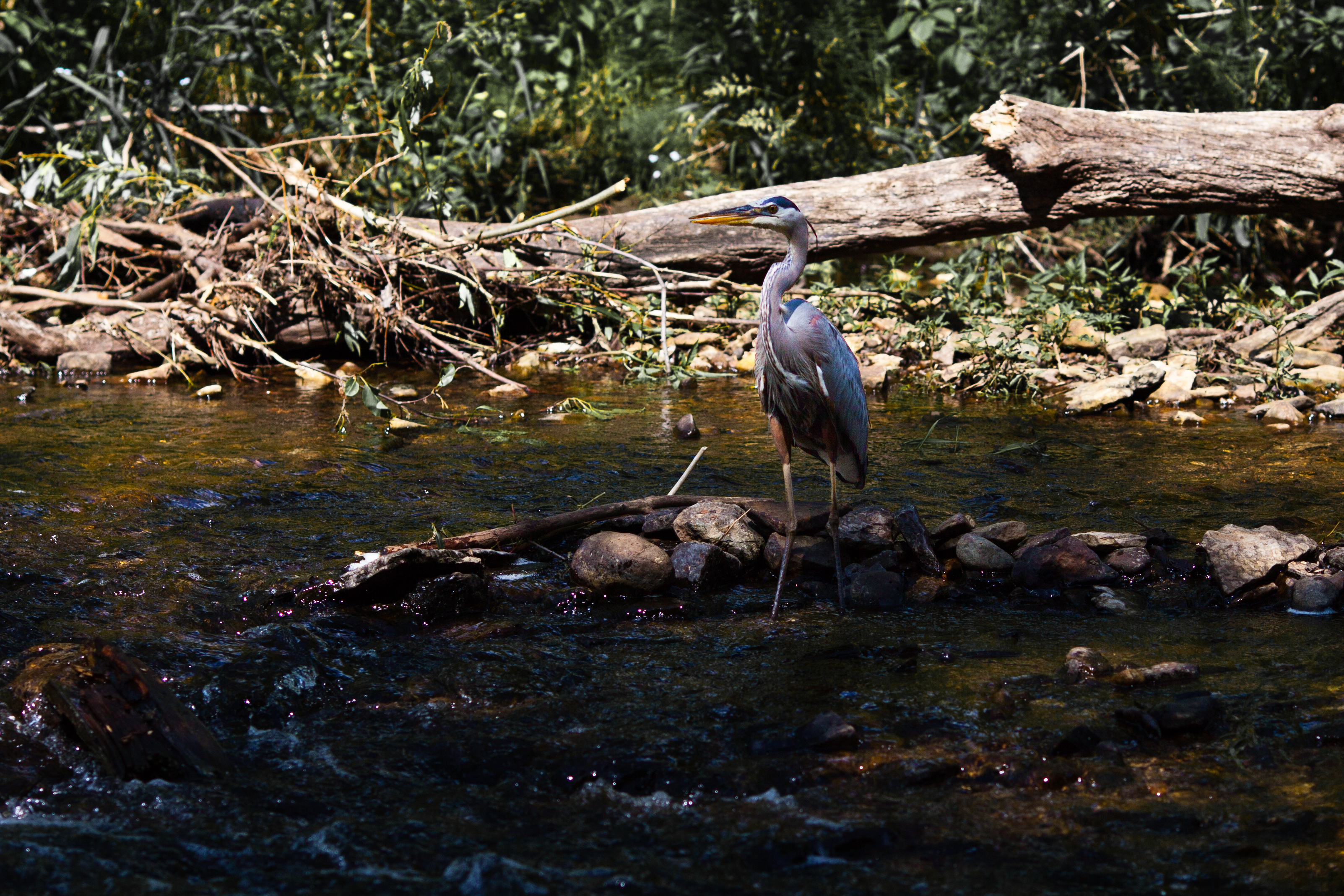
Downstream of the swimming area, the creek continues broad and calm, with walking paths now on both sides and the creek now suitable both for fishing and for viewing wildlife. Being in the middle of the city, there's not a lot of animal activity beyond a ubiquitous population of frogs, but I've been known to sometimes spot wild turkeys or a Great Blue Heron in this area.

Reach the end of the path to find the greatest river in North America, the Mighty Mississippi, still near the beginning of its 2,320-mile journey to the Gulf of Mexico. This is near the northern navigation limit of the river. If you stood here 10,000 years ago and looked to your left, you would see a colossal, 180-foot-high waterfall on the Mississippi, St. Anthony Falls, which has since migrated ten miles upstream and become the much smaller, industrialized waterfall which drove the formation of Minneapolis.
As one of Minneapolis' most major parks, Minnehaha Falls is a popular site for weddings, leading to the frequent sight of bridesmaids picking their way down five flights of rough stone stairs in brightly-colored dresses and high-heeled shoes in order to take their wedding photos at the bottom of the Falls.
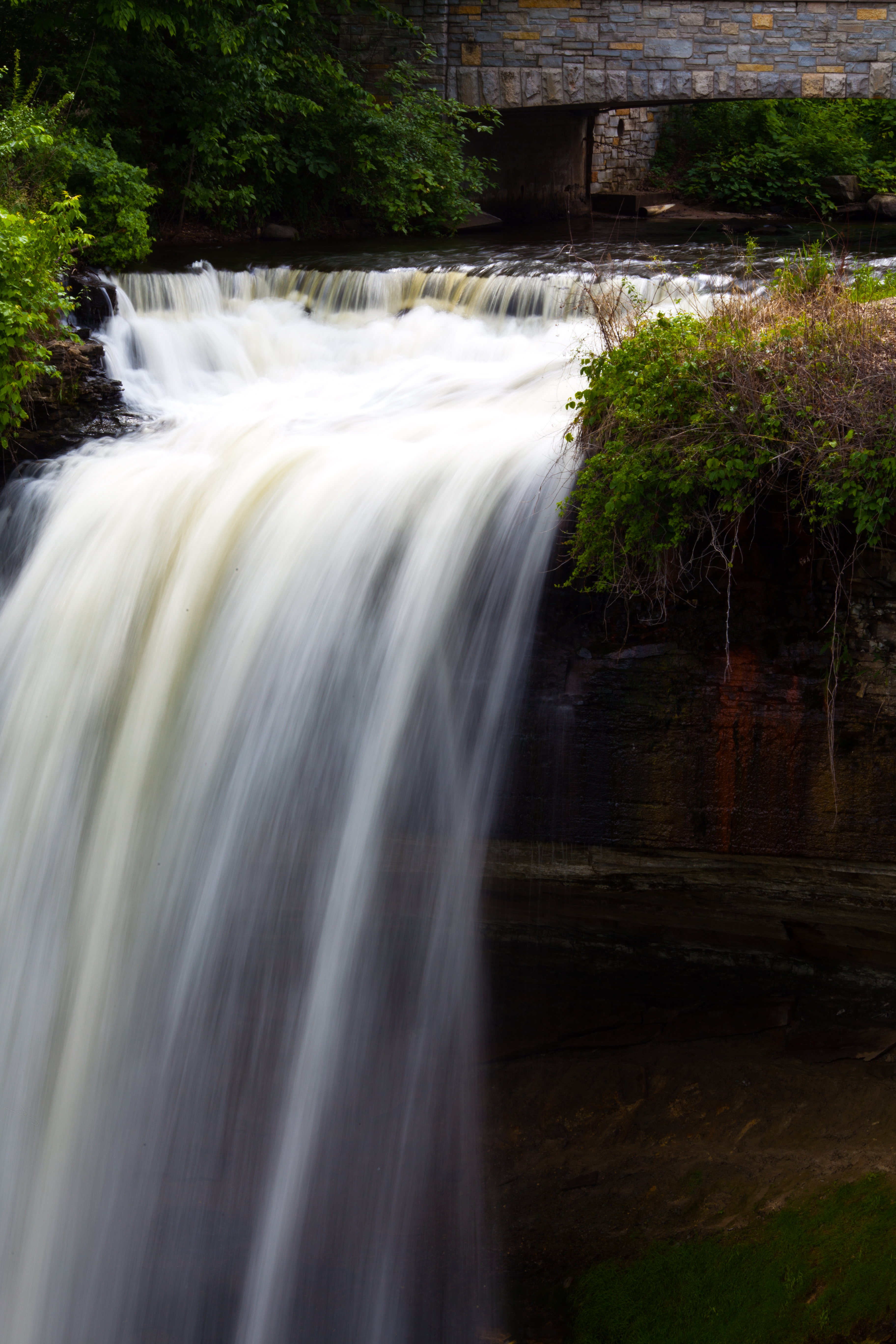
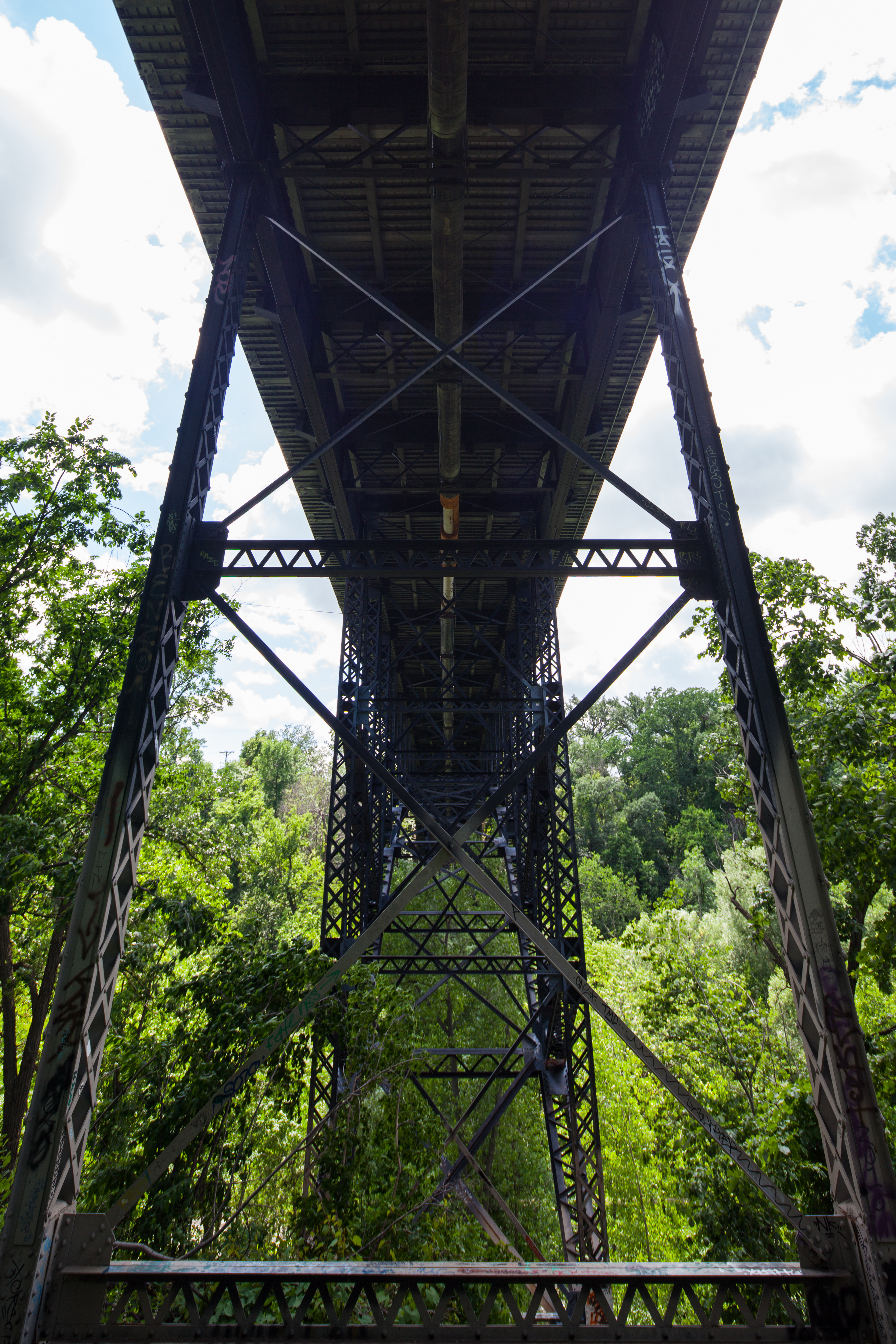
As I mentioned above, the Minneapolis Veterans Home is within the park, on the promontory formed by the creek's ravine on the southwest side and the Mississippi Gorge on the east. One of the most notable and striking features in the ravine is this bridge, used to access the Veterans Home.
The cliffsides underneath the bridge are climbable, and this has become a popular spot for parties and late-night revelry among the city's teenage population.
Unfortunately I've never been able to experience one of those events personally, but the evidence they leave behind is often of interest.
I'd like to thank you for coming on my Steemit tour of Minnehaha Falls. Don't worry, you only have five flights of stairs to climb before you can go home.
All photos in this post are my own work. Many are available as prints on my website.
Wondering why several of these photos have people reading in them? Check out my project The Reader: War for the Oaks and learn about Minnehaha Falls' key place in the history of Urban Fantasy.
This post was created for the @sndbox About My Culture challenge curated by @aaronli.

Congratulations @tcpolymath! You have completed some achievement on Steemit and have been rewarded with new badge(s) :
Click on any badge to view your own Board of Honor on SteemitBoard.
To support your work, I also upvoted your post!
For more information about SteemitBoard, click here
If you no longer want to receive notifications, reply to this comment with the word
STOPUrban waterfalls are a luxury or, put it simply, wishful thinking in Hong Kong, a conetre city surrounded by a high intensity of high-rise buildings.
Congrats on getting through the challenge, I enjoyed your story. :-)