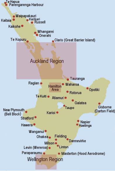
Airfields and Stations in New Zealand Used By the RNZAF, Part 21
Taupo
The old Taupo airfield was on the other side of Taupo Township to the modern one.
Unable to find any reference to it on Google
It was used for some tented camps during 1962-63 and an emergence landing site for south
bound aircraft caught by the weather over the Dessert Road area
No known units were stationed there
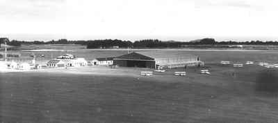
New Plymouth, Bell Block.
39^00’31” S x 174^10’45” E
Nearest town Bell Block
Officially opened by His Excellency The Governor General Lord Galway
on 21st March 1936
The land was first leased by the New Plymouth Aero Club from Mr J S Connell,
In 1929, a 170 Acre block.
The Aero Club went to the New Plymouth Council with the proposal that they purchase the Connell farm.
The Council did not think the airfield would be a significant value the town and the declined the offer.
In 1933, shortly after Kingsford Smith’s successful flight across the Tasman
The council then agreed to the offer, and purchased 177 Acres from Mr Connell.
The Aero club added a further 60 Acres.
Just after the outbreak of war [9th Sept 1939] the Public Works Department
moved in and began transforming the airfield into a Station.
All was complete by October 1939. At the peak time there had been over 200 men
working on the construction.
Opened as RNZAF Station on 25th September 1939.
Closed as RNZAF Station 30th Sept 1945.
No 2 Elementary Flying Training School was set up using impressed
De Havilland Tiger Moths, DH 60 Moths, and other light trainers.
These had been sourced from many aero clubs around the country.
Later in the war No 2 EFTS moved to Ashburton in September 1942.
They were replaced by the School of General Reconnaissance, who had been at Omaka,
near Woodbourne, using modern Avro Ansons to train pilots, navigators,
and gunners who would move on to the General Reconnaissance Squadrons in
the Pacific, flying Hudsons and later Venturas.
No 1 Operational Training Unit, moved from Levin in October 1942, flying
Hudsons, Airspeed Oxfords, Vickers Viscounts, North American Harvards
and later Lockheed Venturas.
After a short time it was found the Hudsons were too heavy for the runway
and No 1 OTU moved to Ohakea.
There were a lot of ground training units there, including one for Officers
already trained as accountants, lawyers or teachers etc.
In 1967 the existing airfield was closed turned into an industrial estate.
A new airfield was constructed at the end of Browns Road and opened in
March 1967.
Known to have been stationed there
No 2 EFTS [Elementary Flying Training School]
School of General Reconnaissance.
No 1 OTU [Operational Training Unit]
No 308 Ground Training Squadron
For the entrants had a qualification.
Meteorology School
Various Ground training Schools
Karioi
39^28’ S x 175^33’ E
Nearest town, Ohakune, or Waiouru?
A civil airfield.
Listed for emergency use
No known units stationed there.
In the 1960’s it was used for exercises with the NZ Army by Austers and Harvards.
Waiouru
39^47’04” S x 175^68’03” E
Opened
Closed
Units known to have been Stationed there
Communications Flight 39 to 45
Stratford
Nearest town, Stratford,
A civil airfield opened on 19th March 1935.
Listed as an emergency airfield
No known units stationed there.
Hawera
Nearest town, Hawera,
Opened in 13th March 1934, had been used in 1928 when Kingsford Smith and
Southern Cross landed there on its way up to and back from Auckland.
A civil airfield listed for emergency use.
No known units stationed there
Napier Westshore Aerodrome
39^28’06” S x 176^52’18” E
Opened
Closed
A civilian airfield opened 12th Aug 1935
On an area that was raised from the former Ahuriri Lagoon in the 1931
earthquake.
listed as use for emergencies or communications flights
May have been used for overnight and refueling by No 6 Squadron when
based in Gisborne and doing long southerly patrols.
No known units stationed there
Hastings
39^38’48” S x 176^46’01” E
Opened
Closed
Nearest town Bridge Pa
This was NZ’s second aero club, formed on 12th November 1928.
NZ Aerial Mapping purchased its first aircraft in 1936, a Monospar ST25
and has been based at Hastings airfield ever since, making it the oldest NZ
Aviation Company.
The aero club was tasked, in 1939, with an initial batch of 12 trainee pilots
These were supplemented with an extra five trainees every eight weeks.
By March 1940 the aircraft had been taken and the training ended.
32 of the clubs trainees went onto the RNZAF, the RAAF or the RAF.
A civil airfield listed for use in an emergency or communications
No known units Stationed there
Dannevirke
40^13’02” S x 176^04’43” E
Nearest town, Dannevirke
A civil airfield opened on 21st September 1934.
Listed as an emergency airfield
No known units stationed there
Wanganui
Nearest town, Wanganui
A civil airfield opened on 20th March 1935
Taken over in 1939, shared with civil operators who were still operating out of there.
The Public Works Department built a new runway there during the war,
Listed as an emergency airfield
No known units stationed there

with thanks to son-of-satire for the banner

You just got a Team NZ upvote!

This is a curation bot for TeamNZ. Please join our AUS/NZ community on Discord.
Why join discord room? Here are 10 reasons why.<
Enjoying the bump? Please consider supporting your fellow Kiwis with a delegation. How? Read here.
For any inquiries/issues about the bot please contact @cryptonik.