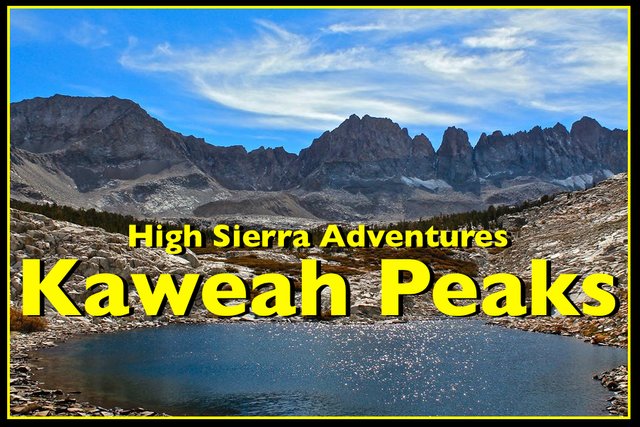
High Sierra Adventures - The Kaweah Peaks Loop
Welcome to the next edition of
California Mountain Adventures!
For this adventure I join friend and fellow mountaineer Rogue Photonic for a 13 day peak bagging journey in the remote Kaweah Range of the High Sierra!
Day 1
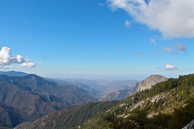
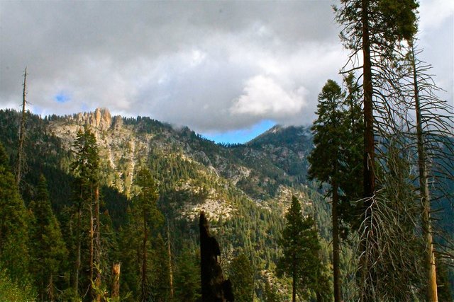
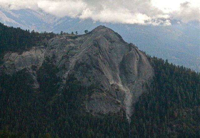
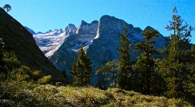
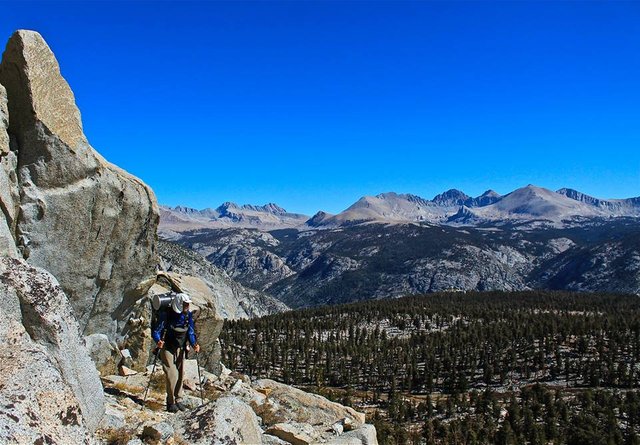
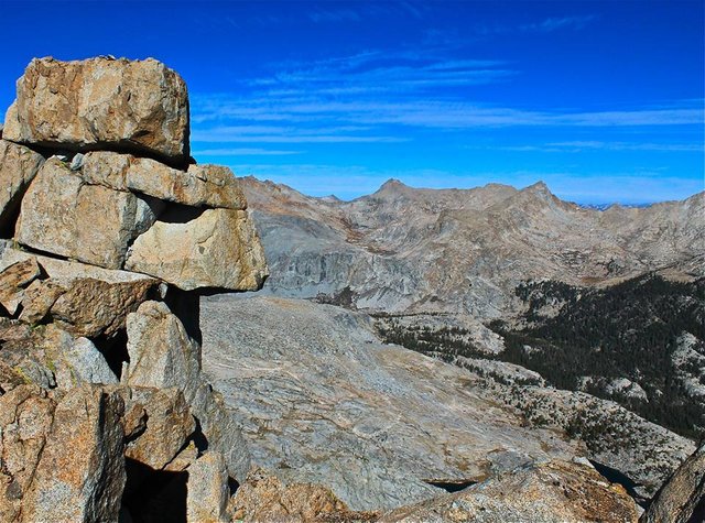
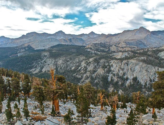
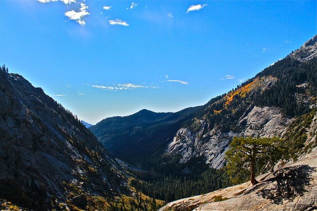
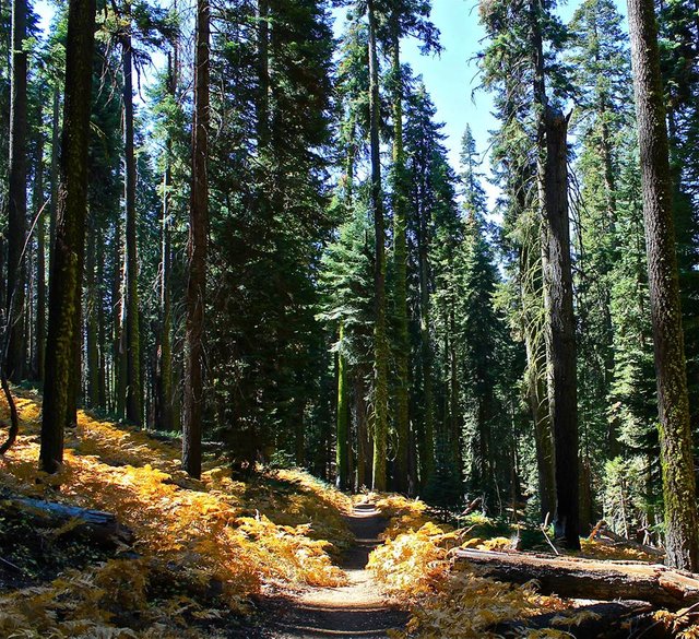
I drove up to Sequoia national park and met Rogue at the Lodgepole campground. We got our gear together and then drove over to the start of the High Sierra trail at Crescent Meadow in the Giant Forest. From the meadow the trail passed through some Giant Sequoias before emerging onto the open hillside high above the Kaweah river providing incredible views across the valley to Castle Rocks, up at the Great Western Divide, as well as Blue Dome, Sugerbowl Dome and back to Moro rock. And while the trail does climb up and down a bit it was still relatively easy going allowing for us to just cruise and enjoy the views.
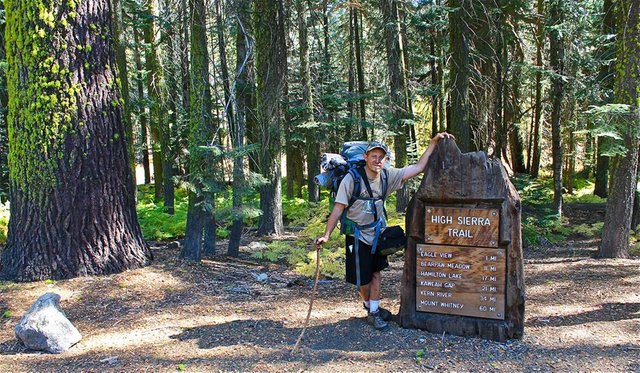
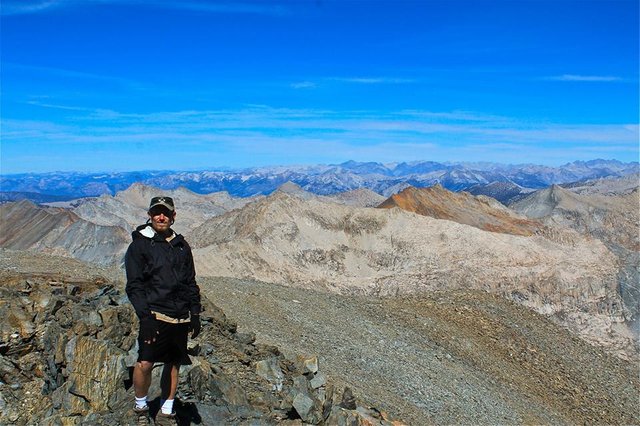
Me at the trailhead

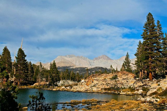
Crescent Meadow
Castle Rocks and the Kaweah River below
Looking back at Moro Rock
Panther Gap
Sugarbowl Dome
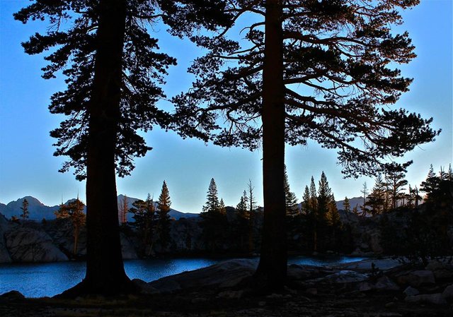
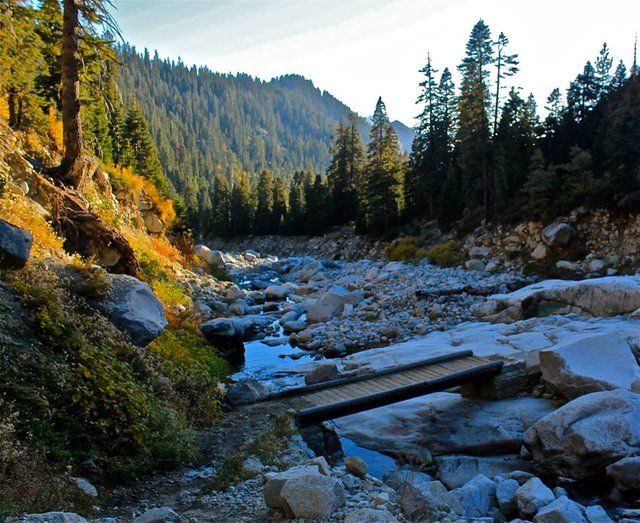
As we hiked the clouds started to build, blocking many of the views. After about 10 miles we dropped into Buck canyon. We climbed up and over Bearpaw meadows, and then traversed along a cliff, high above River Valley, before dropping down to the bridge across the gorge at Lone Pine Creek. Just above the bridge we found a good spot to setup our first camp and a spot to access the creek for water. There was also some Fish and Game employees on the trail, they were pretty friendly and made for some interesting conversation and they camped by us that night and hiked a bit with us the next morning.
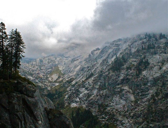
Traversing high above River Valley
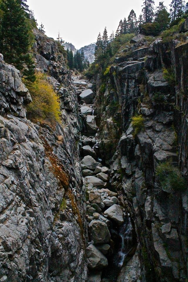
The gorge at Lone Pine creek
Views from camp

Day 2
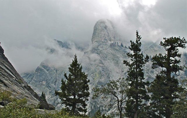
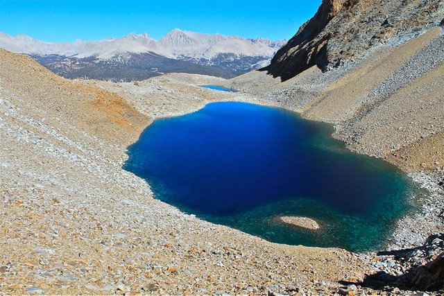
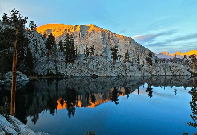
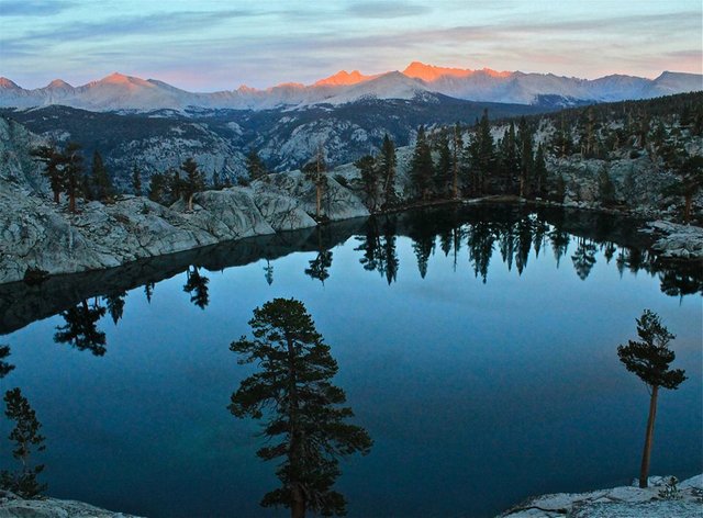
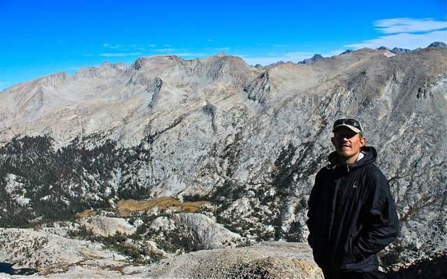
So, those clouds snowed on us the first night! Not a lot though, only a 1/2" or less. Just enough to make stuff all pretty looking in the early morning. We woke up to a clear sunny day, packed up camp as the snow melted and continued up the trail. We climbed up passed the Hamilton lakes and Precipice lake and crossed the Great Western Divide at the 10,700' Kaweah Gap.
Hamilton Towers in the morning
Valhalla
Hamilton Towers, Hamilton Lake, and Valhalla
Eagle Scout peak towering above us on our way up to the gap
Rogue approaching Kaweah Gap
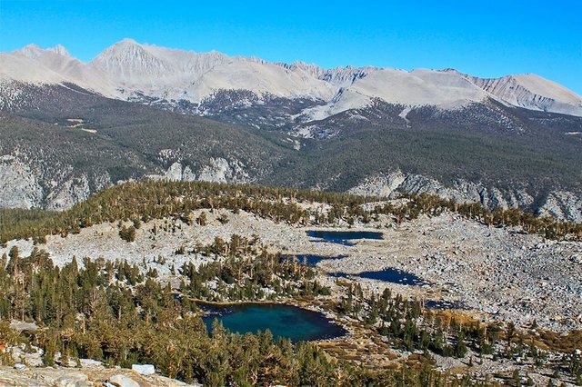
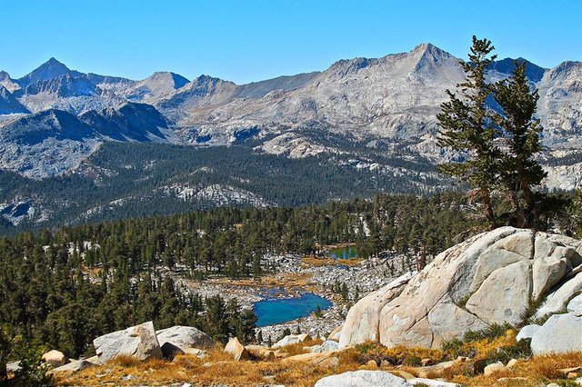
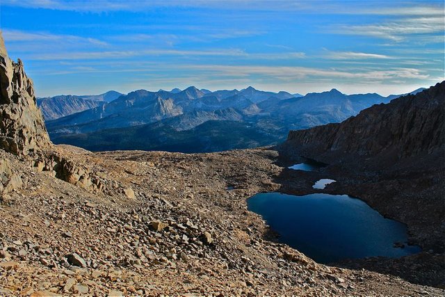
Nine Lakes basin from Kaweah Gap
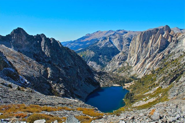
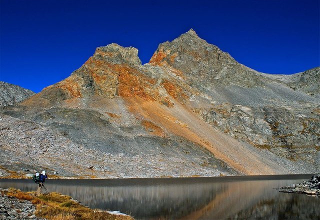
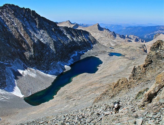
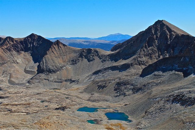
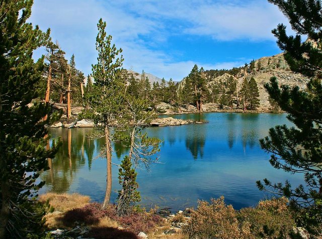
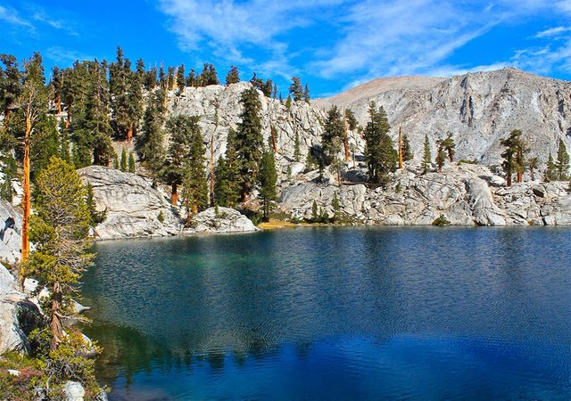
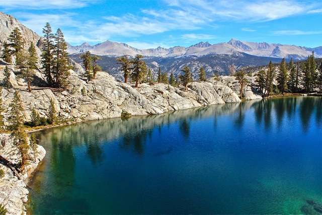
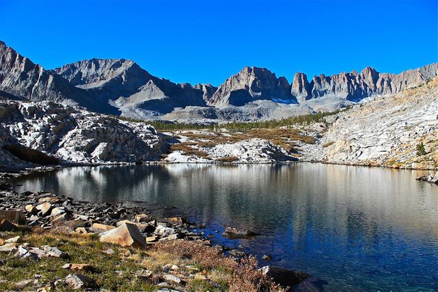
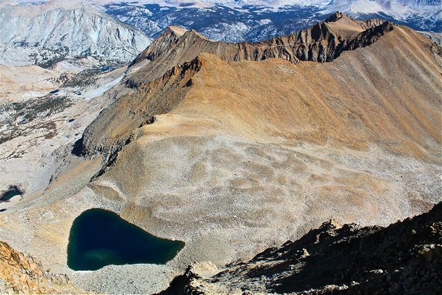
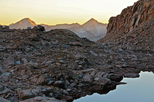
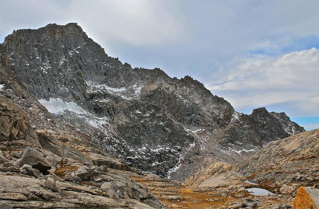
From the gap we left the trail and headed across Nine Lakes basin and climbed up to Lake 11,682' perfectly tucked in between Lawson peak, Kaweah Queen, and the north face of Black Kaweah! We made our camp there by the lake and enjoyed the sunset.
Lawson peak from Nine Lakes basin
Lake 11,682' and the north face of Black Kaweah
Sunset from camp
Day 3
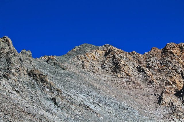
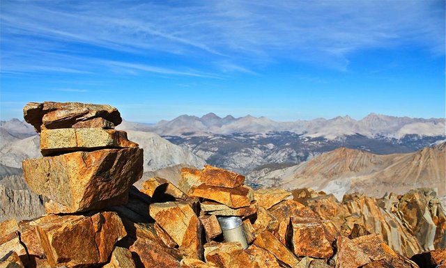
The plan for day 3 was to leave camp setup at Lake 11,682' and spend the day climbing Lawson peak(13,140') and Kaweah Queen(13,382')! First we headed up Lawson peak. It was an easy class 2 climb. The views from the summit were amazing, and the peak register was significantly interesting being a peak that very rarely gets climbed.
Rogue climbing Lawson peak
Me on the summit of Lawson peak
Kaweah Queen from Lawson peak
A zoom in shot of our camp from Lawson peak
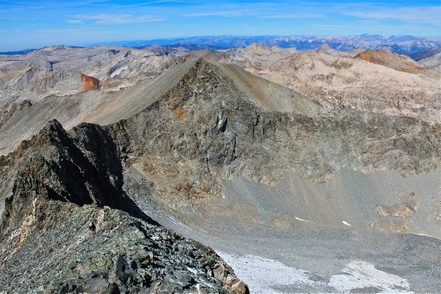
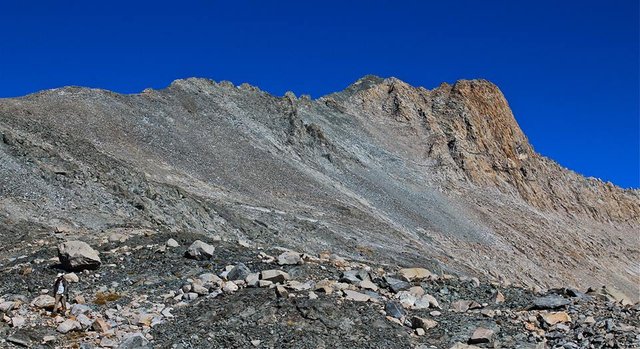
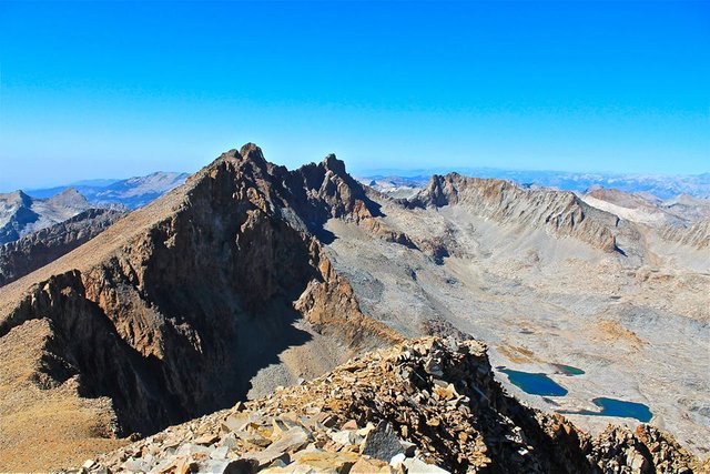
From Lawson we traversed over to Kaweah Queen. The traverse was mostly class 2 talus with a bit of easy class 3 to spice it up a bit. The views from the summit were similar to those on Lawson, but even more amazing with us now getting views into Kaweah basin!
Traversing from Lawson to Kaweah Queen
Climbing Kaweah Queen with Lake 11,682' way down below
Views north from the summit of Kaweah Queen
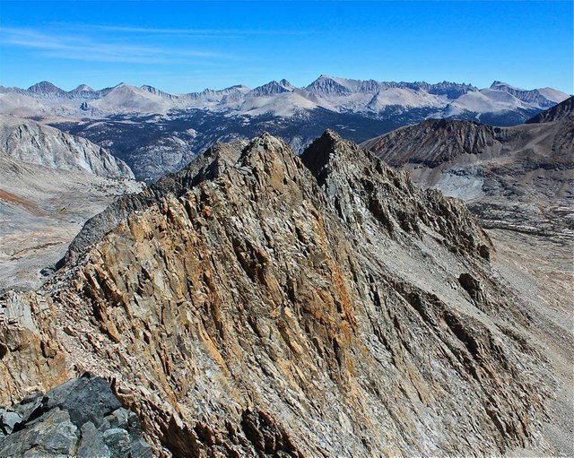
Views east from the summit of Kaweah Queen
Views south from the summit of Kaweah Queen
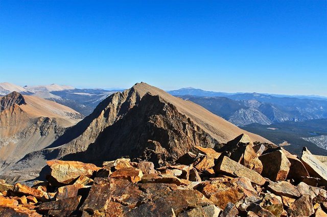
Mt. Kaweah and Kaweah basin
After taking our time enjoying the awesome views on the summit we descended back to our camp with enough time to get a nice swim in the lake before dinner!
Descending Kaweah Queen
Descending Kaweah Queen
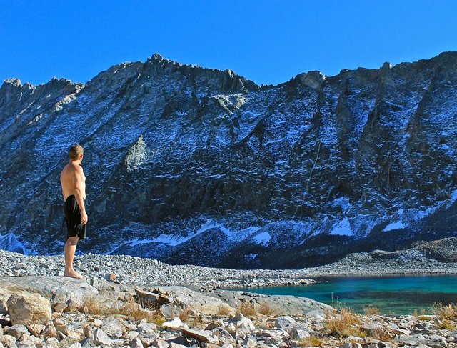
Drying off in the sun after a refreshing swim in Lake 11,682'
Day 4
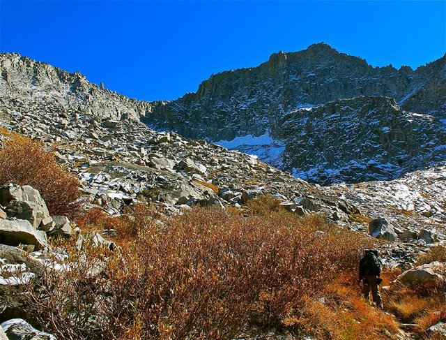
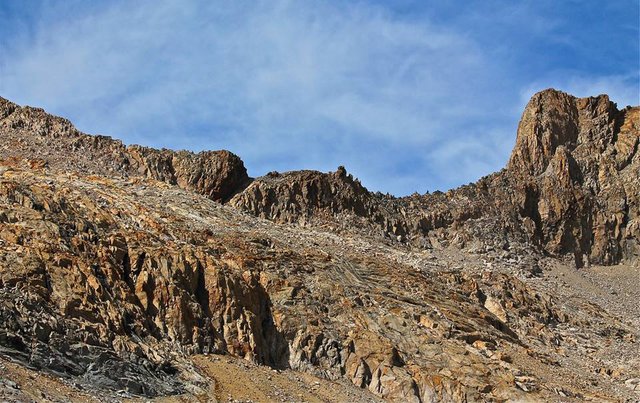
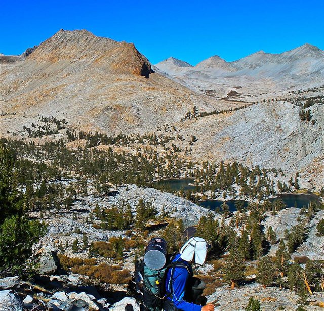
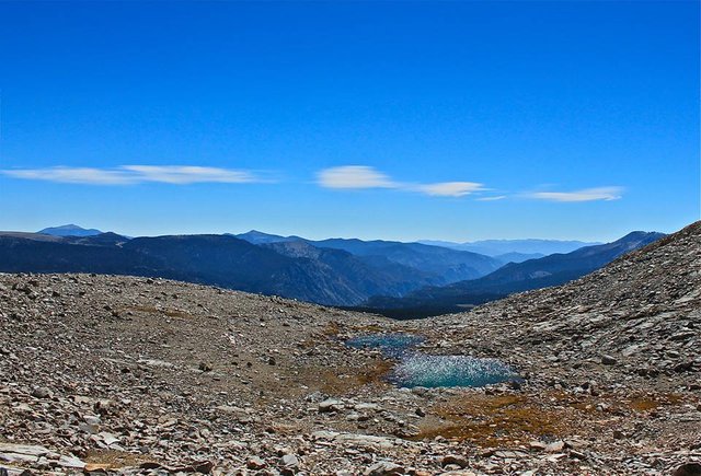
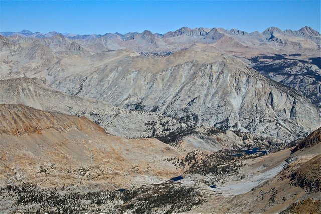
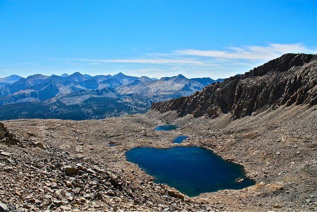
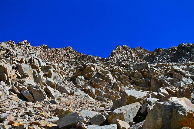
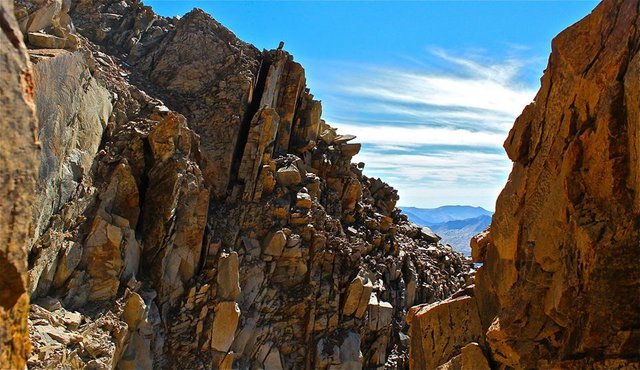
The next morning we packed up camp and began climbing towards Pyra-Queen Col. The pass between Pyramidal Pinnacle and Kaweah Queen that would give us access to the Kaweah basin! On the climb up a cold hard wind was pounding us making the tough climb even tougher. Although mostly all class 2, the Col required a bit of route finding and was full of loose rock everywhere. I got to the top of the Col and got over to the other side to get out of the winds. I waited for Rogue... and I waited... and he didn't show up so I started to get worried. So went back up to look over the Col and I didn't see him!! So I shouted his name. Just then I saw him above me, coming over the Col on a slightly different route. He'd had a minor incident with some loose rock and had hurt his finger. So after resting for a bit he had decided on a slightly different route over the Col. After a quick rest on the backside of the Col we descended into the spectacular Kaweah basin! We hiked down through the Kaweah basin lakes and made our camp at Lucky Clover lake.
Kaweah Queen from Pyra-Queen Col
Looking down into Kaweah basin
Getting into Kaweah basin
Looking back up at Pyra-Queen Col
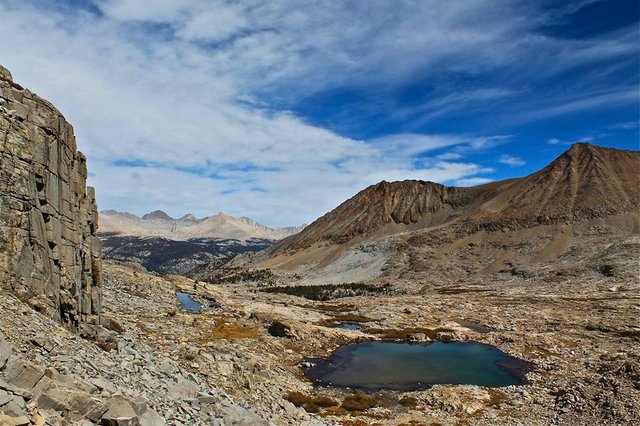
Kaweah basin
Kaweah basin
Kaweah basin
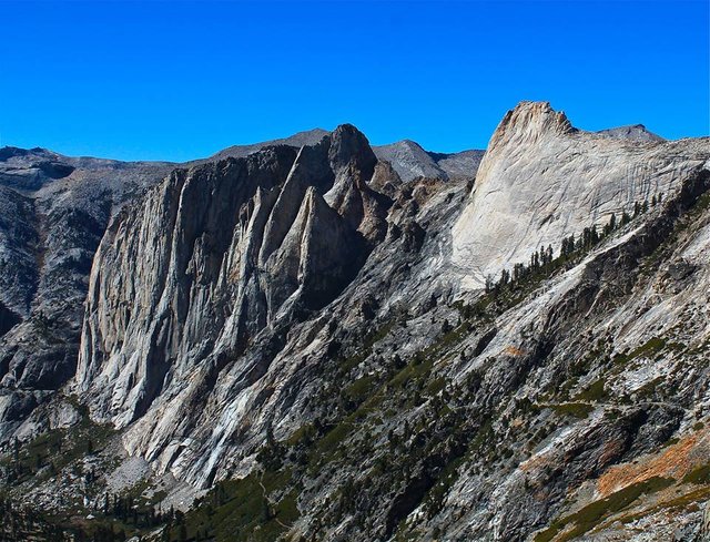
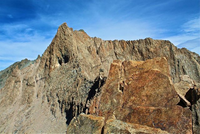
Kaweah peaks ridge
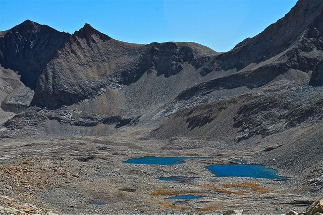
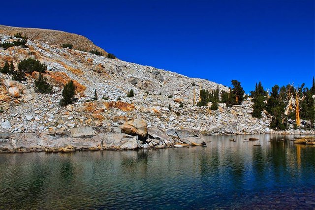
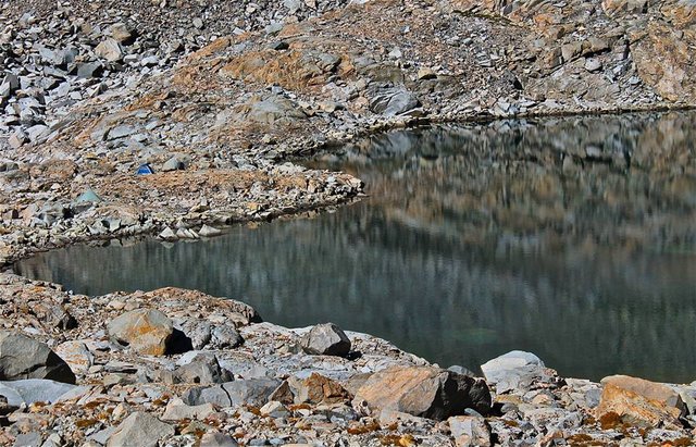
Kaweah Basin lakes
Kaweah Basin lakes
Lucky Clover lake
Camp
Views from camp
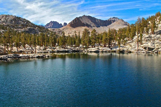
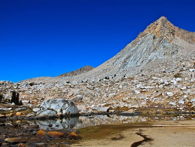
Day 5
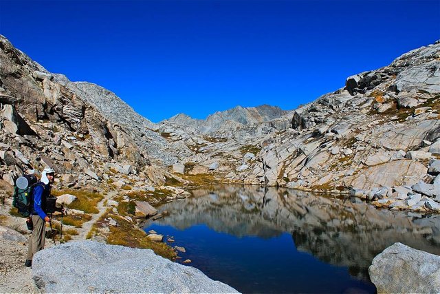
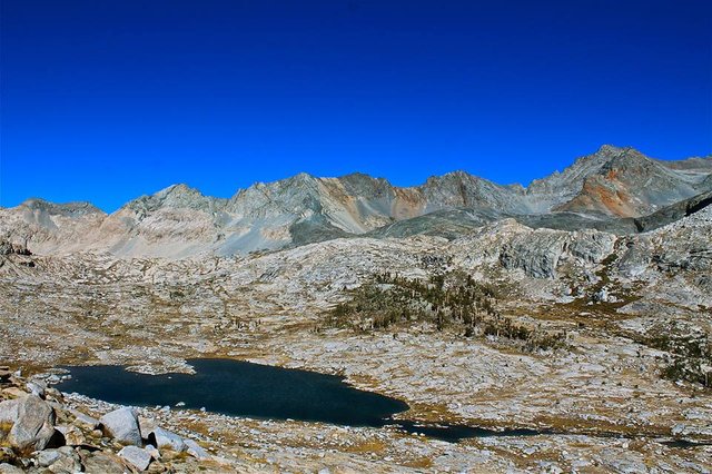
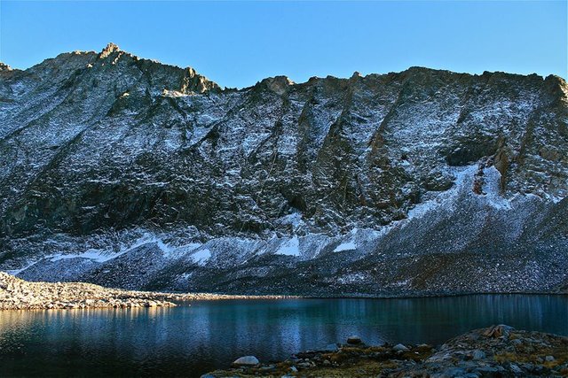
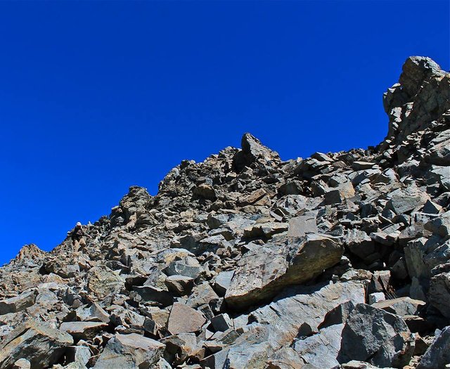
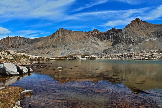
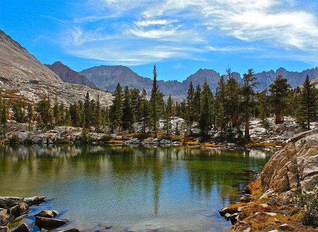
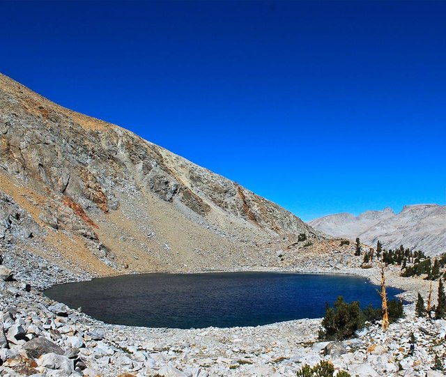
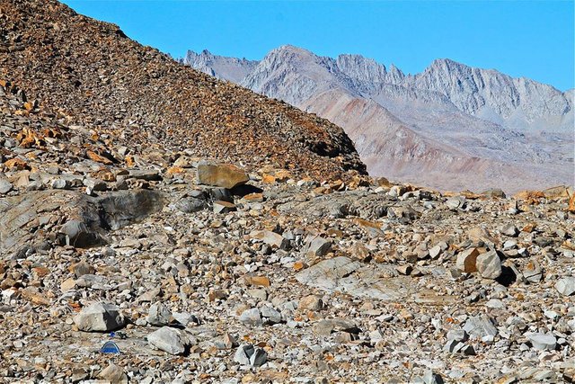
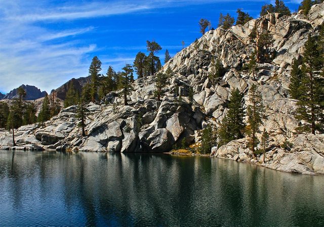
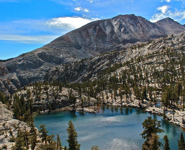
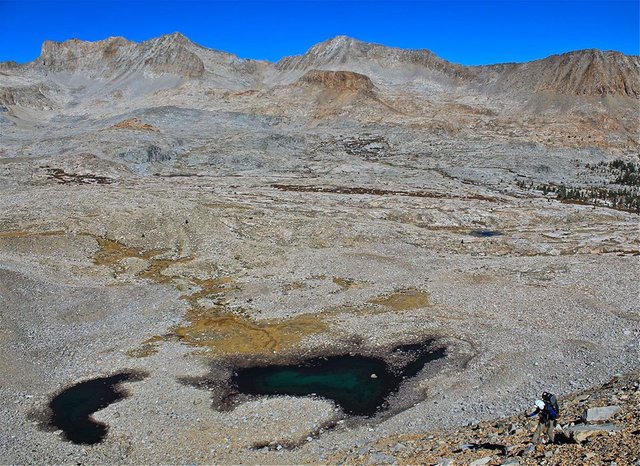
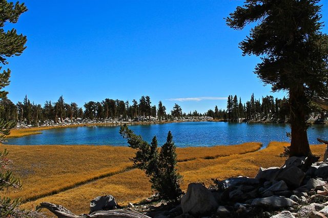
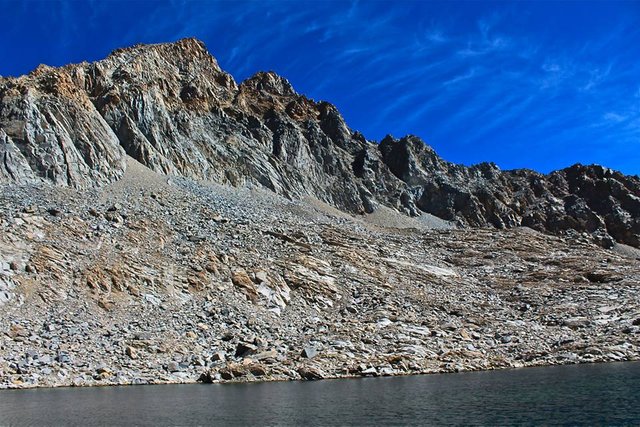
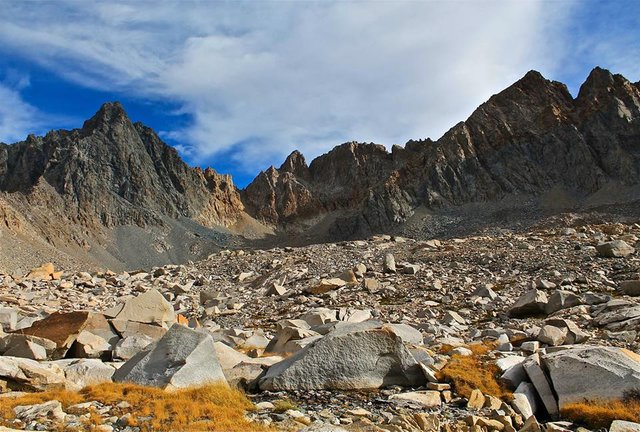
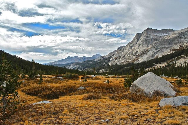
The next day we took our time packing and enjoyed a leisurely morning since we had planned for it to be an easy day. We left Lucky Clover lake and headed south, out of Kaweah basin, around the northern ridge of Red Spur to the Red Spur lakes. On our climb around the ridge we aimed too high and ended up on some cliffs that we hadn't planned on dealing with had we stayed lower. We talked about backtracking and going down and around the cliffs, but with a little route finding we were able to find a fairly short class 4 downclimb that allowed us to bypass the bulk of the cliffs. Passed the cliffs we got to the Red Spur lakes. We climbed up to the highest most remote of the lakes. The water was beautiful! But the surrounding shore was just desolate. Not a single tree or bush. Just talus. So finding spots to camp was a bit tough. I worked to move a bunch of rocks, Rogue just opted to go tentless and just laid out his mat on a big flat rock.
Climbing up from Lucky Clover lake
Making our way through the cliffs
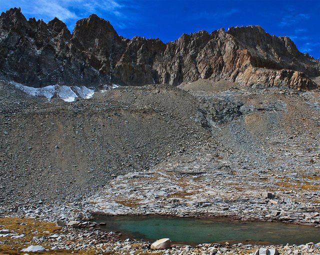
Red Spur lakes
Red Spur lakes
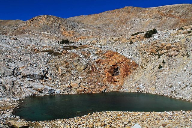
Red Spur lakes
Arriving at the highest of the Red Spur lakes
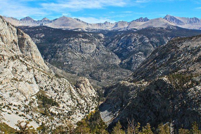
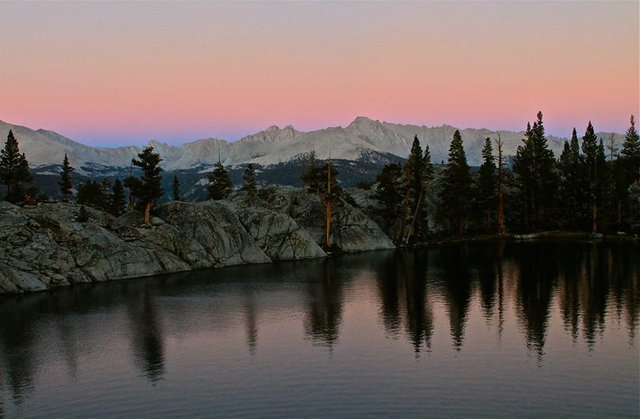
Since we had planned such a short day we were there early. So me being my restless self I headed out on a hike around the lake while Rogue relaxed and caught up on his Star Trek book. On my way around the lake I tried a bit of fishing without success. But I did get some great shots overlooking the lake with Kern canyon and Mt. Whitney behind it. And then that evening the sunset on the Sierra Crest... just spectacular.
Overlooking the lake
Zoom in on camp, my tent and Rogue just laying there reading
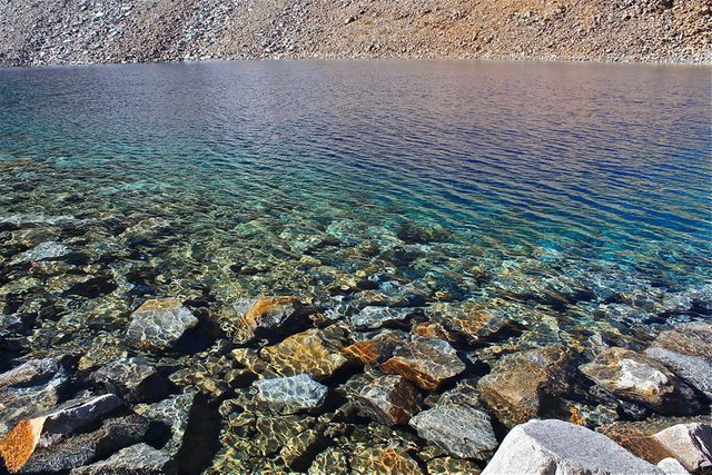
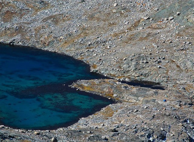
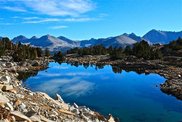
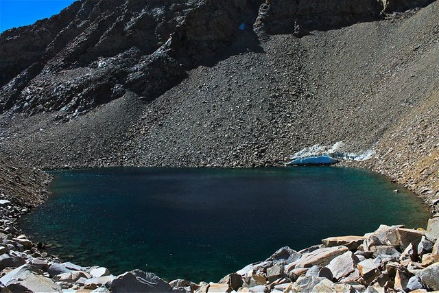
The water in the lake was amazing
More beautiful water
The upper Red Spur lake
Overlooking the lower Red Spur lakes
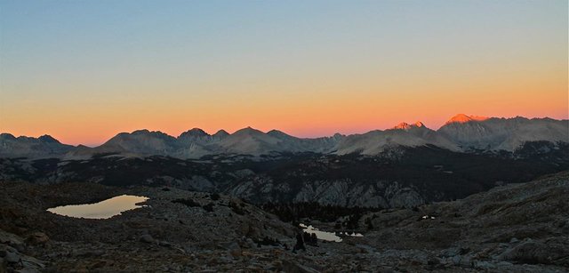
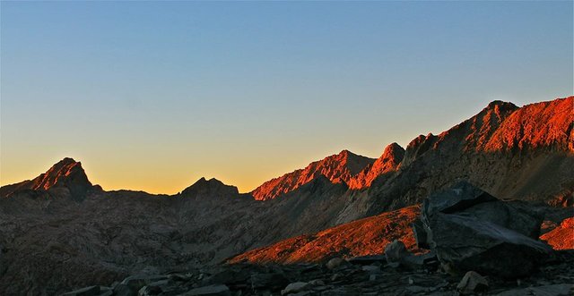
Sunset
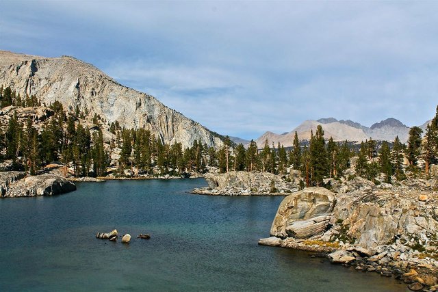
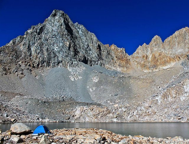
Day 6
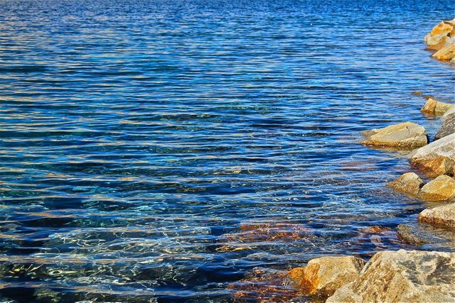
The next morning we packed up and headed back around the northern ridge of Red Spur (this time going lower to avoid the cliffs), and recrossed the lower part of Kaweah basin and crossed into the Picket creek drainage. We descended Picket creek to the renowned Picket Guard lake. The beauty of this lake has made it a desired destination for many a Sierraphile. We found a great spot to camp and spent the evening fishing. Easily just playing around with the huge abundance of trout in the lake! And once again the sunset on the Sierra Crest was just incredible!
Red Spur Lakes
Recrossing Kaweah basin
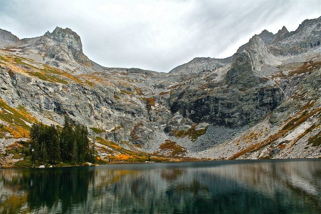
Picket Guard lake
Picket Guard lake
Views of Kern Canyon and the Sierra Crest from Picket Guard lake
Picket Guard lake
Picket Guard lake and the Sierra Crest
Sunset on Kern Point
Sunset on the Sierra Crest
Day 7
On day 7 we left our camp setup at Picket Guard lake and spent the day climbing Picket Guard peak(12,302')! The climb was easy but fun class 2. The peak had a really cool exposed summit block and although it's not the biggest peak, the fact that it stands relatively alone gives it really great views! We spent a good amount of time relaxing on top enjoying the summit then eventually made our way back down to camp. We got back with plenty of time still left in the day so we spent the afternoon swimming and fishing in the lake.
Ascending Picket Guard peak
The summit blocks
Me on the summit
Overlooking the lake on our way down from the peak
Yet another great sunset
Day 8
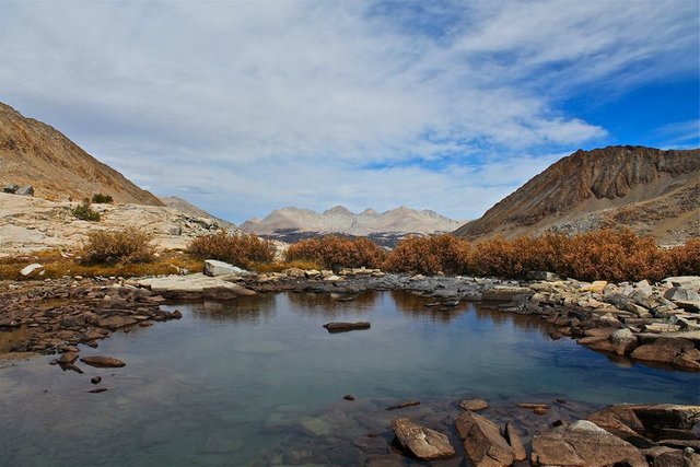
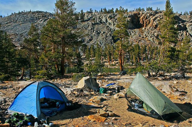
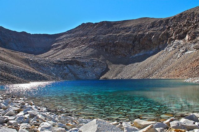
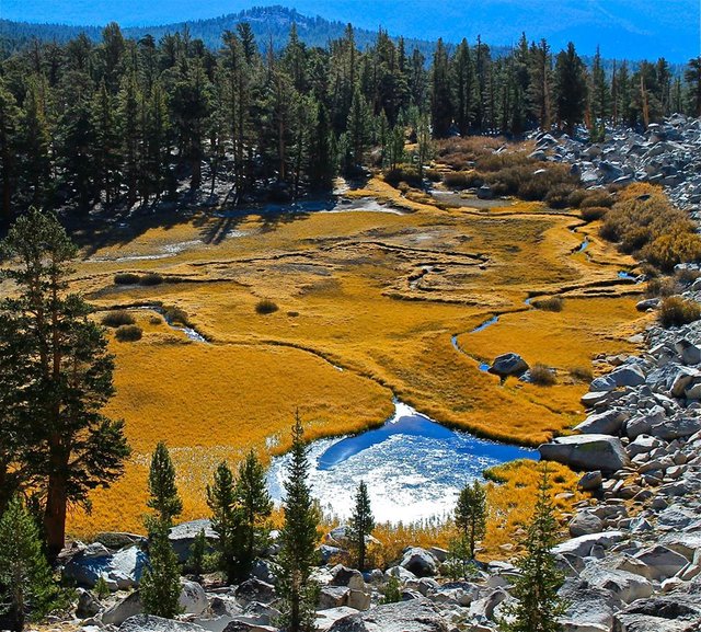
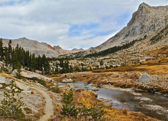
The next day we left Picket Guard lake and recrossed Kaweah basin for the third and final time. This time we headed for Kaweah pass. The climb up the pass wasn't technical, but the big steep climb was quite tiring. And similar to Pyra-Queen Col we had a ferocious cold wind beating on us making it that much tougher. But we made it and got to the lake at the top of the pass, right at the base of the east face of Mt. Kaweah, and we took a good break there before descending the south side of the pass to the Chagoopa plateau where we found a nice meadowy lake to setup our camp by. This night we could tell it got really cold, and that would become the trend for the rest of the trip.
Sunrise at Picket Guard lake
Recrossing Kaweah basin again
Climbing Kaweah Pass
Kaweah Pass lake
Descending to the Chagoopa Plateau
Arriving at the lake
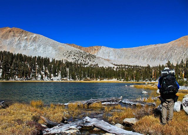
Rogue getting to the lake
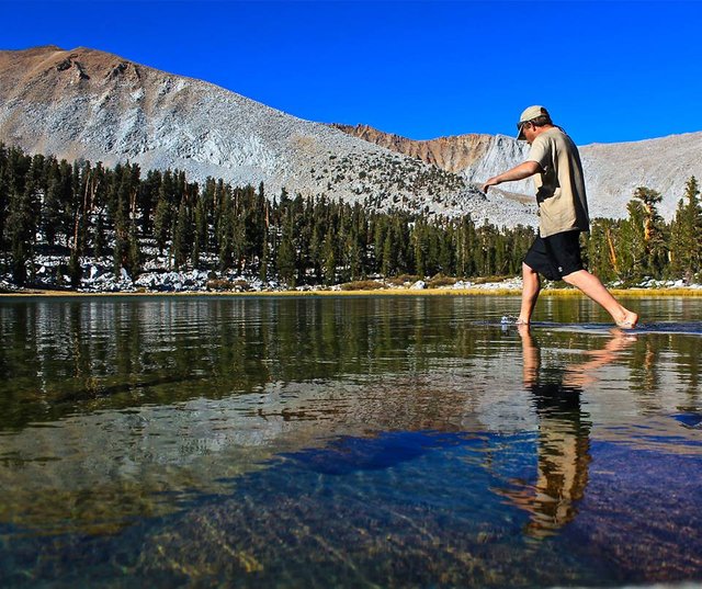
Me dipping my feet into the COLD water
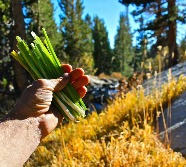
Picking us some wild onions to add to dinner
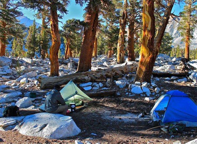
Camp
Day 9
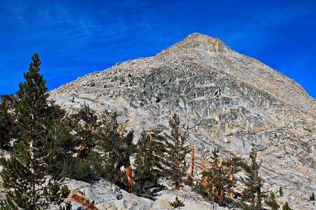
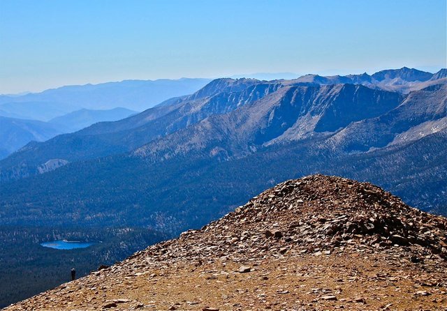
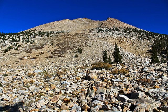
The next day was dedicated to climbing the biggest, tallest, peak in the Kaweah range... Mt Kaweah(13,802')! We left our camp setup on the plateau and headed for the mountain. It wasn't a technical climb but just a long, steep, loose climb. Often sliding back as you climb up creating a two steps forward one step back scenario that can get quite tiring. Eventually we got to the top of it's massive peak, and of course the views were spectacular!! We spent plenty of time on top enjoying the summit and then made our way back down. Now enjoying the loose soft dirt, enabling us to just sort of "rock ski" our way down the mountain. Doing that we got down quick, and made our way back out to our camp for one more cold night on the Chagoopa plateau.
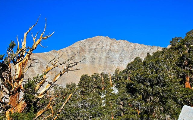
Approaching Mt. Kaweah
Starting the climb
The big climb up Mt. Kaweah
Rogue making his way up the mountain
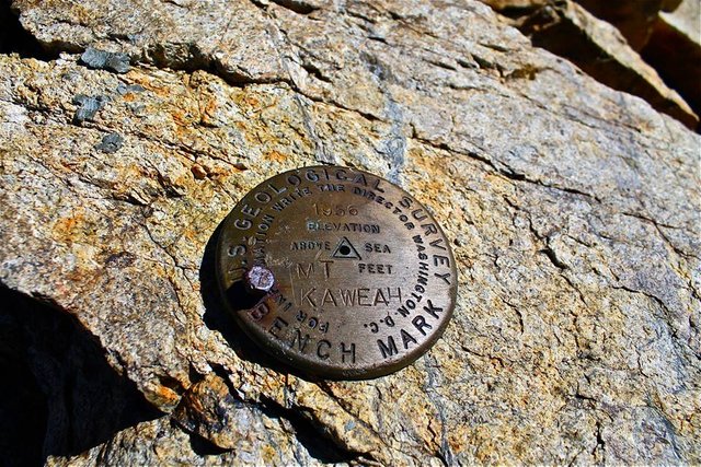
Summit marker!
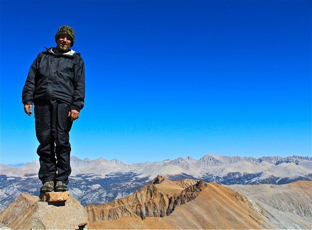
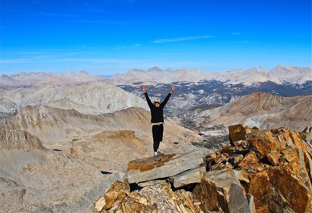
Me on the summit of Mt. Kaweah
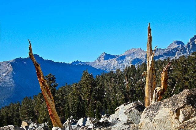
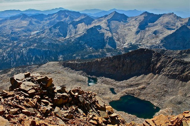
Looking down on Kaweah pass and Red Spur from the summit
Lower Kaweah basin and the Sierra Crest
Upper Kaweah basin and Kaweah Peaks ridge
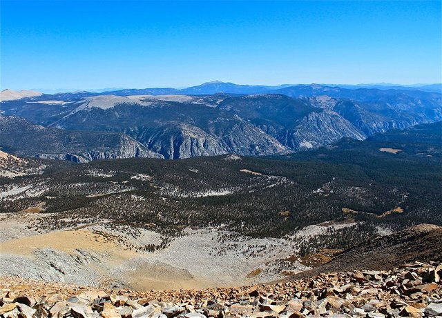
Overlooking Chagoopa plateau and Kern canyon
Looking back up at Mt. Kaweah
Getting back down to the beautiful meadows on the Chagoopa plateau
Day 10
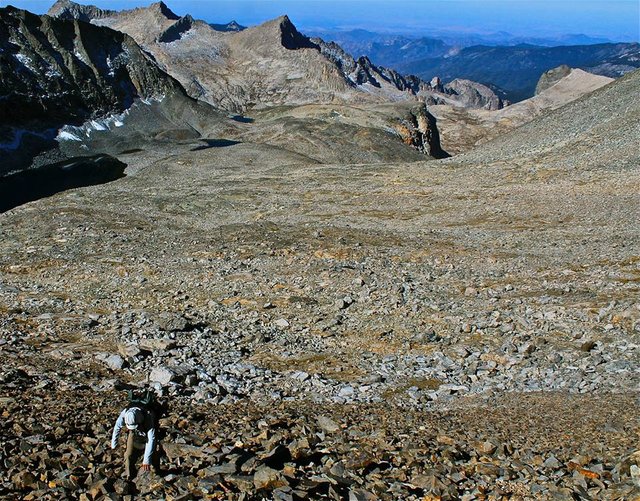
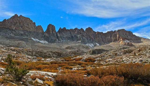
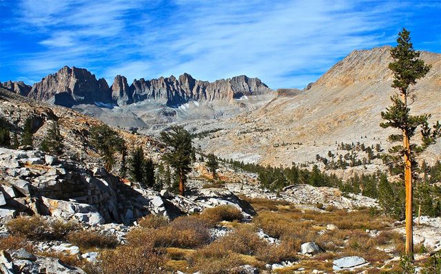
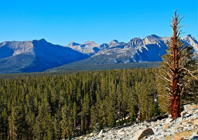
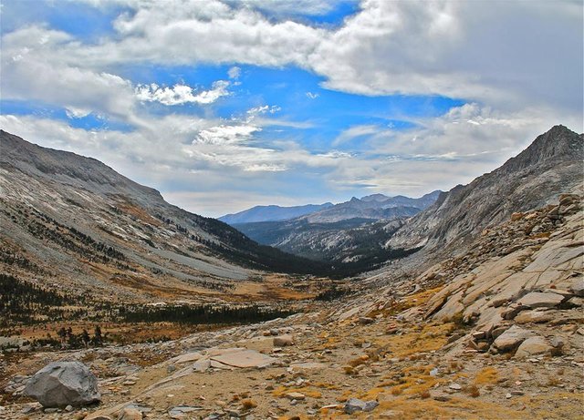
The next day we left the Chagoopa plateau and traversed along the southwest side of Kaweah peaks ridge passing many nice little meadows and lakes along the way. In one meadow I came up on some pieces of airplane from an old airplane wreck! So that was pretty interesting. Eventually we made our way to Red Kaweah lakes and found a spot to camp at the main big lake. The scenery there was stunning with both Black Kaweah and Red Kaweah just towering directly above the lake on the east and excellent views out to the Great Western Divide on the west.
Leaving the Chagoopa plateau
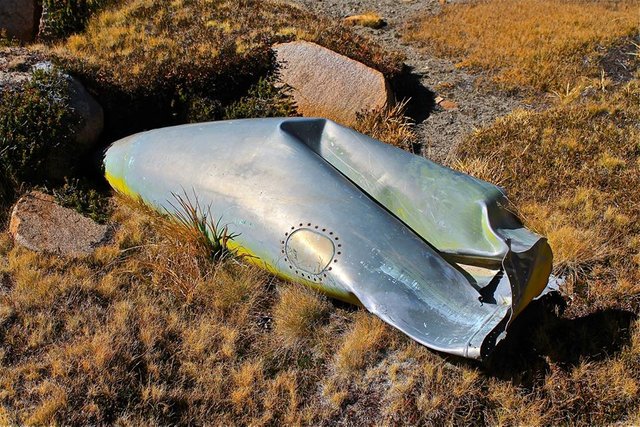
Finding pieces of airplane wreckage
Beautiful little lakes and meadows
Approaching Red Kaweah lakes
Camp at Red Kaweah lakes with Black Kaweah towering over us
Mirror reflection on the lake
Sunset on the Great Western Divide
Day 11
This was a day I will never forget. We started the day like any other. Had our breakfast and discussed our plan for the day. Our plan was to spend the day climbing Red Kaweah. But from the vague description we had I thought it was describing one route and Rogue thought it was describing another. We talked it over, but ultimately it was Rogue who originally planned this trip and had done much more research than I, so we started up his route. This route took us up into a gnarly class 4-5 chute. We tried our best to find a route, but it just kept getting more technical and more dangerous. At one point I was about 40 feet above Rogue, pushing my technical free climbing to the limit trying to scope out a route and coming up empty handed. I told him I was giving up and coming down. And as I started to climb down I made a step onto a large 2'x 3'x 2' rock that broke loose. I was able to stay on balance and secure on the cliff, but the huge rock kept going. Down into the narrow chute with Rogue standing helplessly below with nowhere to hide! My heart jumped out my chest and I yelled "ROCK, ROCK! LOOKOUT!!" Luckily the huge rock hit a ledge on the way down and exploded into a hundred smaller pieces. Still very dangerous, but less deadly. Rogue tucked his body against the far wall of the chute and covered his face in his arms as many of the pieces of rock hit him. I was relived just to see him survive. I made my way down the cliff back to him. And with all that he only had one injury. One of the rocks had made a nice deep cut on his ear. We did a little temporary first aid and then made our way out of the chute and back down to camp where we got his ear properly bandaged. I relaxed a bit and took a swim in the lake to calm my nerves. But with it still being early in the day I couldn't help looking at Red Kaweah and wanting to still try my route.
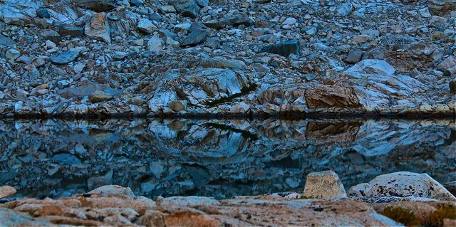
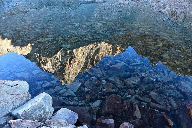 Black Kaweah reflecting in the lake
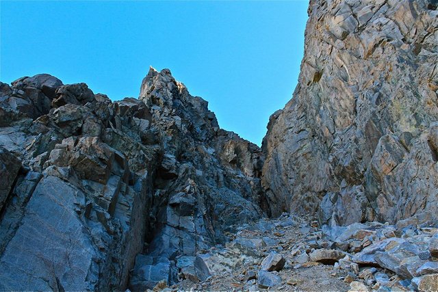
The infamous chute
Views from in the chute
Getting back to camp after the incident
Scoping out Red Kaweah for another attempt
I talked to Rogue about trying again, but he was still hurting and wasn't interested. But he told me to go ahead and give it a try so off I went. My route crossed over to the north face and headed up into a steep, but broad and wide open chute. It was mostly class 2 lower down getting into some fun exposed class 3 higher up. And loose rock EVERYWHERE! And without too much problem, I made it to the summit!! It was a little bittersweet not having Rogue make it with me, but oh my what an awesome summit it is!! Definitely one of my all time favorites. Even though it was getting late in the day I spent lots of time enjoying the fabulous view. Then I started my descent. I almost got into the wrong chute, but luckily realized it before I got too far. That would have sucked. I got back onto the proper route and worked my way back down, getting back to camp at the very end of the day.
Climbing above Red Kaweah lakes on the new route
Climbing up Red Kaweah
Some exposed class 3 in the chute
Red Kaweah summit blocks/summit register
Me on the summit of Red Kaweah
Great Western Divide and Red Kaweah lakes from the summit
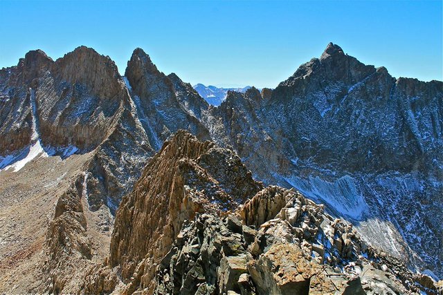
Mt. Kaweah from Red Kaweah
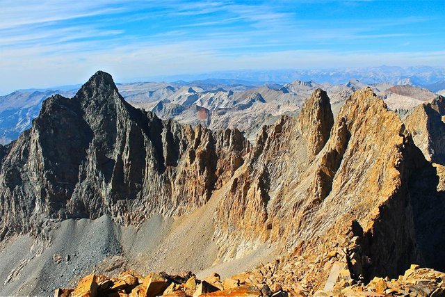
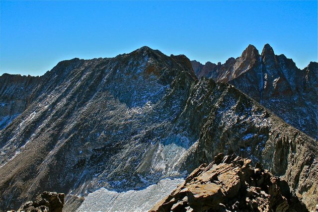
Black Kaweah, Pyramidal Pinnacle, Koontz Pinnacle, and Kaweah Queen, from Red Kaweah
Descending back down to camp
Day 12
So the next day we had planned to climb Black Kaweah. But after the incident Rogue didn't seem interested in climbing anymore peaks. And Black Kaweah was the most complex and technical of all our planned summits, and I had hardly studied the route so there was no way I was going solo. So we made the decision to start making our way out a day earlier than planned. We packed up and left Red Kaweah lakes and dropped down into the Big Arroyo. There we were able to once again catch the High Sierra trail and follow it back over Kaweah gap, down passed Precipice and Hamilton lakes, over Bearpaw meadow and down to Buck creek where we made our final camp. It was a long but pleasant day, the weather was great and just getting back on a trail after so many days of cross country can be a real relief!
Saying goodbye to Black and Red Kaweah
Descending into Big Arroyo
Big Arroyo
Big Arroyo
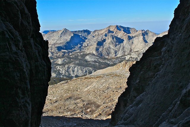
Overlooking Big Arroyo from Kaweah gap
The west side of Kaweah gap
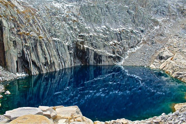
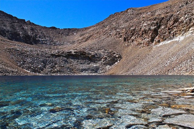
Precipice lake
Hamilton lake
Hamilton towers from the High Sierra trail
Overlooking River Valley
Arriving at Buck creek for our final night of the trip
Day 13
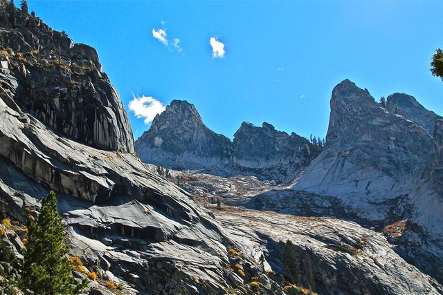
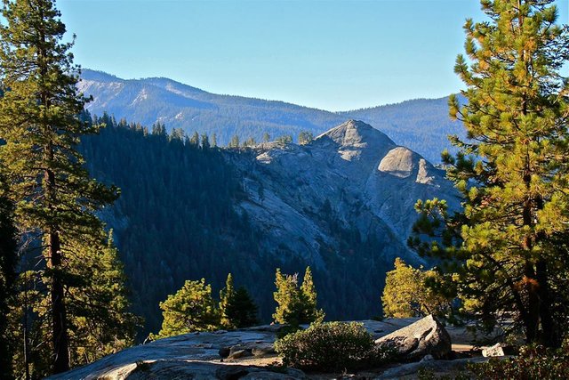
The final day of the trip. Always bittersweet. Such an amazing adventure it's a shame for it to end, but I know they all must eventually end. We packed up our camp at Buck creek and headed out the High Sierra trail for our final 10 miles ending the trip where we started at Crescent meadow in the Giant forest.
Sunrise on Sugarbowl Dome
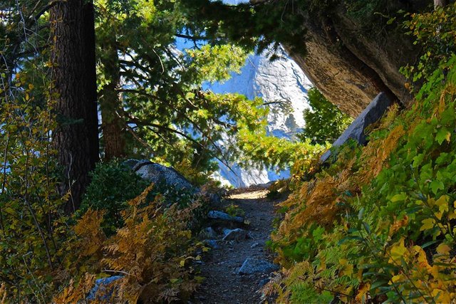
High Sierra trail
Getting back into the Giant forest
Steemit World Map
https://www.facebook.com/CAmountainadventures
Contact me on Discord


#SoCalSteemit is building and supporting the Steemit community of Southern California. If you are from SoCal and are into creating quality content here on Steemit, we'd love for you to follow us @SoCalSteemit and join our group on Discord


Join us @steemitbloggers
Animation By @zord189


Epic... those sunsets are amazing.. .the plane wreckage is pretty cool too.. maybe DB Cooper really isn't in Oregon
Those sunsets were among the best I've ever seen! DB has a little hidden cabin out there on the Chagoopa plateau... he's just out there in the wild livin' the dream. lol. j/k.
Once more you have taken us on a fabulous journey, your terrific photographs letting us see through your eyes what a beautiful country we live in. Please keep reminding us.
Trust me, I'm a doctor.
Hey @catweasel! Thanks! It truly is a beautiful country. I'll try to keep up with the reminders! lol.
Hiya, just swinging by to let you know you're being featured in our daily Travel Digest. Please drop by to check out all the rest of today's great posts and consider upvoting the Travel Digest if you like what we're doing.
Aw heck ya!! Thank you @steemitworldmap.
Wonderful and in depth report. felt like I was almost there.
Thanks @psyceratopsb!
Thank you so much for being part of the #socalsteemit community.
Thank you @socalsteemit!
Stunning, stunning photos @derekrichardson! The lakes are so clear and beautiful as they reflect the mountains, particularly the Precipice lake. Sorry about the accident. Hope Rogue's ear is ok now. What an adventure you guys must have had. Thank you for bringing us to your journey!
Thank you @marblely! Precipice lake really is a gem. Rogue will be fine, he'll probably just have a little scar on his ear to remind him of our wild adventure on Red Kaweah!
Hehe.. that is one cool scar :) You are right, Precipice lake do look like a gem. Is it really blue and green in colour? So beautiful. I love gemstones :D.
There are so many photos in this post (wow!) that only half of them, or a little more, would load for me with my slow Internet. But, what I was able to see were splendid! Maybe a large series like this would be better split into 2 or 3 separate posts? Just a thought...
Anyway, big thanks for sharing your marvelous photographic work with #steemitbloggers
Thank you so much @thekittygirl! The Sierra Nevada has such a variety of amazing geology, the landscapes are often unbelievable!
This post was spotted by @theluvbug and has received a 100% upvote and possibly a resteem too.
If you would like to possibly receive future support from @theluvbug
then please make use of the #theluvbug tag.
Spreading the STEEMIT LOVE with upvotes and resteems of AWESOME Steemit content. Use #theluvbug to get my attention :)
In Proud Collaboration with @steemitbloggers
and their founder @jaynie
interested in joining the Steemit Bloggers Community?
Thanks @theluvbug. Luv U!
13 days of such an adventure? WOW! Can I ask how did you do it with food and water? I see that you had almost no equipment. What an achievement!
You seem to be very lucky with the weather. The mountains seemed to be treating you well.
I'm sorry to hear about Rogue and his ear accident. I'm glad that he didn't get hurt any worse. It is such a pity that he didn't join you on the way to the summit.
The scenery is breathtaking. You show us some amazing photos. The terrain looks pretty rough but you managed very well. So many lose rocks!
Thank you for sharing! Cheers to such adventures!
Ya 13 days is pretty long even for me! It's A LOT of food to carry, the backpacks were definitely heavy at the start. Fresh clean water is fairly abundant in the High Sierra so we usually never have to carry more than 1 or 2 liters at a time. Besides the quick little snow the first night and the really cold nights towards the end we really were spoiled with nice weather on this trip. That's not usually the case in the Sierras. The weather up there can be really unpredictable, sun can be shining, clear blue sky, then clouds come in, huge thunderstorm hits, and just dumps rain and hail, and then by the afternoon the suns back out and the clouds completely disappear. You just never know up there, but we got lucky!
this was a wild ride to read! Very scary about the loose rocks and that big boulder, I'm glad you two made it out okay! The photographs are absolutely stunning though...you should look into submitting these to a gallery or something! Lots of great inspiration for painting, hahaha
Well... it was a wild adventure! lol. Loose rock can be really scary. And the Kaweahs are known for dangerously loose rock. I think the pictures are really awesome too, but I don't know about a gallery? I wouldn't know where to even start with that. Thank you though, I'm really glad you like them! You (or any artist) can paint any of my photos anytime you want.