Map showing the climate of North America compared to other countries
Map showing the climate of North America compared to other countries
Very interesting map, in my opinion very well illustrating the climate of a given region.
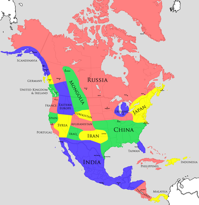
Photo from imgur.com
Please follow me and upvote
There is no reference chart for the color code. I wonder how am I to know what color represent what temperatures?
India is not cold and not too hot. Different citis have different tempratures.
The colors simply separate the regions. Each of these regions in N. America has a different climate. The country names show where in the world there's a similar climate. I live near San Francisco, but i've never been to Portugal nor Spain, (and now I know I never need to because its the same ;)