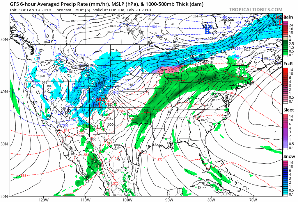
WINTER STORM WARNINGS IN THE WEST RECORD HIGHS POSSIBLE IN THE EASTERN US
The warm front which marks the leading edge of very warm air is pushing eastward and showers will be developing and effecting parts of the area..more north toward Northern Pennsylvania & North Jersey to Southeastern NY and less to the south. Once those showers are done we will probably see fog developing especially in areas north and west of the coast that might have a bit of snow cover left. The fog will take care of that in a hurry. Temperatures are likely to hold in the 40s and lower 50s overnight. Radars are picking up on the developing showers coming in from the west. This will not be a big rain producer and more of a nuisance than anything else.For areas west of the coast any low clouds and fog will give way to some breaks of sunshine which will take highs to the upper 60s and lower 70s however near coastal areas like Long Island for example and in parts of Coastal Southern New England the fog and low clouds could be stubborn for most if not all of the day. Temperatures in these areas will probably struggle in the 50s all day. Wednesday it seems that all areas should participate with at least some sunshine. Highs will reach into the 70s inland and perhaps stay in the 50s only along the immediate coast where fog and low clouds may again put up a good fight.
Thursday colder air returns and there is a chance for rain late in the day into Thursday night. Areas north and west of the coast might actually be cold enough for some freezing rain or sleet. This is a weak system so this won’t produce much but it will give the day a gloomy feel. Then Friday through the weekend several waves will be rippling along with shot of rain. The last one on Sunday will produce probably the most rain before dry air returns early next week.