Winter Weather Storm East Coast Update Major Rain Event Mississippi Valley
Back again with your semi-consistent storm warnings for the eastern portion of the United States! This time, if your living anywhere near the Atlantic Coast from Florida to near the southern end of Maine, even inland a bit from Texas diagonal to Ohio and all the states eastward, you will experience a complete WEATHER WHIPLASH this week and weekend!
Current Temperatures presented below, warm air can be seen advancing quickly into the Mississippi and Ohio Valleys and will move Eastward, bringing a stark change in temperatures across the entire region. Finally warm enough to the melt the snow, this extra run off combined with the massive potential rainstorm/snowstorm, many areas could see severe flooding, but that's my guess for this far out.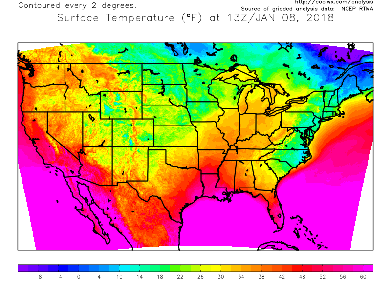
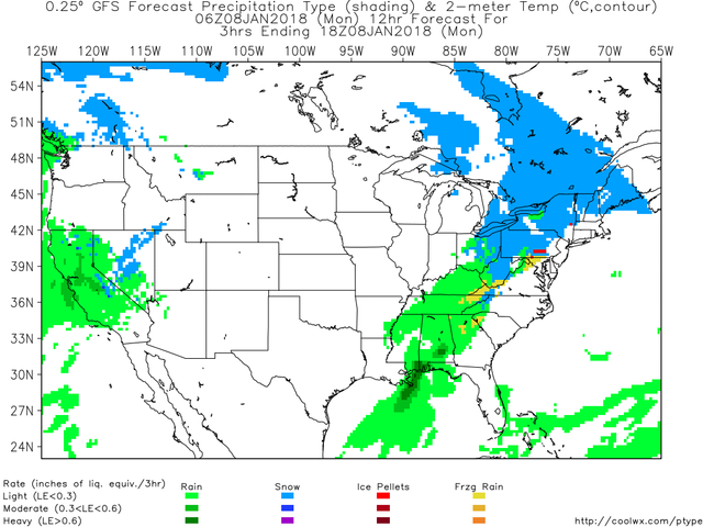
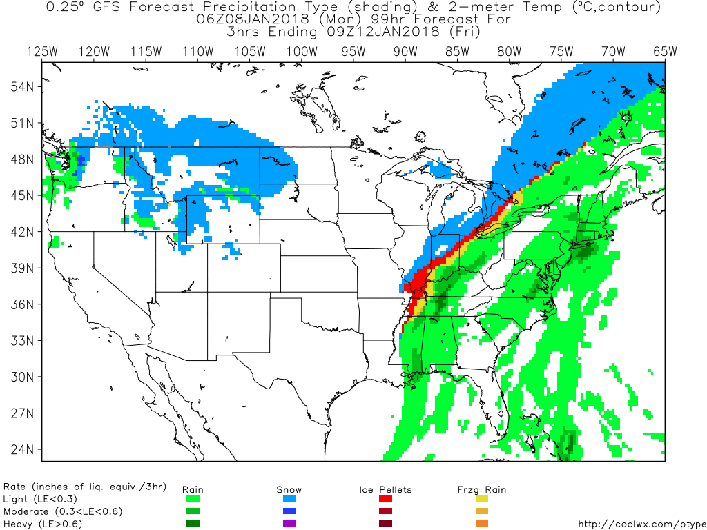
Firstly, the 6Z GFS model predicts our skies to look like the image below at 6pm EST this evening, Monday January 8th 2018..
So I am expecting another light dusting here in PA, and that could extend all the way north to Canada but the water will remain unfrozen just a bit south of the Mason-Dixon Line.
But... shortly after this weak warm front dusting of a storm moves out to sea.. our Temperatures will begin to rise steadily for anyone under the now much more northward jet stream.
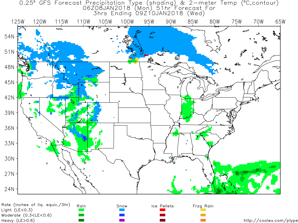
Wednesday at 9AM EST. The freezing line has moved much north and for a few days as the storm begins to converge and trek east, will allow snow to melt off to fill the banks of streams and rivers and low lying ares.
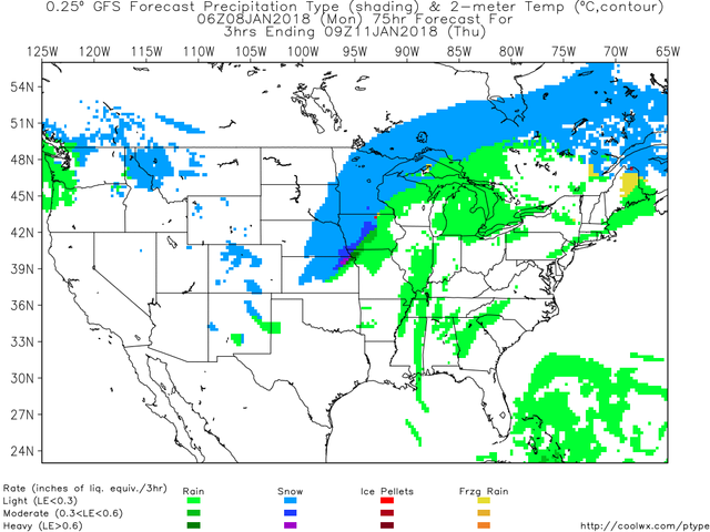
Just 24 Hours later Thursday at 9AM EST, major snow has begun to develop in the bread basket as the storm begins to converge and already rotate over the mainland. Typically, at least in my experience, these storms like to move off the coast before they begin to spin up and intensify like crazy.. Where the purple and dark green is (the heaviest precip) is most likely the rotating center of the storm - moving eastward.
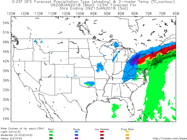
24 Hours Later again, Friday at 9AM EST...
24 Hours Later at Saturday 9AM EST...
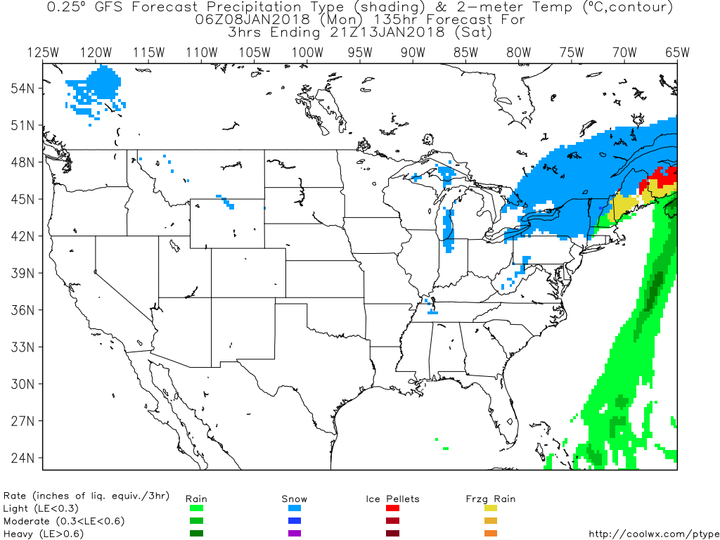
And then Lastly, 12 Hours later at 9PM Saturday..
Accumulation totals at 6AM on Sunday January 14th 2018..
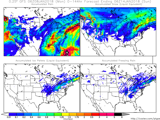
Make of this as you will. The last image i pulled from Coolwx.com shows a significant weather event unfolding this weekend. This could include extreme rain and flooding in the lower states and super icy conditions for northeastern states. And for most people living in the eastern portion of the nation will experience a flip flop in temperatures, for after the storm passing a large arctic air mass is bound to return. Winter is not near over yet. And these predictions are not set in stone. They are not guaranteed to occur so simply just prepare yourself for what you want. I have done good if you read this and look at it for yourself to make a decision to prepare or not. Ice storms have the capacity to bring down trees and take out power.
Stay safe out there!

Nice reporting. Resteemed and following. Brrrrrrrr. Cold
Thanks for the support. Stay warm out there
Your welcome. I escaped south to AZ for the winter. I’m not regretting it.
Gotta love semi-consistent weather predictions!
Sure do. You will too.
I have to say, if ther eis enough melt, then more snow/rain. It will be ugly. My patio was watering ujp nicely today with the melting snow and rain!
Expect it then. Temps are rising, and lots more rain and snow is converging soon. Be aware.