HERE WE GO AGAIN, THURSDAY/FRIDAY SNOWSTORM FOR THE NEAR ENTIRE EAST COAST!!!
Weather is dynamic. Models are beginning to indicate a pretty wicked snowstorm to impact the near entire east coast of the United States from the Northern border of Florida all the way to Maine and beyond..
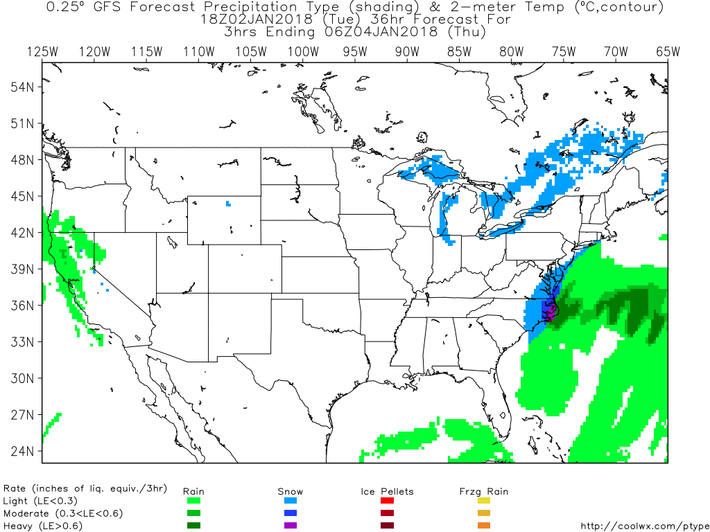
There appears to be a chance for snow in North Florida to begin this snow/rain storm as moist tropical air moves from the Gulf of Mexico and collides with the arctic air mass over the North American continent and moves with the jet stream over Georgia and begins to rotate in a counter clockwise fashion as it swings off the east coast around South Carolina/Georgia and veers sharp north. As it moves northward along the coast, the storms path of snowfall with sweep over land close to the coast, not more than 100 hundred miles or so inland as of this past model, and potentially dumping up to a foot of snow in locations like North Carolina's Outer Banks and anywhere right along the coast.
As of the 18Z GFS Model, the storm appears to be at a high strength/output around 6AM Thursday EST and last for 24 hours as it whips up the coast.
The accumulated precipitation at 78hr or Saturday at Midnight January 6th 2017.
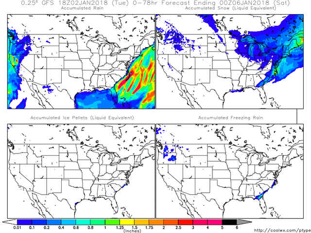
Don't forget, 1 inch of rain = ~11in of snow
I HAVE BEEN CLOSELY MONITORING THIS MODEL THIS PAST WEEK, AND THERE APPEARS TO BE A TREND IN THIS STORM. It originally converged off shore and had no significant human impact, but over the past few days I have noticed the convergence zone shift to over land, and may continue to do so, which could result in more snow in different areas and less in others! It all rides with that convergence and rotation of the storm.
My favorite website is Coolwx.com, its really simple to use with any basic understanding of weather and how read a legend of a map. I am sure they love my free advertising.
Stay safe yall!
-Biffy

Stay warm. Insane how it's been cold for a few days now and going to stay that way.
Im in PA, its been cold for more than a few days. But ironically, there will be a warm front to follow later next week.