And Here We Have It.. Both The NAM and GFS Agree, One More Winter Weather Blast (the last one I hope)! Set For March 20th - 22nd 2018
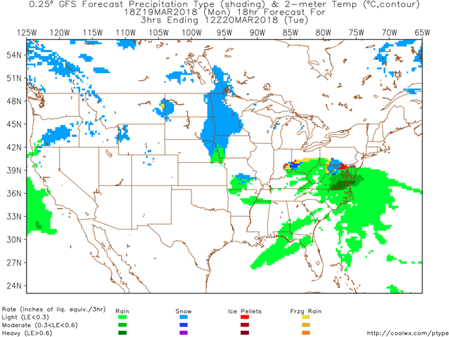
GFS Model result for Tuesday March 20th at Noon, EST
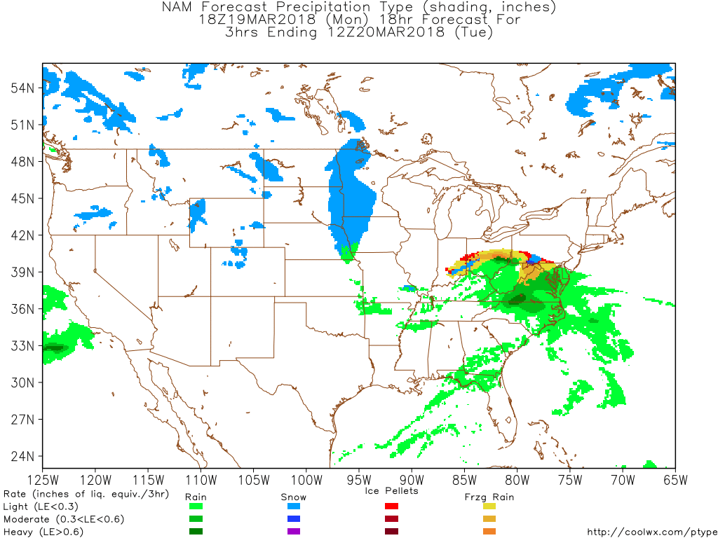
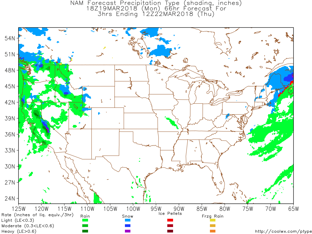
NAM Model result for Tuesday March 20th at Noon, EST
As is evident in the model results above for the 18Z runs, the two different models are beginning to come together in agreement that this storm is going to lay impact directly over my area, as well as millions upon millions of other people as it sweep up through the New England states.

GFS Model, Wednesday at Midnight
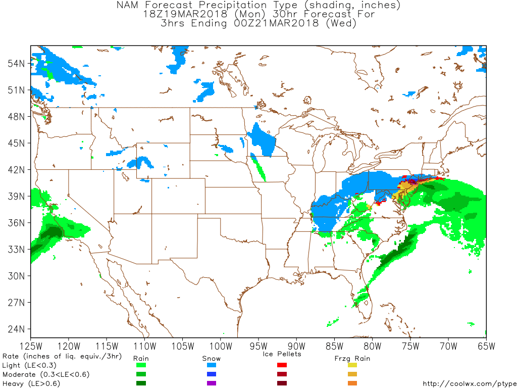
NAM Model, Wednesday at Midnight
Both indicate a decent blast of wintry weather to blow thru my area and perhaps knock down some trees and such with decent bursts of wind. As is pretty common for my area, with all these massive trees of Nolde Forest nesting on steep escarpments.. they are ready to fall with another slushy soil flush and windy weather cycle.

GFS Model, Wednesday at Noon

NAM Model, Wednesday at Noon
Winter weather will persist thru the day and into the evening on Wednesday for a large swath of land extending from the Ohio valley all the way to the Coast. Snow for Northern latitudes and lots of heavy rain for locations a bit South.

GFS Model, Thursday at Midnight

NAM Model, Thursday at Midnight
Wow, check the circular counter clockwise rotation on the cell in both the model runs. Looks like a hurricane, and will literally be packing winds close enough to be considered near the coasts.
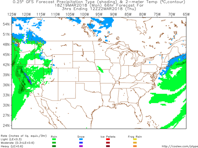
GFS Model, Thursday at Noon
NAM Model, Thursday at Noon
Both models are forecasting the storm to have just about cleared out entirely from the states, besides those locations closest to the coast and northern. Cape Cod, i would suspect, could experience some super intense, destructive winds this coming few days and then onward into the future as the large expansive air mass moves out.
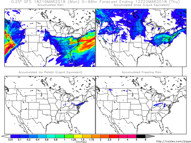
GFS Model, Total Accumulations as of Thursday at Noon
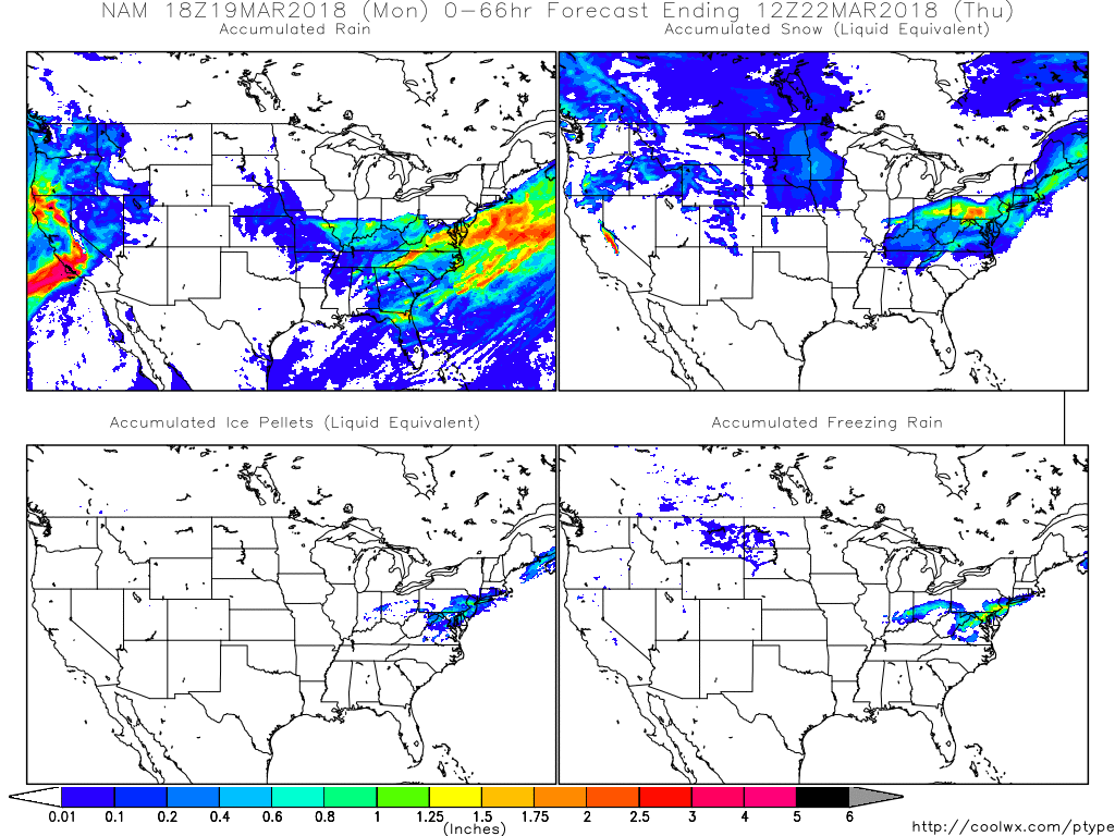
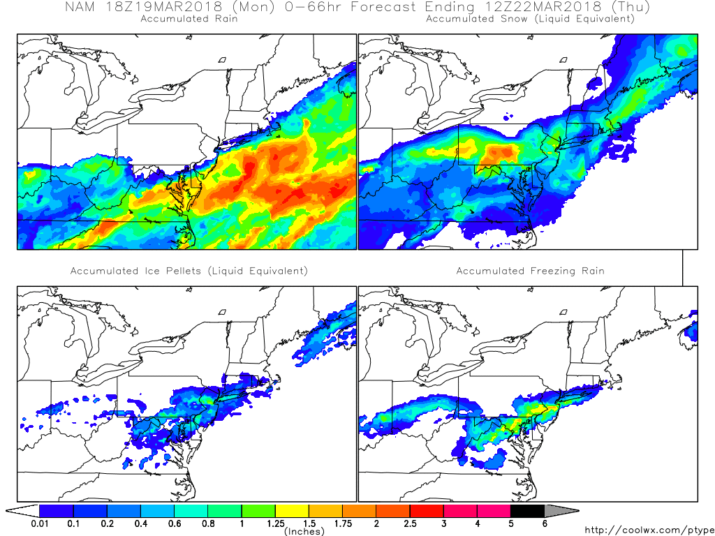
NAM Model, Total Accumulations as of Thursday at Noon
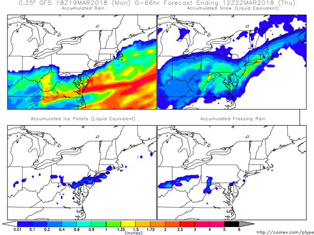
GFS Model, Zoomed on Northeast Sector, Thursday at Noon, Total Accumulations
NAM Model, Zoomed on Northeast Sector, Thursday at Noon, Total Accumulations
Certainly the NAM Model is showing some higher peak "local" totals for snow than the GFS Model, but both are in agreement that plenty of snow is going to fall regardless. But we shall see!
Lots of people are in the potential impact zone of this storm. Everybody stay safe out there.
We pray for Susan and her health. And for everyone else and their health.
Source: Coolwx.com