Walkwithme: Langåra nearby Oslo - autumn colors
First, some basic facts on Langåra - it's an island that is around 2 km long, and around 200m wide on it's widest. One thing that is really spectacular with this island is it's influence on the local meteorology. Sometimes it can be really windy on the south-east side of the island (during the last two weeks it has several times been near-gale, my wind meter has been measuring between 10 and 20 m/s, one of the reasons why I've been here at all), but really peaceful and quiet on the north-west side (with wind speeds usually between 0-5 m/s, largely dependent on the general wind direction). This day was one of them, around 1 m/s on the north-west side of the island, and probably around 8-15 m/s on the south-east side.
There has been some limestone mines on the island - I should check that up closer on my next visit. It was a very popular island for tenting in the summer season - many would live there the whole summer. By today, Langøyene has taken over this role (two long islands with a former garbage landfill between - they have more grass, better beach, better ferry connectivity), so most of the tourists on the island are boaters like us (perhaps the tenting people will return to Langåra in 2020 - they have big problems containing the old landfill at Langøyene, and will renovate the island in 2020/2021).
The island is largely unbuilt. There are two houses on the island plus some toilet buildings - one of the houses is a first aid station, the other house used to be a shop for the tenters. Today it's possible to rent "the shop" for overnight stays.
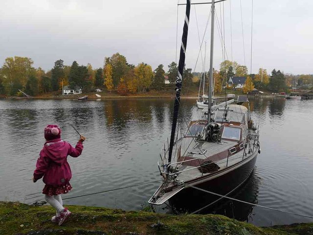
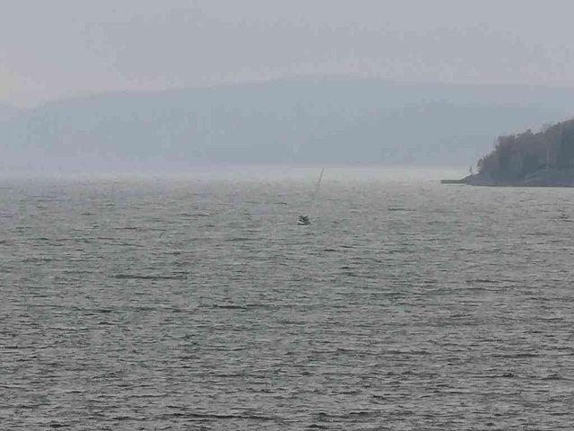
I briefly mentioned in my previous post that our dhingy got stolen. In the Oslofjord and Bohuslän the tide differences are very small, hence this is a popular way of anchoring the boat - one (or occationally two) anchors in the water connected to the stern of the ship, and then the boat tied up with two or more ropes to the land. The island behind is Brønnøya, which I covered in my previous post. The strait here is called Middagsbukta, I don't think I've written a post on it yet, but I for sure will - but then with the main tag #anchorage, not #walkwithme :-)
position: geo:59.852577,10.543096 (geohack) - 2018-10-14 11:21:22 localtime - full quality
Well, I feel like digressing a bit more ... some people really prefer this kind of anchorage, and think it's scary to "hang by a thread" as @marygreensmith put it. Well, to me it's the opposite. Dropping one anchor into the sea, that's easy and that's generally safe (exceptions apply), and one can go straight to bed. Connecting the bow to the land, that's a harder task, difficult to do it in the darkness, one ought to be at least two persons (one to jump in land, and the other one to control the anchor and engine), jumping can be difficult and/or dangerous (I once seriously hurt my foot and fell into the water as I underestimated the vertical distance), there is often some uncertainity if it's deep enough so close to land, it's difficult when it's a side wind, the force on the anchor (and ropes, and boat) will be very high if it's a strong sidewind, etc. But now ... #walkwithme! (or, rather, walk with us!) The main quay at the right hand of the strait here was briefly visited in my previous post.
position: geo:59.433044,10.652709 (geohack) - 2018-10-14 11:22:50 localtime - full quality
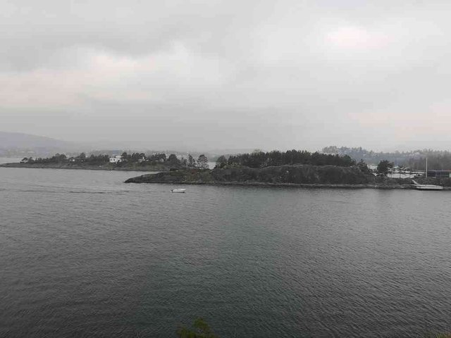
One more photo of Brønnøya. I'm not sure if I mentioned it in the previous post, but most of the beach territory on Brønnøya belongs to the commons, but there are exceptions, just to the right of the "no anchoring sign" (possibly the most disrespected "no anchoring"-sign in the world? but I'll get back to that in another post) there is a fence, to the right there is private land inaccessible for the commons. The road goes around this property.
position: geo:59.8516,10.539624 (geohack) - 2018-10-14 11:33:37 localtime - full quality
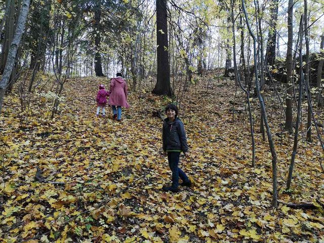
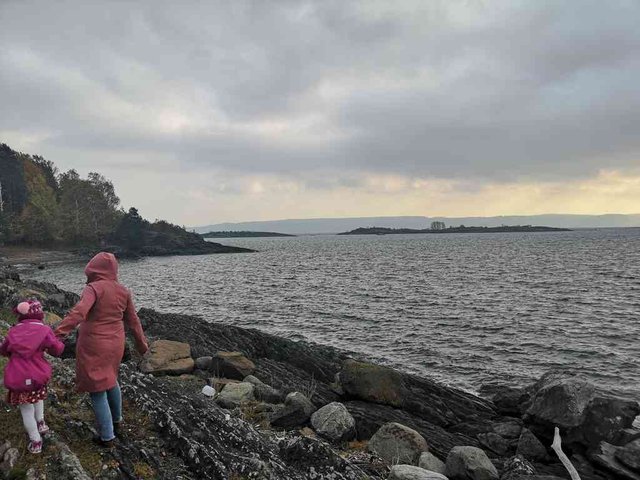
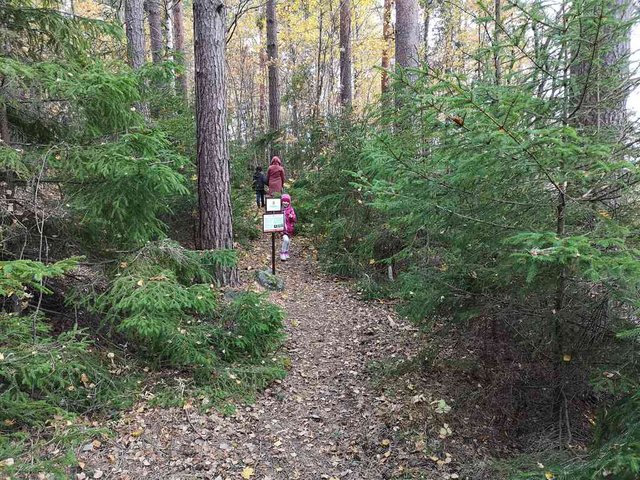
Autumn is here
position: geo:59.850307,10.53579 (geohack) - 2018-10-14 11:41:06 localtime - full quality
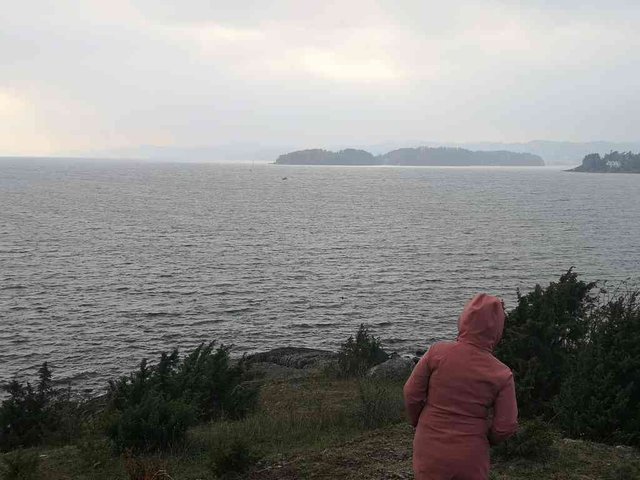
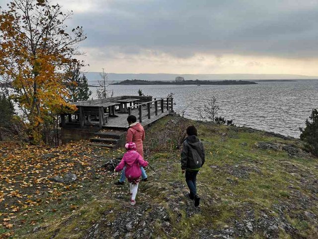
We're still on the north-west side of the island, and there is still no wind - but up this hill it tends to be more windy.
position: geo:59.848995,10.531836 (geohack) - 2018-10-14 11:49:09 localtime - full quality
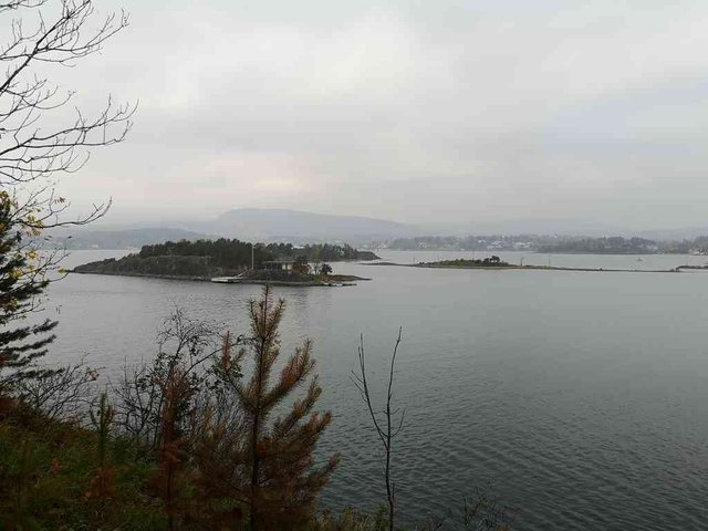
Those islands and the mainland behind was also photographed from Nesøya in my previous post
position: geo:59.84901,10.531142 (geohack) - 2018-10-14 11:50:23 localtime - full quality
Quite some distance down
position: geo:59.848163,10.527914 (geohack) - 2018-10-14 11:58:40 localtime - full quality
position: geo:59.848163,10.527914 (geohack) - 2018-10-14 11:58:46 localtime - full quality
The south-west tip of the island
position: geo:59.848011,10.527552 (geohack) - 2018-10-14 12:00:00 localtime - full quality
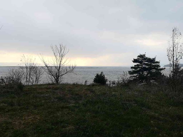
My last photo towards the northwest ...
position: geo:59.847774,10.527018 (geohack) - 2018-10-14 12:04:43 localtime - full quality
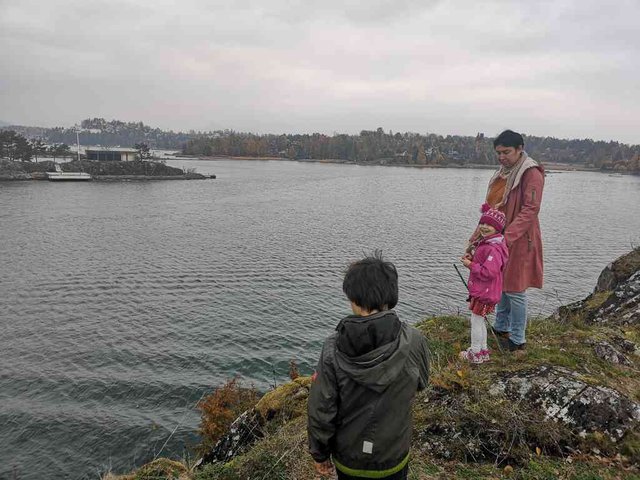
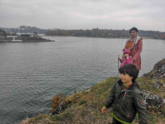
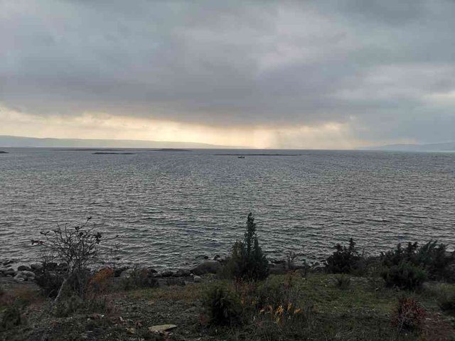
Then we're on the southeast side. It was not promised rain, but it seems like it's raining a bit in the distance. There is much more wind here, though the small islets shade a bit for the waves.
position: geo:59.847774,10.527018 (geohack) - 2018-10-14 12:04:48 localtime - full quality
position: geo:59.847774,10.527018 (geohack) - 2018-10-14 12:05:07 localtime - full quality
position: geo:59.847793,10.526943 (geohack) - 2018-10-14 12:05:33 localtime - full quality
position: geo:59.847793,10.526943 (geohack) - 2018-10-14 12:05:44 localtime - full quality
position: geo:59.823547,10.614574 (geohack) - 2018-10-14 12:08:13 localtime - full quality
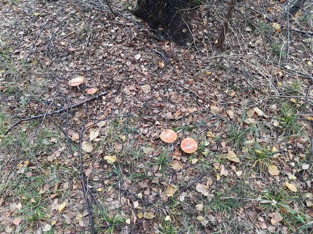
Amanita muscaria aka fly agaric (fluesopp på norsk). Poisionuos but beatiful mushroom.
position: geo:59.848159,10.531012 (geohack) - 2018-10-14 12:17:37 localtime - full quality
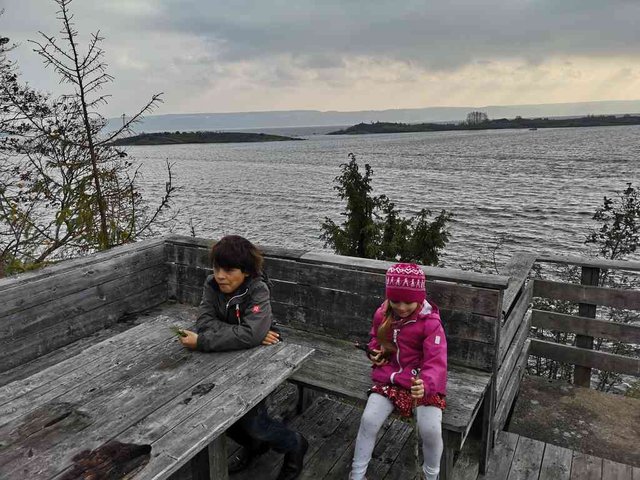
Picnic tables with a view
position: geo:59.847999,10.532361 (geohack) - 2018-10-14 12:19:22 localtime - full quality
They found some cloves to eat
position: geo:59.848098,10.532441 (geohack) - 2018-10-14 12:20:14 localtime - full quality
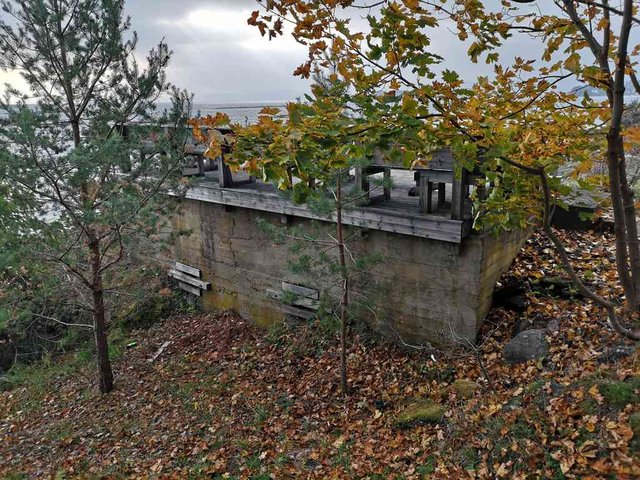
I guess there has been a building here before, only the fundament and basement left
position: geo:59.823547,10.614574 (geohack) - 2018-10-14 12:21:10 localtime - full quality
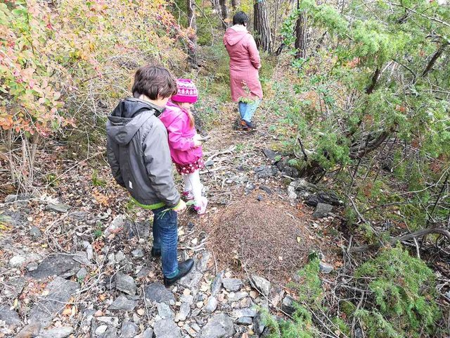
We found several ant colonies
position: geo:59.808994,10.46961 (geohack) - 2018-10-14 12:22:31 localtime - full quality
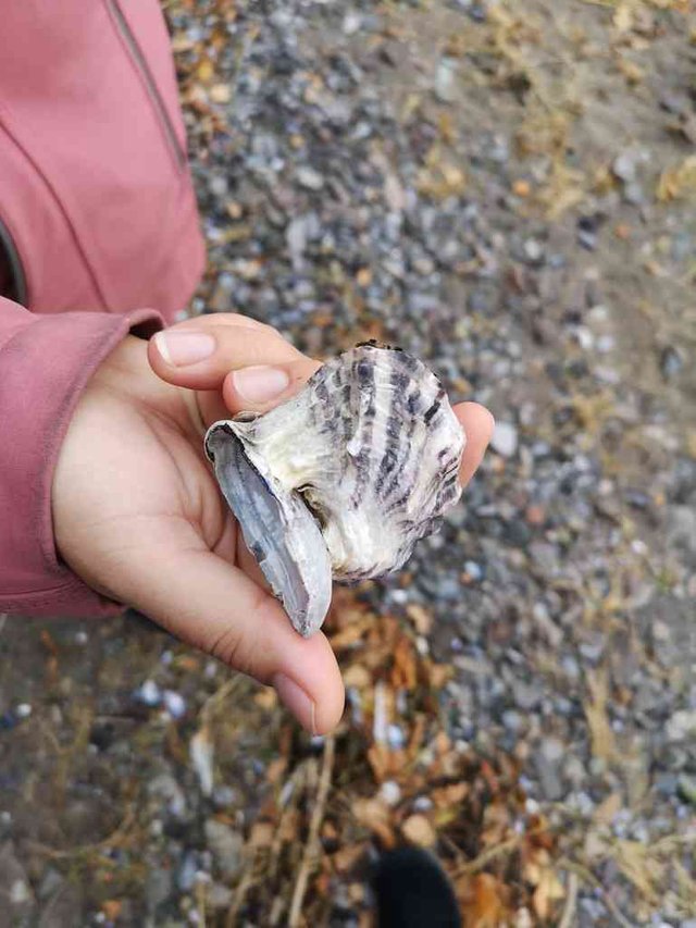
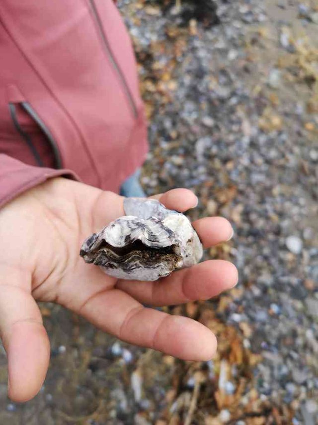
An oyster shell that has grown on the top of a mussel
position: geo:59.83395,10.643695 (geohack) - 2018-10-14 12:27:40 localtime - full quality
position: geo:59.84914,10.535257 (geohack) - 2018-10-14 12:27:43 localtime - full quality
The poster says that the area behind is protected
position: geo:59.789081,10.490362 (geohack) - 2018-10-14 12:47:49 localtime - full quality
Selected photos available in original quality on IPFS QmWCCufZxs2KoPeoLZLWFFdSLLvDbBMexywu8vwP3Fq82X. All photos taken available in original quality on IPFS QmXoY5foywrqbGVYwqWHxmWnkchZydDUuLmetQfBGmkhF8. The CC BY-SA 4.0 license applies on both my photos and the article
Don't be afraid to criticize my posts. I will give a 100% upvote to any (unique) reply pointing out typos, grammar mistakes or mistakes in the facts presented. This applies to any post or comment from me, no matter how old. I also usually give upvotes to opposing points of view, particularly when a good and logically valid argument is given.
The most disrespected no anchorage sign in the world, lol. What a beautiful place!!
Posted using Partiko Android
That place with the picnic table is definitely my tape of place. I like old tables in the open air and also eating outside. I haven't done that for a while though.
Are you going to keep the boat in the water over winter or take it out?
Quite windy there, though.
Boat stays in the water throughout the winters.
Its beautiful.
Congratulations, Your Post Has Been Added To The Steemit Worldmap!
Author link: http://steemitworldmap.com?author=tobixen
Post link: http://steemitworldmap.com?post=walkwithme-langara-nearby-oslo-autumn-colors
Want to have your post on the map too?
Hi @tobixen!
Your post was upvoted by @steem-ua, new Steem dApp, using UserAuthority for algorithmic post curation!
Your UA account score is currently 3.865 which ranks you at #4148 across all Steem accounts.
Your rank has improved 3 places in the last three days (old rank 4151).
In our last Algorithmic Curation Round, consisting of 329 contributions, your post is ranked at #199.
Evaluation of your UA score:
Feel free to join our @steem-ua Discord server
Hiya, just swinging by to let you know that this post made the Honorable Mentions list in our daily Travel Digest. Please drop by to check out all the rest of today's great posts and consider upvoting the Travel Digest if you like what we're doing.
Wow, you and your family sure get out there, what a healthy way to live. I loved all the fall colours, the water, the shell, and of course that cloudy mist/threatening rain.
Thanks for another outstanding #walkwithme @tobixen! You are a champion.