The steep Daba Mountains
(Ta - pa bus Mountains Mountains also for Ta - pa Shan or Daba Shan) in western China, is China's shaanxi, sichuan, hubei provinces border the floorboard of the mountain.More than 500 kilometers [1] things, therefore, said li of bashan, abbreviation of bashan.[2] dabashan mountain is also the jialing river and the han river watershed, the sichuan basin and hanzhong basin
In a broad sense, dabashan refers to the general name of mountain areas stretching in sichuan, gansu, shaanxi and hubei provinces.The narrow sense of daba mountain in the han river tributary river valley east, sichuan, shaanxi, hubei province border.[3]
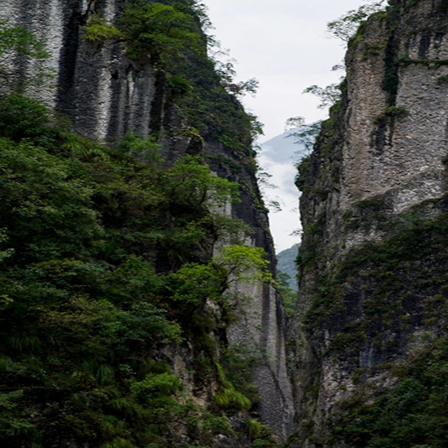
The great bus mountains are composed of mikangshan, dabashan (narrow sense), da-shennongjia, wudang mountain and jingshan mountain.The mountains run from northwest to southeast, facing the han river in the north, the Yangtze river in the south, the han river in the east and the dahong mountain in the south, the jialing river in the west and the motian mountains in the west, and the nanyang basin, jianghan plain and chengdu plain in the northeast, southeast and southwest respectively.It is about 560 kilometers from east to west and about 140 kilometers from north to south.The elevation of the ridge is generally about 2000 meters.Limestone, dolomite and sandstone are widely distributed in mountainous areas.Karst landform development, multi - peak cluster, cave, river and so on.Mountain valley height difference 800 ~ 1200 meters.[1]
The grand bus mountains from the northwest
To the southeast, including the motianling, mikang mountain and wudang mountain, nangong mountain, 2,000-2,500 meters above sea level, there are traces of ancient glaciers.Made up of hard crystalline limestone, the high mountain ranges are well developed.Mountain by the river for a long time after the strong cut, many canyons, steep valley slope
In a broad sense, dabashan refers to the mountains stretching across the borders of chongqing municipality, sichuan province, shaanxi province, gansu province and hubei province, with a length of 1,000 kilometers.It is the boundary mountain of sichuan basin and hanzhong basin.It's a folded mountain.The eastern end is connected with shennongjia and wushan.West and the motian mountains;The north is bounded by the han river valley.Northwest - southeast direction.Most of the mountains are more than 2000 meters above sea level. Due to the extensive distribution of limestone and the development of karst landform, there are peak clusters, underground rivers, trough valleys, and ancient glacier remains.The valley is deep, with a height difference of 800 ~ 1200 meters. There are only a few small mountain basins such as chongqing chengkou and sichuan wanyuan
In the narrow sense, daba mountain is located in the east of the tributary of the han river through the river valley, along the borders of chongqing, sichuan, shaanxi and hubei provinces (cities). It is the watershed between the han river and the jialing river, with an elevation of 1300 ~ 2000 meters.The main peak shennongding, 3105.4 meters above sea level, is located in shennongjia forest area, hubei province.Rich forest, mineral resources.
There are three sections in total: the eastern section da-shennongjia is located in the western end of hubei province, and the main peak shennongding is 3,053 meters above sea level, the first peak in central China.Its branch wudang mountain is located in the northwest corner of hubei province, the main peak tianzhu peak 1612 meters above sea level.Jingshan in the southeast of wudang mountain, the main peak of julong mountain elevation of 1852 meters.Taiping mountain and hualong mountain in the middle daba mountain (narrow sense) are 2,797 meters and 2,917 meters above sea level respectively.The western section of mikang mountain lies across the border between shaanxi and sichuan, and is the watershed between the han river and the jialing river, with an elevation of 1300 ~ 2000 meters, and the main peak of guangfu mountain is 2,507 meters above sea level.
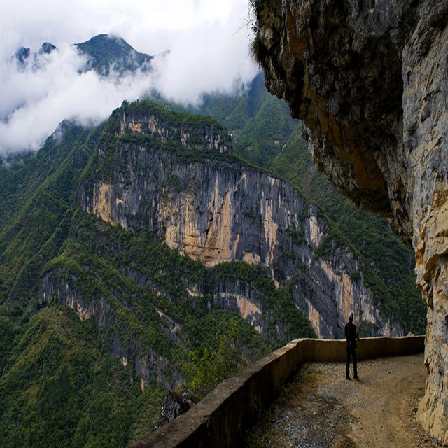
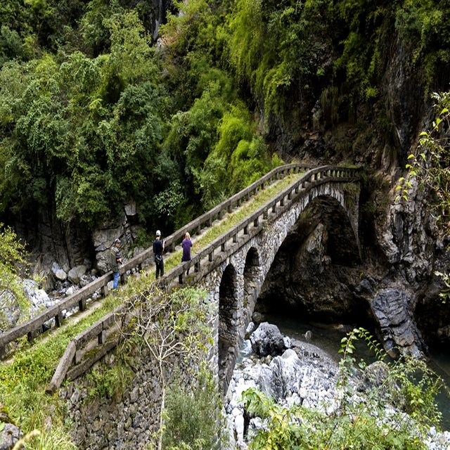
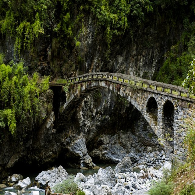
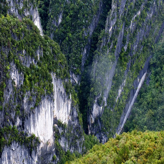
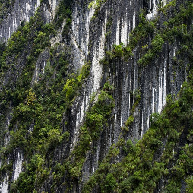
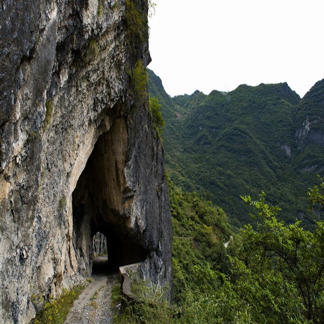
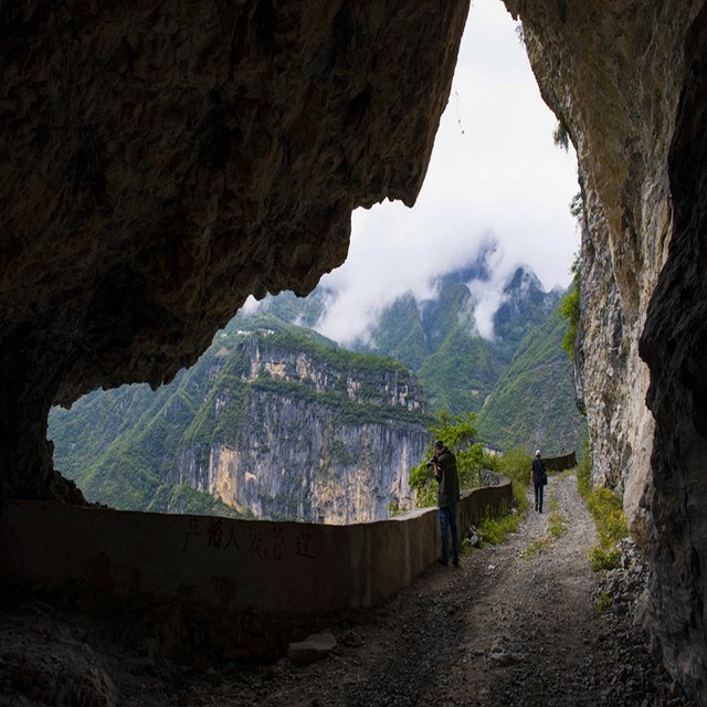
Daba mountain is a compound anticline structure.The axial part is the high mountains formed by the crystalline limestone, and the two wings of the limestone have a large area, and the karst landform is developed. There are many large karst depressions, karst caves, funnels and karst springs, etc., mostly developed along the structure line.Due to the tight tectonic fold, fault development, steep valley slope, collapse, landslide and other gravity geomorphological phenomena are more prominent.The river cuts strongly, many canyons, the valley height difference reaches 800 ~ 1200 meters, the mountain plastic surgery is messy, the ground is rugged, the traffic is inconvenient, often needs to dig the tunnel in the cliff and walk, since ancient times is known as "the shu road is difficult, difficult to the sky".

Dabashan mountain is the natural barrier of northern sichuan basin, block or weaken the south of winter in the north cold air invasion
Dabashan mountain autumn
Dabashan mountain autumn [10]
, the influence on the formation of a spring warm winter climate in sichuan.For the central Asian tropical dabashan mountain to the south of sichuan basin, and belong to north subtropical north of hanzhong basin.
Daba mountain is the boundary between China's subtropical climate and the north subtropical climate, most of which belongs to the north subtropical climate.Average annual temperature: below 14℃ in the ridges of mizang mountain, daba mountain and shennongding;The southern foot of daba mountain (around fengjie and wushan)Other areas 14 ~ 16℃.Average annual precipitation: below 1200 mm in the east of mikangshan, about 1400 mm in shennongjia forest area, and 1000 ~ 1200 mm in other areas.The areas around wanyuan and wuxi are the center of the heavy rainfall area of sichuan, shaanxi and hubei province.
Mountain plant species, there are white, white bear and other dozens of rare animals, [1] which belong to the protection of the state of four kinds of wild animals, a national level to protect animals have leopard, clouded leopards, Lin musk deer, golden eagle, the national level 2 protect animals have golden cat, monkey, contens, chrysolophus pictus, kestrels, giant salamander, the state protects the beneficial or have important economic and scientific research value of terrestrial wildlife is a hedgehog, wolves, wild boar, hare, the bamboo rat, azalea, rana chensinensis, bamboo green snake, etc.
Hello wanglizhuifeng, welcome to Partiko, an amazing community for crypto lovers! Here, you will find cool people to connect with, and interesting articles to read!
You can also earn Partiko Points by engaging with people and bringing new people in. And you can convert them into crypto! How cool is that!
Hopefully you will have a lot of fun using Partiko! And never hesitate to reach out to me when you have questions!
Cheers,
crypto.talk
Creator of Partiko
Congratulations @wanglizhuifeng! You have completed the following achievement on the Steem blockchain and have been rewarded with new badge(s) :
You can view your badges on your Steem Board and compare to others on the Steem Ranking
If you no longer want to receive notifications, reply to this comment with the word
STOPVote for @Steemitboard as a witness to get one more award and increased upvotes!