Czerwone Wierchy, Tatras (Poland)
Hi Steemians!
I will take you this time on the most famous mountain massif of the Polish Tatra Mountains. Czerwone Wierchy. This is my trip from June 6, 2015. I invite you for a short relation.
The trip starts from Kościelisko. I start from the parking lot in Kiry village. This is the beginning of the Kościeliska Valley. The road to this massif is quite long, but easier than to the popular Giewont. Walk over 15 kilometers with breaks for rest, eating and taking photos took me about 10 hours. So I'm on the trail from 6am to late afternoon. Czerwone Wierchy is one of my favorite places in the Tatra Mountains. Although we cross the border here 2000 meters above sea level, in fact in the summer it is a route for practically every healthy person with good condition.
These Are the closest peaks from the city of Zakopane, very safe and technically simple. Believe me, the lower Giewont is much more difficult and much more dangerous than the massif of the Czerwone Wierchy. In addition, you only need to walk 1.5 kilometers from the parking lot to start quickly going up. I describe here the basic version of the trail with three (Ciemniak, Krzesanica and Małołączniak) from four peaks of the Czerwone Wierchy. The route can be extended to the Kopka Kondracka (2005 m a.s.l.) as well as to the Giewont (1 895 m a.s.l.), which is nearby.
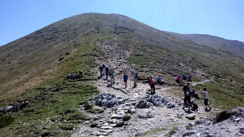
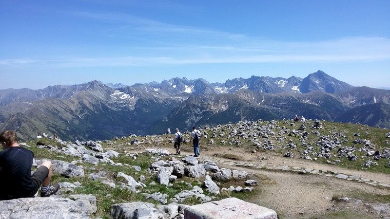
On the second photo, we have a look behind us on the way to the Ciemniak peak. This mountain range seems really huge! Already halfway to the top, after leaving the forest part of the trail the views are amazing! As you can see, many people walk to these peaks in the summer. Getting three or four high peaks in one day is an amazing opportunity. In the first photo from the beginning of the article, we see the Chuda Przełączka (1850 m a.s.l.), i.e. a mountain pass from which you can go down to the Tomanowa Valley, from where you can reach the mountain hostel at Hala Ornak.
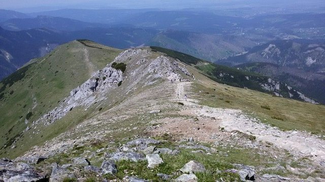
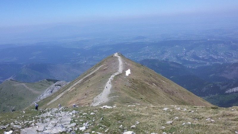
I am on Ciemniak (2096 m a.s.l.) North view (third photo). On the horizon, on the left, the Babia Góra is visible in the fog, the city of Zakopane is closer to the right, and the last straight to the top of Ciemniak is visible in the foreground. People in the distance look like ants. Below, look back on the way to the Krzesanica peak. On the Ciemniak, people visible in the distance. There is a huge cliff between Ciemniak and Krzesanica (fourth photo). Be careful here and keep away from the edges! The cliff is about 300 meters high. Such a high vertical wall is impressive.
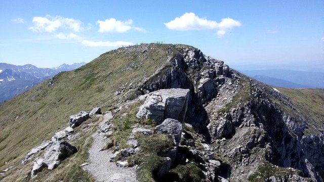
I am already at the peak of the Krzesanica! It is the middle and highest of the peaks of the entire massif. 2122 m a.s.l. is the height you can easily get here. It's 260 meters higher than the Giewont, which I described some time ago. There are no chains or dangerous places here. Have you ever been so high? I encourage you to try to get here in the summer. You only need to choose days with good and reliable weather. The storm is a huge threat here. There would be nowhere to hide. The area is open here and there are huge empty spaces that provide great breathtaking views.
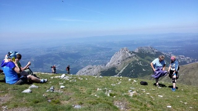
At the end of the views from the Małołączniak (2096 m a.s.l.). We see the Giewont peak here, which is much lower. We have a great view of the whole of Zakopane city! Do you like it? The grassy slopes of the Czerwone Wierchy are even suitable for a picnic. Dozens of people are lounging here in the summer sun. However, remember one thing! At an altitude of over 2,000 meters above sea level, the sun has great power and is easy to get sunburned. Therefore, if you want to lie on the top longer, always use creams with a strong UV filter! See you on the trail. Greetings to all those who love mountains!