Beautiful Sumba


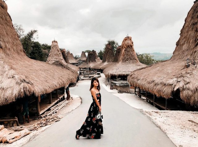
East Sumba to the west boundary of West Sumba district, north, south and east of the sea surrounded by Sabu. The total area of 7000.5 km2. East Sumba Nature consists of rolling hills with the characteristic savanna that stretches far to the east till to the south, except for the area around Lewa approximately 60 km from the capital towards the west Waingapu a rice warehouse district. According to records A.N.T.J. Van der Hoop cited B. Soelarto saying that people actually came from Indochina Sumba who have formed a new race the young Malays who would sail to the mouth of the river Kambaniru and set up a traditional village at this place and later called Kampung Lambanapu. In 1522 a ship belonging Magalhaens strong and good, ‘Victoria’ sailed around the world under the leadership of Juan Sebastian de Elcano. On board was also an officer candidate named Antonio Pigafetta. Padea dated 14 Pebuari 1522 the ship was sailing near the island of Sabu westward south of Sumba Island. Pigafetta the voyage may have heard of a driveway pointing out port or strait ‘sandalwood’ and ‘Melolo’ then he thought that it was the two names of the island. Later Pigafetta in his chart describing the two islands ‘sandalwood’ and ‘Batalo’ (which no other villages Malolo now). Approximately 40 years later the island was drawn by a draftsman map of the earth, Jacobo Gastaldi. In 1561 he published a map of the earth, and the island was named ‘Subao’ Then in 1593 Cornelius de Judaeis publish maps and ‘Island Merapu called’ Suban ‘there is even more to say’ Siombo ‘. While the country boy himself called tana ‘Sumba’. Patterns of the general public starting a family incest / core, the contents biliku father, Ubu, and the child, who then formed uma uma and a combination of several forms kabisu or large clan. Kabihu mean angle, shows that the settlement kabihu corner ridge, elongated and rectangular narrow both ends of the boat-shaped village. Each kabihu has ancestors, and the land itself kabihu inherited from grandmother – their grandfather, also sometimes kabihu terhoimpun into several kabihu example: (1) Kabihu Angupaluku / kabihu brothers (2) Kabihu Jer / kabihu giving women (3) child Kabihu mating / female recipient kabihu Some Kabihu later formed my town / hamlet and eventually established a village called Praingu. Commonly known four Kabihu important in every village of the parent who always called in Seloka in pairs, namely: (1) Lewa: Motolangu – Parai Majangga (2) Kambera: Mbujika – Parai Karaba, Kabiku – Anamburu (3) Tabundung: Hau – Harikundu, Kawatangu – Dukuwatu (4) Mangili: Maru – Watumbulu, Matolangu – Wanggirara. Marapu indigenous people of Sumba religion in economic activities rely on the agriculture sector, livestock, and household industries such as weaving crafts. Craft, there are some places that are famous for weaving binding, the village Kaliuda (kec. Pahungalodu), Rindi and Watuhadang (kec. Rindiumalulu), Rambangaru (kec. Pandawai) and Village Prailiu. Weaving high quality because it is made using traditional ingredients that have been inherited from his ancestors since time immemorial. West Sumba is one of the districts of the two districts in the northern part of the island of Sumba bordering the Sabu Sea, south and west by the East Sea with Indonesia and East Sumba. The total area of 4051.92 km2 of West Sumba district. In many ways the cultural manifestation of West Sumba there are similarities with the East Sumba regency, which primarily is that religious institutions Merapu as a ‘Religion Original’ Sumba people in general. The most ancient life on West Sumba Sumba particularly found in Li’i Merapu, is sacred tale about the origin of our ancestors. Usually held at a time when a night specifically told by a singer and an accelerator, are alternated, said-replied interspersed gong and drum sounds. In an atmosphere of solemn and touched the hearts of the villagers listen to ancient history narrated with great fanfare. Short story on the North coast’s where our ancestors peddle foot, the beach was Sasar name. Tanjung Sasar it before there was a ‘Lende Watu’ Jembatab Stones that connect the island of Sumba and Bima, even narrating the stone bridge stretching away to the beach Manggarai. West Sumba is traditionally inhabitants is farming (bersawa) and a farm with a holy rice (pare) as a staple tenaman respected. There are several series of ceremonies in West Sumba livelihoods among other ceremonies: Ceremony sharpening machetes (Urata patama keto) that machete / knife and others can function at the time was about to cut the large animals, working farm. Urata Pogo wasu (cutting trees) Urata Tenu (wood burning) Urata Wuke Oma (open gardens) is a series of ceremonies as the god of compassion for the applicant to request a sanctity to the war, and the soil in order to produce a lot of rain. Urata Dengu Ura (invoke rain) all of the above events led by Rato by taking good sprinkled chicken blood to the machete, trees, and il. Urata Dengi Ina (ceremony reap the rewards)