Trip to the Nephrite Lakes, Uzbekistan
Well, more than four months have passed since my last trip report. Over the past four months in my life there have been some huge changes. I lost more than 35 kilograms and now I can visit more complex locations than before. My previous travel topics were more relevant to the historical sights of Uzbekistan because I could reach them by trains, planes or taxi. But now, my physical form allows to climb mountains and see the beautiful nature of Uzbekistan!
I decided to commit my first trip in this year to the Nephrite Lakes, located 160km far from Tashkent in the Ugam-Chatkal Nature Reserve. Nephrite Lakes is a group of two lakes - a smaller Lower or Small Lake, and a larger Upper. They feed the sai (stream) Urungach, originating in the glaciers of the Western Tien Shan. By the way, Urungach is translated as "light or white nephrite " (from Uygur language "Urung" - light, "kash (or gash)" - nephrite). Indeed, the water in these lakes has a beautiful turquoise hue.
I wanted to go there for a long time but always postponed due to different reasons. It was mid-June and it became clear to me that it was impossible to delay. The fact is that the lakes are the most beautiful and picturesque only a month and a half per year. In the second half of June, when the 40-degree heat (Celcius, of course!) comes to Uzbekistan, the Lower lake dries up and the Upper lake becomes very shallow. So, the ticket was bought, the rucksack was collected, the passport in one pocket, the money in another pocket and the baseball cap on my head – no way back!
Departure was scheduled for 5 a.m. We packed like herring in a barrel in small, but incredibly jumping and uncomfortable microvans of the Uzbek brand "Damas" and rushed to meet the sun.
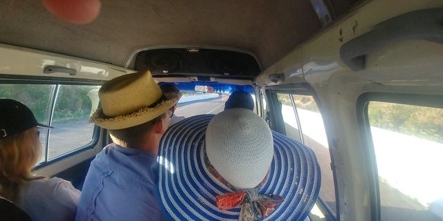
As I said, the distance from Tashkent to the Nephrite Lakes is only 160 km, but due to the very difficult relief and the terrible road surface, the trip to one side stretched for almost four hours. These were long, tiring and painful hours, but running the winds, I will say - it was worth it! The seat of Damas was very tough. In addition, there was a longitudinal pipe inside the seat, which hurt me very painfully on the coccyx, whenever the car jumped on the potholes, and there were a lot of bumps and that's why the car jumped like a frolicking goat.
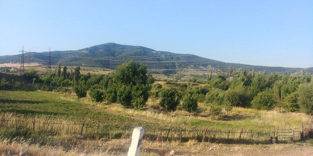
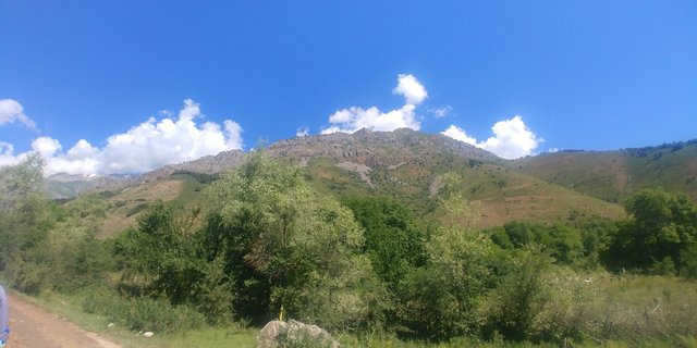
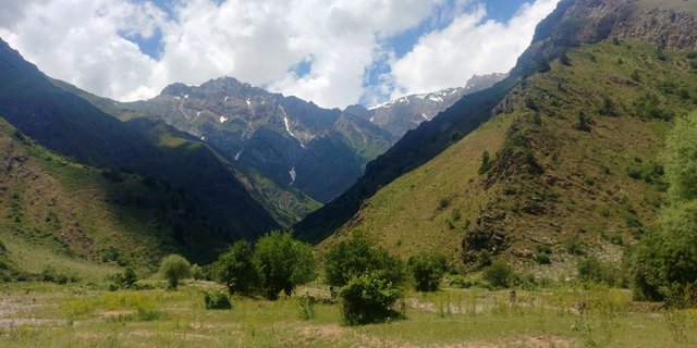
After about an hour and a half, we reached the foothills of the Western Tien Shan.
We started to climb the mountains - the dam of Charvak reservoir appeared ahead. A favorite place of rest for Tashkent people. At other time, I would be glad to relax on Charvak but this is another time - now we were waiting for the Nephrite Lakes!
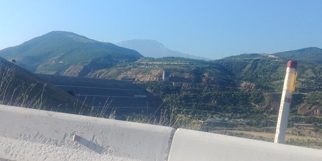
We climbed above the dam and from there opened a view of the Chirchik River, the main water artery of Tashkent.
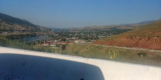
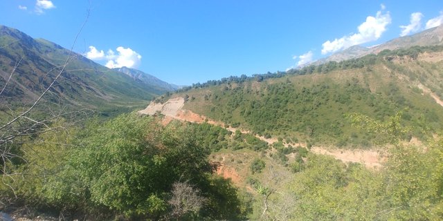
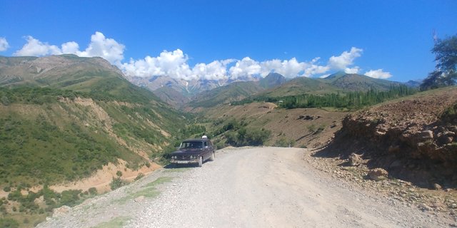
The mountains grew slowly from the morning mist ...and our little "Damases" cheerfully went up the narrow road.
"Damases" rather rushed along the road, so I barely had time to take pictures of the opening landscapes ...
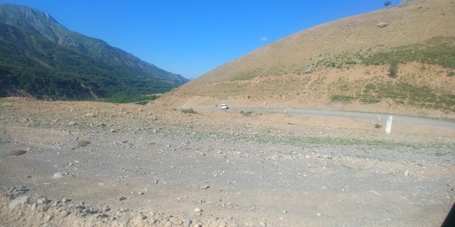
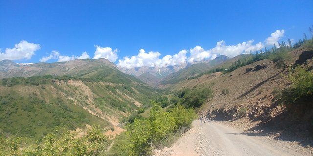
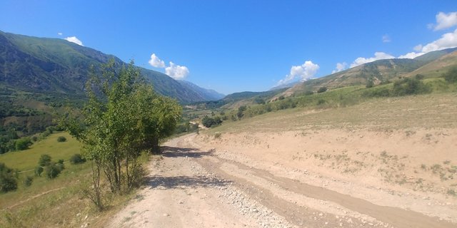
Gradually, the quality of the road began to deteriorate. The matter is that in the upper reaches of Charvak they build a hydroelectric station and the road is broken by heavy dump trucks scurrying back and forth. The road began to rise upward and our "Damases" exhausted the engine with a nervous howl. Soon we reached the border post Karabulak. The fact is that the Nephrite Lakes are located in a protected area. In addition, the territory of the reserve is bordered by Kazakhstan and Kyrgyzstan, so border guards keep a strict record of arriving and departing persons. Having reached the post and spending about 20-30 minutes for registration, we went further.
The road expanded and narrowed. On one side, it pressed herself to the mountainside, on the other side there was a steep cliff.
We toured one or the other hill, slipped into small valleys and climbed up again
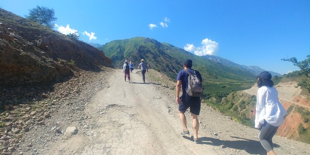
Soon the cars began to get stuck on the rise and we had to get out, push "Damas" and continue to climb by ourselves on foot.
We climbed to the site where our caravan was waiting for us. We made a couple of photos, took a breath and drove on.
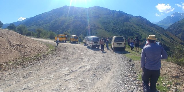
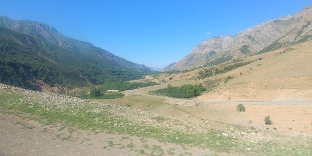
Asphalt road has finally turned into serpentine.
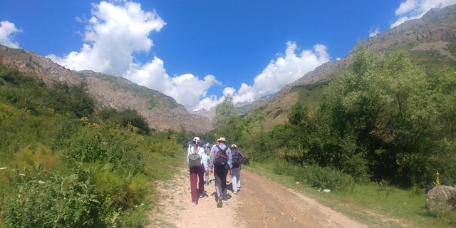
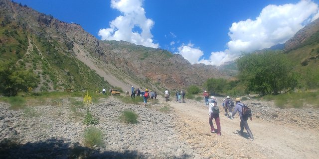
After a couple of hours of shaking, we finally reached our destination. From there we had to walk.
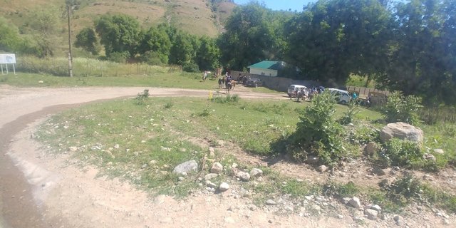
Our group, screeched and moaning, unloaded from their "Damases". Slightly stretched and climbed up to the Nephrite Lakes.
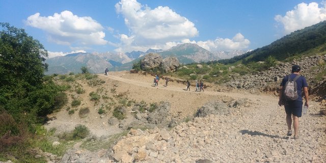
The local population is actively earning money on tourists, offering to bring their own or their cargo to the Lower Lake on the Off-road vehicles, horses or donkeys.
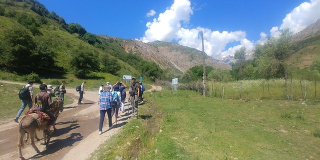
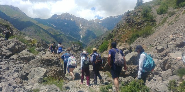
But we are not some kind of weaklings and proudly refused from help, having decided to overcome the whole path independently.
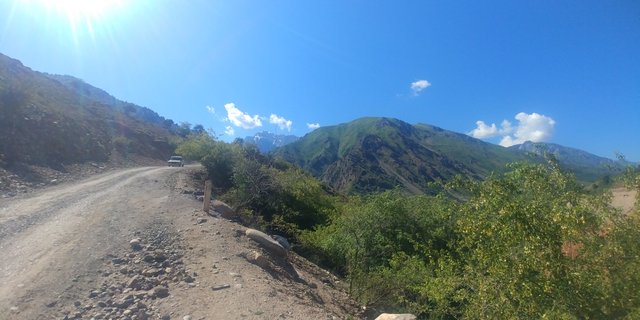
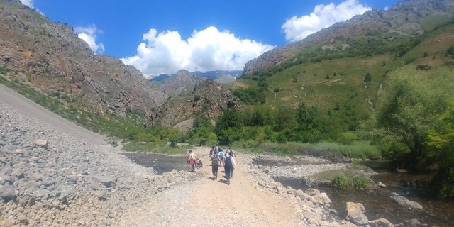
The road gradually rose.
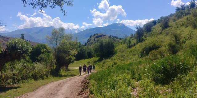
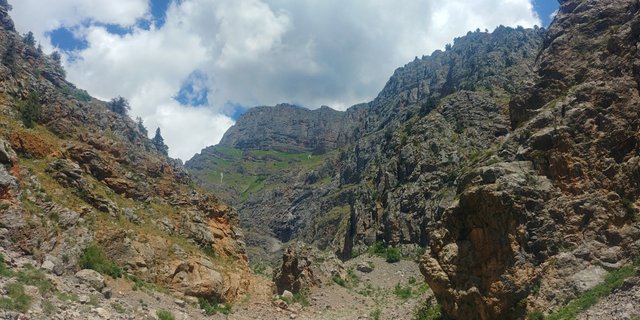
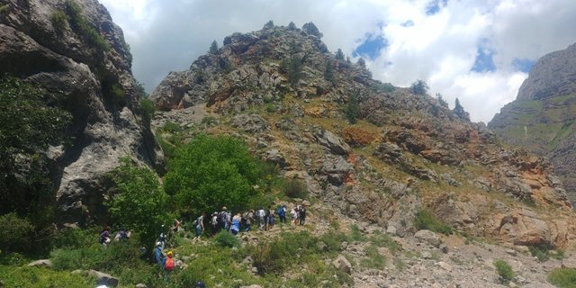
The climb was quite simple, so I was taking pictures of everything around me.
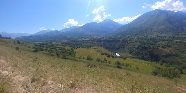
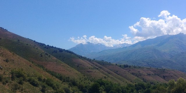
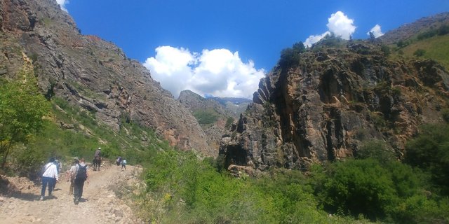
Along the way, I listened to our guide, who was very interesting about the history and peculiarities of this region. In the photo below you can see a three-headed mountain. For traders, it probably reminds the "head and shoulders" chart.
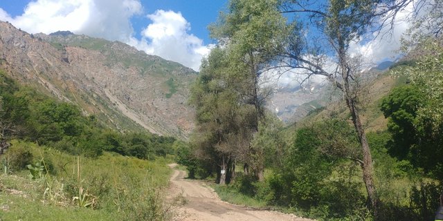
If I remember correctly, then somewhere there is the Arashan Lake - a very interesting place. The lakes are formed by glaciers and are located somewhere at the level of 2800-3500 meters above sea level. Near the glacial lake there is a geothermal spring. I will definitely go there in the very near future and tell about this trip. In the meantime, we return to the Nephrite Lakes.
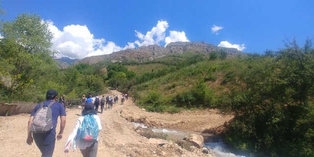
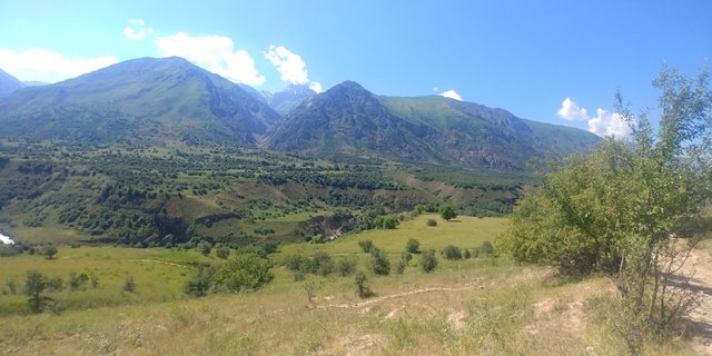
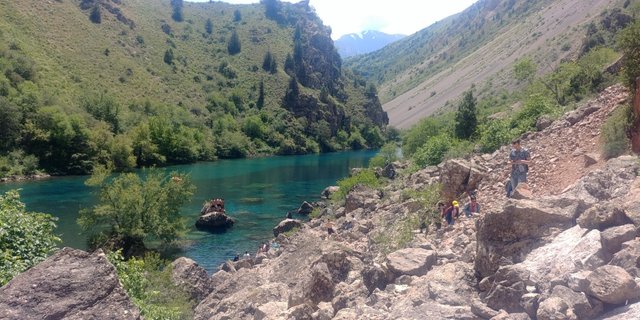
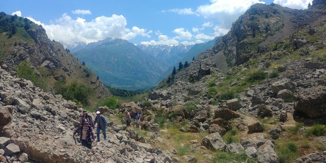
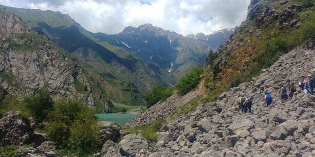
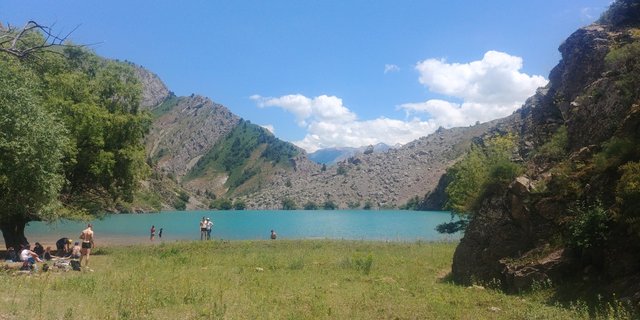
Gradually, we began to approach a small gorge, inside which was the Small Nephrite Lake.
We passed a large rock and saw a small grove, and the lake behind it. As you can see, the water has a very beautiful turquoise hue but it is as transparent as glass… and cold as ice!
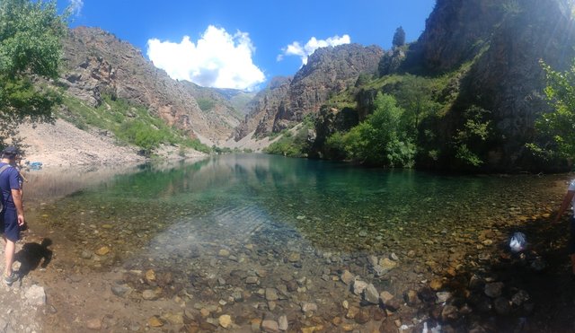
The guide announced a halt. We took out our provisions and started for a brunch. Part of the group threw off their clothes and ran to splash around in the lake. I just washed myself with icy water - I decided to bathe in the Upper Lake.
Nephrite lakes are filled with meltwater from glaciers, so their temperature rarely exceeds 5-8 degrees Celsius.
Somewhere in half an hour the guide ordered the climb and we moved on. Several people decided not to go any further and splash in this lake. We, determinedly, climbed on.
To get to the Upper Lake, it was necessary to overcome 4 kilometers of stony terrain. According to the guide, the road should take about an hour in one direction, so we did not waste time and lined up in a chain climbed up.
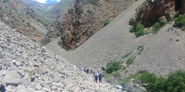
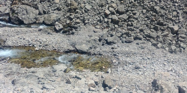
I paid attention to the brooks, from somewhere flowed, but did not go anywhere - they ended right at the halfway point. It is clear that they went underground, and there, under the ground, filtering, already fell into the Lower Lake.
In the meantime, the ascent to the mountain began and my hydrological observations had to be postponed.
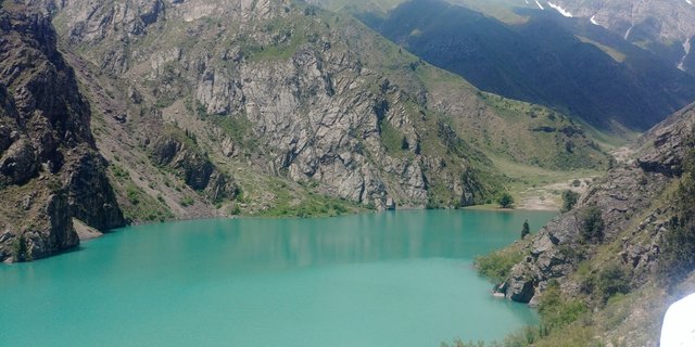
We scrambled up and climbed up. Half an hour after we left Lower Lake, the guide announced a halt.
We gathered in a small area between rocks, someone took out water, someone climbed onto huge boulders to take pictures. I found a good place to make a panoramic photo.
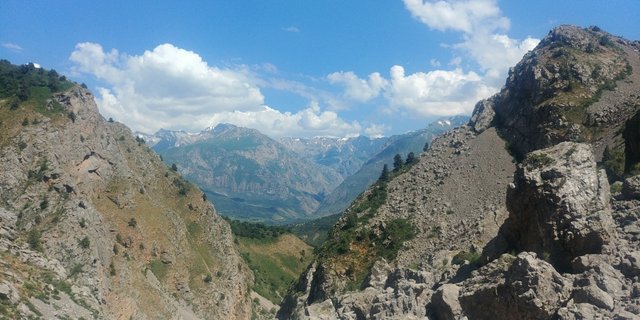
Unfortunately, the Lower Lake hid the rocks, so I had to go down to hook it in the frame.
After a little rest, we climbed further.
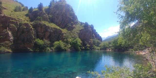
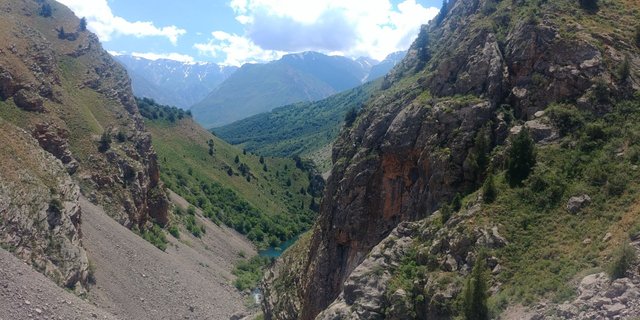
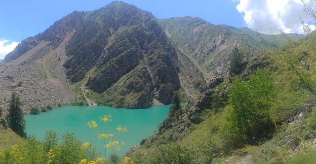
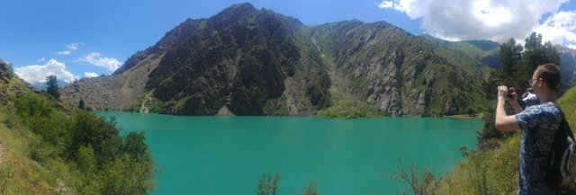
Having crossed the mountain we saw the Upper Lake.
It had a greener shade and was rather azure than turquoise. Although, damn it knows, I'm confused in these "turquoise-azure" shades. Somehow the color of the lake was beautiful.
Then the guide stopped us and said that those who wish can immediately go down to the lake and swim. Courageous and courageous can pass along the almost steep slope of the mountain (in the photo the right slope) and reach the lower edge of the lake, into a small valley. There we can relax, swim and have lunch.
Of course, I joined the "courageous and brave" and went on. About a third of the group decided not to take risks and stayed at the near edge of the lake. On some goat tracks we climbed further. I wouldn’t say that it was a difficult road, but not easy - you had to crawl along a narrow path and cling to stunted bushes so as not to fall on sharp stones below.
Nevertheless, it was worth it - we went around the lake on the mountainside and went down into a very beautiful valley.
There we camped, threw off our clothes and ran to swim. The water was just ice cold. Probably degrees 5, not more. It literally knocked from the heels to the top of her head. But all the fatigue instantly evaporated, the body was filled with vivacity and a brutal appetite awoke.
Having eaten and plenty of rest, we poured into the shade of the trees. After a couple of hours I had to gather to catch a dark return home.
And again we climbed on the steep slope of the mountain, we reached the place where we had left part of the group. Then they crossed the mountain and went down to the Lower Lake. Without stopping we went on to the place where the cars waited for us. Having overcome a total of more than 20 kilometers, my legs were buzzing with fatigue.
I am very glad that I went to the Nephrite Lakes. During the trip I enjoyed the magnificent nature and clean air, and even the jumping "Damases" didn’t spoil the impression.
In my next topic I will tell about my trip to another reserve - Zaamin.

!steemitworldmap 41.923005 lat 70.309786 long Trip to Nephrite Lakes, Uzbekistan d3scr
✅ @damm-steemit, enjoy the vote!
Have you claimed your FREE Byteballs yet? Check out this post on how you can get $10-80 just for having a Steem account: https://steemit.com/steem/@berniesanders/get-free-byteballs-today-just-for-having-a-steem-account-usd10-80-in-free-coins
beautiful lake with beautiful view of mountains perfect place for picnic : )
Thank you! You're totally right, it's a very good place for picnic.
Congratulations, Your Post Has Been Added To The Steemit Worldmap!
Author link: http://steemitworldmap.com?author=damm-steemit
Post link: http://steemitworldmap.com?post=trip-to-the-nephrite-lakes-uzbekistan
Want to have your post on the map too?
Heya, just swinging by to let you know you're being featured in our Daily Travel Digest!
Thank for sharing this, central Asian countries is a mystery to me, hardly know anything on them. So, it was very interesting to see what you do down there:) and congrats on loosing weight! Good health opens up many doors.
Thank you! I was long and hard way but now I can discover new locations
Yeah, I can feel you. Once you complete I hard trip, you get self-confidence in your own strength for further explorations:)
Oh wow - what an awesome and extensive photo report!! And the views are absolutely breathtaking :)). Thank you very much for sharing :).
Thank you! Uzbekistan is aimed at the development of tourism and planning to increase the q-ty of tourists from 1 mln to 5-10 million. We canceled entry visas for 20 or 30 countries and welcome tourists from all of the world. I obligatory will share my new trip reports.
Cool! I'd love to visit Uzbekistan one day!
Wow! I am so glad to see such a post about my country!
When did you visit Uzbekistan?
Have you been to Khiva as well?
I am from Khorezm region where Khiva is located.
I'm from Uzbekistan too. I'm living in Tashkent. I was few times in Khiva and Khorezm as well. My first topic on steemit was dedicated to Ayaz-Kala.
Great pleasure to hear that. Locals speaking in a foreign language, haha ))) zo'r. Omad ishlarizga! Postlar bo'lsa xabar bering layk mayk komment pomment kerak bo'lsa ))))