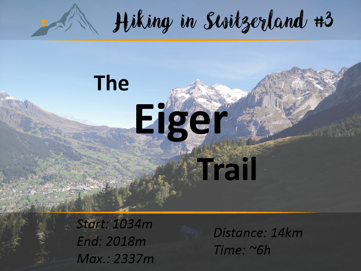
Hiking in Switzerland #3: The Eiger Trail
Let's do some hiking!
Welcome again for another hiking trip trough Switzerland!
Follow me on this trail, which leads us from Grindelwald to Kleine Scheidegg, always next to the impressive Eiger-Nordwand! Let's get going!
Today we will do a rather laid-back and relaxed, but at the same time stunning hike. The journey takes us to the wonderful Berner Alpen, just a little ways south of Interlaken. From Zurich, the SBB takes us to Interlaken in roughly two hours. After a short change, we will continue with a narrow-gauge railway, the Berner Oberland-Bahn. If the train ride to Interlaken didn't spark your enthusiasm already, the next 40 minutes will!
From Interlaken, two train routes connect Interlaken with Grindelwald and Lauterbrunnen. Both cities are not accessible with cars and therefore the only way to get to these places is by train! In the summer the Berner Alpen are very famous places for hiking, mountain biking, paragliding and other sport activities. Once the fall comes around, the nice green grass gets covered by snow and the sky lifts start running, turning the area in a paradies for wintersport enthusiasts.

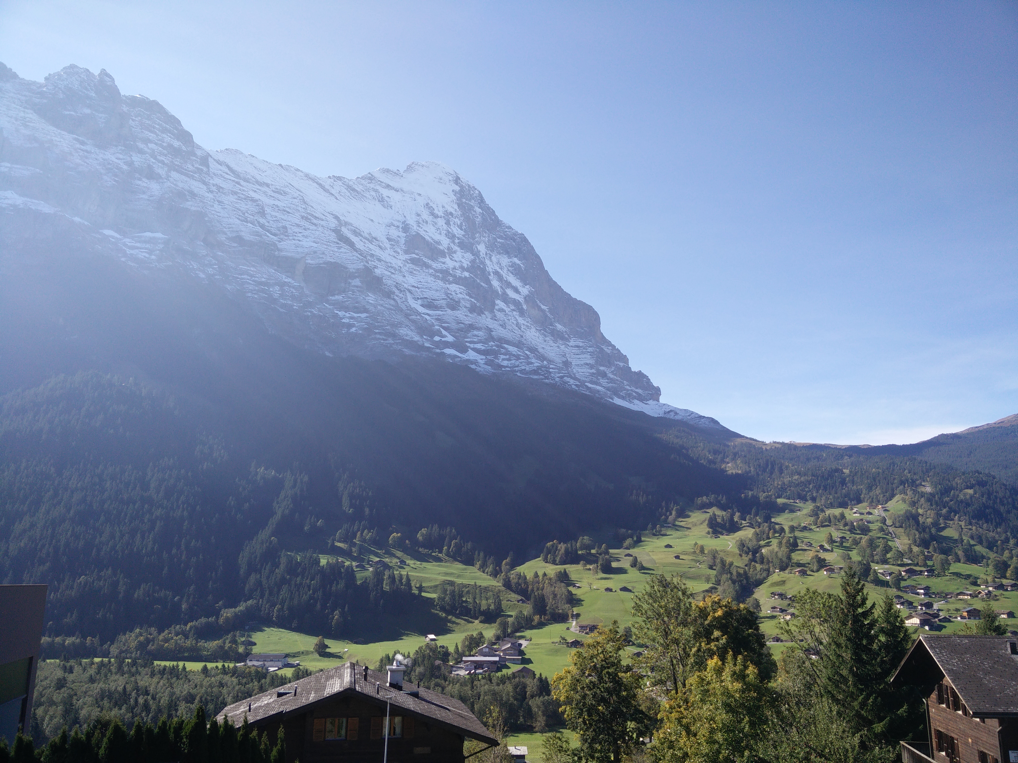
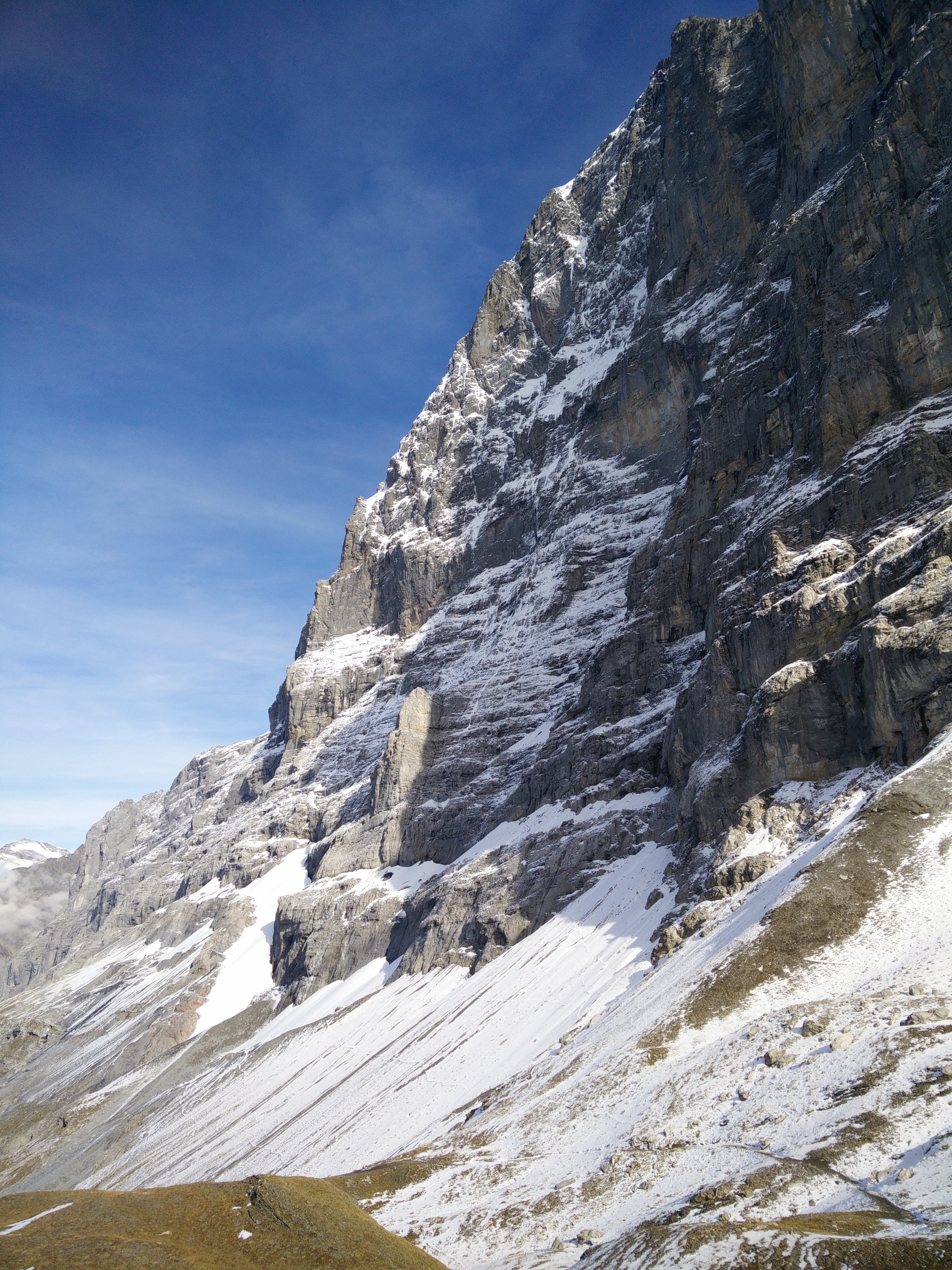
But back to topic! After getting of the lovely swiss train, we are already stunned by the beautiful weather and the great view from 1034 meters. Just up ahead we can see the massive Eiger-Nordwand rise up out of nowhere with it's peak being as high as 3970m.
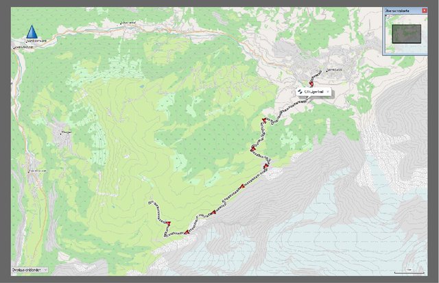
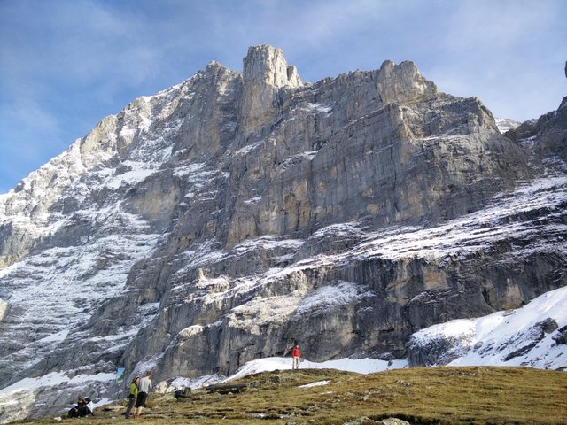
But where is our hike gonna take us today? Well, let's get an overview of our rote. We want to hike up to Kleine Scheidegg, which can be seen just in the top picture on the right side. First, we have to walk down before we can start running up. We will then follow the Eiger-Nordwand and come closer and closer to it. We will finish our relatively short hike at the Kleine Scheidegg, which connects both Grindelwald and Lauterbrunnen with a small mountain train.
Are you ready for the hike? Or do you need more motivation? Okay, here you have it (I didn't capture the first 2km, sorry :( ):
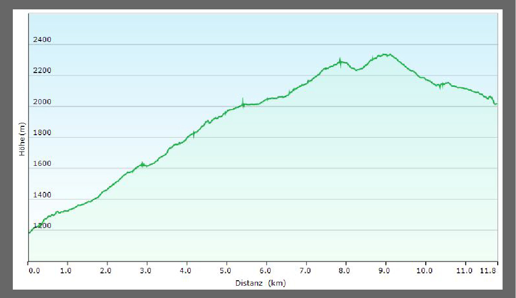
Okay - so we have roughly 1300 meters to climb. We follow the trail up some small hiking paths and sometimes it intersects with a small road leading to the top. After about 5 kilometers and at an elevation of 1600 meters, there's a small stop to fill up water, eat and drink some snacks (or even buy some). Then we turn left, going closer to the Eiger-Nordwand. Here and there we have some cold water streams coming from the mountain.

As we get closer to the mountain, we realice it's unbelievable height and the almost straight wall!
Now imagine climbing up this wall. Can you? I don't think I can! It's impossible. Unimaginable. But yet there are people who climb this wall without any ropes / security. How is this possible? Go ahead and have a look at Ueli Steck setting a new speed record. Sadly, as some of you may have heard, Ueli Steck just recently died during preparations for climbing the Mount Everest :(. He was one of the best solo climbers in the world and famous for his fast ascends! He brought great enthusiasm to this sport!
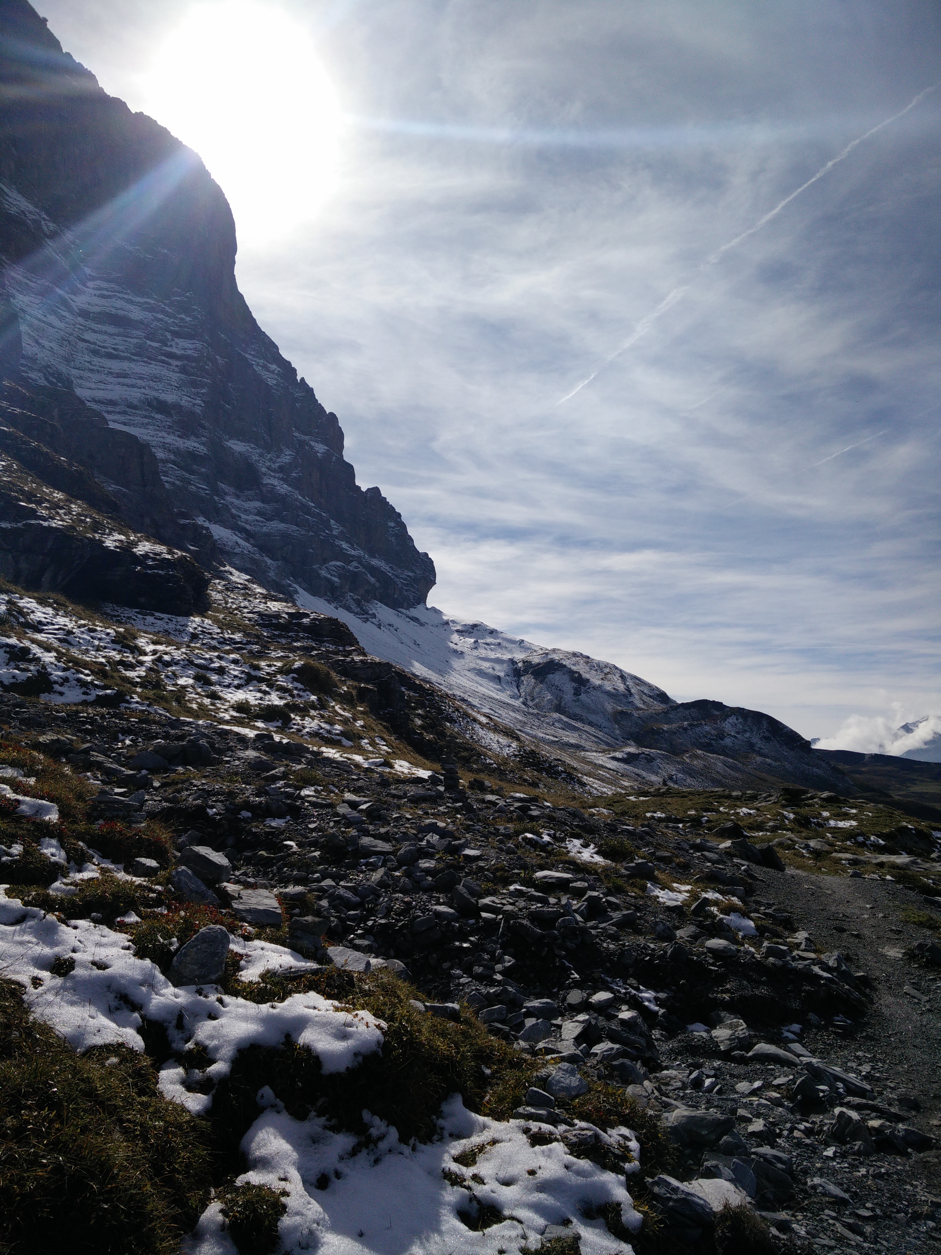
We contine our hike up the mountain. After maybe 4h or 5h we get to the highest point on our hike at approximately 2340meters.
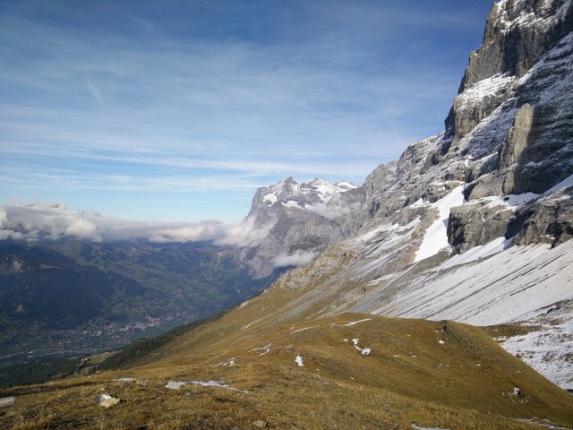
Again, the view and weather couldn't be better! We follow a trail down to Kleine Scheidegg, where the trains from Grindelwald and Lauterbrunnen meet. From this place, one train continues to go up to Jungfrau Joch, which is also advertised as "The Top of Europe". Unfortunately, I haven't been up there, since train tickets are crazily expensive. However, the view must be amazing! Maybe at some point, I can do a small post about this amazing place!
Soo...we arrive at the train station and as we were a bit slow today, we decide to take the train back down to Lauterbrunnen and then return home. If you still have enough power, you should consider hiking down to Lauterbrunnen. It's quite some way, but there is also a small train stop some halfway down in Wengen.
From Grindelwald train station to Kleine Scheidegg:
Distance: 14 km
Starting altitude: 1034m
Finish altitude: 2018m
Highest altitude: 2337m
Up: 1321m
Down: 490m
Time total including breaks: ~6h
Make sure to check out my other posts in this series:
Thank you very much for reading! In case you liked this post, feel free to follow me - @saper. If you have any feedback on what you would like to have included in the posts or what I could do better, please drop me a line!
Stay tuned for more awesome shit,
-Steffen
What an adventure @saper !!!
I like the maps you put into the post and that first picture is breathe taking!
Excellent way to spend a part of the day.
Steem on 🐳!
Thank for the feedback. I am glad you like it. I just think a (travel) post needs a bit more than just fancy pictures.
Nice post too, with nice pics - I'll follow you too :-D
The Alps are just wow, no matter if you see them from far or near! Happy journey!
Great post!
Excellent use of maps and charts
and nice photos. How cool to be able to
enjoy your hike from the U.S. Pacific Northwest.
Cheers!
Thanks! Where are you located in the Northwest?
Pardon my delinquency. I'm in the NW section of Oregon's Willamette Valley.
McMinnville, to be specific. :-)
Impressing images 🙌🏼
Thanks! I am still longing for a proper camera, but I still couldn't convince myself to getting one. It's not just buying one, it's the time you have to put in to actually become a good photographer that has put me off a little. Even though I enjoy it a lot.
Which camera do you use? Maybe a GoPro would be better for you?
I was just using my phone, a OnePlus One.
Yeah, on another trip I had a chinese GoPro version with me. But I feel like with the GoPro you're just making so many pictures and overflooding your drives. Really good pictures are rare and you need to take time to do them! With a GoPro, you just try to capture everything but with less quality, I would say.
I think a GoPro is great for filming and you have a great quality 4k ... video upload on steemit is coming soon. I think the best camera you can have is that one in your pocket, you doing great with your phone
Wow what an adventure! Looks awesome and the photos are great too! following and upvoted :)
I went to Lauterbrunnen and a couple of the towns you mentioned a few years ago. It's a really wonderful place. Very expensive as you mentioned - but that's Switzerland for you.
Thank you for sharing - it brought back some lovely memories.
nice

https://en.wikipedia.org/wiki/The_Eiger_Sanction