Asiatic Travels #2: Valley of Zanskar
Above the nameless mountain is a cloud formation that hardly changes for hours. I see in the cloud, without a doubt, the shape of a dragon. The Druk of Zanskar nests on the nameless mountain today, watching over our journey. Behind us, Gumburanjum watches over the valley. Today will be the longest, hardest day of all.
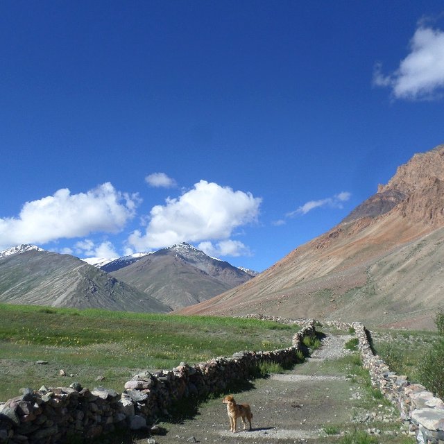
The shadows lay in the Kargyak valley for a long time as we pass the first bend. A dog follows us from the nearest village outside of Kargyak. Tall groundhog creatures call a warning from the catacombs among the rocks and fallow land, and the dog gallops over to challenge them. Quickly, the shadows of morning are replaced by a scorching, unfettered sun.
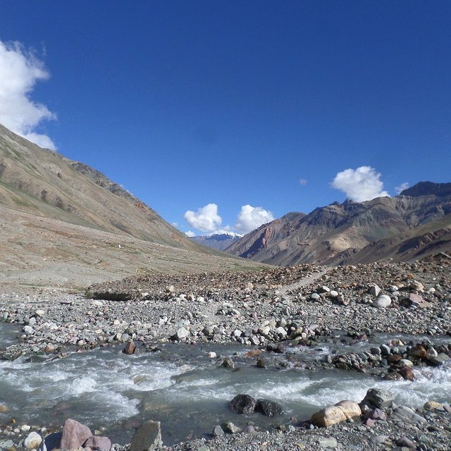
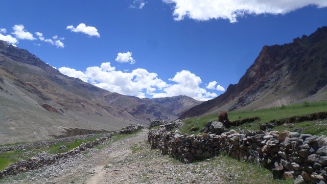
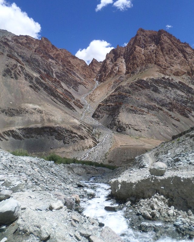
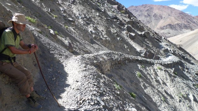
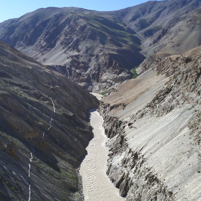
The flatland is replaced with narrow passages pressed against mountains of gravel. The way is often littered with large stones that steadily bruise and blister my feet (my shoes have nearly withered away by now). A river rages next to us. There is no ice here, only dry heat and dust.
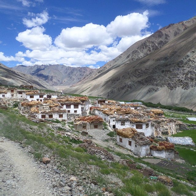
Maybe an hour later, we come upon a vast red mountain. Very little grows on its steep slopes, and a narrow donkey trail crosses the high rock face from one infinity to the other. Down below is the bridge to Purne (3820), an expansive village that flows around the mountain bend and continues in the hidden valley beyond.
All around and above me there are mountain peaks, puffy white clouds snake up and down them. I have the impression that the entire range is the back of an enormous dragon. The Druk of Zanskar watches patiently, and we move on.
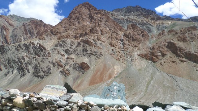
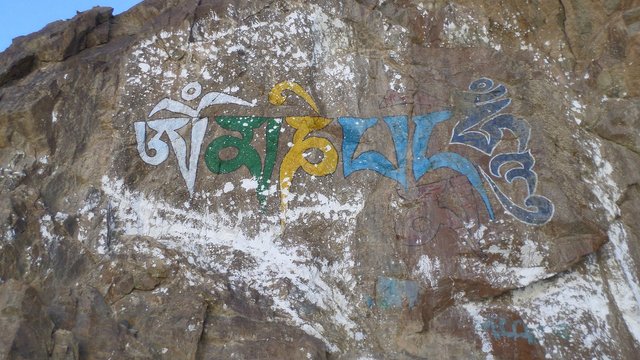
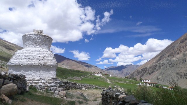
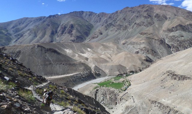
We cross another wide bend and climb a hill that overlooks a glacial stream, where we wet our shoes to offset the heat. Then we approach the village called Yal (3820m). We search and cannot find a single soul. The buildings look lived in, and smoke rises from the chimney of one. Cows graze in the field, two goats are tied up by the road. The road splits around a rock wall that is decorated with stones engraved with Ladakhi pujas (prayers) and proverbs.These are the sort of monuments that I see on the outskirts of every old Tibetan village.
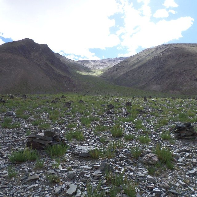
On the left of the village is a wide plateau of roughly vegetated earth that sprawls all the way up the slopes of the range beyond. The plateau is marked with hundreds of mysterious, neat piles of rock.
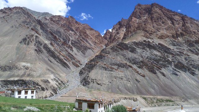
The next village is just as vacant. The sun is becoming intense and we are in full view of the giant red mountain. We pass through the quiet village, we see a shrine facing the mountain, built into the stone wall along the road. On the wall are colorful proverbs.
The dog turns around somewhere between here and the next village. The landscape rolls by, an hour passes, and the red mountain hardly changes; it's deceivingly large. We rest by an abandoned government building overlooking the mountain. Desert bees zip through the swirling red dust, and occasional men with ponies walk by, greeting us with a "julé". The shadows grow old and draw over my toes, it was roughly midday.
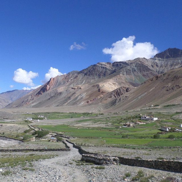
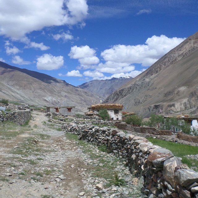
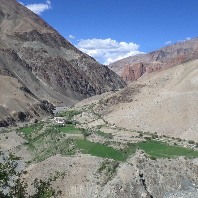
It takes an hour to pass through the expansive, empty outskirts of the village. Far down the valley we reach Yal, where we finally find somewhere that can serve a lunch. There are many people considering the village's size. The buildings are made of mud, strong wooden beams, dung and straw. Most of them are home to satellite dishes and solar panels.
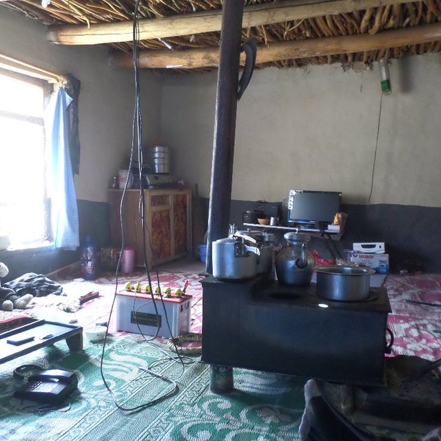
A family brings us into their home for lunch. Their home was so serene and simple, I found that very relaxing. Around two in the evening, we paid the family and moved on.
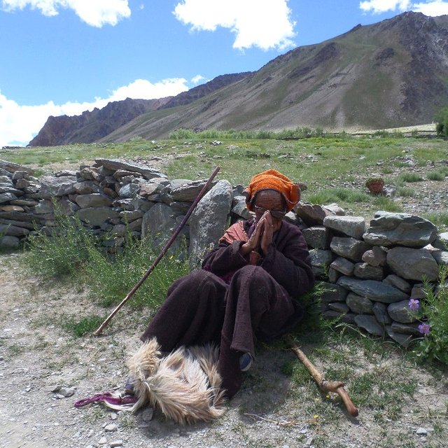
In the outskirts of Yal, we meet a senile old lady at the edge of the road. She can't speak the local language very clearly, I'm not sure if she is a beggar, but we give her some money for a few pictures. She looks so interesting wearing that hat!

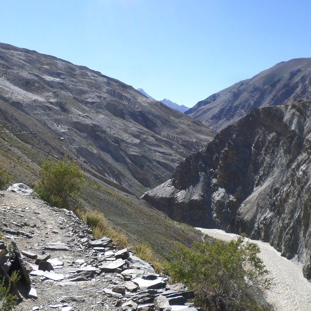
We reach the bridge to Char, and there are only a couple of hours of good sunlight left. High above the plateau village of Char, to the edge of the mountain, a group of horsemen gallop past. The trail looks very tough and dangerous, so we wait to ask a local for directions. Three different people tell us that there's a shortcut down by the river across the bridge, so we agree to try it. We pass a grove of trees and the trail splits. One leads down to the river and an abandoned house, the other leads uphill in a confusing climb towards the horse trail. We choose the river, and after a while are exhausted and cannot find a way over the mountain. It is getting darker, we have to cut over the steep and crumbling slope of the mountain to the horse trail. There is no other way to reach Amu (3820m) before nightfall.
Darkness falls, both of our phones and flashlights lose power, we are out of water. The moon is the only source of light, but it is one of the darkest nights of its cycle. The mountains around us turn to deep shades of red. We are maybe a kilometer uphill, not a meter's distance from a dead drop to the river below. We cross over man-made ledges and incredibly narrow bends. While walking, I scope out potential caves or flats to set up an emergency camp. Each bend reveals still another long stretch of cliffside trail. This is one of the most difficult things I've ever done.
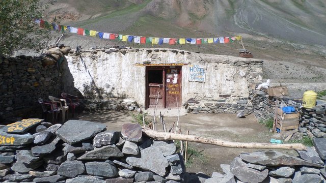
Hours pass. A road. A big one, probably stretching in the direction of Tsetang (3564m) on the other side of the river. In ten minutes the trail begins to descend. We come upon a group of drunk village men by a locked-up streetside chai shop, and they guide us to a homestay on the hill. To me it looks like a palace, a place of feasts and deep sleep. Tonight we sleep like solders after a long march.
Thank you for visiting my posts, I'm happy to share some of these journal notes and old photos. I did not have the best camera at the time, but I hope that this inspires you to go for what you want in life. It can be life-changing.
Very beautiful in nature, there are beautiful things hidden.
There certainly are.
Definitely interesting photos. Never been to a place like that before.
Thanks. It's a place like no other, one of those places anyone with a sense of adventure aught to consider visiting.
Those are some amazing pictures!
Were the places that served food along the way traditional restaurants, or more of the sort of places that care for travelers as they pass through?
Good question. Along this particular route, there was a small village roughly every 10 kilometers where one can find a family willing to accommodate for travelers. Traders and shepherds have roamed through these valleys for centuries, so the village people are accustomed to making a little income from lodging. Its lucrative enough now that they generally put up a sign somewhere near the entrances of the village, stating what is available. In other places there may not be anything for more than fifteen or twenty kilometers but an occasional and often abandoned teahouse. There you'll only find Maggi (like cheap ramen noodles) and chompa (a kind of bread or porridge) if you're lucky. On more developed routes such as those that run through Annapurna or the Khumbu in Nepal, you'll find quite lavish teahouses as far as Namche Bazaar. Generally the higher up you go, the lower the chance of getting a good and decently priced meal. Those days of eating nothing but maggi and some peanuts mixed with chicory makes a fella cry when he finally finds a place that serves rice and dal (an Indian lentil soup).
Imagine this, but a couple standard deviations lower in quality, without the cream:
Awesome shots! Your photography skills are superb, and the blog is well-written. Following you!
Thank you for the observation. Please contribute if you wish to add anything :)
Some very beautiful photos, the river :D
Thank you.
WOW WOW WOW! We are so moved. Amazing photography. Thank you for sharing!
I appreciate the eyeballs :)
Great post!
Thanks, Camilla.
follow me and vote up my post i am voting you and following you thanks ,welcome to steemit i am supporting you nice post best wishes for you