The Volcanos of Antigua: Acatenango + Pacaya
Steem fam!
I've decided to revisit some old travel posts that I have up on my blog - Expansive Exploration. My blog is no longer active and I feel like some of the posts would be better shared here on Steemit.
I hope you enjoy!
Biggest love to you.
Sarah. 🌋
Volcán Pacaya
Log: 6th July 2016 – 14th July 2016
• I’ve travelled to Antigua on three separate occasions and each time has brought new and different experiences. It is one of my favourite colonial towns and although small, it’s always bustling and lively. Third time is definitely a charm, and this time around I decided (or was sweetly persuaded) to hike one of the surrounding volcanoes.
On arrival Neven and I's initial plan was to pitch up in a local policed area that was offering free camping. The outcome seemed only relevant to my perspective when we found out the space was just for camper vans. With no idea what we were doing for the night, darkness creeping up and an urgent need for a bathroom, we settled at Hostel Capitan Tom, a place not far from the markets. The hostel was full of film students making different educational documentaries addressing local issues. It made for great conversations and I found it inspiring to see them create and pursue their passions.
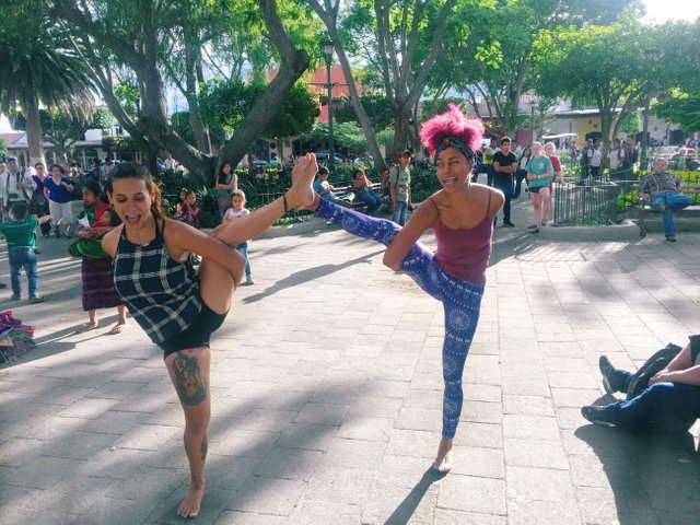
Bri + I playing in Parque Central
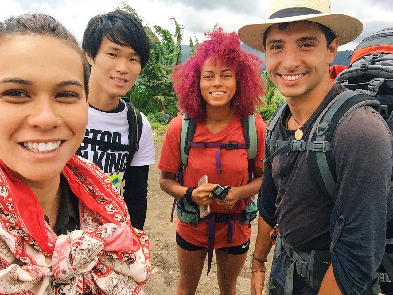
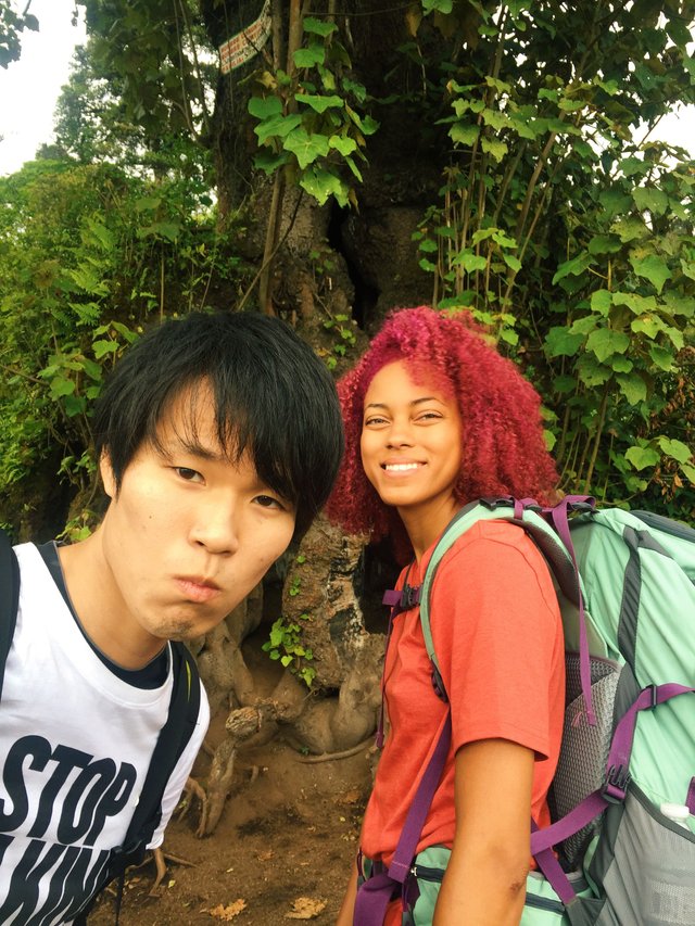
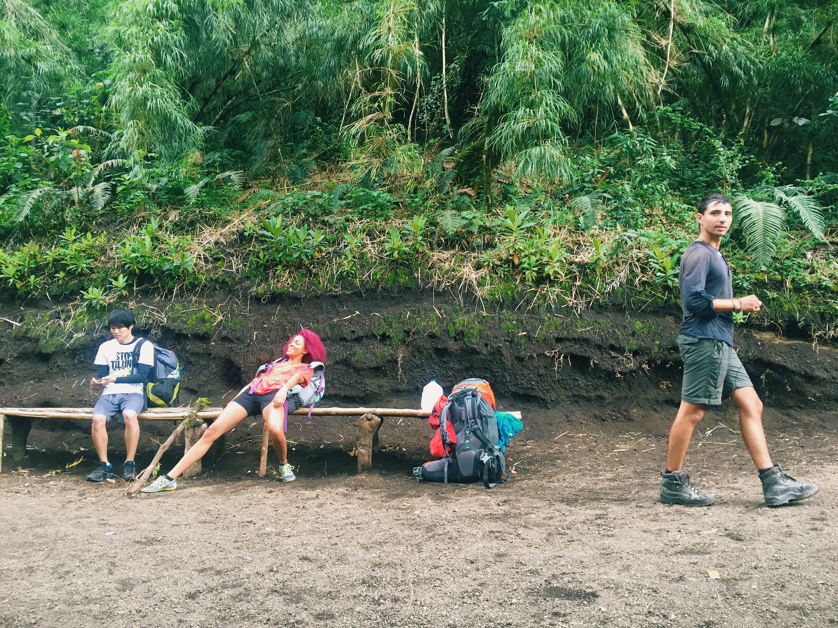
After leaving the lake I received news about the opportunity of crossing paths with a friend, Briani, who I had connected deeply with during our yoga teacher training. I wasn’t expecting that I would be seeing her so soon, especially not in Guatemala. We made arrangements to reunite in Antigua. Such a wonderful surprise! On Bri’s journey to Antigua she befriended a Japanese guy named Naoki who was also staying at the hostel. Naoki had such a sweet and innocent persona and was continuously confident and optimistic about learning Spanish. A simple but powerful statement that he expressed was that “everybody is my teacher.” His enthusiasm inspired me and reminded me that it didn’t matter how little you knew or how silly you sounded, it only mattered the passion you emanated for learning. Neven proposed gathering a small group together for our hike to the volcano and I ran the idea past Bri and Naoki and they happily agreed to come along.
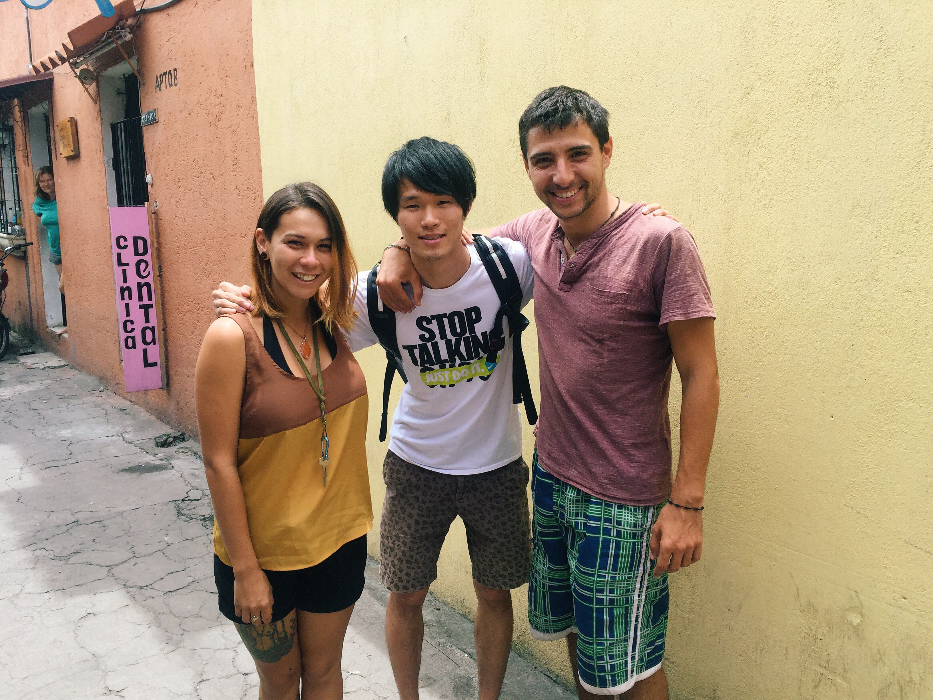
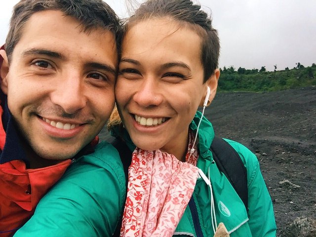
Neven + I with Naoki
Acatenango
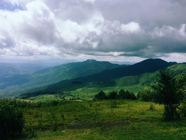
The view out from the base of Acatenango
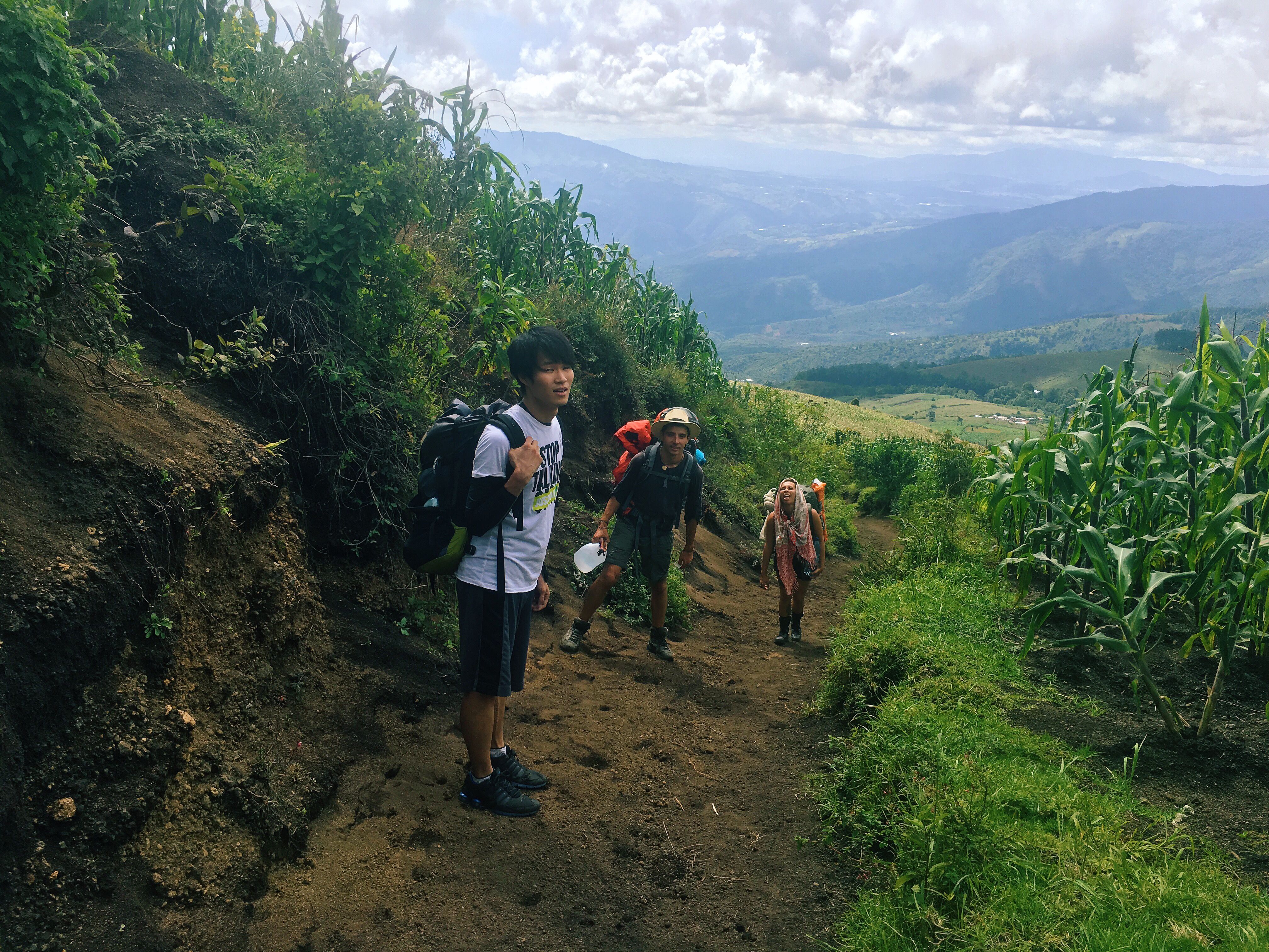
One thing that is generally unpredictably (like all events of the future) is you can never assume how a hike is going to go. We were getting all sorts of stories and advice from others who had already taken the challenge. “Take more water…, take less water…, it’s not that hard…, it’s the hardest thing I’ve ever done.., you guys are going without a guide, crazy!” Sometimes you’ve just got to work with what you’ve got, and what we all had was enthusiasm and excitement.
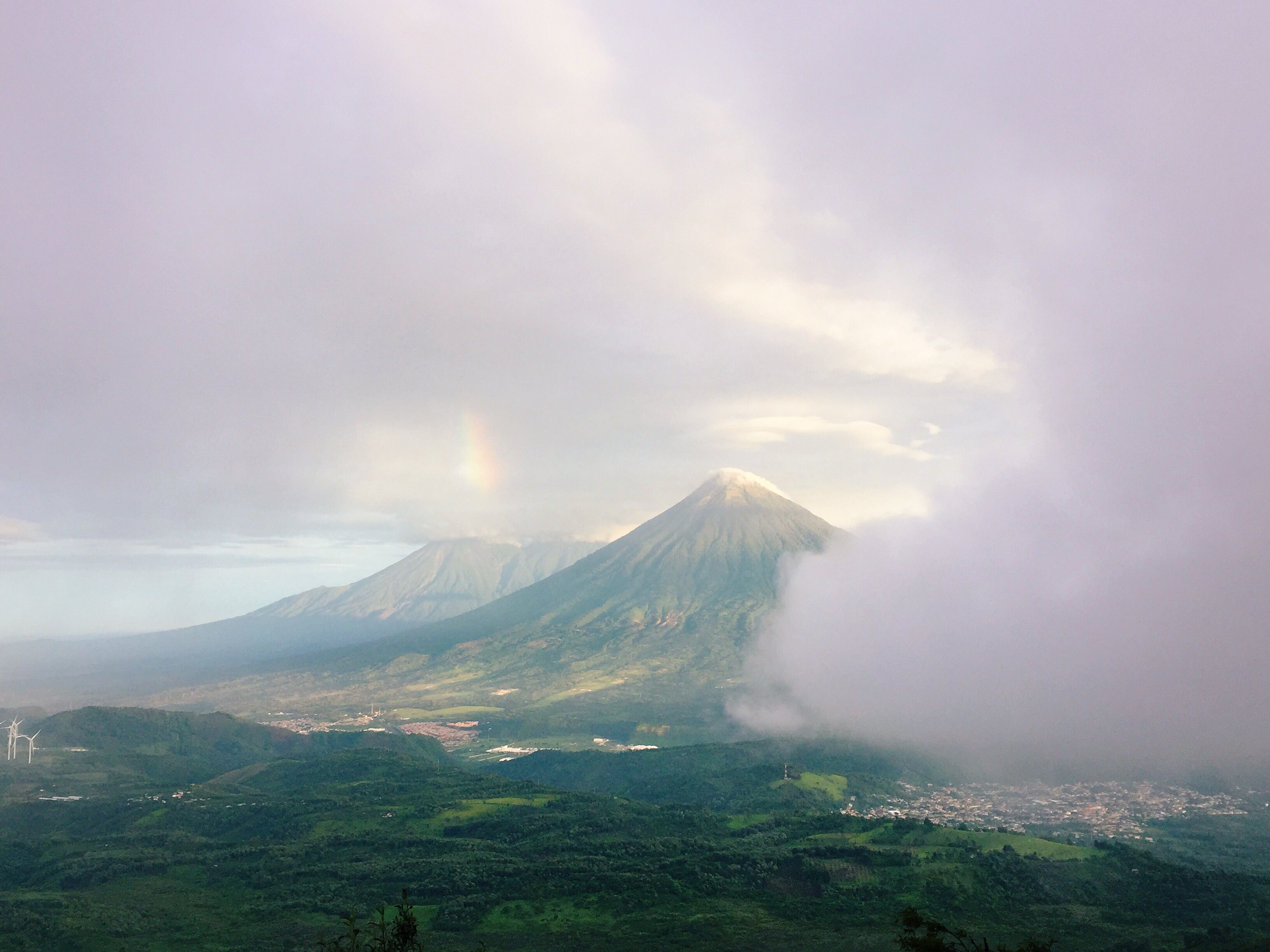
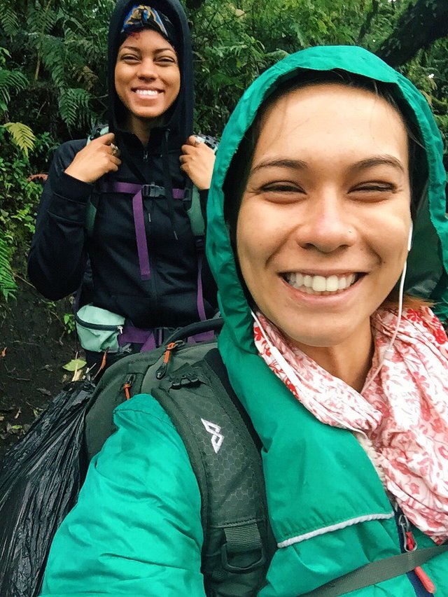
Acatenango is the third highest volcano in Central America measuring at 3975 metres above sea level. It’s inactive compared to its neighbour Fuego which you can see from the peak spitting fire when the weather plays nice. Unfortunately for us this wasn’t the case. After a slight delay we arrived at the beginning of the walking track just after lunch. The estimated time up was 6 hours. With a slow and steady pace we began our journey to the top. What I struggled with the most was the first two hours, I just couldn’t regulate my breathing. I’ve never been a fan of inclines and as we continued I self diagnosed that I must suffer from asthma or some sort of lung condition. Don’t ever take your unconscious breathing for granted! With Bri leading, Naoki in front, and Neven behind me ensuring I wouldn’t fall behind (although he won’t admit it and claims he was only there for the “view”), I felt supported by my friends.
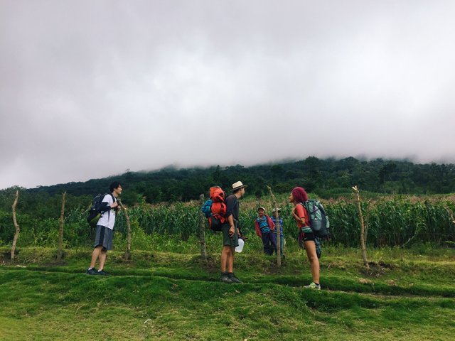
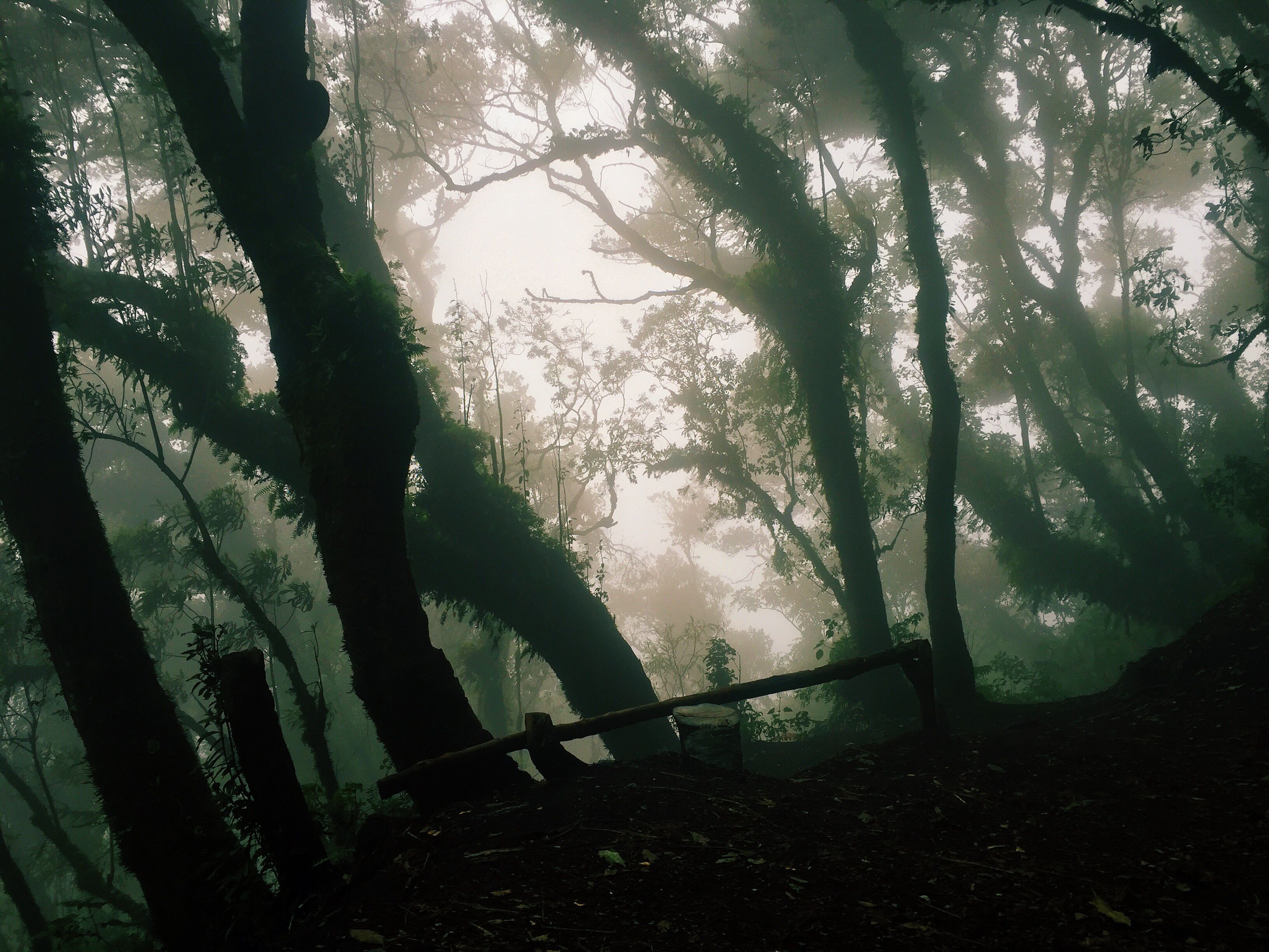
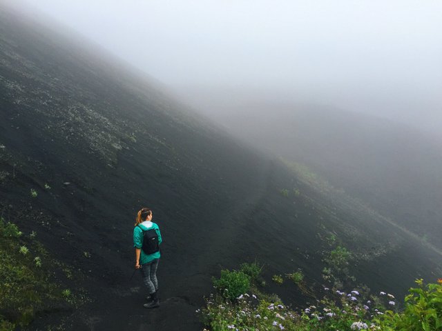
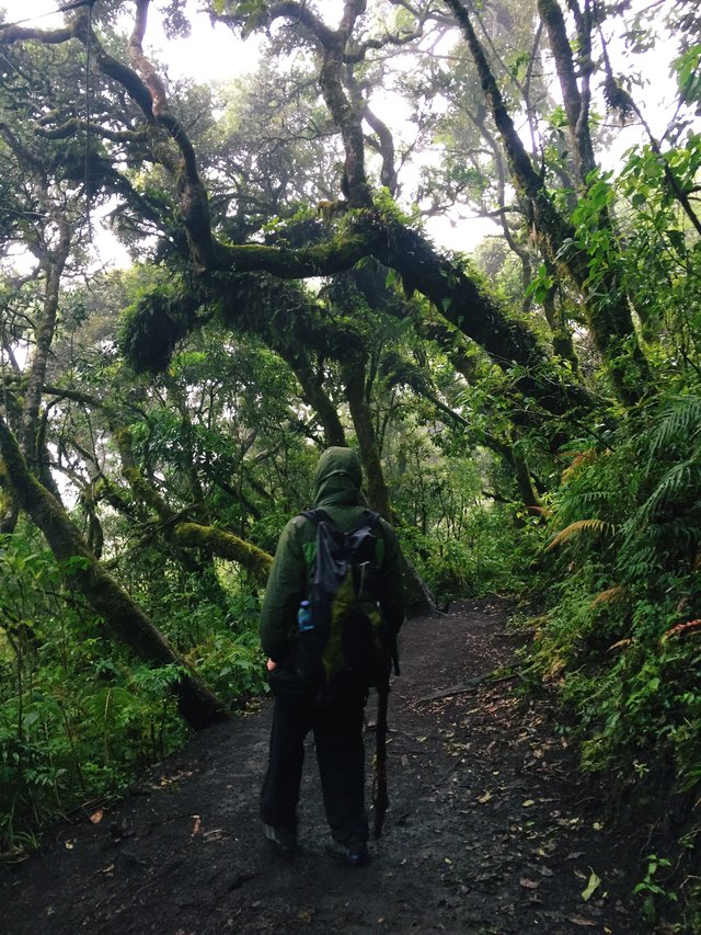
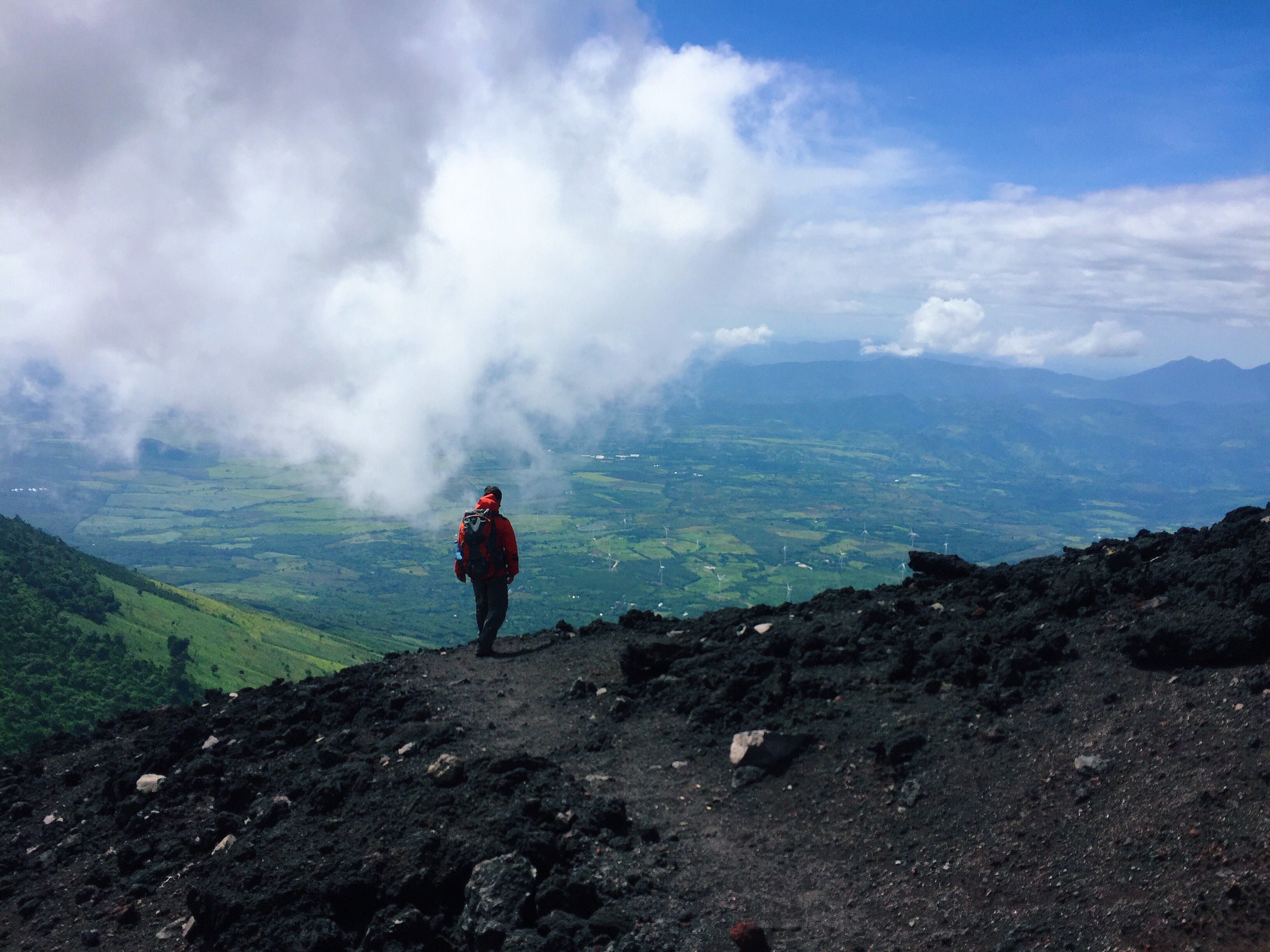
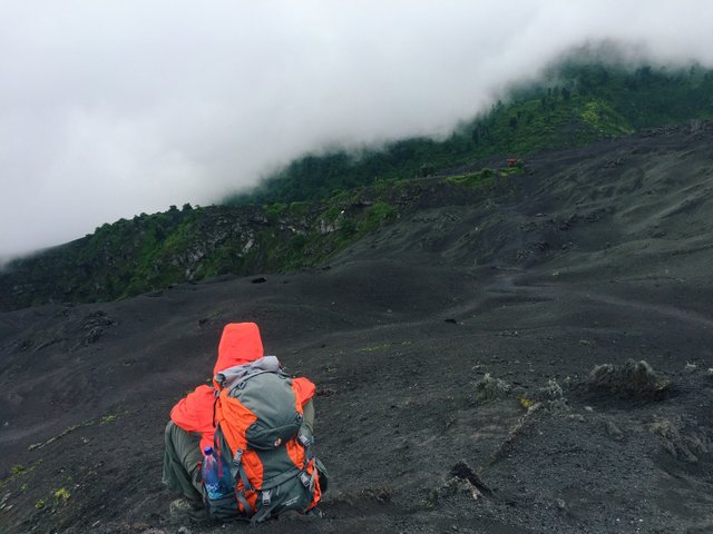
After you pass the growing corn fields down at the base, you move into the cloud forest. The temperature drops and there is a still and eery silence. The forest however, is lush and the surrounding trees are dripping and overgrown with moss and ferns. After the cloud forest than follows the high alpine forest. Generally from here you would be over the clouds, the view would optimally be bright and clear, but for us there were only rain clouds and darkness. Exhausted and hungry, we decided to stop and camp just before the summit. It was becoming dangerous hiking through the night. We agreed to rise early and continue before sunrise.
I want to say we had a restful and refreshing night, but as the temperature continued to drop, the rain began. I woke to a familiar yet unwelcoming sensation in my stomach – a burp with a terrible taste of eggs was the warning for what was to come next. At least I can tick puking on a volcano off the bucket list (salmonella ain’t kind!) In the morning I was in a sad state so Bri agreed to stay with me as the boys made their way to the top. From what I’m told a storm hit the peak and not much more than a metre in front could be seen. No doubt it was a series of unfortunate events so what more can you do than just appreciate what is!
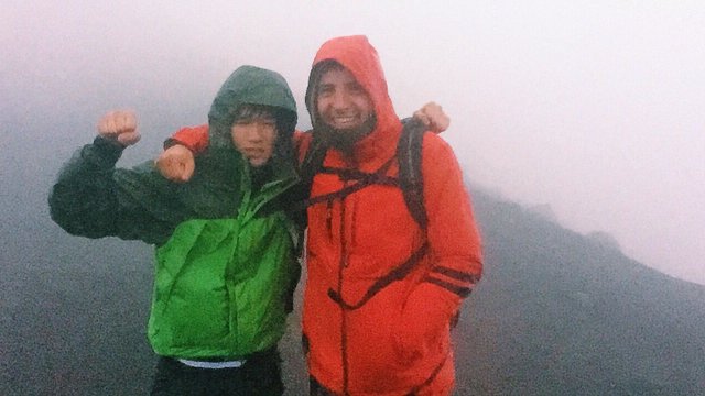
With the rain having dampened everything but our spirits, we collectively appreciated making the hike. Not everything will always go the way you anticipate but that doesn’t take anything away from the experiential journey. My legs were burning, my belly was empty but I shared the experience with amazing friends and if my heart could smile, it was bloody beaming. Regardless of everything we still climbed that big baby!
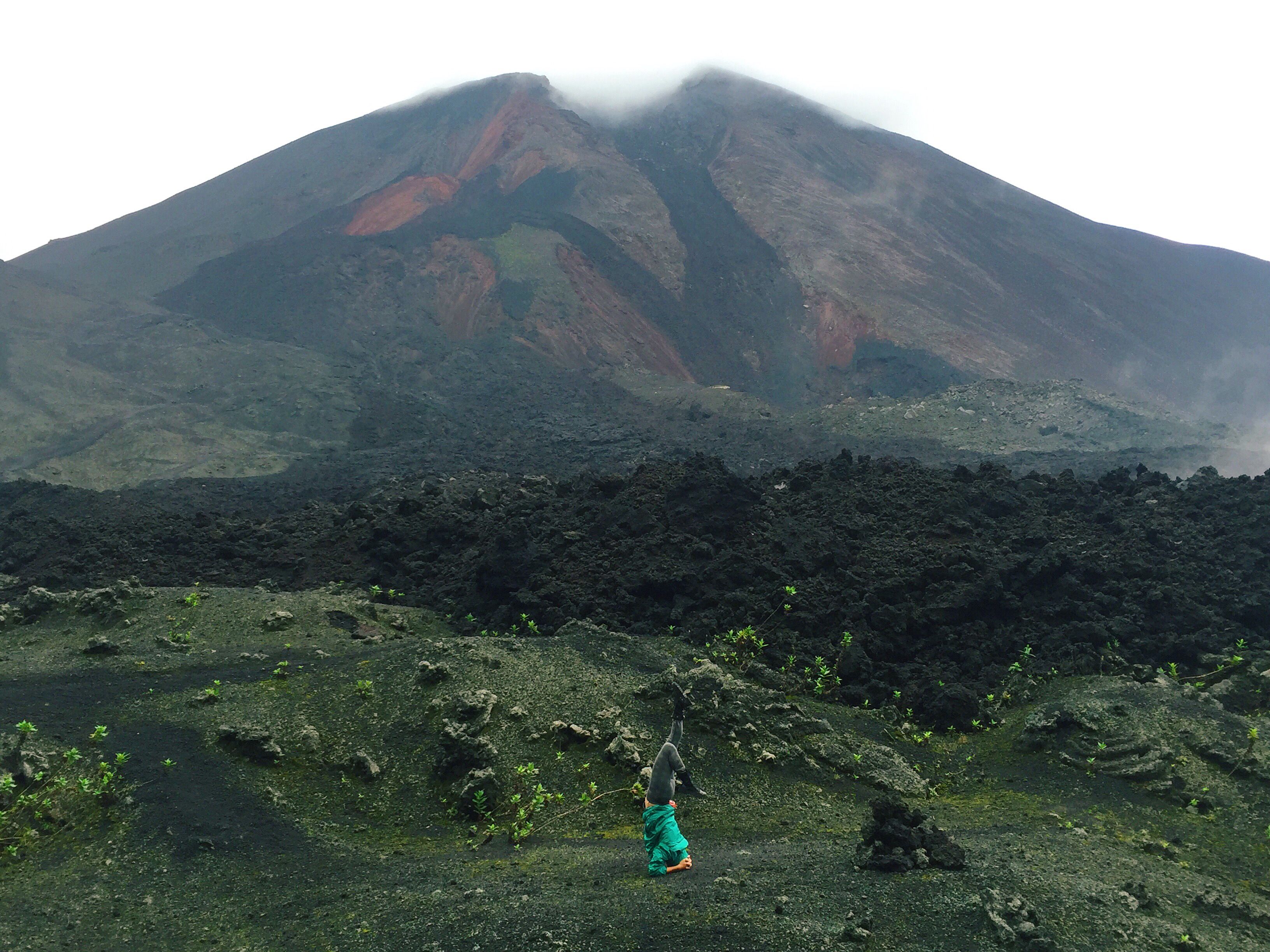
Pacaya
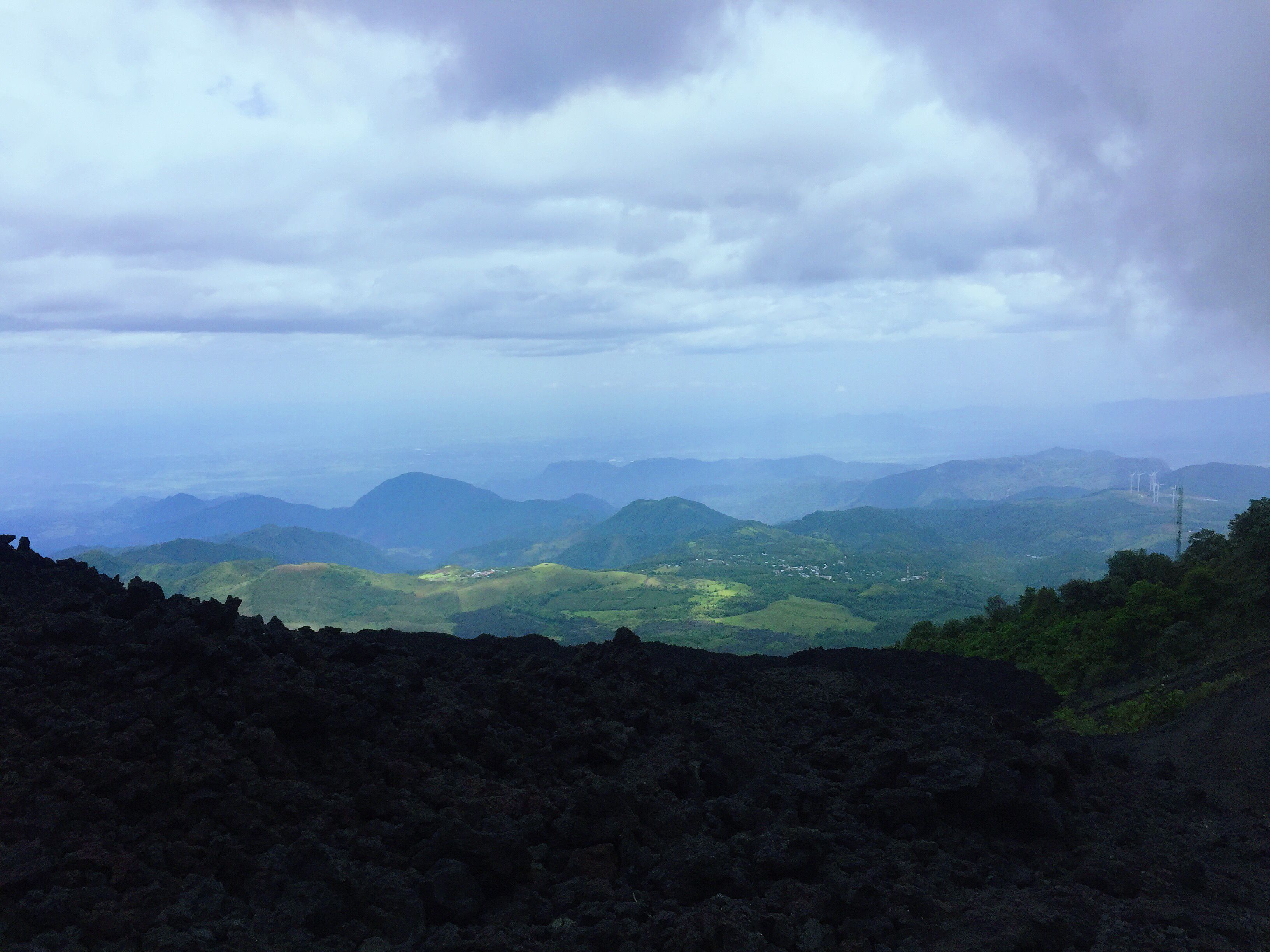
The view from Pacaya
You would think after the last volcanic adventure that I would’ve had my fill but soon after Neven tempted the thought of us climbing Pacaya, a smaller but active volcano that was part of the Central American Volcano Arc. Call me crazy but there was something about seeing lava that tickled my fancy. Plus I had to make it to the top of at least one volcano!
We decided to hike up in the early morning with hopes of catching the sunrise. All I can say is that regardless of the reviews we had read about Pacaya, it’s almost a walk in the park compared to Acatenango. Fog moved throughout the landscape as the sun started to rise. I had scepticism about seeing the volcano, as we were faced with little view of our path. Then just as if my thoughts had been heard, the clouds parted and I saw my first glimpse.
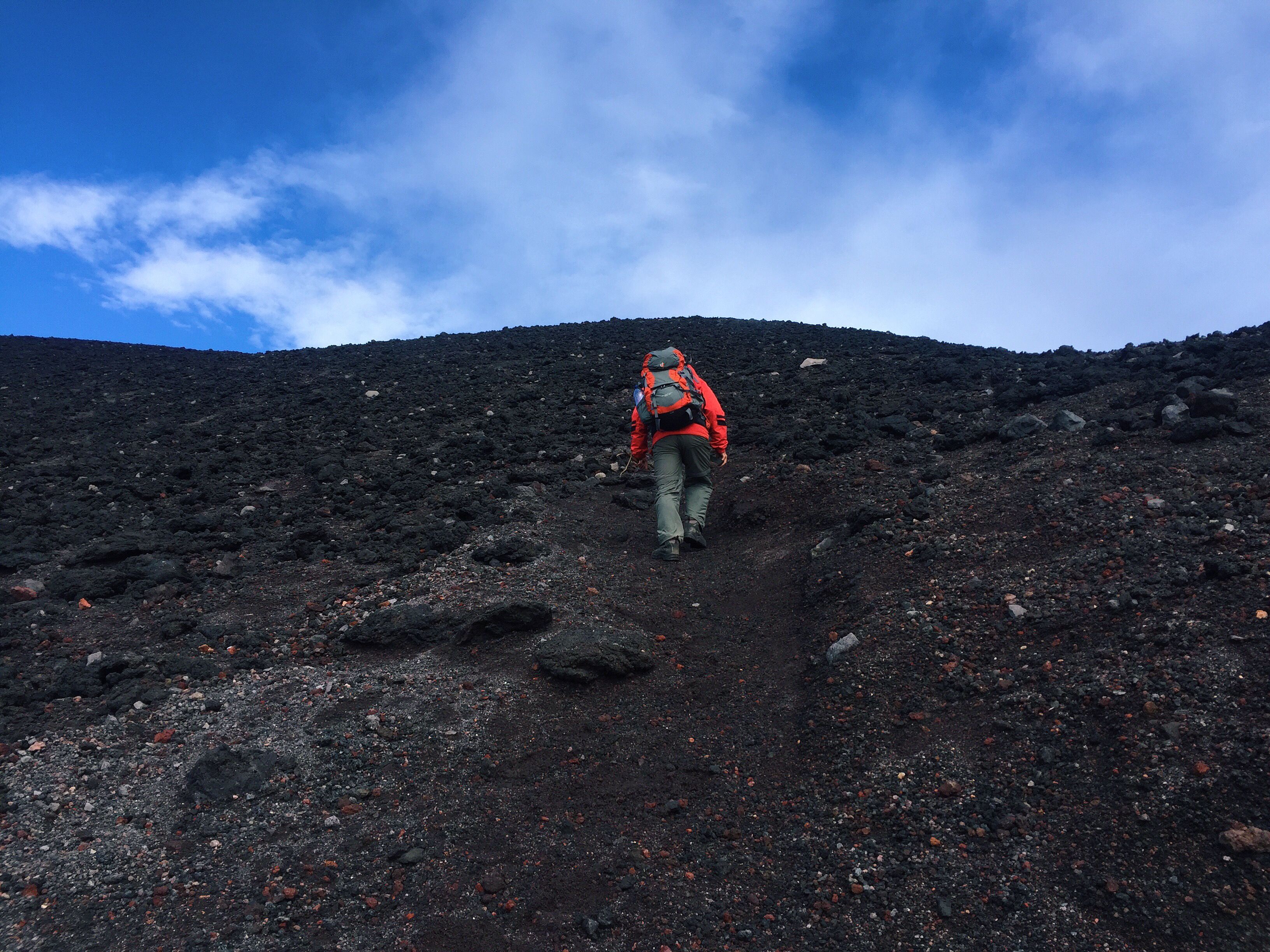
There was no way I was hiking my third volcano without reaching the crater. With my stubborn persistence and the sweet sounds of Neven’s persuasion we were fast bypassing the “prohibido” sign on the way to the top. The first gestures of a clearer day began to tease us and upon reaching half way, the scene beneath finally opened up – a guided group with close to 30 people down below staring up at us. Screams and shouts floated up to us but we continued to maintain oblivious to their obvious discourse.
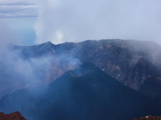
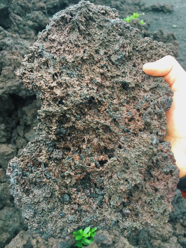
It’s sure as hell windy top a volcano, who would’a thought? We had to wait some time for the whirlwind to settle and our sight to clear, but within the shortest moment we saw the belly of the beast. To be honest I was expecting to see a gushing river of flaming hot lava dancing below but there was a only a smaller cone, barely a couple of metres wide, peeping back at us. Sure enough though you could see the fiery red iridescent glow accompanied by some soothing crackles and pops. I had a single thought, “Fuck yeah! You so cool nature.” But my moment of gratitude burst just as a national park officer approached us.
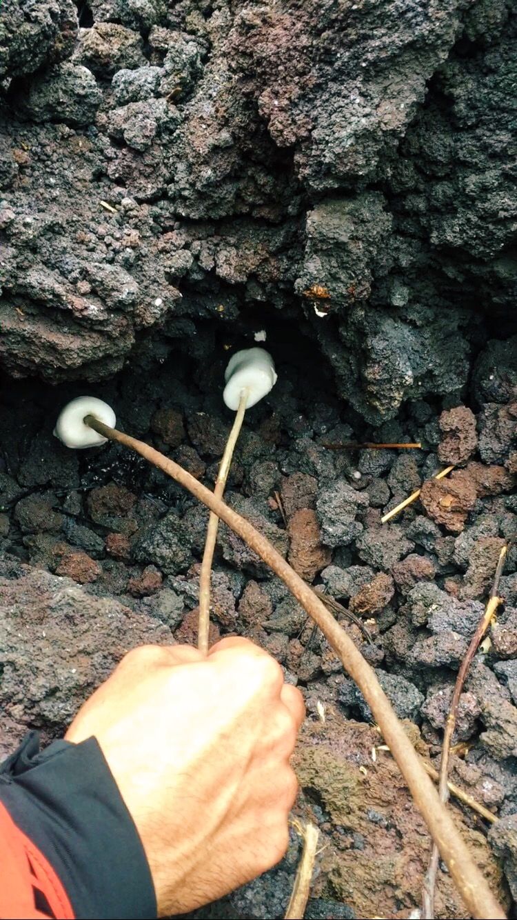
To no surprise we were escorted down, although unfazed because we had seen what we had come for. Neven and the officer exchanged some words about things and such, and what… tickets? Okay so maybe it wasn’t a coincidence we started climbing before sunrise when no one had been at the gate (doesn’t hurt trying). 50Q each later and we’re off down to find the warm spots where you can roast marshmallows. For real, this is what I am all about. You roast a marshmallow in a fire and there’s a high chance of it burning. You heat it over some hot volcanic rock and you got some real magic. Toasted to perfection!
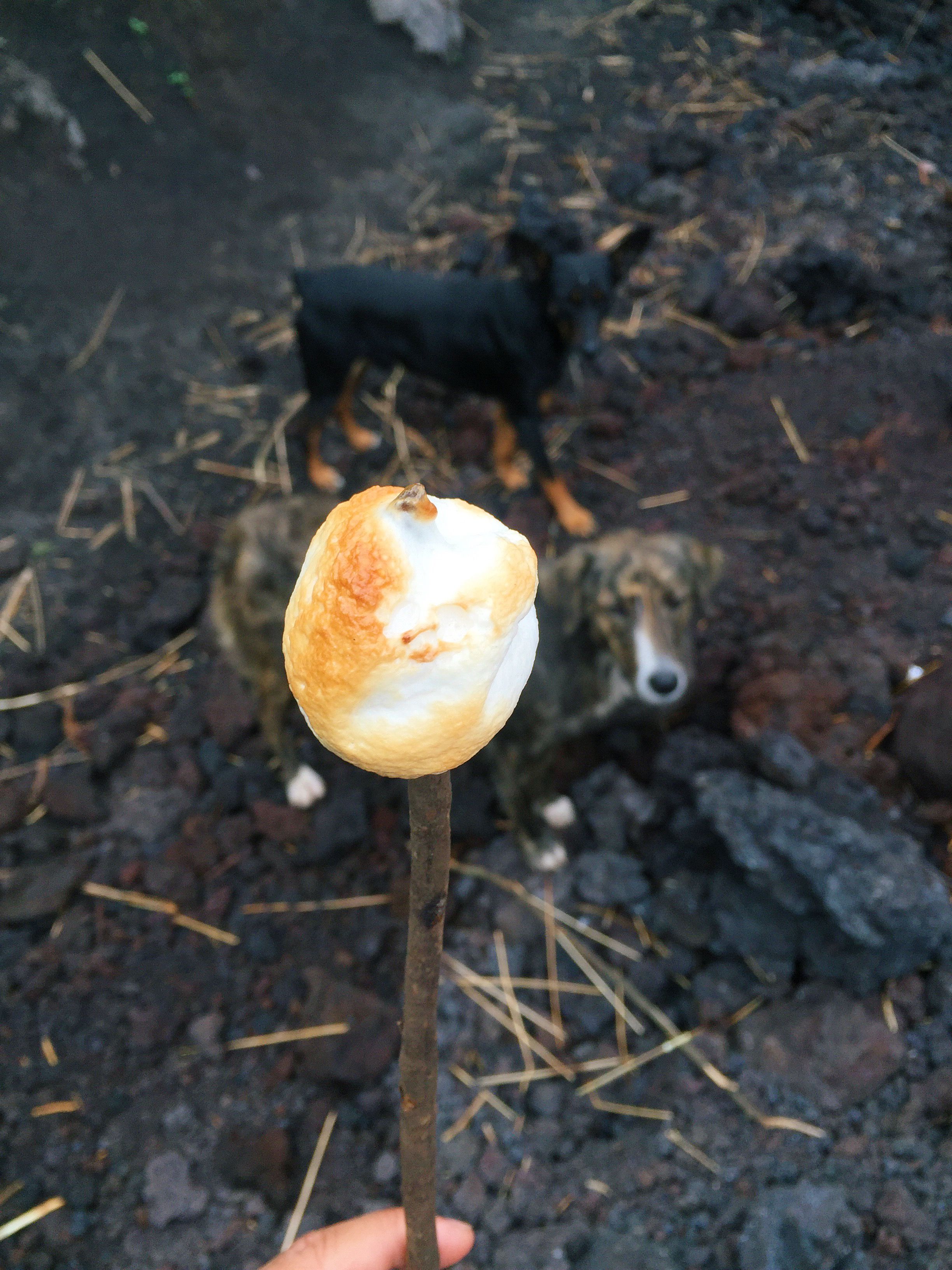
Caution! Watch for marshmallow snatching dogs!
So after our volcanic adventures our time was up in Guatemala. Another month gone by and my appreciation for this country only continues to go. With memories in my heart, we’re back on the road and ready for El Salvador!
Extra photos:
💚
Dreamy, out-worldly stuff. Also, the photography is just incredible. That photo with the two mountains with the rainbow-like light diffraction is my favourite. OMG.
Also, I was reading this while listening to @drKent 's sound --> https://dsound.audio/#/@drkent/suitcase-of-memories-time-after-time--cyndi-lauper-cover
Beautiful stuff.
Haha! I guess we have to do a collaboration to make @adetorrent happy @neeqi :)
It's inevitable!
That is one heck of a foot high five!
Glad you revived this to share here. I appreciate the combination of landscapes and people in spectacular photos with strong narrative support from your writing. How many people have toasted marshmallows over volcanic rock? Great job!
@custone Thank you! I have a new found appreciation going over these old posts. Guatemala is a beautiful country and I made some amazing friends whilst travelling through. And it's very true, not every day you got to toast marshmallows over some hot rock. 😁
awesome places and beautiful people, i hope you enjoy a lot with your friends
It was definitely a good time!
Awesome place wish I could go there too
If you want something enough you can make it happen. 😊
Man!! Those places just look freaking amazing!!! Incredible!!!
Winny out...for now ;)
PS: next time take me with you ok?
I'll be sure to make room in my backpack for you Winny!
Congratulations, Your Post Has Been Added To The Steemit Worldmap!
Author link: http://steemitworldmap.com?author=neeqi
Post link: http://steemitworldmap.com?post=the-volcanos-of-antigua-acatenango-pacaya
Want to have your post on the map too?
Legends!
Wow these blogs are just fantastic, so I'm glad you put this up. The pictures are amazing of the trees and volcano. I've a friend who has been on a couple of mission trips to Guatemala and it seemed the experience really changed him.
Thanks @captainbob! Honestly I never expected to find myself in Guatemala when I first had plans to travel to Central America and I am so very glad I ended up there. In total I've spent about three months. It's such a beautiful country and still so rich in culture. I highly recommend it!
hey...i recognize that volcano....hehe...nice.....love the renegade post....playing dumb and just doing it... signs were meant for those who choose to read them.
Hahaha I figured afterwards that we probably should've been a bit more respectful. Even at the point where the sign was if the thing was gonna blow we would've still taken a hit so why not at least make it an exciting one.