Hiking the Western States “No Hands Bridge” Trail
A Nice Hike
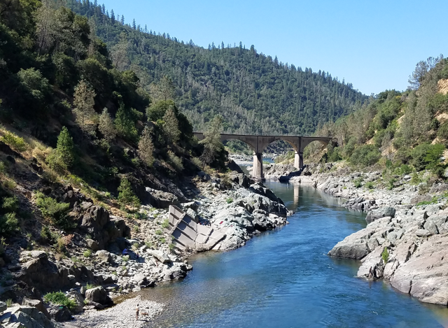
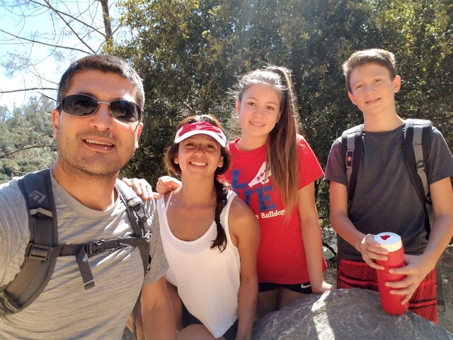
California’s Sierra Nevada range has countless trails to walk, hike, ride, and explore. The Western States Pioneer Express Trail is one of many located on the river just outside of Auburn CA along the North Fork of the American River. This popular and scenic trail crosses the old Mountain Quarries Rail Road Bridge, also known as the No Hands Bridge. This week I took the family to hike the trail and enjoy the beauty of the canyon, river, and historic bridge.
The trail is just under 9 miles in length and is rated as moderate due to the elevation climb of over 1500 feet. There are many offshoots from the trail down to the river, especially near the bridge. People, dogs (which are supposed to be kept on leashes), and horses are regular users of the trail.
History of a Bridge
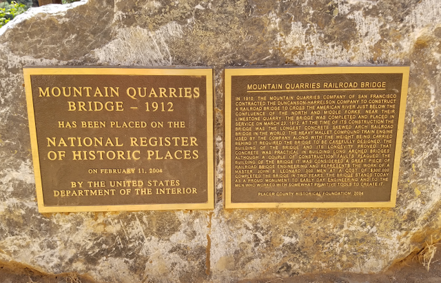
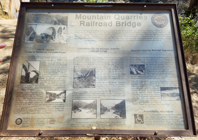
The Mountain Quarries Rail Road Bridge, which was the longest arched railroad bridge in 1912 when it was built, was constructed from reinforced concrete. Something new at the time and meant to prove concrete was a viable construction material for such structures. It served to connect a nearby limestone quarry with the town of Auburn, crossing the Middle Fork of the American River.
Construction began in 1910, by a crew of 800 men, at a cost of $300,000. The bridge was completed on March 23, 1912. It is 482 feet long and rises 150 feet tall.
Its durability was proven in 1964 when the upstream Hell Hole Dam failed and water crashed down the canyon. Two other modern steel and concrete bridges were washed away, but the No Hands Bridge endured. Then in 1986, during the great Valentine’s Day Flood, the bridge was completely submerged by water and still survived. Although no longer in service, with the railroad ties removed during WWII for scrap metal, it remains part of the history and is on the U.S. Department of the Interior’s National Register of Historic Places.
Location
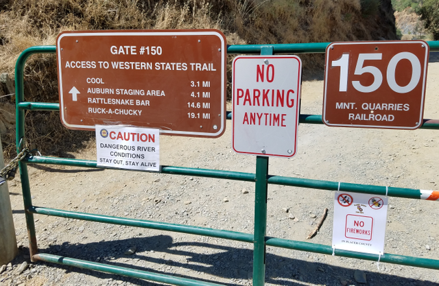
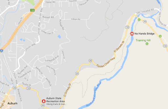
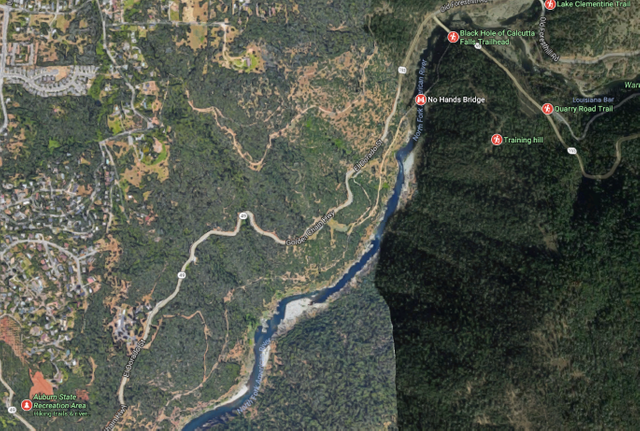
There are two possible starting points for the trail. I recommend the Northern point to begin the hike. It is closest to the No Hands Bridge and a much easier start. From Auburn, take highway 49 until you cross the middle fork of the American River. Immediately to your right is a turnout where some parking is available. The start of the trail is clearly visible from the road and marked with Gate #150, giving access to the Western States Trail.
The trail is easy down to the No Hands Bridge and many people frequent this area looking for a nice place near the river to relax on sunny days. The trail is mostly dirt and well-traveled. Expect runners, hikers, day-walkers, and occasionally horseback riders.
The trail mostly follows the river South. There is very little shade, so bring lots of water and sunscreen. The views of the valley and river are spectacular. The sounds of the rapids below can be heard from the trail above. After a few miles, the trail begins a long incline and eventually makes its way to the Auburn State Recreation Area. This is an alternative place to begin the hike. Overall, it is less than 9 miles there and back. Beware of summer afternoons as the temperature can reach upwards to 100 degrees Fahrenheit.
Scenery
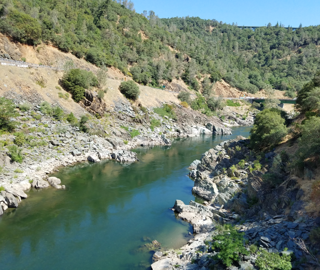
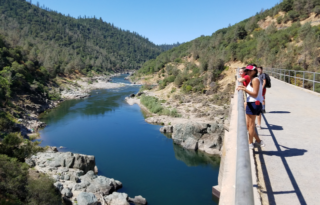
The air is clean and fresh. The water is clear. The valley was cut by the river and beautiful rock formations guard both sides of the river, giving way to pockets of pebble and beach access. This is typical Northern California Sierra foothill terrain at its best. The trail crosses the No Hands Bridge, which has handrails and provides great views both upstream and downstream.
Our hike was wonderful. We just took a water bottle and made sure we were covered in sunscreen and bug spray. The sun was grueling, so we made a stop at the water’s edge to cool off in the river.
It is a leisurely hike and a busy trail for both young and old. I definitely recommend taking a walk and enjoying the peacefulness of nature, sights of the river, and the history of the bridge.
Map Images Source: https://www.google.com/maps/search/no+hands+bridge+hike/@38.908231,-121.053231,2194m/data=!3m1!1e3
the views are beautiful! i cant wait to explore more trails in that area!
my water bottle broke early on and i was like -_-
The Clamentine area is beautiful and it is easy to explore whether you are fit for a 12 mile hike or a 1 mile hike. We saw quite a few fur babies as well as horses on our hike. Definitely a place to check out!
great post bro keep it up :)
perfect shots :)
No Hands, always a fun time during WS!
It's never bad to go hiking with the family surrounded by nature and fresh air with a wonderful eye catching view.
You've got a beautiful family, man.
Enjoyed reading!)
Thanks! I am a fortunate man.
Very scary😗 I don't do bridges or heights lol
But nice post
It didn't seem scary at all. That bridge is solid.
It's a hinking to learn a lot and have fun in nature, the first shot it's simply amazing
Nice description and pictures. Thanks for your recommendation !