A Clear Depiction of the Western Frontier of the United States in the Mid-1800s.
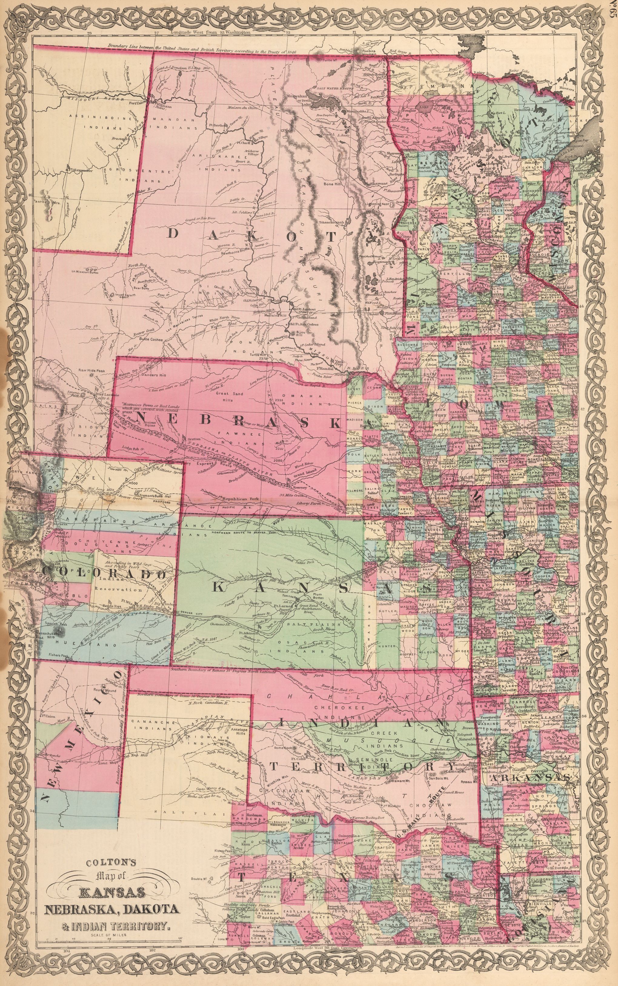
Colton’s Map of Kansas, Nebraska, Dakota & Indian Territory
By: Joseph Hutchins Colton
Date: 1864 (Published) New York
Dimensions: 17 x 27 inches (43.2 x 68.6 cm)
This scarce Civil War era map of the US mid-continent was probably printed only from 1864 to 1866, with minor changes. The map covers the upper half of Texas, eastern half of Colorado and an unusually shaped Dakota, predating Wyoming and Montana. In 1865 Montana was added to the map, and it was updated with additional counties. The map is highly detailed, with rivers, lakes, routes of explorers, forts, settlements, towns and railroad lines. There are large Indian reservations depicted in the Indian territory,and many Indian nations are named in the location of their settlements, with most of Nebraska and Kansas still denoted as Indian lands.
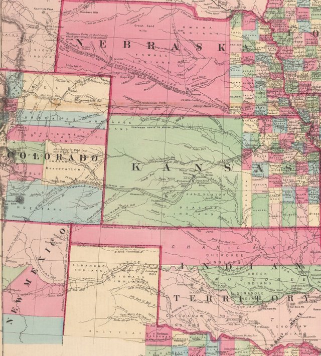
Rapid settlement and growth took place in this region during that period of time. The old Missouri Territory was remolded to become Nebraska Territory and Kansas Territory. In 1861, Kansas attained statehood, while the Nebraska Territory, lost two-thirds of its land to the newly created Dakota Territory, and the Territory of Colorado was created. Western parts of states along the Mississippi River are depicted demonstrating the considerable development which had already taken place there. Other areas which had experienced similar development were the eastern parts of Kansas and Nebraska, and eastern Texas.
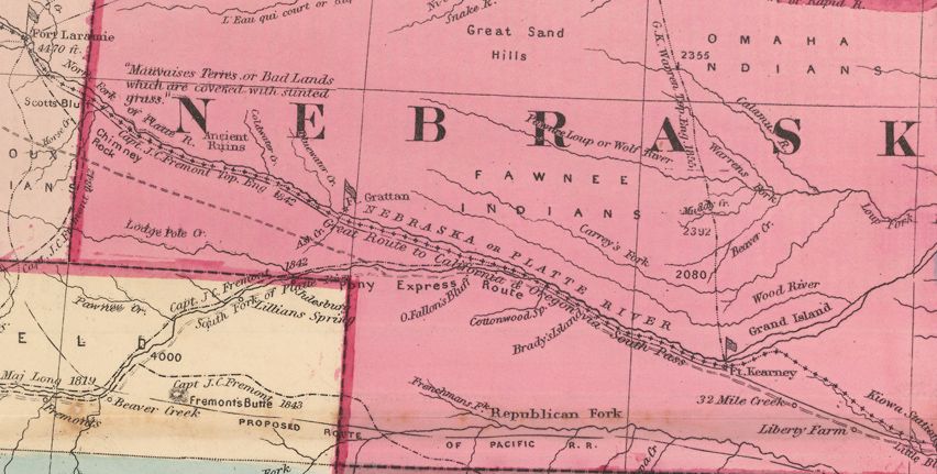
This is a scarce map which rarely appears on the market. Of particular interest is the graphic portrayal of the "Great Route to California and Oregon via South Pass," extending from Omaha to Fort Laramie and beyond. Within the same section of the map, one can find a proposed route of the Pacific Railroad. This railroad would play an integral role in the idea of "Manifest Destiny" and unite the country from coast to coast, propelling the nation to prosperity through industry, shortly after the most devastating war in America's history.
Have questions about this map or would like to see an old map of somewhere else in the world? Comment below.
Like antique maps and history? Follow me on Steemit and visit my website where you can buy antique maps with bitcoin (https://www.hjbmaps.com)
We also sell fine print reproductions at (https://www.thevintagemapshop.com)
Thank you for collaborating with me to promote this post as explained at https://steemit.com/steemit/@jerrybanfield/10-ways-to-fund-a-steem-growth-project.
You got a 1.36% upvote from @buildawhale courtesy of @mapman5000!
If you believe this post is spam or abuse, please report it to our Discord #abuse channel.
If you want to support our Curation Digest or our Spam & Abuse prevention efforts, please vote @themarkymark as witness.
@masterbot has been called by @mapman5000 to give you 4.44% upvote!
Check this post for information about delegation. Make me strong!