16th Century Map of Transylvania printed from a Woodcut Engraving by Sebastian Munster
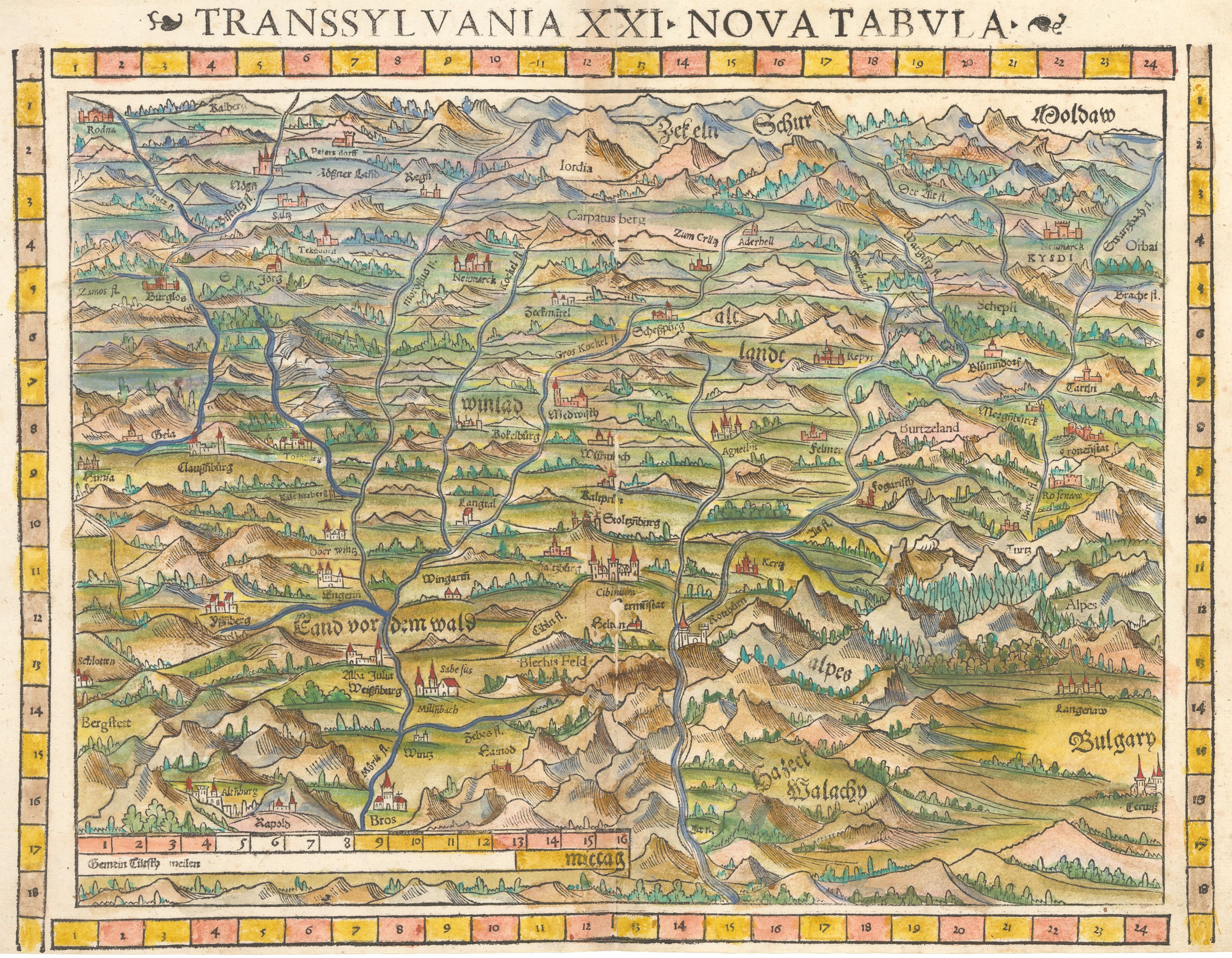
Transsylvania XXI Nova Tabula
By: Sebastian Munster
Date: 1552 (Published) Basel
Dimensions: 12 x 14.75 inches (30.1 cm x 37.5 cm)
This marvelous and scarce Munster woodcut is the earliest obtainable map to specifically depict Transylvania. It is based on the 1530 map by Rumanian cartographer Johannes Honterus.
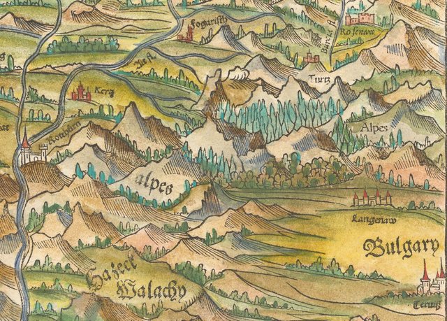
This attractive woodblock map covers the region of present-day Romania which at the time was the heartland of the Saxon community in southern Transylvania. This example is from the rare 1552 edition of Munster’s Geographia, the only one to feature coordinate bars at top and bottom. The map depicts the cities, rivers and forests of the vast area, and extends from Moldavia to Bulgaria in the east. The map’s western border lies within the boundaries of modern-day Romania. At the time Munster made his map of Transylvania and its Alps, the Carpathians, the area was part of the Ottoman Empire under the rule of one its greatest Sultans, Suleiman the Magnificent.
The region was semi-autonomic, and according to Ottoman custom its reigning princes (Hungarian) were only required to pay tribute to the Ottomans in order to be left in relative peace. At the same time Ivan Grozny (the Terrible) ruled all of Russia, having finally wrested power from the grandson of Genghis Khan, the last Khan, and bringing an end to the rule of the Golden Horde. Henry VI of the House of Lancaster ruled over England at this time, when most of its territories in France were lost. Though much of Europe was in flux when Munster made this map, it was also a time which saw the rise of the West, as European explorers set out to expand the borders of the known and mapped world. Munster and his maps played an important role in the expansionism of the time.
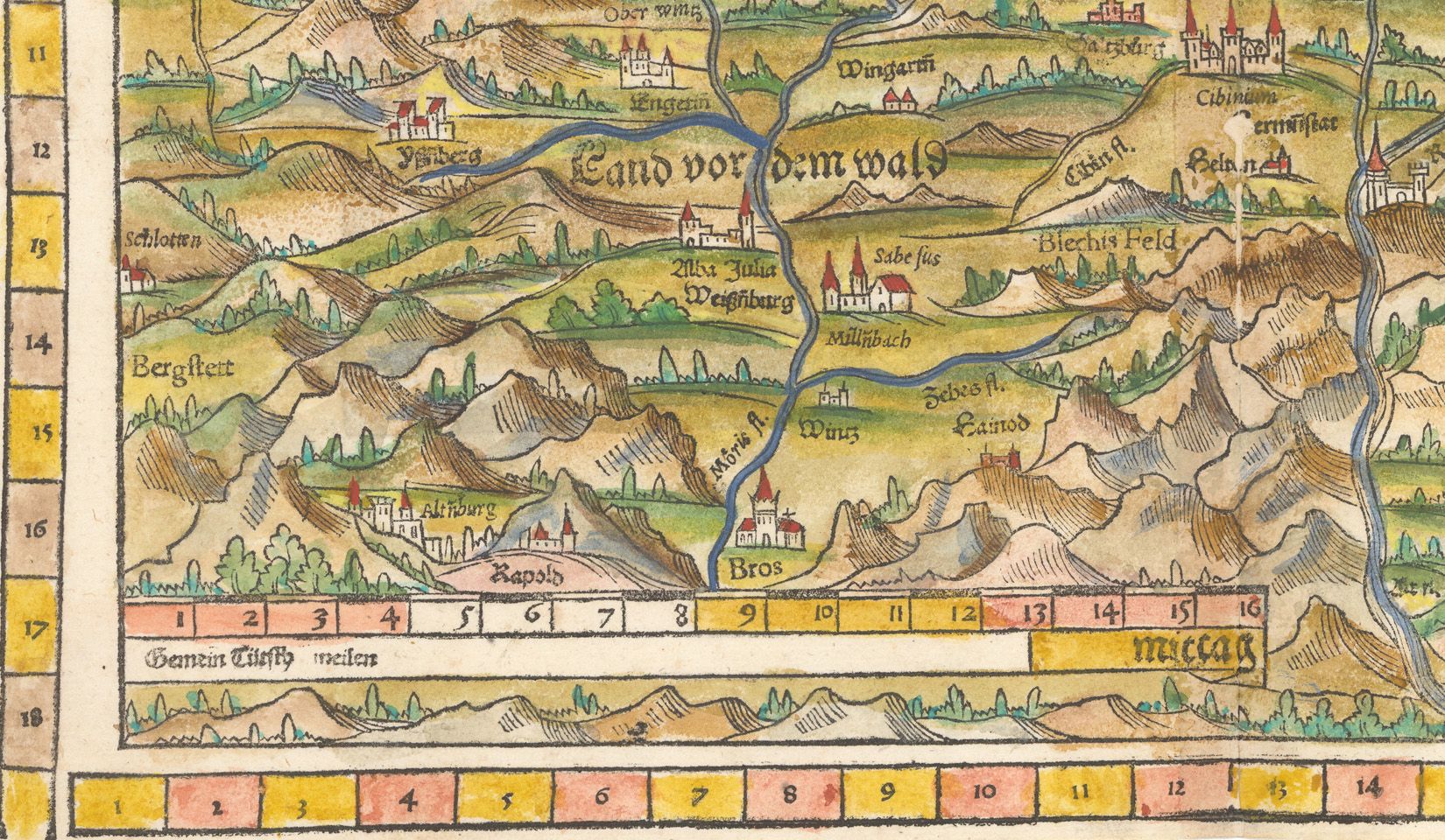
This example is from the rare 1552 edition of Munster’s Geographia, the only one to feature coordinate bars provided at top and bottom. A large distance scale is at bottom and the title is in the top margin. This map only appears in a few editions of Munster's Cosmographia, and is therefore uncommon. On the verso, Latin text describing the map is bordered by a decorative cartouche.
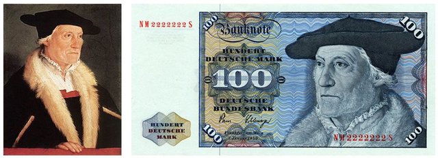
Sebastian Münster (20th January 1488 - 26th May 1552) was a German cartographer, cosmographer, and theologian. A gifted scholar of Hebraic he was appointed to the University of Basel in 1529, and published a number of works in Latin, Greek, and Hebrew. His most celebrated works are his Latin edition of Ptolemy's Geographia in 1540, and the Cosmographia in 1544. The Cosmographia was the earliest German description of the world, an ambitious work of 6 volumes published in numerous editions in German, Latin, French, Italian, and Czech.
Have questions about this map or would like to see an old map of somewhere else in the world? Comment below.
Like antique maps and history? Follow me on Steemit and visit my website where you can buy antique maps with bitcoin (https://www.hjbmaps.com)
We also sell fine print reproductions at (https://www.thevintagemapshop.com)
4.52% @pushup from @mapman5000
these are incredible maps, I wish I could get my hands on one, frame it up and hang it on my wall. feel free to follow me as I will and upvote your future content
You got a 2.86% upvote from @upmyvote courtesy of @mapman5000!
If you believe this post is spam or abuse, please report it to our Discord #abuse channel.
If you want to support our Curation Digest or our Spam & Abuse prevention efforts, please vote @themarkymark as witness.
You got a 11.39% upvote from @ipromote courtesy of @mapman5000!
If you believe this post is spam or abuse, please report it to our Discord #abuse channel.
If you want to support our Curation Digest or our Spam & Abuse prevention efforts, please vote @themarkymark as witness.