Places to see absolutely before dying #9
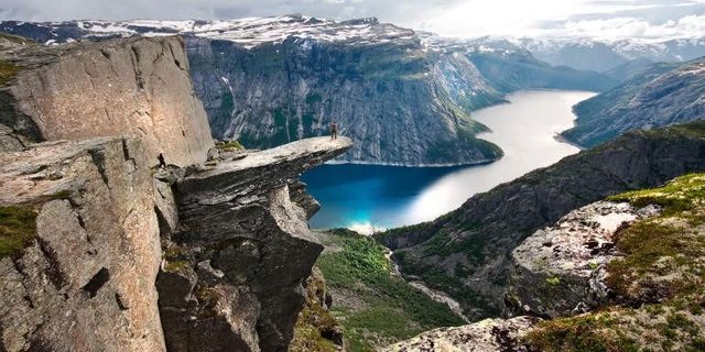
Trolltunga (Troll tongue)
Is a rock formation situated about 1,100 metres above sea level in the municipality of Odda in Hordaland county, Norway. The special cliff is jutting horizontally out from the mountain, into free air about 700 metres (2,300 ft) above the north side of the lake Ringedalsvatnet.
Popularity of the hike to Trolltunga and rock formation itself has exploded in recent years. The increased popularity has turned Trolltunga into a national icon and a major tourist attraction for the region. In 2016 more than 80,000 people hiked the 27 kilometres round-trip from Skjeggedal, making it one of Norway's most popular hikes.
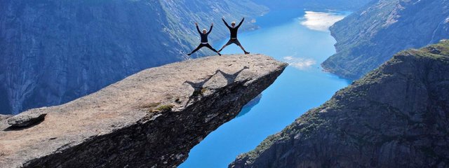
Geology of Trolltunga
The cliff is part of the Precambrian bedrock and was formed during the Ice Age, approximately 10,000 years ago, when the edges of the glacier reached the cliff. The water from the glacier froze in the crevices of the mountain and eventually broke off large, angular blocks, which were later carried away with the glacier. Along the cliff itself, a gneiss, there continues to be deep cracks.
Gneiss
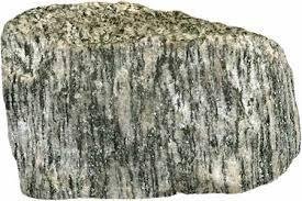
Is a common distributed type of rock formed by high-grade regional metamorphic processes from pre-existing formations that were originally either igneous or sedimentary rocks. It is often foliated (composed of layers of sheet-like planar structures).
The foliations are characterized by alternating darker and lighter colored bands, called "gneissic banding".
The trail to Trolltunga also passes through the bedrock and washed slippery hillsides in the background also containing gneiss.
How to go there?
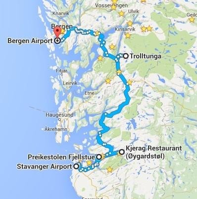
Trolltunga is located 17 kilometres from city centre in Odda, Hordaland, a county in Western Norway. The city of Bergen, is about 190 kilometres from the site via main roads.
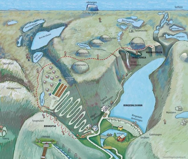
The trailhead is located by a small parking area with toilet facilities at Skjeggedal, about 7 kilometres from Riksvei 13 in Tyssedalen, near the dam at the end of Ringedalsvatnet.
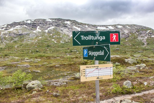
The hike from the parking area to Trolltunga and back again is a 27 kilometre round-trip in terrain with 1,100 metres of elevation gain, and takes approximately 10–12 hours, including breaks.
The hiking trail to Trolltunga
At Skjeggedal, there is a funicular called Mågelibanen. The trail to Trolltunga begins here, on the left side of the funicular. It is marked with red T´s painted in the terrain, and signs along the route that marks the distance left to Trolltunga and to the starting point at Skjeggedal.
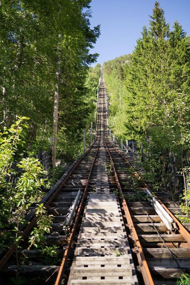
For the first 1.5 kilometres, up to the Måglitopp, the trail rises about 450 metres. From here the track surfaces slightly out before it gets steep again, rising another 330 metres up from Gryteskaret to Trombåskåret.
This section is the steepest part on this hike. This section have been improved by Nepalese sherpas now, making it easier to traverse.
The trail continues over Hesteflåene and the dried out river Endåno, before it gets steeper up to Endanuten and crosses the dried river to Tyssestrengene.
From here the trail goes on past glacial potholes, then continues past Tysshøl, and finally approaches Trolltunga, 13,5 kilometres from the starting point at Skjeggedal.
In 2017 a new alternative toll road up the steep hillside to Mågelitopp opens to the public. It allows vehicles to access the plateau at Måglitopp. Due to limited parking the maximum capacity here is 30 cars per day.
The road opens each day during the season at 7.00 AM, and closes when the first 30 cars have entered the gate. There is no reservation is possible.
The route to Trolltunga goes through high mountain terrain with creeks, steams, boulders, mud puddles, wet march and water at several spots on the hike.
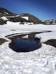
From late-September to June the terrain is normally covered with ice and snow. After a hard winter it can be snow at Trolltunga even during the summer season.
Climate
Trolltunga is accessible from mid-June to mid-September, depending on when the snow melts in the Spring. The season for guided trips with snowshoes or skis starts in March.
During summer and autumn the weather conditions often change quickly, from blue sky to wind, rain and dense fog. Before go hiking check the weather forecast.
Due to the long distance, hikers to Trolltunga needs to start before 10:00 AM in the summer season to get home before it gets dark and cold. And in September at 8:00 AM at latest, since it gets darker earlier in the evening.
Surrounding landscape
The cliff overlooks the valleys of the Hardanger region. The mountains surrounding the cliff reach heights of up to 1500 meters. Some of the hilltops have plains which are interspersed with lakes. Patches of snow are present in some areas, even in the summer months. Due to heavy use by tourists, the trail to Trolltunga quickly turns to mud after a rain in the summer.
Wow, this is amazing. Is that you guys in that jumping picture? So cool!
No sadly... but one day I hope it'll be me !!!!
I hope to go there too after reading this - good luck on your adventures! :)
I want to visit these beautiful Places to see absolutely before dying @indesta120282 plese pray for me !
Okay, that's incredible.
Quite a hike through some seriously rugged terrain to get there, too.
I wonder how many people jumping would it take to break that Troll's Tongue right off of there...
wow...
good post brother @indesta120282.. i liked ,,so nice
Wow awesome! Thanks for the travel inspiration!