Callanish - Isle of Lewis
 Hello Steemit friends:
After I visit places such as Callanish I am always bewildered, as I am sure that I can’t satisfactorily answer any of the obvious questions - why was it built, how was it built, who built it, what was the reason for building it here rather than on any other hillock in the area? Even the question as to when the site was constructed is open to discussion.
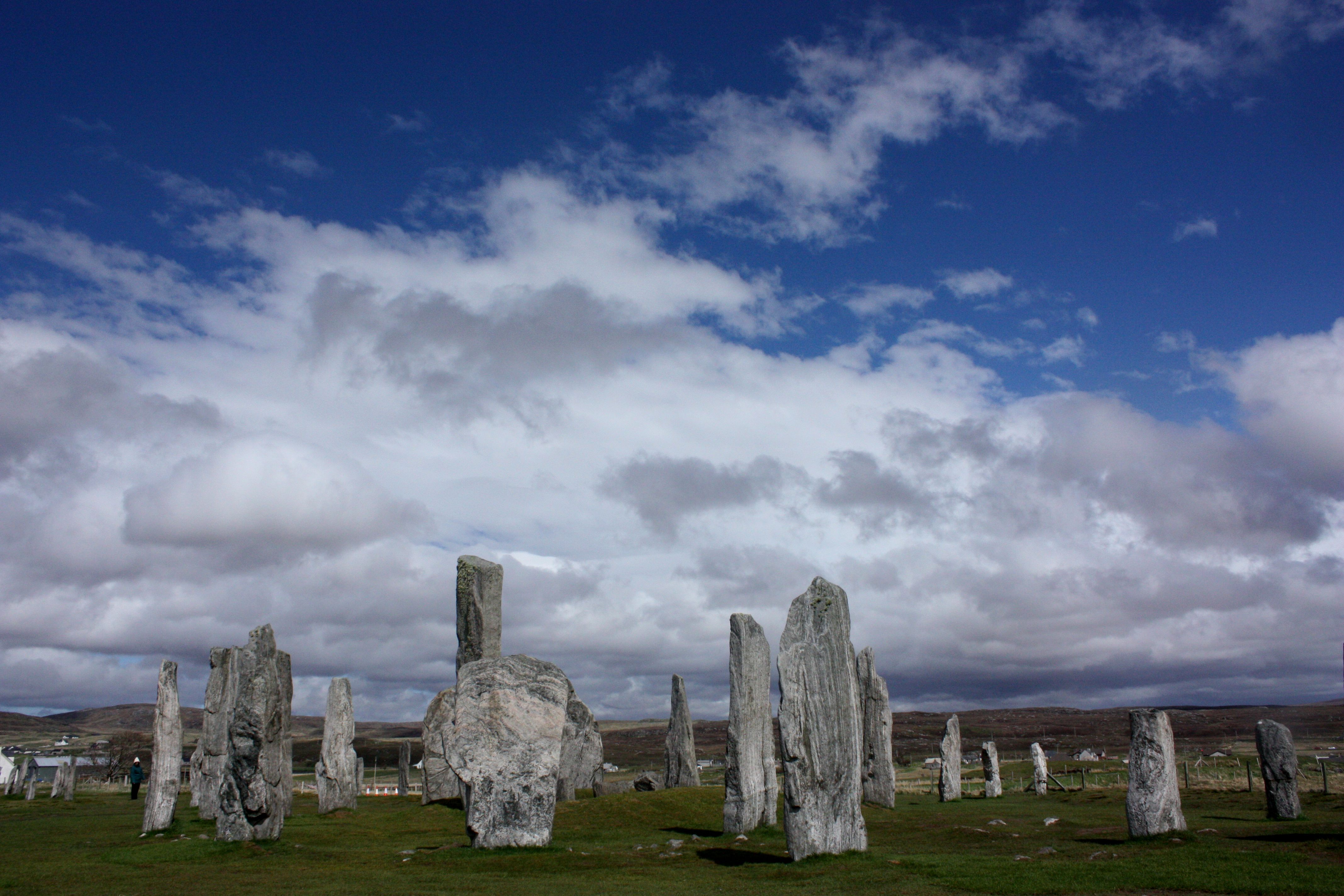
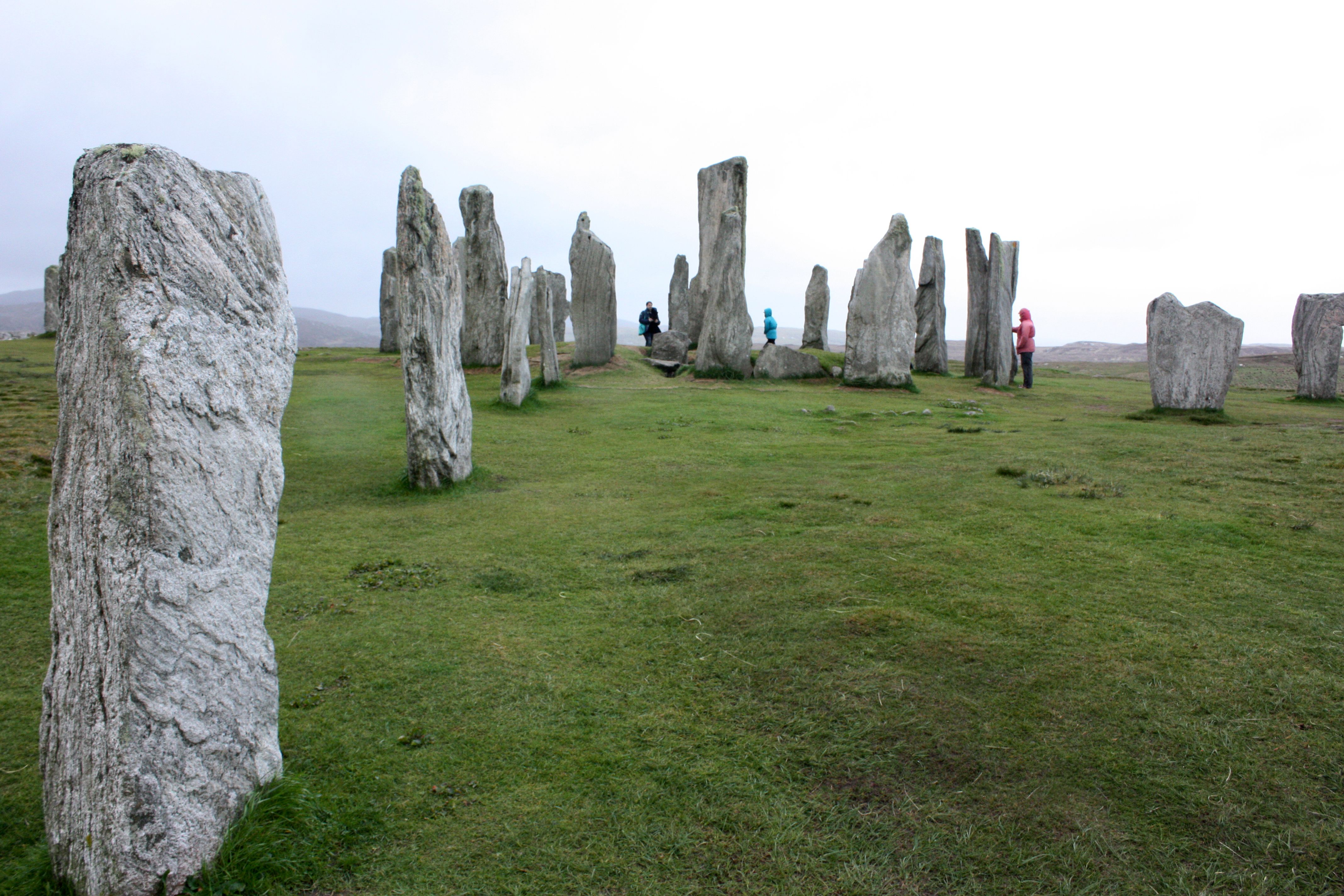
Callanish comprises several different elements - a stone circle containing a central monolith and a chambered tomb, three rows of stones intersecting with the circle, and an avenue of stones heading roughly northwards away from the circle. All the stones are Lewisian gneiss and were quarried locally.
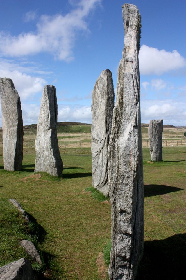
The stone circle consists of thirteen stones, with an average height of 3 metres. The circle is not quite perfect as the east side is slightly squashed. The circle covers an area of 124 square metres with a diameter of 11.4 metres. The circle was built between 2,900 BC and 2,600 BC making it slightly older than Stonehenge.
The 6.4-metre-long chambered tomb, in the central part of the circle, was almost certainly added after the circle was set up and was used for many centuries, as not only local pottery was found, but also Beaker vessels dating from 2000BC.
The central monolith stands 0.8 metres west of the true centre of the stone circle. The monolith is 4.8 metres high and 1.5 metres wide. This stone is on an almost perfect north to south axis, making me wonder how people 5,000 years ago could align a 7-tonne stone so accurately.
The avenue connects to the stone circle from the north-northeast and is just over 83 metres long. There are 19 stones remaining in the avenue: nine stones on the eastern side, ten on the western side. It’s tempting to think that some of the original stones might have been taken for building projects on the island as there seems to be no real consistency in the layout of the stones on the two sides of the avenue. The largest stone in the avenue is 3.5 metres high and stands on the western end of the row. The two rows are not parallel, but fan out the further away they get from the circle - at the north end the rows are 6.7 metres apart, but only 6 metres apart at the south end, nearer the stone circle.
From the circle, the height of the stones decreases towards the middle of the avenue; from there the height increases again. The stones of the eastern side of the avenue have only three-quarters of the height of the stones on the western side. When I saw this, I wondered whether this was deliberate or just accidental - why would these details be important to the people who created the site?
Do we try and provide explanations for the reasons why things are a certain way at ancient sites, when in fact the creators of these places meant nothing by them? Did the stones of the North Avenue fan out deliberately the further away they went away from the stone circle or was it because the people creating the avenue didn’t have accurate measuring devices or just didn’t care whether the distance between the stones was the same all along the avenue - i.e. they just wanted an avenue of stones heading in a roughly northern direction?
I believe they did care, as the central monolith was so accurately aligned north to south, therefore the fanning out was deliberate, but what was the reason for this? Was it meant to represent something? If so, what?
Another confusing feature are the three rows of stones that join the southern end of the stone circle. One row comes from the direction of east-northeast, one from the south, and one from the west-southwest. The east-northeast row comprises five stones, the southern row also has five stones and the west-southwest row four stones. None of the stone rows is aimed at the centre of the stone circle.
Again, is this significant, or have the stones just been displaced over the thousands of years of their existence? It’s worth mentioning the stones at Callanish were abandoned, for whatever task they were intended, around 800BC and that not much is written about them until 1857, when over 5 feet of peat was removed from the site, revealing the chambered grave and the true height of the stones.
A Scottish writer Martin Martin visited Lewis in 1695, researching his book A Description of the Western Islands of Scotland, and was told that Callanish was “a place appointed for worship in the time of heathenism, and that the chief druid or priest stood near the big stone in the centre, from whence he addressed himself to the people that surrounded him”. This is an interesting explanation, but doesn’t provide an insight into when the ‘time of heathenism’ was.
I first saw the stones silhouetted against the sky when I was driving from the airport to my hotel for the night. I could have visited the stones, even at 9pm, because the site is free and open to all, the way it should be. I pulled over to the side of the road, because it was difficult for me to comprehend that 5,000 years ago, I could have stood in the same spot I was now and seen the same view I was seeing now. 1,825,000 days ago, the view would have been the same. For me, that is an amazing feeling to have, and ultimately the fact the stones are still there is more important than the reasons why the stones were placed where they were.
Fantastic Photos, the clarity is amazing! Very nice post here, Thanks.