🇯🇵 [Travel Japan JR 带你游日本] Tateyama Kurobe Alpine Route | 立山黒部アルペンルート
Long post ahead, go grab a coffee before you start. :)
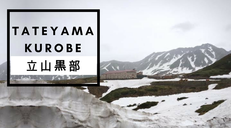
We have always heard so much and seen many spectacular views of the Tateyama Kurobe Alpine Route (立山黒部アルペンルート), especially the classic snow wall but have never gotten to visit it as we were previously travelling to the more typical touristy destinations. With this longer break, we had purposely planned our itinerary to include the Alpine Route, which was one of the highlights of our trip.
Oh my! Travelling through the Tateyama Kurobe Alpine Route really do require planning, time and energy!!! – That’s my thoughts upon our completion. We took approximately 8 hours to complete the Alpine Route and that’s the longest that we had ever spent on a destination. (To think that I was skeptical on the estimation stated on website and assumed they were too generous. haha!)
Summary of our trip with our recommendations:
What is Tateyama Kurobe Alpine Route?
To put it simply, it’s a unique route where you travel from Point A to Point J [ (A) Toyama -> (B) Tateyama -> (C) Bijodaira ->(D) Murodo -> (E) Daikanbo -> (F) Kurobedaira -> (G) Kurobeko -> (H) Kurobe Dam -> (I) Ogizawa -> (J) Nagano] via 8 different modes of transportation, which takes you through stunning and unique landscapes of Mt Tateyama. The highlight of the Alpine Route is at the highest point of 2450m at Murodo where you will witness the infamous alps snow wall.
Note: You can travel vice versa from Point H to Point A (Nagano to Toyama) depending on your preferred starting point. We commenced our journey at Toyama.
Recommended preparation work before the trip
Decide where you want to commence your trip.
(From Nagano or Toyama?)Purchase your tickets.
You can choose to buy your tickets at each destination point (day ticket or advanced ticket are available. Refer to: http://www.alpen-route.com/en/transport_new/ticket.html. As we were already holding the Hokuriku Arch Pass http://hokuriku-arch-pass.com/en/#sec02, we bought the complementing Tateyama Kurobe Option Ticket http://jrtateyama.com/e/, which is valid for 5 days at 9,000 yen per person.Visit their official website to read about each destination point that you are interested in visiting.
A good and quick reference would be to download the Guide Pamphlet located at the bottom of their official website here: http://www.alpen-route.com/en/about/introduction.html.Refer to the available timings of the different modes of transport.
They are listed on the website here: http://www.alpen-route.com/en/timetable/timetable.html?date=0416-1103. It’s important that you pay attention to the departure timing at each point, especially if you intend to complete the Kurobe Alpine Route within a day. For example, if you would like to visit the Shomyo Falls at Tateyama, you have to factor in an additional 2.5 hours for the round trip to Shomyo Falls and back to Tateyama Station.
Note: Unexpected situation may occur (well, we did have one) so it’s recommended to be more generous in your time estimation.Plan your attire.
We went in mid-June and it is quite cooling, but the highest point at Murodo is relatively cold at 7 degrees. I did not want the hassle of bringing my winter wear (to wear for only 1 day during my summer holiday) so I was layering myself with a few jackets. It was also the rainy season and we were glad we had an umbrella with us albeit too small.
Our Alpine Route Experience:
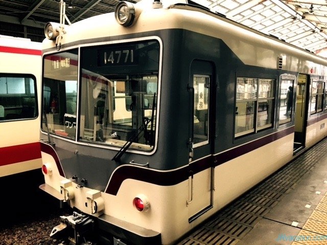
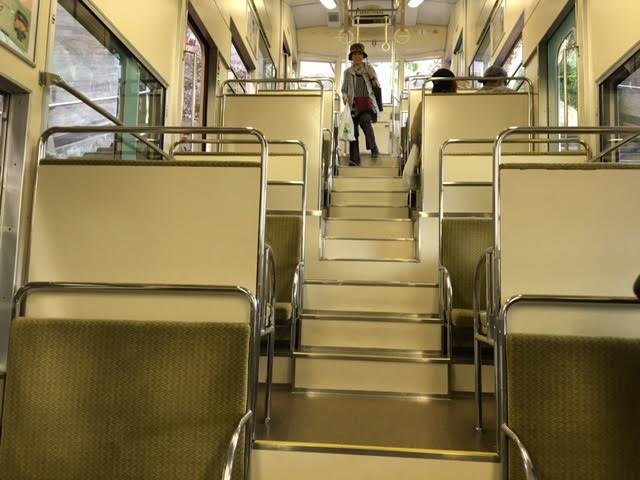
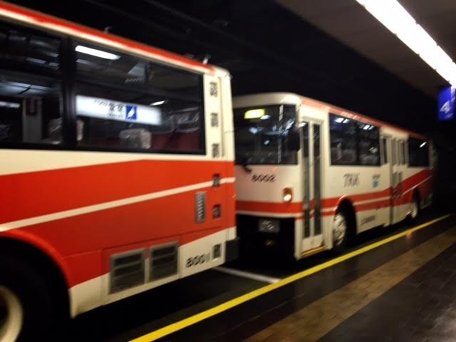
Point A: Dentetsu Toyama Station -> Point B: Tateyama Station, 475m (via Toyama Chiho Railroad)
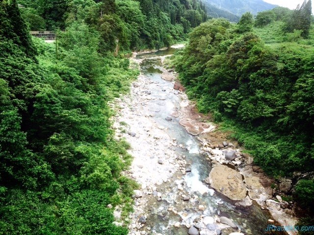
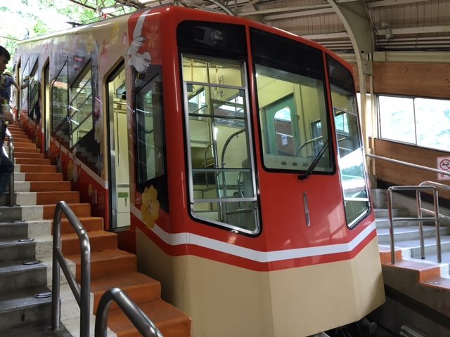
We took the Toyama Chiho Railroad from Dentetsu Totyama Station to Tateyama Station. A slow moving, old-school looking train that brings you to the suburbs. The train is clean but has a strong musty smell, which you will eventually get used to during the 60 minutes journey.
The “old-school” train
Moving away from the city…
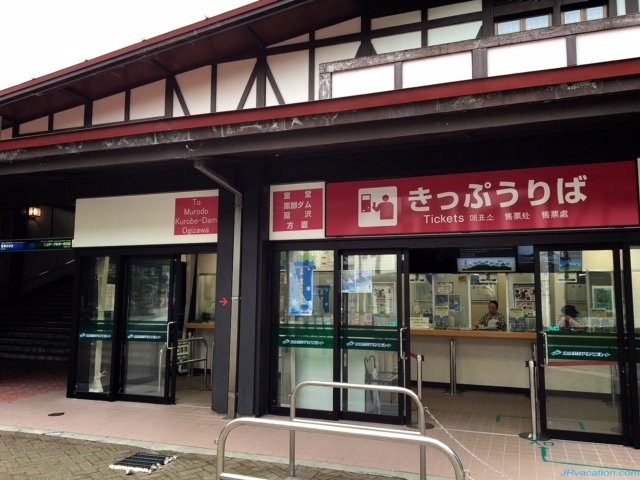
Tateyama Station
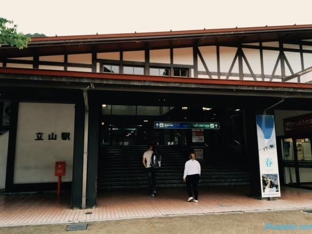
Head to the ticket sales counter located on the left as you walk out of the station if you are buying day ticket to the next destination point.
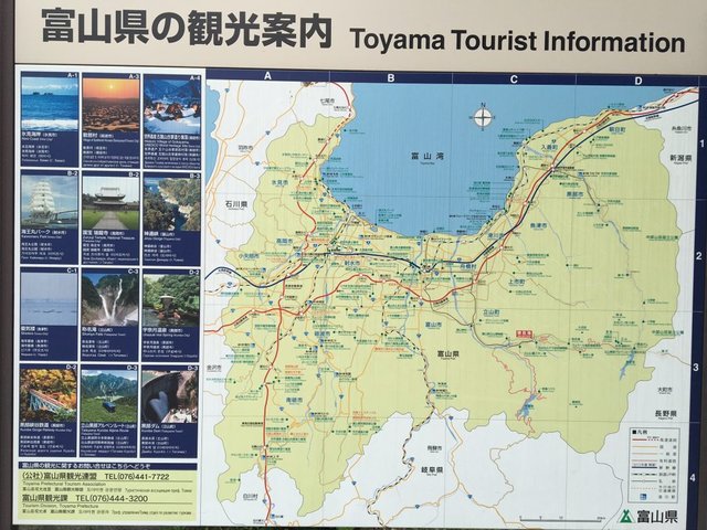
Overview of tourist attractions available in Toyama. Some destinations are covered within the Alpine Route
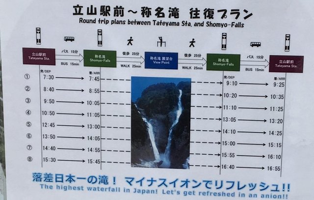
The Shomyo Falls is the highest waterfall in Japan and it is regretful that we did not have sufficient time to visit as it will take an additional 2.5 hours. 🙁
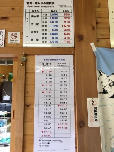
Bus schedule of the Shomyo Falls and fare for planning:
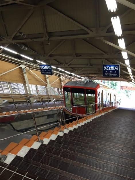
Point B: Tateyama Station -> Point C: Bijodaira, 977m (via Tateyama Cable Car)
We took the Tateyama Cable Car to the second destination point at Bijodaira. The cable car resembles the Peak Tram in Hong Kong, which travels up-slope at a relatively steep gradient steadily, allowing you to admire the greenery.
The Tateyama Cable Car.
Interior of the Cable Car.
Reached Bijodaira. Very steep gradient!
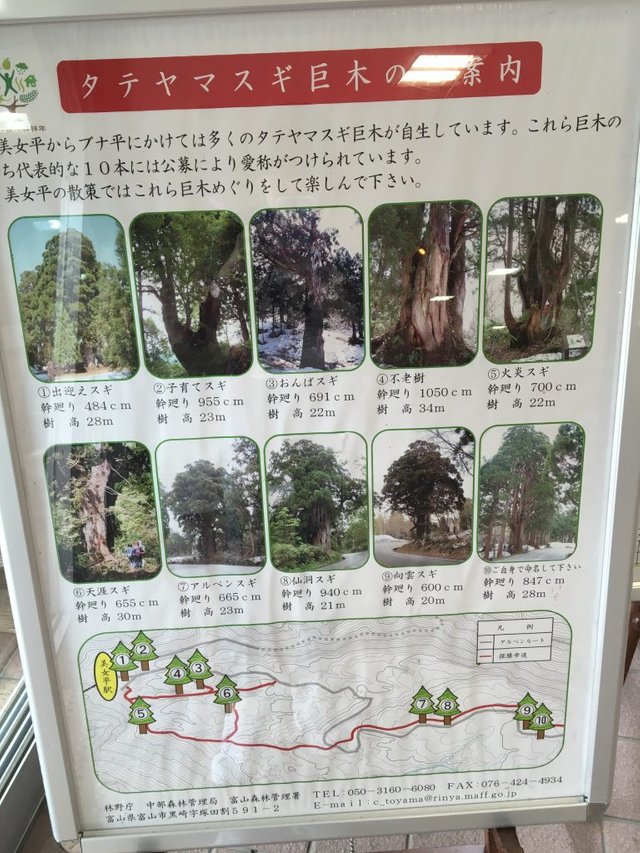
If you are interested in nature observation, heritage trees, forests bathing etc, you might be keen in doing a walking path (from 2km in an hour to 4 km in 2.5 hours) through the primeval forest from Bijodaira Station. Do keep a lookout for the legendary “Bijosugi” tree, a.k.a “Beautiful Woman Cedar”. Legend of Bijosugi can be found in the guide pamphlet.
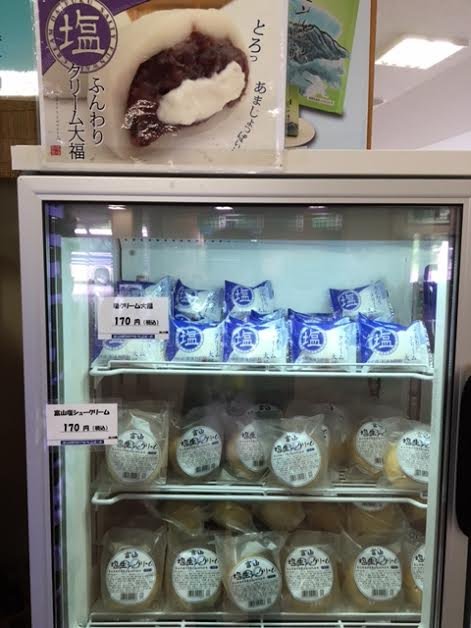
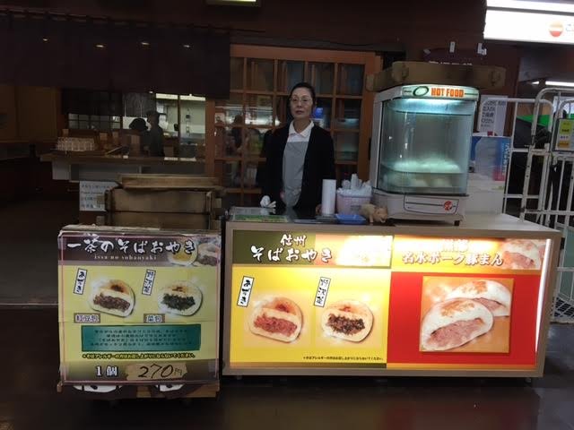
Food sold at the station. Look cute and yummy!
We decided to proceed directly to our next point destination at Murodo and I was silly enough to only realise a huge Bijosugi was located outside the train station as the bus moves away… 🙁
Point C: Bijodaira -> Point D: Murodo, 2,450m (via Tateyama Highland Bus)
The next mode of transport is the Tateyama Highland Bus which will bring you from Bijodaira to Murodo. The driver will play a video showing scenes of the alpine route and also highlight beautiful views to lookout for during the bus journey.
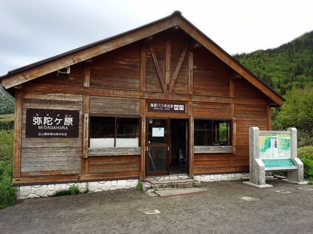
Special note: The highland bus will make a stop at Midagahara, near to Midagahara Hotel. We made a mistake in alighting here with the rest of the tourists on the bus, thinking that it’s one of the destination point and also due to “peer pressure” when you have the whole bus alighting. Well, maybe those who alighted thought alike. haha. Anyway, our whole plan is disrupted as we wasted 45 minutes to wait for the next bus to Murodo. 🙁
Lockers available in the bus stop.
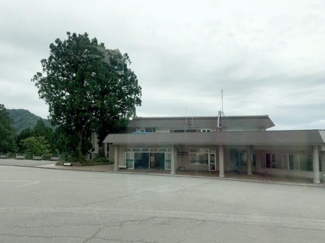
Midagahara is at 1,930m. It is a wetland and if you follow the boardwalk, you will reach an observation deck for a caldera formed during volcanic activity 200,000 years ago.
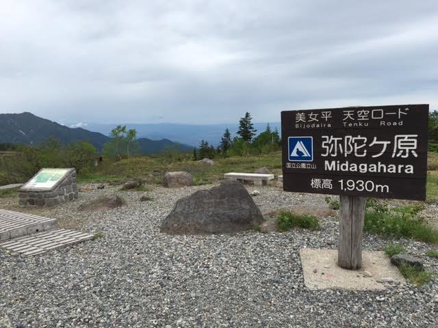
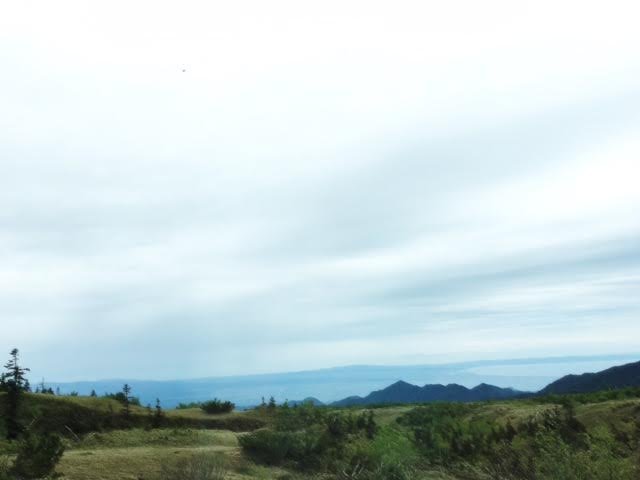
Our views. No doubt Midagahara was an unexpected stop, it was nice to be surrounded by nature. Very surreal. We followed the boardwalk for approximately 5 minutes before it started drizzling. We decided to take shelter at Midagahara Hotel.
Finally, the next bus came and we continued our journey to Murodo. On the bus, a few Hong Konger tourists were also contemplating if they had to alight at Midagahara. Same predicament as we had previously. Haha.
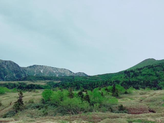
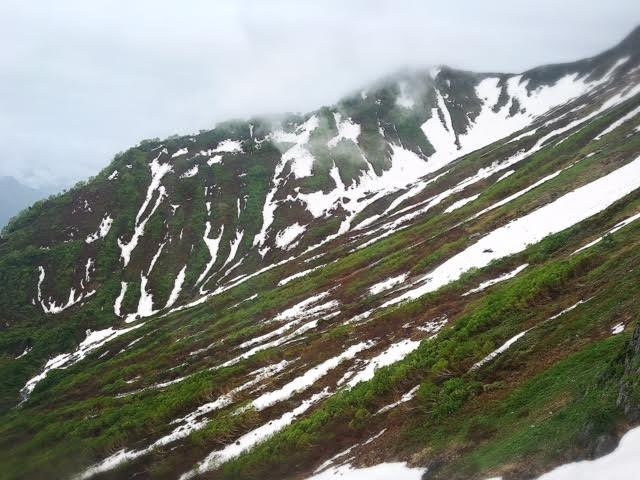
As we approach nearer to our destination, snow become visible on the highlands and soon, we seemed to have transcend from summer to near-winter. We got more excited as we witnessed more snow. (Guess most Singaporeans feel the same? haha).
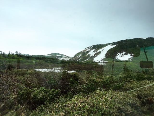
Then, we saw the building. I especially like the setting of this photo which somewhat reminds me of Swiss Alps.
And, enroute to this building, the bus went past the snow wall. We looked at each other and went “huh? This is the snow wall???”
The snow wall was disappointing.
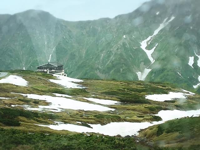
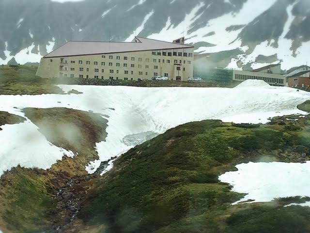
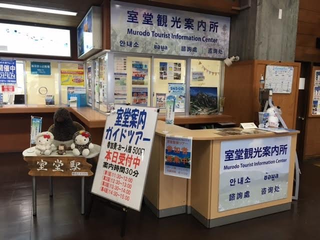
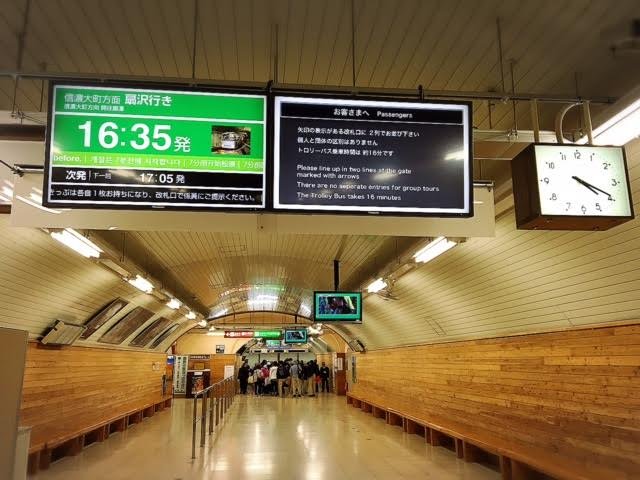
The bus terminated at Murodo Station, the highest train station in Japan, which also house Hotel Tateyama. There are a few eateries in the complex, tourist information counter and ticket counter for the next destination.
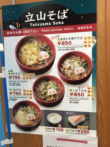
After having a quick bite, we walked out to the snow wall for more photo-taking after pilling on a few layers of outerwear. It was 7 degrees at that time, cold and windy due to the rain. The snow wall is located approximately 400 meters away from the terminal. Along the way, there is a snow slide on the right, with a few children playing in the rain. I guess the snow slide must have been very popular, hence it has turned greyish (and dirty) from the heavy utilisation. haha
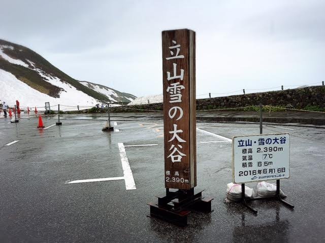
We are at 2,390m now.
mmm..I was not so keen to play on a greyish snow slide in the rain though….
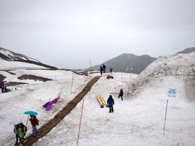
Tada! The Snow Wall….
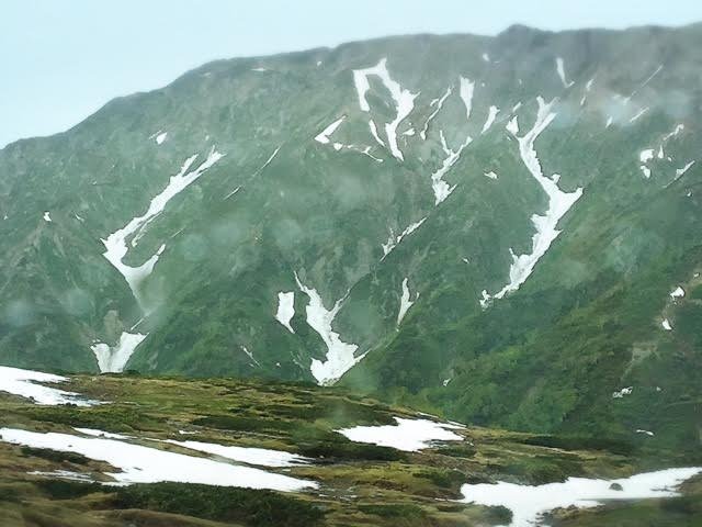
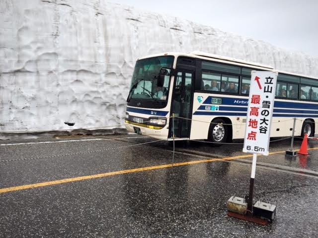
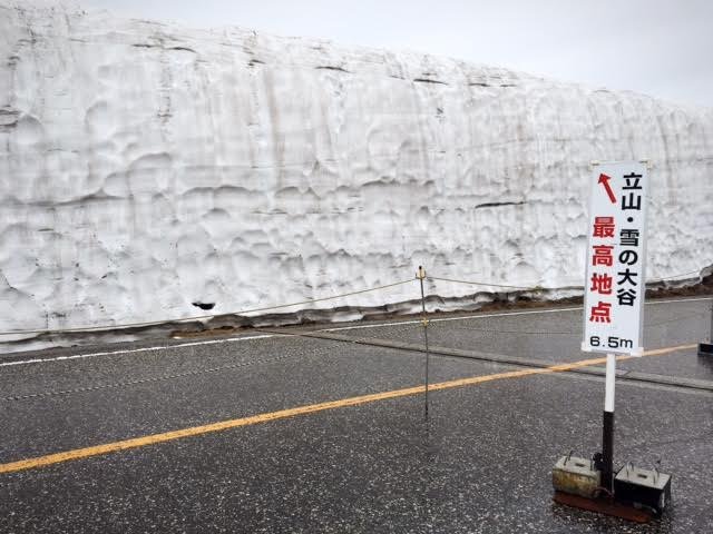
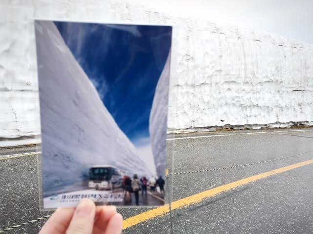
Coincidentally, a bus approaches as we were nearing the snow wall and I managed to capture this photo. In comparison with the official photo, I guess you can understand my disappointment. The snow wall was dirty and low at 6.5 metres. And, there was only 1 wall, instead of 2. Afterall, it was already 2 months since the opening of the Tateyama Kurobe Alpine Route; long enough to melt away the second wall. As such, I strongly recommend visiting the Tateyama Kurobe Alpine Route in April to obtain the best view.
If you have the time, there are three hiking courses available near Murodo Terminal: Mikurigaike Pond Return (600m, 30 minutes), Mikurigaike Pond Loop (1.7km, 1 hour) and Raichozawa Return (2.4m, 2 hours 30 minutes). Taking the Raichozawa return course will lead you to the Mikuriga-ike Hot Spring, the highest hot spring in Japan. Unfortunately, we did not have the luxury of time and had to quickly proceed to our next destination.
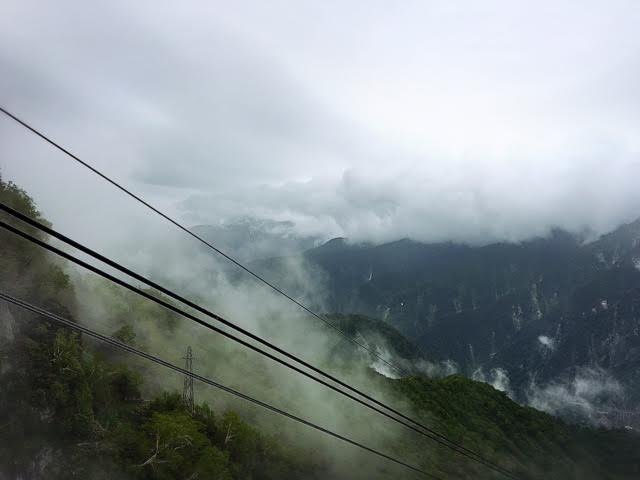
Point D: Murodo -> Point E: Daikanbo, 2,316m (via Tateyama Tunnel Trolley Bus)
Next, we took the Tateyama Tunnel Trolley Bus to Daikanbo. The Tunnel Trolley Bus, being the only one available in Japan was an interesting experience. The electric bus was noisy and moved fast in the tunnel across Mt Tateyama; we reached Daikanbo within 10 minutes. There is an observation deck at the upper level of Daikanbo station with stunning view of the Japan alps and lake formed by Kurobe Dam. It was too crowded, and we took the below photo of the view at the boarding point of the Tateyama Ropeway to our next destination.
The tunnel bus:
View of alps:
Point E: Daikanbo -> Point F: Kurobedaira, 1,828m (via Tateyama Ropeway)
The Tateyama Ropeway is the longest unsupported ropeway in Japan and I was truly mesmerized by the breathtaking views as we descend towards to Kurobedaira. The actual views are way better than what I have taken, trying to squeeze my way through other tourists in the ropeway.
The main feature of Kurobedaira would be the botanical garden located outside the station, with unique high altitude plants. We decided to give this garden a miss and head towards our next destination.
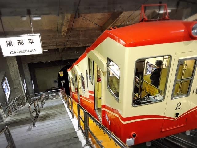
Point F: Kurobedaira -> Point G: Kurobeko, 1,455m (via Kurobe Cable Car)
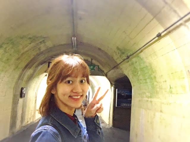
I would describe the Kurobe Cable Car as an “underground cable car”. It resembles the Tateyama Cable Car but we were descending in a tunnel. Upon arrival at the Kurobeko station, we had to walk a short 2 minutes distance out of the tunnel towards our next destination.
The Kurobe Cable Car; it will descend into the tunnel.
Eagerly walking out of the tunnel to brightness!
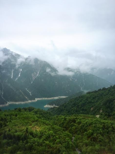
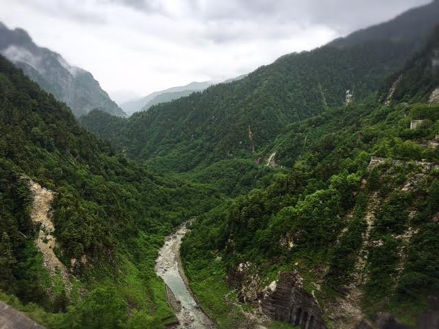
Point G: Kurobeko to Point H: Kurobe Dam, 1,470m (via 15 minutes slow walk)
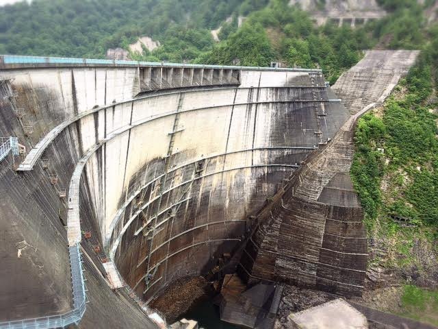
I was in awe the moment I walked out of the tunnel. Situated in front of me were huge majestic mountains and on my right was a picturesque view of the Lake Kurobe. Clouds and fog were hovering over the mountains. Coupled with the light drizzles, it was like a typical scene in the Chinese novel “Journey to the West”. haha. I felt strangely dreamy yet a little intimidated by my surroundings.
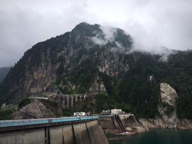
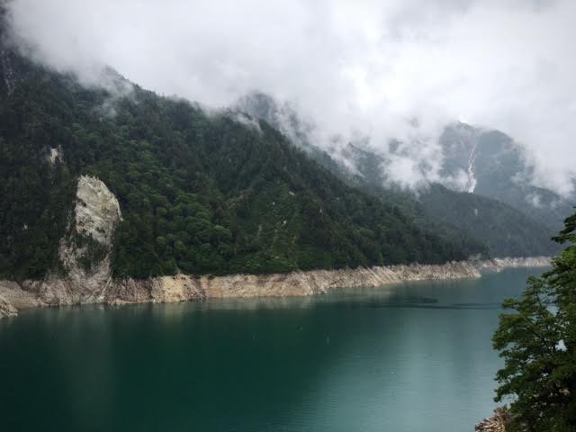
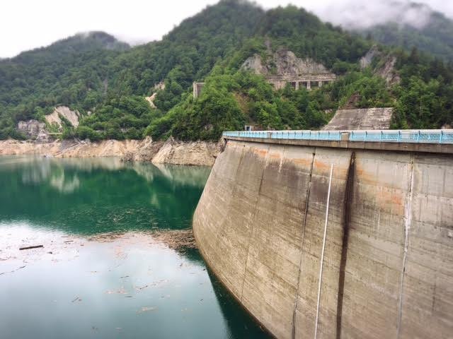
The Kurobe dam is the highest arch dam in Japan, standing at 1,470m. Constructed by over 10 million people, this 186m tall dam releases 10 cubic meters of water every second and generates 1 billion kWh of electricity for Japan per year. Unfortunately, we were not able to witness the grand view of dam discharge, which will only take place from end June to mid October. Nevertheless, I’m thoroughly enjoyed the fascinating views as I made my way across the dam. Somehow the views look different under different lightings.
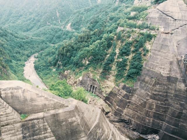
We had to walk through another tunnel again into the Kurobe Dam Station to Ogizawa.
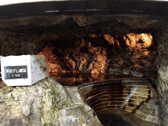
A model remake of the Kurobe Dam at the ratio of 1:186.
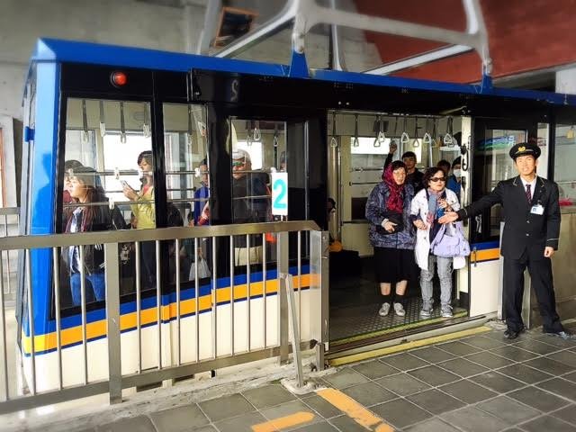
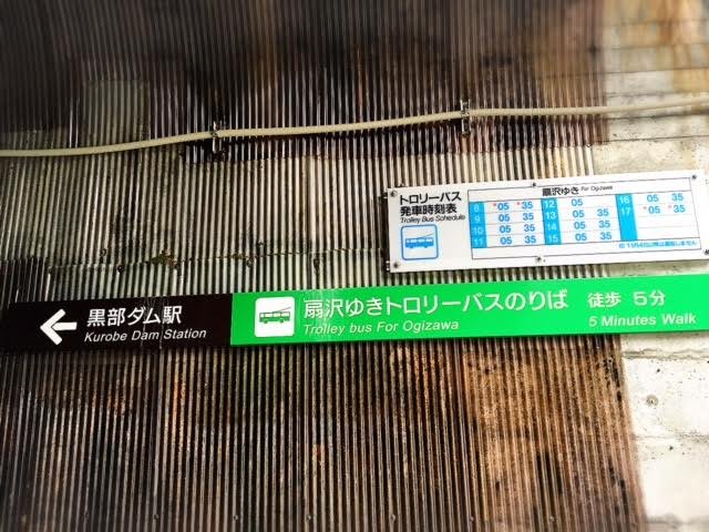
Point H:Kurobe Dam to Point I: Ogizawa, 1,433m (via Kanden Tunnel Trolley Bus)
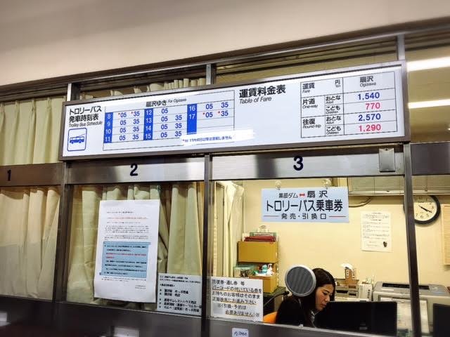
Bus schedule of the Trolley Bus to Ogizawa.
The queue to the Bus.
The Trolley Bus.
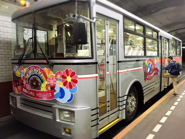
Similarly to the Tateyama Tunnel Trolley Bus, the Kanden Tunnel Trolley Bus took us through a quick and noisy 16 minutes bus journey underground across Mt Akazawa-dake.
Point I: Ogizawa to Point J: Nagano (via Local Bus)
We finally reached Ogizawa, the last station of our Alpine Route journey before we made our way back to city.
Regretfully, we were complacent with our plannings and have commenced our Alpine Route journey too late in the morning. Furthermore, we made the terrible mistake of alighting Midagahara and wasted more time. Eventually, we had to shorten our time at other points and we missed the last direct bus to Nagano. What followed were another long draining close to 2 hours journey back to Kanazawa via a local bus ride to Shinano-Omachi station, local train and shinkansen ride to Kanazawa. 🙁
At the end of the day, we were fully exhausted but we had a fully memorable and uniquely worthwhile experience of the Tateyama Kurobe Alpine Route, which I would gladly recommend to all.
!steemitworldmap 36.569025 lat 137.540453 long Tateyama Kurobe Alpine Route, JAPAN. D3SCR
Heya, just swinging by to let you know you're being featured in our Daily Travel Digest!
Thanks! Finally got featured!
Really nice write up. I've never been on this Alpine route but you gave some good tips. The snow wall is crazy different to the picture! lol
I think the Ropeway and Dam look really nice though. Keep up the good work :D
Yeah you can imagine our disappointment then. We kept asking ourselves "is this it? is this the wall? are we in the right place???" LOL
wow, how long does it took to write this writing? It's amazing
Many days to piece everything together.
Thanks for reading!
I grabbed a coffee and read this long post :D
I´ve never seen such a train :o must have been a cool experience
and the pics you made of the foods made me really hungry for japanese food
Great post by the way!
Haha we went through so many different form of transport in this trip.
Thanks! Hope you enjoyed the post, and the coffee.
wow!!Looks amazing.
I'll follow your recomendation.
Thanks!
はじめまして!フォローさせていただきました。私は日本に住んでいる日本人です。 @rt395さんのresteemで@jrvacationさんのことを知ることが出来ました。私が知らない日本の魅力を知ることができそうです。
立山はまだ行ったことありません。素敵な風景ですね!行ってみたいなあ。
はじめまして@yasu24さん!私の日本語は弱いです。:(
Thank you for following me too. ありがとうございました! I had been following you too!
立山は美しい。You should go someday :)
I’ve ticked this also ... indeed a tiring journey but smiling with satisfaction.
Haha yes exhausting trip that takes a whole day.
will be more adventurous and try visiting alpine route in the future... seeing your journey already makes me quite tired, not sure if I can tahan till the end of the day ahaha
Must dedicate one full day for it. If not will be very rush.
Congratulations, Your Post Has Been Added To The Steemit Worldmap!
Author link: http://steemitworldmap.com?author=jrvacation
Post link: http://steemitworldmap.com?post=travel-japan-jr-tateyama-kurobe-alpine-route-or
Want to have your post on the map too?
I've heard lots of comments about this, and have to be honest, the snow wall does look a bit disappointing. Do you think if i go in October I'll get a better view?
The route will be open but no snow wall in October. Best time to see the wall is actually April and May. Our trip above is in June and you can see its only at half the height. Few more weeks and all the snow will be gone. October will probably be good to see some autumn leaves at around the Dam area.