THE WORLD'S MOST MAJESTIC ROAD, CHAPMAN’S PEAK SOUTH AFRICA
Between Hout Bay and Noordhoek towers Chapman’s peak, one of Cape Town's top 10 tourist destinations. It’s a mountain, situated on the Atlantic Coast of the western side of the Cape Peninsula.
The base of Chapman’s peak consists of Cape Granite, and the top is composed from sedimentary flat rocks.
These two formations meet at what is a gap in the geologic rock record called geological unconformity - here a world famous formation. It is also recognised as being one of the most spectacular, marine drives in the world.
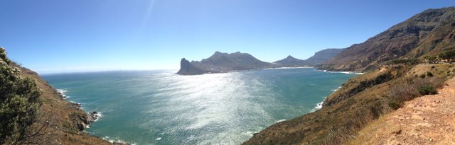
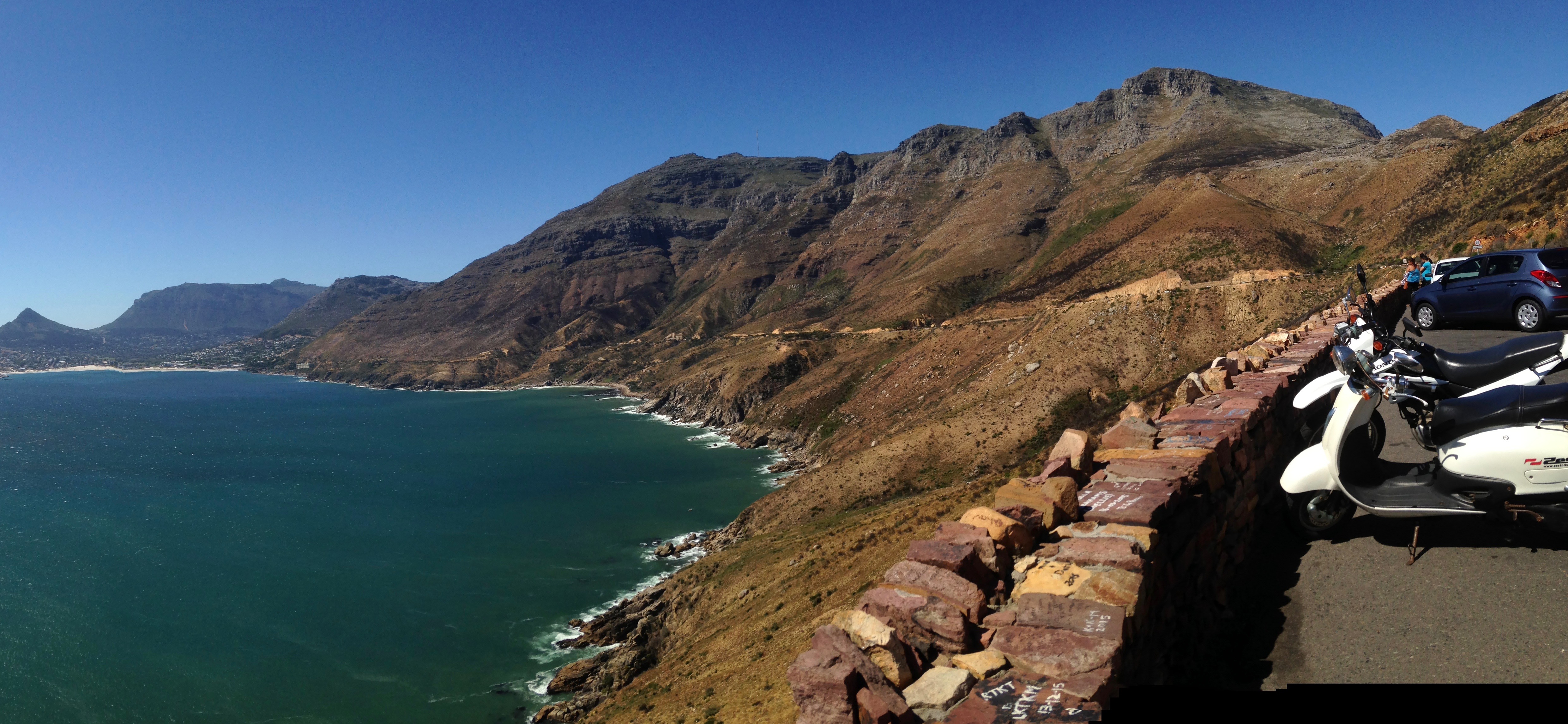
Chapman‘s peak panorama
Named after the Captain’s mate, John Chapman, who row ashore in search of provisions, after the English ship that he served on in 1607 got becalmed in Hout Bay.
Since then the mans name become the official name on all East India charts- it was referred to as the Chapman's Chaunce (chance).
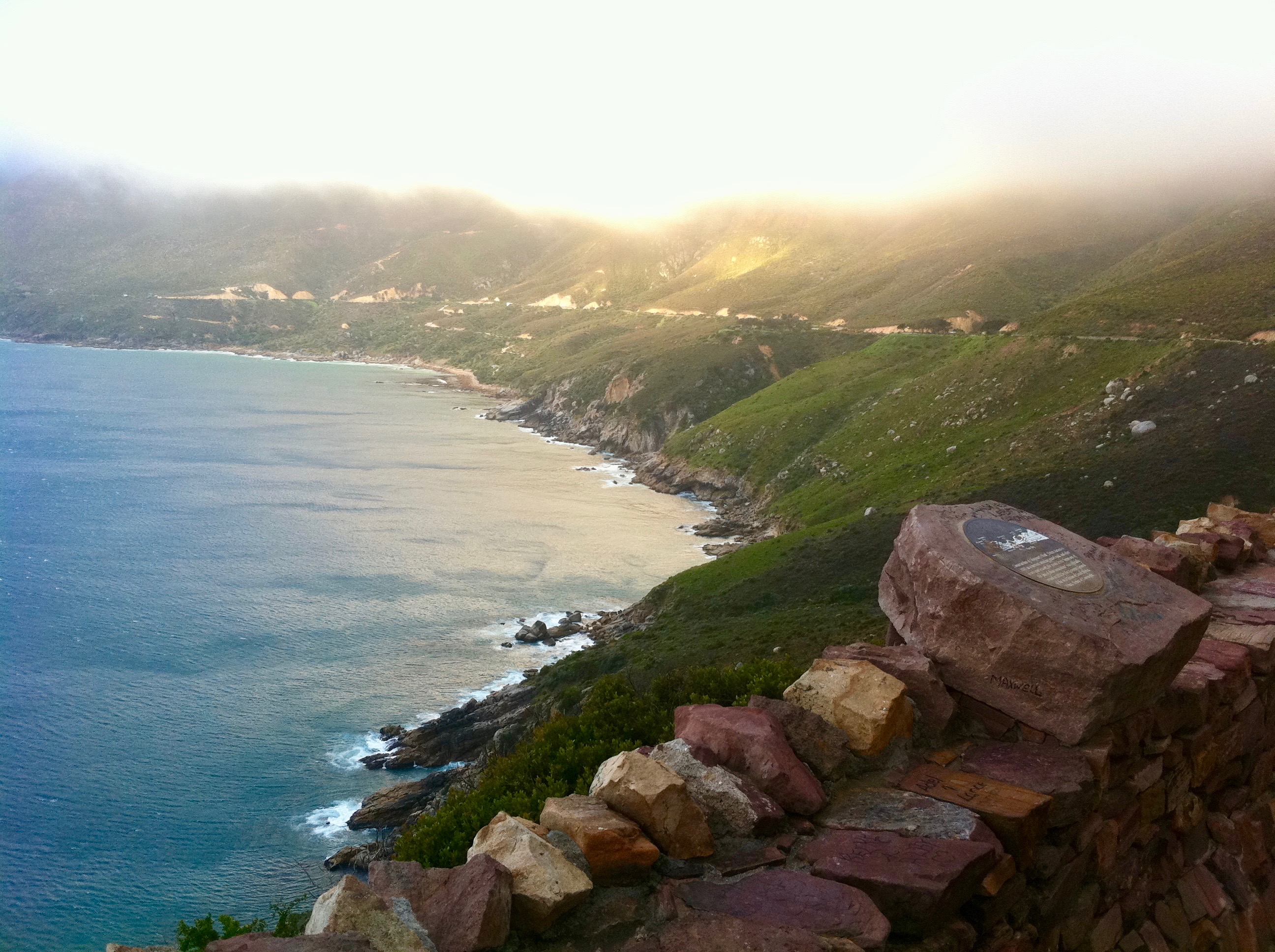
Fog over the peak
The preliminary surveys for the high-level roads begun in 1914. The man who ordered the constructions, was the first administrator of the Cape Province, Sir Nicolas Fredrick de Waal. Two roads were built subsequently, one linking Cape Town with the Southern Suburbs another linking Hout Bay to Noordhoek.
It took seven years to complete this spectacular roadway, simply because the terrain was very unstable, the ravines and cliffs were, steep making it a very inhospitable and dangerous place. Many roadside cuttings were hewn out in Malmesbury series sediments and the surface of the road is based on 630 million year old Cape Granite contour. It is carved out of the almost vertical cliff faces and is regarded as a major feat of engineering back then.
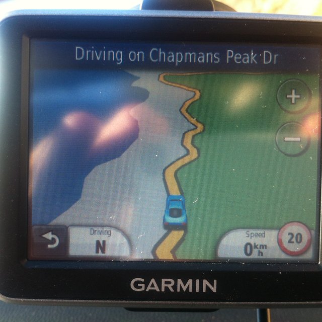
Along the length of Chapman's Peak 9km route, one drives through the rocky coastline, through stunning landscapes. It has 114 curves and corners, two semi-tunnels and a massive steel catch nets that provide protection against rock fall.
On the north-western slopes, just above the start as the road climbs to the Chapman’s peak, old abandoned manganese mine is located.
The ore occurs in a relatively narrow vein here.
Manganese was known to have existed in the Cape from 1676 but there were difficulties
with exploiting it. In the nineteenth century a small mining company managed to overcome them, which led to one of the earliest recorded manganese operations in the area of Hout Bay.
The mine was fully operational by 1910. Extending 700 meters chute, was specially constructed for the ore to slide down to a collection point at the beach down below. Than, it would be loaded into small wagons and transferred to the jetty. Loaded onto the ships waiting in the bay and shipped to Belgium.
.jpg)
Most of the shafts remain shallow or filled in, thirteen of them are still visible. Still accessible and quite extensive one, leads horizontally about 70 meters into the mountain.
The heaps of manganese ore and old adits, intact for more than a century are easy to see, while hiking up the mountain.
https://www.flickr.com/photos/hilton-t/5394893367/lightbox/
Jetty
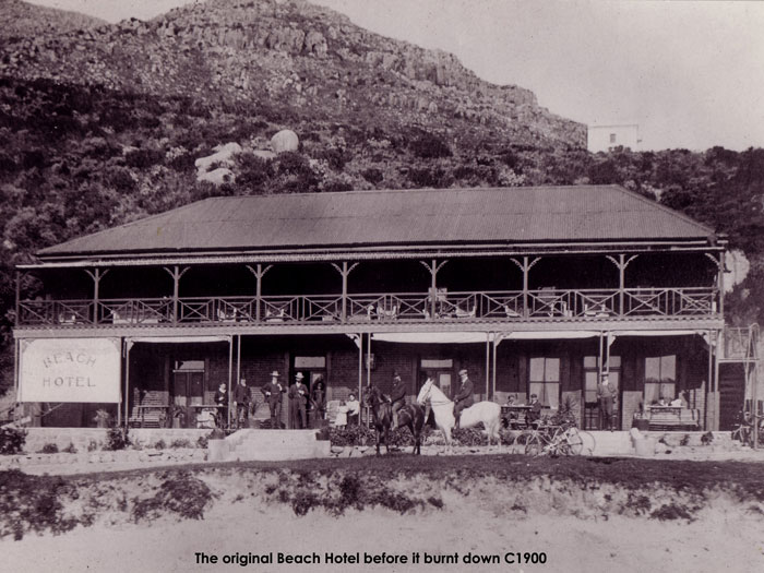
Just before the remains of the jetty at the foothills of the drive, stands a landmark in Hout Bay, Chapmans Peak Hotel.
Occupied since the 1880s but tragically gutted by fire in 1903 got later renovated and restored to its genuine splendour, with many original features still intact. Its highlight is, sourced from local shipwrecks and made of teak timber bar counter. The hotel has been the earliest of seaside establishments in the Cape.
On the other side of Chapman's Peak graced with an awesome mountain and sea views is one of the Cape Town's treasured destinations, the Noordhoek valley.
Surrounded by Table Mountain National Park, bordered by the white sands of Long Beach that stretch for about 7 km.
Originally the valley was occupied by Khoi nomads. It was first named in 1743 by the Dutch settlers – the Rousseau family. This name Noordhoek means the north corner and describes the position of the farm Slangkop.
It was also an important supply station; the vegetables were grown here to supply the ships calling at Simon's Town.
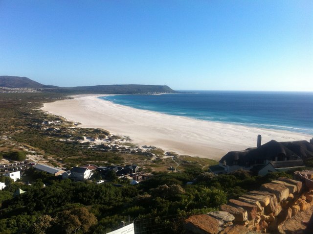
Noordhoek beach
In the city, one can find many Equestrian Centres based in historical farmsteads.
They offer a scenic horseback rides onto beautiful Noordhoek beach, towards Chapman’s Peak and back.
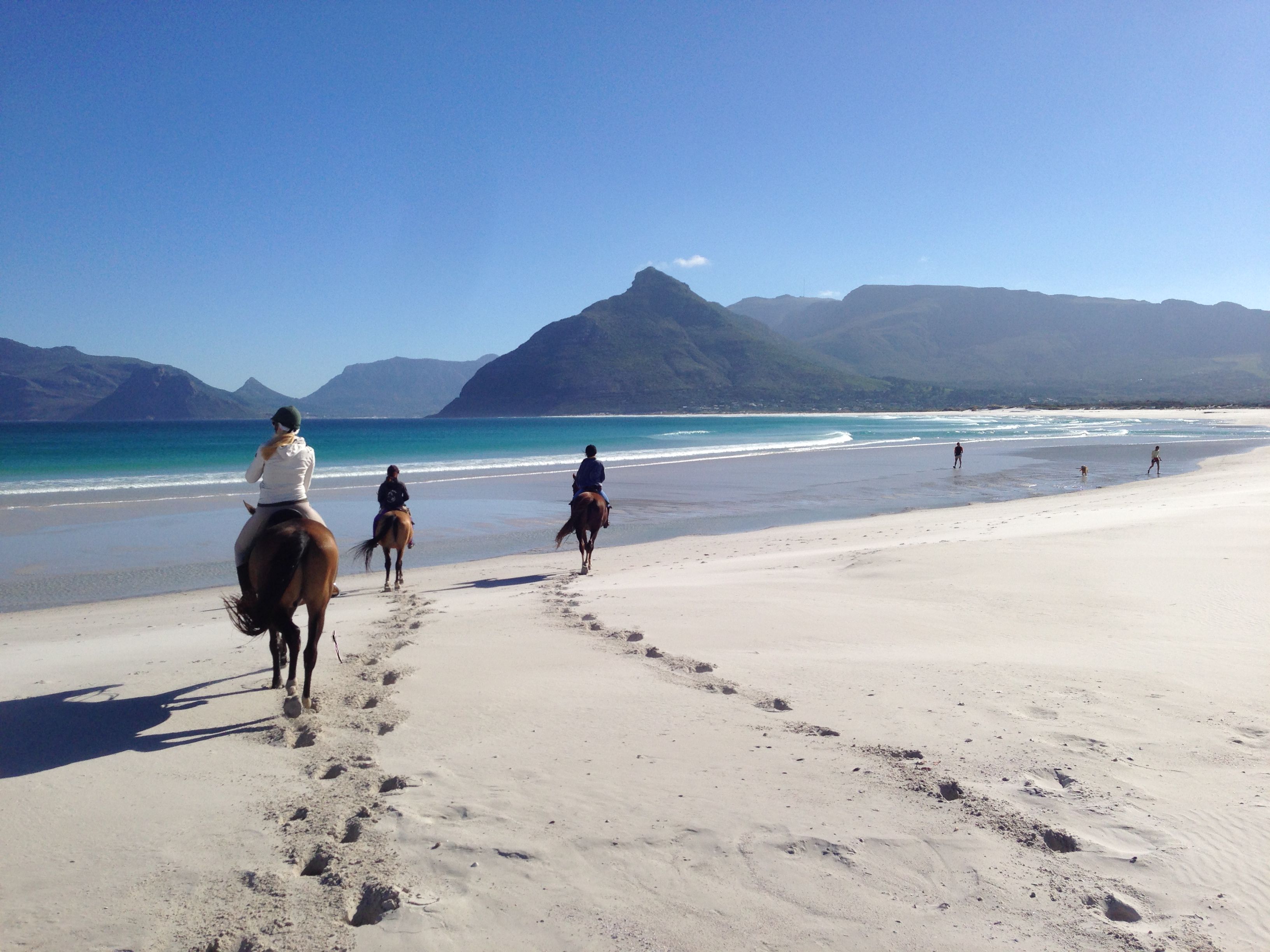
Scenic ride
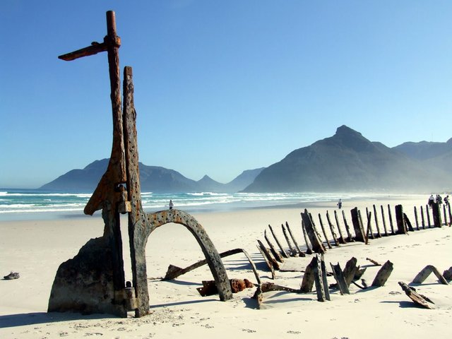
One of the highlights on the beach is a wreck of the famous steamer SS Kakapo.
The ship wrecked herself on the way to Sydney from the United Kingdom on 25 May 1900.
Rounding the Cape of Storms, the 665 ton ship ended up on the beach, mistaking Chapman’s Peak for Cape Point. To this day the rusty remains rest in the sand, making it a peculiar exhibition.
*Photographs taken by @highonthehog
*Other sources : linked below photographs.
Environmental Management Department website
http://resource.capetown.gov.za/documentcentre/Documents/Graphics%20and%20educational%20material/Biodiv_fact_sheet_03_PenSandFyn_2011-03.pdf
very beautiful!
I'm glad you like it , I will most definitely post some more soon :)
Congratulations! This post has been upvoted from the communal account, @minnowsupport, by highonthehog from the Minnow Support Project. It's a witness project run by aggroed, ausbitbank, teamsteem, theprophet0, someguy123, neoxian, followbtcnews, and netuoso. The goal is to help Steemit grow by supporting Minnows. Please find us at the Peace, Abundance, and Liberty Network (PALnet) Discord Channel. It's a completely public and open space to all members of the Steemit community who voluntarily choose to be there.
If you would like to delegate to the Minnow Support Project you can do so by clicking on the following links: 50SP, 100SP, 250SP, 500SP, 1000SP, 5000SP.
Be sure to leave at least 50SP undelegated on your account.
Awesome post, awesome description, awesome pictures
Sadly, I'm still stuck in Nigeria. But when I do get the chance, I'll be in S.A
Stuck , really , how come ?
I mean I can't leave Nigeria for now
Yet to process my passport
Congratulations, Your Post Has Been Added To The Steemit Worldmap!
Author link: http://steemitworldmap.com?author=highonthehog
Post link: http://steemitworldmap.com?post=the-world-s-most-majestic-road-chapman-s-peak-south-africa
Want to have your post on the map too?
There is a good chance we're going to SA this year for one of our For 91 Days - that beach picture with the horses basically sold us - and I don't even like horses very much.
HA! glad to hear that , I'm going in March , there will be more photos and some useful info, if u want to know something in particular lemme know. cheers.
Great post, i like your writing.
Nice picture @highonthehog 👏
Keep working.
I will do my best , enjoy !
yeah,
great job, keep working @highonthehog
I must make sure to visit capetown next time am in SA. It looks soo amazing with rich history.
Thanx for sharing. And that photo with the hoarse by the beach looks too good to be true.. Pure gem.
Thank you , yup it's me on the photo , but the real star is the horse and his. ..;)
Amazing post, lovely pictures and a horse butt! :)
it was especially for you. XD
Wow, great. I love this pics.
Thanks dear :*
Beautiful photos. We loved Cape Town but missed these sites unfortunately. We really loved the drive from Cape Town to Hermanus. It was a very quaint town and easy to sit on the shore and watch the wales. Thanks for bringing back some great memories. This is beautiful and informative post.