This day we drove from the Valemount Country Lodge early in the morning to be at the tour operator’s office on time to get our full day trip.
Tego dnia wyruszylismy wcześnie rano z Valemount Country Lodge, aby być w biurze touroperatorów na czas, aby zaliczyć nasza całodniową wycieczkę.
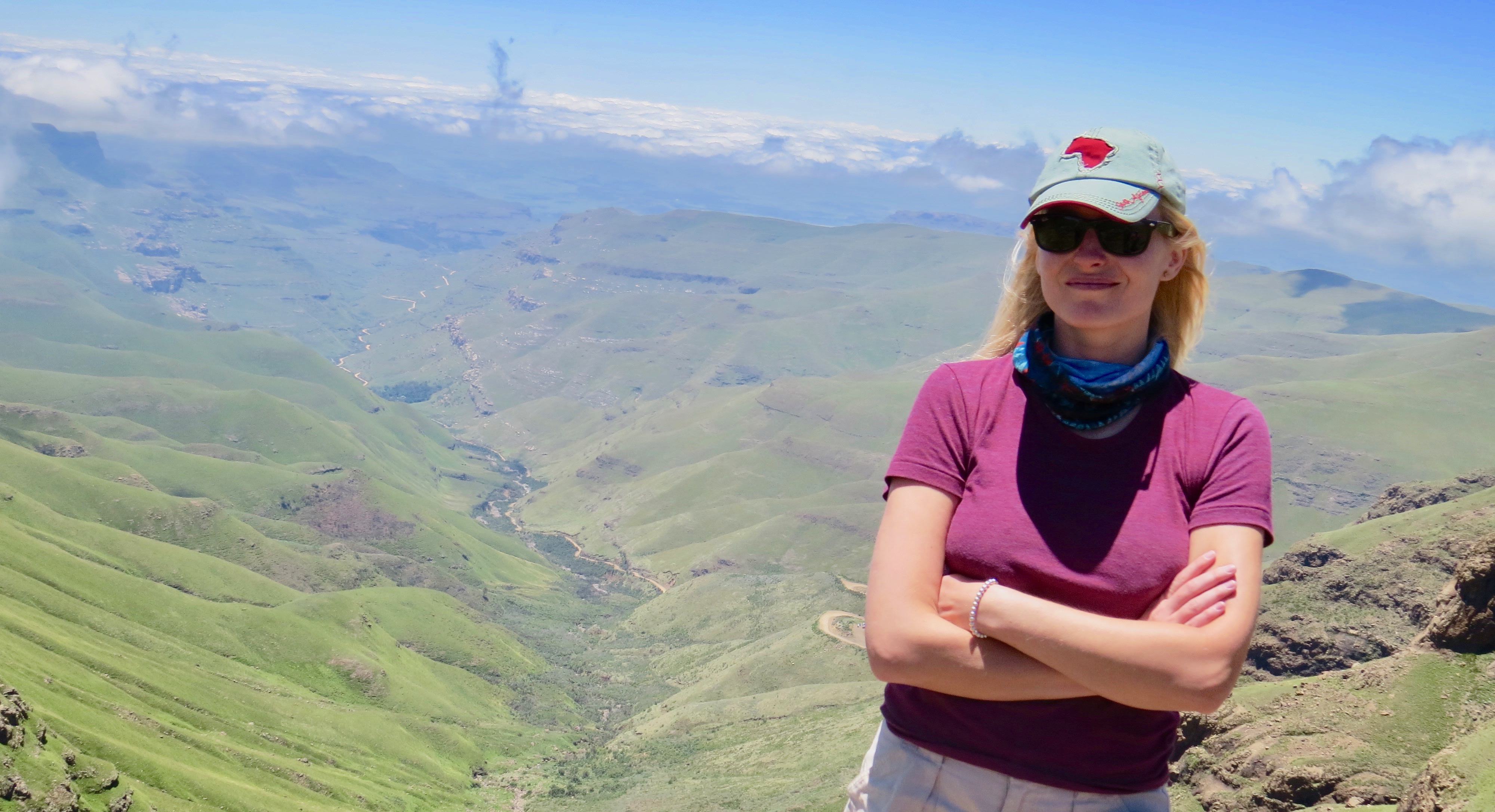
I was travelling with my friend, who certain of his driving skills, was eager to drive up by himself. I on the other hand, wanted to visit the mother of all South African passes with an experienced guide. So we have sticked to my version of sightseeing. Shortly after embarking the 4X4 vehicle from the tour office, we were super happy with the decision, simply becasue the drive really requires above average driving experience.
Podróżowałam wraz z przyjacielem, który był aż nadto pewien swoich umiejętności prowadzenia samochodu, oczywiście był nastawiony na jazdę samemu. Ja z drugiej strony chciałam odwiedzić matkę wszystkich południowoafrykańskich przełęczy z doświadczonym przewodnikiem. Tak więc zdecydowaliśmy się wybrać moją wersję zwiedzania. Kiedy już wyruszyliśmy w drogę z biurem podróży, pojazdem z napędem 4X4, utwierdziliśmy się w naszej decyzji decyzji, ponieważ poruszanie się po tej trasie wymaga ponadprzeciętnych umiejętności.
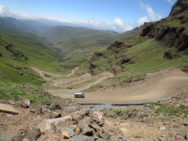
Start of the pass
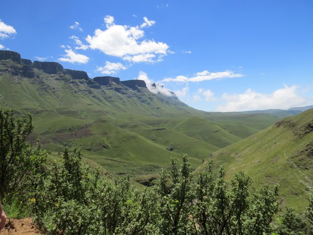
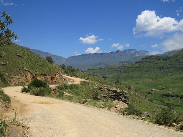
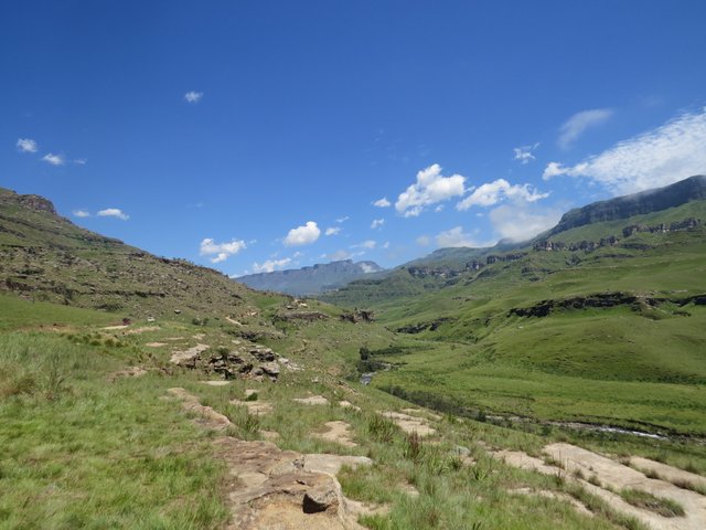
Sani Pass is a mountain pass located in the West of KwaZulu-Natal, South Africa on the road between Underberg, KwaZulu-Natal and Mokhotlong, Lesotho. Lies exactly between the border controls of both countries Lesotho and South Africa, and the caution must be paid. It’s one of the worlds most famous roads–hairpinned ones.
Sani Pass to przełęcz położona w zachodniej części KwaZulu-Natal, w Republice Południowej Afryki, na trasie między Underberg, KwaZulu-Natal i Mokhotlong, Lesotho. Leży dokładnie pomiędzy kontrolami granicznymi obu krajów, Lesotho i RPA i należy uiścić stosowną opłatę za jej przekroczenie. To jedna z najsłynniejszych dróg na świecie.
The beginning of the road
It is a steep gravel road, and is approximately 9 km in length.
Starts at 1544 m, and climbs 1332 vertical metres to an altitude of 2876 m. Was built circa 1950 and it can be difficult to drive because of many loose rocks. In bad weather and usually is covered with snow, mud and ice in winter.
Therefore by South African law only 4x4 vehicles are allowed on the road. Occasionally the remains of vehicles that did not succeed in navigating the pass's steep gradients can be seen.
Jest to stroma żwirowa droga o długości około 9 km.
Rozpoczyna się na wysokości 1544 m i wspina się na 1332 metry pionowe do wysokości 2876 metrów. Została zbudowana około 1950 roku i może być trudna do jazdy z powodu wielu luźno lezących kamieni. W złych warunkach pogodowych, zwykle pokryta jest śniegiem, błotem oraz lodem w zimie.
Dlatego w prawie południowoafrykańskim dozwolone na niej są tylko pojazdy o napędzie 4x4. Od czasu do czasu można zobaczyć pozostałości pojazdów, którym nie udało się pokonać stromych pochyłości przełęczy.
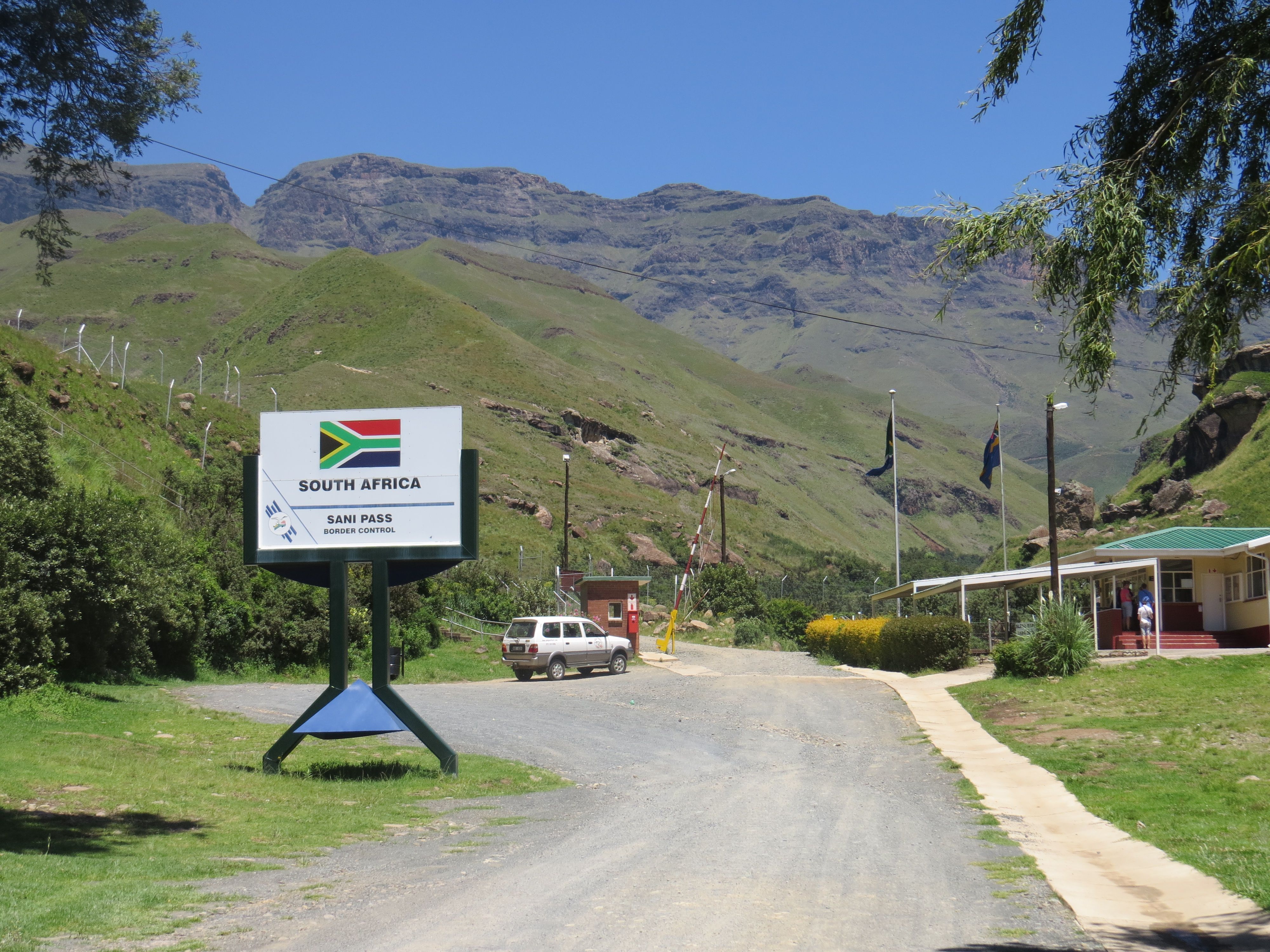
South Africa Border control
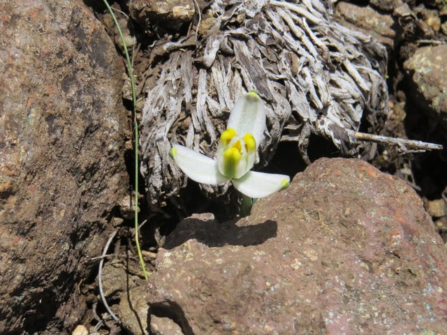
On the way we were able to see the biggest South African antilopes called Eland, chilling on the slopes. groups of baboons, many wonderful birds and interesting species of vegetation.
Po drodze mogliśmy zobaczyć największe południowoafrykańskie antylopy Eland, odpoczywające na stokach. grupy pawianów, wiele wspaniałych ptaków oraz niezwykle odmiany roślin.
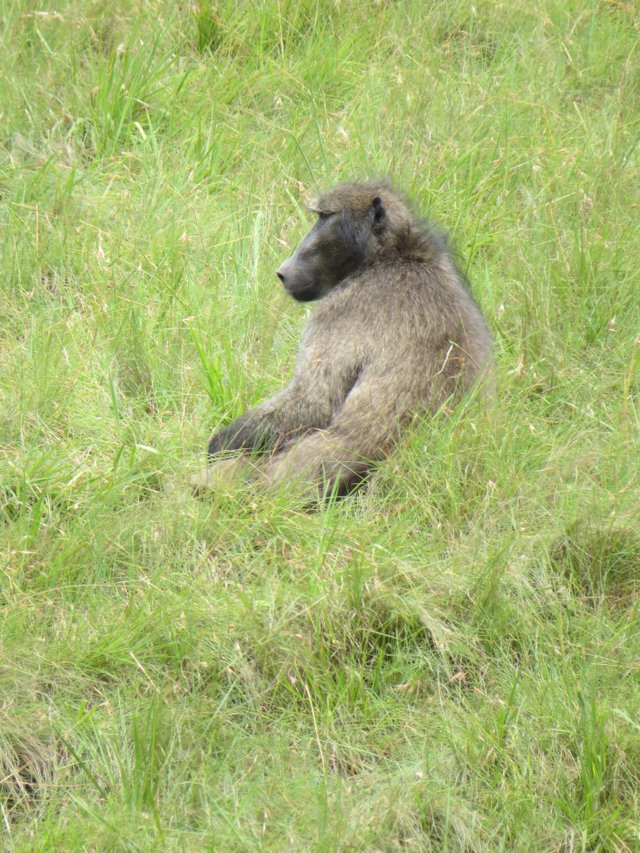
Baboon
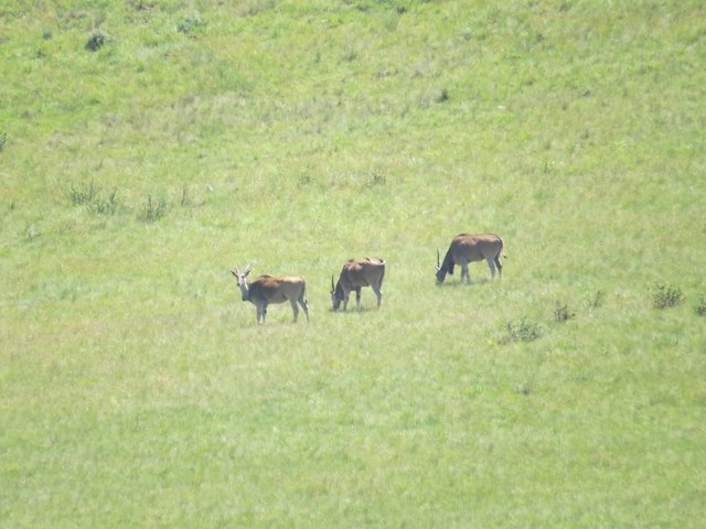
Elands
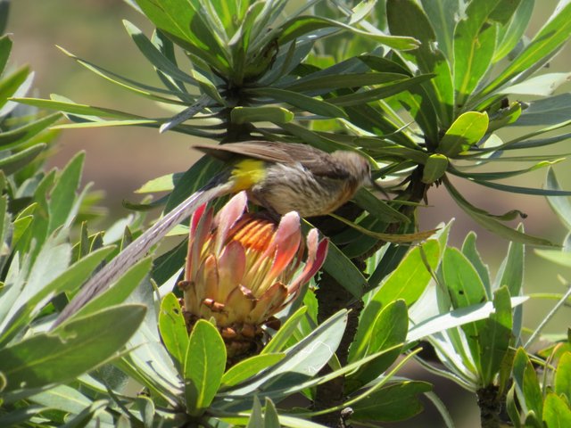
Protea
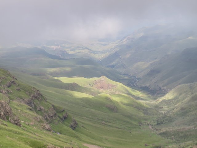
We were so awe inspired by the beauty of this pass, we have learned about the rock formations and as mentioned before vegetation occurring on different altitudes. Our guide was very well informed. The day was sunny and we had all possibilities to enjoy the landscapes.
Byliśmy tak zachwyceni pięknem tej przełęczy, dowiedzieliśmy się o formacjach skalnych i wspomnianej wcześniej roślinności występującej na różnych wysokościach. Nasz przewodnik był bardzo dobrze poinformowany. Dzień był słoneczny i mieliśmy wszystkie możliwości, aby w pełni cieszyć się krajobrazem.
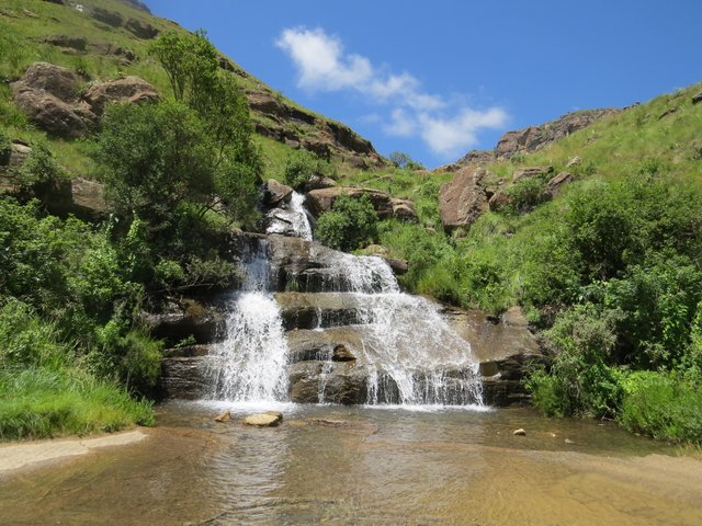
Waterfall on the way up
On 26.10 1948, Godfrey Edmonds as a first person who drove the pass in the vehicle . This was before the road was built. It took him five and a half hours to reach the summit. He was assisted by a team of Basothos of course with mules, ropes and other equipment. In those days, this achievement was as climbing the Everest. It was so remarkable and eventually led to the approval of the road construction.
Sani Pass (P318) - Mountain Passes South Africa
26.10.1948 r. Godfrey Edmonds jako pierwsza osoba, która przejechała przełęcz w pojeździe. To było zanim droga została zbudowana. Dotarcie na szczyt zajęło mu pięć i pół godziny. Pomagała mu grupa Basothos, oczywiście w asyście mułów, lin i innym sprzętem. W tamtych czasach osiągnięcie to było jak wspięcie się na Everest. To było tak niezwykłe i ostatecznie doprowadziło do zatwierdzenia budowy drogi.
Sani Pass (P318) - Mountain Passes South Africa
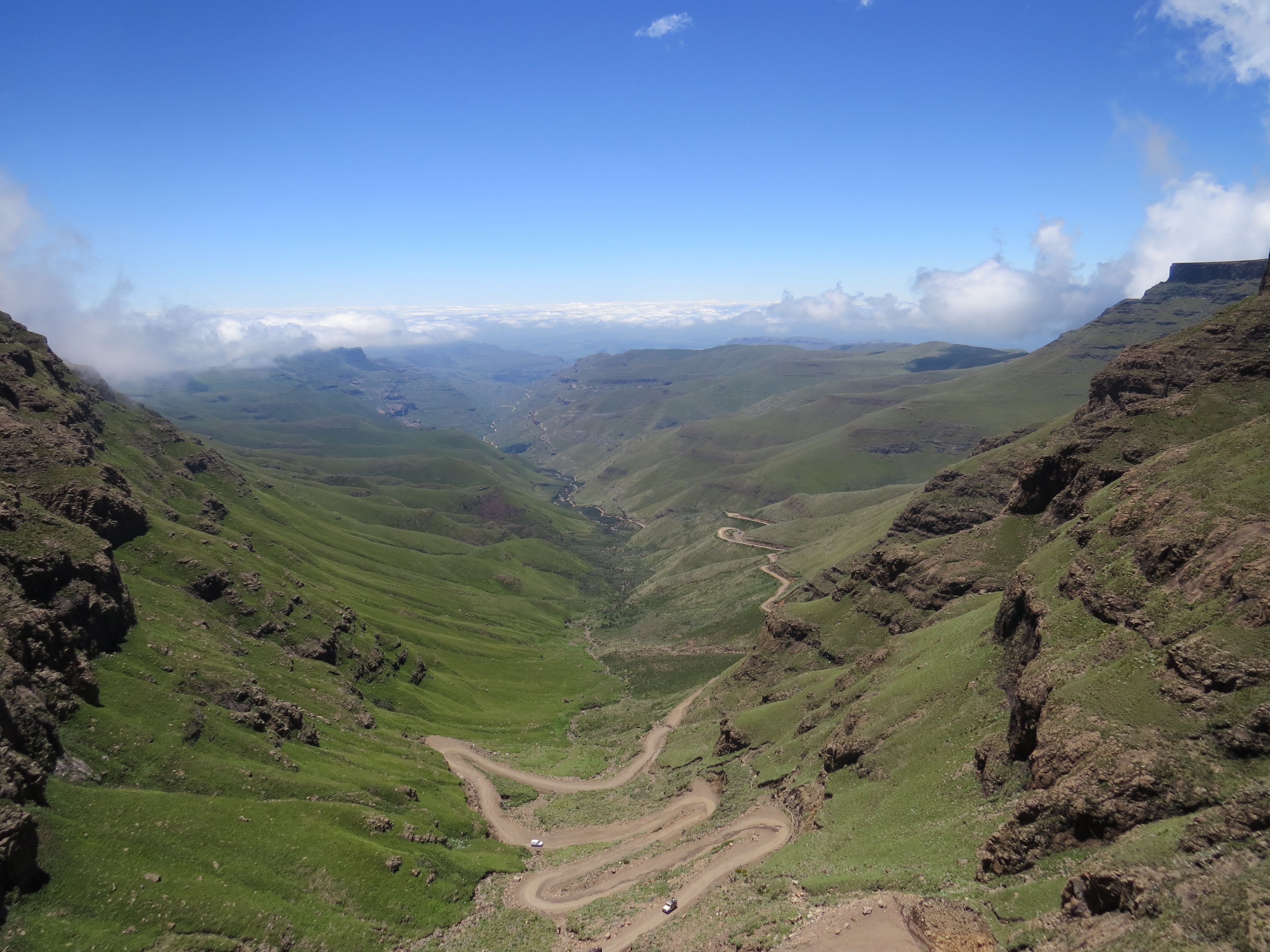
Looking down at the hairpinned road
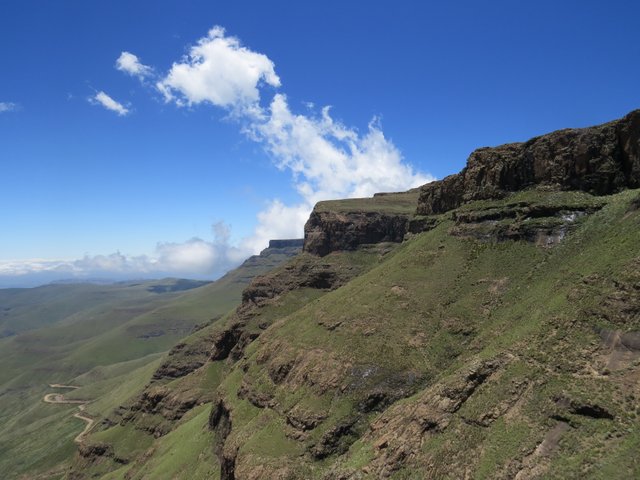
The panorama
The panorama and the 12 apostles
Almost at the summit
The first half is just a casual drive but the altitude gain is rapid, we have even experienced popping ears. What was waiting higher up the pass, was the most difficult section. From the South African border to the summit at the Lesotho border control post. As we were climbing, there was very few places to stop safely.
But we were almost at the top and decided to have a nice photo session looking down on the road. Suddenly we have noticed a silhouette above us, a horse, carefully coming down the hill. He was scared and seemed like he just wanted to get back to the place where he was taken from. The idea of our guide was that it happens quite often, the horse was stolen, but somehow he managed to escape. His ribs were clearly visible, he looked a bit like a lost ghost. Anyway we didn't try to catch him, just let him be.
Pierwsza połowa to zwyczajna jazda, ale wzrost wysokości jest szybki, więc czuliśmy jak odtykają się bębenki w uszach. To, co czekało wyżej, było najtrudniejszą częścią. Od granicy południowoafrykańskiej do szczytu i stanowiska kontroli granicznej w Lesotho. Podczas wspinaczki było bardzo mało okazji, aby bezpiecznie się zatrzymać.
Ale byliśmy już prawie na szczycie i zdecydowaliśmy się na sesję zdjęciową spoglądając w dół na drogę. Nagle zauważyliśmy nad nami sylwetkę, konia, ostrożnie schodzącego ze wzgórza. Wyglądał na bardzo przestraszonego i wydawało się, że chciał tylko wrócić do miejsca, z którego został zabrany. Według naszego przewodnika, zdarza się to dość często, koń został skradziony, ale jakoś udało mu się uciec. Jego żebra były wyraźnie widoczne, wyglądał trochę jak zagubiony duch. W każdym razie nie próbowaliśmy go złapać, po prostu pozwoliliśmy mu zmierzać.
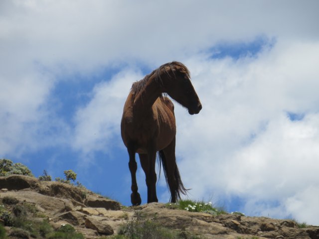
Recidivist
Lilly
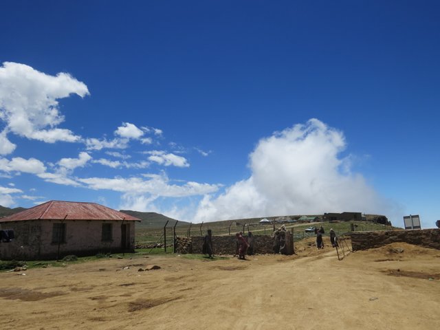
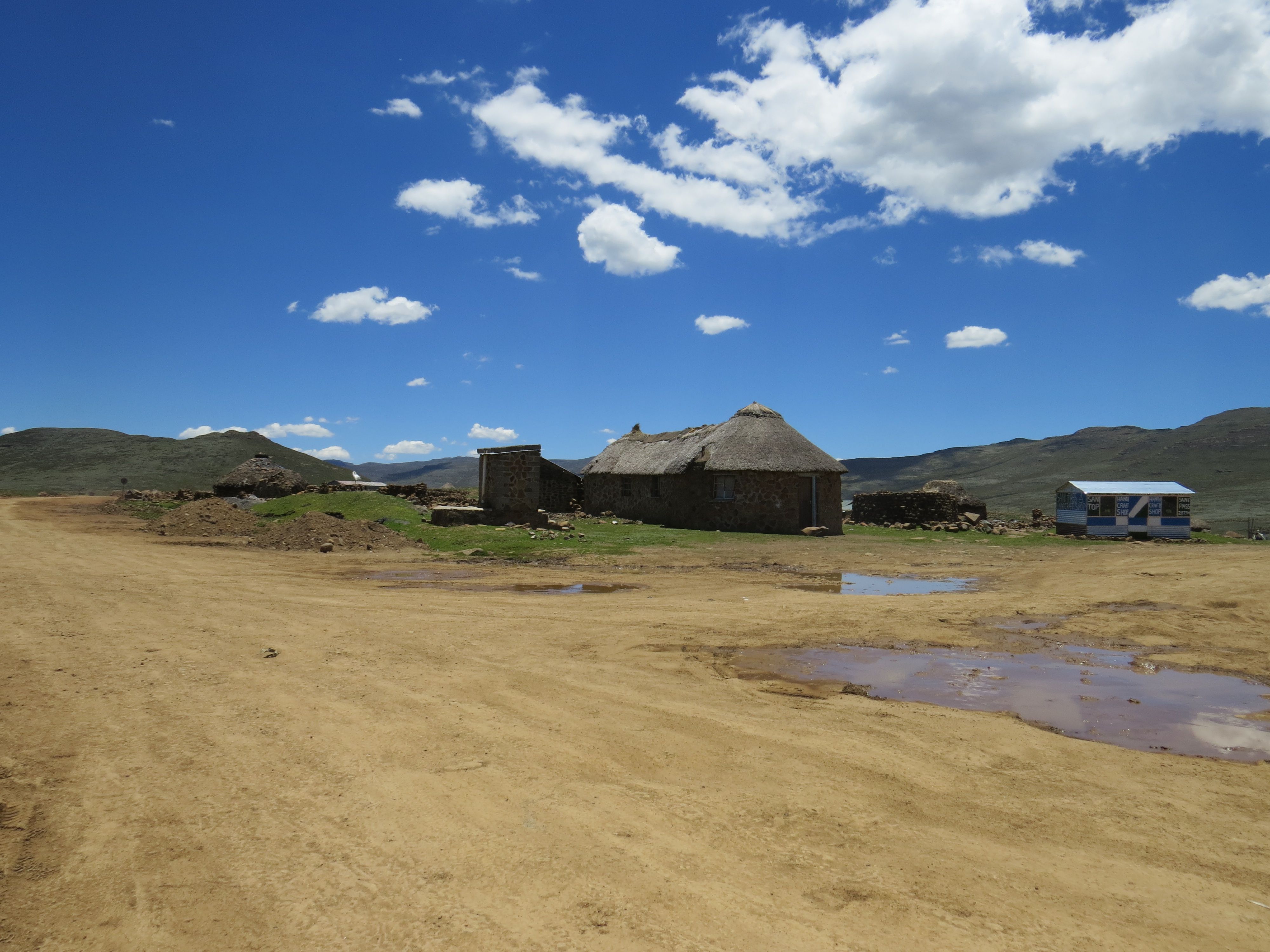
The entire Sani Pass is on South African soil. After having arrived at the summit we have reached the Lesotho border control post. We have found ourselves driving on a wide plateau. Along the road, on both sides we have seen construction machines, left alone holes in the ground. Seems like there was some big development going on, but at this stage, they were not operating.
Cała Sani Pass znajduje się na południowoafrykańskiej ziemi. Po przybyciu na szczyt dotarliśmy do posterunku kontroli granicznej w Lesotho. Znaleźliśmy się na szerokim płaskowyżu. Wzdłuż drogi, po obu stronach widzieliśmy maszyny budowlane, pozostawione w ziemi dziury. Wyglądało na to, że odbywała się tam wielka rozbudowa, jednakże na tym etapie nic się chwilo nie działo.
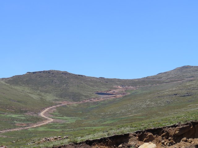
The plateau
The plateau
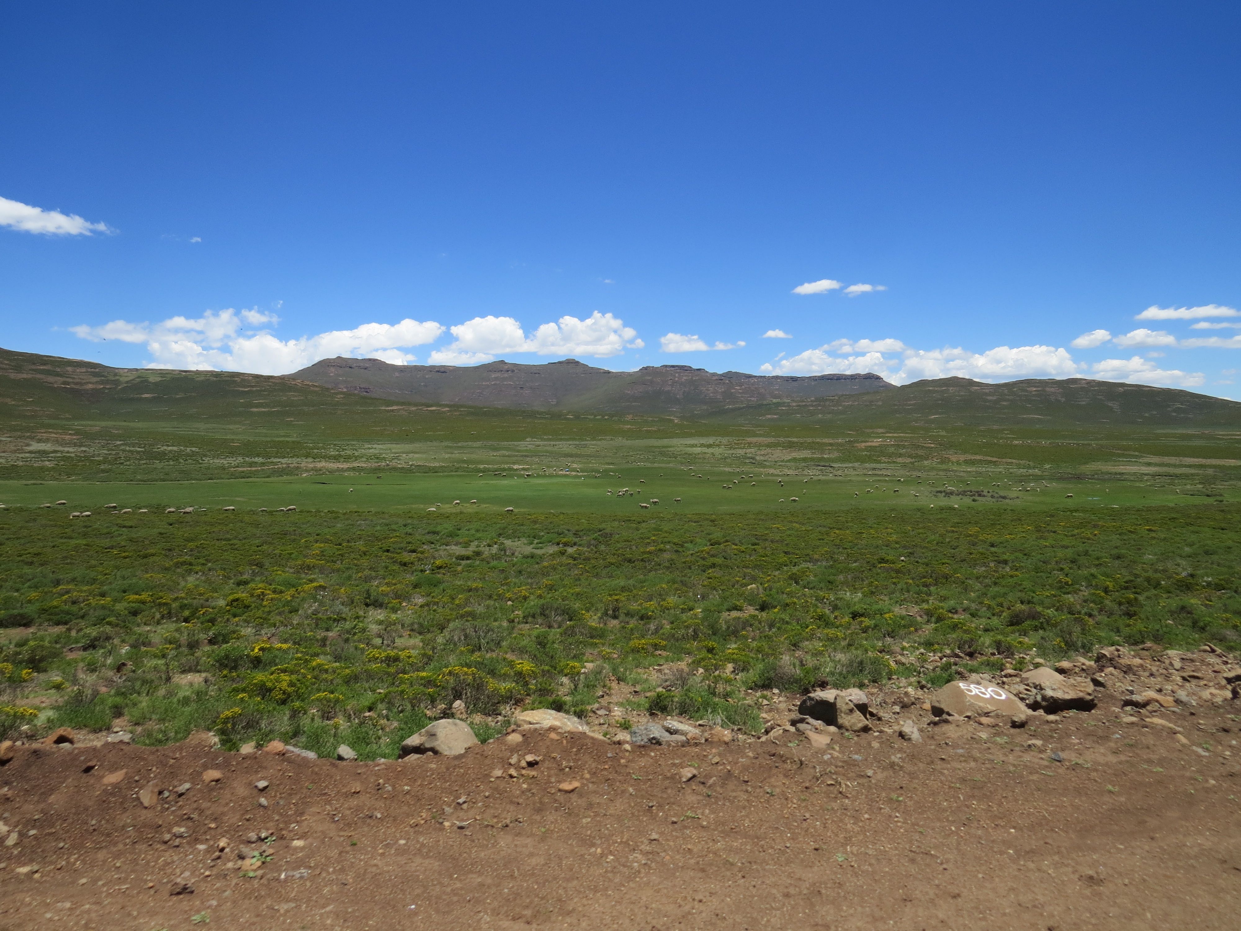
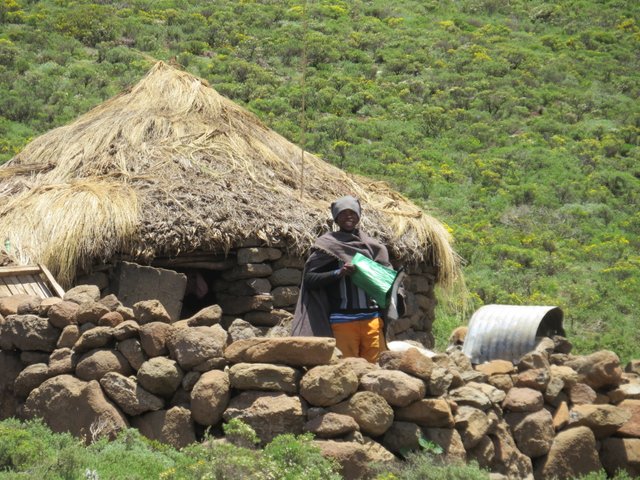
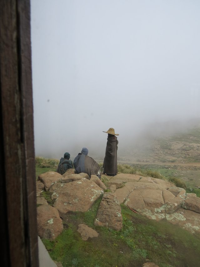
What we saw all around were run down old buildings and some small groups of Basotho men, dressed in poncho like coats, rubber boots. Some of them wearing cone shaped straw hats. We have learned that they are leaving their homesteads for few months and travel to this region to hoard sheep as a way to earn money.
To, co widzieliśmy dookoła to mnóstwo zaniedbanych starych budynków i kilka małych grup ludzi z plemienia Basotho, ubranych w podobne do ponczo płaszcze, gumowe buty. Niektórzy z nich nosili słomiane kapelusze w kształcie stożka. Dowiedzieliśmy się, że opuszczają swoje gospodarstwa domowe na kilka miesięcy i podróżują do tego regionu, aby paść owce i zarabiać w ten sposób pieniędze.
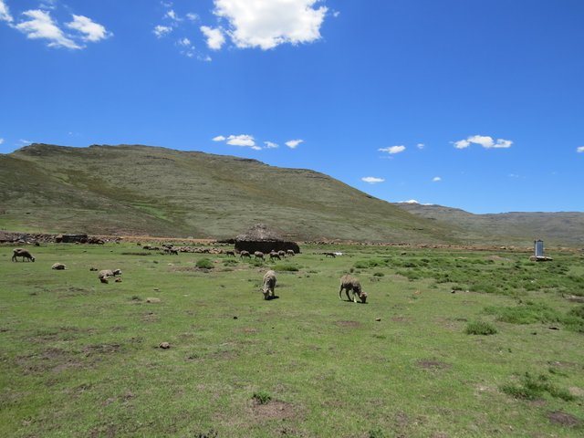
The plateau of goats
Beehive with resident
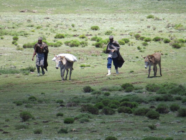
Basotho men with donkeys and food
Basotho people
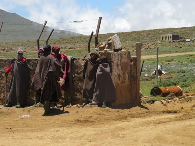
Near the border post at the summit
Near the border post at the summit
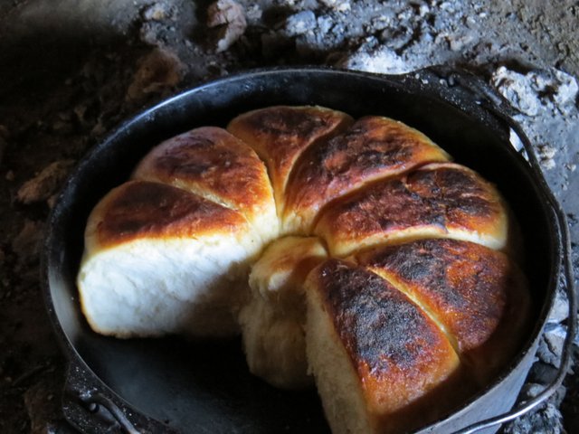
Our guide took us to one of the beehive huts, it was almost as prepared for the tourists. A very hospitable lady showed us some handcrafted goods. Almost like as if waiting for us was buried in coals a pot with still steaming bread. She handed us a piece and this was honestly one of the best breads I have ever tasted, hot, buttery, slightly sweet and soft. We have bought the whole piece to later enjoy it with dinner.
Nasz przewodnik zabrał nas do jednej z chat, była prawie jakby wręcz przygotowana na przyjazd turystów. Bardzo gościnna pani pokazała nam jakieś ręcznie robione towary. Prawie jak gdyby już na nas czekał zagrzebany w węglu kociołek z wciąż parującym ciepłym chlebem. Podała nam kawałek i szczerze, był to jeden z najlepszych chlebów, jakie kiedykolwiek jadłam, gorący, maślany, lekko słodki i miękki. Kupiliśmy całą sztukę, aby później cieszyć się nim do kolacji.
Sweet pot of bread from Lesotho
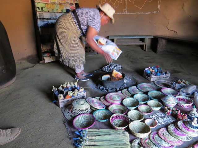
Handcrafted goods
Our end stop was the Sani Mountain Lodge where we could enjoy a rest at the highest pub in Africa. By this time it got a bit chilly so the pub was a nice refuge. With a fire and walls completely covered in graffiti of travellers, we have enjoyed the local beer and some food. Just outside the window gathered a group of local men, they started singing, it was a very unique atmosphere.
Naszym końcowym przystankiem była Sani Mountain Lodge, gdzie mogliśmy odpocząć w najwyższym pubie w Afryce. W tym czasie zrobiło się trochę chłodno, więc pub był miłym schronieniem. Z ogniem i ścianami całkowicie pokrytymi graffiti innych podróżników, cieszyliśmy się lokalnym piwem i jedzeniem. Tuż za oknem zebrała się grupa miejscowych mężczyzn, zaczęli śpiewać, była to bardzo wyjątkowa atmosfera.
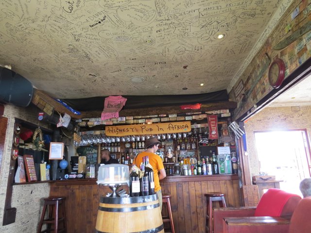
Highest pub in South Africa
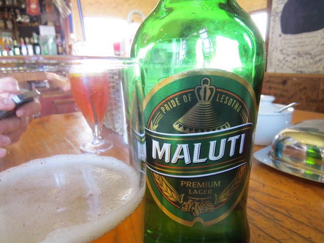
Maluti Lesotho beer
Singing locals
The fog slowly covered almost the whole summit and we were no longer able to see the astonishing landscapes, nor the road down under.
Mgła powoli pokrywała prawie cały szczyt i nie byliśmy już w stanie zobaczyć zadziwiających krajobrazów ani drogi pod nami.
the fog on the way down
Still The Sani Pass remains the most iconic pass in South Africa. Unfortunatelly there is a big controversy right now, also connected to the construction happening at the top . There is a possibility of the pass becoming tarred and it might drastically decrease it’s popularity and have a great impact on the landscape.
Mimo to Sani Pass pozostaje najbardziej charakterystyczną przełęczą w Południowej Afryce. Niestety, jest wiele kontrowersji, również związanych z budową na szczycie. Istnieje możliwość, że droga zostanie całkowicie pokryta asfaltem, może to drastycznie zmniejszyć jej popularność oraz mieć duży wpływ na otoczenie.
*All photographs taken by @highonthehog
*Source: Own article previously published on my blog-site. visit my blog
Great post :)
Thanks for kind words ;)
Wspaniała podróż i zdjęcia. Pozdrawiam
Last picture is amazing. Wow!
Yup , that was just before the huge wall of fog came upon the pass. We were really lucky to get a good view on the way up , thanks to the experienced guide we managed without any problems, but alone we would drive down by the seat of one’s pants
The mountains look like the time I live.
Thank you!
Congratulations! This post has been upvoted from the communal account, @minnowsupport, by highonthehog from the Minnow Support Project. It's a witness project run by aggroed, ausbitbank, teamsteem, theprophet0, someguy123, neoxian, followbtcnews/crimsonclad, and netuoso. The goal is to help Steemit grow by supporting Minnows and creating a social network. Please find us in the Peace, Abundance, and Liberty Network (PALnet) Discord Channel. It's a completely public and open space to all members of the Steemit community who voluntarily choose to be there.
If you would like to delegate to the Minnow Support Project you can do so by clicking on the following links: 50SP, 100SP, 250SP, 500SP, 1000SP, 5000SP. Be sure to leave at least 50SP undelegated on your account.
Congratulations, Your Post Has Been Added To The Steemit Worldmap!
Author link: http://steemitworldmap.com?author=highonthehog
Post link: http://steemitworldmap.com?post=the-mother-of-south-african-passes-sani-pass-en-pl
Want to have your post on the map too?
Add the following inside your post:
!steemitworldmap xxx lat yyy long description d3scr
(replace xxx and yyy with latitude and longitude)
@originalworks
The @OriginalWorks bot has upvoted and checked this post!
Some similarity seems to be present here:
https://en.wikipedia.org/wiki/Sani_Pass
This is an early BETA version. If you cited this source, then ignore this message! Reply if you feel this is an error.
Hi there, yes I have cited the original source , which happens to be the same as Wiki ..
This post has received a 0.24 % upvote from thanks to: @highonthehog.
For more information, click here!!!!
Send minimum 0.010 SBD to bid for votes.
The Minnowhelper team is still looking for investors (Minimum 10 SP), if you are interested in this, read the conditions of how to invest click here!!!
ROI Calculator for Investors click here!!!
Pictures are amazing, the post is perfect. I did enjoy reading it! Great job. Thank you so much for sharing your experiences :)
This is Beautiful, well written!
Thank you !