IT'S NOT A LEGEND OF THE FLYING DUTCHMAN! SOUTH AFRICAN CAPE OF GOOD HOPE. [EN/PL]
For a long time, it was mistakenly claimed that the Cape peninsula was the southern tip of Africa. It was believed that the two oceans, Atlantic and Indian meet exactly here. Thanks to the modern science we know today, it’s where the Cape Agulhas is. And as I have mentioned in my previous post:
Przez długi czas mylnie twierdzono, że Półwysep Przylądkowy jest południowym krańcem Afryki. Uważano, że dwa oceany, Atlantycki i Indyjski spotykają się dokładnie tutaj. Dzięki współczesnej nauce, wiemy dzisiaj, iż jest tym miejscem Cape Agulhas. I jak wspomniałam w poprzednim poście:
Cape point www.ashworthafrica.com
The first modern European who sailed around the southern tip of Africa was Bartolomeo Dias in 1488. Although according to Herodotus the Phoenicians had done in earlier. Dias was hoping to find a trade route to India, he reached the furthest point at Kwaaihoek in the Indian Ocean, but was forced to turn back. On his return journey he has discovered the Cape of Storms, later named the Cape of Good Hope, because it represented the opening of a route to the east. https://steemit.com/travel/@highonthehog/the-real-geographic-southern-tip-of-african-continent
Pierwszym współczesnym Europejczykiem, który opłynął południowy kraniec Afryki, był Bartolomeo Dias, nastąpiło to w 1488 roku. Chociaż według Herodota, Fenicjanom udało się to o wiele wcześniej. Dias miał nadzieję znaleźć drogę do Indii, dotarł do najdalszego punktu na Kwaaihoek na Oceanie Indyjskim, lecz był zmuszony zawrócić. W drodze powrotnej odkrył Przylądek Burz, nazwany później Przylądkiem Dobrej Nadziei, ponieważ oznaczał otwarcie drogi na wschód. https://steemit.com/travel/@highonthehog/the-real-geographic-southern-tip-of-african-continent
Cape of Good Hope
The first European colony in the Cape was established in 1652 by the Dutch East India Company (VOC), commanded by colonial administrator Jan van Riebeeck.
It was situated around 50 km north of the cape in Table Bay, and eventually evolved into Cape Town.
Pierwsza europejska kolonia na Przylądku została założona w 1652 r. przez Holenderską Kompanię Wschodnioindyjską (VOC), której dowodził kolonialny administrator Jan van Riebeeck.
Położona była około 50 km na północ od przylądka w Zatoce Góry Stołowej (Table Bay), i ostatecznie przekształciła się w Cape Town.
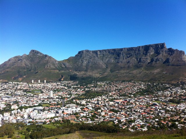
City of Cape Town
It was a re-supply point for the vessels on their way back and forth between the Netherlands and Jakarta. The support station gradually became a settler community. At this time the land was inhabited by pastoral San and Khoikhoi people.
Był to punkt zaopatrzenia dla statków w drodze do i powrotnej między Holandią a Dżakartą. Stacja wsparcia stopniowo stała się wspólnotą osadniczą. W tym czasie ziemia była zamieszkana przez plemiona pasterskie San i Khoikhoi.
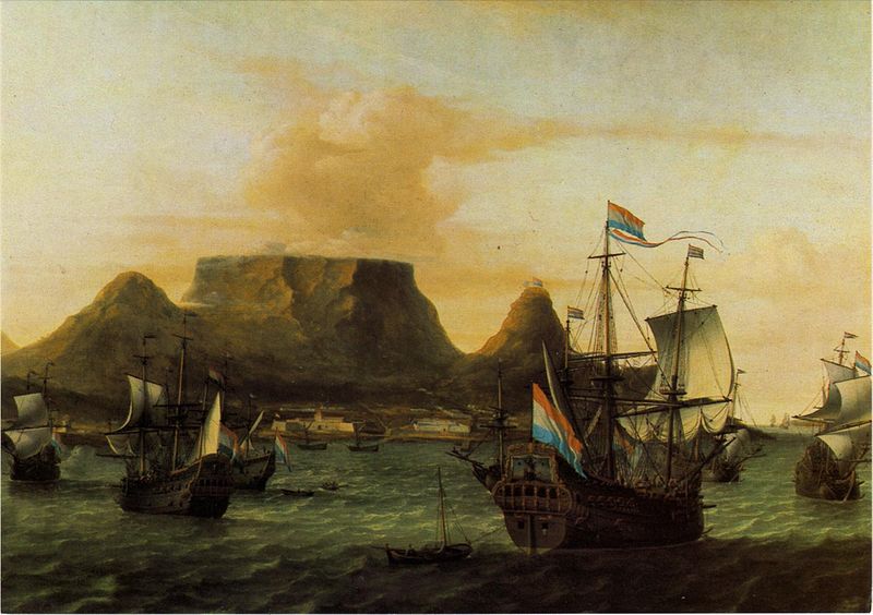
View of Table Bay circa 1683 [https://en.wikipedia.org/wiki/Dutch_East_India_Company]
Supplies of fresh food on this long journey rounding Africa were vital and Cape Town settlement became known as "The Tavern of the Seas".
Zapotrzebowanie na świeżą żywność w tej długiej podróży po Afryce było niezwykle ważne, a osadnictwo w Cape Town zyskało miano "Tawerny Mórz".
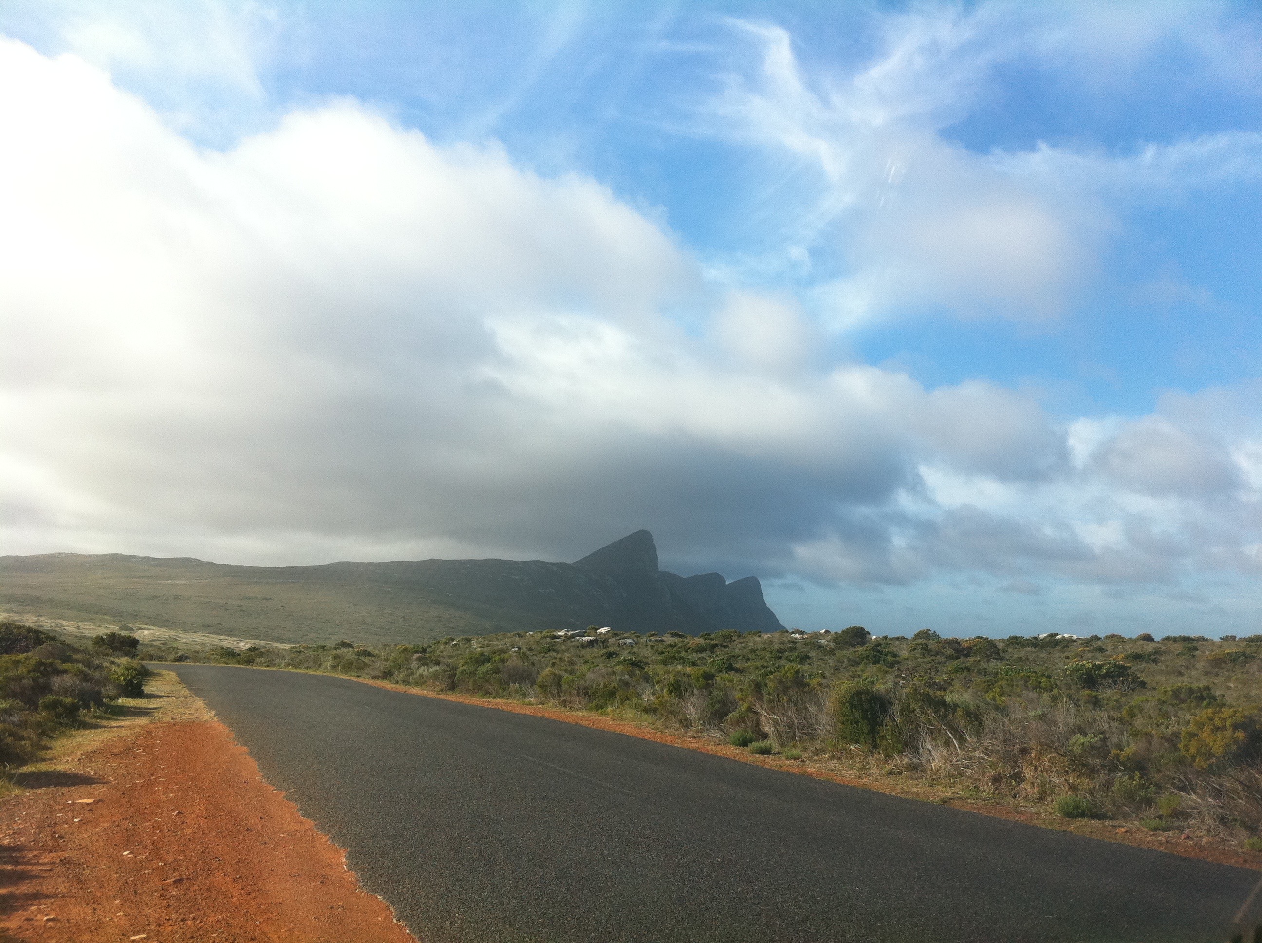
On the way
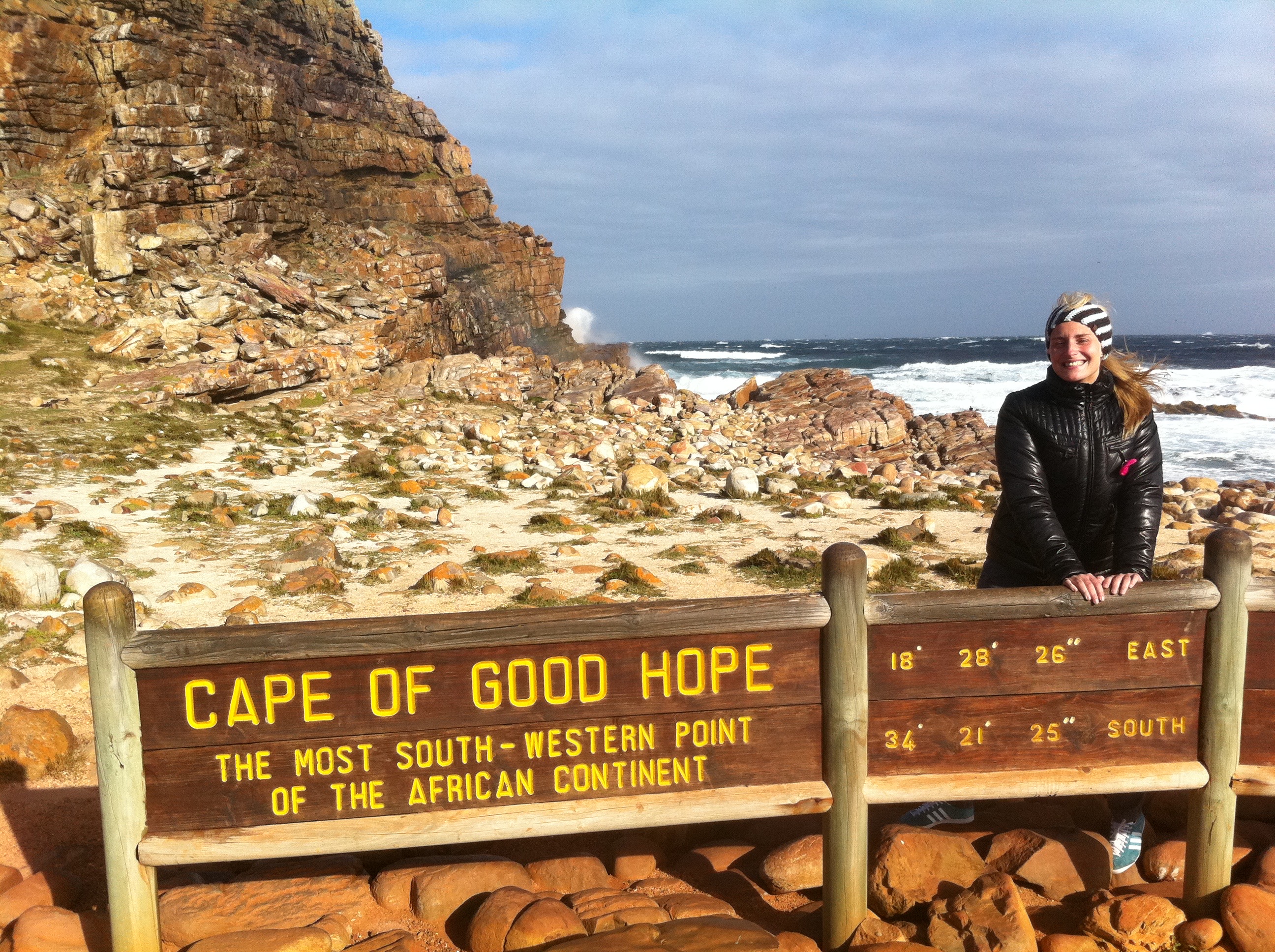
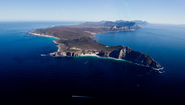
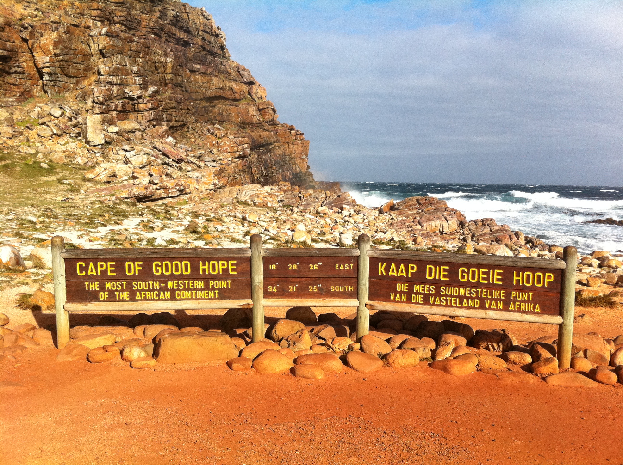
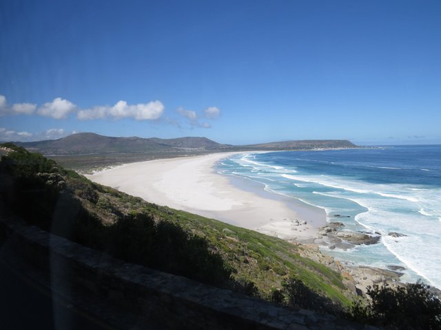
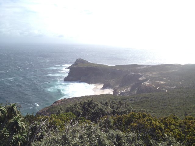
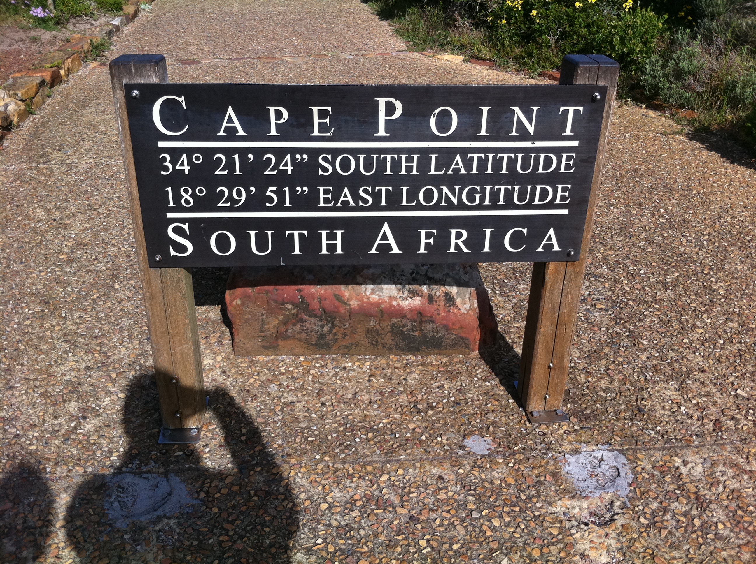
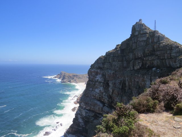
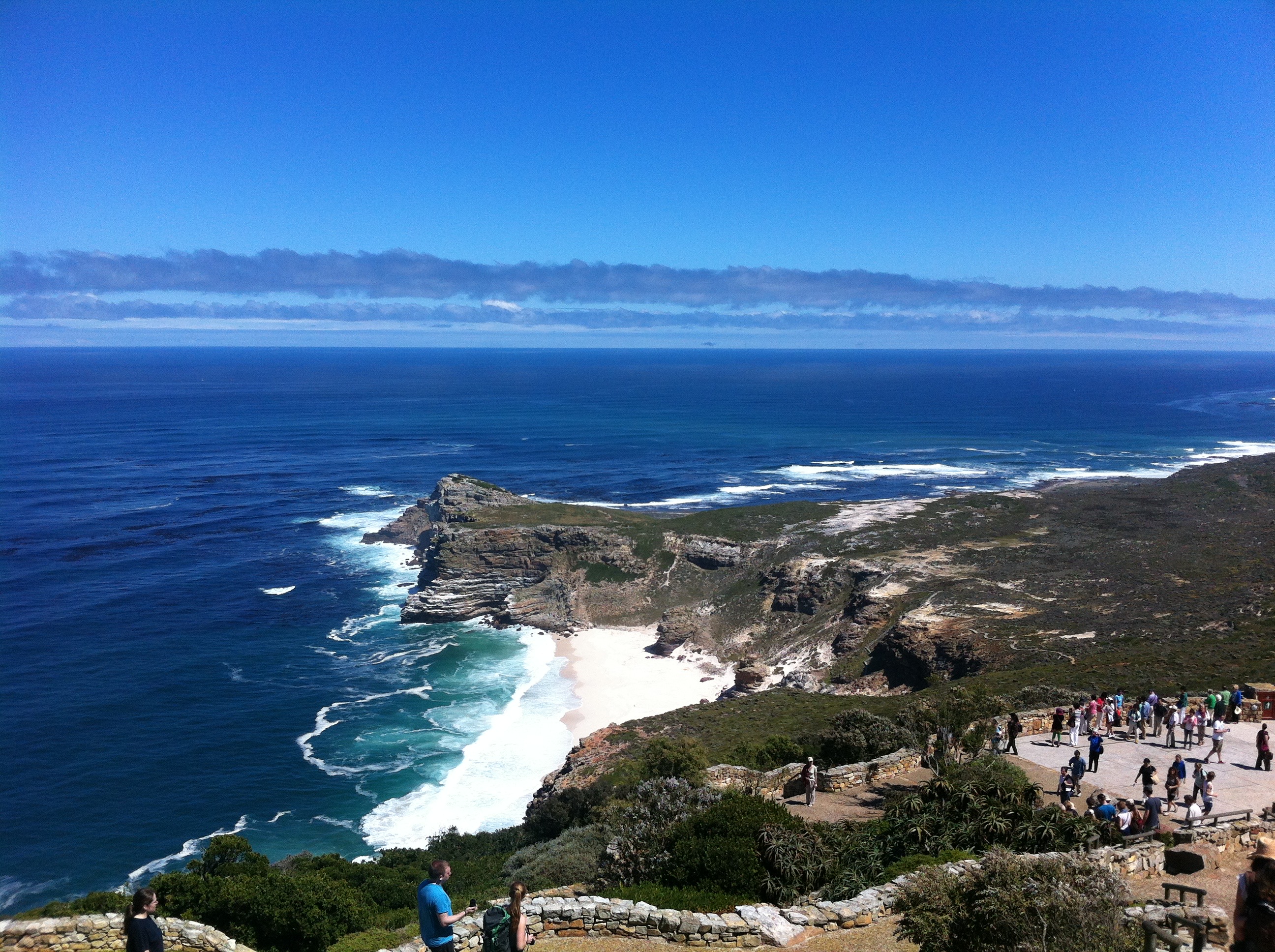
The tip of the Cape Peninsula: The Cape of Good Hope, it’s about 2.3 kilometres (1.4 mi) west of Cape Point on the south-east corner.
Cape Peninsula is unspoiled national park with coarse, scrubby nature of fynbos vegetation. It’s a rugged, wild, scenic landform.
Kraniec Półwyspu Przylądkowego: Przylądek Dobrej Nadziei, jest około 2,3 km (1,4 mil) na zachód od Cape Point w południowo-wschodnim narożniku.
Półwysep Przylądkowy jest dziewiczym parkiem narodowym z szorstką, krzewiastą roślinnością tzw. fynbos. To surowa, dzika, malownicza forma terenu.
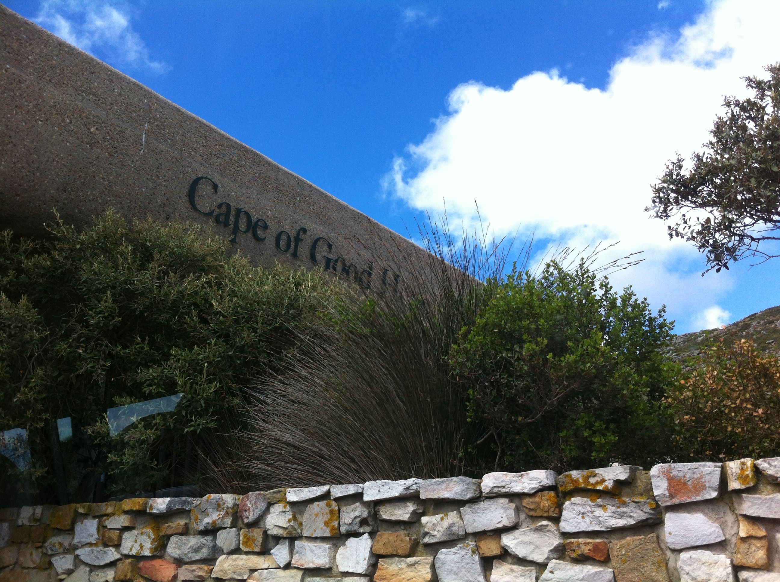
The entrance
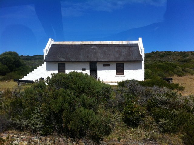
The cottage
In the park
Driving within the national park one can spot two navigational beacons- Dias Cross and Gama Cross. Vasco da Gama and Bartolomeo Dias were commemorated as explorers who were the first to reach the cape. The beacons were erected by the Portuguese government.
Przemieszczając się w parku narodowym, można dostrzec dwa punkty orientacyjne- Dias Cross i Gama Cross. Vasco da Gama i Bartolomeo Dias zostali upamiętnieni jako odkrywcy, którzy jako pierwsi dotarli na przylądek. Pomniki te zostały wzniesione przez rząd portugalski.
Dias beach
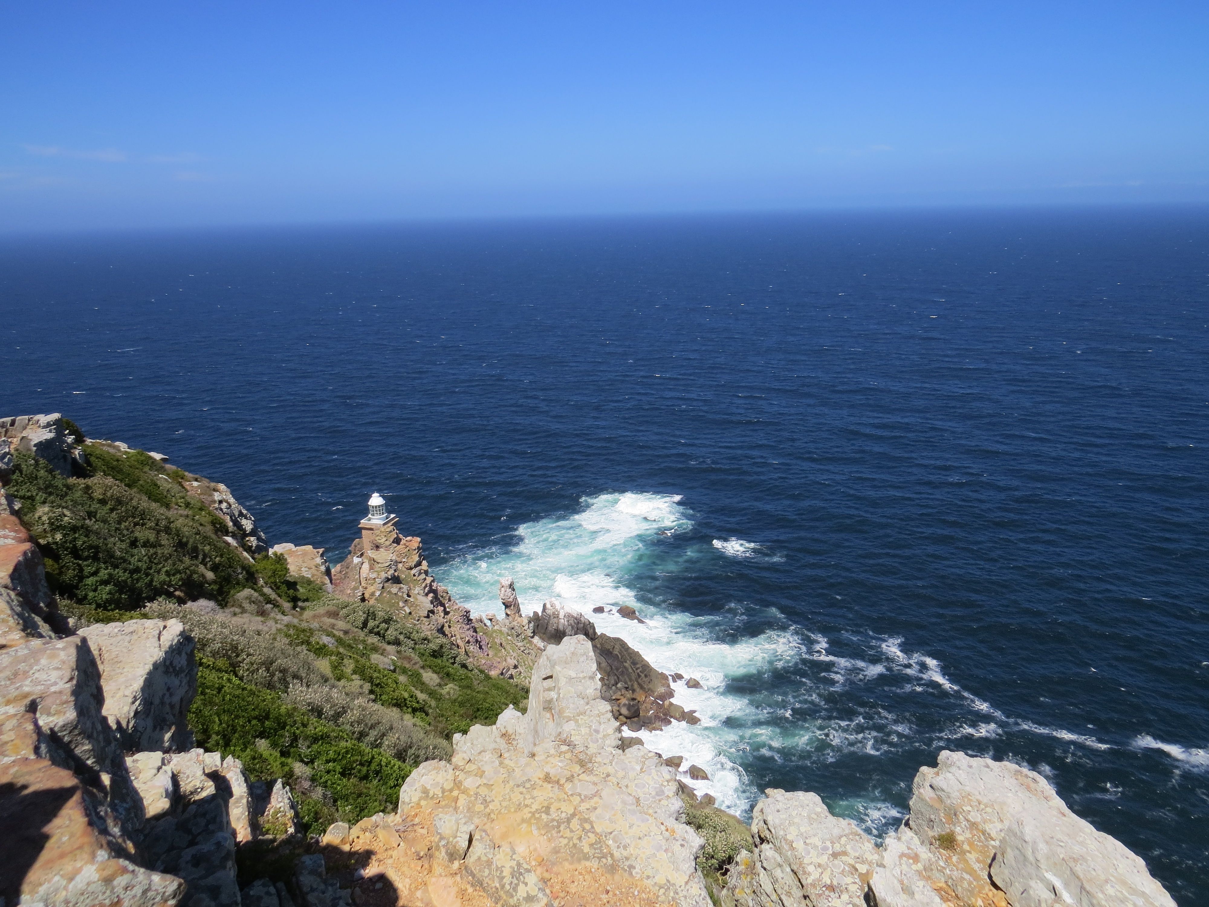
Cape point
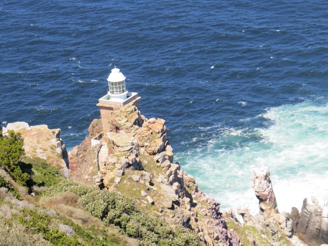
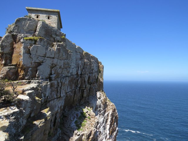
The peak of Cape Point is crowned with the old lighthouse. One can reach the top climbing the stairs or with a funicular The Flying Dutchman, that runs from a car park up. The new lighthouse was built at a lower elevation to prevent the ships from approaching too closely.
The relocation was also necessary due to often prevailing fog on the old lighthouse level.
Szczyt Cape Point zwieńczony jest starą latarnią morską. Do góry można wejść po schodach lub kolejką linową "Latającym Holendrem", która startuje z poziomu parkingu. Nowa latarnia morska została zbudowana na niższej wysokości, aby nie dopuścić do zbytniego zbliżania się statków. Przeniesienie było również konieczne ze względu na często panującą mgłę na poziomie starej latarni.
The new lighthouse
...Now in perspective
From the new lighthouse - somehow managed to climb there
View from the top close to the old lighthouse
Rugged rocks
The Cape of Good Hope is an integral part of the Cape Floristic Kingdom, the smallest but richest of the world's six floral kingdoms. This comprises a treasure trove of 1100 species of indigenous plants, of which a number are endemic (occur naturally nowhere else on earth). The main type of fynbos ("fine bush") vegetation at the Cape of Good Hope is Peninsula Sandstone Fynbos, an endangered vegetation type that is endemic to the Cape Peninsula. Characteristic fynbos plants include proteas, ericas (heath), and restios (reeds). https://en.wikipedia.org/wiki/Cape_of_Good_Hope
Przylądek Dobrej Nadziei jest integralną częścią Przylądkowego Królestwa Florystycznego, najmniejszego, ale najbogatszego z sześciu królestw świata. Obejmuje to skarbnicę 1100 gatunków rodzimych roślin, z których wiele jest endemicznych (nie występują naturalnie nigdzie indziej na ziemi). Głównym rodzajem roślinności fynbos ("drobny krzew") na Przylądku Dobrej Nadziei jest Przyladkowy Sandwich Fynbos, zagrożony typ roślinności, endemiczny dla Półwyspu Przylądkowego. Charakterystyczne rośliny fynbos obejmują protea, ericas i restios. https://en.wikipedia.org/wiki/Cape_of_Good_Hope
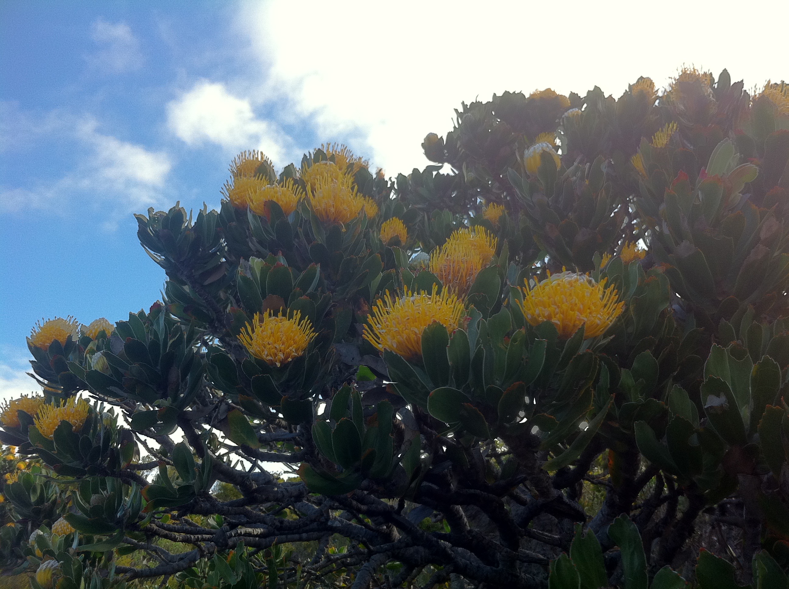
Pincushion proteas
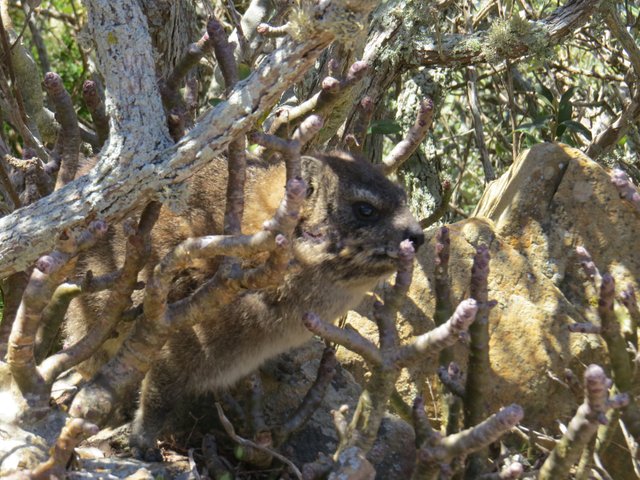
Hidden Dassie
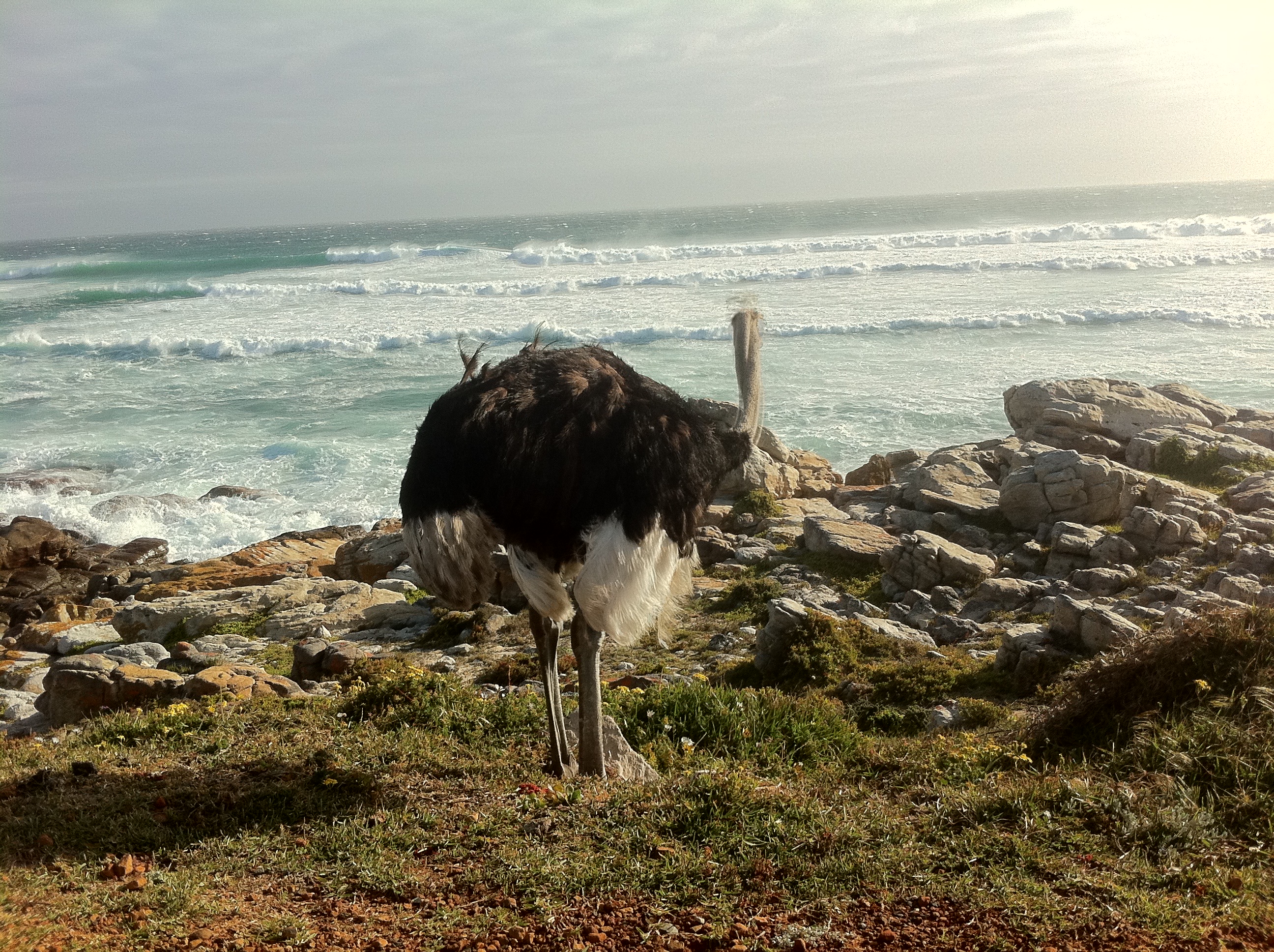
Ostrich
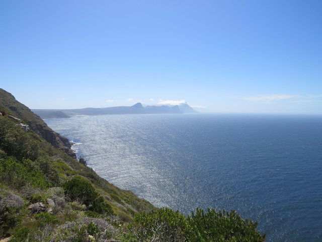
Rocky Mountains, open sea and unspoiled beaches make It a diverse habitat.
Cape peninsula is between two major ocean currents. It’s the strategic position that ensures a rich diversity of marine life, and is a splendid area for whale watching.
Skaliste góry, otwarte morze i dziewicze plaże sprawiają, że jest to zróżnicowane środowisko.
Półwysep Przylądkowy znajduje się pomiędzy dwoma głównymi prądami oceanicznymi. To strategiczne położenie, które zapewnia bogatą różnorodność życia morskiego i jest wspaniałym miejscem do obserwacji wielorybów.
False Bay view
The humpback whale and Bryde's whale can be seen and between June and November the southern right whale, killer whales, seals, dusky dolphins and great white sharks breaching in the False Bay.
Można zaobserwować wieloryba humbaka i wieloryba Bryde'a, a od czerwca do listopada walenia południowego, orki, foki, delfiny i Żarłacze białe pojawiające się w False Bay.
This one was dead before I got there
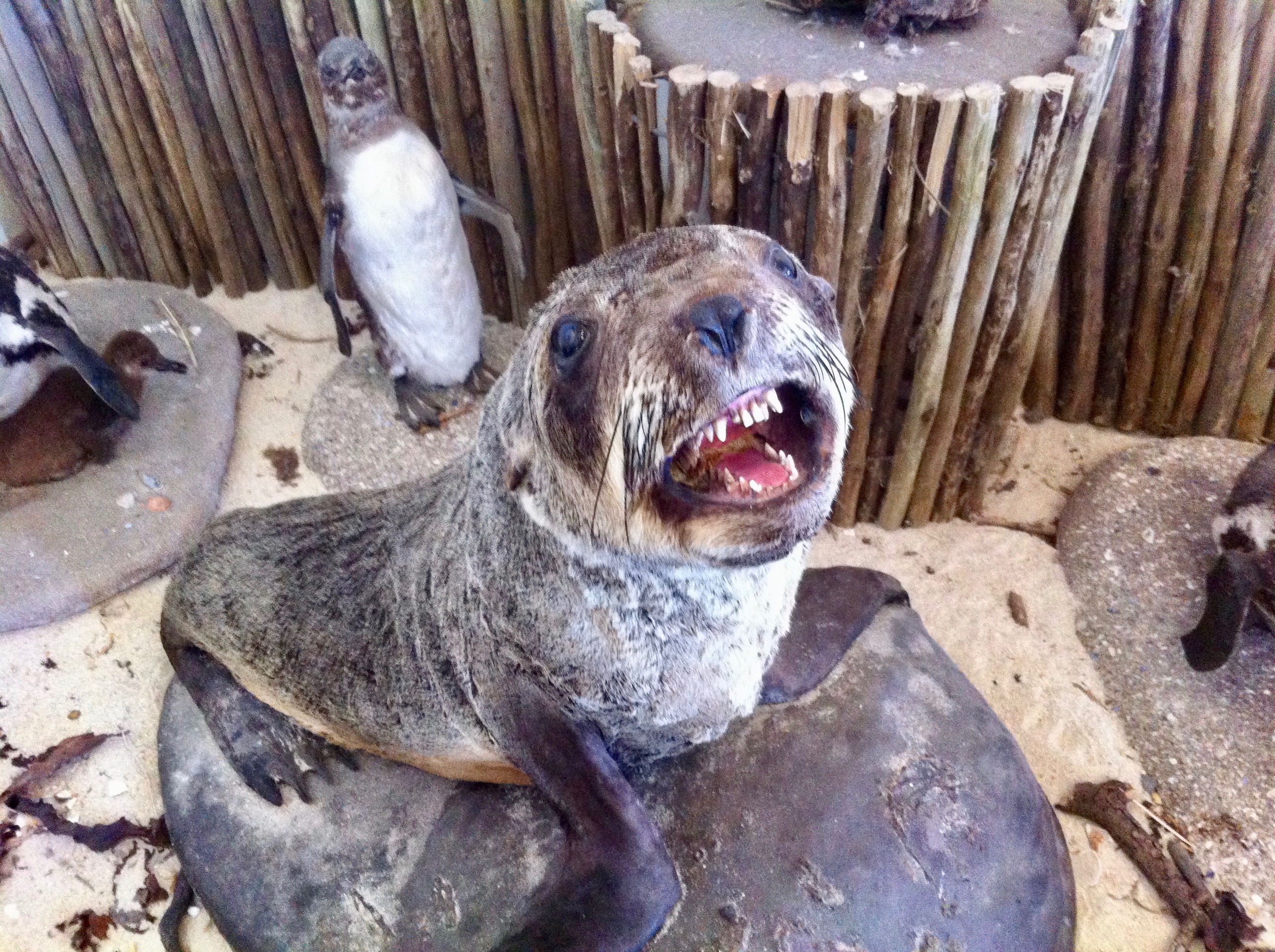
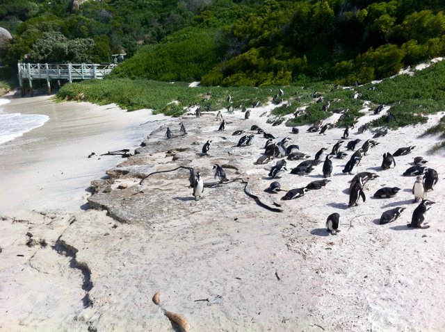
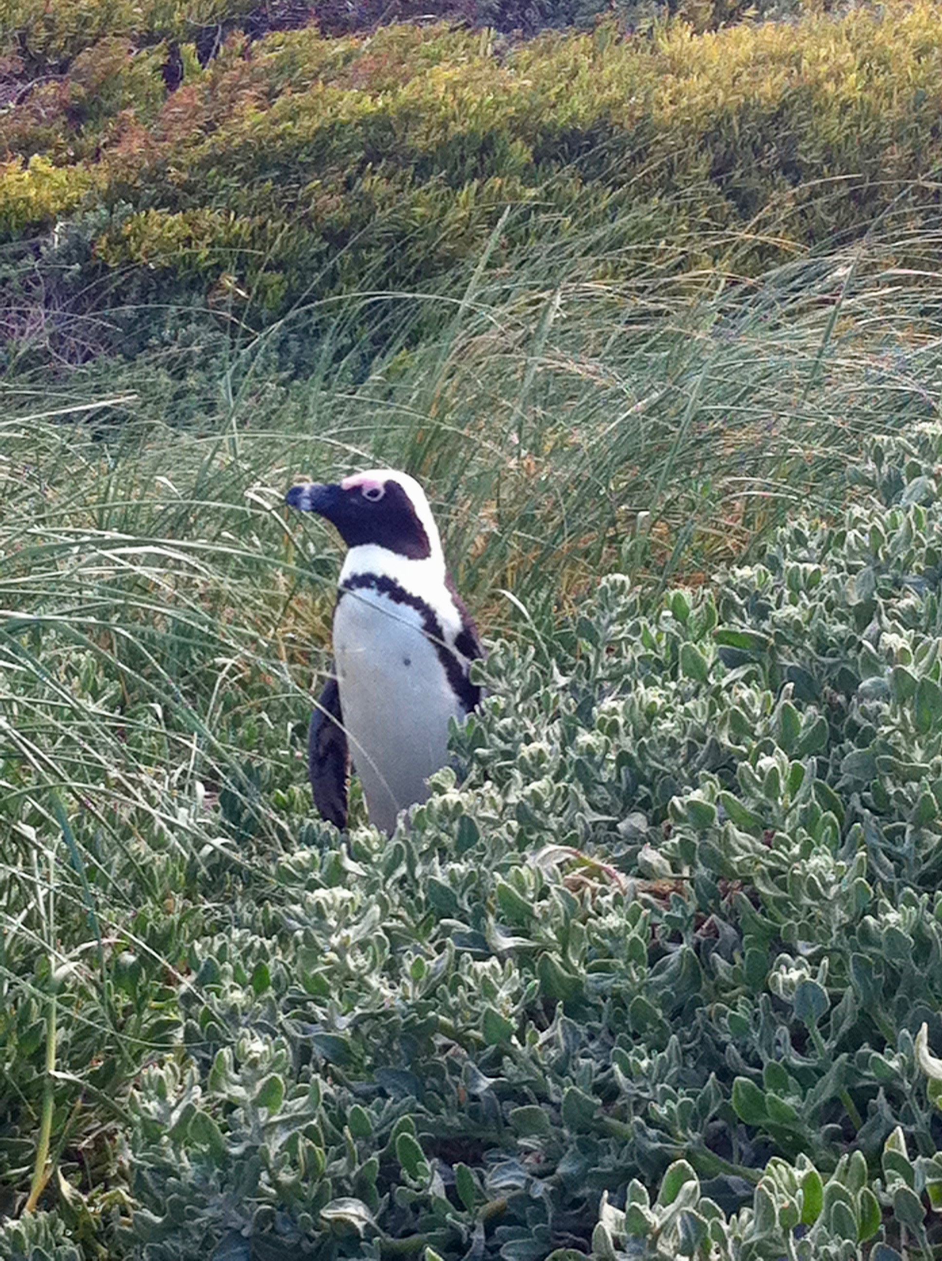
It is also home to at least 250 species of birds. Proteas and Ericas attract sunbirds, sugarbirds, and other species in search of nectar. Two mainland colonies of African penguins are permanent residents too.
Jest także domem dla co najmniej 250 gatunków ptaków. Proteas i Ericas przyciągają nektarniki, cukrzyki i inne gatunki ptaków w poszukiwaniu nektaru. Dwie kolonie afrykańskich pingwinów są również stałymi mieszkańcami.
Resting on the beach
Little fellow
*Photographs taken by @highonthehog
Your post has been selected as #adsactlyspostoftheday :)
Join us in our Discord channel here to drop your post in our post promotion page, and make sure to use the @adsactly tag in the post itself.
Pretty awesome tale of a place many can only vision on a map.
Thanks , I will be there again in March. I will make a summary of the travel costs , so perhaps it will help someone to decide to come ;)
Greetings and lovely post :) From a fellow Cape Tonian!
I mean this place is a treasury, I just scratched the surface. Glad u liked it ;) Hope to see you guys in March !
Very interesting and beautiful photos. Nice history shown and good informative post.
Thank you. For me this is so fascinating, I would love people to learn more about SA.
Good picture and Good content
Thanks , glad u like it ;)
I can see my house! Awesome post :) and i love the seal. Looks like he is smiling at the camera
Hey, I was living for some time in the Tampon Towers , the 17th and 14th floor, the one on the far right side. Im glad you liked the post I imagine it's nothing new for you but hopefully the photos and writing does full justice to the beauty of the Cape. Heh I have one good photo with this seal , but I will keep it for later ;)
It's a great post. The view from those apartments is incredible
You did more than do it justice xx
That sounds like an amazing place. I loved all the photos. The lighthouses look really cool, I bet that was fun to checkout. And that Ostrich.. whoa... what a creature that is! Really amazing. Thank you for sharing.
Yeah we have actually sneaked into the restricted area to get closer to the new lighthouse. Than we just sat on a small piece of ground, completely alone in silence for like 40 min. I keep this image in my memory.
Congratulations, Your Post Has Been Added To The Steemit Worldmap!
Author link: http://steemitworldmap.com?author=highonthehog
Post link: http://steemitworldmap.com?post=flying-dutchman-south-african-cape-of-good-hope
Want to have your post on the map too?
Add the following inside your post:
!steemitworldmap xxx lat yyy long description d3scr
(replace xxx and yyy with latitude and longitude)
Whoa. What a stunning set of photos! Your post is so well written and formatted. It looks like an article in a magazine.
I am so intrigued with the idea of visiting new places and I've now added this to my bucket list! Fantastic post!
Thank you Byn, coming from a native speaker- it's a great compliment.
You absolutely need to go to CT, and South Africa for that matter, it's the whole world in one country :)
your posts are making me want to go to south africa more and more! :)
And you will not be disappointed , than we can write a shared memo from the trip ;)
Have no doubt, after reading your posts :) sure, it would be amazing if I can go there some day :)