Hiking On Krafla Volcano Explosion Crater.
Again its been some time since my last Icelandic post. If I carry on with the same Iceland topic posting frequency then I'm never gonna finish with this lol.
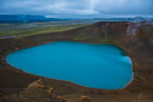
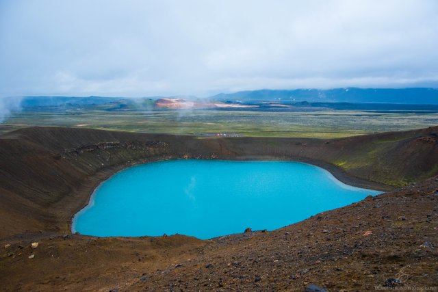
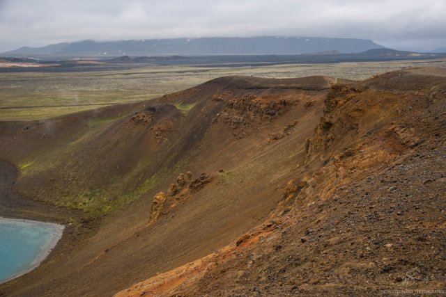
Anyway, This is Krafla Volcano carter. It is located in northern Iceland, not far from the lake Myvatn. It is one of the most spectacular places to see in the northern part. When walking on the edge of the crater you can see other craters and very colorful mountains. Also, this place is seismically very active with magma being just 2 kilometers below our feet. Volcano sits on a 90-kilometer fissure zone.
Krafla volcano is about 300 meters in diameter, it took about 40 minutes to walk around on the rim of the crater. Of course I stopped many times for photos too. The crater is formed in 1729 during the 5-year long explosive eruption.
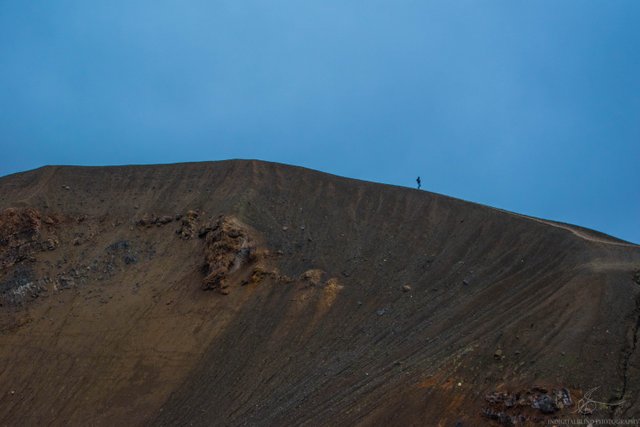
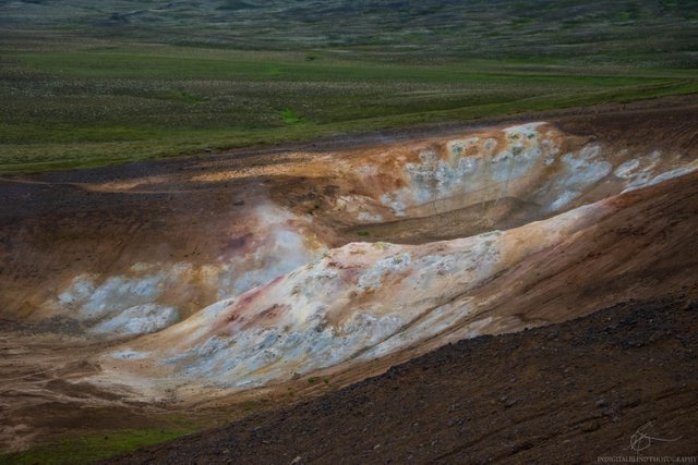
On that photo below you can see how small the human is compared with the crater wall.
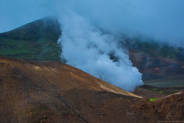
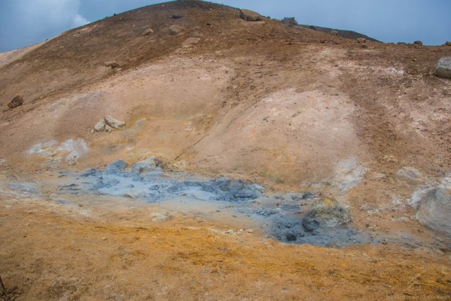
During our hike around the Volcano, we had to watch out for the boiling hot ground we were basically walking on.
Sulfur pushed out of the mud and holes there, you don't want to accidentally step into 150C mud and bur yourself badly.
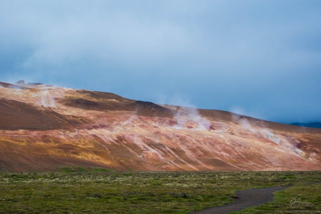
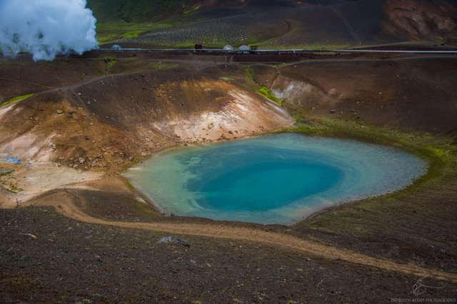
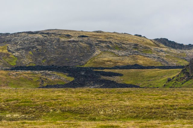
On the last photo, you can clearly see how lava has been flowing not so long ago. This exact lava flow was happening in the mid-80's.
If you want the exact location, check in the comment section for @steemitworldmap comment.

Stunning! I wanna slide there weeee! :D
You can do that but it will probably hurt, much :D
Congratulations, Your Post Has Been Added To The Steemit Worldmap!
Author link: http://steemitworldmap.com?author=greddyforce
Post link: http://steemitworldmap.com?post=krafla-volcano-explosion-crater
Want to have your post on the map too?