The ancient river port of Kampyrtepa or a trip to Buddhist Termez, Uzbekistan.
This post is the second from the cycle "Directly to the South!", In which I will describe my trip to the sights of the southernmost city of Uzbekistan - Termez. In my first post I talked about how we visited the salt mines. After the walls of the salt mines of Tuz-Gori were licked, we jumped into our shaking bus and jumped back to Termez. Already it was almost four o'clock in the afternoon, and we still did not have a full meal of pomegranates previously bought and persimmon had long been eaten and digested. We unloaded near one of the cafes and sat down at the tables. By the way, Uzbekistan is famous for its culinary masterpieces and our national dish can be considered pilaf. It was even recognized by UNESCO as an intangible heritage of mankind. In each region of Uzbekistan there is a kind of pilaf, but I did not have a chance to try Termez pilaf. Guide advised to order, something meat - that's meat dishes from Termez locals really delicious and portions are simply huge.
The full negativity did not last long - the guide did not allow us to sit long and drove to the next point of our trip - the ancient site of Kampyrtepa, which is located about 30 kilometers from Termez. While we had dinner, while we reached Kampyrtepa - the sun had already begun to set. Nevertheless, I managed to run around the neighborhood and take pictures
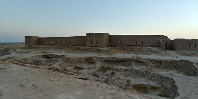
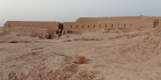
Kampirtepa was founded approximately at the end of IV century BC. - beginning of the III century BC. and lasted more than three centuries before the I century AD. It was a port city, which was located on the right bank of the Amu Darya river (in ancient times known as Oks). The city was a transit point for merchants who drove their goods along the Great Silk Road and also performed customs functions.
The city is located on an area of 4 hectares and its distinctive feature was that it was built according to a standard design. After the strongest earthquake, the Amu Darya changed its current and retired from the city for several kilometers. After that the city came to desolation.
According to some scholars it was Alexandria on Oks founded by a great general. The reason for this version can serve as well-preserved cultural layers belonging to the early Hellenistic period and the Greco-Bactrian era. However, other sources claim that Alexandria on Oks is located in the northeast of modern Afghanistan. I will leave this question to archeologists and historians. Anyway, the city is more than two thousand years old and this is a very interesting place! It is included in the list of UNESCO World Heritage Sites.
By the way, in fact, this place was mentioned earlier in sources as Burdagui and it is believed that this name was transformed from the ancient Greek "pandokeon" - an inn or inn. I do not know how the linguists defined it, but the name is clearly suitable. Already in later times, the hill, under which the ruins were hidden, was called Kampyrtepa. By the way, if you look at the word "Kampyrtepa" from the point of view of the Uzbek language, you will get "Old Woman's Hill" ("kamyr" - old woman, "tepah" - hill or hill). But the guide said that the correct name is Camburtep - or "Ancient Hill" (agree, so it sounds better). But over time the name was distorted and subsequent generations already used a distorted name, which was included in the scientific literature. So the "Ancient Hill" turned into an "old woman" ...
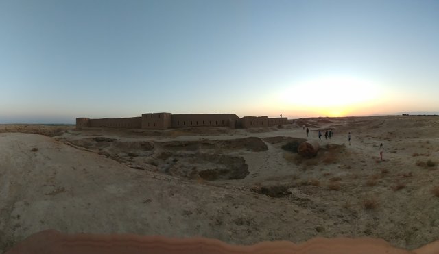
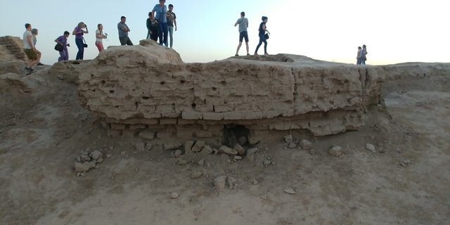
The settlement was discovered in the distant 1972 by the well-known archaeologist Eduard Rtveladze, and active excavations began in 1979 and continue to this day. For more than forty years, international archeological expeditions have been conducting their research here and finding something new and unexplored every time. Over the past decades, almost 4/5 of this complex has been excavated and explored.
For these years, there were found objects of culture and life of residents. Studies have shown a very strong influence of ancient Greek culture on the development of this settlement. For example, arrow-shaped loopholes and windows characteristic of the Greco-Bactrian period.
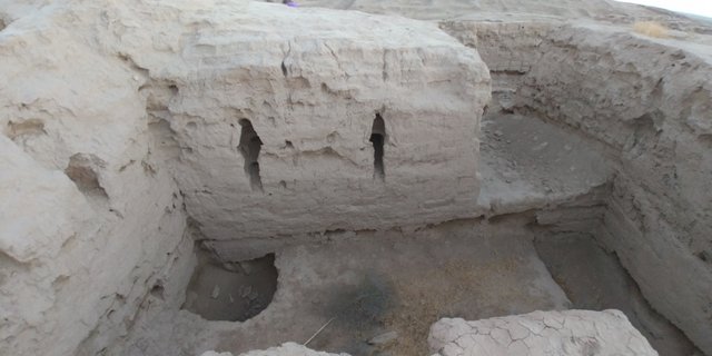
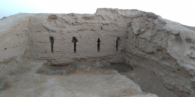
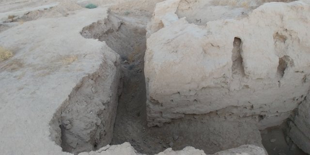
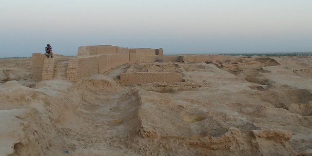
The examination of the town of Kampyrtepa gave an idea of how people lived in that era, what construction technologies they used. For example, the builders of the ancient city actively used the surrounding terrain, cutting through the rocks of the building and combining them with the buildings of raw. Coins, ceramics, objects of worship and life testify to the close connection of the city with other trading cities of modern Afghanistan and India.
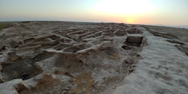
The city was divided into "upper" and "lower". First, the "upper" city or citadel was built. The remains of these buildings you can see in the photos below. The houses in the citadel were two- or four-roomed, very close to each other.
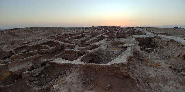
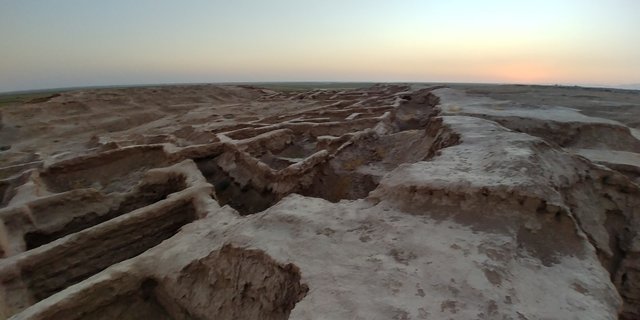
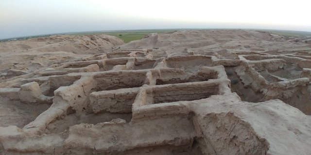
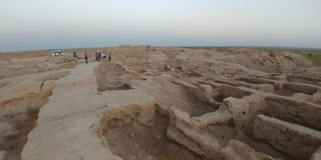
The history of the city can be conditionally divided into three epochs: Early Hellenistic, Greco-Bactrian and Kushan-Yuechzhi. During excavations, archaeologists have made a number of interesting and curious finds. For example, earlier in this area Buddhism was widespread. The evidence of this can be found in the many terracotta statuettes of the Buddha found here. It is also interesting that in this region there was a mutual confusion of religions and beliefs. For example, a Buddha figure was found, which simultaneously had the features of Ahura-Mazda, the Zoroastrian deity. In addition, during the reign of the Kushan king Kanishka I, who ruled this territory in the beginning of the II century AD. a policy of tolerance and religious tolerance was conducted. This is evidenced by more than a thousand coins of that period, depicted in Kampyrtypa, depicting deities belonging to the most diverse religions and beliefs. For example, in the citadel in the room for the guard was found the figure of Athena, which was considered by the Greeks to be the patroness of the soldiers, and in the neighborhood found the statues of the Buddha.
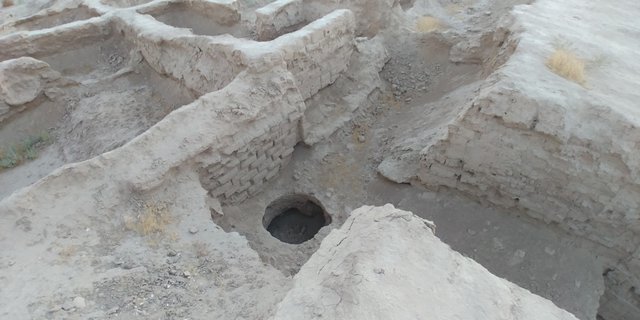
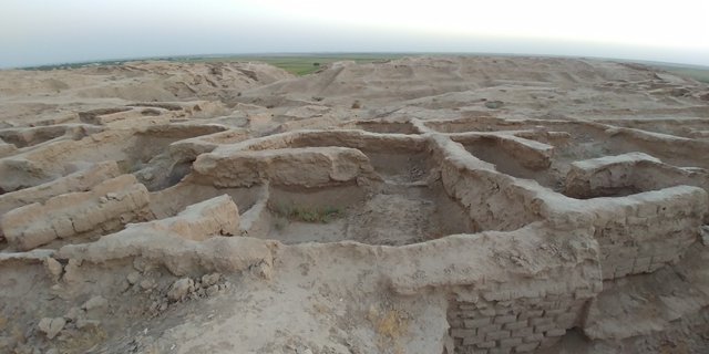
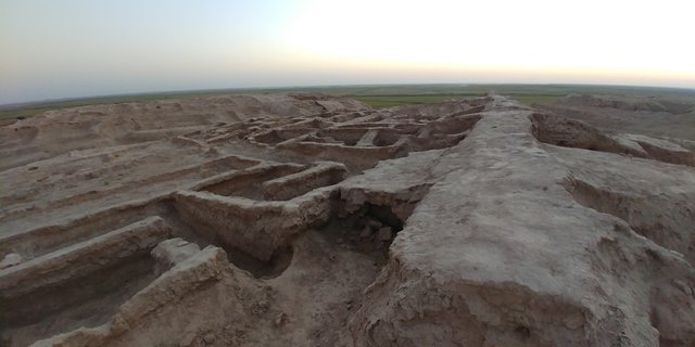
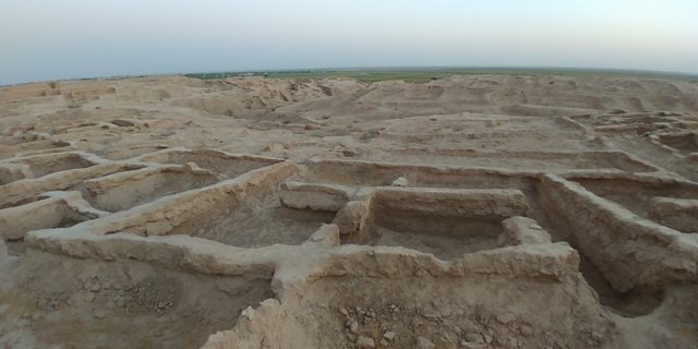
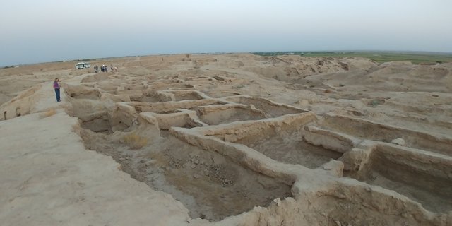
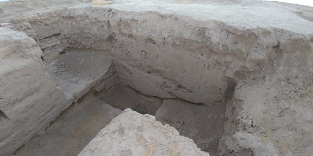
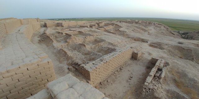
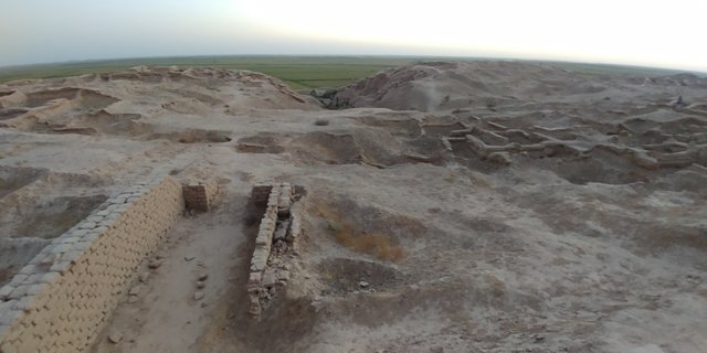
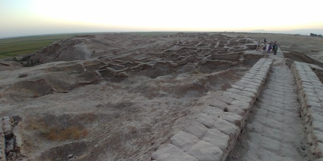
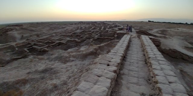
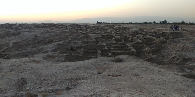
At the same time, during the reign of Kanishka I, the "lower" city appeared, which was built according to the standard approved plan. The houses had specially designated places for food storage, fires and family altars.
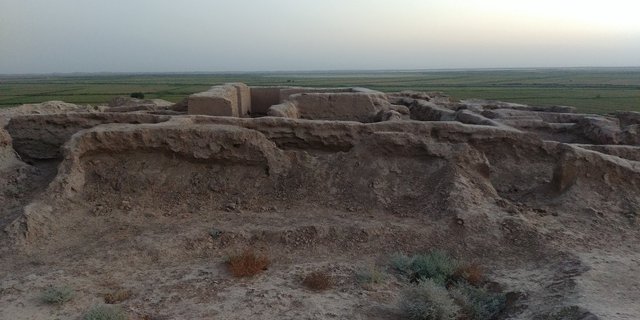
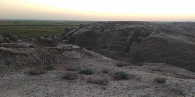
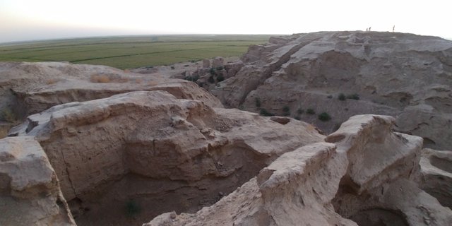
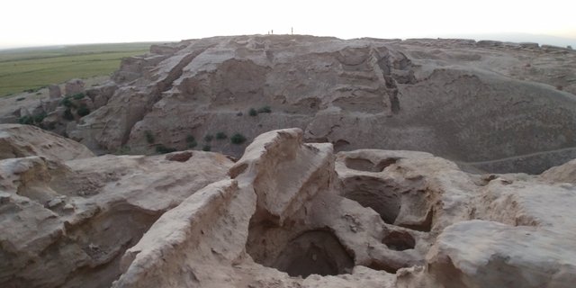
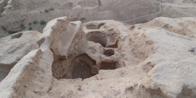
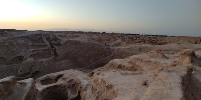
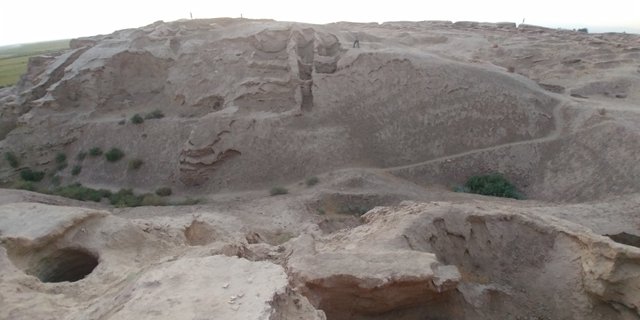
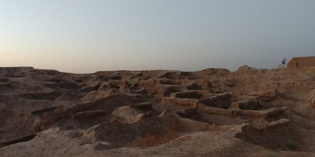
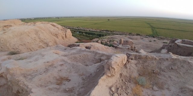
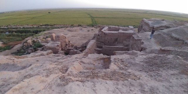
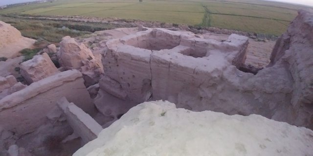
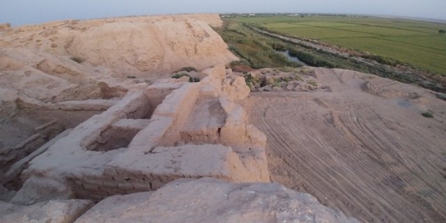
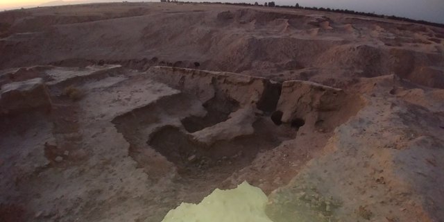
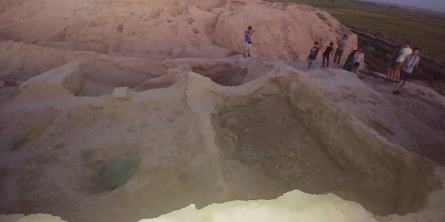
During the excavation, archaeologists, they say, "have a hand" in the restoration of architectural monuments, conservation and strengthening of existing debris. In addition, a huge amount of historical and archaeological values were found - from papyri to ceramics. When we climbed Kampyrtepa, I found several clay shards. The guide said that during the excavations they find a very large number of archaeological finds and the most preserved artifacts are handed over to museums, but such small pieces are left. And sometimes it's unclear - whether it's a shard for hundreds and thousands of years, or whether it's just a modern clay jug that some awkward archaeologist-practitioner defeated during the last expedition ...
Anyway, but although the work has been going on here for almost forty years, it will be enough for the current young archaeologists. This land is so rich and the cultural layers are vast. Part of the finds from Kampyrtepa was sent to the leading museums of the Soviet Union, part of it settled in Tashkent museums, well, something happened to Termez. The next day after visiting Kampirtepa, we went to the Museum of Archeology of the town of Termez, where we were shown some of the finds from this ancient settlement. But I'll talk about this in my next post.
!steemitworldmap 37.283341 lat 67.332802 long The ancient river port of Kampyrtepa or a trip to Buddhist Termez, Uzbekistan. d3scr

This post has received a 0.63 % upvote from @drotto thanks to: @banjo.
Congratulations, Your Post Has Been Added To The Steemit Worldmap!
Author link: http://steemitworldmap.com?author=damm-steemit
Post link: http://steemitworldmap.com?post=the-ancient-river-port-of-kampyrtepa-or-a-trip-to-buddhist-termez-uzbekistan
Want to have your post on the map too?
Add the following inside your post:
!steemitworldmap xxx lat yyy long description d3scr
(replace xxx and yyy with latitude and longitude)