The Copper Canyon with questionable maps. Part three.

While the scenery was undeniably impressive around the area, we weren’t really finding anything that really captured our imagination.
What proved to be more memorable than the scenery and the ‘tourist attractions’ were the local Rarámuri (Tarahumara) people. No matter how far away from a town or how far down a winding back road we found ourselves, there was always a chance of rounding a corner and finding a family walking (what we can only assume were quite long distances) along the side of the road. Sometimes they would be seated around an impromptu lunch-time camp fire. Given the distances and the temperature, we knew these people were made of sterner stuff than us—in our car, with our cushy hotel room, both with a heater.
The local women typically dressed in brightly coloured outfits. Many were very shy of passers-by, turning into the woods and hiding their faces as we drove past, although their husbands and children would often smile and wave.
Tourism appeared to be becoming a big industry in the area, which meant everywhere we stopped for something touristy, there would be throngs of local people selling their handcrafts.
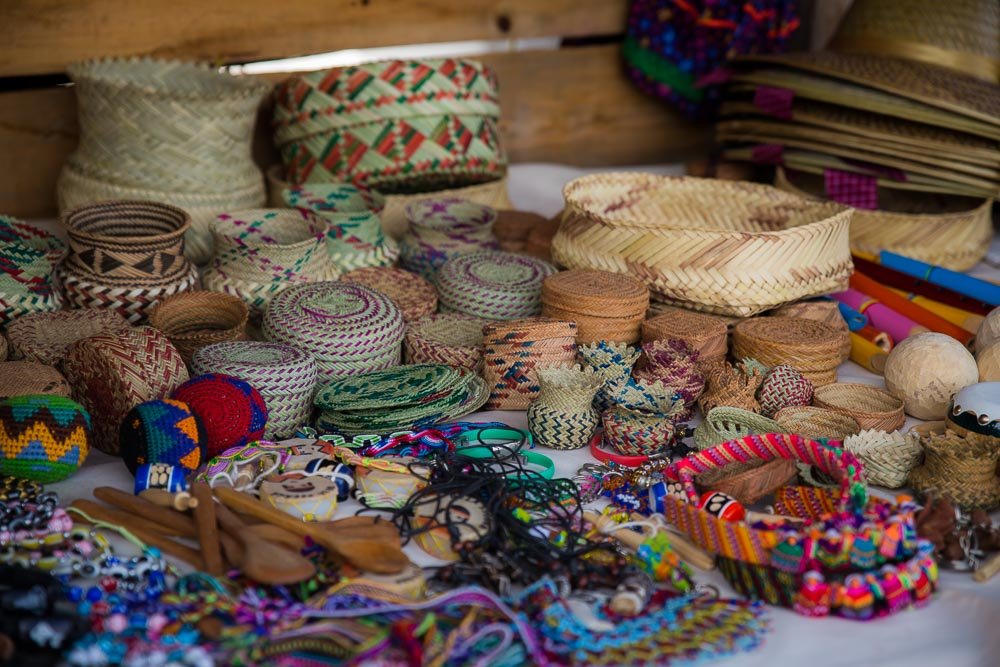
Locally made woven baskets.

Intricate weaving.
When we visited a cafe in Creel we were asked approximately 10 times by the same three kids whether we wanted to buy a basket as they did the rounds of nearby restaurants. It is scenes like this that make you wonder what kind of impacts increasing tourism is going to have on the area and how it will affect the people living there. Will it unbalance the local economy or enhance it? Will it provide opportunities, or will it take them away? Will it strengthen or diminish the local people’s cultural identity?
It leaves you wondering how much of a completely selfish enterprise this whole travelling malarkey is. It is questions like these that always make you feel like a bit of an intruder in someone’s backyard.
Realistically, that is what our entire journey is about—intruding in people’s backyards all the way from Alaska to Argentina, we’re somewhat committed now. Perhaps that should be our new motto?
However, we were here to see the canyon, so it was time to stop looking at rocks, lakes and handcraft stalls and to go see what the fuss was about.
As advertised, there was a very dramatic canyon to see.

We decided that a night’s camping on the canyon rim was in order.

We asked a local farmer where we could camp. For a 20 pesos (less than $2 NZD), he was happy to allow us to camp right there at 2,500 or so metres with a million dollar view of the canyon below. That sounded like good value to us. (Technically 30 pesos because we also bought a well-made woven basket from his shy young son who was sent up to visit us once we set up camp).
We settled in to our spectacular camping spot, hoping for a dramatic sunrise over the canyon the next morning.
Instead, we awoke to this:

Mist.

More mist.

Even more mist.
After breakfast and a hot cup of coffee to get us moving in the chilly morning air, we realised that the canyon wasn’t enveloped in mist, we were just camping in a cloud.

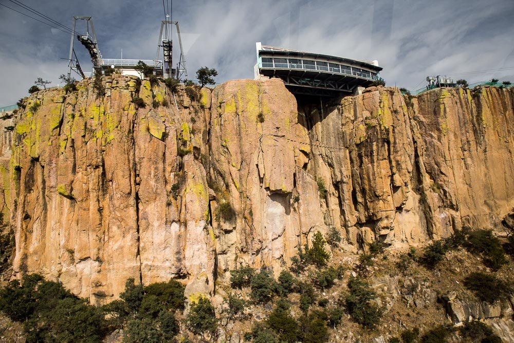
We made for lower ground to get below the cloud and enjoy the canyon scenery from the walkway between the Divisadero train station and the Parque Aventura Barrancas del Cobre.

Spectacular.


Now what is the Parque Aventura Barrancas del Cobre? As it happens, it is a tourist park with… wait for it—the world’s longest zipline! What better way to get a closer view of the spectacular Copper Canyon?
Well, what better way for Emma to see it anyway, Ben took one look at the zipline and promptly decided that he was not keen to spend a lot of money to be dangled 440m (1450′) above the canyon floor, hanging only from a thin cable.
Emma however was sold by the hype: 2.5km (8350′) of zipline, 100km/h(65m/h) 440m (1450′) above the bone-crunching canyon floor. Yes please.

Emma, looking pretty stoked after zipping her way along 2.5km of narrow cable.
Despite all the hype, it transpired that it was a pretty sedate journey. They sat you in a comfy seat and you were so far from the ground that it didn’t feel like you were moving fast—except for the biting wind and the roar of the zipline.
But it did provide a whole new perspective on the sheer scale and dramatic topography of the canyon.


It also included a free ride back to civilization on the even more sedate and not quite as spectacular cable car.


View from the slow moving cable car.
Several minutes later the cable car slowly approached the starting terminus. Definitely not as exciting as the zipline.

Ben was patiently waiting, enjoying the view without the price tag or risk of accidental death-plummet.
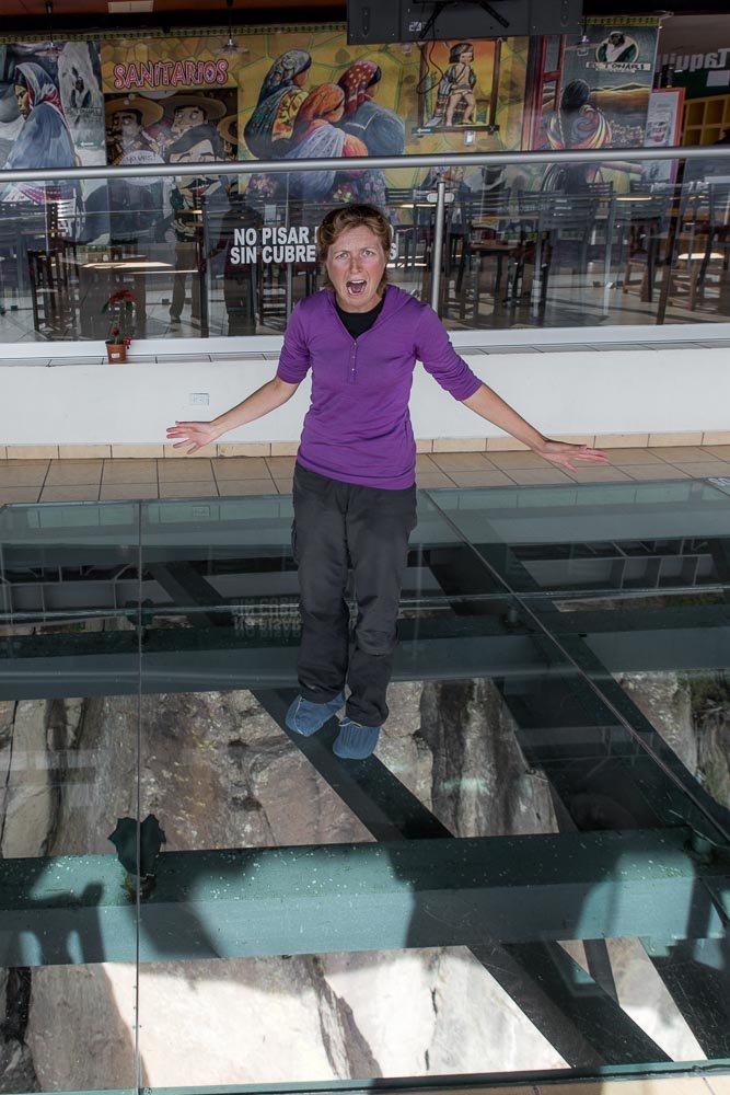
What was actually far more terrifying than any zipline was the glass-floored restaurant extending out over the canyon rim.
The glass looked like it was held in place by chunks of scrap metal.

Genuinely terrifying.
We stopped by at a few more viewpoints to gawk at the abyss from different angles. Sorry for so many canyon photos, but we didn’t spend nearly long enough and Arizona’s Grand Canyon, so we had to make up for it somehow.

And saw yet another crumbling Jesuit mission.


Nestled in this peaceful mountain village:

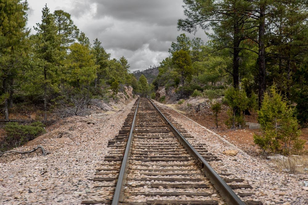
We never did see the famous Copper Canyon train El Chepe.
We felt we had been pretty successful at exploring the area without effective maps.
Although, in all fairness, much of the area around Creel was paved and for the most part clearly signposted, so aside from briefly getting lost in the town of Bahuichivo we hadn’t really felt the need for a map, or had to ask Javier for directions.
It was time to return to the coast. Instead of heading back towards Urique from Creel, we decided to drive to the town of Batopilas to see if we could find a way back to El Fuerte from there. We still had no maps of that area, but it sounded like there was a rough road from Batopilas to Urique at the very least. A quick look on Google Maps suggested there were other, more direct options as well. We figured we’d just ask locally for directions and go from there.
Incredible photos! I'm really enjoying your series.
Thanks.