Following the Devil’s Backbone

El Espinazo del Diablo (the Devil’s Backbone—a mountain pass along Mexico’s highway 40) is an infamously sinuous mountain road that joins the towns of Mazatlán, Sinaloa and Durango, Durango. The road has a bit of a reputation for punishing travellers with terrifying accident-inducing winding turns. Luckily travellers are also rewarded with spectacular views as the road runs along a mountain ridge, high in the Sierra Madre mountains.
This seemed like exactly the kind of thing we should investigate further.
A journey along el Espinazo del Diablo was previously the only way to drive between Mazatlán and Durango—without having to go the long way around. We had heard about this road as we travelled. People would speak of it in hushed tones, a road that demanded respect, a road so wild it could never be tamed. They spoke of white-knuckle drives around narrow winding corners, teetering on the edge of a cavernous abyss, all with the majestic, jagged folds of the Sierra Madre range stretching out at far as the eye could see.
Perhaps this is how it was. Once.
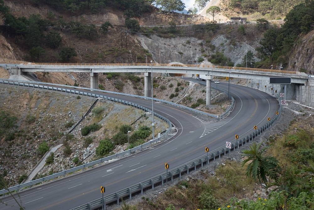
In 2013, work was completed on a much more straightforward to drive (but ridiculously complicated to build) toll road. The Mexican Federal Highway 40D apparently cuts about 5–6 hours off the drive between Durango and Mazatlán. It does this by traversing 115 bridges and 63 tunnels. (18km [11 mi] of them). The largest of the bridges is the Baluarte Bridge—1.1km (3,600′) long and 400m (1,300′) high—it is the highest suspension bridge in the world.
We planned to drive to Durango by one road and to return to Mazatlán by the other.
We didn’t really have a reason to return to Mazatlán though. Also, the tolls on the 40D were rumoured to total to about $50 USD—more than one day’s budget. We cheaped out and didn’t return to the coast. This meant that we missed out on all the tunnels and bridges. But driving one way along El Espinazo Del Diablo, we still got to experience the view.

These views remind us of the Copper Canyon.


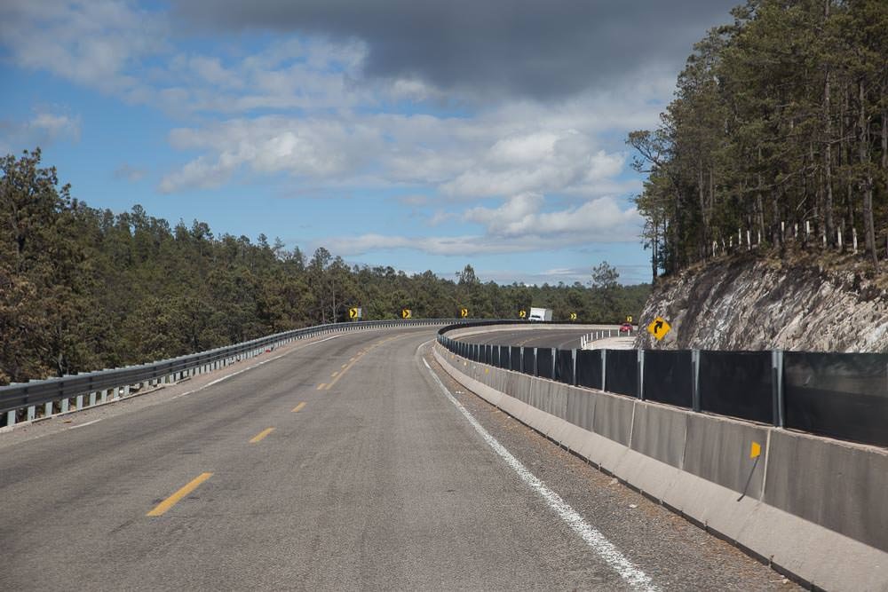
The whole road was actually in pretty good condition, the corners weren’t as windy and scary as everyone had said. We could see how it could be a bit upsetting to round a sharp corner in bad weather only to find yourself face to face with an oncoming truck. Not an uncommon sight anywhere in Mexico, even less so on narrow, winding mountain roads.
It might have been because we had just recently come from driving the higher, more winding, more dramatic, much narrower gravelly death-roads of the COPPER CANYON, but we found the drive pretty tame and not as death-defying as it had been sold to us as.
More likely it was because the new toll road was funnelling much of the traffic away from the old road, which also appeared to have been recently upgraded. It probably also helped that the weather was calm and warm, no snow, rain, cloud or ice to hamper our journey.
We’re not saying that the mythic ‘Espinazo Del Diablo’ no longer exists. Just that it has been tamed a little now. It is still a spectacular drive with jaw-dropping views. Also, yes, it is rather winding.
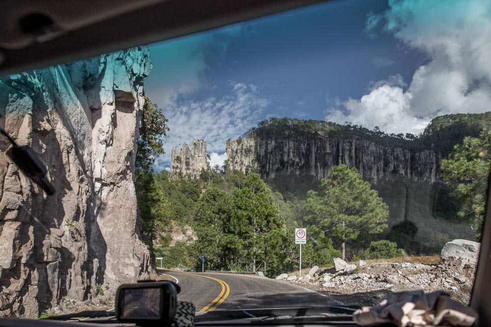
Can’t complain about a view like this.
While we were too cheap to actually drive on the toll road, we did catch glimpses of some of the engineering feats that had gone in to creating it.
This looks complicated.
We never did see the famous Baluarte Bridge, but there were a few glimpses of other bridges and tunnels en route.


Sometimes the toll road ran right alongside the free road with just a concrete divider to remind you that you were an almighty cheap skate.
I’m sorry. You didn’t pay the toll. Please stay on the cheap side of the barrier here.
We broke up the slow, winding journey with an overnight stop high in the mountains at Mexiquillo park. It didn’t appear to be a popular spot in the middle of winter. The nights were rather brisk this high in the mountains. Our only company was of the four-legged, mooing variety.


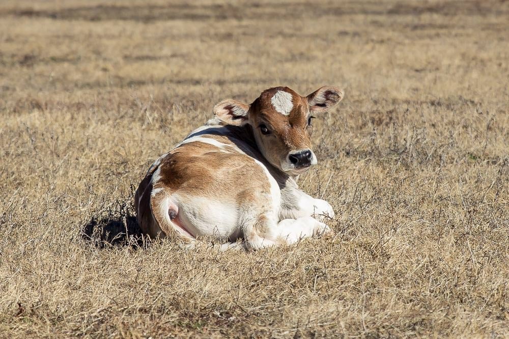
So cute! Would an adorable calf be a reasonable pet on a road trip?
Within the park, there were waterfalls and tunnels to visit. Upon arriving at the first waterfall we realised that the dry season was perhaps not the best time to enjoy water features. There were also rocks to look at, these were luckily not weather dependent.


These remind us of the rock formations near CREEL, except no one is claiming that they are frogs, mushrooms, monks or otherwise.
From Mexiquillo the road became far less winding and dramatic and it finally spilled out onto the alpine plateau where the city of Durango is situated.