AMAZING!! INCREDIBLE JOURNEY IN BROMO
Amazing!! Incredible journey in Bromo
Hallo ...
To get out of the routine and boredom we all decided to do a tour on the way to mount Bromo, East Java.
So This time I will share a trip to Mt. Bromo in September 2016.
To be able to enjoy the beauty of Mount Bromo and tourists can choose several existing transportation services. the tourist area is indeed very easy to reach, if you come from outside of East Java, you can first transit in Surabaya can at the airport or the train station. then you can continue your journey towards a route or path below. You can through Lumajang, Malang, Pasuruan Regency, or through the following Probolinngo
We all went to Surabaya to meet companions who were living there and you as our guide :)
As information, we must prepare, travelling, health equipment because there the weather is so cold and the difficult terrain.
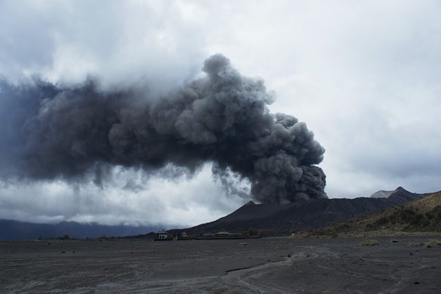
Before the we decided to visit Bromo make sure looking for information on Bromo, because not every time the attractions of bromo in open to the public. Because the status of Bromo mountain status who are still active at the time of the eruption. Mount Bromo tours not open to the public.
After we make sure everything is ready you will get incredible experience when they visit Bromo.
For additional information we provide information about Bromo
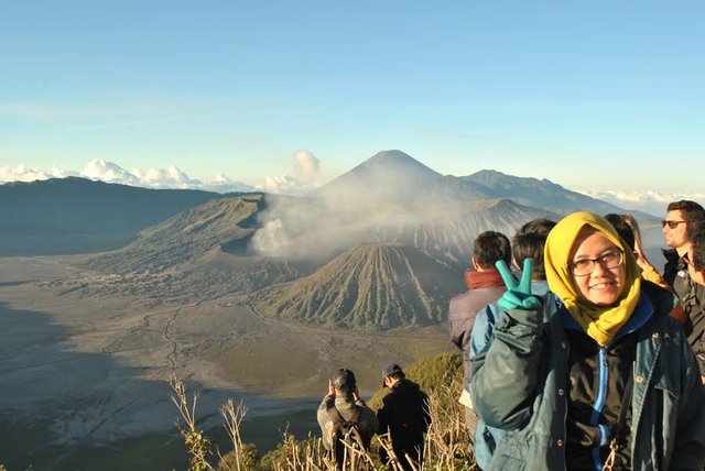
Mount Bromo (from Sanskrit: Brahma, one of the Main Deities in Hinduism), is an active volcano in East Java, Indonesia. This mountain has an altitude of 2,329 meters above sea level and is in four counties, namely Kabupaten Pasuruan Regency Probolinggo, Lumajang and Malang. Mount Bromo is famous as the main tourist attraction in East Java. As a tourist, Bromo to be attractive because of its status as a still active volcano. Mount Bromo is included in the area of the Bromo Tengger Semeru National Park.
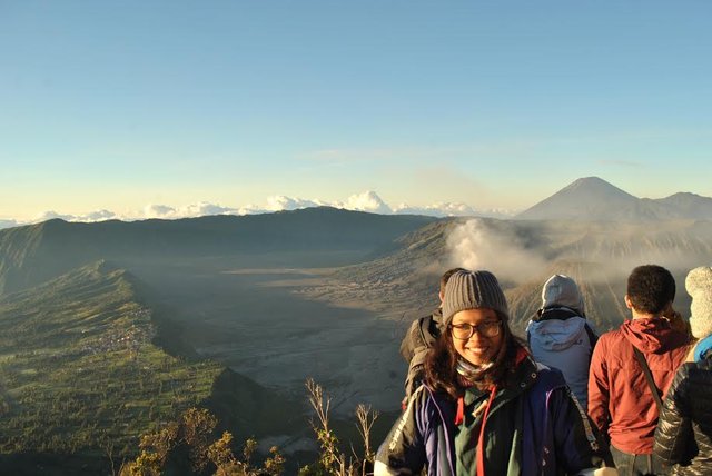
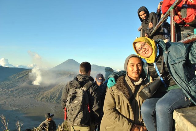
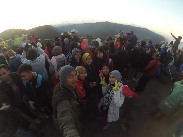
The most beautiful moment is when the wait for Sunrise or you lost moment :)
The shape of the body mount Bromo is intertwined between valleys and Gorges with Caldera or the sea of sand covering an area of about 10 square kilometers.
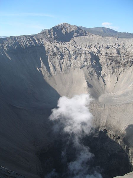
Mount Bromo has a crater with a diameter of approximately 800 metres (North-South) and ± 600 metres (East-West). While the danger area in the form of a circle with a radius of 4 km from the center of the crater of Mount Bromo Bromo., is an active volcano in East Java, Indonesia. This mountain has an altitude of 2,329 meters above sea level and is in four counties.
Height: 2,329 m
Relative height: 586 m
The last eruption: 2016
Province: East Java
Mount Bromo has a crater with a diameter of approximately 800 metres (North-South) and ± 600 metres (East-West). While the danger area in the form of a circle with a radius of 4 km from the Centre of Bromo crater.
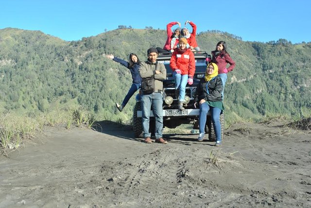
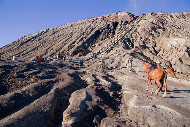
Travel to bromo first through the West from the town of pasuruan that is entered from the village to go to Centre Tosari attractions (sea sand) is quite heavy because the terrain that must be reached could not be traversed by this excellent 4-wheeled vehicles because of the way towards the sea of sand is extremely penanjakan steep, unless we rented a jeep provided by tour manager, so many tourists who walk to the center of the site. But when we go through from the North before entering Probolinggo in Tongas area, we will be heading for the village of cemoro lawang before descending to the sea sand then it is not too heavy because the derivative of lerengnya is not too steep so that the bike can through it. Most of the tourists who want to easily reach the sea of sand passing through this route. But if you want to witness a sunrise that is often shown in the photos, the much-photographed from the top then you'd practically bypassed the West.
But if you have an adventurous spirit then you can try the route less traveled by tourists. Namely, through the town of Malang, you enter through the small town of storeys then enters the town of Pronojiwo Hill will be through the picturesque nature reserve from here you will find a fork in the road where the southward will enter the ranu pane (towards mount semeru) and towards North you enter the sea of sand located on the backs of bromo bromo volcano to the South. The intersection is named Jemplang. The trip starts with a downhill that was then greeted by meadows gradually change into a sea of sand. This path will be circling mount bromo past a sea of sand for about 3 hours. The line is actually not too steep and can be passed on a motorcycle, but requires an adventurous spirit because the path is still rarely passed and none of the stopover or houses. We will really become a very challenging ride. But you'll be rewarded with secret Bromo another, which is very rarely seen tourists, namely the desert ruput savanna and a very broad interest lies behind the mount Bromo. Truly breathtaking views are the opposite on the north side of the arid and dusty. But keep in mind, it's not through this route at night and in foggy weather. The line will not be visible in kondidi like this.
The ocean sand tourism is a mainstay of the Bromo volcano, in the cool mountain nature, we can see the desert and the grass. While most awaited from Mount bromo is sightview when Sunrise and sunset because it will seem obviously and very beautiful. Although travel to Bromo is very dusty, but does not feel, because the beauty of pace is really incredible.
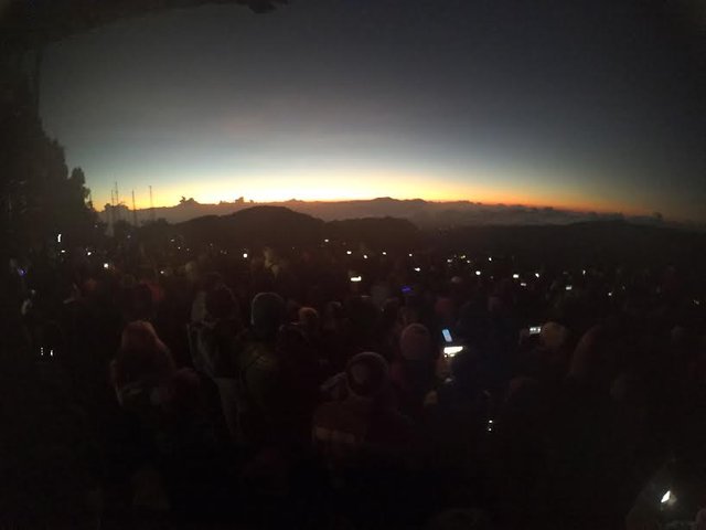
Holidaymakers toward bromo can arguably be practical if you like the type of traveller and through the North door. You can make a visit within a period of 12 hours. of course when you start it from the city of Surabaya, Malang, Jember and surrounding areas. The trip can be started from 11 nights so you'll be up at around 2-3 am. Where you can rest before sunrise. Sellers of food and drink in the area of the sea of sand is usually already go ahead at 3 am, so you can already getting ready to do the climbing of stairs past the peak of the bromo. enjoy views of up to 9 am and you can return to your city of departure at around 12 noon. As a side note, if you travel diareal Ocean sand amid the darkness of the night, as a benchmark toward the parking area around the temple you can see the PIN from the concrete that was deliberately given as a pointer towards the area of the temple. And if you get lost don't panic and proceeded (let alone amid the thick fog), wait because usually start at 2-3 am some cross Charter Horseman diarea sea sand
*Some photos taken using xiaomi yi camera action
don't forget to vote and follow to the next cool articles and who have not read the article before you can read it Here
OK GUYs "don't forget be happy" ^__^
This is amazing, thank you for sharing!
thanks @codydeeds :)
Welcome to steemit, great intro!!
thank you @gringalicious :)
Great intro and beautiful photos, welcome to Steemit! :))
thank you... :)
Nice place & pictures @anitrisnawati
upvoted
thank you @araki :)
Fantastic trip dude... Like your share...
thanks @zulmirita I hope you like and enjoy, wait for my next article ^_^