Underground Manhattan : Old World Rivers & Basement Fishing (Part 1 of 2)
Before Manhattan there was “Mannahatta”... an island of complex waterways, marshes, natural springs and rocky hills. Back in 1811 - the southern edge of New York City was boiling over with health woes and an ever expanding populace. The pressures of 19th century growth forced the city planning commision to develop an aggressive plan that would encompass the whole of old Mannahatta. A massive 2,028 block grid stretched 13.4 miles and took nearly 60 years to complete.
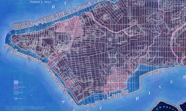
Second Avenue in 1861, city grid in the making (above) “Egbert Viele Map” of Manhattan island in 1865 (below)
Streets were laid quickly to keep pace with the rising buildings surrounding them. The perfection of the grid on paper had proven more difficult to articulate between the cutting and filling of land sometimes upwards of 40 feet and downwards even further. The grid was in conflict with over 20 ponds, 60 miles of streams (sometimes twenty or more feet wide) and over 300 natural springs. Marshes were haphazardly filled-in using local topography. Streets were laid directly on top of soil as it settled and the old land of Mannahatta was quickly being erased.
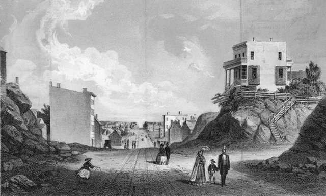
Fifth Avenue in 1894 (above) “Turtle Bay” illustration (below)
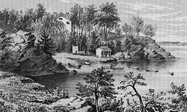
“Turtle Bay” in the Midtown Manhattan was one of these neighborhoods in the throws of such a violent transformation. The east-side Bay became filled in with the land of hills that once defined it, topped with industrial warehouses and informal immigrant housing that ran along the swelling coastline. As this edge became reinforced with hard surfaced development, the interior waterways of Manhattan had fewer access points to empty. Low-lying land, and newly filled blocks became over-saturated, swampy, and dangerously unhealthy. As a result, creeks were forced into a sewer pipe along 49th Street, which then eventually emptied into the East River.
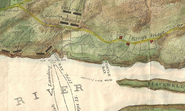
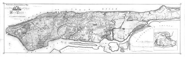
”Bein and Johnson Map” of New York City in 1878 (above) highlighting Turtle Bay.
Gone Fishing... Below 2nd Avenue
In August 1955, two major hurricanes swept across the Northeast United States. First was hurricane Connie, and then Hurricane Diane about one week later.
Over the course of a 10 day period, both storm systems traced a similar route across the Eastern seaboard, causing unprecedented flooding and damage. In New York City, LaGuardia Airport recorded nearly 12 inches of rainfall over a 32-hour period between August 11th and 12th (from the first of the two storms.) Subways flooded and were shut down, ferry services were suspended due to high tides, and nearly a quarter of Manhattan lost power. A storm surge inundated scattered areas along coastal properties, and flooded one particular basement of a supply warehouse on Second Avenue, between 52nd and 53rd street. Jack Gasnick later wrote to the New York Times about his experiences, reminiscing of the storm’s aftermath. When the water of his boiler-room receded, to his surprise he found pieces of an old wine cask, some crawfish and minnows and most surprisingly; “two or three flapping fish.” He discovered an iron grate in his basement, that he pried open to find; “...[a] stream bubbling and pushing about, five feet wide and up on its either side, dark green mossed rocks. The lively riverlet was revealed to us exactly as it must have appeared to a Manhattan Indian many years ago.”
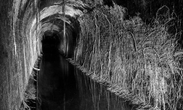
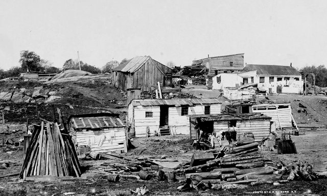
Photograph by Steve Duncan (above)
Gasnick and his brother measured the depth of the river with a plumb-bob and line, finding it to be “over six feet deep.” The size of the stream was enough to test Gasnick’s curiosity a step further, prompting him to set out with a fishing line. “Deep in the basement of an ancient tenement building on Second Avenue in the heart of midtown New York City, I was fishing. Feeling a tug, I hauled up in excitement and there was a carp skipping before me, an almost three-pounder. I was brave enough to have it pan-broiled and buttered in our upstairs kitchen...”
The Gasnick brothers re-discovered a long lost riverbed still alive beneath the concrete of Manhattan. The waterway was once called “Turtle Creek” and flowed along present-day 2nd Avenue. The stream was once nearly twenty feet wide, now channeled or perhaps divided to a quarter of its original size.
Jack Gasnick wrote this letter to the Times editor in August 1971. He did so partially as a complaint of having lost his underground secret only a couple of years after discovering it. His hidden river was drying up… and he pointed the blame towards the “Corning Glass Building at 56th Street and Fifth Avenue.” The 26-story modern glass building was constructed between 1956-1959, the first International-Style skyscraper on 5th Avenue. Now called the “Steuben Building” a building so tall, modern, and out of place it as said to have “burst onto a Depression-era Fifth Avenue like a jet at an airshow of biplanes.”
In the late 1950’s - newer, bigger buildings grew heavier and dug deeper into the old world networks below. Big development in Midtown Manhattan caused the rivers to re-route once again and hundred-year-old fishing spots grew dry...
… stay tuned for Part 2, on Monday. For more musings on architecture, art and history...
Very interesting. Perhaps there are alligators in the sewers!!
Absolutely - the sewer rumors could be true after all! Hah, thanks for reading!
The ninja turtles displaced all the alligators.
Haha, there's a complicated habitat going on here.
Great! Resteemed
Glad you enjoyed reading! Thank you @marcodobrovich !
I'm waiting for the second episode.
I have just published the first in a series of posts on the games we played as children. We called the game "Three, Three, Down, Down!" Did you play it? Have a look and let me know if you like it...
Be tuned!
Thank you! Interesting article on children's games... really interesting to see as they change through the decades. Thanks for sharing!
...I follow you