Let's learn about CLIMATE AROUND THE WORLD
The difference between weather and climate
Both weather and climate describe the temperature, rainfall, cloud cover and winds. Weather describes these conditions over a short time, such as a day or even a few hours. The area described is also small, such as a town or a section of a province. Climate describes the same conditions, but over a longer time, such as a season or a year. Climate describes conditions over a bigger area such as a province, a country or the whole world. In this part, we will look at different climates around the world.
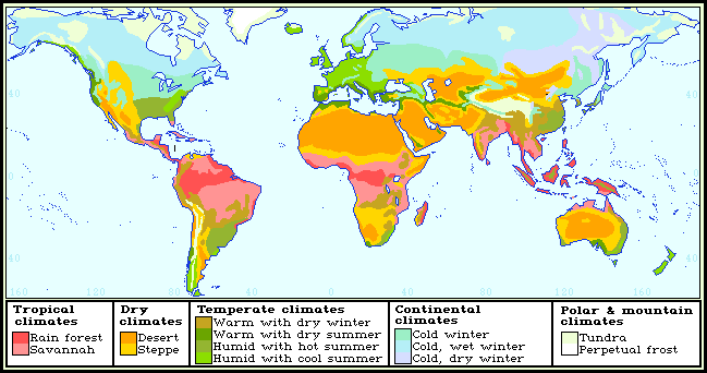
Hot, mild and cold climates of the world
The average temperatures at different seasons tell us whether a region has a hot climate, a mild climate or a cold climate. January and July are the months that fall in the middle of summer and winter. So, we are going to look at the average temperatures for those to months on the maps of the world.
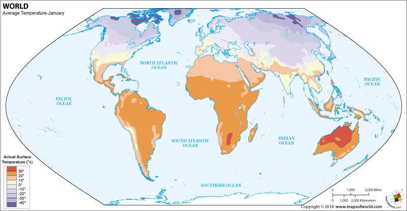
January temperatures
In January, it is summer in the southern hemisphere and winter in the northern hemisphere. So, we find the highest temperature in the southern hemisphere and the lowest temperature in the northern hemisphere. Look at the map:
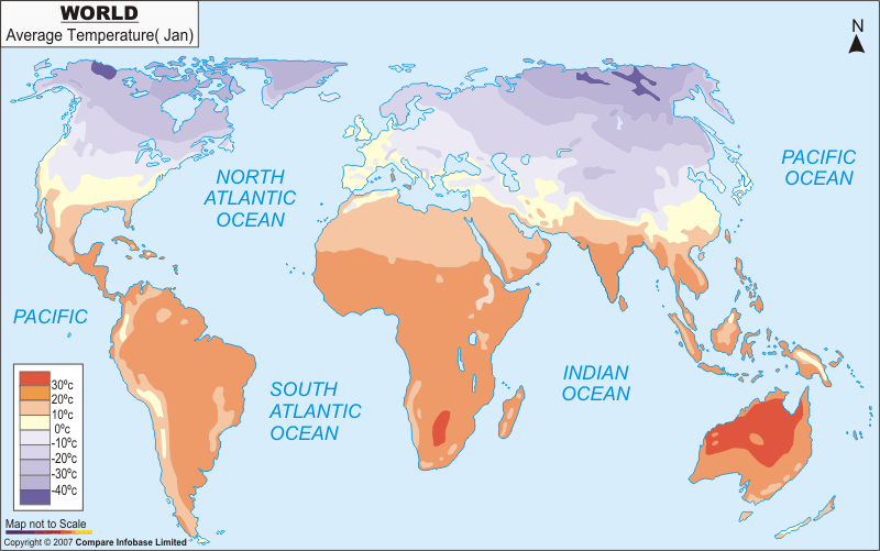
Image source
Look at the key so that you can read the map. Notice the following on the map of January temperatures:
- The highest average temperatures are over 30°C. The northern part of Australia and the middle of Southern Africa have temperatures over 30°C. These regions are having hot summer.
- The lowest average temperatures are under -20°C. The northern part of North America and northern part of Asia have temperatures under -20°C. These regions are having a very cold winter.
July temperatures
In, July it is winter in the southern hemisphere and summer in the northern hemisphere. So, we find the highest temperature in the northern hemisphere and the lowest temperature in the southern hemisphere. Look at the map.
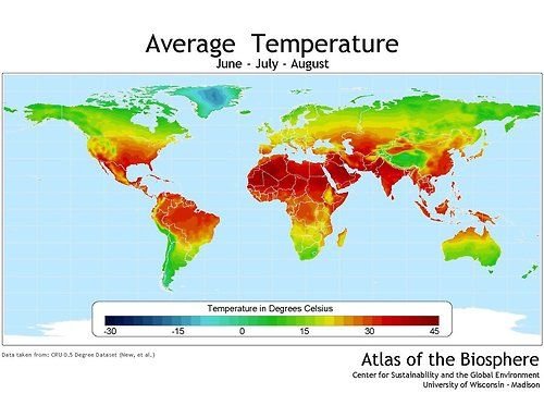
Image source
Activity:
Read the world map showing average July temperatures
- What is the highest temperature shown on the map?
- Name a part of the world that has:
A very hot summer in July.
A warm summer in July.
A mild winter in July.
A cool summer in July. - Which continent, not shown on this map, has very low temperatures in July?
Wet and dry areas of the world
Look at the map below, which shows the average annual rainfall throughout the world.
![]()
Image source
The annual rainfall means the total amount of rain that falls in a year. Rainfall is measured in millimetres (mm). Look at the key to the map.
Notice the following on this map:
- Most of the wettest areas of the world are between the lines of latitude are called the Tropic of Cancer (latitude 23,5°N) and the Tropic of Capricorn (latitude 23,5°S). These regions are also the hottest parts of the world.
- Some of the driest parts of the world are the hot deserts- for example the Sahara in North Africa.
- The very cold regions of the world are also dry.
Activity:
Read the map of the rainfall
- Around which line of Latitude is the world’s wettest region?
- How much rain does this region receive in one year?
- How much rain does the world’s driest region receive in a year?
- Look at the very cold regions of the world on the temperature maps. Are the coldest parts of the world dry or wet?
Bibliography & Extra reading:
- Winter
- Climate
- Season
- National geographic society
- Temperate climate
- Continental climate
- Earth, seasons, climate
- E classroom geography
- Tropics
- Tropic of Cancer
- Equator and tropics
- Climates of the tropic

Terimakasih atas ilmunya
Jangan lupa vote saya