What is a GIS Technician?
Following up on my previous post https://steemit.com/introduceyourself/@lizelle/hi-steemit-this-is-lizelle-from-laid-back-city-of-durban, I was asked a question about what a GIS Technician is, by @geechidan, this briefly is my explanation and experience of doing this job at a local government organisation:
I started my career working as a draughtsperson for Land Surveyors, and later went on to become a GIS Technician at Ethekwini Municipality, retired in 2016 and now run the beautiful Lily's Cottage Durban West, http://www.lilyscottage.co.za.
Briefly, dependent on the industry, it entails electronic capturing and maintenance of geographical features and storing it into a database; be it property boundaries, electricity, water, roads, sewer/ water/ oil/ pipelines, aerial photography, educational institutions, restaurants, hotels, and many many more, the list is endless!
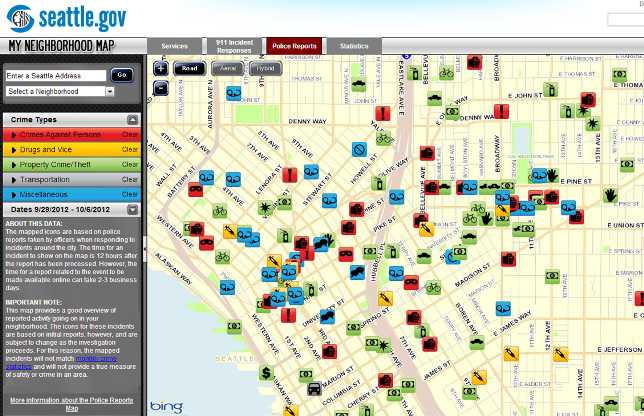
The GIS Technician can create maps electronically from this data, as well as do data analysis. One example is crime mapping, which is an excellent tool for policing as they can pinpoint areas they need to focus on.
Image from www.epcupdates.org

GIS is an excellent tool for business decisions as well, as all the data captured has attributes such as demographics, which for example can assist in determining a viable site for a restaurant or hotel. Vital for regional planning, engineering, conservation projects and more.
Check out for more on the following link:
https://en.wikipedia.org/wiki/Geographic_information_system
Hope you enjoyed this brief insight and perhaps some of you already are in the industry and can add your insights?
My farewell at Ethekwini Municipality GIS Department
So now I also know what you did your entire career, never knew ;)
:)