MOUNTAIN TRAINING - ULTIMATE NAVIGATION PART 2: BACKYARD NAVIGATION
LEARN HANDY SKILLS RIGHT OUTSIDE YOUR DOOR IN PART 2 OF OUR NEW SERIES. LEARN NAVIGATION
BECOME A JEDI IN THE NEW STEEMIT Hill SKILLS GUIDE......
"In Part 1 you recive some navigation tips and tools that you can try in the comfort of your own home or office."
Now, we’re taking you outside, all the way to… your garden! Here is a trio of techniques that you can learn in your own outdoor space before taking them to the hills to put into practice."
FINDING NORTH USING A SHADOW
Rarely – in fact only in an emergency when all your other nav kit has died – are you going to use this technique; but (a) it is fun to do, and (b) it aids understanding of the sun’s movements – important when you come to learn other aspects of natural navigation.
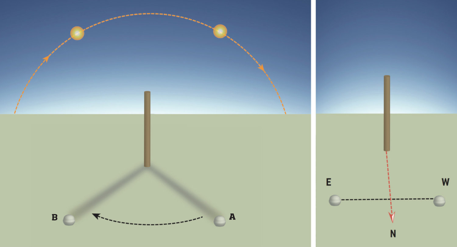
The sun always moves from east to west, in both hemispheres, so shadows always move from west to east in both hemispheres. Thus, if you mark the position of a shadow, it will always be west of any subsequent marks.
- Place a stick, walking pole etc. (a minimum of 1m in length) into the ground.
- Mark the tip of its shadow (A). Wait at least 20 minutes.
- Mark the new tip of its shadow (B).
- Draw a line connecting these marks. This runs west to east, so you can now work out where north is.
This is a relatively accurate method (±12°) that is best performed within 2 hours of when the sun reaches its maximum altitude (noon, so around lunchtime) and the shadow is at its shortest.
An even more accurate way (±6°) is to measure the shadow cast sometime before the sun is highest and the shadow shortest. Mark this spot. Wait until the shadow reaches the same length again (this may take some hours) and mark this second spot. A line from the first mark to the second will run more closely west-east.
USING AIRCRAFT FLIGHT PATHS AND CONTRAILS
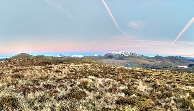
Commercial aircraft fly along designated ‘air corridors’ that connect one location to another at a specified altitude. You can easily identify commercial aircraft flying overhead with your naked eye (or with binoculars); the exhaust from their engines creates long artificial clouds of condensed water vapour, known as ‘contrails’.
These contrails remain observable for anything from a few seconds or minutes to many hours, depending on atmospheric conditions, and they can be used to determine direction. Prior to embarking upon your journey, check which flight paths exist for commercial aircraft in the area. You can find these on websites such as www.flightradar24.com
In this screen shot you can see that in the selected area, these corridors run in the direction of NNW-SSE across the Lake District. Knowing this, you can use the contrails to determine the other cardinal points of the compass. (Note that military aircraft do not use these corridors and tend to fly lower than commercial aircraft.)
USING THE PREVAILING WIND
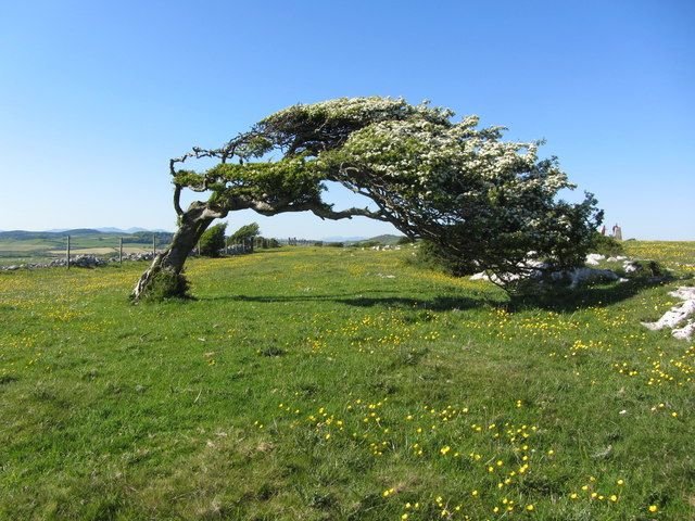
Although wind direction can change throughout the day, you can usually find permanent signs that indicate the prevailing wind’s direction – for example, trees and shrubs whose branches are bent to shape by the directional wind.
In the UK these tree and bushes lean eastwards, as the prevailing wind comes from the west. Knowing which direction they lean in can help you determine the other cardinal points of the compass. In other parts of the world you may need to first establish which way the prevailing winds blow and if they are seasonal. This can be found easily from many sources, ranging from meteorological internet sites to local farmers!
MOUNTAIN TRAINING - ULTIMATE NAVIGATION CLICK HERE PART 1: ARMCHAIR NAVIGATION


Found it very useful! Thanks for sharing and keep the good work!
This is extremely useful, Thank you for sharing Matthew.
I can't say I've ever seen a tree quite like that. Very interesting post. And dont worry about Cheetah giving you flack for quoting your own article. Happens all the time -- Glad to see you on Steemit :)
I find it very interesting navigation is a skill particularly in low visibility, thank you for the comment ))