An International Spotlight : How Maps Formed The Modern Centralized State System
I co-wrote this spotlight with my boyfriend, Victor Lucas. He graduated in December 2015 from American University with a BA in International Studies. He had a regional focus on Asia and a specialty in Environmental Sustainability and Global Health. He also studied abroad at National Chengchi University in Taiwan. I just completed my degree requirements at American University in July with a BA in International Studies. I had a regional focus on Latin America and a specialty in Global Inequality and Development. I studied abroad at University of Auckland in New Zealand and at Universidad Adolfo Ibanez in Chile.
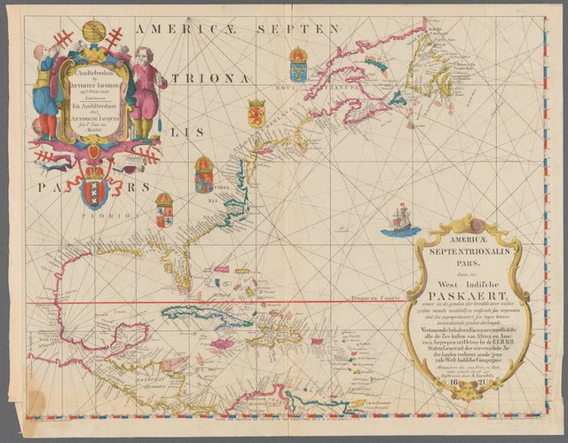
We source all of our images from public domain image resources, such as those in this list: https://en.wikipedia.org/wiki/Wikipedia:Public_domain_image_resources
An International Spotlight :
How Maps Formed The Modern Centralized State System
It sounds absolutely far-fetched, doesn't it?
"Maps were the driving force behind the creation of the modern state."
Ludicrous. But maybe by the end of this article, you'll arrive at the same conclusion as myself and numerous well-respected political science and international relations theorists. The argument is this:
The development of new mapping technologies in early modern Europe (ie. starting in the 15th century) changed the way that political actors thought about things like political space, organization, and authority, and as a result shaped the international system functioned. More specifically, mapping led to the birth of three key characteristics of the modern system: the creation of central governments with total sovereignty, the creation of borders , and the elimination of all non-state actors.
So in order to make this argument we have to:
- Define the modern international system and
- Show how changes in cartography directly led to the creation of that system
Background: The Modern International System
The modern international system is based on the following three characteristics (there are more, but these are the relative ones for the argument):
- Each state has total sovereignty
- Each state has territorial boundaries
- All states are nominally equal
What this means is that within the internationally agreed upon borders of the United States of America, the government of the United States has absolute control over what happens within those borders. Kenya can't decide that it doesn't like the way that the United States is running things within the borders of the United States, and force it to change. In that way, all states are sovereign within their own boundaries, and no state can force another state to change the way it functions. (At least not through the institution of the international system. This is, of course, not how it always practically plays out.)
What Preceded this System?

Before the 16th century, power was highly decentralized in a feudal system. Power was divided between the Church, royalty, and nobility whose authority's frequently overlapped with one another. For example, the Pope was the head of all Christendom, and thus had legal rights over all Christian kingdoms. Simultaneously, the King of France had authority over the lords who had given him their fealty. And even at the same time as these two other authorities, individual lords frequently had authority over other lesser actors that the King had no direct control over. All of these authorities could clash and overlap.
How Maps Caused a Shift from the Feudal System to the Modern State System
Fast forward to the modern system and, as I mentioned above, there are autonomous, centralized powers that have full authority over all players within their boundaries, and (nominally at least) no authority over those outside them. This happened as a result of the following three stages:
1) There was a revolution in cartographic understanding and methodology due to:
- The advent of Ptolemaic mapping, caused by the translation of Ptolemy's Geography into Latin in the 15th century. This caused mapmakers to start using the graticule (ie. latitude and latitude). Previously, maps had taken a variety of forms such as Mappae Mundi, itinerary maps, and portolan charts. Ill cover those in more depth in a post tomorrow.
- The creation of the printing press lead to the explosion of map production, changing it from something limited exclusively to the rich to something that was accessible to the masses. The number of maps in circulation changed from a few thousand maps in circulation before 1470 to millions in the sixteenth century.
- Commercial pressures led to the habit of mapmakers using color to fill in blocks of spaces on maps (as this added value to the maps)....even when this did not do justice to the complexity of the situation on the ground.
2) Those in positions of authority began to think about the world in terms of territorially delineated areas of control.
- The way that mapmakers filled in maps with blocks of color led to political elites seeing the world in terms of blocks of territorial authority, as opposed to feudal ideas of individual allegiance.
- This new form of maps further made territorial goals imaginable and appealing. Prior to the 15th century, full and sovereign control over an area with borders was just not conceivable.
- This new way of thinking about power drove out all non-territorial powers (such as the Church or conflicting oaths of fealty) because they undermined the idea of total authority over an area. States started to play the "mutual recognition game" where they would acknowledge one another's authority and refuse to acknowledge that of other types of actors.

3) The birth of the modern state system.
- The exclusively territorial basis for authority was completely consolidated by the early 19th century, more specifically directly following the Napoleonic wars. At the Congress of Vienna (convened to settle lasting grievances from the Napoleonic wars), all actors were defined in terms of centralized and territorial sovereign powers.

Conclusion
The rise of Ptolemaic mapping that coincided with the birth of the printing press led to the wide distribution of maps that depicted states as centralized, sovereign, and territorial powers. This led to a change in the way that those in power conceived, as well as were able to imagine, how the power structure existed. This further influenced the goals that those in power had, as well as the way that they interacted with one another. Over a period of some 3 centuries, this then led to the birth of the modern state system as fully formed by the end of the Napoleonic wars.

Source
This article was inspired by and draws upon the article "Mapping the Sovereign State: Technology, Authority, and System Change" by Jordan Branch, published in the journal International Organizations in January, 2011.
there is surely a correlation between the mapping change way and the birth of modern state, but you can't say it is the cause. Rather, there are lot of factors which lead to the modern world, and mapping is just one of them.
So the hypothesis is that a new mode of visualisation reframed people's abstract concepts of statehood and nationality? That is both amazing and could also be seen as being quite strange even disturbing.
I suppose there is now way to actually be 100% sure (as with most things in history). I think an analogue of this would be the way that perception of an issue or problem can be influenced by the language used to describe it.
The modality is different but the principle is somewhat similar.
It is incredible how malleable our minds our to such kinds of influence.
Good work to find on Steemit, thank you for sharing your thoughts and views on the matter. Namaste :)
good post @anwenbaumeister ! 8]
Quite interesting....
This is fascinating. I've been researching and writing about the decentralized nature of feudal medieval Ireland, in contrast with the much more centralized English crown. Thank you for this - great info, and perfectly suited to what I'm studying right now!
I Like it, Love it , Upvote it
✅✅✅👍👍👍
I would have liked to make a small reference copernico as a great influence on the world cartographic
Great post. Didn't realize you studied in Auckland, very cool:)