Where Eagles Fly : Taos to Winslow ~ All 5 Parts in 1 Post For You To Binge Read!
This is complete 5 post series based on an aerial exploration from Taos, New Mexico, across the desert to Winslow, Arizona across some very interesting and unusual wilderness. This version combines all 5 posts into 1 for binge reading.
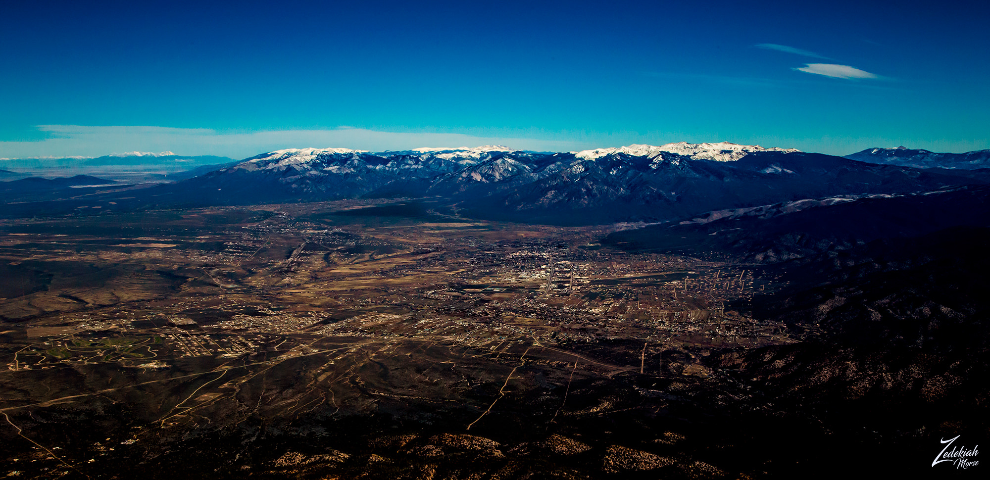 Taos, New Mexico from above ~ Click to Enlarge
There are many things to consider in flying these expeditions across the remote back country wilderness. I want to show you how this is accomplished so that you can get a sense of the planning and the various factors which must be considered for a safe and successful journey.
I landed in Taos, New Mexico after flying north from Albuquerque while being chased by a storm! But I got on the ground in Taos and got the airplane secured before the rain hit hard. After getting a car into town for food and a motel room, I prepared for the next leg of my flight early the next morning. There was much to consider.
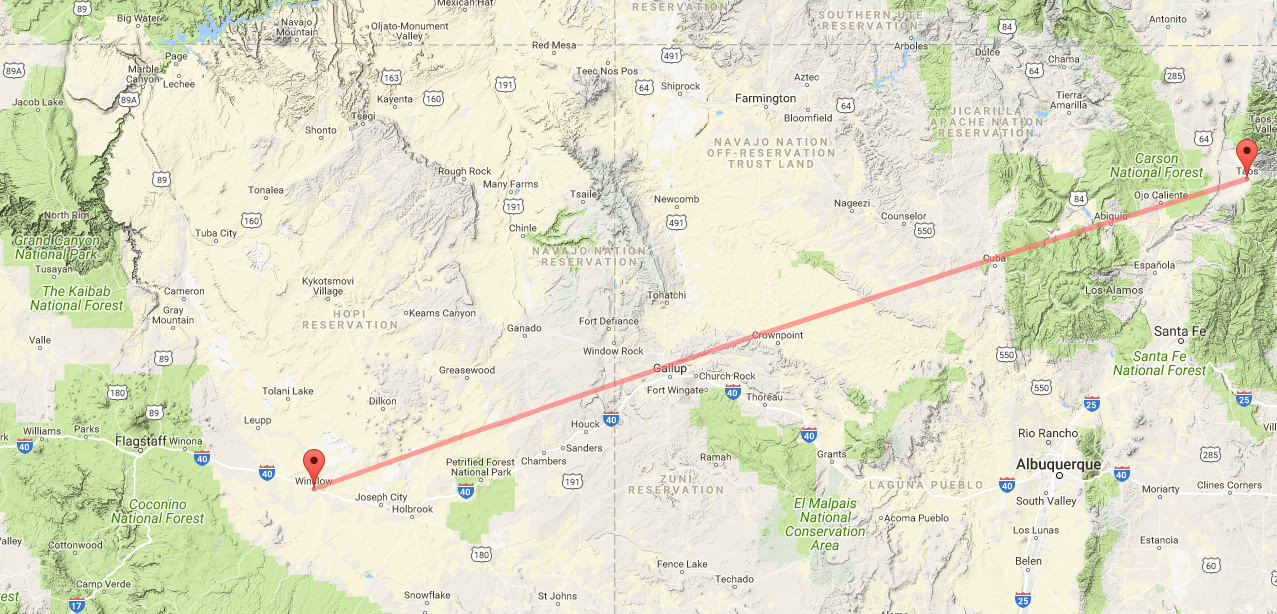 Taos to Winslow as the Crow Flies ~ Click to enlarge
Flight Planning
I consult the FAA sectional maps for the route and compare that with topographic maps to identify anything interesting I might want to shoot. Once I determine my flight route I am ready to do the flight planning.
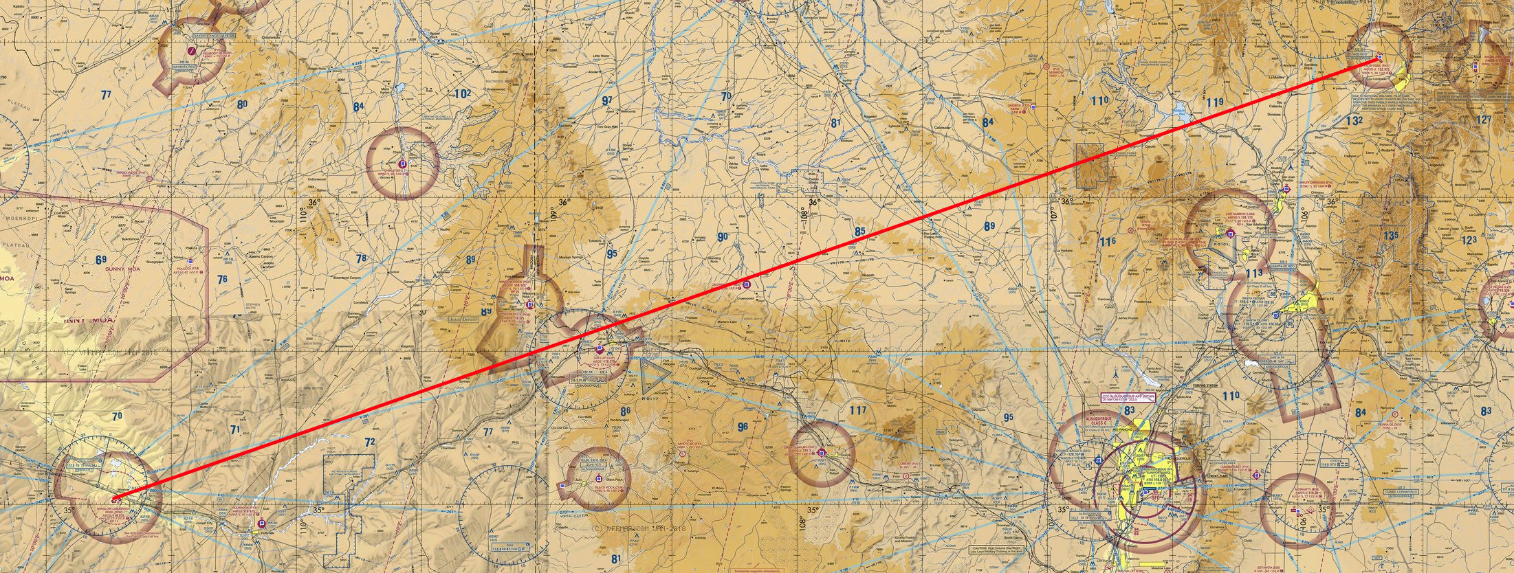 FAA Sectional Map of Flight Route
This flight is a distance of 303 miles as the crow flies. I will be climbing up and down in altitude as I cross over the different mountains and valleys on this journey so I need to figure my potential flight time to distance. Many things that must be factored in but for this post I have simplified this a great deal:
- First I check the weather forecast for conditions along the route for the time I am planning on flying. The forecast called for “severe clear” conditions with variable light to strong westerly winds along the way and at the different altitudes I was planning on flying at. This means clear visibility for miles but the wind could create issues with filming. Getting violently bounced around is always difficult when you are trying to focus for the shot and fly the airplane!
- Second I did a flight fuel/time calculation. The ground altitude in the departure location is 7,800 ft (2,377 m) and 5,000 ft (1,524 m) at my arrival location. To be able to spot interesting things below on the ground I will fly at least 2,000 ft (609 m) to 4,000 ft (1,219 m) above ground level (AGL), depending on the terrain and what I find along the way. This means I will fly between 10,000 ft (3,048 m) to 7,000 ft (2,133 m).
- Based on the known flight performance characteristics of my bush plane this means my fuel burn rate will vary with altitude from 7.1 gallons per hour at 5,000 ft (1,524 m), to 6.1 gallon per hour at 10,000 ft (3,048 m) if I maintain a prop speed of 2,500 rpm with no head or cross wind. The forecast called for variable wind along the route so the safest calculation would be a very conservative 4 hours flight time.
- This has to be factored with flight (FAR) rules that state you must land at your destination airport with at least 30 minutes of fuel on board in case the airport runway is fouled and you cannot land or fuel is unavailable and you would need to continue on to another airport. So if we take away 30 minutes that leaves us with 3.5 hours of flight time.
- The Bluebird (my bush plane) can fly an average speed of 120 miles per hour and the distance is 303 miles which translates to 2.5 hours of travel time, depending on the wind of course. This means I could possibly have about an hour of loiter time to circle locations when I find something interesting I want to photograph. Sometimes I need make a number of passes around the location at various altitudes to find the shot.
- Based on the known flight performance characteristics of my bush plane this means my fuel burn rate will vary with altitude from 7.1 gallons per hour at 5,000 ft (1,524 m), to 6.1 gallon per hour at 10,000 ft (3,048 m) if I maintain a prop speed of 2,500 rpm with no head or cross wind. The forecast called for variable wind along the route so the safest calculation would be a very conservative 4 hours flight time.
- The last thing to consider is actually really the very first pre-flight thing to do when planning these exploration flights and could be the most important. I prepare my survival gear. I carry a hefty kit which contains food, water, emergency communication and tracking equipment, camping gear, flares, weapons and first aid medical supplies. Also in my flight pants (lots of pockets) I have smaller versions of the larger kit. You never know so it is always better to be prepared.
The Journey Begins
After a good nights sleep I awoke at 4 a.m. and got to the airport at 5 and then proceeded to do my preflight inspection on the aircraft before taking off. Getting airborne at dawn I climbed to 9,500 and headed south across the Rio Grande River and headed towards the Abiquiu Reservoir and where the Rio Chama River enters the Cańon De Chama.
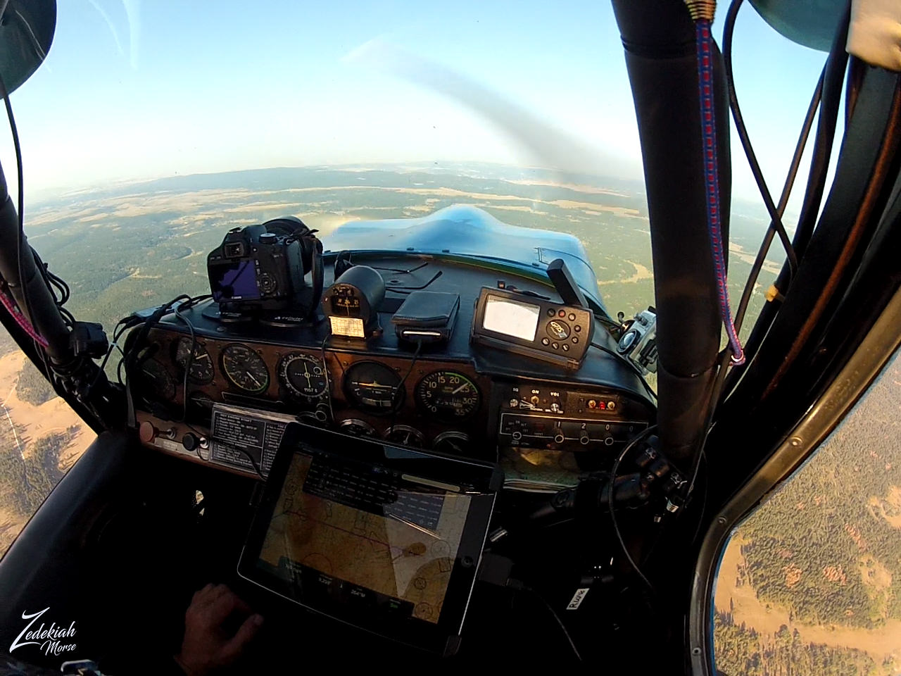 My Cockpit of the Bluebird in Flight ~ Click to Enlarge
As I reached the Abiquiu Reservoir, off to my right I noticed a very white capped protuberance on the side of the otherwise reddish and amber-brown cliffs that rimmed the lake below. This white capped mountain is known nowadays as Kitchen Mesa but the the First Nations Tewa Tribes people of San Juan Pueblo call the place "T'ibuhu'u", which is described as a low, round place they would use for their winter dances. But the Spanish settlers called the place "Piedra Lumbre" (Spanish for "Shining Rock").
 Kitchen Mesa and Ghost Ranch ~ Click to Enlarge
The Ghost Ranch
At the bottom of this white capped mountain lies a really cool historical place called the "Ghost Ranch". This is a beautiful and remote 21,000-acre (85 km2) retreat and education center which has been a source of inspiration for many artists but in particular Georgia O'Keeffe, who maintained a home and studio here, as well it was the main subject of many of her paintings.
And though this is a wonderfully peaceful place now, its origins are rather violent. The canyon was first inhabited by the Archuleta Brothers, cattle rustlers who enjoyed the coverage and invisibility that the canyon provided as well as their ability to see for miles down the valley. They created two jacal homes and would move stolen cattle throughout the night to Box Canyon. By transporting the cattle through streams, footprints would be lost and they could not be tracked. Stories of people staying with the Archuleta brothers who had gone missing (and their clothing on the men) circulated around the area.
One day one of the brothers made a transaction without the other, and claimed he had buried the gold for safety. The second brother killed him, and kept his wife and daughter hostage until they admitted to knowing where the gold was hidden. Although the mother and daughter feared the rumored spirits of the canyon, they mustered up the courage to sneak away at night through the Chama Valley. A group of local men then came to the ranch, fighting through their fear, and hung the remaining brother and his gang from a cottonwood tree that still stands next to one of the casitas on the property. Other visitors who stayed in the casita later on noted that they could hear voices of a man and a woman fighting.
(Research Source)
Chama River Canyon Wilderness
 Cańon De Chama and the Rio Chama ~ Click to Enlarge
Chama Canyon or rather Cańon De Chama is an ancient place, used by First Nations Tribes for nearly 10,000 years, from the time period when camels and wooly mammoths roamed the southwestern United States. Running down the bottom of this wide canyon is the Rio Chama. At 130 miles (210 km) long, this river is a major tributary of the Rio Grande.
Chama River Canyon Wilderness is a relatively small 50,300 acre (20,356 ha) protected wilderness area that exists along the river in the bottom left area of the photo above. This river is a well known river rafting, canoeing and kayaking.
(Research Source)
This timeworn valley is home to dense stands of ponderosa pine, douglas-fir, pinyon, juniper, mountain-mahogany, gambel oak and serviceberry. The riparian area also includes cottonwoods, box elder, willows, hackberry and numerous shrubs that are indigenous to north-central New Mexico.
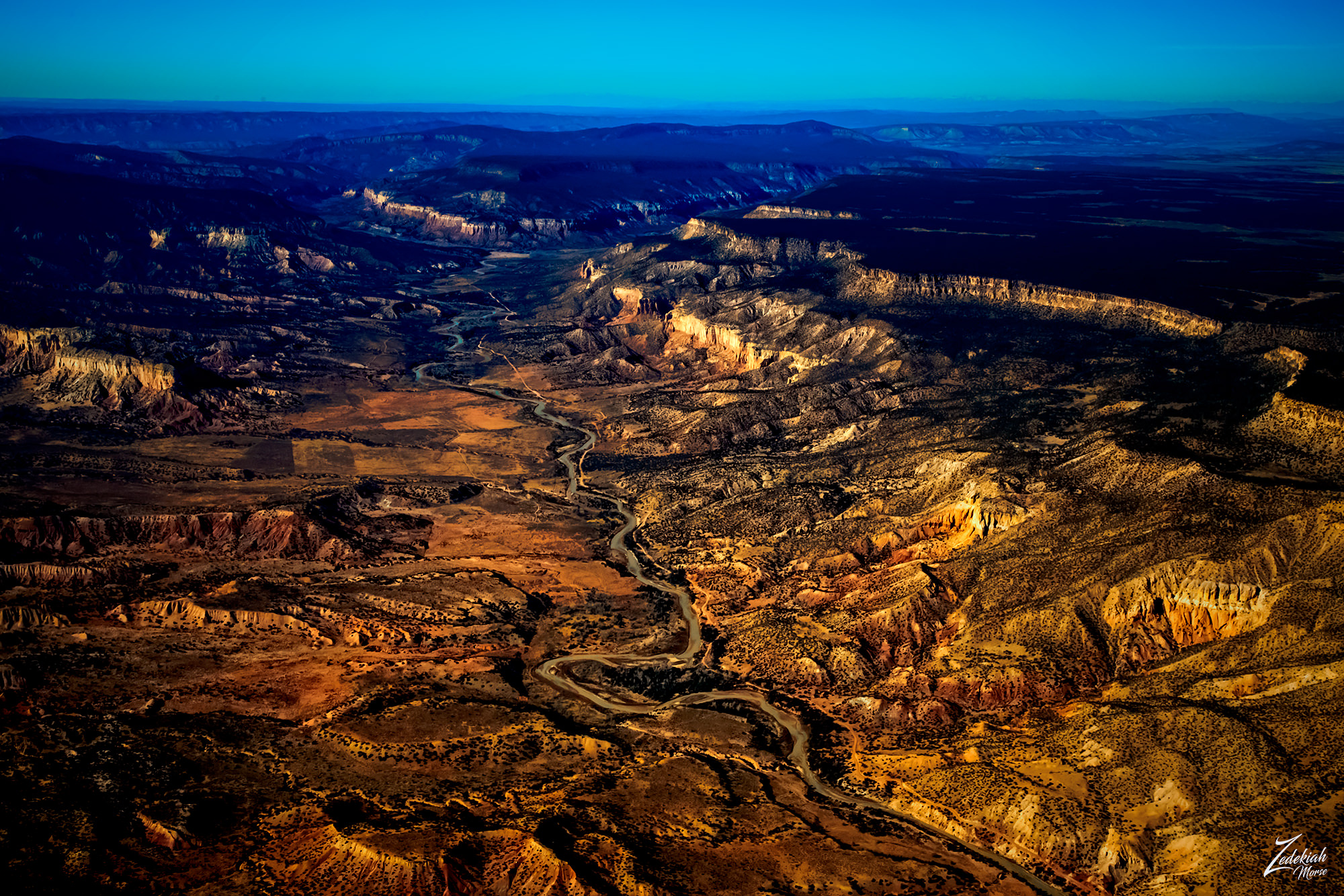
 Rio Chama & Rio Gallina at Mesa Golondrina ~ Click to Enlarge
This foreboding place is called Mesa De Los Viejos (Plateau of the Old Ones) on the right side of the image while the Rio Chama (river) runs along the bottom of the canyon and forks into the Rio Gallina at the base of Golondrina Mesa (here in the middle of the image).
It is teeming with an impressive variety of wildlife including cougars, black bears, elk, mule deer, badgers, bobcats, coyotes, beavers and raccoons. The sky is full of ducks, dippers, spotted sandpipers, Canada geese, turkey, golden eagles, bald eagles, falcons, hawks, owls and the ever present turkey vultures.
The river is full of brown and rainbow trout, flathead chub, flathead minnows, white suckers, carp, channel catfish, black crappie and longnose dace.... to name a few... also rattlesnakes are found in the adjacent mountain valleys and canyons.
(Research Source)
Gallina Monocline
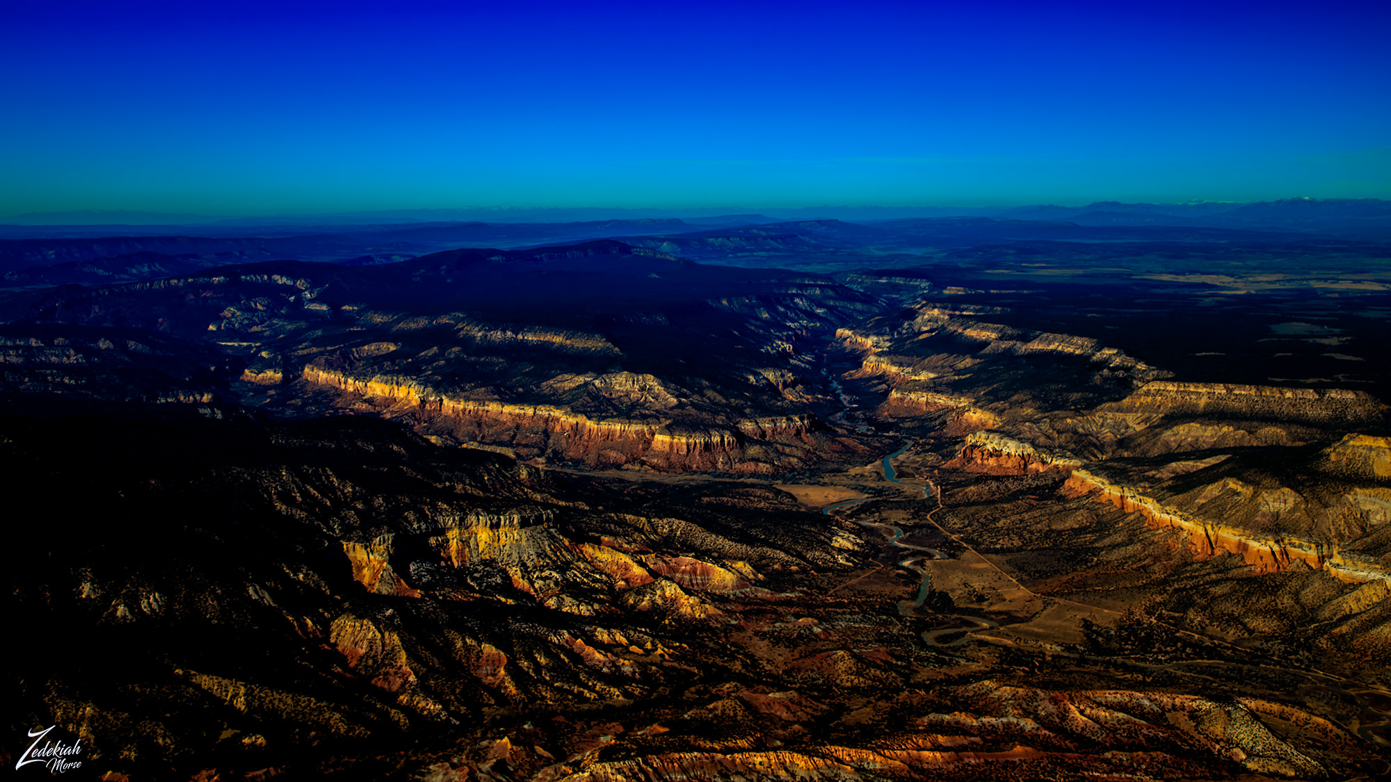
Flying southwesterly I crossed the ridge from Chama River Canyon and followed the Rio Gallina as it crossed Capulin Mesa. Here was a dramatically lifted ridge line, rising sharply up out of the canyon floor. This long, partitioned and solitary monocline ran for miles up through the canyon.
 Rio Gallina & Monocline ~ Click to Enlarge
The Ancient Anasazi Gallina People
Reaching back across thousands of years the Rio Gallina was home to the Gallina or Largo-Gallina culture was an occupation sequence during the pre-Hispanic period in the American Southwest/ As members of the Ancient Anasazi Ancestral Puebloans people they thrived from approximately 1050 to 1300.
No one knows exactly what happened to them, however their few remains tell a dark tale;
Almost every Gallina skeleton ever found has been that of someone murdered. Broken necks are the most common and the skeletons rarely appear to have been buried. Also commonly found has been remains of Gallina who were murdered, thrown into their homes, and then had the homes burned. Some of the skeletons of the murder victims have been found in the towers. The debate is ongoing for the cause of these murders. Genocide has been considered, and so has internecine war.
(Research Source)
The following diagram illustrates my relative flight path and position to the subject matter for the 1st, 2nd and 3rd photo above. This shows how I deviate from my straight flight path to "follow the shot" when I see something that interests me. This is the reason why it is crucial to do proper flight planning so that you can allow for time to explore areas of interest.
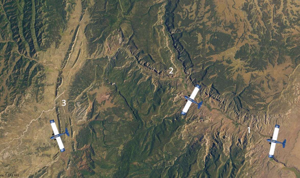 Flight Path Illustration Showing Route Deviation ~ Click to Enlarge
As I flew westward the run continued to rise behind me while in front of me across the misty horizon, I could now make out the looming monadnock shapes around Huerfano Mountain. A Most Sacred Place.
 Huerfana Mountain on the Horizon ~ Click to Enlarge
Huerfano Mountain
Huerfano Mountain climbs to 7,441 feet (2,268.02 meters) above sea level and is one of the most sacred traditional sites to the First Nations Diné (Navajo) Tribe. They call the mountain "Dzil Na’oodilii " and it is said to be suspended from the sky with sunbeams.
Dzil Na’oodilii is considered to be the “lungs” of Diné country. This sacred mountain is the home of Yódí’ashkii (Goods of Value Boy), and Yódí’at’ééd (Goods of Value Girl), and one of the homes of ‘Altsé Hastiin (First Man), and ‘Altsé ‘Asdzáá (First Woman). In the beginning DzilNa’oodilii was decorated with pollen, rugs, hides, cloth, and Male Rain for the coming of a Special Child (Changing Woman)
(Research Source)
 Huerfano Mountains & Jacarilla Tribal Lands ~ Click to Enlarge
Jicarilla Apache Lands
The tribal name of "Jicarilla", pronounced "heek-ah-REE-yah", comes from Mexican Spanish meaning "little basket" meaning "People who make little baskets". However the surrounding fellow Apache bands; Mescalero and Lipan called them "Kinya-Inde" meaning "People who live in fixed houses".
The Jicarilla reffered to themselves as "Haisndayin" translated as "People who came from below", because they believed they are the sole descendants of the very first people, who emerged from the underworld, which they see as the Original Abode (home) of Ancestral Man and Ancestral Woman who produced the first people on the earth. They call this reservation you see in the first and second photos "Dachizhozhin".
These are incredibly hardy people to live in such a seemingly harsh environment, but they learned about farming and pottery from the Puebloan peoples and also learned how to survive on the plains from the Plains Indians which provided sustenance via a rich and varied diet. They planted along the rivers, a variety of crops, sometimes using irrigation to aid in growing squash, beans, pumpkins, melons, peas, wheat, and corn. They found farming in the mountains safer than on the open plains. They primarily hunted buffalo, antelope, deer, mountain sheep, elk, and buffalo. From the wild, women gathered berries, agave, honey, onions, potatoes, nuts and seeds.
(Research Source)
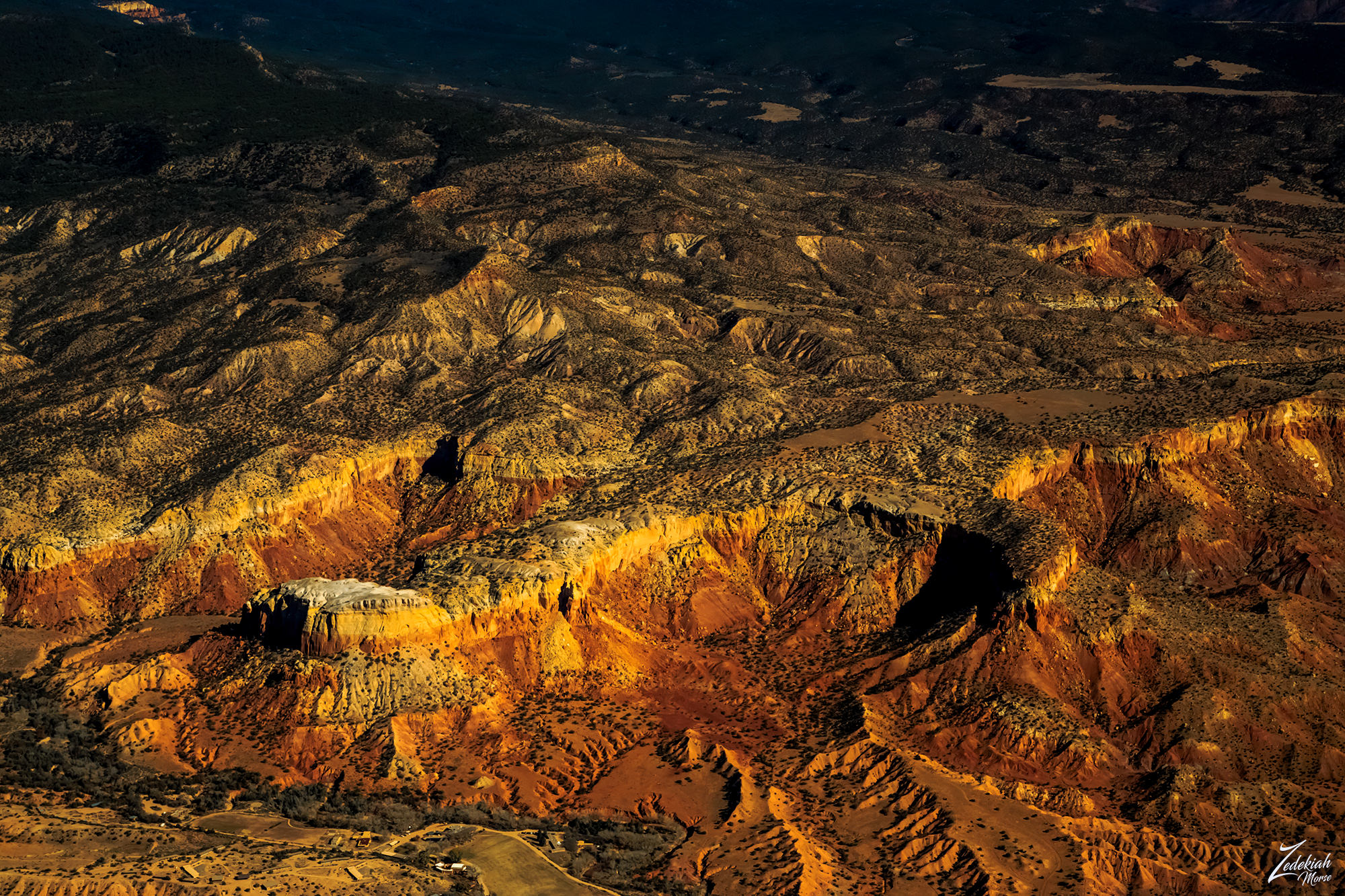
 Badland Hills of the Jicarillo Reservation ~ Click to Enlarge
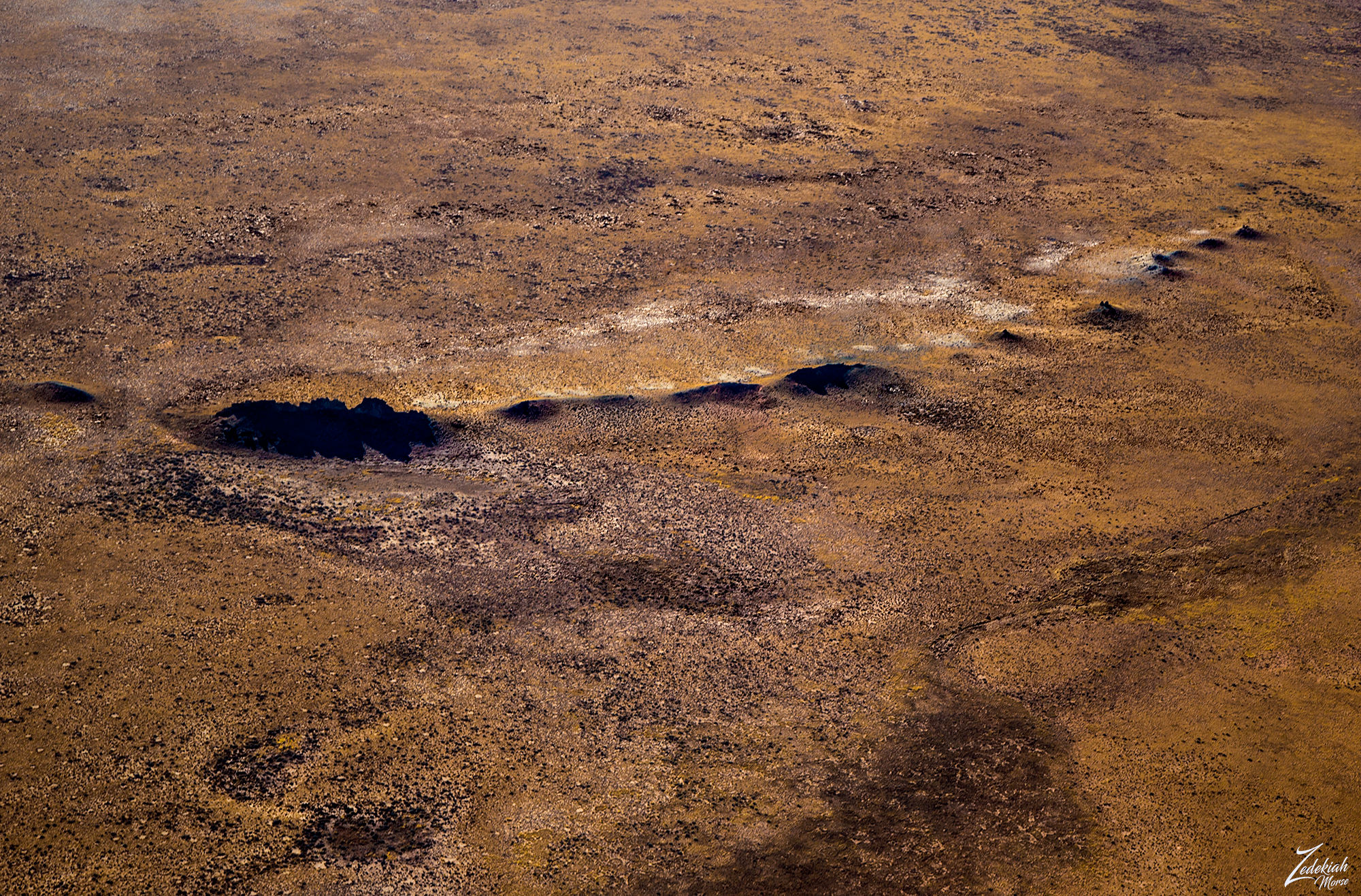
I continued flying westward over the reservation lands and across Cańon Largo and over Sisnathyel Mesa. It was here that I spotted some very odd "bubble" formations all clumped together at the bottom of the sloped ridge of the western part of Sisnathyel Mesa.
This place was so small it barely shows up on a map and has no name. Go here to see a Google Map location and zoom out just and bit and it easily vanishes on the map. That is one of the advantages of exploring via bush plane in these remote areas. It is easy to spot these interesting geological anomalies.
 Sisnathyel Mesa Outcrop ~ Click to Enlarge
There are some very interesting geological processes going on here. The black material is deeply carved and smoothed by long term erosion of a much higher layer, of which you can still see remnants on top. Oddly, the black strata itself is laying on top of multiple layers as you can see on the right side of the formation. One could surmise that this is an exposed piece of a very old volcanic layer which covers the Sisnathyel Mesa above and surrounding this formation. Whatever it is, it looks pretty otherworldly from above.
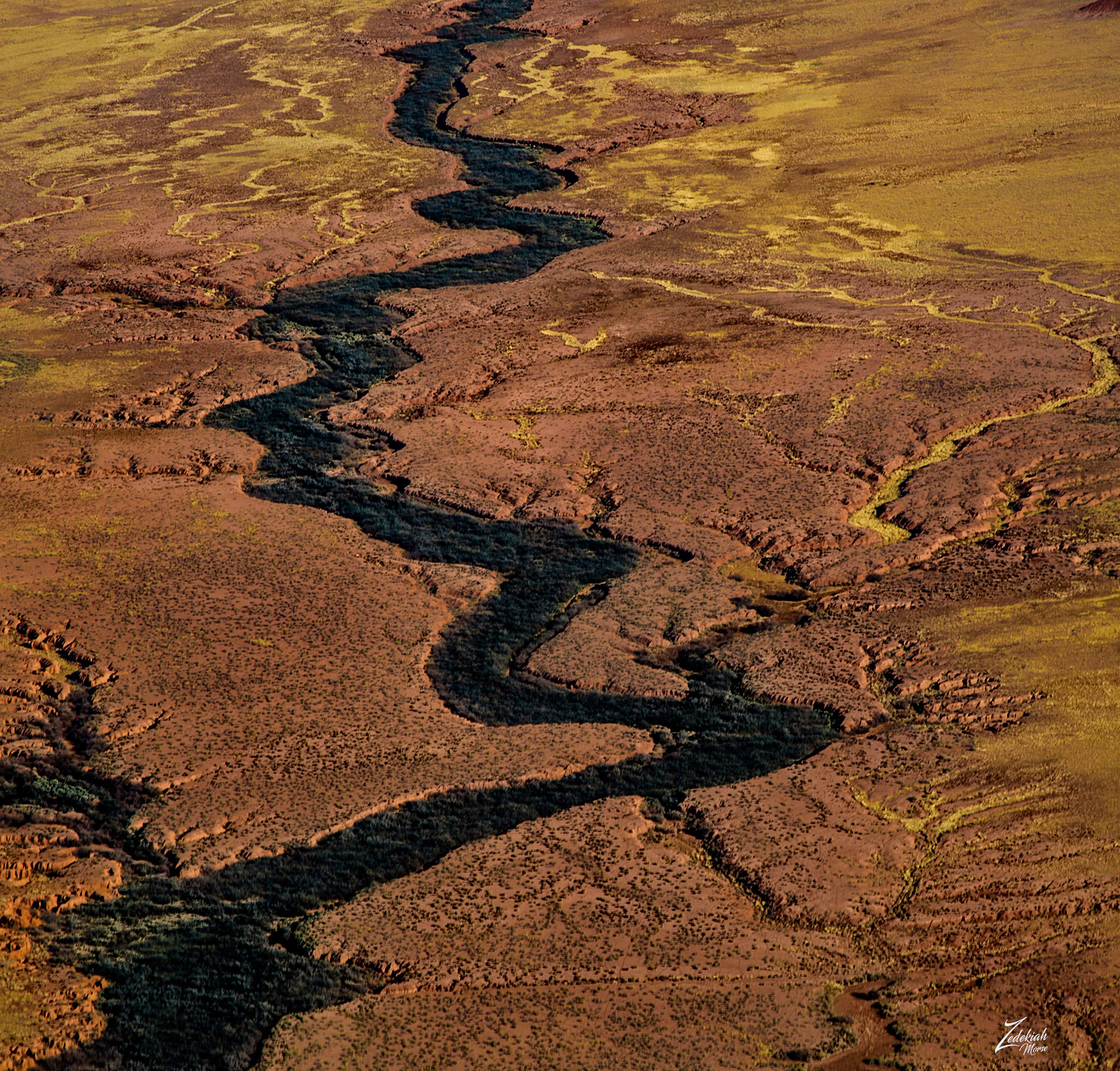
After taking a couple of pictures of this unusual formation I continued west, following above the Cañada Alemita river across the high desert mesa tops towards Chaco Canyon.
Chaco Canyon ~ Ancient Anasazi Lands
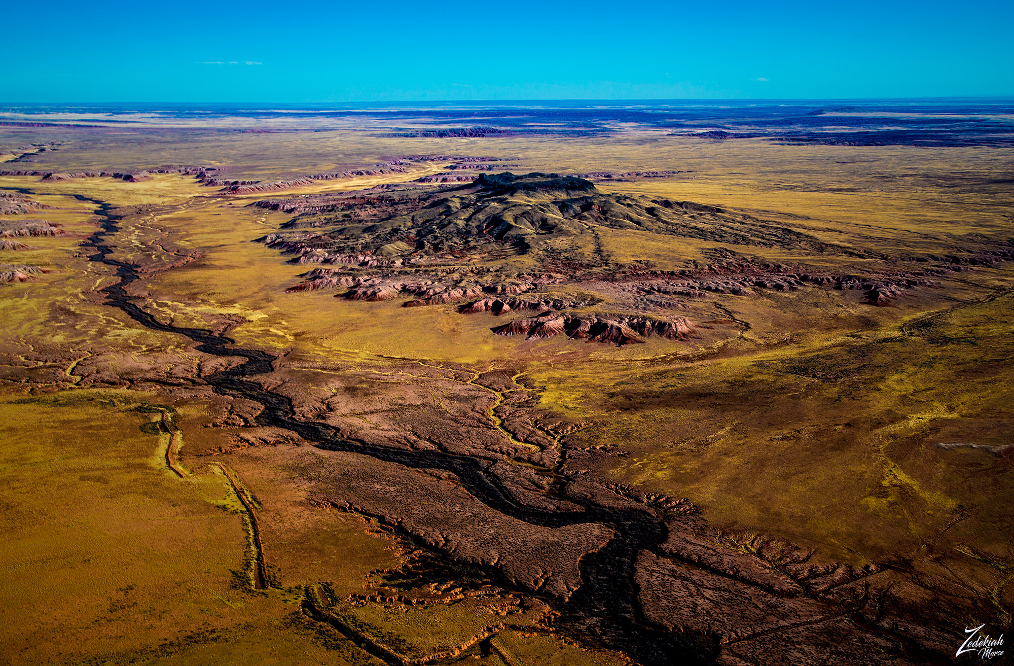
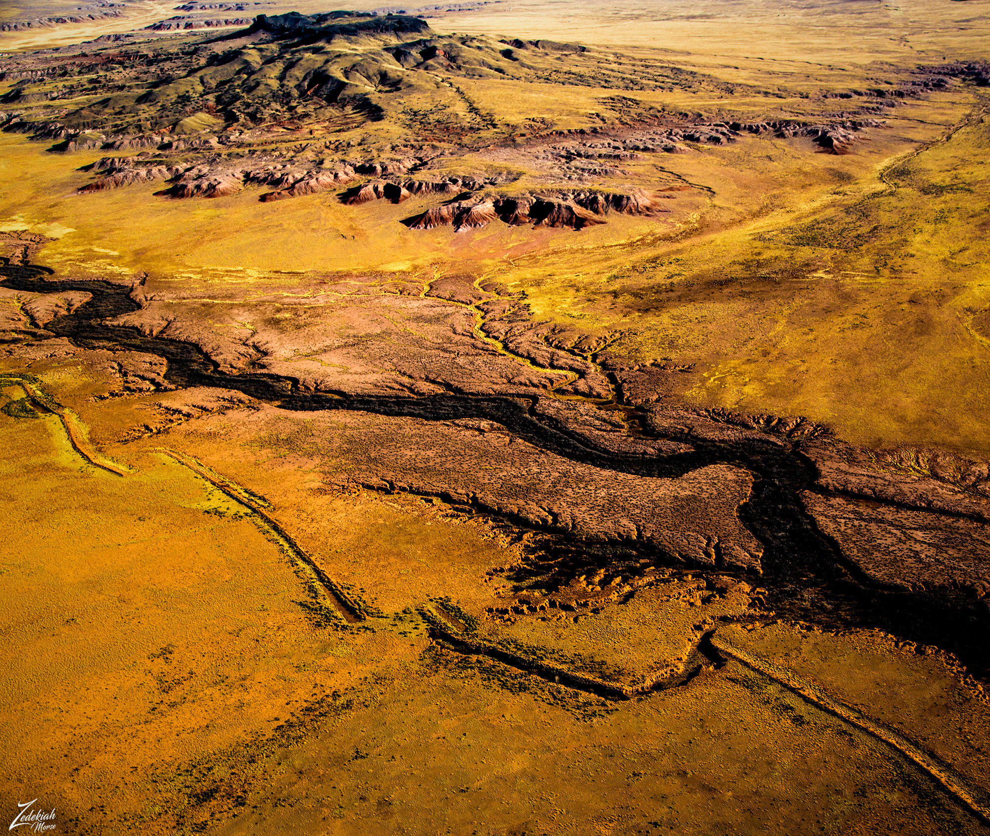
Crossing over the top western end of Chacra Mesa, you can see the abrupt cliff edge towering over Fajada Wash. In the distance along the river you can see historic Anasazi roads.
 Chacra Mesa Looking East ~ Click to Enlarge
Chacra Mesa is part of Chaco Culture National Historical Park, a National Historical Park hosting the densest and most exceptional concentration of ancient Anasazi pueblos in the American Southwest. This vast wilderness area contains the one of the most sweeping collections of ancient ruins north of Mexico. Here are preserved some of the most crucially important pre-Columbian cultural and historical areas in the world.
In the image directly above we are looking east along the edge of Chacra Mesa, in the image directly below we are looking west towards Chaco Canyon. If you follow the dirt road on the in the foreground of this image you can see where it splits off to the right into the middle of that mesa top prairie. This is the location of Tsin Kletsin, an Ancestral Puebloan great house and archaeological site.
Imagine if you can, just over 900 years ago there was an Anasazi Great House with 81 rooms, 3 kivas and a plaza constructed to create a 2-story structure. The plaza was enclosed by a wall, and a 1-meter-wide entry portal allowed access to the plaza from the south. The masonry style of this complex is called McElmo (Chaco-McElmo), characterized by large sandstone blocks and some tubular slabs. This was a beautiful home to many people!
(Research Source)
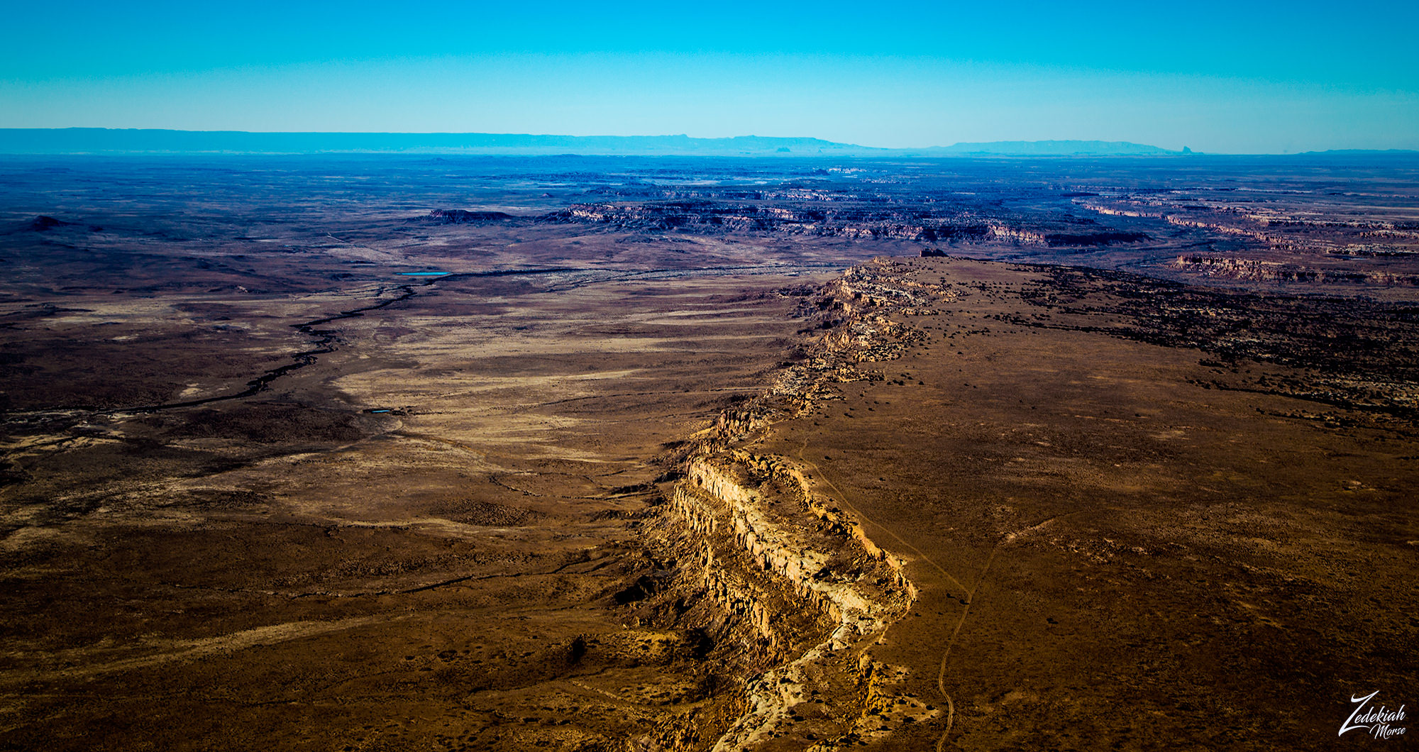 Chacra Mesa Looking West ~ Click to Enlarge
Looking further to the top middle of the image you can see Chaco Canyon, this entire canyon in the distance is the Chaco Canyon National Monument. These are very sacred lands to the First Nations Diné (Navajo) and Hopi tribes people who are considered to be the descendants of the Ancient Anasazi.
The central portion of that canyon contains the largest Chacoan complexes. The most studied is Pueblo Bonito. Covering almost 2 acres (0.81 ha) and comprising at least 650 rooms, it is the largest great house; in parts of the complex, the structure was four stories high.
(Research Source)
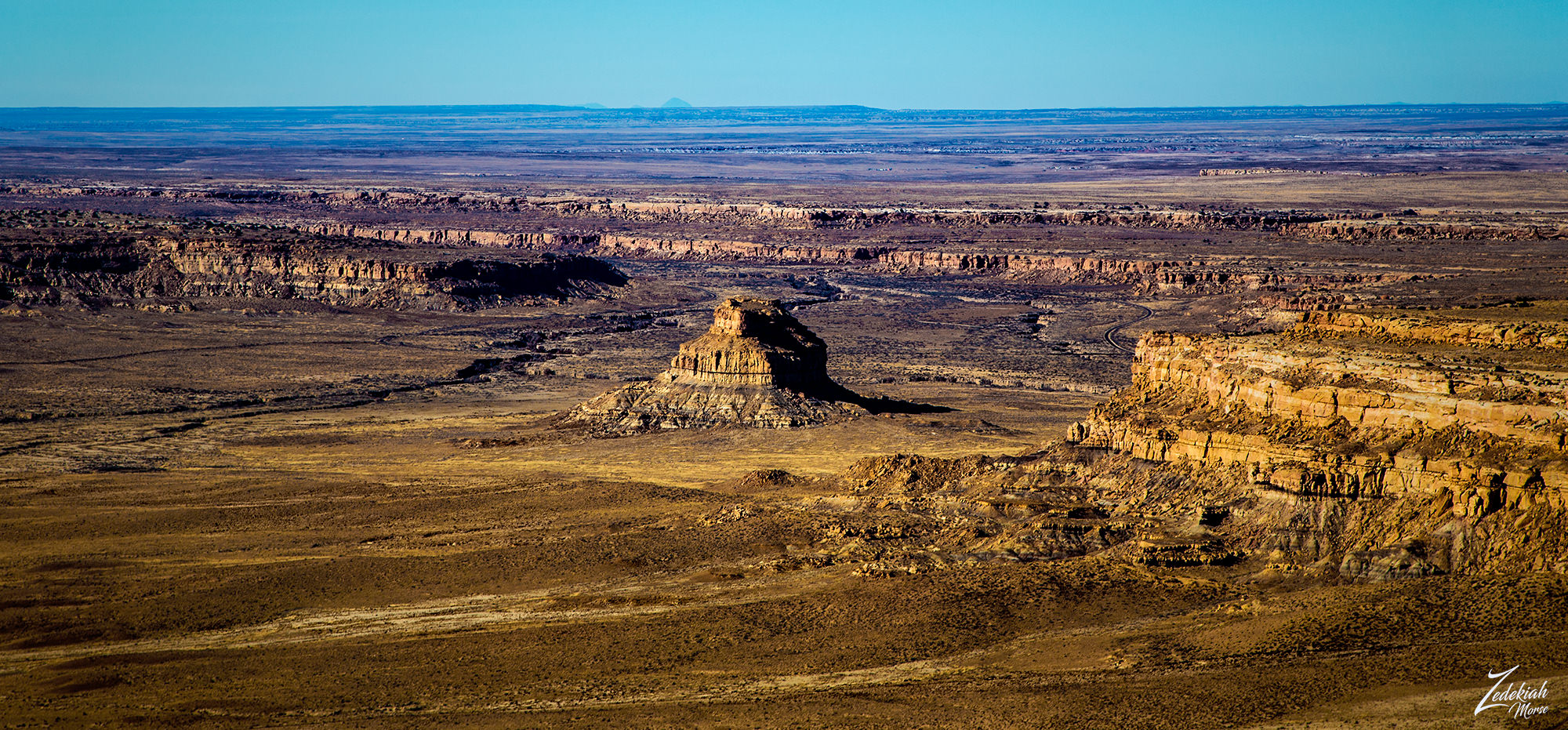 Fajada Butte & Entrance to Chaco Canyon ~ Click to Enlarge
Fajada Butte (Banded Butte) rises 135 meters above the canyon floor in this image I lensed as I flew out over Fajada Wash. This is also part of the Anasazi culture of Chaco Canyon. Although there is no water source on the butte, there are ruins of small cliff dwellings in the higher regions of the butte. Analysis of fragments of pottery found at these ruins show that these structures were used between the 10th to 13th centuries.
If you enlarge this image and look closely on the bottom left side of the butte in the middle you can see the remains of a 95-meter-high, 230-meter-long ramp going up the the first lower cliff. The sheer magnitude of this building project, done by hand and without an apparent utilitarian purpose, indicates that Fajada Butte may have had considerable ceremonial importance for the Chacoan people.
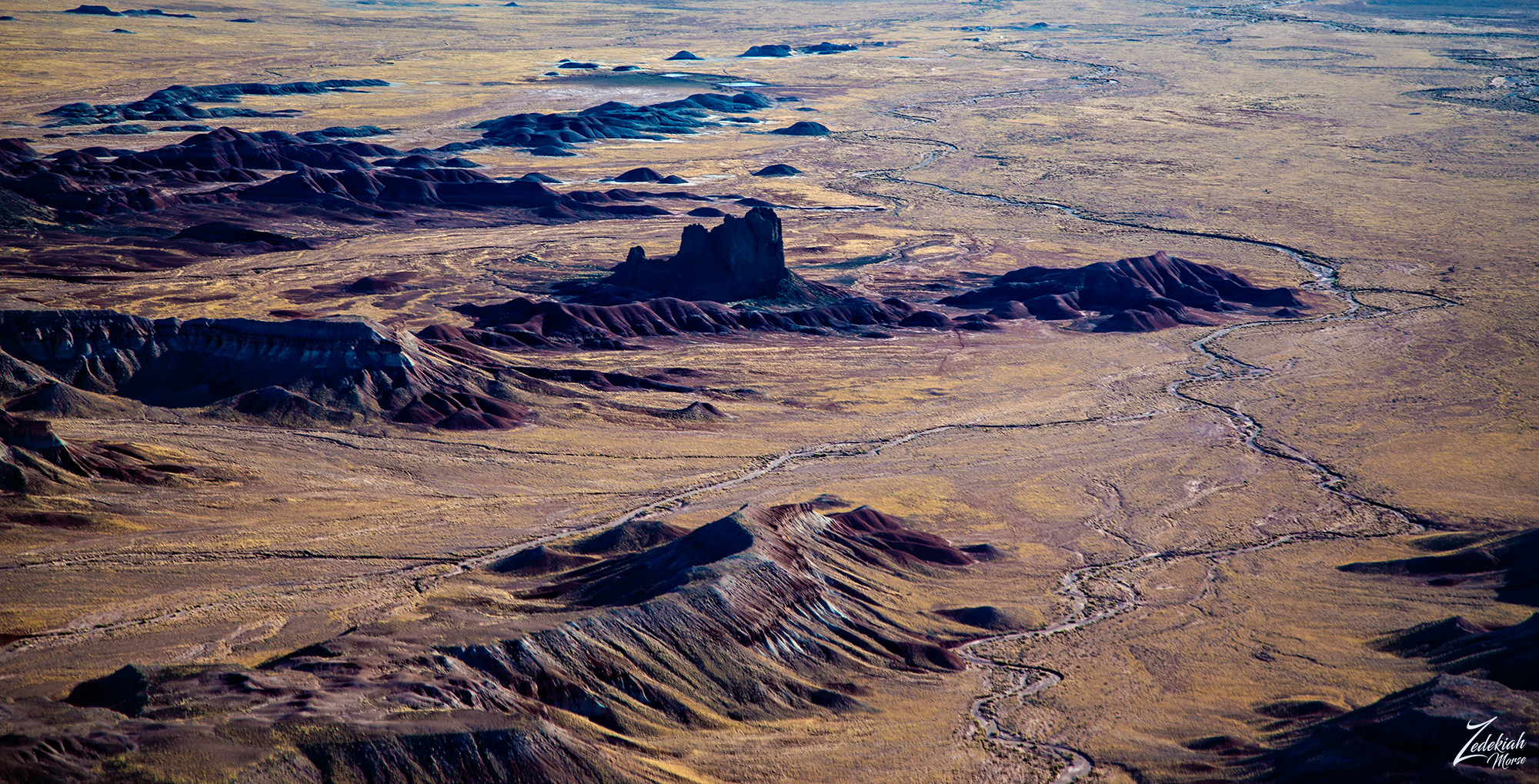
As I flew westward, away from the cliffs of Chacra Mesa, across the desert floor below I could see numerous old roads radiating out from the central southern entrance in Chaco Canyon. While some followed Fajada Wash and were obviously in use as dirt roads that connected the small First Nations Diné (Navajo) farms that sparsely dotted the harsh desert, others were the ancient straight roadways built by the Anasazi people as part of the Chacoan Culture beginning 1,200 years ago.In the following image you can clearly see the straight archaic roads on the lower right side.
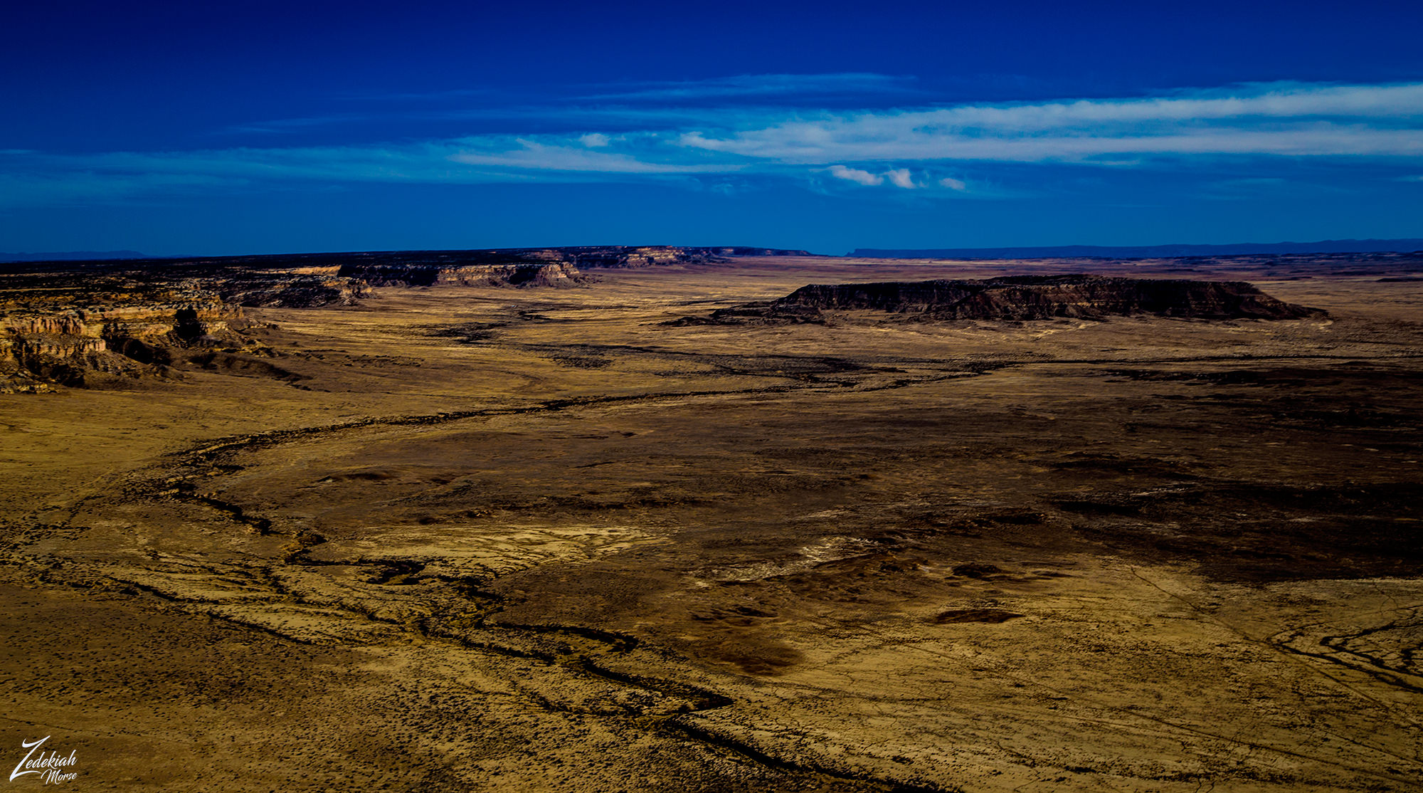 Fajada Wash & Chacoan Roads Near Red Mountain ~ Click to Enlarge
Ancient Chacoan Road System
Chacoan roads are generally aligned very precisely, and continue for considerable distances with the same alignment without curving or adapting to the landscape as modern roads and trails usually do. When they do change direction, it tends to be with sharp, angled turns rather than gentle curves. When a road comes to a mesa or cliff face, rather than curving or turning it will often go straight up with stairs carved into the rock and continue on top with its original alignment.
One of the most remarkable aspects of Chaco Culture, at least from a modern perspective, is the extensive system of finely engineered roads both within the canyon and extending out a considerable distance to the outlying sites throughout the San Juan Basin and beyond. These roads are remarkably safe, straight, and carefully constructed. The ones inside the canyon average about 15 (4.5 m) feet in width, while the ones going out toward the communities outside the main canyon tend to be about twice that wide at 30 feet (9 m).
It is an interesting when you realize this ancient society had neither pack animals nor wheeled vehicles. So it is unclear what, if any, practical need could have required roads 30 feet (9 m) wide! The enormous amount of labor invested in the construction of the roads at a scale well beyond practical need suggests a higher purpose than mere transportation.
(Research Source)
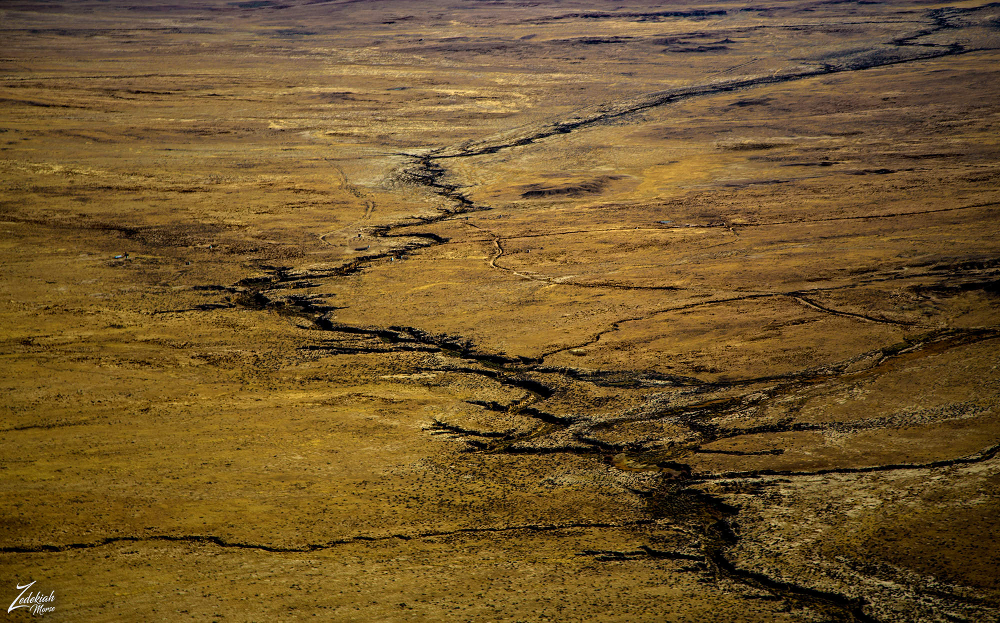 Fajada Wash and Ancient Chacoan Roads ~ Click to Enlarge
In this image you can see various segments of the Chacoan Roads spread out across the desert floor. The roads are generally not visible on the ground and although many of these segments have been identified from aerial photographs and then confirmed from the ground, only a few of these segments have been found to connect to each other to form roads that run continuously for significant distances. This only adds to the mystery of why they were built!? Were they used ritualistically or for practical transportation of people and goods?
Experiments have shown that walking on one of the surviving road segments requires considerably less energy than walking the same distance on the unmodified terrain next to the road, suggesting that even if the primary purpose of the roads was religious they would certainly have been useful for transportation as well.
(Research Source)
Finding Unknown Ruins
While flying west across the desert away from Chaco Canyon I was about 2,500 ft (762 m) above ground when off to my right I noticed unusual and unnatural shapes on a slight mound area. One thing about flying in wilderness areas is that from up in the air, man made structures stick out pretty clearly, and these were most definitely man made, and old!
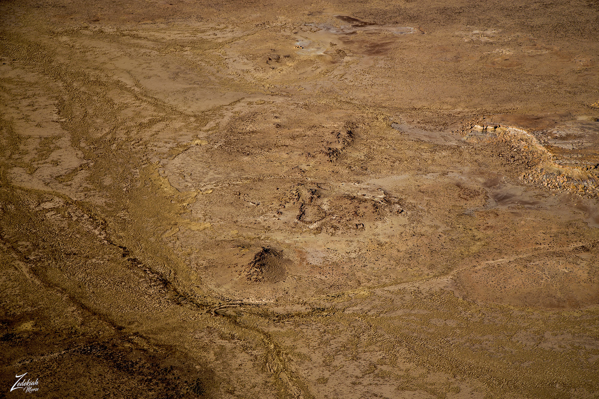 Strange Man Made Ruins in the Desert ~ Click to Enlarge
I you open the image above and follow the faint traces of a very old grown over road (that obviously has not been used is quite a while) you can see what looks like a small dam/bridge over a stream. This is what first caught my eye, now look slightly above it to the right. Do you see the ruins of structures?
When I circled back around the site and got a bit lower, I was able to get a much better view of the different structures that were positioned in an orderly fashion around what appears to be an ancient pit house with various smaller Kiva style buildings and storage structures.
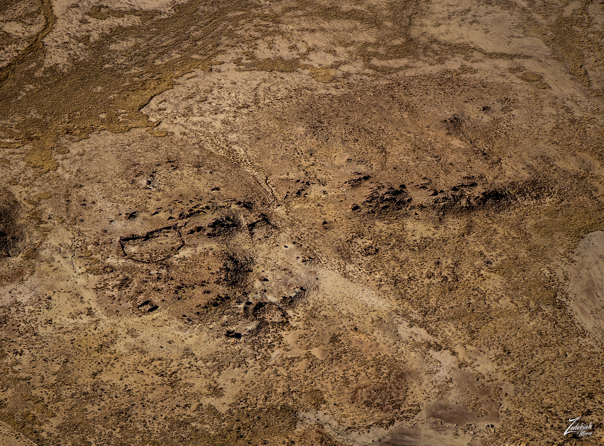 Clearer View of Uncharted Chacoan Ruins ~ Click to Enlarge
The following image is a close up of the site which shows very clearly that there are different structures spread out across this small hillside. I count 6 structures in this image and possibly 8 as I can see faint outlines under the surface for a couple more potential ruins.
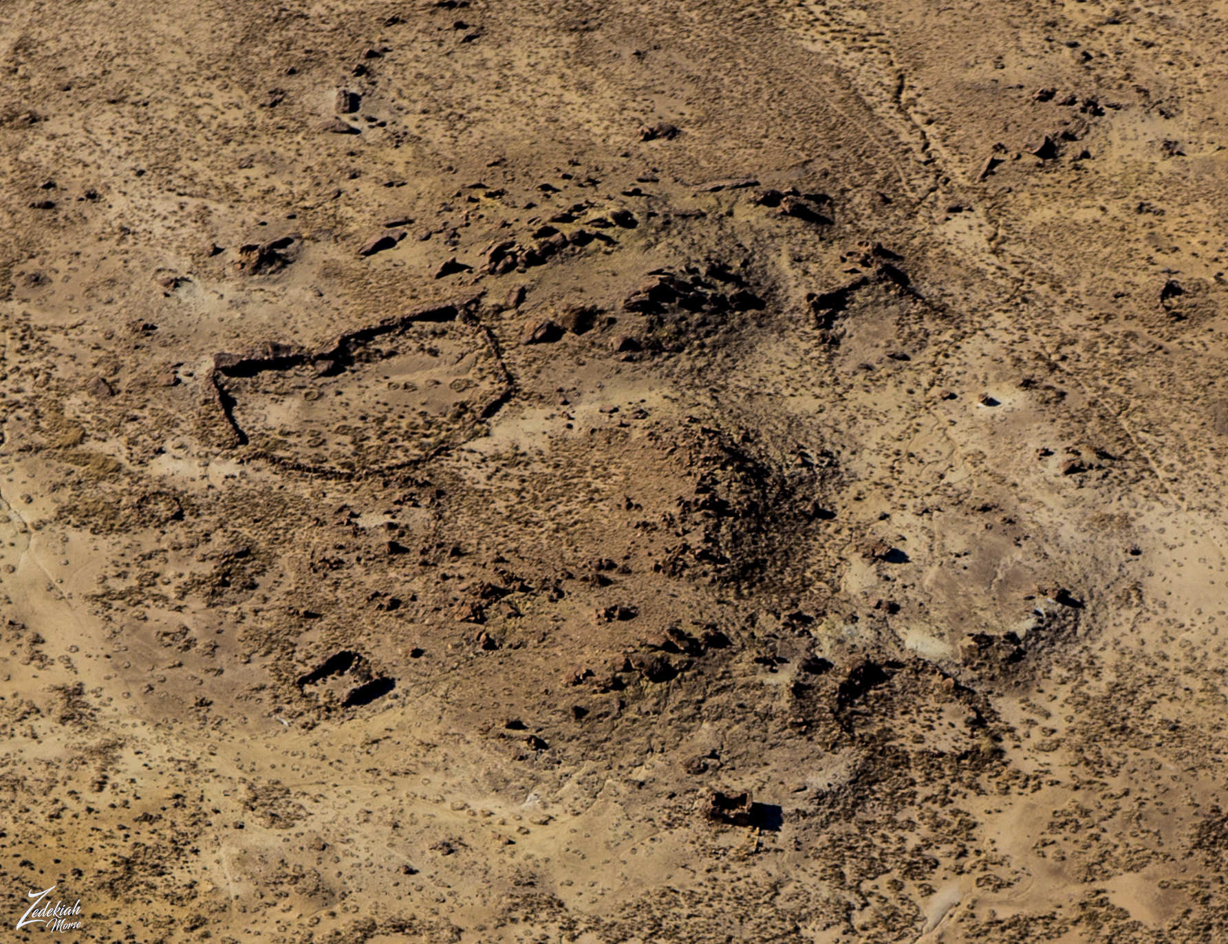 Close up of Chacoan Ruins ~ Click to Enlarge
And to help you identify exactly the structure ruins I am speaking about I have outlined the ruins in this following image. Compare this with the other images above and you will be able to make out the different man made structures.
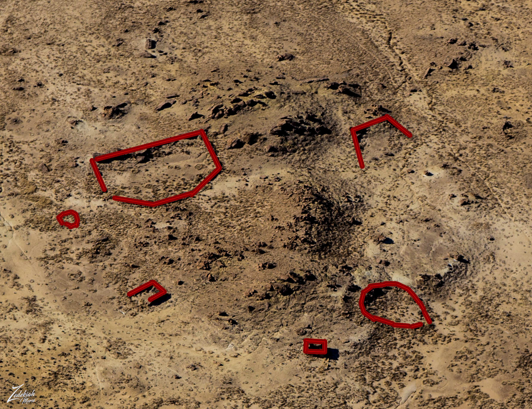 Outlines of Ancient Chacoan Structures ~ Click to Enlarge
When you compare these ruins to typical Chaco Culture buildings and ruins you will see very similar shapes int he design. To view those ancient Anasazi ruins for your self to compare to this site, go here for a link.
What's especially intriguing to me is the remote location of this small cluster of ruins. This is out a few miles away from the main historic Chaco Culture site, however if you look at the following map of known sites it is not unusual as there were many outlying locations that were used for farming.
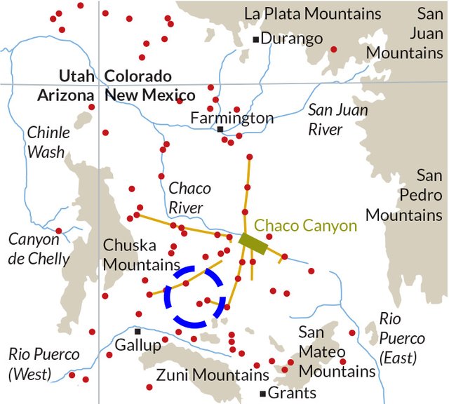 Location of Unknown Ruins Site in Blue Segmented Cirlce
The site is somewhere within that blue segmented circle I put on this map, though I am not saying exactly where because I don't want anyone disturbing the ruins. It is not easy to visit this location as there are no roads nearby. I love to imagine the people living on this site, many thousands of years ago. Think of how clear the night skies must have been, how peaceful the sounds of silence were.
After circling around those interesting ruins I took note of the time I'd been in the air and my GPS told me I was 150 miles (241 k) away from Winslow. Looking at my current fuel status I calculated I was safely within my established flight parameters and even though there was a 10 knot right quartering headwind, I still had enough fuel to fly some exploration.Instant Aerial Roller Coaster
I had spent a little over 2 hours in the air and covered a number of interesting locations so far. Suddenly winds across the desert picked up, as they usually do when dawn becomes day. It wasn't unexpected but the immediate fury of the wind was intense. The beating I was taking made me reconsider my route. I did some quick calculating and determined that these rapidly changing variable headwind speeds would decrease my speed while increasing my fuel burn.
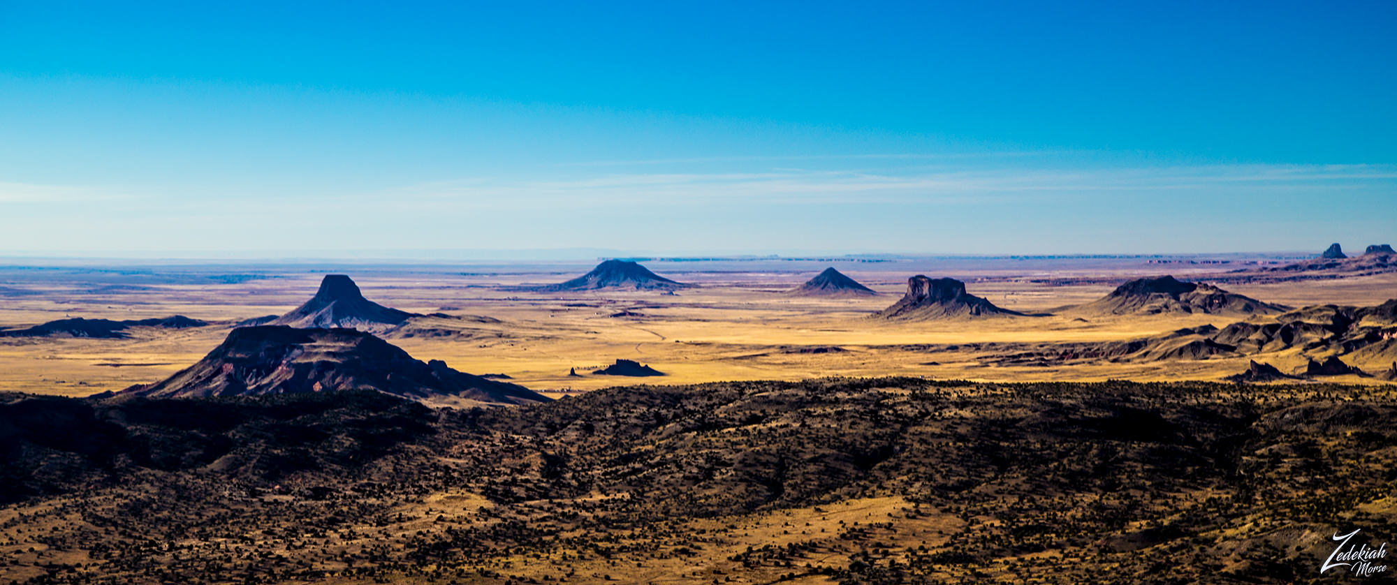
Flying west bound I could see in the distance the distinctive shapes of the Hopi Buttes Volcanic Field across the and it was getting very violently bumpy. I was getting pretty harshly slammed. The upside of wind is it clears the air, providing a beautiful field of depth for miles. The downside is it makes photography focusing rather difficult.
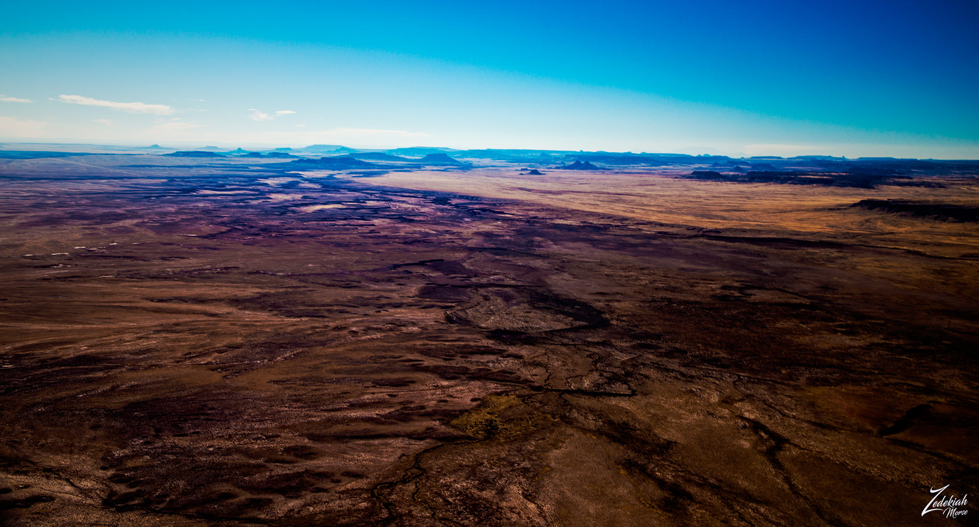 Hopi Buttes Across the Valley ~ Click to Enlarge
Looking toward Yellow Creek Valley across the Chuska Mountains and onto Defiance Plateau, I thought about the strong winds. This updraft buffeting was happening because the rising warm air, heated up by the ground in the morning sun, mixed with the general coriolis-effect and produced intense winds.
Then those fast winds coming across the deserts would sink into those cooler canyons and become amplified by the Venturi effect in those deep canyons. This would then whip up out of the canyons for thousands of feet on the leeward side, which was the direction I was approaching from. Crossing that rough terrain in windy conditions was not a good idea.
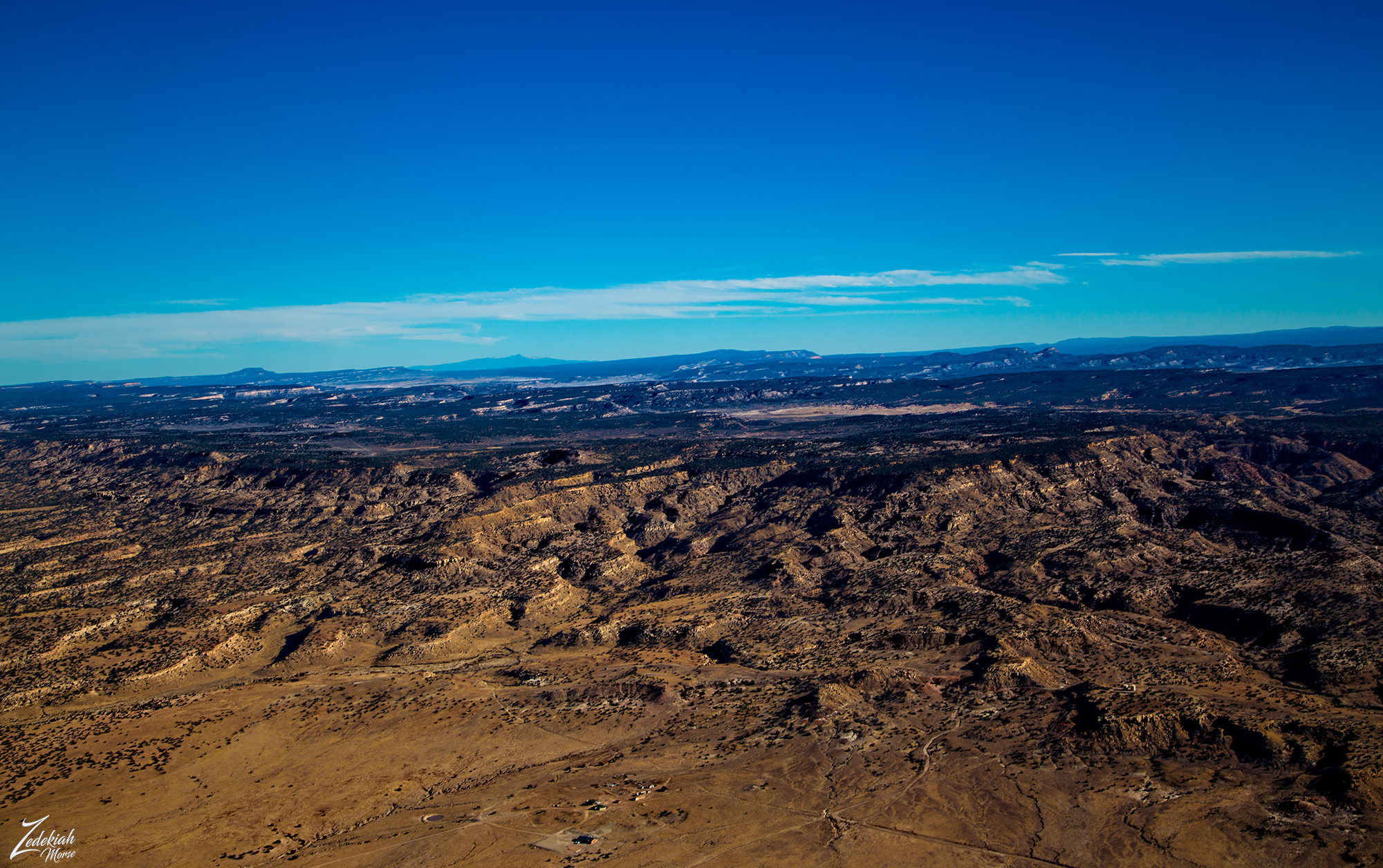 Chuska Mountains & Yellow Creek Valley ~ Click to Enlarge
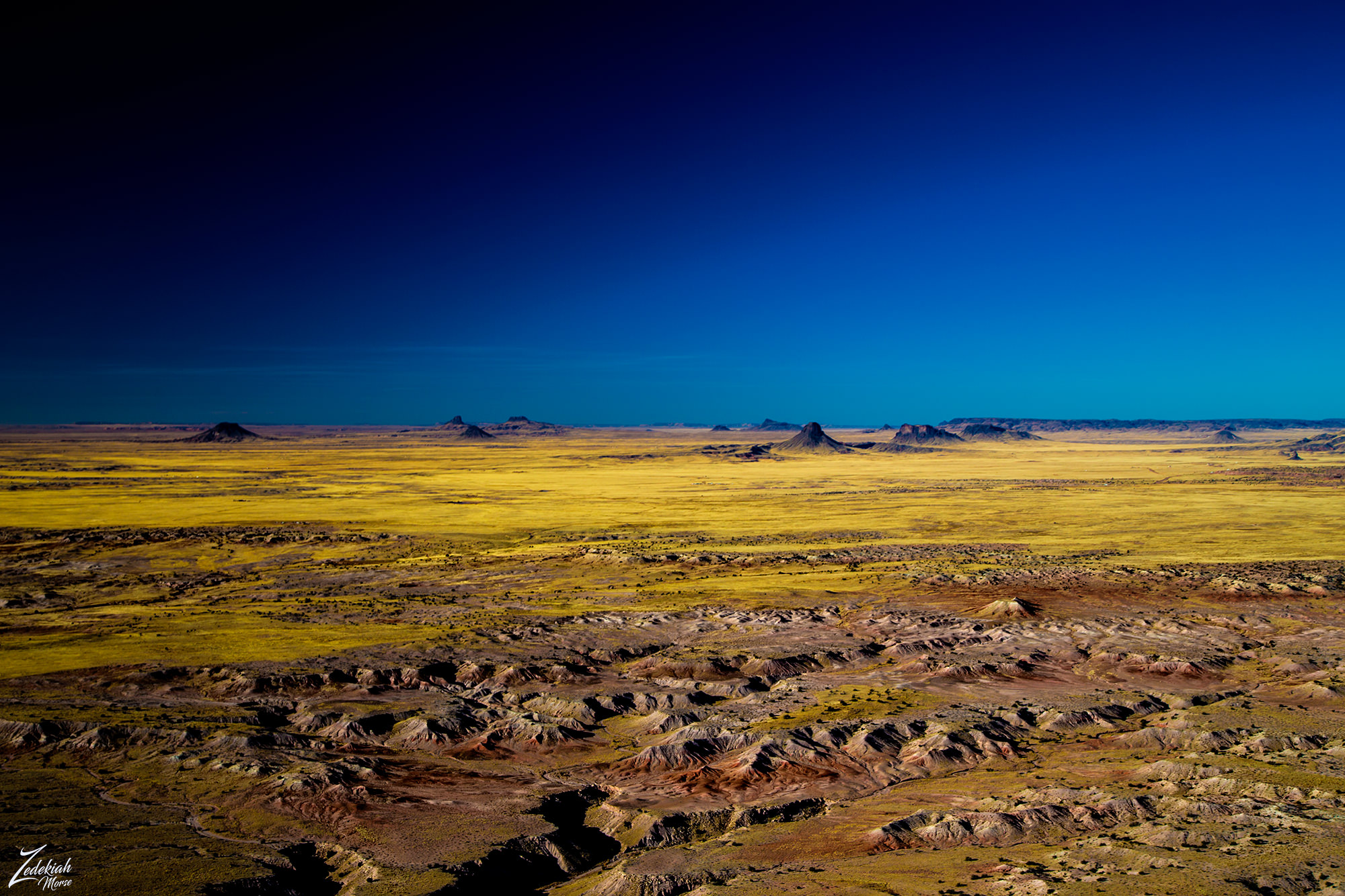
I decided to forgo visiting the Chuska Mountains and continued on for another 40 miles until I came out of the windy conditions on the southwestern side of the Red Hills in the First Nations Diné (Navajo) Reservation. As I turned towards the large shapes of the Hopi Buttes Volcanic Field on the horizon, I came upon this strangely colored scar across the ground.
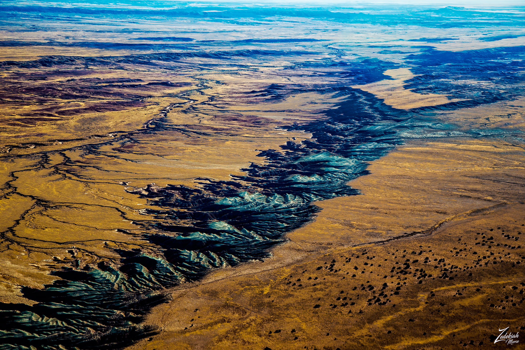 The Colors of Sabito Wash ~ Click to Enlarge
Resembling an abstract painting, this surreal landscape is caused by the mesa on the right side being slowly eroded at such a shallow angle that it exposes a large layer of gray material in bands caused by the thousands of small rivulets created by the rain and winds. All those many rivulets lead dow to bigger and larger streams which all flow into Sabito Wash and on into the amazing Petrified Forest National Park on the left side of this image.
Hopi Buttes Volcanic Field
Hopi Buttes volcanic field is a 965 square miles (2,500 km2) monogenetic volcanic field located on the First Nations Diné (Navajo) Reservation. The image above is of a feeder diatreme made of monchiquite. In this large volcanic field most of the volcanic activity occurred between 8.5 and 6 million years ago, with the most recent at 4.2 million years ago.
(Research Source)
 Hopi Volcanic Dinosaur Spine ~ Click to Enlarge
As I entered the Hopi Buttes Volcanic Field the very first thing that caught my eye was this small series of volcanic remnants sticking up out of the desert floor. I named this formation "Hopi Dinosaur Spine" as it is literally a ridge line of small volcanic cores, now exposed.
As I flew into the volcanic field I was surrounded by an array of large multi-hued buttes of various sizes and shapes.Go here to view a satellite image and map of the location.
To my left was a river cutting through the desert next to a statuesque volcanic capped butte. This was the Pueblo Colorado Wash, an alluvial aquifer, and an important water source for the First Nations Diné (Navajo) Reservation. The name “alluvial” refers to the loose, un-layered nature of the material – often silt, clay, sand, and gravel which are deposited by running water in and around rivers.
The colors of the river as it cuts across the desert are juxtaposed against the vibrant hues of the different rock layers that make up the base of this magnificent butte.
 Pueblo Colorado Wash & Volcanic Caprock Butte ~ Click to Enlarge
Buttes such as this are tall, flat-topped, steep-sided towers of rock created through the powerful process of erosion. Millions of years ago the buttes seen in these images were all part of a vast flat elevated area that was either a mesa or plateau. Over time, the overwhelming natural forces of water, wind, and ice slowly cut through the ground and created streams, creeks rivers and lakes.
This continuous, timeless process slowly eroded away the softer soil while leaving the hard top layer, called a caprock, which resists weathering and erosion. As a result, this formation is about the same height as the original plateau or mesa that surrounded it. Because caprock protects the more vulnerable rock beneath it, buttes are constantly evolving.
(Research Source)
 Erosion Process Over Millions of Years ~ Click to Enlarge
Evidence of this continual process is everywhere in these images. The colorful base of the butte with its many eroded hills of purple and magenta; the many streams and rivulets draining down into the main river and finally the cracked earth fault line on the left side of the image; All of these are a testament to the transformative power of nature.
 The Lush Trees of the Pueblo Colorado Wash ~ Click to Enlarge
An interesting thing about this image above. Looking closely at the river, note that there is a carpet of trees and brush that occupy the entire river bottom. Notice the depth of the main river which is running on the right side of the river channel. Many rivulets drain into the main wash, collecting as much water runoff as possible.
In the image below at the western base of the formation known as Five Buttes I found this solitary towering monadnock this impressive formation is an exposed ancient volcanic throat or core. Multiple volcanic maars and diatremes range across the field in the distance.
 Flying Butte ~ Volcanic Throat Core ~ Click to Enlarge
As I crossed through the eastern side of the Hopi Buttes Volcanic Field, I was surrounded by numerous volcanic buttes. This volcanic field covers an area of approximately 965 square miles (2,500 km) and contains about 300 such volcanic formations. It is interesting to look at these images and realize all of these towers, cones and spires used to be underground. And then to realize this process is still happening. What will it look like in a few million years?
 Tode Haho Tsiquini & Chezin Chotah Buttes ~ Click to Enlarge
My GPS showed I was only 20 miles from Winslow, but before I began my landing checklist I took one more picture of this otherworldly landscape, stunning in its primordial starkness. This was the land of dinosaurs, where the human concept of time has little bearing. This place will always be here, slowly transforming. Imagine the night sky here!
 Hoppi Butte Volcanic Buttes ~ Click to Enlarge
Trip Summary
After flying from Taos, New Mexico in a fairly straight line across the desert I safely landed at Winslow after being in the air for 3 hours and 12 minutes. This map shows my path and denotes the different places I photographed along the way.
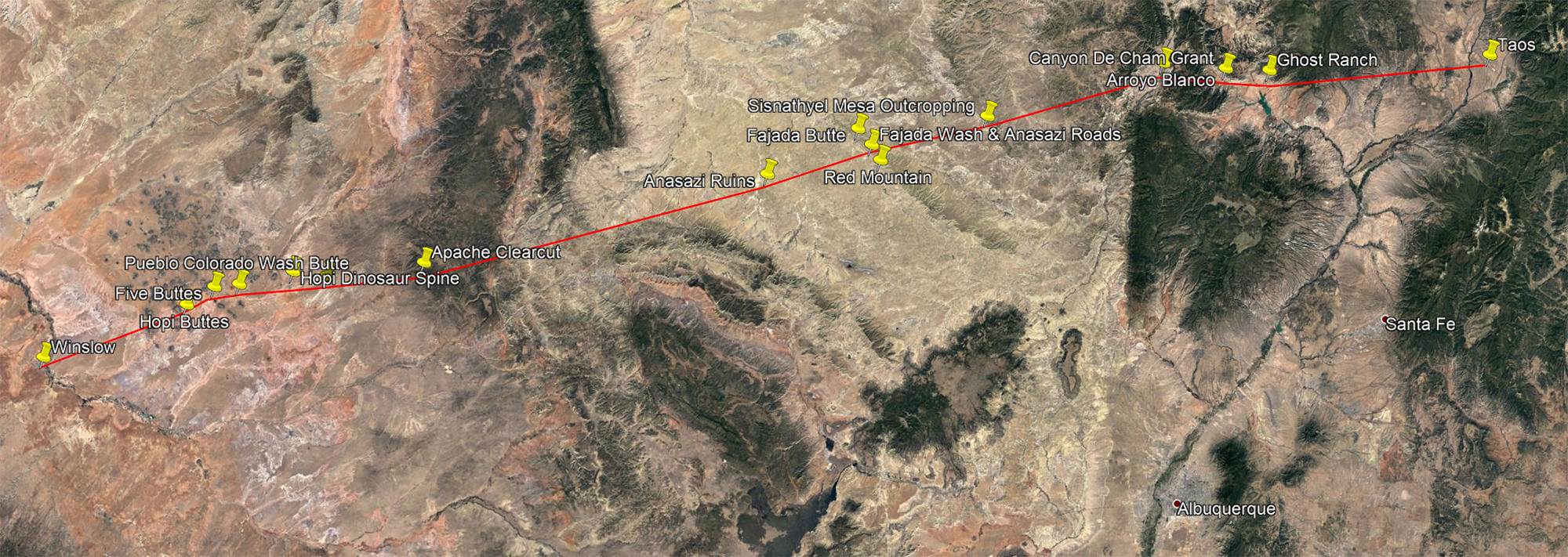 Flight Map with Photo Locations ~ Click to Enlarge
In a trip lasting a little over 3 hours I was able to visit some absolutely remarkable places. That is exactly what my project is all about, taking cross country trips to reveal a unique view of the world rarely seen. There is so much of the world to explore in this manner.
We are utterly surrounded by wild spaces, awe-inspiring places with forgotten history and I am going to explore as many as I possibly can!
About The Project
Where Eagles Fly - The American Wilderness Expedition is my personal mission to introduce people to these amazing locations that surround us. I am piloting a bush plane while exploring and filming throughout the remote back-country areas of North America to raise awareness of the 47% of the USA and 90% of Canada that are unpopulated wilderness.

About The Author
My name is Zedekiah Morse and I'm a Bush Pilot, Photographer, Explorer and Filmmaker. I live in the Rocky Mountains and devote my time and resources to exploring as much of the world as I can by air. If you wish to watch a short film detailing how I do my work and this project, go here.
If you like what you see here upvote and resteemit so that others may experience these wondrous places.
And if you'd like these images to be part of your feed, follow me.
Thanks for your support and Yehaw!!
Your blog is amazing for sure . Sights are off the charts
Thanks for saying that...
What a fantastic post @skypilot! Thanks for going into such depth, always amazes me how much thoughtful planning goes into these types of expeditions.
Hey thanks very much for taking time to read and get an understanding of the process. It is definitely a complex process.
Nice
#vote and ##followme
@kurniamega
GREAT JOB!
What a nice summary/combined recap.
Thanks for popping some locations on the map, as this helps ground the trip for some of us.
Also, let me know if you need someone to hold the camera, while you are flying, next time!
LOL ~!! Thanks... I will keep that in mind! Yes I hoped that putting the maps on would help folks get an idea of the location. I am slowly but surely developing a method of posting on steemit. I have so many stories to share!!!!!
I just saw this when I don't have the time to indulge. A great post (I already follow you) and it takes us out of ourselves for a while with interesting facts and great pictures. You have to carry on, so upvoting you. Saving this for tomorrow when I have more time to take it all in. Particularly like the thought of Georgina O'Keefe and must read that. Thank you skypilot.
Very cool... hope you found time to go through it all... and thanks for the support! I really appreciate it
If anyone deserves upvotes on this platform you do! Lovely pictures and the narrative very interesting. I was drawn to the American Indian tribes after being told the story of Haiwatha as a young child and moved on from there. You include history and local facts and paint a thorough picture of the landscapes you fly to and over. I appreciate that and will read more of your back posts, rather like an evolving mystery. Thank you.
Your blog is amazing for sure . Sights are off the charts.
wow.. super nice post. I have read it yet but surely I will. Nice pictures .. followed you. @dabird
thanks for sharing post with high level
Thank you DaBird! hope you got the time to check it all out!
Thank you so much @skypilot for all that
you do and for putting all 5 posts together
into one awesome binge read! I really like that!!
Also it's great for re-steeming a 5 in 1 👍
The Chaco area is most interesting to me, the
Fajada Butte Sun Daggers.
Thought you might like to see these :-)
Take care ☀
And thank you so much for knowing about the Sun Daggers!!! There is so much yet to be discovered around the entire Chaco Culture area and surrounding lands. Glad you like the binge post! I will still do the separate parts as well, some folks have short attention spans and I feel this way I offer both methods to read the story.Take care as well!!
Oh my gosh what a fantastic post. I will come back and read all the details. I grew up in El Paso, Tx and I love New Mexico, Colorado and Arizona! We went on summer vacations to those states!
El Paso.... I have great memories of that town !! Thanks so much for taking time to read it all and I hope you visit more on my blog! Yehaw
"Nature does not have organs of speech, but it creates languages and hearts, through which it speaks and feels"