Where Eagles Fly : Sucker-Hole in the Sky ~ Seeking a Path Through Clouds
Flying safely in the back country wilderness is a combination of skillful application of knowledge, access to information via flight instruments and software and a continuous evaluation of the surrounding conditions. Sometimes atmospheric conditions change rapidly, leading to necessary adjustments in your flight plan and your ability to call upon experience, information and pilotage
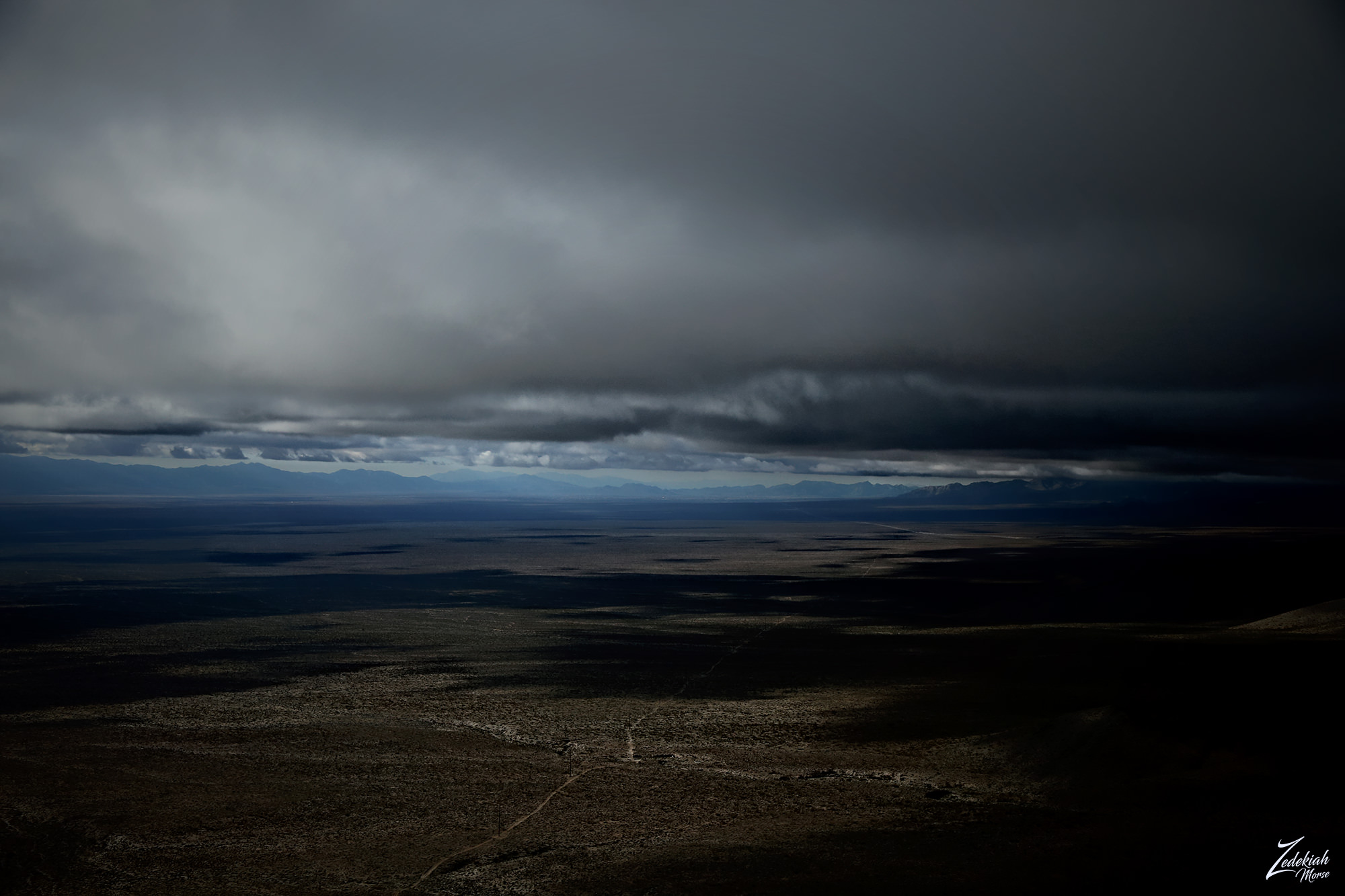
I was flying across the Mojave Desert from Death Valley and was trying to beat a rapidly forming storm back to Boulder City Airport. It was late afternoon and as I flew along, the sparsely scattered storm clouds above and in the distance began to coalesce into larger patches until the entire sky was occluded.
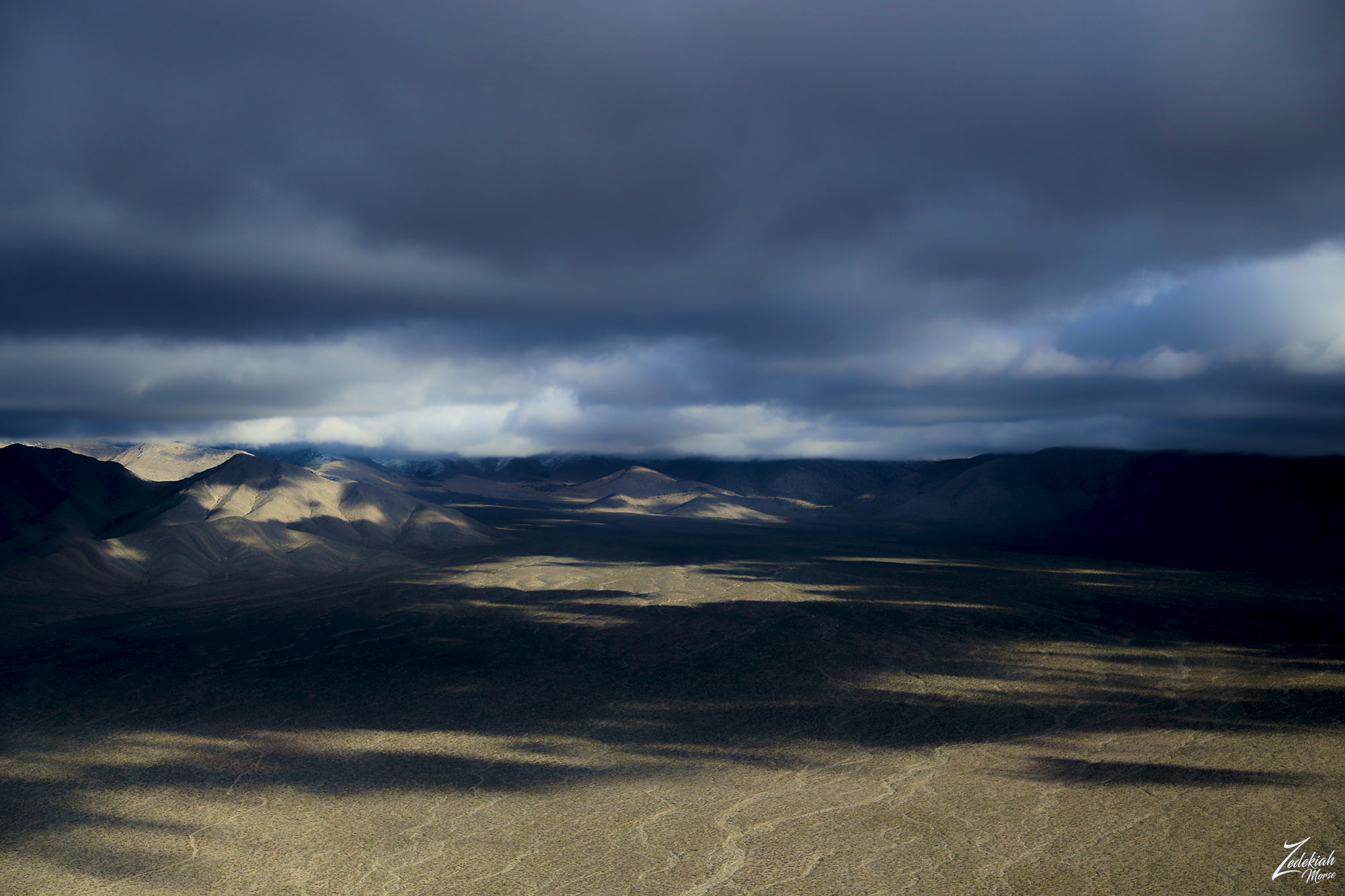
This valley is known as Dead Horse Loop, located along the ridge between the Nopah Range Wilderness and the Spring Mountains in the Mojave Desert to the west of Las Vegas, Nevada on the California border.
Trapped Beneath Clouds Over The Desert
Once the sky above was covered with clouds the bottom of the clouds were about 2,500 ft (762 m) above the desert floor giving me plenty of room to fly. The issue was that I needed to fly over the mountain ridges to get to where I was going so I had to look for a break in the clouds or fly for almost 100 miles in the opposite direction until I could find clear sky, and then go up and back over the clouds to get to my destination.
This created a problem for me because my bush plane does not have instruments that allow me to fly in inclement weather through the clouds, and this also means by FAA rules I am not allowed to fly over a solid cloud cover where I cannot see the ground. This is to make certain I don't get into a predicament if I were to experience engine failure or need to land in an emergency situation, because obviously if I cannot see the ground because of clouds then it will be impossible to determine where I should try to make my emergency landing.
It is worth mentioning here that I actually have what is called "synthetic vision" as part of my flight software package from Foreflight. And synthetic vision does allow me to see what is around me and on the ground below me pretty clearly so if I really had to descend through a cloud cover in an emergency situation I could do so. However it is still against the FAA rules to fly above a solid cloud in IMC (Instrument Meteorological Conditions) without an IFR clearance which require me to fly primarily by reference to instruments, and therefore under instrument flight rules (IFR), rather than by outside visual references under visual flight rules (VFR).
Again, my bush plane does not have the proper instruments for IFR flight, why you ask? I personally do not enjoy flying when I cannot see what I am flying around. I am in the air to experience the view so seeing the inside of a storm cloud is not that interesting to me. So when these clouds rapidly coalesced in the atmosphere above me I had to either turn back or look for what we pilots call a "sucker hole".
Sucker Hole ~ Safe Escape or Dangerous Path?
They are called sucker holes because they have a tendency to sucker you into believing you can make it through them before they close in, trapping you inside the very thing you are trying to avoid, clouds! Since I was flying along the edge of the Spring Mountains I began to look for breaks in the clouds along the sides of the hills and valleys.
This is where you can usually find breaks in the clouds that will allow you to fly out of the valley. But you must make certain that you have a good understanding of what is on the other side of the cloud break (sucker hole) because you don't want to end up flying into a box or dead-end canyon with nowhere to go and no ability to fly out of it. Many good pilots have met their demise this way.
I flew along the edge of the mountain Range until I noticed a break in the clouds up in the back of a long valley on the backside of Potosi Mountain, in what is known as Potosi Wash. But the situation is not so simple here, if you look closely at this image below you can see in the distance the clear blue sky peeking through the clouds at the end of this valley. However, notice that the floor of this desert valley rises up as it becomes the slope of the mountain on either side of this pass, which means that the distance from the bottom of the clouds to the surface of the desert decreases as it gets closer to the break in the clouds.
Scud Running ~ Finding a Way To Break Through
After consulting my Foreflight Synthetic Vision and my VFR Sectional, I determined that if I could make it through this break in the clouds safely, I would be totally clear on the other side as apparently, the clouds above and around me had backed up on this side of the mountain range while it opened up into a large valley with a much higher cloud layer on the other side.
To get to the other side of the range would require a bit of what pilots call "scud running". This type of flying has led to pilots flying into the ground and is referred to as terrain or obstacles, such as radio or power towers. This can be fatal and is known as CFIT (controlled flight into terrain).
In scud running the biggest concern is whether the break in the clouds would close in around me as I was flying through them, creating a classic dangerous sucker hole condition. And whether I could maintain enough clearance over the desert floor and the walls of the mountains on either side of the narrowing valley as I flew towards the break in the clouds.
Luckily I had my synthetic vision which gave me accurate heights and distances for the surrounding terrain and the valley was wide enough so that had I gotten close to the cloud break and it began to close up, I would still be able to execute a 180° turn back out of the canyon safely.
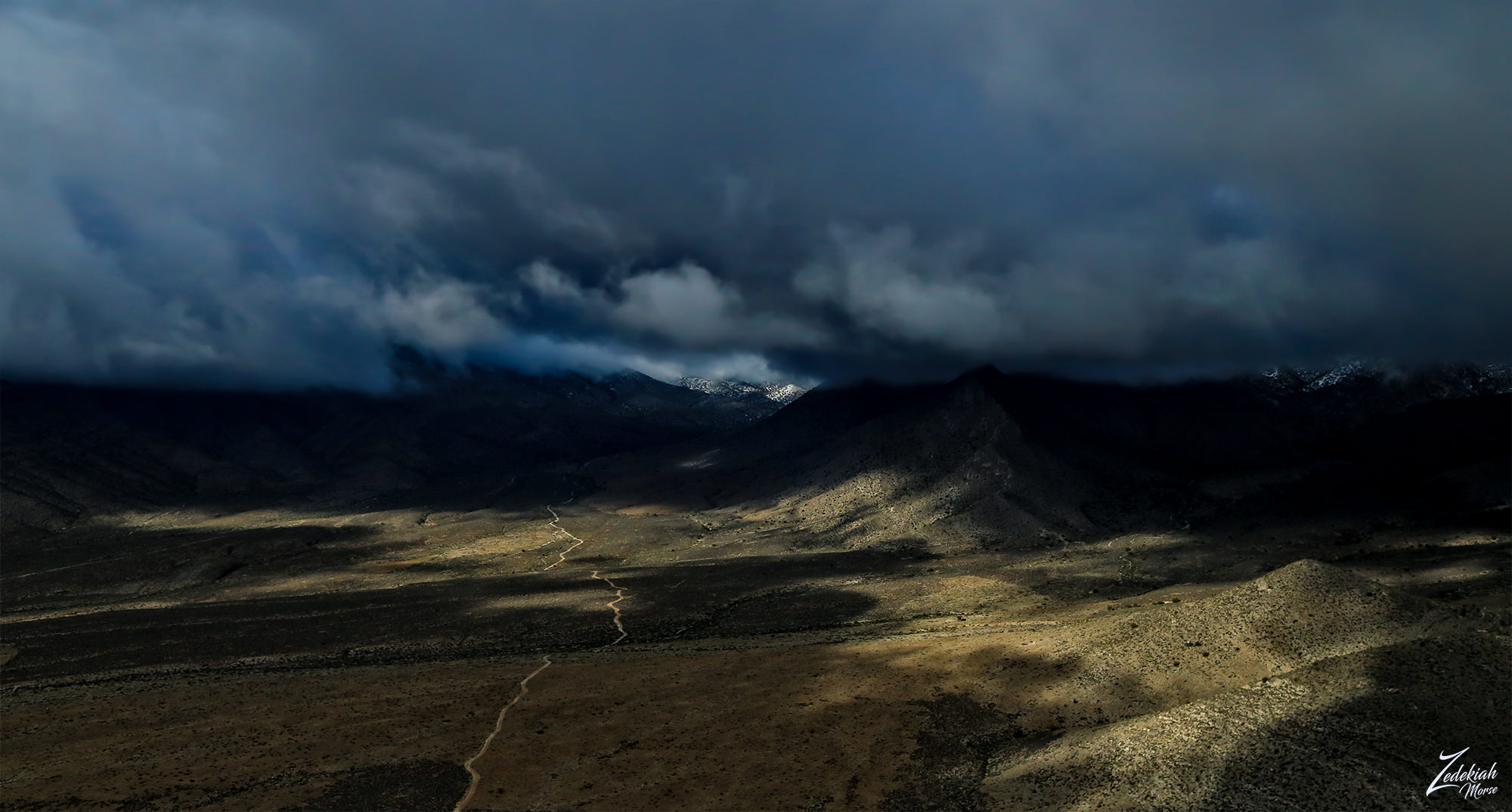
I followed the road in the image all the way up the valley and was able to fly through the hole in the clouds along the edge of the mountains and safely get through, breaking out into the large valley on the other side as seen above.
This story is from my project "Where Eagles Fly".
About The Project
Where Eagles Fly - The American Wilderness Expedition is my personal mission to introduce people to these amazing locations that surround us. I am piloting a bush plane while exploring and filming throughout the remote back-country areas of North America to raise awareness of the 47% of the USA and 90% of Canada that remain unpopulated wilderness.
About The Author
My name is Zedekiah Morse and I'm a Bush Pilot, Photographer, Explorerand Filmmaker. I live in the Rocky Mountains and devote my time and resources to exploring as much of the world as I can by air.
If you wish to watch a short film detailing how I do my work and this project, go here.
Thank you for your support and Yehaw!!
👀
Posted using Partiko iOS
That is quite a story! I felt like watching a movie or reading a book... ha ha ha ... wanting to go to the end to know what happened. Thank you for sharing your experience.
My pleasure! and thank you for taking time to read it! Glad you enjoyed.
Stunning once again!
Must be kinda scarry being in such stormy clouds either as breathtaking...i can really imagine the pure air such storm clouds must have - just like the pure air after a heavy rain.
Is it that fresh up there? :)
Hey Joannes, no it is not scary if you pay attention to what is going on and don't allow yourself to get into a bad spot. Situational awareness is important to maintain always!! And yes the air is remarkably fresh up there... and colder. It drops a few degrees with every 1000 feet (304m) in altitude you gain.