Where Eagles Fly : Red Rock & Potosi Mountain ~ Part 3 ~ The Ancient and Stunning Cliffs of Red Rock
This is the third and final post from my 3 part post series on my exploration flight around the Spring Mountains and Red Rock Canyon area in the wilderness of Nevada, west of Las Vegas.
Continued from Part 2....
Once I got all squared away after being bounced around like a ping pong ball (go see the film in part 2 if you have not yet) I got down to shooing the amazing spectacle being created by the morning sunlight casting cloud shadows across the many cliff faces of Red Rock Canyon.
In the image below, taken while at the very north end of the canyon, in the center foreground the pyramid shaped formation is called White Rock Hills. In the distant background Mount Charleston is cloaked in multiple layers of clouds and snow that drift all across the entire length of the Spring Mountain Range.
I am flying underneath the low lying clouds which are casting shadows from the rising sun behind me, onto the cliff faces of the mountains to the west in front of me.
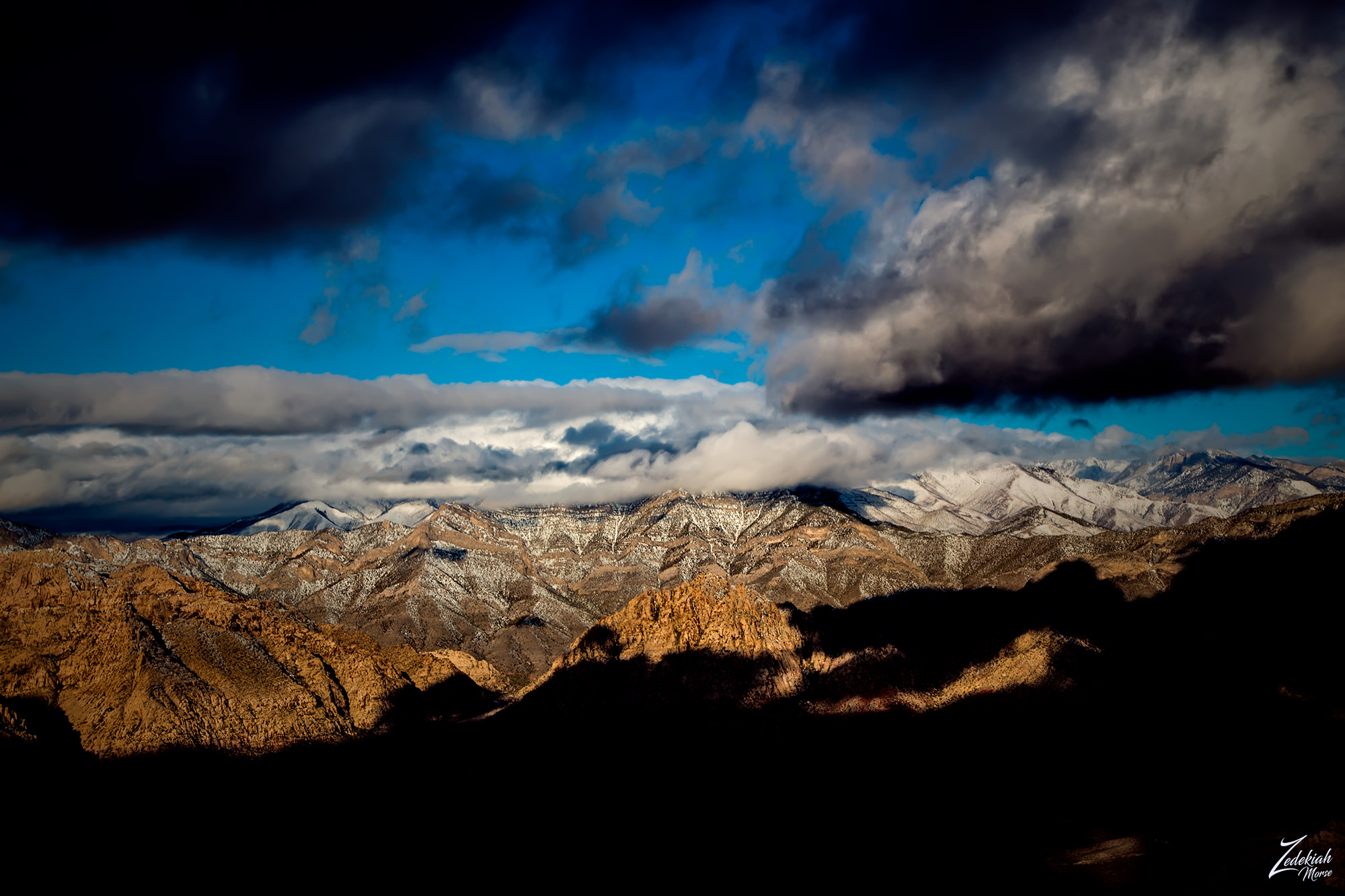 White Rock and Mount Charleston ~ Click to Enlarge
The cliff faces, known as the Sandstone Bluffs, are bathed in a warm golden glow from the rising sun in the image below. The dark shadows cast from the line of clouds east of the cliffs seem to contour the length of the bluffs. In the foreground on the desert floor below the cliffs the multiple rivulets all drain into (from the left) Lone Grapevine Spring, Mud Spring 1 & 2 and the awesome resort at Bonnie Springs.
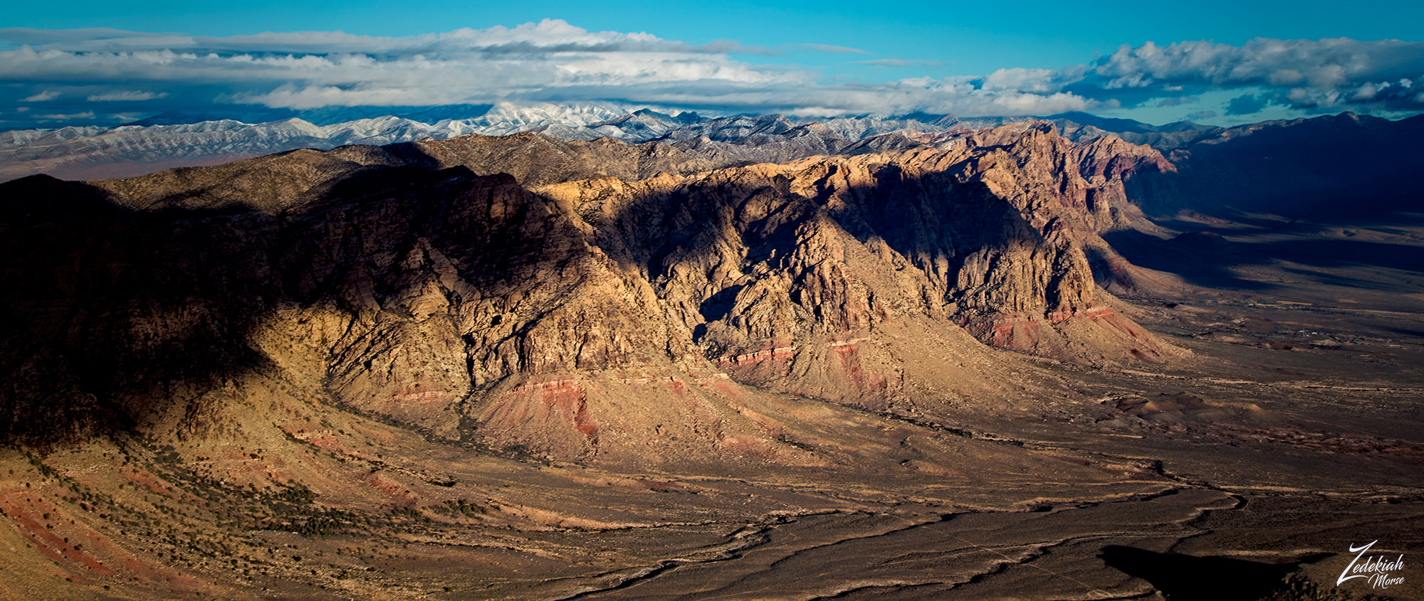 Sandstone Bluffs & Cottonwood Valley ~ Click to Enlarge
Up higher on the right side of the image in the middle lies the Spring Mountain Ranch State Park, a famous desert oasis getaway with a history as storied as nearby Las Vegas.
In the image below, the vermilion streak staggeringly splashed across cliff faces indicate that this is the Wilson Cliffs and accompanying Keystone Thrust, two beautiful geological formations that are part of the Red Rock Canyon Conservation Area. Both these unique geologic sites began forming millions of years ago, and are still changing to this day.
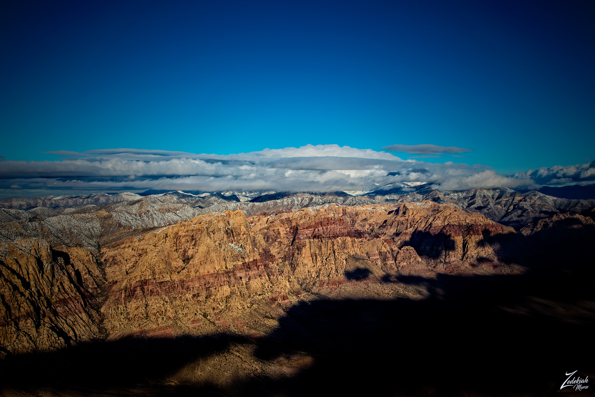 Mount Wilson & Rainbow Mountain ~ Click to Enlarge
Mount Wilson on the left and to the right, Rainbow Mountain (above) are part of the Keystone Thrust with older grey sedimentary rocks above the newer red sandstone. These different layers of rock have been slowly pushed up by the unrelenting forces of the fault line, and then after being exposed to the elements over a long period of time they were eroded by wind and water.
Red Rock has a vastly complex geologic history. Formed over the course of millions of years, this area was originally an underwater ocean basin during the Paleozoic Era over 600 million years back.
Up to 9,000 feet of limey sediments were deposited and eventually lithified into limestone. Then, during the Mesozoic Era some 250 million years ago, the earth's crust began rising because of the powerful tectonic shifts, this resulted in a huge deposit of marine shales and sandstones.
I lensed this dramatic image below, while flying to the south through the canyon. On the left is Rainbow Mountain and Bridge Mountain is on the right, both glowing with the amber warmth of morning sunlight.
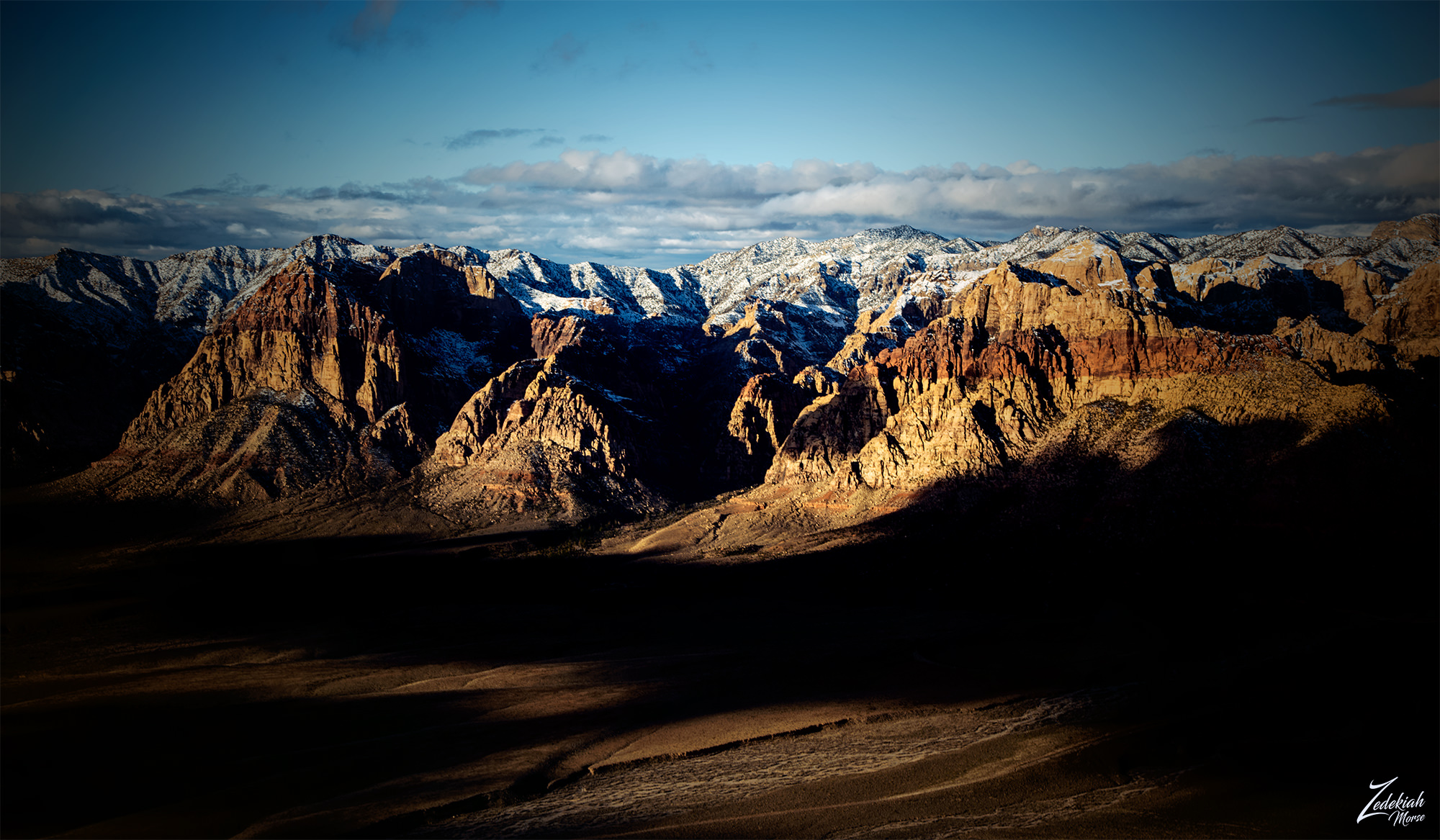 Rainbow Mountain & Bridge Mountain ~ Click to Enlarge
Over vast periods of time, the basin became isolated and evaporite formations of salt and gypsum were deposited. This was followed by oxidation of the iron minerals in the sediments which resulted in the red colors you see splashed across some areas of rock.
By 180 million years ago, the climate continued to change so much the area became a desert with vast expanses of huge shifting sand dunes. These dunes then accumulated over a giant area, and stacked up to a half mile thick!
These dunes then were lithified, cemented with calcium carbonate and iron oxides. This developed into the beautiful colored Aztec Sandstone that makes up mose ot the cliffs in the canyons. And finally around 66 million years ago, during a long mountain-building period known as the Laramide orogeny , the Keystone Thrust Fault developed. This is part of a series of thrust faults which ran through a large section of western North America and through the Red Rock Conservation Area. The gradual movement of this fault forced the older gray sedimentary rock to slide over the younger red rocks, forming the multicolored landscape that you seen in these images.
(Research Source)
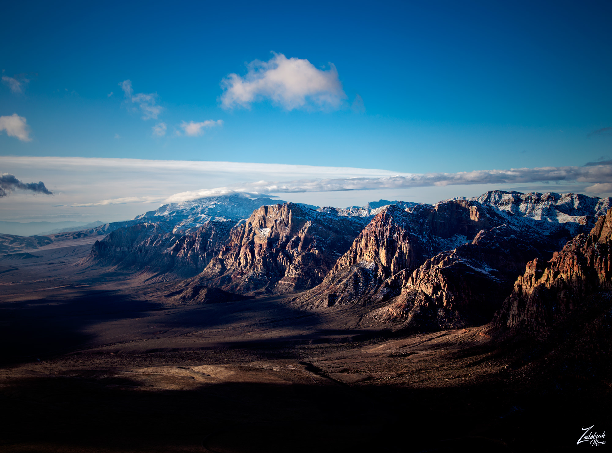 Red Rock Valley & Potosi Mountain ~ Click to Enlarge
In this image below, the majestic cliffs of Red Rock Canyon with Potosi Mountain in the background, sit timelessly observing the planet... can you imagine all that has occurred at the base of these cliffs?
First Nations Tribes were attracted to this canyon valley due to natural resources from its water, plant, and animal life that were scarce in the surrounding desolate desert.
Hunters and gatherers such as the historical Southern Paiute and the much older Archaic, or Desert Culture Native Americans, have occupied this area for many millennia. At least 6 different First Nations Native American cultures have possibly occupied this area. The following chronology is an qualified approximation, beginning from present day to ancient pre-history:
- Southern Paiute- 900 to modern times
- Patayan Culture - 900 to early historic times in the 1800s
- Anasazi - 1 AD to 1150.
- Pinto/Gypsum- (Archaic) 3500 BC to 1 AD.
- San Dieguito - 7000 to 5500 BC.
- Paleo-Indians (Tule Springs)- 11,000 to 8000 BC.
Numerous native petroglyphs, as well as pottery and tool fragments can still be found today scattered throughout the area. Also there are several roasting pits used by the early Native Americans at Red Rock provide further evidence of human activity in the past.
(Research Source)
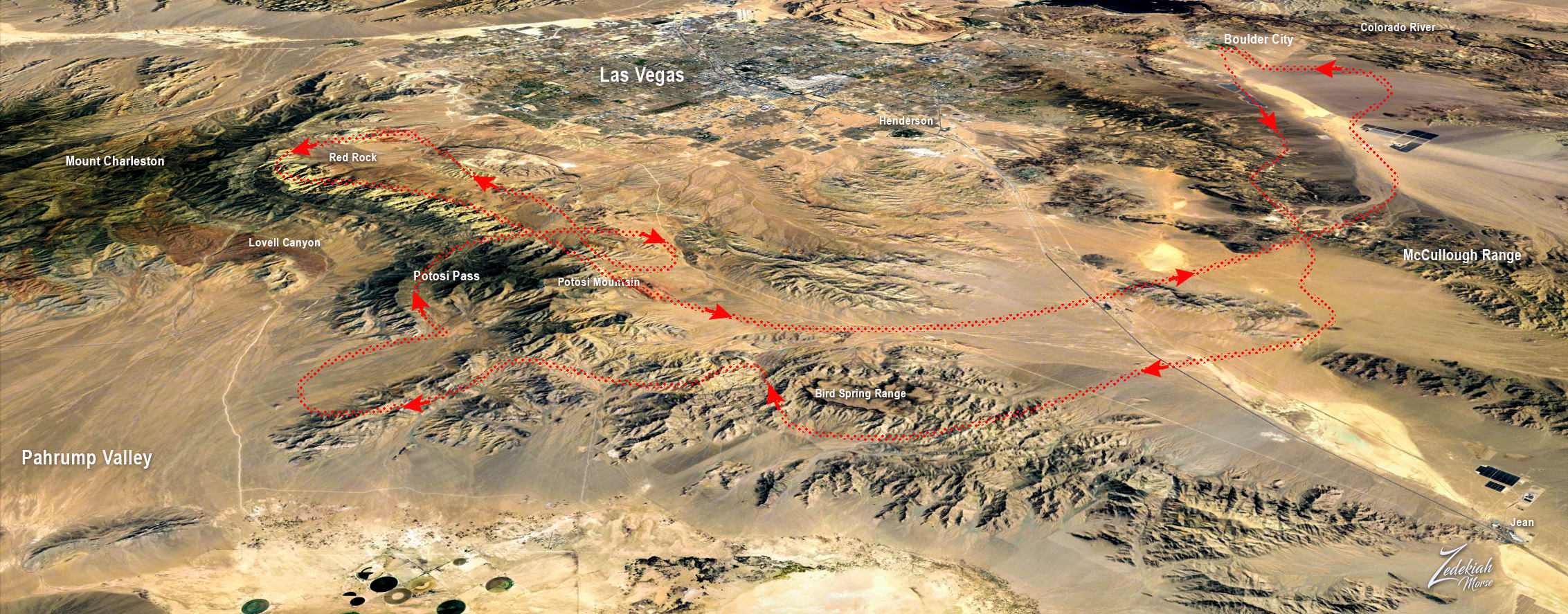 Flight Route Path ~ Full Trip ~ Click to Enlarge
After flying and filming south bound along the line of cliffs I finished up my shooting, packed the camera away and headed for the airport back in Boulder City. In the map above you can see my entire circuitous route. It was a really awesome journey and I got to experience some amazing flying and captured a number of really interesting images of the area.
I lensed these images at different times while exploring this awe-inspiring wilderness area for my ongoing project, "Where Eagles Fly".
About The Project
Where Eagles Fly - The American Wilderness Expedition is my personal mission to introduce people to these amazing locations that surround us. I am piloting a bush plane while exploring and filming throughout the remote back-country areas of North America to raise awareness of the 47% of the USA and 90% of Canada that remain unpopulated wilderness.
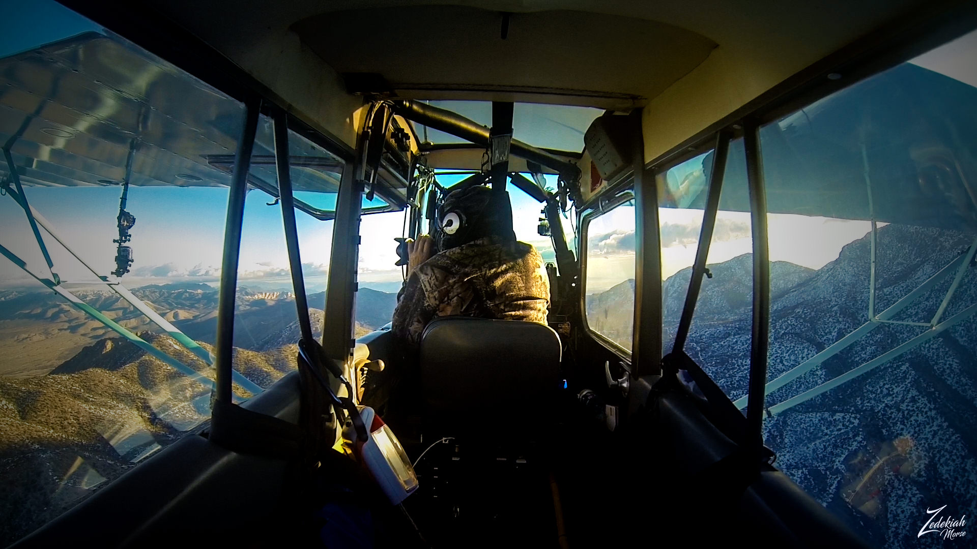 Shooting Red Rock ~ Rear Cockpit Camera View ~ Click to Enlarge
About The Author
My name is Zedekiah Morse and I'm a Bush Pilot, Photographer, Explorer and Filmmaker. I live in the Rocky Mountains and devote my time and resources to exploring as much of the world as I can by air. If you wish to watch a short film detailing how I do my work and this project, go here.
If you like what you see here upvote and resteemit so that others may experience these wondrous places.
And if you'd like these images to be part of your feed, follow me.
Thanks for your support and Yehaw!!
Perfect pictures my friend you are really like an eagle..!
Have a nice day... :)
LOL thanks!!! Very cool of you to say... I can only hope to live free like an eagle!
Sensational. The shot is impressive. Thanks for sharing.
You are welcome... hopefully you got to check out the other posts in this series
Beautiful photography @skypilot...
Thanks for this aerial roam in paradise!
Thanks Daniela, glad you liked it!
really nice and unique perspective!
Breath taking, staggering.... words fall so short to describe nature’s creations. Thank you zed for being my eagle in the sky.
Thanks! I am very happy to be your Eagle in the sky!!! What a cool statement Sally Beth!!! Thank you
Awesome! That first one is superb! Stunning way to start the post!
Great post once again, I take it because of the sediments form millions of years ago you could technically find fossils in these rocks?
In different parts of the rock yes...but it depends on the depth of the layer being exposed.
Amazing, I'm sure there are some very large ones that are still yet to be discovered!
amazing post, please visit my blog teacher :-)