Where Eagles Fly : Nebraska ~ Along the Loup River, The Sand Hills and The Snake River
in Nebraska, this is the North Loup River, a tributary of the Platte River, which runs for approximately 68 miles (109 km). The name of the river means "wolf" in French, and was named by early French trappers in association with the First Nations Skidi band of the Pawnee tribe, whose name means "Wolf People," and who lived along the rivers banks. The Loup River and its tributaries, including the North Loup, Middle Loup, and South Loup, are known colloquially as "The Loups".
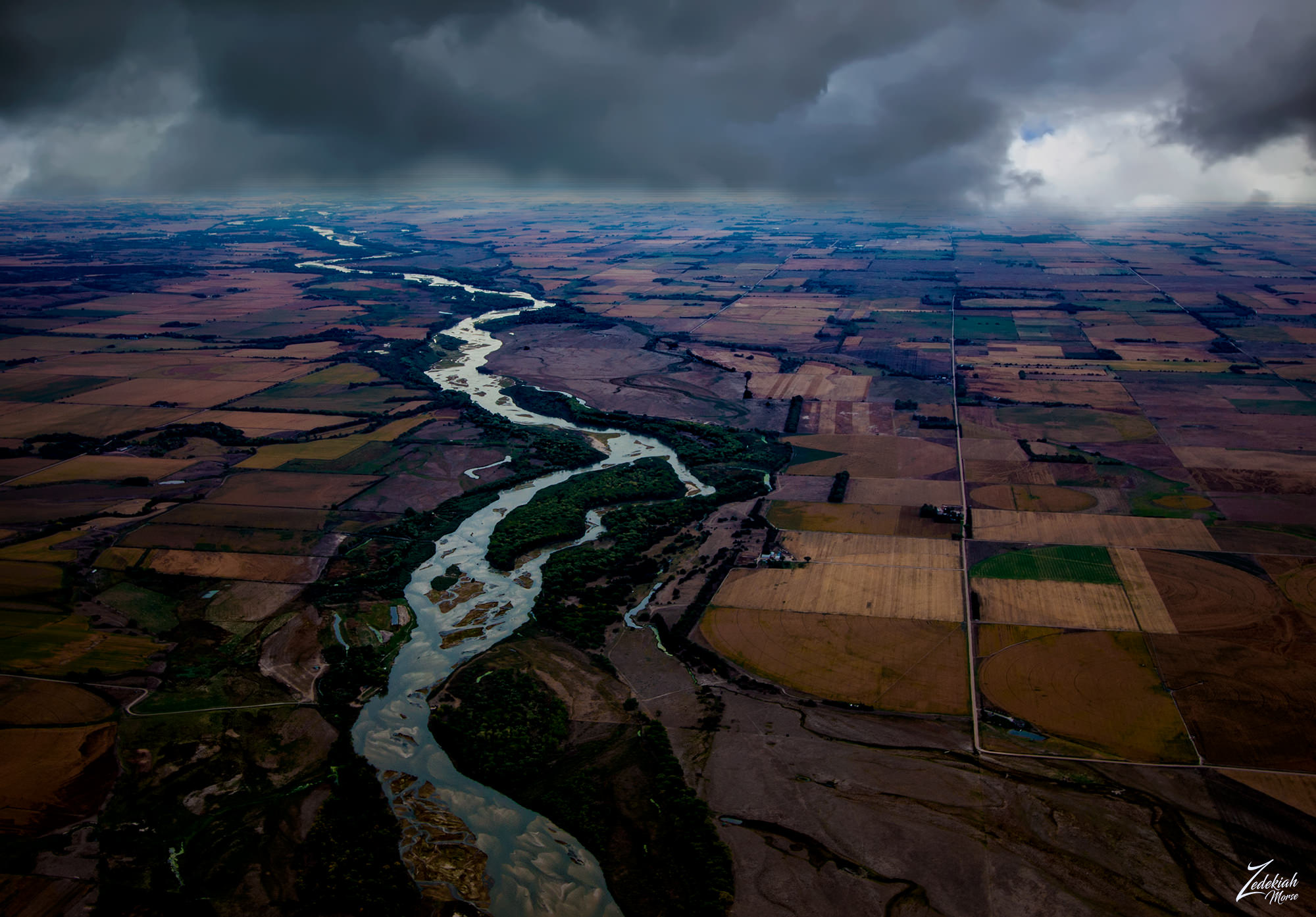 North Loup River ~ Click to Enlarge
Nebraska lays pretty much in the very middle of the United States straddling both the Great Plains and the Midwestern United States. Nebraska's name is derived from transliteration of the archaic First Nations Otoe words Ñí Brásge, pronounced [ɲĩbɾasꜜkɛ] (contemporary Otoe: Ñí Bráhge), or the First Nations Omaha Ní Btháska, pronounced [nĩbɫᶞasꜜka], meaning "flat water", after the Platte River that flows through the state.
(Research Source)
As you fly north past the Loup River the terrain begins to dramatically shift from flat plains to a seemingly never ending expanse of undulating dunes. These are the rolling Sandhills (sand dunes) of western Nebraska which stretch for miles across the plains, covering just over one quarter (1/4) of the state.
 The Vast SandHills ~ Clifk to Enlarge
These dunes can reach heights of 400 feet (121 M) with lengths as long as 20 miles (32 K) , and slopes as steep as 25 percent. These are the largest sand dune formations in the Western Hemisphere and one of the largest grass-stabilized dune regions in the world. The large sand masses that were formed by blowing sand are now held in place and stabilized by vegetation that consists mainly of grasses.
(Research Source)
Then as you fly directly into the center of these vast undulating sand hills you come up on the Snake River, a 126-mile-long (203 km) tributary of the Niobrara River, which you can see in the distance along the horizon on the of of this image. Entirely located within the Sandhills the river flows past the southern edge of the Samuel R. McKelvie National Forest.
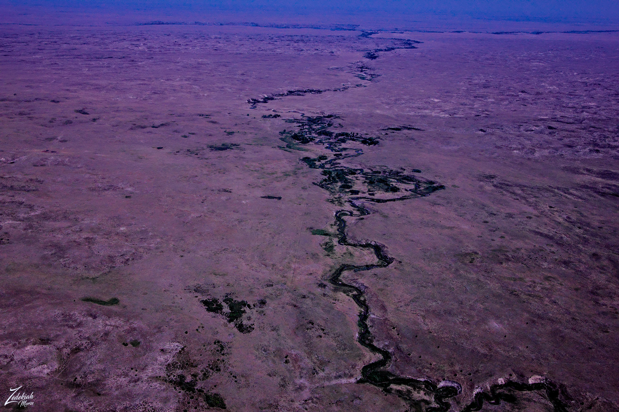 Snake River with Niobrara River in the Distance ~ Click to Enlarge
I found this interest article while researching this area from this Research Source:
This river has provided an oasis source of shelter and water for thousands of years to the First Nations Pawnee who lived on the south bank of the Platte River, their main village being a few miles east of where Fremont now stands.
They numbered then between 4,000 and 5,000. They had been residents, of Nebraska for a century or more, and are spoken of by both Spanish and French explorers as being a warlike and powerful nation, and the most numerous of any west of the Missouri. They were first heard of through the Illinois, and the name is of that language. Marquette noted several bands on his map in 1673.
They were hostile toward the Spaniards but have always been friendly toward the Americans. Their first stopping place on the west side of the Missouri River seems to have been at the confluence of the Republican, which place they soon abandoned, however, moving a considerable distance up the latter stream, where they established a large permanent village of earth-covered lodges, and cultivated corn, beans and melons, frequently going off to the buffalo lands to hunt and meet their enemies in warfare.
They claimed the country south to the Kansas River and north to the Platte. Pike, in 1806, estimated the population of three villages at 6,223, with two thousand warriors. They were divided into four bands - T -swa (Grand Pawnee), Tskithka Petower Kattahankies (Republican Pawnee), Tapage Pawnee and Sker Pawnee, Mahas or Loups
I lensed these images in Nebraska at different times while exploring this area for my ongoing project, "Where Eagles Fly".
About The Project
Where Eagles Fly - The American Wilderness Expedition is my personal mission to introduce people to these amazing locations that surround us. I am piloting a bush plane while exploring and filming throughout the remote back-country areas of North America to raise awareness of the 47% of the USA and 90% of Canada that remain unpopulated wilderness.
About The Author
My name is Zedekiah Morse and I'm a Bush Pilot, Photographer, Explorer and Filmmaker. I live in the Rocky Mountains and devote my time and resources to exploring as much of the world as I can by air. If you wish to watch a short film detailing how I do my work and this project, go here.
If you like what you see here upvote and resteemit so that others may experience these wondrous places.
And if you'd like these images to be part of your feed, follow me.
Thanks for your support and Yehaw!!
Hi @skypilot. Amazing working. But, I do not seem to see any signs of life around the river.
Thanks, always good to hear from you down then in Aceh! Please allow me to explain ....In the first picture, the river is surrounded by farmland with small farmhouses dotting the land. In the third picture, the river is in that deep ravine hence all signs of life are down in the trees in the ravine next to the river.
Thank you for explaining that to me. Hopefully you are always given health and able to finish the project you are working on @skypilot.
Perfect timing, perfect view👌🏼🤗
Thank you, glad you like it!
I really enjoy your pictures.
I am happy you enjoyed them! Thanks for taking time to look and comment.
Very beautiful)
Very kind of you to say!
Wow, awesome viewpoint, that first one especially is an absolutely cracking shot! Love it!
Thanks so much! I like the way it juxtaposes the river, which has been there forever, as it cuts through the farmland, which has only been there for a few decades.
It really does, it's amazing to think about the planning, technology and evolution that went into making all of those uniform fields, possibly irrigated, fertilized etc. Then the absolutely unstoppable force of nature just cutting through it all. I imagine as a pilot you're constantly seeing this battle of man vs nature!
Unbelievable photography. Exceptional work.
Thanks so much Casey, your work is really amazing!!
I take a look on your pictures wow you're doing well my friend wonderful collection
Hey thanks so much for taking time to check it out! I really appreciate the support and comment!!
I am very happy to see the scenery that you share this .. thanks for the information
You are always welcome my friend!!!
Someday I would like to know Nebraska. Excellent images Thanks for sharing
Thanks for you kind comment!