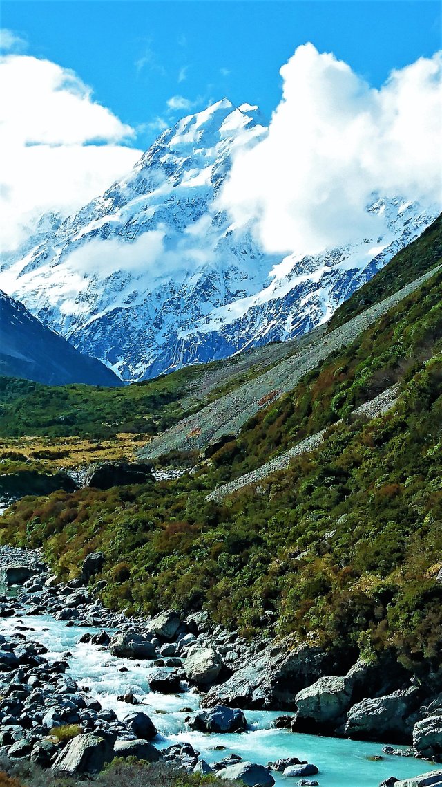
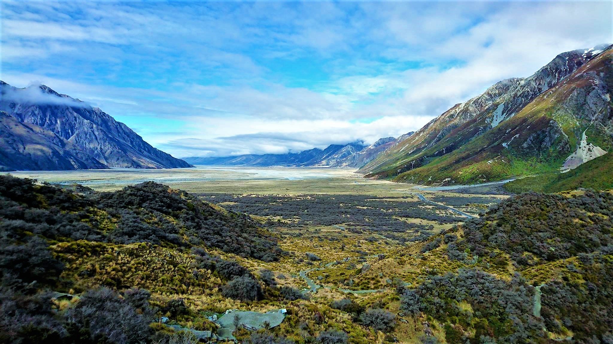
Journey continue - The almighty Aoraki aka Mount Cook, New Zealand
I presente to you the majestic Mount Cook National park
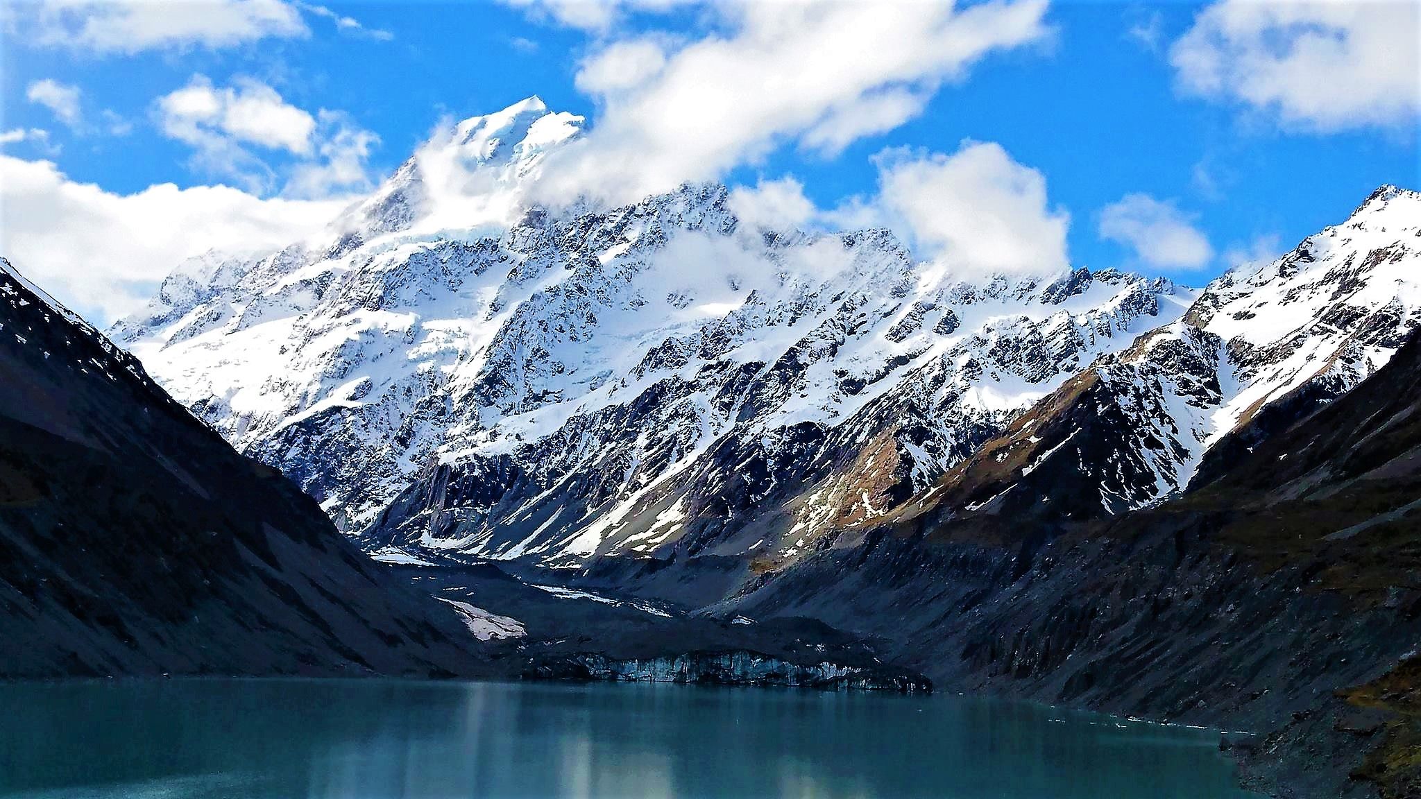
Aoraki / Mount Cook is the highest mountain in New Zealand. Its height since 2014 is listed as 3,724 metres (12,218 feet), down from 3,764 m (12,349 ft) before December 1991, due to a rockslide and subsequent erosion
According to Māori legend, Aoraki was a young boy who, along with his three brothers, were the sons of Rakinui, the Sky Father. On their voyage around the Papatuanuku, the Earth Mother, their canoe became stranded on a reef and tilted. Aoraki and his brothers climbed onto the top side of their canoe. However, the south wind froze them and turned them to stone. Their canoe became the Te Waka o Aoraki, the South Island, and their prows, the Marlborough Sounds. Aoraki, the tallest, became the highest peak, and his brothers created the Kā Tiritiri o te Moana, the Southern Alps.

The Ngāi Tahu, the main iwi (tribe) of New Zealand's southern region, consider Aoraki as the most sacred of the ancestors that they had descended from. Aoraki brings the iwi with its sense of community and purpose, and remains the physical form of Aoraki and the link between the worlds of the supernatural and nature.
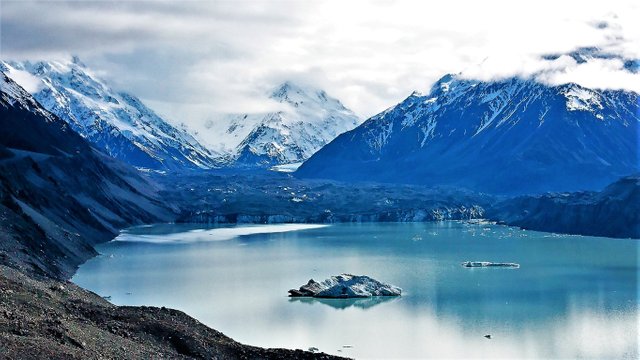
Glaciers cover 40% of the park area, notably the Tasman Glacier in the Tasman Valley east of Aoraki / Mount Cook. Eight of the twelve largest glaciers in New Zealand lie within Aoraki/Mount Cook National Park, all of which terminate at proglacial lakes formed in recent decades due to a sustained period of shrinking

Tasman Lake is a proglacial lake formed by the recent retreat of the Tasman Glacier

In the early 1970s, there were several small meltwater ponds on the Tasman Glacier. By 1990, these ponds had merged into Tasman Lake
I've been pretty shocked by the evolution of the different glaciers, compared to the documentation about what it looked like not so long time ago.
So I think, maybe this can be interesting about the Tasman Glacier
Tasman Lake has quickened the retreat of the Tasman Glacier. Initially it did so by undercutting the cliff at the end of the glacier, causing parts of the cliff to fall into the lake. Since 2006, however, a 50–60 m apron of submerged glacial ice projects out from the cliff, and icebergs periodically break off the apron and float away down the lake. Because more of the glacier is now in contact with the water, its rate of retreat has increased. By 2008 the lake was 7 km long, 2 km wide and 245 m deep, having almost doubled in area since 2000. It is expected to grow to a maximum length of about 16 km within the next one or two decades
Stunning view. I love mountains very much. It can take a long time to watch and enjoy
Congrats @mazar. Your photo made it on the Top Photographs Daily Selection today :). Upvoted and Resteemd!
https://steemit.com/photography/@mycamerashots/best-photos-trail-24th-july-2017-2017724t13143584z
Nice post and awesome shots of Mt Cook and our beautiful scenery @mazar!! 😁 #proudkiwi
Have upvoted and given you a follow!
Beautiful journey like your photos..
Saw your photo in daily selection - congratulations. Great photos and narrative. We spent a month in NZ last year and hope to get back - great country. Hope to do a blog series soon about our 3 month trip to Tahiti,Ox and NZ. Following.
great post !!!
follow me and i will follow you
Great post, very informative, thank you. @mazar
Stunning landscape. The different shades of blue from the sky, snow and water are incredible. My favourite images are #2 and #6. What equipment did you use for your photographs?
Thanks nature lover :-) See also my blogs @livelifefullest
like like like :)