Job Shadow: A sneak peak [Career]
People are often fascinated when they learn what I do for a living in my daytime job, because I am such a jack-of-all-trades. I've come up with some interesting responses over the year.
Riddle:
- I repair your house and fence.
- I paint with all the colors of the wind.
- I hold the fabric of the universe together.
- I can make a bright day blue, and a dark day red.
- I spy on your girlfriend when she sunbathes in the backyard.
- When you take a wiz outside, I take measurements.
Answer:
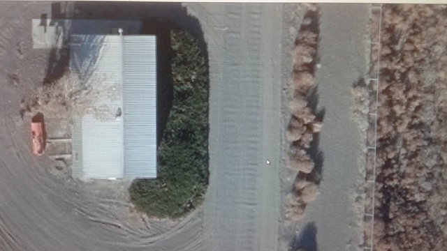
I make maps. No, I am not a cartographer, because I am not using stereoscopes to look at 3D photos to draw elevation lines and points. I am more like the artistic editor, who uses a TIN surface to tailor-fit the photos over it. I change the color of photos so they match. I get to decide which photos look best to show off a crowded city block. I make sure the same speeding car doesn't appear three times as it races down a road, because it was traveling faster than the speed of the camera snapping photos. I have tools that allow me to extend roads, fences, and buildings from one photo into another, so that it looks seamless. Sometimes the automatic mosaicing process leaves a pixelated edge between photos, and I smooth that out with a more realistic blend, keeping everything true to measurement.
People are often fascinated by my job. Looking at new lands without having to leave the comforts of my office is probably the most interesting part.
The interesting life of mapping...
Like it's always been done, all of our photos come from a camera that is mounted to the underside of an airplane. Even the old cameras provide a read-out of the exact camera focal length. Nowadays, the pilots use digital cameras, and they can even collect LiDAR measurements of the land in the same moment as the photo was taken. Newer cameras can take high resolution photos with more colors and less sun-glare visibly reflecting on rivers, beaches, and lakes. They can also take infra-red photos, which can be used to make vegetation maps, displaying which trees are dead and alive.
In our office, we don't fly on the airplanes, but contract pilots to fly over certain regions, and provide us with the custom photos.
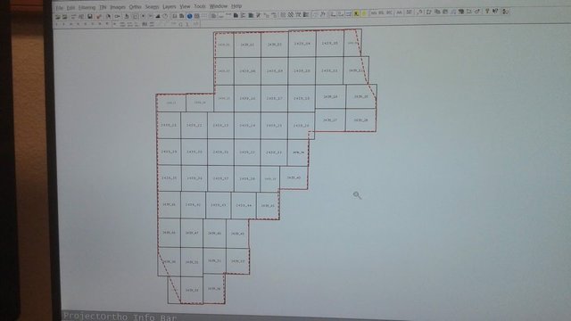
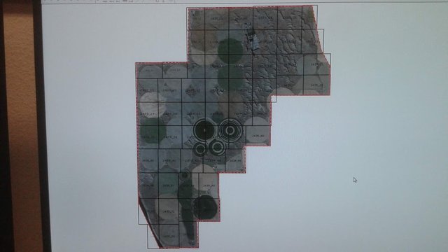
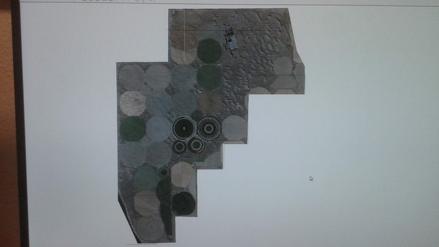
When I organize the layout for building a map, I usually start out with a strangely shaped area line. I make tiled map sections (Expert Know-How: Having smaller tiles allows the map to exist in smaller sized files rather than one huge image file, and this makes computers run faster when zooming in and out). Everybody thinks maps should be square or rectangle in shape, but that rarely happens. Cities are rarely shaped like a square. Property and neighborhood boundaries are not always square. Rivers, streams, lakes, and mountains are never squared. Mapping is very expensive work when you talk about having to pay pilots to fly on certain days of the year when weather conditions provide an ideal visual of the land for cameras. Usually we only get paid to map a very specific region of interest.
Why not just use google maps?
We are better than google maps.
Have you ever thought about where the google maps come from? Somebody had to make all those mapped areas. Have you ever seen google maps so bad they make your front lawn look purple, or the mountain in your state looks like a melted, pixelated hamburger? That's what you get when you buy a free map! Those dark spots on the side of the Himalayas are not secret alien bases; they are the un-photographed areas between and under cliffs that those sophisticated google satellites are unable to see.
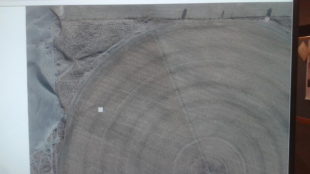
Aerial photography is much better than satellite photos used on google maps. Think about it. Would you rather have maps made by people, creating a quality image that look decent throughout, or automatically stitched together random photos by a computer algorithm that can't fathom what looks good or bad? The photos from an airplane are much closer to the earth than satellites. Therefore they have better resolution and less atmosphere and weather to contend with. One pixel on this image represents about two feet. Our maps are usually accurate within 6 inches of our measurements.
Often times google maps are outdated by many years. Land changes. Buildings get made. Roads are widened. Rivers change direction. Floods wash away hillsides. Birds re-paint the town. City planners and environmental studies need updated custom maps like ours to conduct research on the land, or to make future plans.
Always learning something new on the job
I've been working at this job for about ten years, and I'm always improving my game. I can work faster, and produce higher quality work. This is a dinosaur old industry that is very competitive in using cutting edge technology. Each time a new job comes in, there are new things to notice and pay attention to. Some jobs we make the same map every two months, and I notice small differences. Last time that pile of sand was over other. There used to be a pond over here.
Trying to decide what color photos should be is sometimes a difficult task. I have to ask myself what color should the sand be? Do the trees look green enough? Too green? Do the rooftops have a color, or is there some white glare I can reduce? Usually I am trying to make shadows look dark, but not so dark that you can't see through them. White roofs I am looking to reduce the contrast, if there actually is some texture to see on it. The Red, Green, Blue values I am always toying with to get the roads looking like the perfect 125/125/125 gray, unless it's dark asphalt road, or a light sandy road.
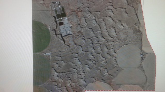
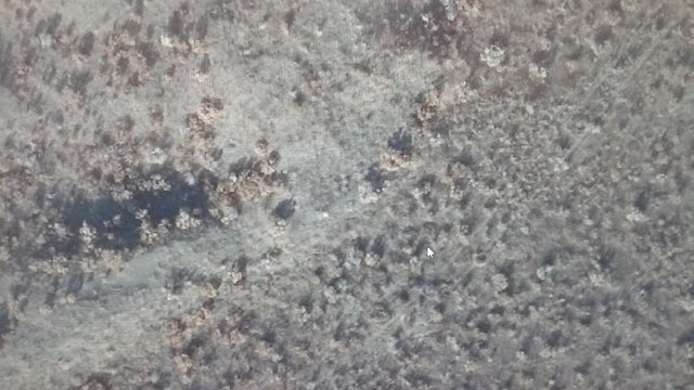
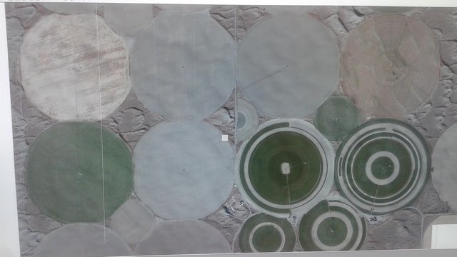
On this job I kept noticing all the sand. Maybe this is what our clients requested the maps for. There is tons and tons of sand, and it forms dunes in the wind. My guess is this is near the beach somewhere.
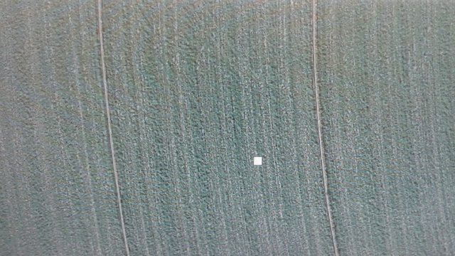
There are no animals or livestock. Just commercial farm equipment, and green fields being grown. Possibly this is food being grown for animal feed. It is amazing for me to see that every square inch of the land is filled with crops. This is winter, and yet these crops are still looking quite healthy.
Other fields are already harvested, plowed, and looking quite barren.
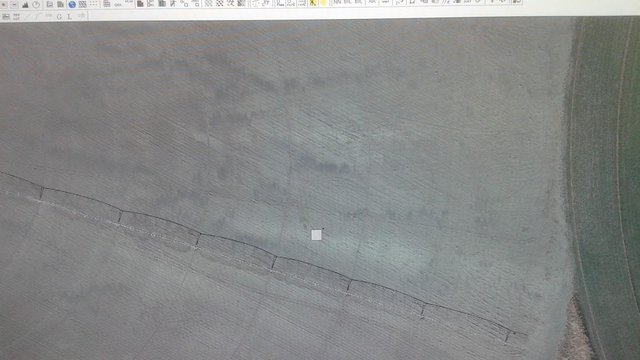
The sands of time return, changing a manicured field back into dunes.
.jpg)
Being a gardener hobbyist, these images got me thinking about the soil content necessary for building a better structure for life. While I often plant by seed through careful manual handling of the seeds and soil and water, a professional farmer does not have time for that.
They use gigantic machines to spread millions of seeds across the land, and they need as much crop as possible to grow on their land, with no open spaces. In this case they use a cheap resources they have available, rather than pay for truckloads of compost to amend the soil. They use a sandy soil, and the proof that this method works is right there in the photos. Grain grows in sand. The most basic ingredient, small quartz rocks provide winter warmth, perfect drainage, humidity, and lightweight material easy for plant roots to crawl through.
This article is my reflection on my personal work I wanted to share with others. People often have a lot of questions when they learn about what I do, and I do get to see a lot of fascinating things. You wouldn't believe what I see in people's backyards. Yes, I've been asked to cover up some oddities that shouldn't exist, once in a while.
Image Notes: Photos in this post were taken using my smartphone camera, and do not represent the final published works of the company I work for. These image views are demonstrative of some of the variety of terrain I analyze in my role. Radial glare lines and pixel distortion are a result of my smartphone camera. Although these maps are not considered confidential, I choose not to publish our finished maps or disclose details of their locations out of respect to our clients.
Thank you for viewing. Rock on!
#farming #land-use #career #job-shadow #cartography #map #mapping #soil #crops #plants
Bonsai!
| Account Value: $682.11 | Votes Given / Received: 4,762 / 12,829 |
| SP: 1,958.904 | Posts / Comments: 274 / 2,172 |
| STEEM / SBD: 3.817 / $0.007 | Delegated In / Out: 188 / 180 |
| REP: 63.31 | Followers: 1,657 / 205 following |
| Curation Rewards: 2.15 SP | Author Rewards SP / S / SBD: 28.967 / 1.999 / 0.005 |

| STEEM In / Ex = 0.34753 / 0.26765 | BTC / ETH/ LTC = 3622 / 126.2 / 31.6 |
| SBD = 0.74722 | Gold/Silver oz. = 1,291 / 15.62 |

Wow. This is super interesting. Does your company use drones? The human eye still has a place in this world :)
Drones are the hot technology right now in mapping. I think cost of drones, flying abilities, drone cameras, and software that runs the drone cameras is the biggest limiter right now. We don't use them yet for regular jobs, other than research and testing. Our best and most reliable cameras are still the digital ones on airplanes.
I think height of the photo makes a big difference in the maps. The higher up you go, the better top view (ortho correct) you will get over trees and buildings. The lower the photo is taken from the more you will see the sides of trees and buildings in most of the photo. Before drones, people used to ask a lot about helicopter photos. They are too low. You would need dozens of photos over every rooftop, just to stitch together a single building. Much easier to map several buildings that appear ortho correct from a single photo taken from a thousand feet up in the air.
Good to hear some old tech is still superior :) I'm sure drones will continue to improve and the legal issues about flying drones higher will eventually be worked out.