The Wildlands Conservancy, Pt. 2: Whitewater Preserve
The Interstate 10 is one of the world's most heavily traveled freeways. The drive through the Mojave Desert turns into a beige blur, punctuated by casinos and epic windmills. It is understandable that you might miss the offramp to Whitewater as you speed past the outskirts of Palm Springs.

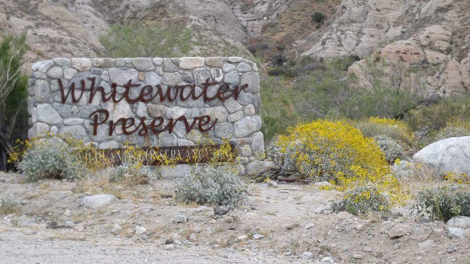
Everyone who drives on by is seriously missing out: Whitewater Preserve, an ancient oasis, is a place of local, state, and federal significance, as well as a place of world renown.

The Wildlands Conservancy, true to their mission, purchased this watershed from private ranchers, adding in federal parcels purchased from the Bureau of Land Management (BLM). You see, prior to Obama designating the Sand to Snow National Monument between Joshua Tree National Park to the San Gorgonio Wilderness, the region was a literal checkerboard of BLM / private land. https://www.fs.fed.us/visit/sand-to-snow-national-monument Every other quadrangle on the topo map could be abused by resource extraction and overgrazing.

"The Conservancy's purchase and restoration of the 40,032 Whitewater Range Allotment has transformed a black water cattle wallow into crystal clear waters." http://wildlandsconservancy.org/preserve_whitewater.html In my opinion, TWC led the way to saving this critical environment and enshrining it as a National Monument.

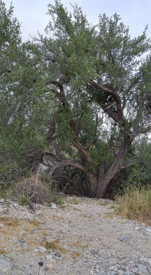
So join me in taking that offramp from your trip to Palm Springs or Coachella. Drive a couple of miles up the cobblestrewn floodplain, where the tan background of the desert basin comes alive with a riparian wonderland of cottonwood, willow, and mesquite trees. You will pass a few remaining private homes before the long driveway to the Preserve narrows against the Matterdome.

Beautiful Craftsman style iron gates and a vintage trout farm turned visitor center usher you into the generous parking lot and beautiful grassy picnic/camping area dotted with shade trees. The trout ponds feature massive Rainbows destined for no one's dinner table. The paved walk offers John Muir quotes engraved into granite to guide your quiet reflections.

You may be wondering why I called this location WORLD renowned. You see, three Wildlands Conservancy preserves clustered here encircle 30 miles of the Pacific Crest Trail. People from around the globe prepare for years physically, mentally, and financially to take a through-hike from the border of Mexico to Canada. The trail was also popularized by the Reese Witherspoon film, "Wild".

After tackling the treacherous peaks of the San Jacinto mountains and the pitiless drought of the desert floor, the PCT hiker rejoices at arriving in this oasis. April is a fabulous month to visit Whitewater and strike up a conversation with someone taking advantage of the free camping and running water available to thru-hikers. You never know if you will meet someone from halfway across the world! Bring some "trail magic" to gift them just in case.

As you head northbound up the Pacific Crest Trail, the rugged terrain cannot fail to delight. Peaks over 10,000 feet tall lurch above, like cathedrals, sacred to First Nation inhabitants. (You can visit the nearby Morongo Reservation Malki Museum for more cultural heritage information. http://www.malkimuseum.org )

Native grasses, herbs, and cacti line the canyon walls and floor,


while sugarbush, mesquite, willow, and ironwood acacia trees, dripping with mistletoe passengers, cram into the drainages.
It's also a wildlife corridor allowing bighorn, cougars, coyotes, bears, and more to migrate between the two mountain ranges.

The PCT crosses the Whitewater River a couple of miles north of the trailhead at Red Dome, a brick-red geological feature jutting out of the pure white sand.

The floodplain spreads wide in this bowl of a canyon, crisscrossed by the ever-changing ways of water. It's a great place to picnic, play, and to try out your water filter gear.

Next, follow stone cairns to stay on the PCT, where it takes us up to the ridgetop via windswept southfacing switchbacks. Hopefully you packed plenty of water, because this climb will make you sweat even on a cold day, and the desert dryness will whisk it away before you even notice. Take this climb in March or April when the beavertail cactus bursts into fuschia splendor

and the gravelly ground is covered by blankets of ephemeral blooms.


Don't try it during the heat of summer!
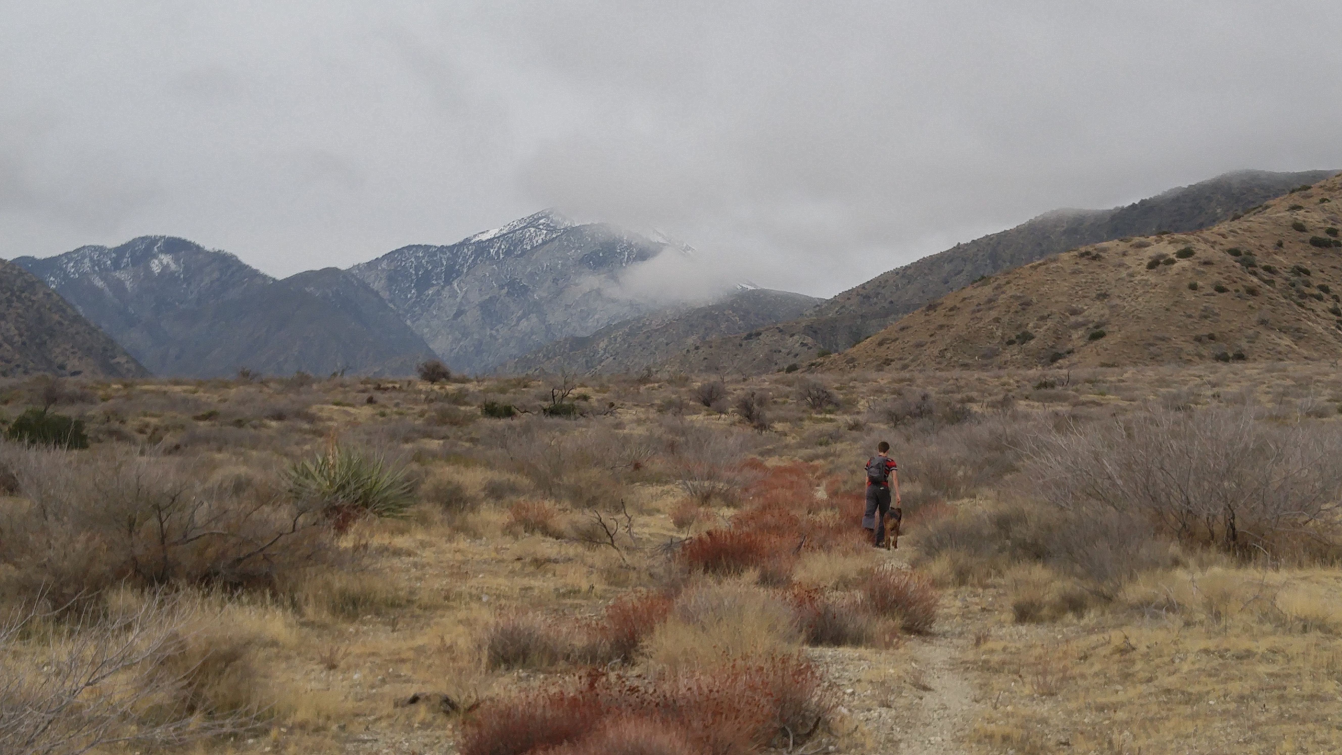
Pause for a moment at the summit and take in the view. To the south, the peaks of San Jacinto frame those otherworldly-looking wind mills, and the Salton Sea sprawls down Imperial County. To the west, firstborn son of Earth Mother, Mt. San Gorgonio, reigns supreme with its almost perpetual cap of snow. Ah, yes, purple mountain's majesty, indeed!

The trail leads down, through the northfacing juniper forest into the Mission Creek arroyo. Here, day hikers with a shuttle can veer east into another Wildlands Conservancy Preserve for an 8 mile loop. I will cover that option in another installment of this series.

For this one, let us continue northbound on the PCT just a little further, before it once again heads westward up to the next switchbacks up to a mesa offering even more awe-inspiring views of the entire canyon, including the previous ridge we just surmounted.
There is another trail option, a road less traveled, just the ghost of a single track, weaving through the burro bush and tufted grasses, into Catclaw Flats.

The slopes cupping this alluvial plain are wooded with juniper and thickets of cholla cactus. Beckoned by Mt. San Gorgonio, you can hike to some ruins at its base, called Wathier Landing, and see how the snowmelt births the confluence of Whitewater and San Gorgonio Rivers.

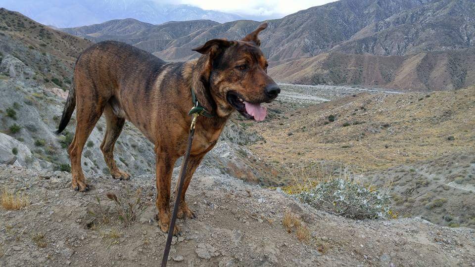
I was forced by circumstances to turn off before Wathier Landing and just follow the drainage creeks downstream back to Red Dome. But my boy and his dog certainly enjoyed this offtrail adventure, following deer and big cat tracks in the damp sand and splashing in the refreshing water.

Still, cutting it "short" amounted to nearly 12 miles roundtrip. Perhaps Wathier Landing is a bridge too far for a day hike, or perhaps I could shave off some mileage by just cutting off the trail and following the river upstream to its origin.

I must stress to the casual hiker that this is dangerous backcountry

subject to flashflooding, landslides, bears, snakes, and mountain lions, as well as shifting river forks that can lead you into unmarked territory in the literal wilderness. Note your intentions at the trailhead sign-in, and bring a satellite communicator and desert/mountaineering safety supplies.
I have dreams of upping my game and backpacking deeper into the Whitewater Preserve backcountry. There are springs, waterfalls, and a "secret entrance" to National Forest wilderness trails whose former trailheads have been blocked by reservation gates. The mountain scenery only becomes lusher and more shaded by tall conifers the further you head northwest.

I hope you enjoyed this tour of the Wildlands Conservancy Whitewater Preserve. Please visit their website, and considering planning a trip to one of their pristine California locations. I promise you won't regret it.
Also, don't miss Part One of this series: Bluff Lake Reserve.
https://steemit.com/photography/@creationofcare/the-wildlands-conservancy-pt-1-bluff-lake-reserve
Although I have visited a number of TWC sites, it is my goal now to check out all 15 and report on them to you here on Steemit! They are a wonderful model of how we the people can perform the Creation of Care, and rehabilitate our world in balance with nature!
Love,Cat
(All photos were taken by me on my phone over a few years, some of which were posted on my fb .)
I love Brisket!
He is quite the trail dog! I hope we can take a hike with you when you visit. This year is gloriously green!
Excellent post. Love your photographs especially the ones with the cacti. Keep soaking up the beauty around you and sharing it with us.
Thanks so much for checking it out and for your kind remarks! Part 3 is coming. Plus, this fall I have plans to visit three of The Wildlands Conservancy locations on the Northern California coast as well as many other beautiful sceneries of the American West.