TeamSerbia Photo SerbiaContest — Landscape photography(Something about Tara Mountain)
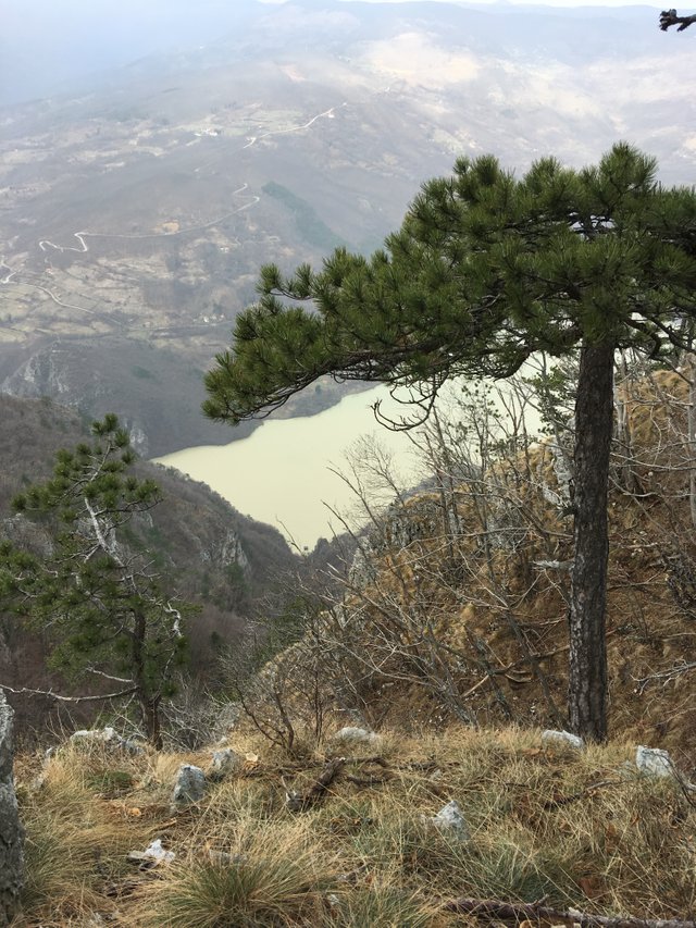
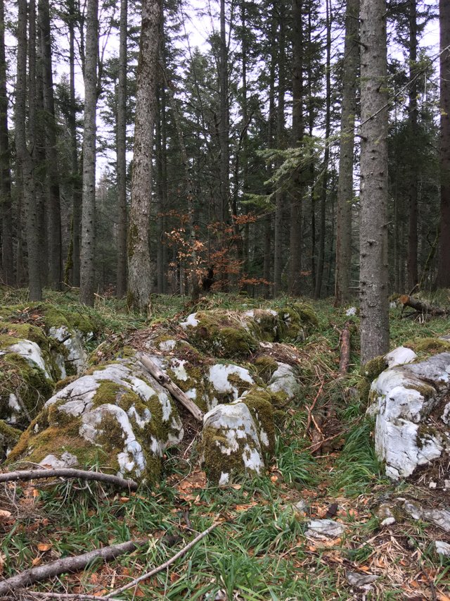
These landscape photos were photographed on Tara Mountain
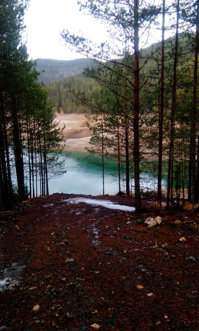
- Tara is located in the western part of Serbia and belongs to the inner belt of the Dinarides. The average altitude of Tara Mountain is 1200 m. The highest peak is Kozji rid with 1591 m. It belongs to the group of Podrinje mountains and has a complex geological past and diverse petrographic structure.
The location of the Tara Mountains is a favorable condition for the development of tourism, as it enables a diverse content of tourist stay, that is, a visit to a number of tourist sites. The richness and diversity of tourist values, ecologically preserved natural environment, mountainous relief with moderate altitudes of 800-1500 m, suitable grounds for winter sports, rich and diverse flora and fauna, beneficial climate, Drina with artificial lakes Zaovine and Perućac, give This mountain has great tourist value, which makes it competitive with Zlatibor and other mountains. Tara has a favorable position towards complementary tourist values in the immediate vicinity: Uzice, Mokra Gora, Visegrad with numerous cultural and historical monuments, which attract the excursion movements of tourists stationed on Tara in order to meet educational and cultural needs and a richer content and stay. Tara has an excellent predisposition for sustainable tourism, which represents any tourism that has minimal impact on the environment and cultural heritage, but at the same time leads to the economic development of the local community.
The delicate relief of Tara is suitable for tourist construction, as there are good conditions for locating tourist facilities. In places of gentle slopes, passages and erosion extensions, there are localities that are very sunny and sheltered from the winds. During winter the conditions for sledding, Nordic, beginner skiing are favorable. Alpine skiing opportunities are limited due to the altitude difference of only 400 m and the length of trails that do not exceed 2 km.
The highest quality ski slopes are in the area of Predov krst, with a height difference of 500 m. The length of the trail is from 3 to 5 km. Tara's relief has suitable recreational properties, as low inclines favor walking, horseback riding, various sports games, use of the treadmill and the like.
TARA NATIONAL PARK
Tara has been since July 13, 1981. The National Park was proclaimed by the National Assembly of the Republic of Serbia and covers an area of 24,991.82 hectares.
Caring for the most beautiful mountain of Western Serbia in 1981. entrusted to JP Tara National Park. It is assumed that the Triassic limestones, on the northern sides of the Tara in the Tertiary, were the coast of the Pannonian Sea. Due to its favorable climate and remoteness, the relic and endemic of the Balkan Peninsula, Pancic omorica, and many other natural monuments, to put it mildly, live on the Tara. Tara is mostly built of limestone, with an average altitude of 1000-1200m. The highest elevation is Kozji Rid 1591m and the lowest elevation 291m or the height of Lake Perućac. The Vrelo River is the strongest karst spring in the N P whose water flows into the Drina after exactly 365m. The climate is extremely mountainous, the summers are fresh and the winters cold with plenty of snow. Rainfall is most common in May. The driest months are July and August, autumn is sunny and warmer than spring.
Tara NP is an 80% area of forest ecosystems. 34 forest and 19 meadow communities were discovered.75% are mixed stands of spruce, fir and beech. In addition to Pancic's cabinet, mussel hazel, yew, holly, jeremyak, dervenski variety, peony, rib fern…
Of the 53 mammal species recorded on Tara, the most attractive are the brown bear, the chamois that live on Tara at 290mnv. Of the 135 bird species, 43 are migratory species, with the most endangered species such as eagles, falcons and other nature cleaners.
There are more than 251 fungal species in the Tara forests, 3 of which are poisonous. One of them is the Green Bud - the most dangerous fungus in Europe.
Fishing on the waters managed by NP Tara is a real pleasure. These watercourses are inhabited by about 40 species of fish (juvenile, grayling, catfish, carp, catfish, barb…).
The Tara NP area is rich in archeological sites dating from the Neolithic to the Middle Ages. Some necropolises are known - the stećak tombstones in Perućac, the remains of the medieval fortress Solotnik and the Rača monastery, the endowment of King Dragutin Nemanjic from the 13th century.
18 hiking trails with a total length of 120km are marked on Tara. For the use of these trails it is recommended to use hiking maps that can be reached at the information points in the Park.
The TAROCIKL project defines 27 cycle paths approximately 420km long and opens the door to a new type of tourism, without adverse effects.
Hunting in the Tara NP is always organized and in accordance with the planning documents. There are about 40 bears, 300 chamois, 320 deer and about 40 wild boars in the forests of Tara. The permit for hunting, guides and transport of game to other areas is approved by the Tara Hunting and Fisheries Protection and Promotion Service JP Tara National Park.

The middle part of that first photo looks like a painting my grandma had on her her wall. I like it a lot! Thanks for sharing the pics and telling us about Tara Mountain. :)
Wow the views are simply amazing, is it a place only to hike or are you allowed to camp there?
Nice capture.
This post has been manually curated by The PhotoStream team: The Photography Tribe!