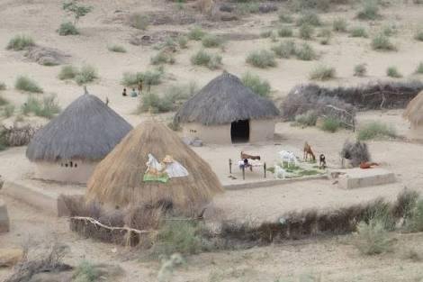
Beauty of tharparkar desert..
It was in 1843 when Sir Charles Napier became victor of Sindh and this part was merged into Katchh political agency in Hyderabad collect-orate, later on in 1858 the entire area became part of Hyderabad. Subsequently, in 1860 it was renamed as “Eastern Sindh frontier” with its Headquarters Umerkot, controlled by Political Superintendent. In 1882 it was renamed as district and its administrative head was Deputy Commissioner. Lastly in 1906 Headquarters of the district was shifted from Umerkot to Mirpurkhas. Until 1990 the present district of Tharparkar, Umerkot and Mirpurkhas comprised one separate district in 1990 i.e. Mirpurkhas and Thar established the town on Mithi as the new headquarters of the Tharparkar district, while Umerkot was bifurcated on 17 April 1993.
Geographical features:
There is no stream of fresh water in the region. However, in Nagarparkar there are two perennial springs, namely Anchlesar and Sardhro, as well as temporary streams called Bhatuyani River and Gordhro River which flow during the rainy season. There are some hilly tracks called Parkar. The Granite Marble has been found there. “Karoonjhar Mountain” is near to Nagarparkar. There are no lakes, glaciers, plains in the district. This district is mainly a desert area. 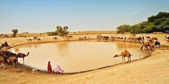
[wikipedia]
Congratulations @abuzarabbas! You have completed some achievement on Steemit and have been rewarded with new badge(s) :
Click on any badge to view your own Board of Honor on SteemitBoard.
For more information about SteemitBoard, click here
If you no longer want to receive notifications, reply to this comment with the word
STOP