Low in the Water: wild camping on Rams Island
Last weekend’s overnighter made me nostalgic, so I thought I’d revisit an older wild camping adventure.
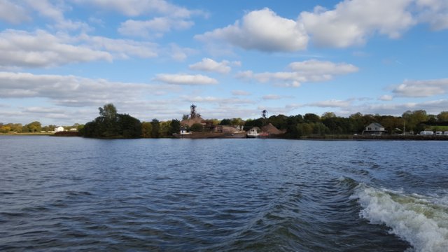
This is back in October 2015, almost Hallowe’en, but July weather: hot, bright. The water sparkled as a small boat, the Island Warrior, took us on the short crossing to Rams Island, a long, low apostrophe of land lying in the largest inland water body in the British Isles, Lough Neagh. Only a few hundred yards across and barely a mile long, it once sat even lower in the water but climate change (and water extraction) has seen water levels drop in recent decades.
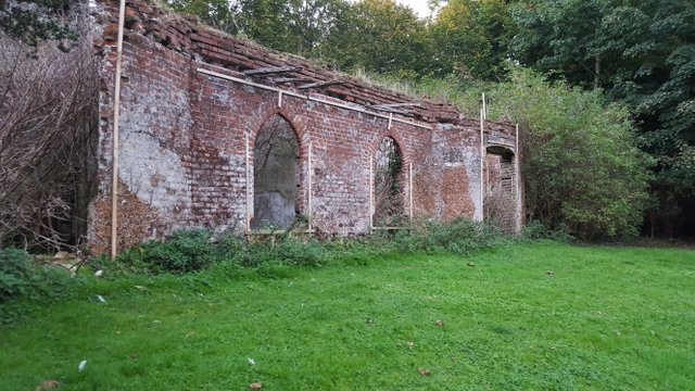
The island was once the summer home of the O’Neills, an important aristocratic family in these parts. Their summer house lies in ruins, burned down by vandals - possible drunken GIs from their base nearby - during WWII.
Long before, as Inis Draicrenn, it was home to a monastic settlement gathered at the base of the round tower whose stump still stands.
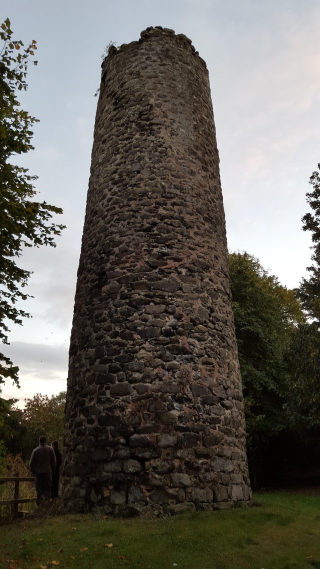
They had chosen the site for safety, but the annals mention raids and massacres.
Further proof of ecclesiastical occupation of the site came in the late eighteenth and early nineteenth centuries when human bones including several complete skeletons and remains of coffins were occasionally dug up in the vicinity of the Round Tower. A number of brass fastening pins, probably for monks' cloaks or shrouds, were found in conjunction with the burials, and amongst the coins discovered was one of Edward I.
(Rams Island Heritage Project)]
The island is being restored and cared for by the Rams Island Heritage Project, cleared of rats and invasive plant species like Himalayan Balsam. Visitors aren’t allowed during the bird breeding season, but we were coming ashore to woods full of birdsong. Oh, and chickens clucking - there’s a large flock kept behind wire mesh near the jetty.
Speed's map of Ulster, dated 1610, and Johan Blaue's map of 1654, both mark the island as "Enis Garden" and show the symbol of a church tower. It is on record that the ruins of a church were still visible near the Round Tower in the middle of the eighteenth century.
(Rams Island Heritage Project)]
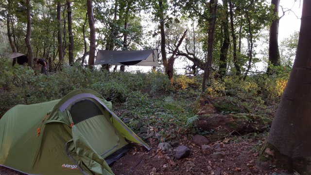
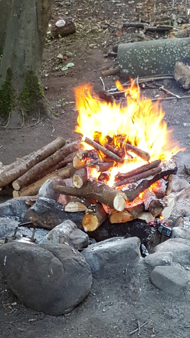
Our gear was humped to the camp ground by a young man on a quad bike and trailer combo, who delivered it, sped off and returned with a huge load of firewood. Now this was camping! No hunting, hauling deadfall and sawing half the day. A half hour of splitting and batoning, and the upside-down fire was ready to go.

What’s an upside-down fire? Well, in your typical campfire, tinder and kindling lie at the bottom and fuel is piled or stacked on top. In the upside-down fire, the fuel is stacked like a Mayan ziggurat, and the tinder bundle and kindling ignited on top. The fire burns down - and takes a lot less maintenance.
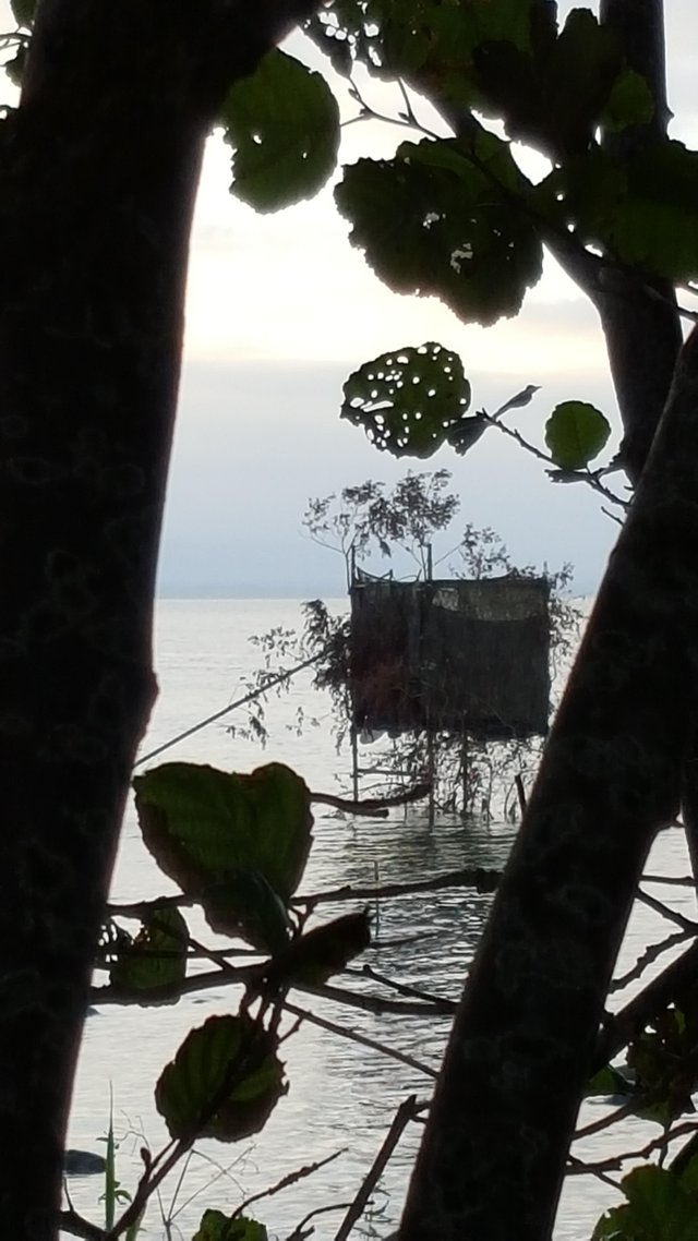
Before dinner, while the fire burned down to coals to cook on, we roamed the shoreline. Out on the water, a shooter’s hide lay abandoned.
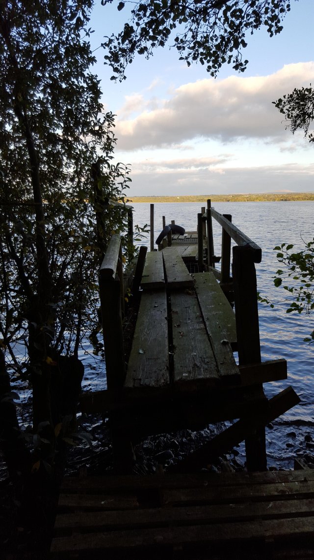
A little further, and a broken jetty rotted in the shadows, near a small gravel beach. The sun was setting. In the morning, I would creep back here while the other still slept, and dip my toes in the cold water...
If you’ve enjoyed this report, follow me to see more. And of course it’d be great if you’d upvote and reSteem.
If you want to find out more about Rams Island, check out the Rams Island Heritage Project and do what you can to support their great work.
Nice post and looks like a very nice experience for you.