[EN] News: Mapillary features inside OpenStreetMap editing tools
It's the first non-polish post in OpenStreetMap community. I hope that you'll enjoy it.
Intro

OpenStreetMap is a collaborative project to create a map of the world on a free license ODbL. Project in assumptions is similar to Wikipedia. It is an alternative for GoogleMaps where data is owned by corporation.

Mapillary contains crowdsourced geotagged photos. Co-founders were Jan Erik Solem, Johan Gyllenspetz, Peter Neubauer and Yubin Kuang but Facebook acquired Mapillary in June 2020. It is an alternative for Google StreetView. Mapillary has supported OpenStreetMap since the beginning.

News
Mapillary features are now available in OpenStreetMap editors like iD and JOSM. It means that objects recognized on the photos can be shown as additional data in editors. Here how it looks:

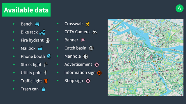
List of all features is available on the image below.

Together with provided traffic signs it looks very nice and can be very helpful during a mapping.

Sources:
[1]: OSM logo by Ken Vermette
[2]: News https://blog.mapillary.com/update/2020/08/24/global-map-features-openstreetmap.html