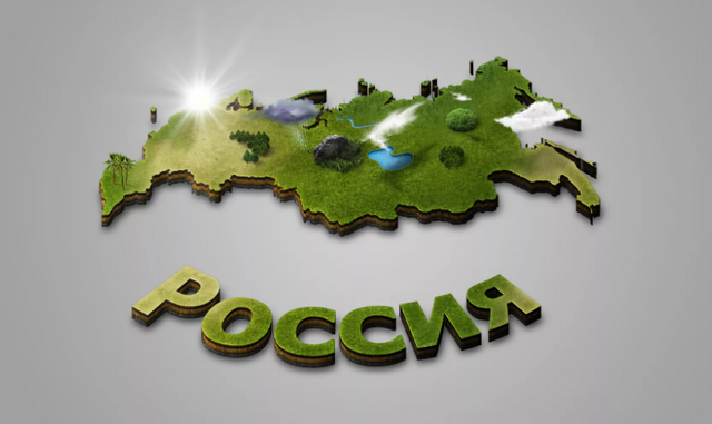
UNUSUAL AND BEAUTIFUL PLACES OF RUSSIA
 Russia is the country with the largest territory in the world. In this area there are nine climatic zones, from Arctic deserts to the subtropics. The nature of Russia is surprisingly diverse and never ceases to amaze travelers with new discoveries, and more than a thousand years of history has left many amazing traces. We are starting to publish descriptions of unusual places in Russia that are of interest to tourists as natural, historical and architectural monuments.
The Manpupuner – "Pillars of weathering". Republic of Komi
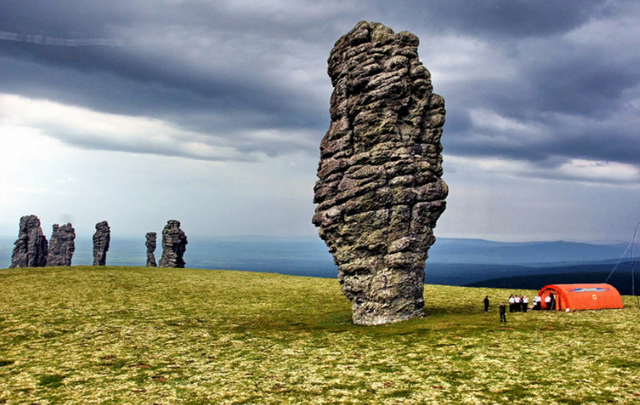
In the language of Mansi, the indigenous inhabitants of the Northern Urals, the name of the geological monument "man-Pupu-ner" means "a small mountain of idols." The monument is located in the Pechero-Troitsky district of the Komi Republic, in a remote, inaccessible place for tourists. By its nature, this remains - stone cliffs of hard rock, the rest of the once towering mountains here. Wind, atmospheric precipitation gives the rocks a bizarre shape.
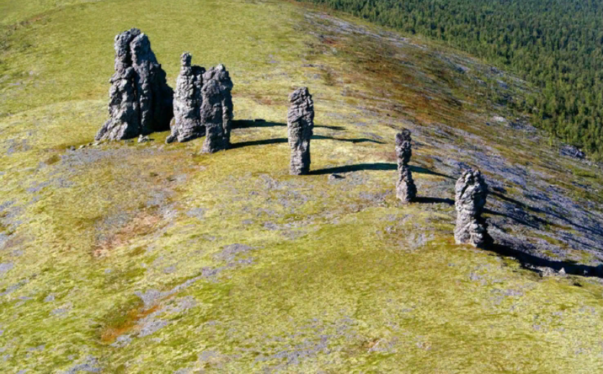
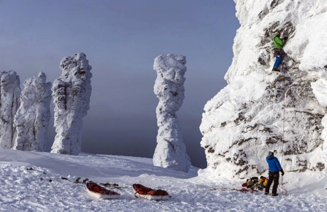
The tallest of which is 34 meters, and the lowest 7 m, and the whole "pillars of weathering" in the Manpupuner seven. Posts have a bizarre shape, reminiscent of the silhouettes of various animals. Silhouettes can change depending on the point of view: from different places you can see the figure of a standing man, the horse's head or the silhouette of a RAM.
«Lena pillars.» The Republic Of Sakha (YakutiaThe Republic Of Sakha (Yakutia)
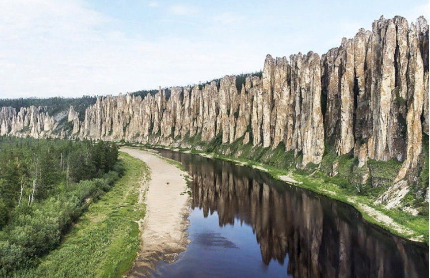
Natural monument "Lena Pillars" in Khangalassky ulus (district) of Yakutia, as described above Manpupuner – the result of weathering rocks. However, the size of the Yakut monument is much superior severouralsky. "Lena pillars" stretch along the right Bank of the Lena for several kilometers, and make a mystical impression on observers. Places around wild, crowded. Around there is an improbable silence, and purity of air can cause dizziness at the city dweller.
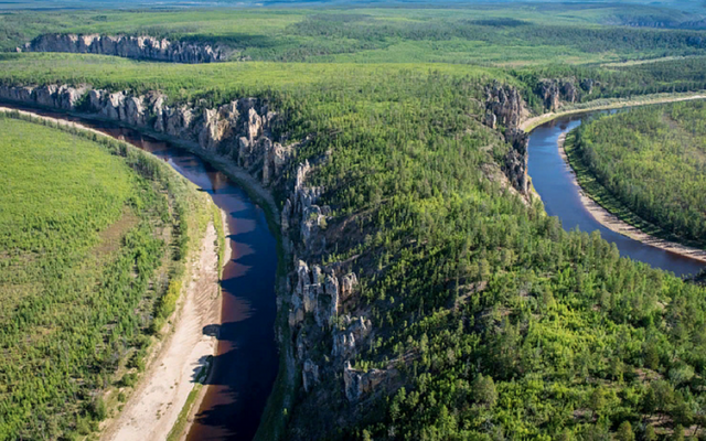
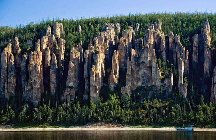
In this unusual place, the government of Yakutia has created a natural Park, tourists usually visit the "Lena pillars" in the summer, on ships and boats. The object entered in the register of UNESCO as a unique monument of wild nature.
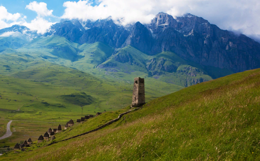
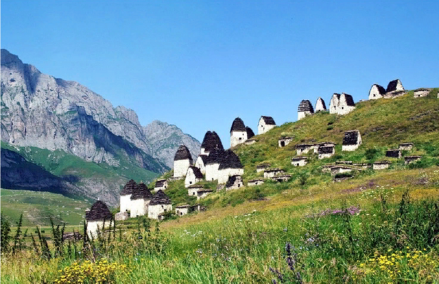
City of the dead. Republic Of North Ossetia-Alania
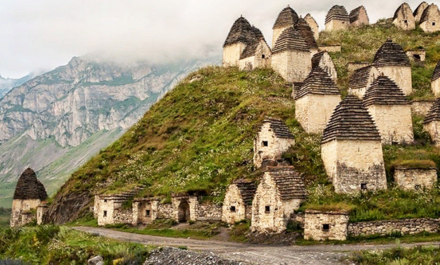
In the Suburban area of North Ossetia-Alania, in the mountain village of Dargavs is a unique historical and architectural monument-the"City of the dead". This necropolis consists of 99 stone-built two-storey and four-storey crypts. The crypts amaze skillful masonry and in perfect architectural form. There is a theory that there were buried victims of the plague which raged in South Ossetia in the XVIII century.
Lake Baikal. Irkutsk region, Republic of Buryatia
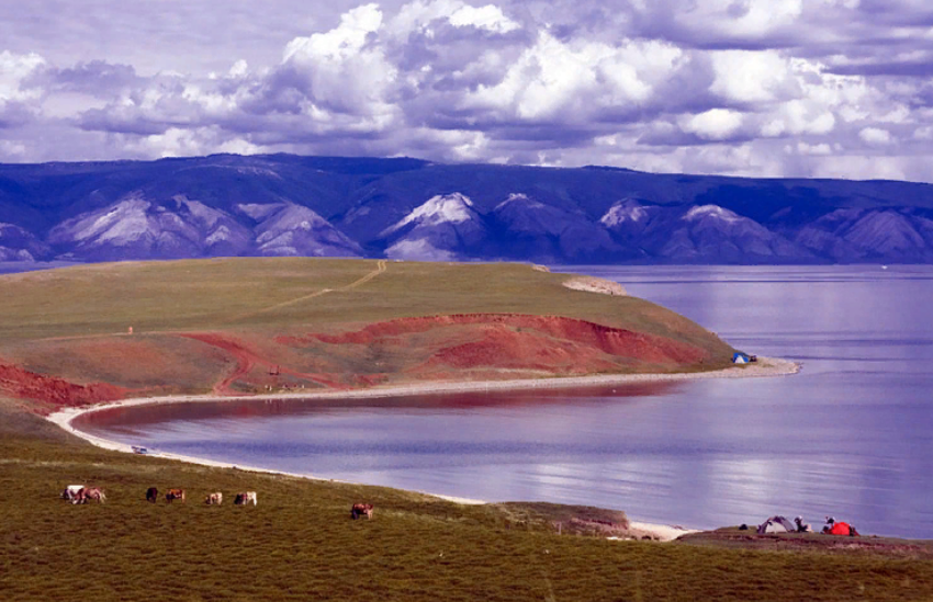
The deepest lake on the planet, the average depth - about 700 meters, and the maximum – 1642 meters. The largest reservoir of fresh water on Earth, lake Baikal it 19% of the world's reserves. The lake is fed by over three hundred large and small rivers, and flows only one – Angara. The beauty of Baikal amazes everyone who sees it. The water in the lake is so clear that the pitfalls and other fragments of the bottom can be seen at a depth of 40 meters.
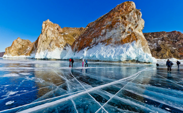
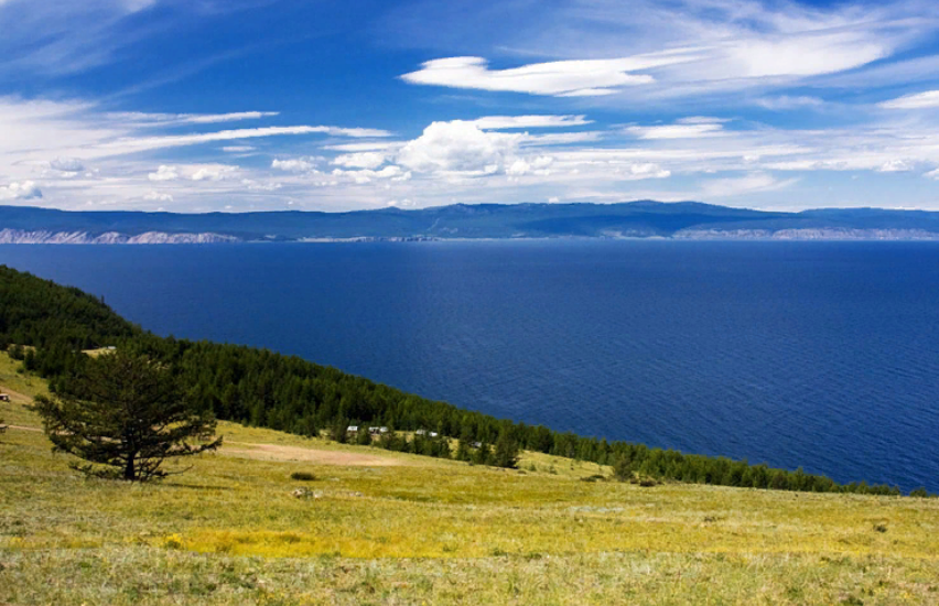
There are so few mineral salts in Baikal water that it is sometimes used as distilled water for technical purposes. And the nature of the Baikal shores reflected in these crystal waters is one of the most beautiful in Siberia.
A giant diamond quarry. The Republic Of Sakha (YakutiaThe Republic Of Sakha (Yakutia)
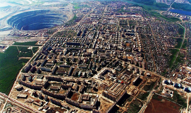
A kind of" anti - pendulum " - evidence of how harmful can affect the nature of unrestrained desire of people with its wealth. Diamond quarry in the Yakut settlement Mirny began to develop in 1957. Currently, its diameter at the top – 1200 meters, the maximum depth – 525 meters, diamond mining stopped. At the last stages of development of the quarry dump truck drivers had to overcome about eight kilometers of climbing along the serpentine road of the quarry.
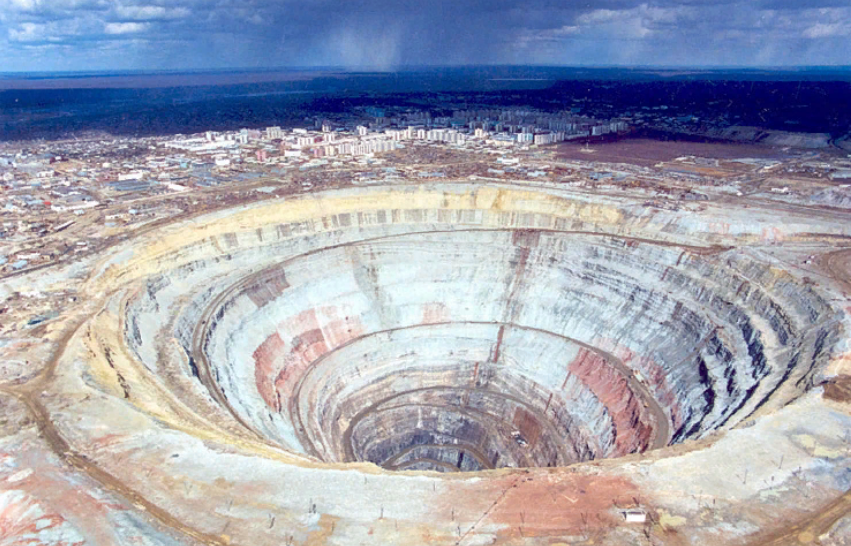
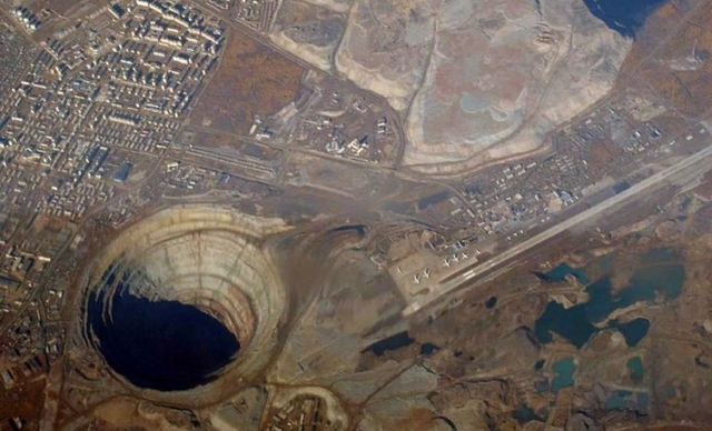
Above the quarry banned helicopter flights – a giant funnel may simply be pull on the bottom along with the air flow.
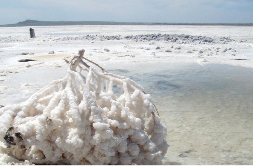
Lake El'ton. Volgograd region
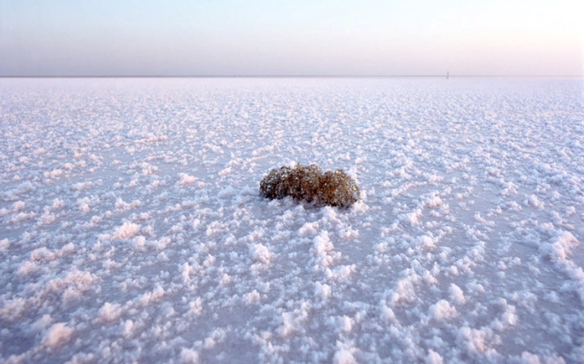
A desolate salt lake near the border of Russia with Kazakhstan, an area of about 150 square kilometers. Sometimes it is called "big salty puddle" – the average depth of lake Elton in the summer of only 10 centimeters, in the spring-70-80 centimeters. Lake Elton is famous for its" salt paintings "and"salt landscapes". They are created by nature itself in the form of crystalline formations of salt solution (brine) on plants, stones and other objects.
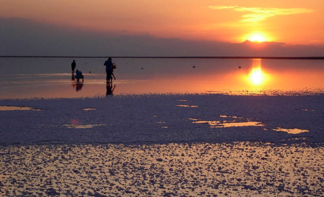
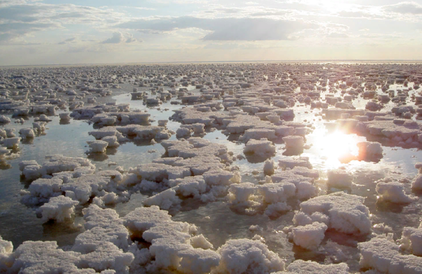
Elton-a popular Spa resort, salt baths and salt-saturated air have a healing effect on the human body.
Curonian spit. Kaliningrad region
A unique natural object on the Baltic coast of Russia is a 98 km long sandy spit overgrown with forest. The length of the Russian part of the spit – 49 kilometers, the rest belongs to Lithuania. The main feature of the spit-huge, constantly changing its terrain under the influence of wind sand dunes. The Curonian spit is also a kind of" bird's bridge " - a route of flight of many birds from southern and Central Europe to the European North. On the territory of the spit is ornithological station, where birds ring and study the ways of their migration.
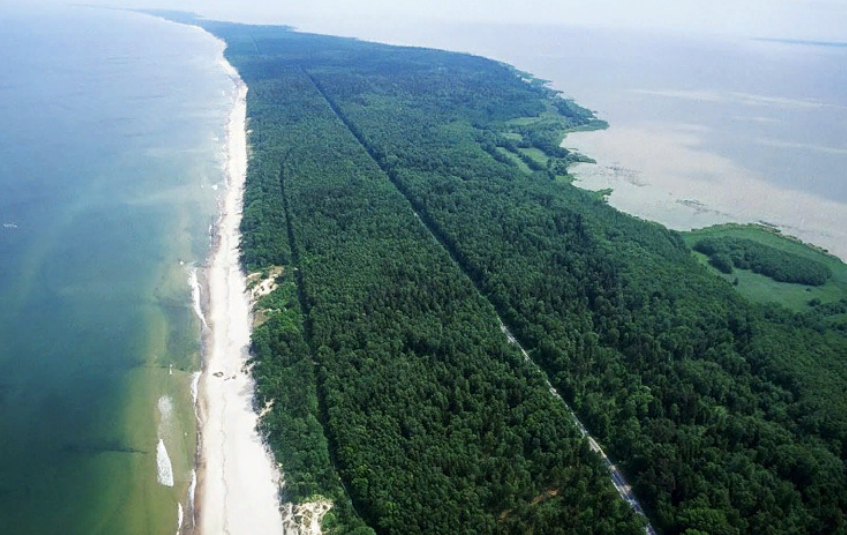
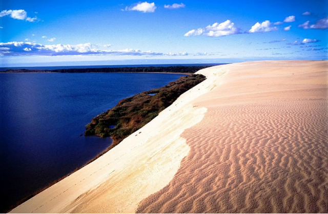
Tourists can see a lot of unusual things here: "Dancing forest" - a pine grove with intricately curved trees; abundance of birds and other aquatic animals in the freshwater Curonian lagoon; freely walking wild boars and ROE deer; unique vegetation with trees and shrubs from around the world. And, of course, the unique Baltic landscape – leaving the distance and the seemingly endless strip of sandy beach.
Wrangel island. Chukotka Autonomous Okrug
Visiting this large island on the border of the Chukchi and East Siberian seas, you can see the nature of the Arctic in all its pristine beauty. The indigenous population of Wrangel island never existed, and the Russian territory of Wrangel island became in 1911. The polar desert on the island is adjacent to the mountains and tundra. In Soviet times, a state nature reserve was established here.
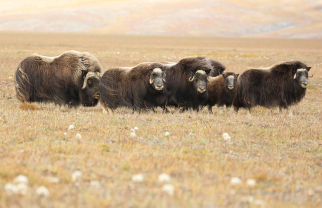
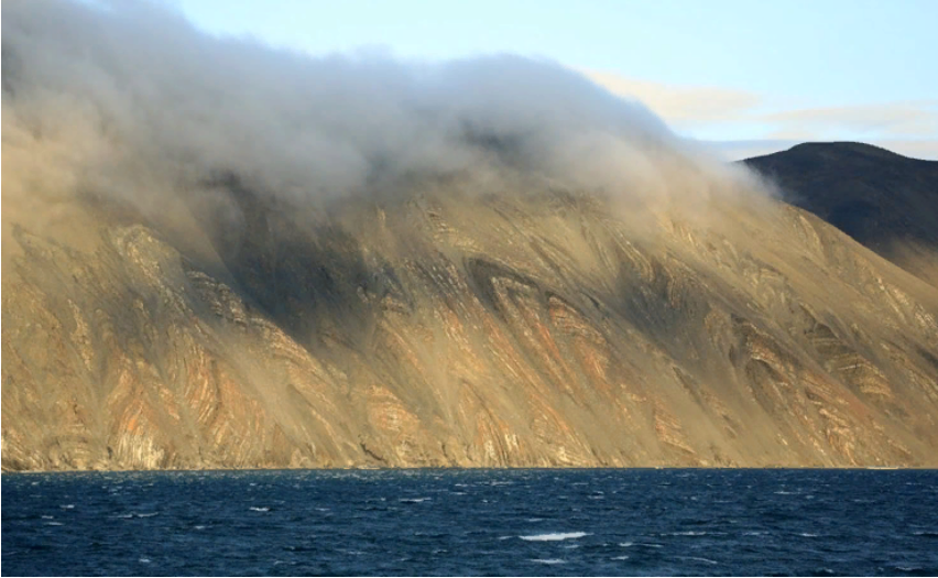
Numerous fauna of the island - polar bears, walruses, wild reindeer feel at ease on the island – any hunting is prohibited. Wrangel island is a UNESCO world natural heritage site.
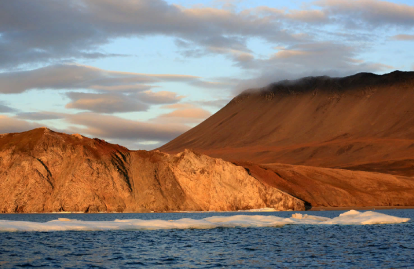
franz josef land
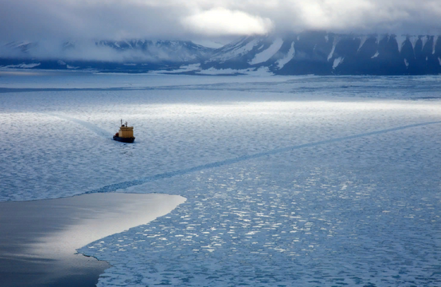
Franz Josef land-one of the most Northern regions of Russia, which is an archipelago in the Arctic ocean, administratively belonging to the Arkhangelsk region. There are 192 Islands with a total area of about 16,134 km2, most of which are covered with glaciers. In addition to the workers of the two polar stations, there are polar bears, Arctic foxes and several species of birds. In addition, occasionally scientific expeditions and tourist groups from Arctic cruise ships come here.
Local landscapes are simply fascinating, and if not hundreds of thousands of barrels of fuel (empty and full), stored in improper conditions and threatening the ecology of the archipelago, this place could be called an Arctic Paradise for eco-tourists.
The Lake Of Jack London. Magadan region
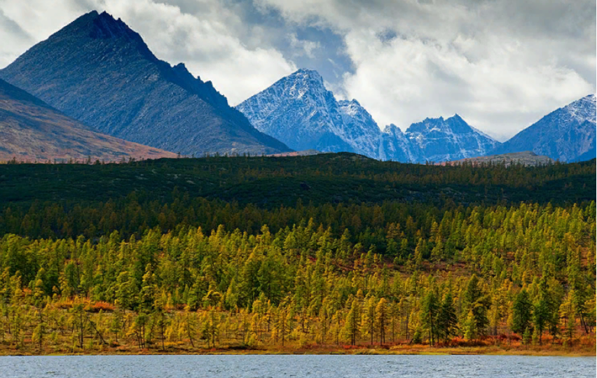
Even against the background of the amazing nature of the Russian Far East, lake Jack London stands out for its unique beauty and exoticism. An unusual name-most likely, a tribute to the literary tastes of its discoverers – geologists. Although there is a legend that the first of them, coming to the lake, found a book by American writer Jack London "Martin Eden".
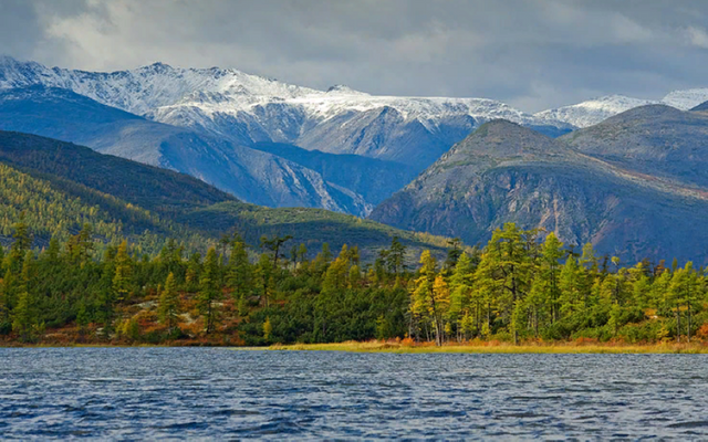
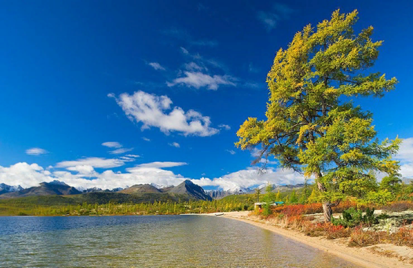
Narrow, 10 kilometers long mirror of the lake is framed by mountains at an altitude of 803 meters above sea level. The water is perfectly clear and very cold, ice floats on the surface of the water usually until the end of July, adding mystery to the lake landscape. Lake Jack London has the status of a national Park, protected by the state.
Holy Dormition monastery. Crimea
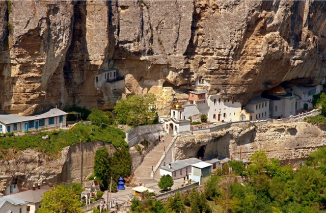
According to legend, on the site of the current Holy Dormition monastery, near the capital of the Crimean khanate Bakhchisarai, in the gorge Maryam-Dere in the Crimean mountains shepherd found the icon of the virgin. Then, how many times wouldn't transfer the icon, the image of the virgin Mary each time came back to the rocks. Local Christians decided to build a temple on this place, but since there was no suitable site, the temple was decided to be carved into the rock, which was done in the VIII century.
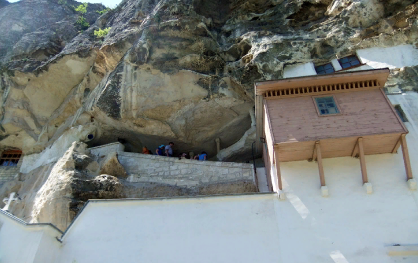
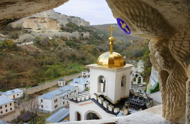
Subsequently, the Greek monks founded a monastery on this site, all five churches of which, cells and official monastery premises are also caves carved into the rocks. In a separate cave is the main Shrine of the monastery-a list with the same icon of the all-Holy virgin.
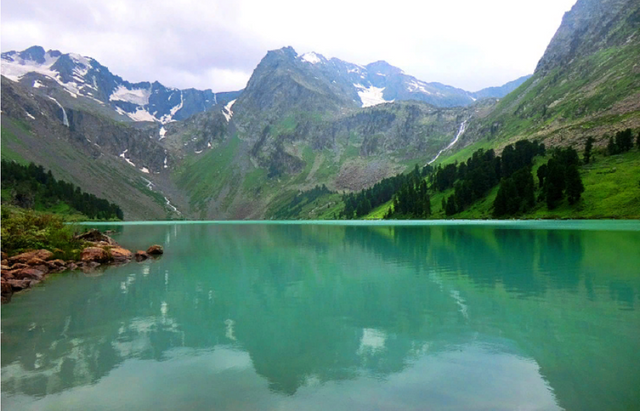
Multinsky lake. altai republic
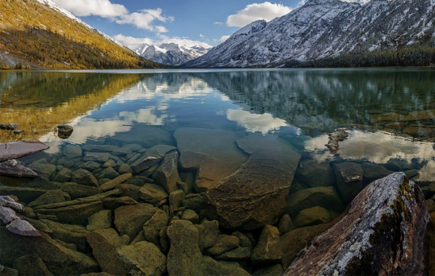
Cascade of seven lakes in the Altai Mountains, located on the Northern slope of the Katun ridge. Lakes Upper, upper Transverse, Middle, Lower, Strong, Kuiguk form a single chain connected by ducts with picturesque waterfalls. Each of the lakes of the cascade is distinguished by amazing views of Alpine meadows and mountain peaks. The water in the lakes is amazing, not found anywhere on the planet greenish-milky color. Multin lakes are a part of Katun biosphere reserve.
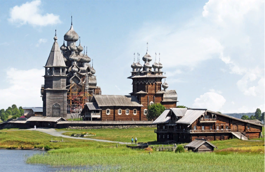
Kizhi. republic of karelia
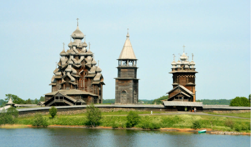
A unique Museum of wooden architecture in the open air. The Museum is located on Kizhi island on lake Onega in Karelia. The basis of the Museum exposition is a complex of wooden temple buildings Kizhi churchyard, built in the XVIII—XIX century. In the construction of churches, builders used techniques Dating back to the ancient Novgorod traditions of Russian wooden architecture, in particular, fastened the details of structures without using metal fasteners-nails, bolts, etc.
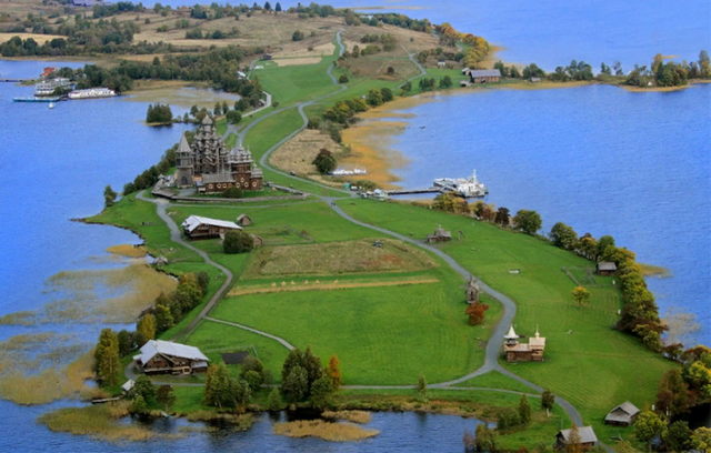
In 1990 Kizhi Pogost was Included in the UNESCO world heritage list.
Kamchatka. Kamchatka territory
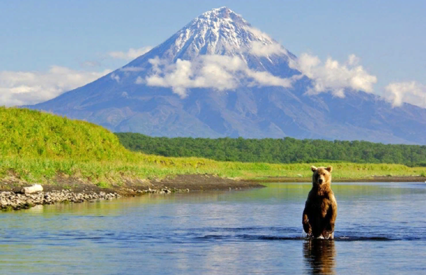
Active volcanoes, geysers, healing hot springs, glaciers, picturesque waterfalls, grass in human growth – all this can be seen on the Kamchatka Peninsula, a huge territory on the Russian coast of the Pacific ocean. The area of the Peninsula is more than 270 thousand square kilometers, from North to South of the Peninsula extends for 1200 kilometers.
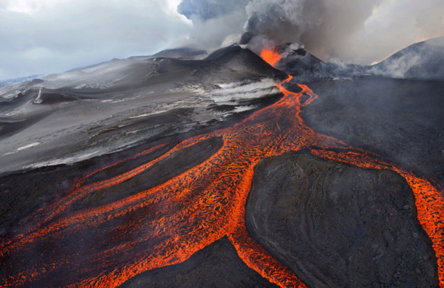
Tourists are particularly attracted to Kamchatka Valley of Geysers-such natural emissions of steam and hot water to a great height, as in Kamchatka, can be seen only in the zones of volcanoes in Iceland, the United States and New Zealand. The valley of Geysers is included in the unofficial list of "Seven wonders of Russia".
Salt lake Baskunchak. Astrakhan region
Lake Baskunchak in the Caspian lowland is, according to scientists, a hollow area of more than 115 square kilometers at the top of a giant underground salt massif. The lake is 21 meters below sea level, but its amazing "salt" landscapes can be admired from the top of Bogdo – the only mountain in the Caspian lowland. Which, besides, was once a seabed – tourists often find there fossilized remains of algae and ancient shellfish.
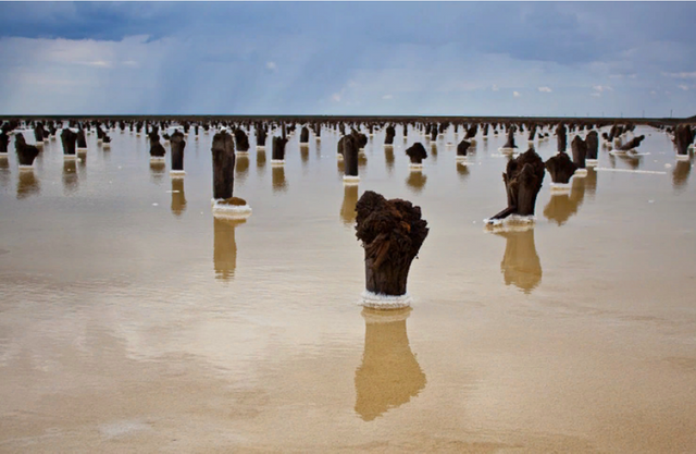
Baskunchak in the middle ages was on the famous Silk road, merchants carried salt in ancient Asian countries and exchanged it for silk, spices and other valuable goods at the time. Nowadays, Baskunchak lake provides 80% of the need for table salt throughout Russia.
Patom crater. Irkutsk region
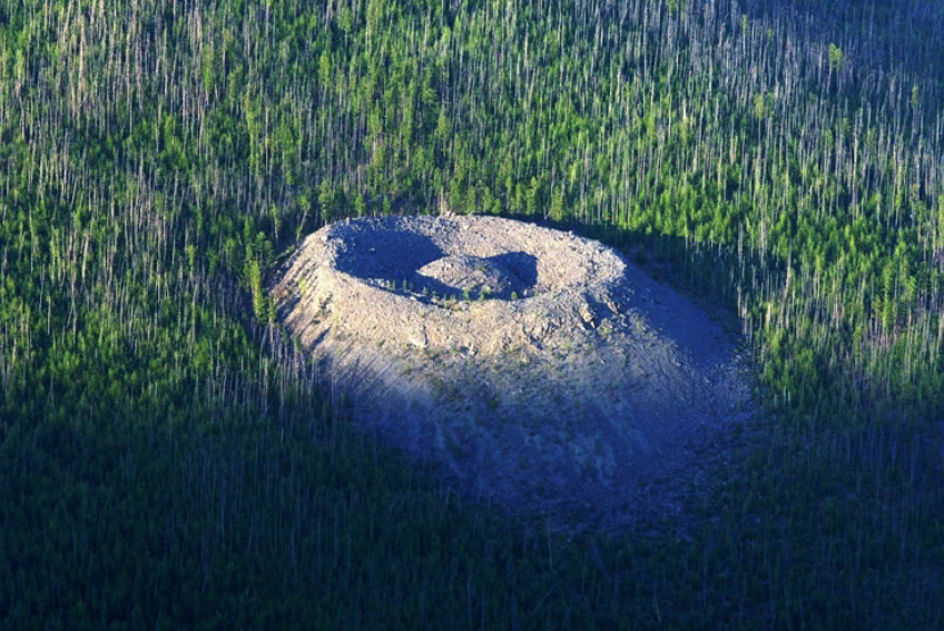
Scientists attribute the formation of Patom crater by the end of XV or early XVI century. However, the reason for its appearance in the Yakut taiga has not yet been reliably established. There are versions of both meteorite and volcanic (more precisely, magmatic), and even "secret-technological" origin of the Patom crater. Local Yakuts call this crater depth of about 40 meters and a diameter of the upper part of 80 meters "Nest fiery eagle" and consider "evil" place. Yakut beliefs, as well as uncertainty about the origin and some natural anomalies, for example, a reduced background radiation, the inaccessibility of the crater led to the fact that around him began to swarm in a variety of mystical rumors and various esoteric versions.
Welcome, we always are happy guests!
We have a lot of beautiful places and good people in the country)
Hi @korolyx, I just stopped back to let you know your post was one of my favourite reads and I included it in my Paddling Nature Ramble. You can read what I wrote about your post here.