Tverrdalsfjellet, hike to 1238 meters above sea level.
Summer in the mountain, North Norway
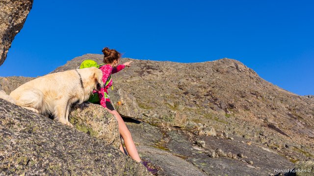
Friday 13.07.18. my daughter @idakarlsen, Nero and I decided to take ha hike on the top of Tverrdalsfjellet. The name means something like a mountain across a valley. After work I went home and picked up Nero, some food and equipment and met Ida at her work. After a pit stop to by spring rolls for dinner we headed to Skamdalen where the hike start. This is a valley around 20 km from Narvik. At the bottom of the valley is a lake called Skamdalsvannet, where we parked the car. The weather was nice and we where ready for 14 km and 1238 meters hike up to the mountain.
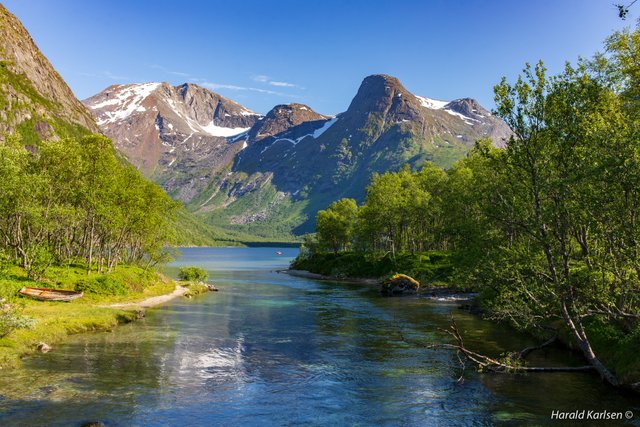
Skamdalsvannet is located in a quite narrow valley surrounded wit steep mountain.
The trail goes from Skamdalsvannet and up to around 600 meter to a valley called Tverrdalen. The valley is shaped by glaciers from the last ice age. In the beginning of the valley there are several moraines made of the glaciers. The trail follows the valley for about 3 km before the climb up to the top.
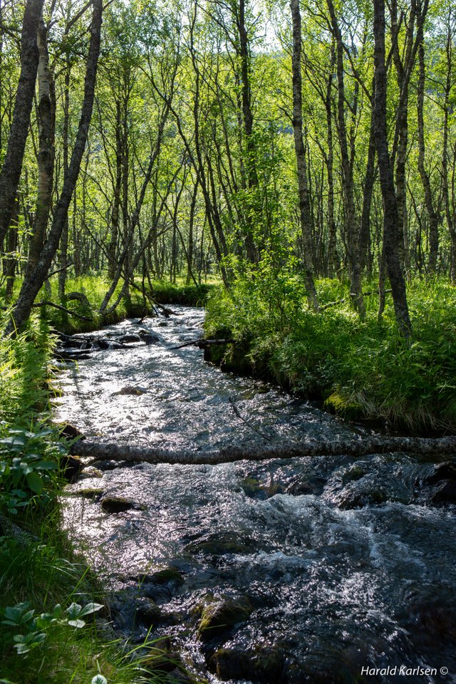
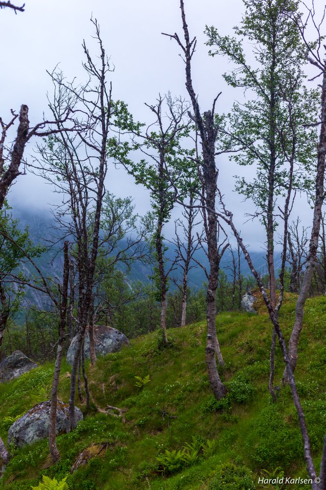
The first part go through birch woods with many small rivers and streams.
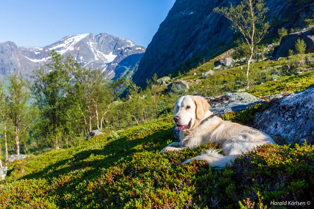
Where the forest ends we deserved a rest.
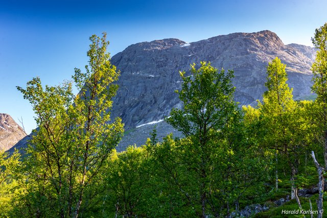
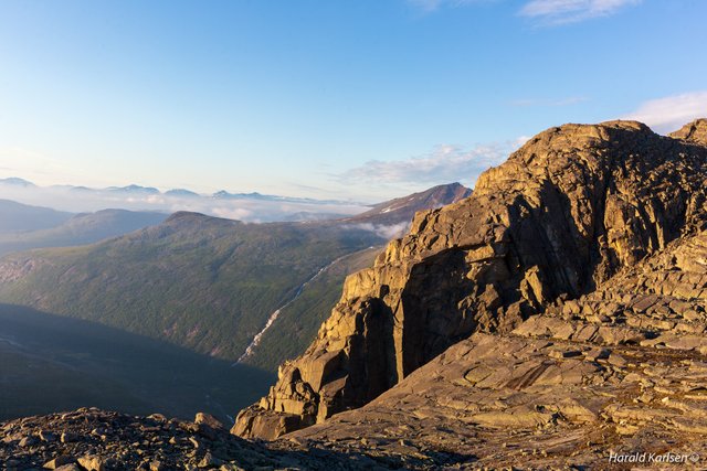
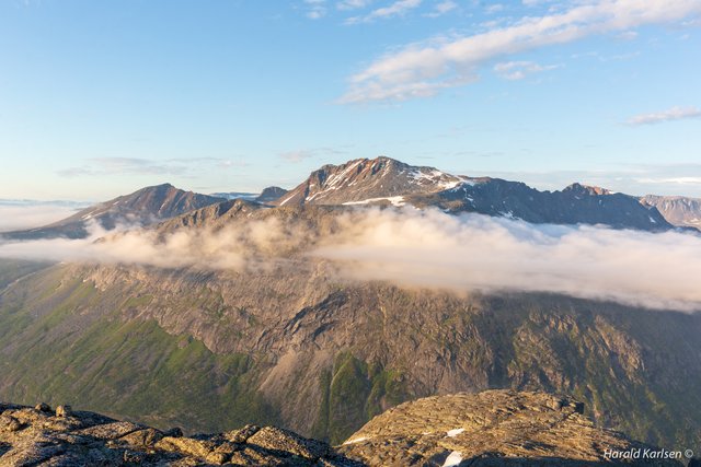
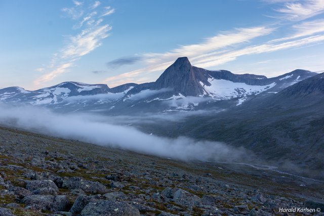
The front of Tverrdalsfjellet, we can't se the peak from this angel. It further back and up. Still a little bit of walking.
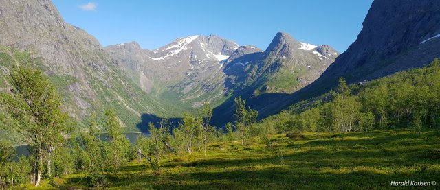
A view down to the valley and the lake.
The moraines where the valley begins.
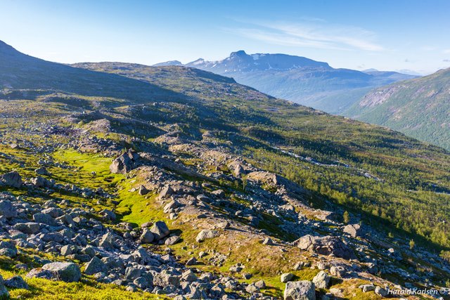
Up there we are at around 1000 m. Where the mountain is dark/black we came across the grouse as you might have seen in a previous post.
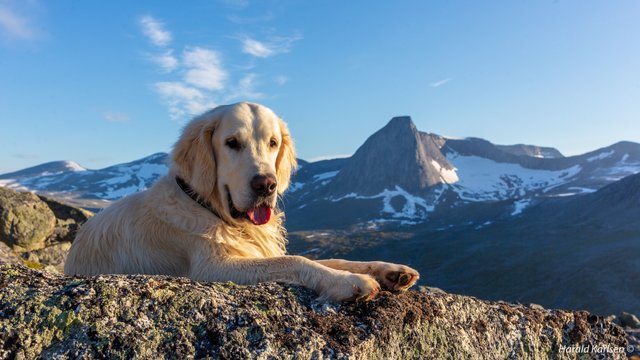
Another rest and posing, had to take a picture ;-).
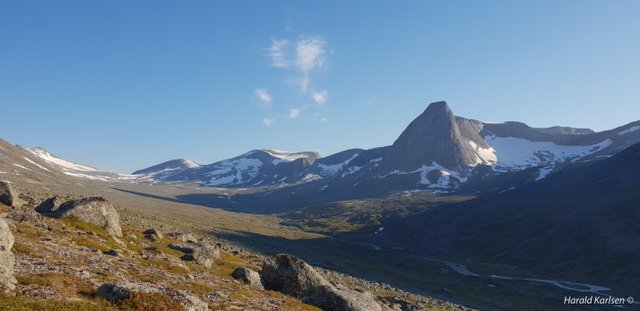
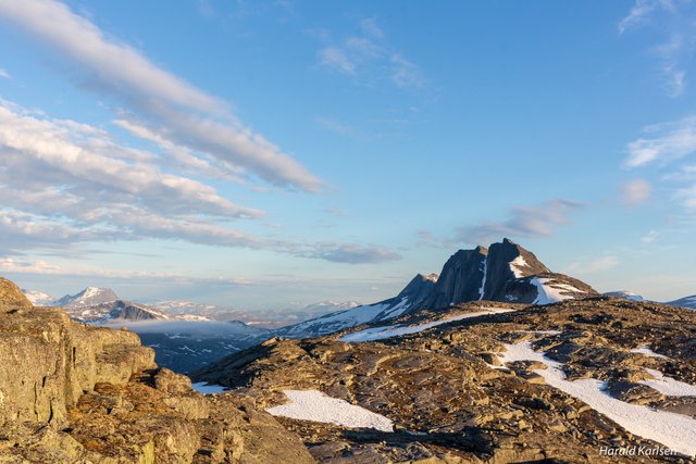
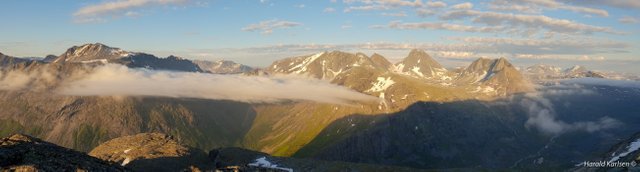
View of the Tverrdalen. To the left of the mountain which looks like a "sugar top" a German plane (Heinkel He 111H bombaricraft) had to land after damage during battle in the world war II. The plane had a crew of four. One of them died. The remains of the aircraft still laying in the same place.
Not far left.
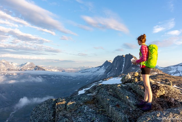
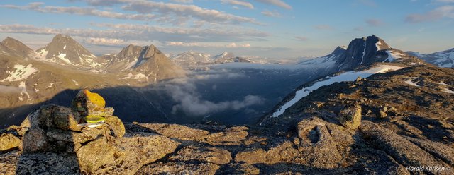
Finally at the top with great views to the surrounding mountains.
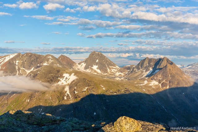
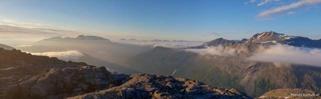
The effort paid off.
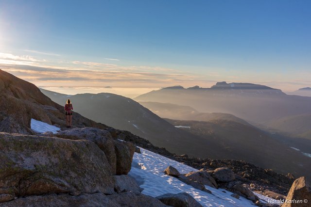
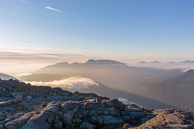
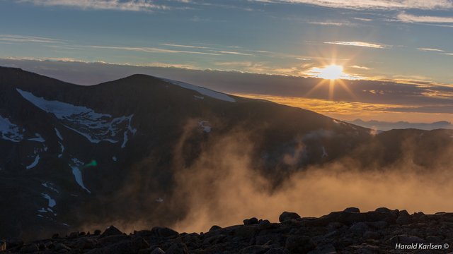
On the top we saw the fog came pretty quick through the valleys. We decided not be to long on the top, but go further down and passing the steepest part before we take a brake and had some food. So after enjoying the view we headed down, a little bit disappointed to not see the midnight sun while up there. But safety first.
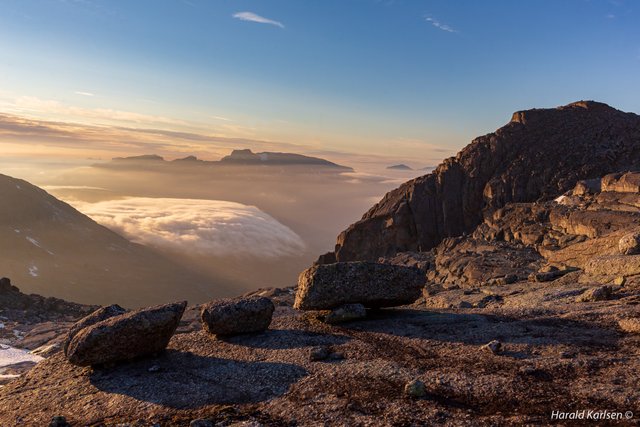
The fog seemed to come from nowhere...
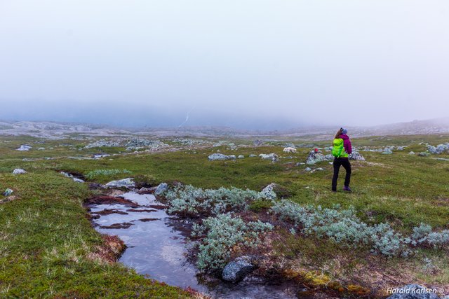
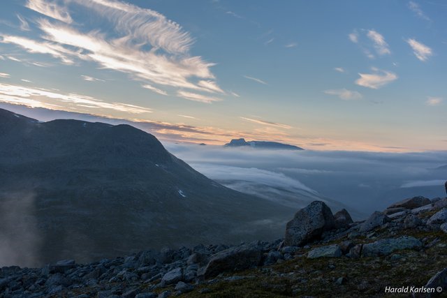
...and after an hour the mountains where covered in fog.
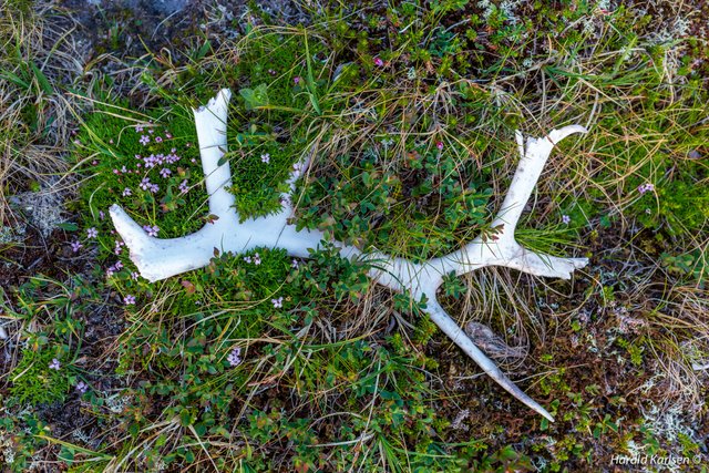
Antlers from a reindeer.
We had a great day with many impressions and experiences that we will not forget. The view, meeting with the grouse and watch Nero finding and follow the track on the way back was fun to observe. What I will forget is the sweat in the heavy upphils.
I will make a short movie from the hike.
Earlier post https://steemit.com/nature/@harkar/nero-the-mountaineer and https://steemit.com/nature/@harkar/mountain-grouse is from the same hike.
Hope you enjoyed this tour, and thank you for visiting.
Best regards
Harald, Ida and Nero 
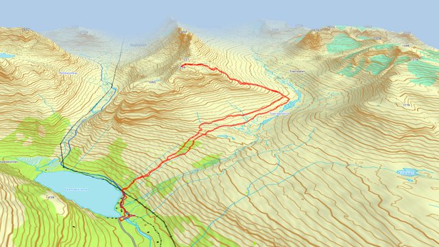
I'm curious about your 3D topographical map with your track superimposed:
Very cool. How'd you make it / which app does it come from? I use ViewRanger which doesn't seem to have this 3D option (as far as I know).
Hello. I use a Garmin gps. (Montana) and Garmin Base Camp on macOS. The maps are Topo Adventure on both units. You have to by detailed maps separate. In Garmin Base Camp you can show either 2D or 3D maps. The track is imported from the gps, or smartphone/watch. From the phone I have to convert track format from gpx to garmin format. With GPS visualizer you can convert GPS data/tracks to many different format. (http://www.gpsvisualizer.com). The track from this hike is from my Samsung watch. I converted it, opened the track on the map, choosed 3D, adjusted the angel/direction I wanted and took a screenshot (jpg).
Crazy insane good pictures! 👌 I Love especially the fog and the clouds between the mountains 👍 up for that !
And I’m sitting in my little garden between other neighbors and other townhouses...
Keep going on mate ✌️😃 makes me feel wanderlust!
Thank you very much for your kind comment. I appreciate it. Glad you liked it :-)
Wow! Your photos of the views along your hike are magnificent. They all look like pictures from a post card that you would purchase in a gift shop some where. Thank you once again for sharing your world with us.
And thank you, for the nice comment. :-) It was a great trip and the light was nice that evening ;-)
Wow, these pictures are truly spectacular, everyone of them are so amazing. Nero looks like he's having the time of his life, lucky dog😁 I look forward to seeing the video you post.
Thank you for very kind comment. The video is now posted ;-)
You live in paradise, @harkar! It is just so amazing! I envy you!! :)
Great photo journal of an adventure!
I can certainly understand wanting to unwind while winding through this trail.
Tahnk you very much.
Do you want $100 and more from byte ball. Sig up now. you will get directly. For more info you can see here http://team2dev.site/how-to-get-160-from-byteball-airdrop-using-your-steemit-account/